(UPDATE at 10:30 a.m. Arizona time, June 4, 2014)
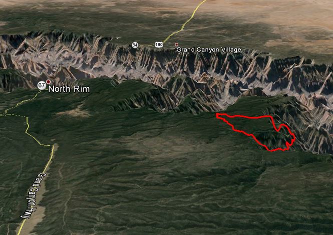
The Galahad Fire on the north rim of the Grand Canyon has grown to 2,702 acres, and the incident management team is calling it 5 percent contained. The containment figure is based on the portion of the fire in which firefighters are continuing to control.
Below is an update from the incident management team Tuesday night:
Today, no additional spots were detected east of the W-4 Road. Containment lines on the W-4 Road continued to be improved by firefighters north and south of Kanabownits Cabin. Firefighters also mopped up along the west side of the W-4 Road where burnout operations were conducted a few days ago. Helicopters were used to assist firefighters in detecting possible spot fires east of the W-4 Road and for water drops in areas below the canyon rim to reduce fire activity.
This video, shot from a helicopter, shows close-up views of the fire. It’s great that the Park is posting these videos, and maybe the next one will include a wide view, showing the context of the fire and its proximity to the canyon and the facilities on the north rim.
****
(Originally published at 9:07 a.m. Arizona time, June 2, 2014)
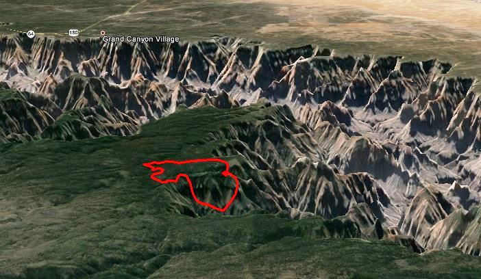
Firefighters are not totally suppressing a fire on the north rim of the Grand Canyon in Arizona, but are managing it for both natural resource and protection objectives. The lightning-caused fire was discovered on May 23 and as of June 1 had burned 1,975 acres with an estimated management cost of $525,000 to date. It is being managed by 171 personnel, including 5 hand crews, 4 helicopters, and 8 engines.
Firefighters are attempting to hold the fire west of the W-4 Road, and suppressed three spot fires across the road on May 31. They do not want the fire to become established east of the road due to the lack of any effective fire breaks or safety zones for firefighters.
The Red Flag Warning in effect for the area today may test firefighters through Monday evening, with 20 to 30 mph southwest winds gusting to 30 to 40, along with a relative humidity below 10 percent. (Map of Red Flag Warning areas.)
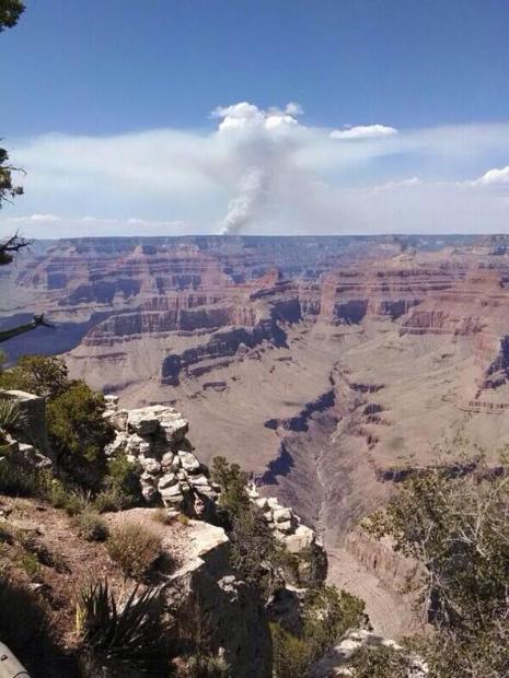
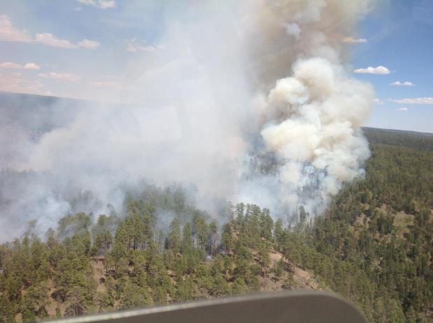
The video below was shot on May 29 and provides some aerial views of the fire. Perhaps next time they will include an establishing shot, showing the proximity of the fire to the Grand Canyon. And, having shot a lot of photographs from helicopters, I know that if you position the lens very close to the plexiglass, or better yet, remove the door, it reduces or eliminates reflections off the window. But, it is great having a video of the fire. It is surprising that this is not done and provided to the public more often — recon helicopters and air attack ships sometimes spend hours orbiting fires or flying the perimeter.
In researching this story, we discovered that the National Park Service has a new high-tech, expensive, “Virtual Studio for Kids” at the Grand Canyon, with green-screen technology and an integrated system that allows for high definition, live, multi-camera video production. The park does a great deal of video distance learning with schools. Having this ability on site provides a unique ability to use the studio production facilities to cover the Galahad Fire in a way that has not previously been done. Maybe they will grab this opportunity and figure out a way to break some new ground.
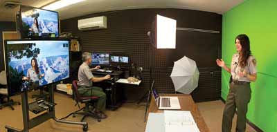
The video below is an example of their work. It is very professional, and looks like it could have been filmed at the NBC studios in New York instead of government facilities at the Grand Canyon.
