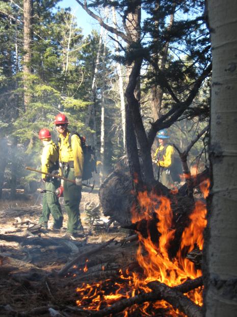
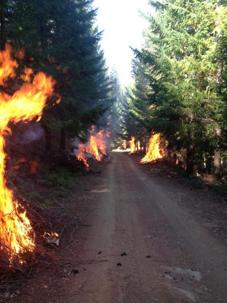
Archaeologists protect history from both fires and firefighters

The nation’s newest national monument has a long history of fighting off fire. Its future may mean defending its artifacts against firefighters.

The Baaj Nwaavjo I’tah Kukveni — the Ancestral Footprints of the Grand Canyon National Monument in northern Arizona — was formally designated in August. The monument land includes three areas to the north and south of the Grand Canyon and takes up approximately 917,600 acres, according to the Forest Service.
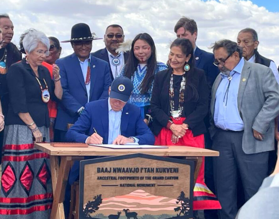
Dedicating the new national monument
President Biden established the Baaj Nwaavjo I’tah Kukveni — Ancestral Footprints of the Grand Canyon National Monument in northern Arizona. The signing event brought together state and federal politicians, officials, and tribal leaders. August 2023 DOI photo.

These lands are at the heart of many tribes in the region, including the Havasupai Tribe, Hopi Tribe, Hualapai Tribe, Kaibab Band of Paiute Indians, Las Vegas Paiute Tribe, Moapa Band of Paiutes, Paiute Indian Tribe of Utah, Navajo Nation, San Juan Southern Paiute Tribe, Yavapai-Apache Nation, Yavapai Prescott, Pueblo of Zuni, and the Colorado River Indian Tribes.

The tribes have called this area home for around 23,000 years, a history told through the numerous dwelling sites, pottery, and numerous other artifacts in the area.

Although a passing wildfire can damage artifacts, the fire itself isn’t often the main concern of the archaeologists in charge of protecting the monument. The cultural resources have existed in spite of the countless wildfires that have burned across the landscape, fires that subsequently give life to the Kaibab National Forest that surrounds the Grand Canyon. More often, archaeologists’ main concern is making sure the efforts of firefighters to contain a wildfire don’t put artifacts at risk.

“We’re not as concerned with the fire itself when fire-sensitive sites like wooden cabins and hogans are not present, but the tactics we often use to contain wildfire like constructing fuel breaks,” explained Michael Terlep, a district archaeologist for the North Kaibab Ranger District.

“The blade of a bulldozer, for example, scrapes the surface and disturbs at least the first six inches or more of topsoil, which might contain pottery, artifacts, arrowheads, tools, and prehistoric habitations. There is also the potential for ancestral burials to be disturbed.”

Terlep was one of the four resource advisors assigned to the Kane Fire that started on August 4 just north of the Grand Canyon. There, he was tasked with working ahead of crews, surveying the land, making sure fire suppression didn’t give way to cultural destruction.

“We were called immediately because anytime firefighting activities might disturb an archaeological site, we can be an asset, and advise on the best way forward,” Terlep said.

Baaj Nwaavjo I’tah Kukveni—Ancestral Footprints of the Grand Canyon National Monument presidential designation

Resource advisors have been deployed to wildfires since the 1970s, according to NPS. However, increasing recruitment and training efforts for the positions have reportedly become a national priority for the agency.

In the past four years, 1,300 students from federal, state, tribal, and local agencies completed the NPS resource advisor training, NPS notes on its website. “This represents an increase of 125 percent compared with the preceding four-year period. Hundreds of the graduates went on to assist on wildfires and other emergency incidents as resource advisors and archaeologists .”

Interested in becoming a resource advisor yourself? Sign up to be notified when the NPS virtual introductory course for 2024 opens in the spring.

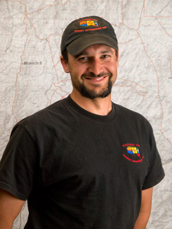
Grand Canyon FMO named Intermountain Region Fire Management Officer

Jay Lusher
Jay Lusher is the new regional fire management officer for NPS’ Intermountain Region. USFS photo by Kari Greer.

Jay Lusher, a 15-year veteran of the National Park Service (NPS), has been named Regional Fire Management Officer of the NPS Intermountain Region. Mr. Lusher is chief of fire and aviation of Grand Canyon National Park in Arizona. He will begin his new assignment July 22, 2018.

Mr. Lusher spent 15 years at Grand Canyon. He began working in the helicopter program in 2003 and eventually oversaw one of the most complex helicopter programs in the NPS. He became Chief of Fire and Aviation in 2012 and continues to embrace the application of fire throughout the landscape of the park both with natural and prescribed fire.

“The NPS Intermountain Region fire management program is diverse and complex,” Mr. Lusher said. “I look forward to being part of the team and managing wildland fire to protect the public, park communities and maintain and restore natural ecosystem process.”

He began his fire career in Wyoming in 1995 on a rural fire department. From 1996 through 2002 he worked for the U.S. Forest Service and Bureau of Land Management throughout Wyoming including a short stint as a structural firefighter for the City of Casper.

Mr. Lusher has been member of a national type 1 incident management team since 2006, working primarily in the Southwest and California.

He will move to Denver with his wife Robin, who currently serves as Chief of Chief of Planning, Environment, and Projects at Grand Canyon.

Mount Emma Fire burns into Grand Canyon NP

(UPDATED at 7:07 p.m. MT, June 26, 2015)

Mount Emma Fire
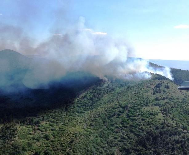
Mount Emma Fire. Undated photo on InciWeb.

The lightning-caused Mount Emma Fire started June 24 in the Grand Canyon-Parashant National Monument in northwest Arizona and has burned into Grand Canyon National Park. The 2,043-acre fire is in a very remote area 60 miles west of the facilities at the North Rim which are at the south end of Highway 67.

Resources on the fire include one load of smoke jumpers, one hot shot crew, one Type 2 initial attack crew, and one Type 3 helicopter. The fire is burning in open Ponderosa pine and pinyon-juniper.

Fire managers are using both direct and indirect approaches for fire suppression on the Mt. Emma fire.

“This is a suppression fire that we are taking action on with resources on the ground,” said BLM Public Affairs Officer Rachel Carnahan. “We’re using both indirect and direct suppression tactics on this fire which is necessary in this kind of remote, rugged terrain. Access to the fire is difficult so we’re working to balance fire fighter safety—which is paramount—with feasible suppression tactics.”

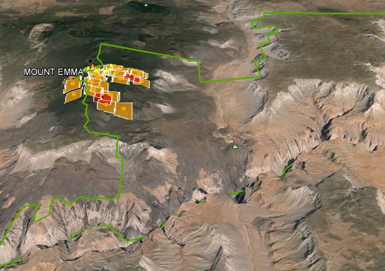
3D view Mount Emma Fire
A 3-D map of heat detected by a satellite on the Mount Emma Fire at 1:55 p.m. June 26, 2015. The Grand Canyon can be seen in the foreground. (click to enlarge)
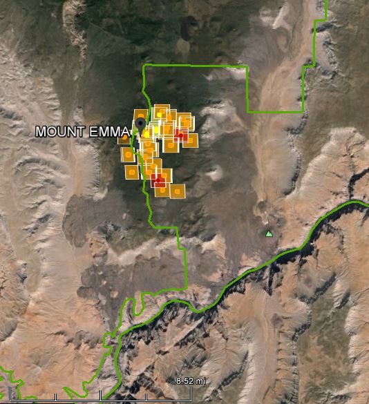
Mount Emma Fire Grand Canyon
A map view of the Mount Emma Fire from directly overhead. The green line is the boundary of Grand Canyon National Park, with the park being on the right, or east side, of the line. At the time of this imagery most of the fire was inside the park.

Galahad Fire burns on North Rim of the Grand Canyon

(UPDATE at 10:30 a.m. Arizona time, June 4, 2014)

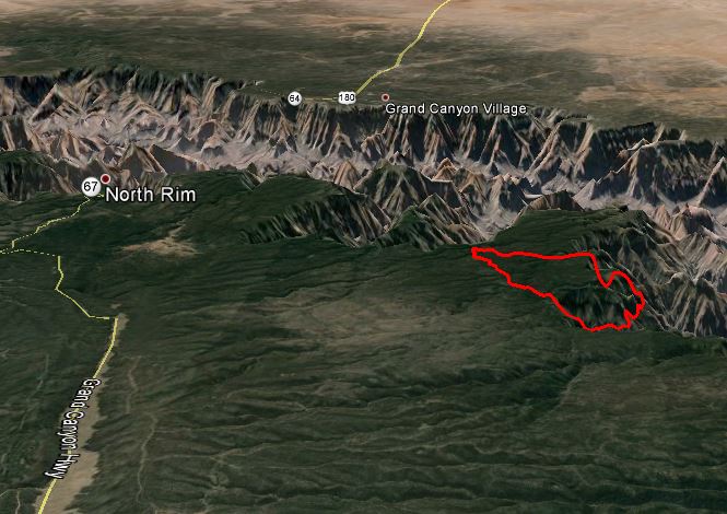
map of the Galahad Fire
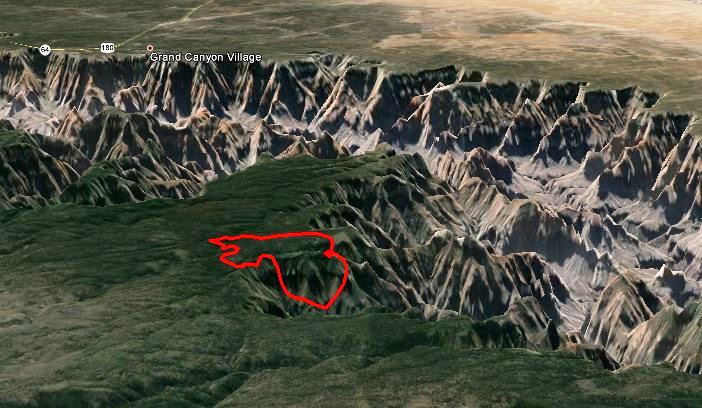
3-D map of the Galahad Fire, looking south at 8:20 p.m. June 4, 2014. Incident Management Team, and Google Earth.

The Galahad Fire on the north rim of the Grand Canyon has grown to 2,702 acres, and the incident management team is calling it 5 percent contained. The containment figure is based on the portion of the fire in which firefighters are continuing to control.

Below is an update from the incident management team Tuesday night:

Today, no additional spots were detected east of the W-4 Road. Containment lines on the W-4 Road continued to be improved by firefighters north and south of Kanabownits Cabin. Firefighters also mopped up along the west side of the W-4 Road where burnout operations were conducted a few days ago. Helicopters were used to assist firefighters in detecting possible spot fires east of the W-4 Road and for water drops in areas below the canyon rim to reduce fire activity.

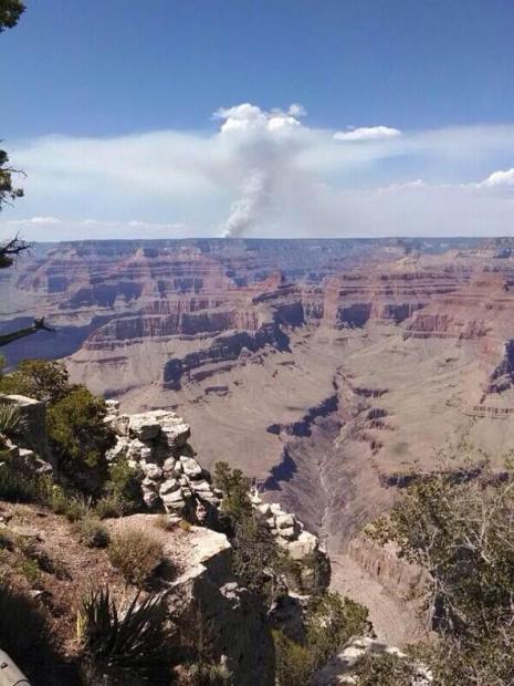
This video, shot from a helicopter, shows close-up views of the fire. It’s great that the Park is posting these videos, and maybe the next one will include a wide view, showing the context of the fire and its proximity to the canyon and the facilities on the north rim.

****

(Originally published at 9:07 a.m. Arizona time, June 2, 2014)

Grand Canyon Map of Galahad Fire
3D map of Galahad Fire, looking south. Perimeter as of 1 p.m., May 29, 2014, Incident Management Team and Google Earth.

Firefighters are not totally suppressing a fire on the north rim of the Grand Canyon in Arizona, but are managing it for both natural resource and protection objectives. The lightning-caused fire was discovered on May 23 and as of June 1 had burned 1,975 acres with an estimated management cost of $525,000 to date. It is being managed by 171 personnel, including 5 hand crews, 4 helicopters, and 8 engines.

Firefighters are attempting to hold the fire west of the W-4 Road, and suppressed three spot fires across the road on May 31. They do not want the fire to become established east of the road due to the lack of any effective fire breaks or safety zones for firefighters.

The Red Flag Warning in effect for the area today may test firefighters through Monday evening, with 20 to 30 mph southwest winds gusting to 30 to 40, along with a relative humidity below 10 percent. (Map of Red Flag Warning areas.)

Galahad Fire, May 27
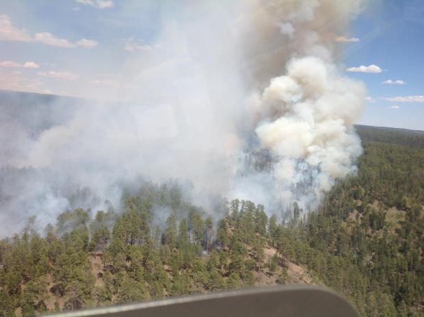
Galahad Fire, May 27. NPS photo by Ron Brown.
Galahad Fire, May 27
Galahad Fire, May 27. NPS photo by Jay Lusher.

The video below was shot on May 29 and provides some aerial views of the fire. Perhaps next time they will include an establishing shot, showing the proximity of the fire to the Grand Canyon. And, having shot a lot of photographs from helicopters, I know that if you position the lens very close to the plexiglass, or better yet, remove the door, it reduces or eliminates reflections off the window. But, it is great having a video of the fire. It is surprising that this is not done and provided to the public more often — recon helicopters and air attack ships sometimes spend hours orbiting fires or flying the perimeter.

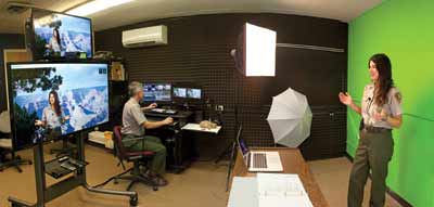
In researching this story, we discovered that the National Park Service has a new high-tech, expensive, “Virtual Studio for Kids” at the Grand Canyon, with green-screen technology and an integrated system that allows for high definition, live, multi-camera video production. The park does a great deal of video distance learning with schools. Having this ability on site provides a unique ability to use the studio production facilities to cover the Galahad Fire in a way that has not previously been done. Maybe they will grab this opportunity and figure out a way to break some new ground.

Andy Pearce and Amala Posey Grand Canyon
Andy Pearce and Amala Posey in the studio. NPS photo.

The video below is an example of their work. It is very professional, and looks like it could have been filmed at the NBC studios in New York instead of government facilities at the Grand Canyon.

Wildfire briefing, October 29, 2013

Smoke creates health problems in Australia

Smoke from wildfires and prescribed fires is being blamed for increased visits to hospitals in New South Wales. On Monday when air quality was at its worst, the number of people treated for asthma in hospitals more than doubled. In recent weeks Sydney has been inundated with smoke from bushfires, but since the weather moderated a week or so ago smoke from prescribed fires, or “backburns”, has replaced it.

Landowners are motivated to use fire to reduce the hazards around their property by insurance companies that impose higher premiums if they don’t have a buffer around their improvements. Some of them are taking advantage of the favorable weather to conduct the backburns before the normal beginning of the bushfire season in December.

Australian government warns operators of UAVs who operate over fires

In what may be a reaction to a stunning video and others taken by unmanned aerial vehicles over bushfires, Australia’s Civil Aviation Safety Authority issued a warning to the operators of small UAVs, saying they are putting fire fighting operations at risk and should be aware of appropriate regulations.

Catastrophic wildfires in Colorado ignite new center for managing ‘WUI’ wildfire risk

Colorado State University’s Department of Forest and Rangeland Stewardship is launching a new center dedicated to creating and applying the next generation of wildfire management solutions. The Center for Managing Wildland Urban Interface (WUI) Wildfire Risk will provide science-based answers to critical questions raised by the most destructive wildfires in Colorado’s history. The Center for Managing WUI Wildfire Risk will provide science-based answers to critical questions raised by the most destructive wildfires in Colorado’s history.

Catching up with Fire Aviation

Recent articles at Fire Aviation:

  • Disney to release animated wildfire aviation movie
  • V-22 Tilt-Rotor Osprey as a firefighting aircraft
  • K-MAX helicopter converted to unmanned aircraft system
  • Slow-motion video of Lockheed Electra L-188 retardant drops
  • 10 Tanker Air Carrier moves to Albuquerque, begins converting a third DC-10
  • Two Aircraft crashes in Australia connected to bushfires
  • Stunning UAV video of bushfire
  • Airliner painted to honor FDNY firefighters
  • Airbus begins tests of C295 air tanker
  • 2013 Airtanker and Water Scooper Forum

Prescribed fire projects underway

Pile burning, Grand Canyon
Pile burning on the Bright Angel project, North Rim of the Grand Canyon, October 24, 2013. NPS photo.
Prescribed fire Shasta-Trinity National Forest
Shasta-Trinity National Forest, October 21, 2013. USFS photo.
Prescribed fire on the Helena National Forest
Prescribed fire on the Helena National Forest, Helena Ranger District. USFS photo.