A perspective on Northern California wildfires from the eyes and lens of a fire photographer

On October 14 fire photographer Jeff Zimmerman wrote about what he had seen after spending time on the wildfires in Northern and Southern California. These photos were taken by him.

By Jeff Zimmerman

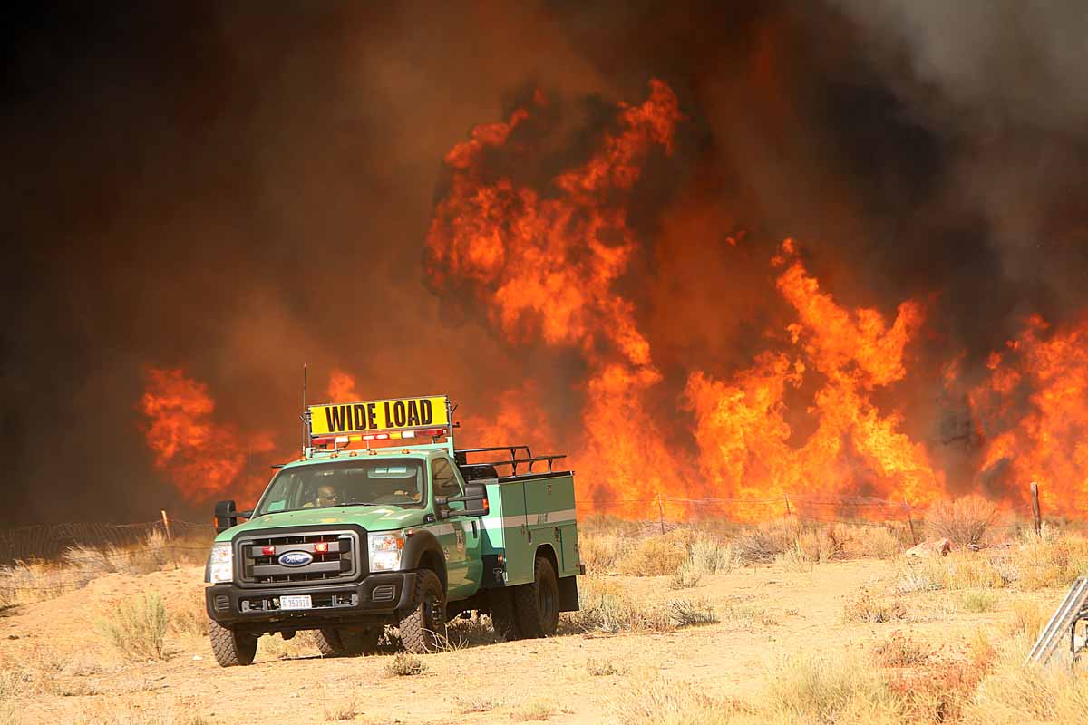
I would not have believed it if I had not seen it for myself, nearly 5,700 homes destroyed, 34 fatalities, dozens of commercial buildings destroyed in a multi-day wind driven inferno pushed by hot dry diablo winds in the scenic Northern California bay area. Dry offshore winds compressed by the narrow canyons rushed down into Santa Rosa at well over 60 mph, sending swirling fire brands for great distances into residential areas, not normally prone to wildfires, just two miles north of town center. In the upper canyon along Tubbs Road in the timber and brush I could clearly see that a downed power line may have sparked a wildfire fire at night in the winds, but in the City of Santa Rosa which sustained massive structural loss to this intensity it was hard to believe.  The Tubbs Fire raced down Potter Creek Road with alarming rates of spread, within a few hours firefighters estimated the fire at 20,000 acres.
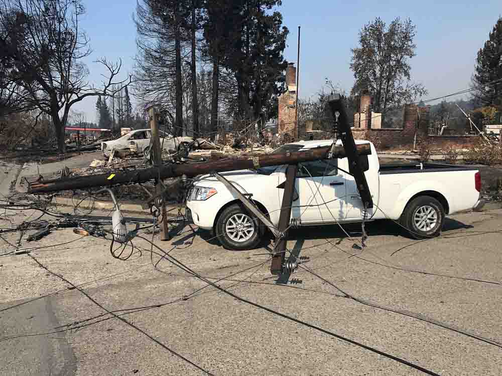
Photo by Jeff Zimmerman

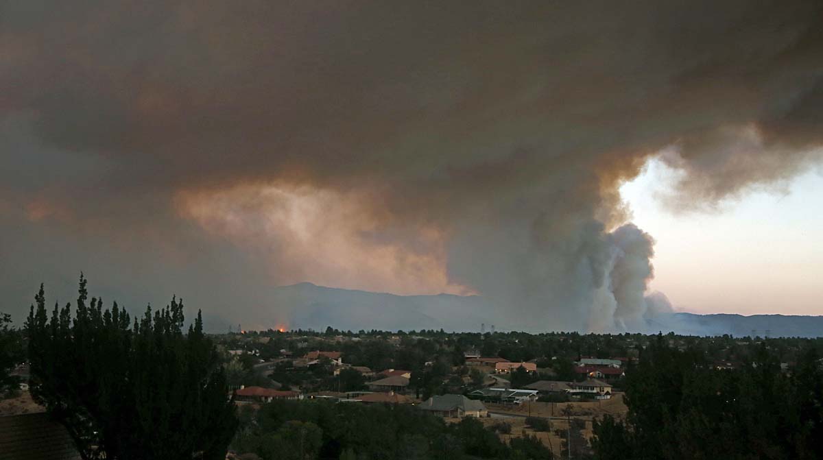
The Coffey Park area just east of the 101 freeway in the City of Santa Rosa, a homey housing tract of single family dwellings is wiped off the map; the Journeys End Mobile Home Park destroyed, Santa Rosa seemingly to take the direct brunt of the LNU fire complex. To the north, Mendocino was hard hit with a family losing their teenage son in the driveway as the mother had to have her legs amputated from running through the fire to escape. How do you ever survive something that horrible? It will be singed in the survivor’s minds forever.

People have underestimated the power of wildfires for years, it won’t happen to me is the mindset of many.  They argue about prescribed burning and air pollution, brush removal destroys habitat, logging is unsightly, the list goes on and on. It takes a massive disaster to get things done unfortunately, better building codes, better water systems, wider roads, fire sprinkler ordinances, better brush clearance is needed; the blue – ribbon panels reports have already explained this after other massive fires in California foothill communities.

Northern California is still in flames, Calistoga, Geyserville, Napa, Sonoma, Mendocino, Nevada and Butte Counties all have fires, over 160,000 acres, with fatality lists growing by the day, possibly as many 5,700 homes destroyed, 75 cell towers destroyed, and scores upon scores of cars on scores of incinerated streets.  Loved ones missing, their dreams, property and many souls never to return; all destroyed in minutes. It is hard to wrap your mind around it; to examine it is difficult at best, to live through it, terrifying.
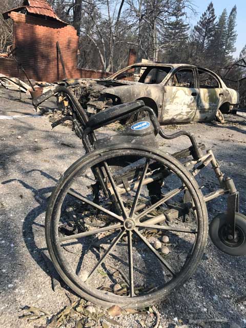
Photo by Jeff Zimmerman

A burning wheel chair curb-side set the tragic tone, burnt cars trapped behind downed power poles with car doors flung in the open position still smoldering, roofs on top of hillside homes still burning several days after the main blaze roared through town. A disaster for learning most certainly, but the lessons will come hard. It will take years for families to negotiate with insurance adjusters, to get architectural drawings, negotiate with contractors, get water, sewer and power lines back, some may never try to rebuild at all. For those families who lost everything it will be hard to sift through the debris before having their lots cleared. Many lessons can be learned from the Oakland Hills fire, they will need to have extreme patience. The scars in their minds will never go away, even once their homes are rebuilt, you just don’t forget a fire like this. It will be hard to rise like the phoenix amidst the ash pits of total destruction.

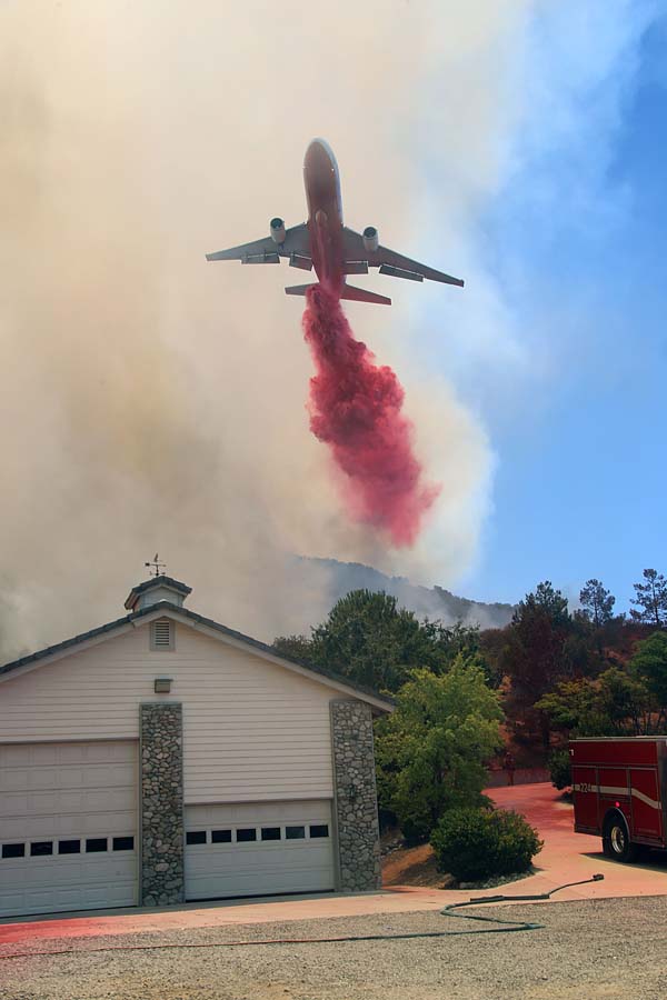
Nighttime fires under sinister diablo winds, very short notification if any to evacuate.  People burned alive in their driveways and furiously burning homes as fires with explosive rates of spread devoured everything in their path.  At least 12 large wind driven urban interface fires have caused 20,000 people to flee in the dark of night as scores of homes were razed to the ground.   Live- stock, pets, wildlife all killed in the flames. Wineries in the foothills destroyed, hospitals with critical patients evacuated in amongst the flames. All too much for the mind to fathom at one time in just a few days.

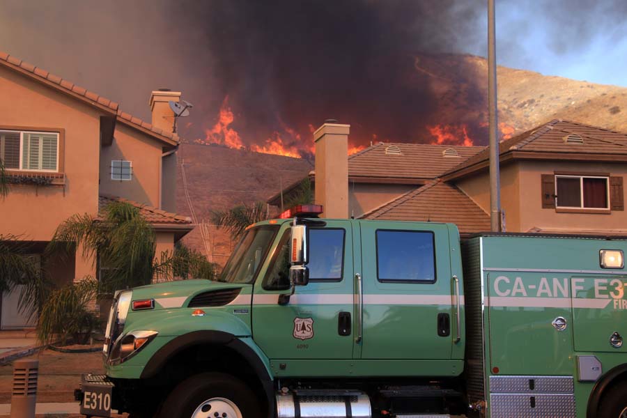
To the south, Santa Ana winds pushed fires into Orange County neighborhoods on October 9-10 along the 91 and 241 freeways. The fire jumped the 241 Toll Road and ran directly into hillside homes on the bluffs that overlook the valley.  A fire that destroyed 24 homes in an hour right before my very eyes. By nightfall the winds subside and the Canyon 2 Fire slowed to a crawl.  Swirling smoke, fire whirls, ember cast, with fire leap frogging from canyon to canyon. Unbelievable rates of spread and long range spotting, just another day covering spot news.

Setting down the camera on several occasions and picking up garden hoses to extinguish hundreds of spot fires, training police officers on site how to tackle incipient blazes to keep homes from burning, a day to remember.

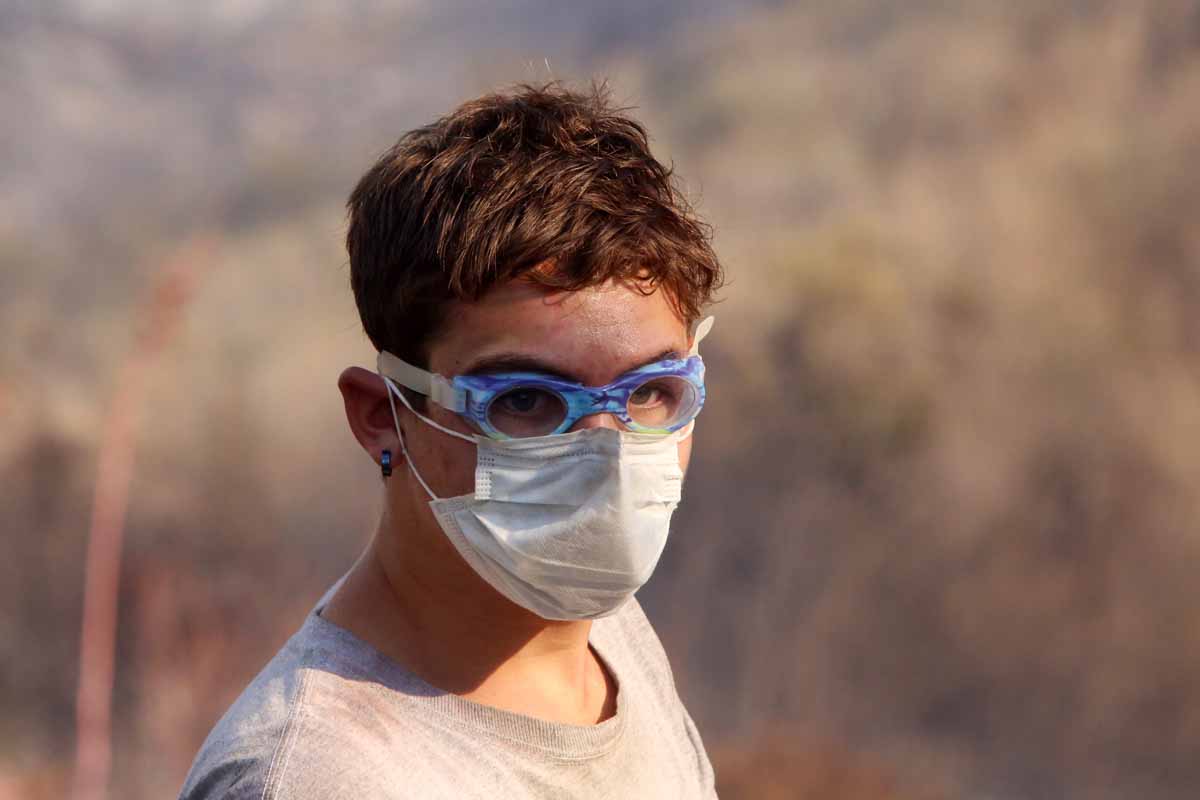
The fire weather forecast as of this quick writing calls for more Santa Ana winds in Southern California, and diablo winds in Northern California putting the entire State into Red Flag Warning.  I thought I would share some of my thoughts and images from Santa Rosa with you all. We are not out of the woods by any stretch of the imagination. Strikes teams of fire equipment are moving up and down the State in order to prepare for the worst. Get ready, Get set, Go! Words to live by today.
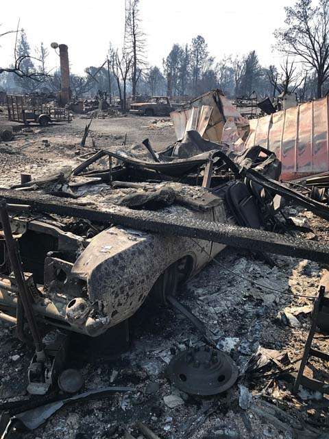
Photo by Jeff Zimmerman

Jeff Zimmerman photographs fires and writes about them, usually from Southern California.

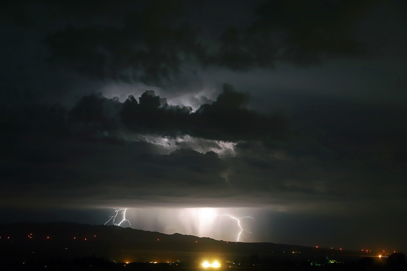
Southern California lightning

(Originally published at 1:33 p.m. MDT September 11, 2017)

Jeff Zimmerman took these photos September 10 and sent them to us today. Here is how he described the event.

From the deserts to the sea, a wonderful display of lightning. Off the coast near Avalon where hundreds of strikes were recorded with numerous strikes all the way to Tehachapi Mountains. Tejon Ranch and Highway 58 area was bathed in lightning too. A new fire was reported on the Los Padres National Forest, lightning strike near Chuchapate (Sawmill). Possibly a few more isolated storms today, followed by gusty NW winds later this week. The first Santa Ana may set up when snow comes to Montana and offshore flow begins later this week bringing critical fire weather with it. Attached are a few shots from the desert in Neenach, CA (map).

lightning Jeff Zimmerman

lightning Jeff Zimmerman

Thanks Jeff!

Rose Fire near Lake Elsinore, California burns 200 acres

Above:  A firefighter on the Rose Fire near Lake Elsinore, CA, July 31, 2017. Photo by Jeff Zimmerman.

(Originally published at 8:20 p.m. MDT August 5, 2017)

On July 31 firefighters were able to prevent structures from burning as a wildfire burned about 200 acres just northwest of Lake Elsinore in Riverside County, California.

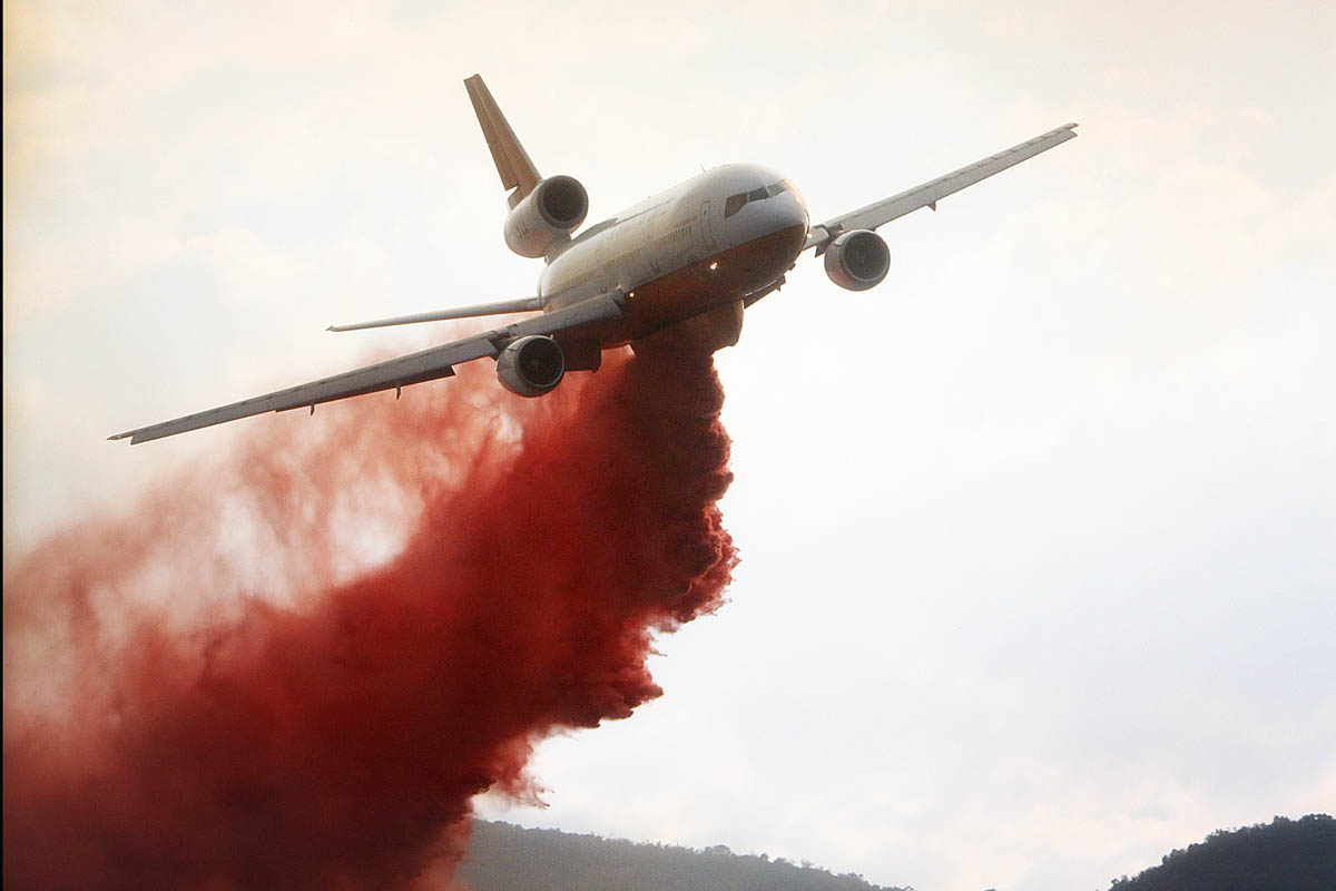
Jeff Zimmerman, who took these photos, said the fire was reportedly started by the use of equipment behind homes in the 100-degree heat. Jeff said heavy air tankers were brought in to help firefighters stop the spread of the fire as it moved up-canyon through heavy chaparral.

For a while homes along several streets in Lake Elsinore were evacuated as well as locations up the hill to the west in the Cleveland National Forest, including the North Main Divide road, El Cariso Campground, and Los Pinos Conservation Camp above El Cariso Village.

Rose Fire Lake Elsinore CA
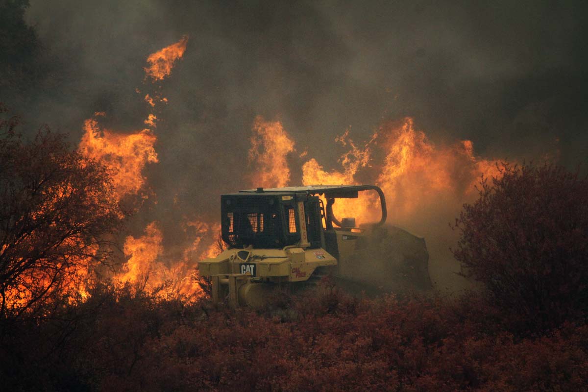
A dozer constructs fireline on the Rose Fire near Lake Elsinore, CA, July 31, 2017 Photo by Jeff Zimmerman.
Rose Fire Lake Elsinore CA
A DC-10 drops on the Rose Fire near Lake Elsinore, CA, July 31, 2017 Photo by Jeff Zimmerman.

Continue reading “Rose Fire near Lake Elsinore, California burns 200 acres”

Dynamic photos from fire in Lake View Terrace, CA

Jeff Zimmerman of Zimmerman Media took some excellent photos at a fire in Lake View Terrace north of Los Angeles last week. The fire spread quickly during Santa Ana wind conditions and burned about 60 acres before several hundred firefighters from Los Angeles County and the U.S. Forest Service contained it after a two-hour battle.

Thankfully for Jeff, California has a different, some would say more enlightened, way of handling the media at emergencies and disasters than some other areas. There are few restrictions as long as the reporters do not interfere with incident operations. Their rights are protected by California Penal Code 409.5d.

lake terrace wildfire

lake terrace wildfire

lake terrace wildfire

All photos are by Jeff Zimmerman.

Two days in the life of a wildfire photographer

A behind the scenes story of action photography at a fast-moving wildfire in southern California.

Pilot Fire
A dozer tender on the Pilot Fire August 7, 2016. Jeff Zimmerman photo.

Since Jeff Zimmerman retired as a fire captain he spends much of his time photographing fires in California, getting up close and personal with the action. The state has a different, some would say more enlightened, way of handling the media at emergencies and disasters than some other areas. There are few restrictions as long as they do not interfere with incident operations (see California Penal Code 409.5d).

Jeff covered the Pilot Fire that so far has burned almost 8,000 acres in southern California near Crestline. He was there for the first two days, took these photos, and wrote down some of his thoughts.

****

By Jeff Zimmerman

During the late afternoon of August 7, 2016, I received word from Tod Sudmeier about a fast moving wildfire along Highway 138 and Pilot rock in San Bernardino County. The first reports were that the fire was not accessible so I did not pay much attention to the pager. An hour after the initial alert rang out, the fire was reported to be a 1,000 acres and moving towards Highway 173 in Summit Valley. With this new information I responded from Towsley Park, cutting my nature hike short.

There was sweltering heat once again in Southern California, which appears to be the new norm, as monsoon moisture had moved to the east and relative humidity was rock bottom. The skies above the desert were clear blue but temperatures were soaring to triple digits.

Pilot Fire
PIlot Fire August 7 2016. Jeff Zimmerman photo.

Once again responding up the long trek of Highway 14 as I have numerous times before, I went east onto Pearblossom Highway and over the summit to Highway 138. A large plume of smoke was clearly visible — another major emergency wildfire threatening homes, chewing through decades old brush, threatening human and animal life. Insatiable flames were bearing down on rural ranches as people packed up livestock in trailers to get away from the menacing flames. Air tankers roared into the valley to cut off the advancing fire from the 17525 block of Highway 173. The fire was marching northeast at a rapid clip, dozers frantically working the fire line to halt advancing flames, but with little success.

This had the makings of yet another dangerous fire, probably human caused, possibly by negligence, hopefully not by arson. I continued through the flame front as the fire jumped Highway 173 and into the spillways of Lake Silverwood. Always moving to stay ahead of the flames, only powered by pure adrenalin and Gatorade, I reluctantly moved up canyon, seemingly to dance with the red devil. By nightfall it was evident that the fire was creeping up the steep brush covered desert slopes moving towards Lake Arrowhead up old Highway 173 into no man’s land. Old Highway 173 is now abandoned and will tear the front end off your vehicle off if you attempt to traverse it.

By twilight it looked as if a nuclear bomb had dropped over Summit Valley and ash was raining down on Hesperia nine miles to the north. Curious onlookers were wondering just how far this fire would travel and could it make it into Hesperia proper. Day was turning to night so a few more hours of shooting then it was time to call it quits.

At 11 p.m. I realized I needed to leave the scene, upload a few images, and get a few hours of rest. By 1 a.m. I arrived home, transferred photos into my computer, took a quick shower and went off to bed. Oh, how I know too well, the magic hour of 2 a.m.; finally some badly needed rest on an old lumpy mattress. I always hate those nagging heat cramps being so dehydrated; now the push is on to get fluids back into the body.

At 6 a.m. I was back at my daily chores, watering the crops, charging camera batteries, double-fisting coffee, grabbing a quick bite to eat, and then out the front door. I met Bernie Deyo in Palmdale at Ave S Park-and-Ride and it was off to the races again. The smoke was already billowing along Highway 173 at 10 a.m. We made a quick stop at Highway 138 and 15 freeways to stretch, pick up lunch at Del Taco. Then it was back onto the firelines.

By noon the fire was rolling, boiling behind homes. Structure protection was now in place and San Bernardino County firefighters from Medic Engine 224 were hunkering down behind a home with a charged 1 ½ inch hose line trying to protect the residence from fire. We parked facing out on a small dirt driveway, ready to escape the flames at a moment’s notice.

PIlot Fire Continue reading “Two days in the life of a wildfire photographer”

California: Sage Fire evacuation orders lifted for Stevenson Ranch

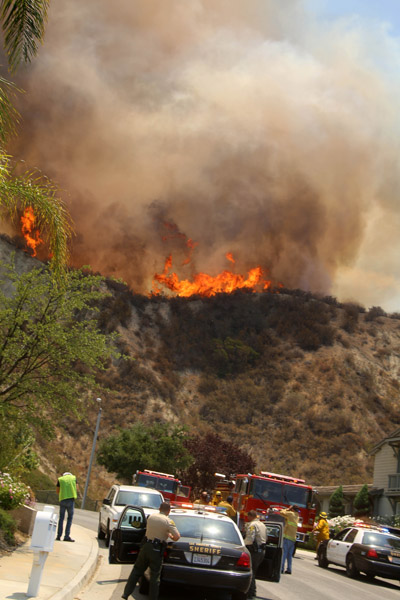
Above Photo by Jeff Zimmerman

Jeff Zimmerman of Zimmerman Media took some excellent photos at the Sage Fire southwest of Santa Clarita on the west side of Interstate 5 north of Los Angeles.

The South Zone Coordination Center reports this morning that the fire has burned 800 acres. The evacuation orders for 700 homes have been lifted for the Stevenson Ranch community however the area remains closed for non-residents. The fire started near Sagecrest Circle and The Old Road.

About 1,200 firefighters battled the blaze.

Sage Fire
Photo by Jeff Zimmerman.
Sage Fire
Sage Fire. Photo by Jeff Zimmerman.

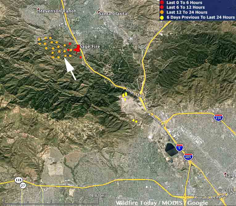
The map of the Sage Fire below was generated at 8 a.m. PDT July 10, 2016 with data current as of 2:25 a.m PDT July 10, 2016.

Map Sage Fire
Map showing heat detected by a satellite (the red dots) over the Sage Fire at 2:25 a.m. PDT July 10, 2016.