Large wildfires in Manitoba prompt smoke advisories

Manitoba fires map
Map showing the locations of wildfires in Southern Manitoba at 5:12 a.m. CDT May 18, 2021. Based on heat detected by satellites.

Multiple wildfires in Southern Manitoba grew large Monday pushed by strong winds while the temperature was high and the relative humidity was low. The smoke being produced by the blazes prompted Environment Canada to issue multiple special air quality statements Monday evening.

“Localized areas of smoke are creating reduced visibilities and poor air quality down wind of fires,” the agency said in the statement.

Satellite photo of smoke from Manitoba wildfires
Satellite photo of smoke from Manitoba wildfires, May 17, 2021.

The areas under the air quality statement as of Monday evening include:

  •  Whiteshell – Lac du Bonnet – Pinawa
  •  Arborg – Hecla – Fisher River – Gypsumville – Ashern
  •  Bissett – Victoria Beach – Nopiming Provincial Park – Pine Falls
  •  Brandon – Neepawa – Carberry – Treherne
  •  Dauphin – Russell – Roblin – Winnipegosis
  •  Dugald – Beausejour – Grand Beach
  •  Grand Rapids – Waterhen
  •  Selkirk – Gimli – Stonewall – Woodlands
  •  Ste. Rose – McCreary – Alonsa – Gladstone

Four 10-person teams of firefighters are being brought in from Ontario to assist, while Quebec sent two air tankers and a bird dog aircraft.

Ontario firefighters en route Manitoba fire
Ontario firefighters en route to assist with wildfires in Manitoba May 15, 2021. Photo by Ontario Ministry of Natural Resources.

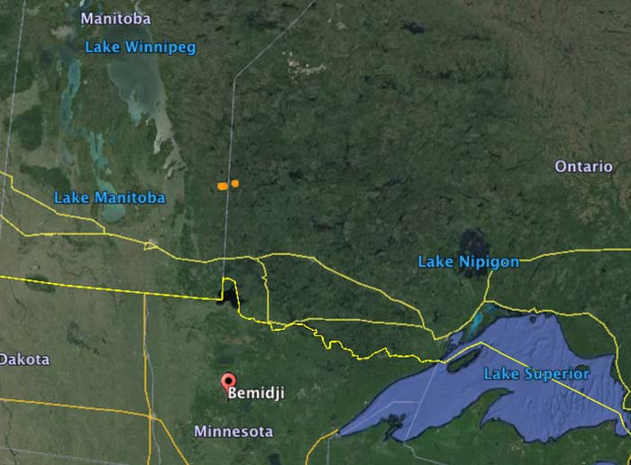
The EA044 fire 23 Km (14 miles) west of Gypsumville seen on the map above is very close to another much larger fire. They may be all one fire separated by an area of light vegetation that cooled in between heat-detecting satellite overflights. If they are one, they cover an area of approximately 52,500 hectares (130,000 acres). About 28,300 hectares (70,000 acres) burned at that location Monday during the strong winds.

Below are forecasts produced by FireSmoke Canada for the distribution of wildfire smoke on Tuesday and Thursday. The circles with numbers indicate multiple fires at each location.

Wildfire activity increases in Manitoba and Ontario

The Red 023 Fire near Sandy Lake in Ontario made a 20 kilometer run Monday afternoon and night

wildfires Manitoba Ontario June 2 2019
Map showing the locations of wildfires in Eastern Manitoba and northwest Ontario at 4:33 a.m. CDT July 2, 2019.

Wildfire activity in Canada has spread from British Columbia and Alberta, east to the provinces of Manitoba and Ontario. In the last several days about a dozen fires have grown much larger in Eastern Manitoba and Northwestern Ontario. Winds out of the west Monday afternoon and night forced some of blazes to grow substantially to the east and northeast.

The largest in the area is in Northwestern Ontario, the Red 023 Fire that started June 15. As illustrated in the map below, between 2:42 p.m. July 1 and 4:33 a.m. CDT July 2 the fire ran east for about 20 kilometers (13 miles). Early Tuesday morning it was 4 miles south of Sandy Lake and six miles southwest of the community of Keewaywin.

The Ontario Ministry of Natural Resources and Forestry’s latest estimate of the size of the Red 023 Fire was 37,390 Ha (92,392 acres). After the major run, our very, very unofficial estimate using satellite data estimates that it has grown to at least 54,000 Ha (130,000 acres).

Map Red 023 fire Keewaywin Ontario Sandy Lake
Map showing heat on the Red 023 Fire detected by a satellite as late as 4:33 a.m. CDT July 2, 2019. The red areas burned between 2:42 p.m. July 1 and 4:33 a.m. CDT July2.

There are three large fires in Ontario northwest of Trout Lake that all started June 30. (See the map at the top of the article) The sizes were reported by the Ontario Ministry of Natural Resources and Forestry on July 1, 2019:

  • Red 038 Fire, 1,100 Ha (2,700 a)
  • Red 039 Fire, 10,000 Ha (24,700 a)
  • Red 040 Fire, 2,832 Ha (7,100 a)

Two of the larger fires in Manitoba are the NE 020 Fire and the NE 019 Fire, east of Lake Winnipeg and southeast of Playgreen Lake, both reported in mid-June. Their reported sizes are 11,000 Ha (27,000 acres) and 9,000 Ha  (22,000 acres), respectively.

The weather forecast for the Pikangikum, Ontario area through Saturday calls for temperatures in the mid to high 70s F, partly cloudy or sunny, winds generally out of the west during the day at 5 to 12 mph, and very little chance of rain.

The map below shows the forecast for the distribution of wildfire smoke from the fires in Alaska, Manitoba, and Ontario at 7 p.m. CDT July 3, 2019.

Smoke Forecast wildfires Canada
Forecast for the distribution of wildfire smoke at 7 p.m. CDT July 3, 2019, produced July 2 by the Canadian government. The forecast only includes the area within the black border.

NIFC mobilizes air tankers to assist Canada

Posted on Categories UncategorizedTags , ,
A BAe-146 air tanker dropping on a recent wildfire in Canada.
A BAe-146 air tanker dropping on the Kenora #18 Fire in Canada. Photo by Chris Sherwin.

This article was first published on Fire Aviation.

The National Interagency Fire Center has mobilized two BAe-146 air tankers and one King Air lead plane to assist the Canadian provinces of Ontario and Manitoba. Tankers 10 and 41 will be working out of the air tanker base at Bemidji, Minnesota 86 miles south of the US/Canadian border.

The aircraft were ordered primarily for the Kenora #18 Fire that straddles the border between Manitoba and Ontario (the brown dots in the map below). But they could be used for fires in either province.

According to the U.S. National Interagency Fire Center, Canada has not requested U.S. assistance specifically for wildfires in Alberta. The aid, they said, was requested through a bilateral firefighting assistance agreement with the Canadian Interagency Fire Center (CIFC). At this time, Canada has not requested additional resources or assistance from the U.S., though NIFC and the CIFC are frequently communicating.

Map Ontario Manitoba US

Manitoba adds 4 air tankers to their fleet

CL-415
Polishing one of the new CL-415 air tankers in Manitoba. (screen grab from ChrisD204 video)

The Canadian province of Manitoba is adding four new scooper air tankers to their fleet. The Bombardier CL-415 tankers can carry about 1,620 gallons of water and cruises at 207 mph. According to the Canadians, a typical mission for a CL-415 on a large fire in Manitoba would last four hours and includes 80 drops, totaling 129,000 gallons.

During an announcement about the new aircraft, Water Stewardship Minister Gord Mackintosh said:

With the new planes they are faster, the carry more water, and they drop double the number of bombs in an hour, in other words, they drop about 20 water bombs in an hour versus 12 with the old planes.

Gotta love the repeated references to the “bombs”.

The “old planes” Minister Mackintosh is referring to are the older CL-215s, which according to an article at the Winnipeg Free Press can make 12 drops per hour, flies at 160 mph, carries 1,412 gallons, totaling 67,776 gallons on a typical 4-hour mission.

For comparison, the large air tankers working the Fourmile Canyon fire west of Boulder, Colorado in September, 2010, where the retardant reload base was unusually close — 15 miles away — were dropping approximately 4,000 gallons per hour. The U.S. Forest Service’s fleet of 10 air tankers does not have any water scoopers or CL-215/415s on exclusive use contracts. The Department of Interior has had two for the last few years. The USFS currently has a Request for Proposal out for scooper air tankers, and may contract for some later this year. While water sources in the United States may not be as prolific as in much of Canada, it’s hard to continue to ignore an air tanker option that can deliver 32 times the number of gallons per hour onto a fire (4,000 vs. 32,000 gallons), comparing the best case scenarios for both scoopers and conventional large air tankers, such as a P2-V.