Fighting another wilderness fire

The Prisoner Lake Fire in the Bob Marshall Wilderness in western Montana is being managed for suppression; the fire was reported on July 30 on the Spotted Bear Ranger District. Natural rock barriers have helped contain the spread of the fire, which is estimated at 3333 acres. A number of spots outside the main perimeter were detected by aerial recon on Thursday in the head of Brownstone Creek. A crew of 8 firefighters is working on the half-acre spot fires and mopping up.
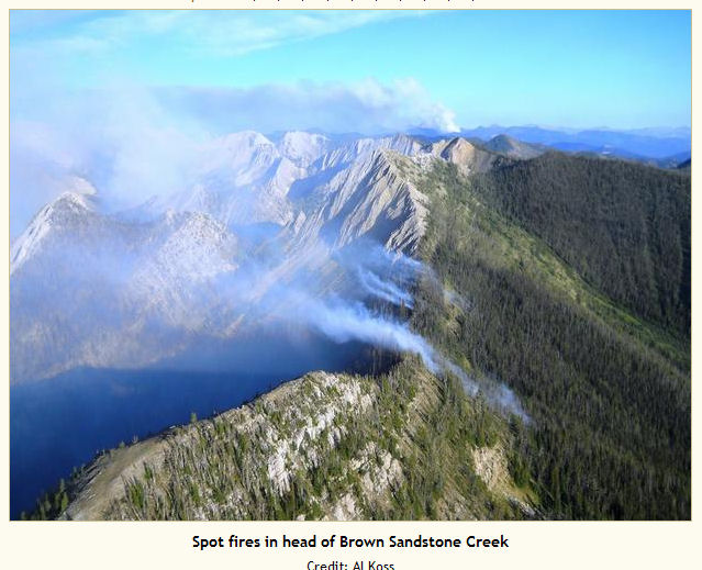
Prisoner Lake Fire in the Bob MarshallThe fire’s about 25 miles east of Condon. Trails in the area have been closed for public safety. Closed trails on the Flathead National Forest are: Trail #138 Molly Creek Trail, from the junction with the White River Trail #112 to White River Pass; Trail #380 South Fork of White River, from the junction with Trail #138 to its end; and Trail #626 Haystack Mountain, from the junction with Trail #138 to Haystack Mountain. Closed trails on the Lewis and Clark National Forest: Trail #211 Indian Creek, from White River Pass to the junction with Trail #203, West Fork of the South Fork Sun River.

An area closure has been issued for the areas around the Elbow Pass Complex to the south and east of the Prisoner Lake Fire.

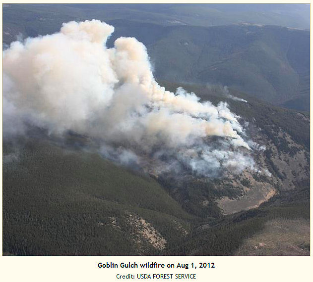
Goblin Gulch Fire too steep for safety

The Goblin Gulch Fire is southwest of Monarch, Montana, on the Belt Creek Ranger District of the Lewis and Clark National Forest. Reported on July 30 by a military aircraft, the fire was probably caused by lightning. Firefighters worked yesterday on scouting adequate safety zones and helicopter landing zones. Crews cleared a spot for helicopters to land closer to the fire, and air resources checked on numerous spot fires on the west side of the fire.

This fire is expected to be active for a long time because of the extreme terrain and concerns for firefighter safety. The fire’s inciweb page says “Firefighter safety will not be compromised in order to suppress this wildfire.”
Goblin Gulch FireIt’s 5 percent contained at 283 acres, and the terrain is extremely steep with a heavy timber canopy of mixed conifers. Crews have reported surface fire with individual tree torching. Work on the fire is expected to be slow. “The terrain this fire is in is really extreme,” public information officer Erin Fryer told the Great Falls Tribune. “It’s about straight up and down and very rocky. It’s been real difficult to even get firefighters in on this fire. We have about 50 firefighters on the site right now, but in terrain like that, it’s hard to get them in and out — hard and slow.”

Montana town emptied

Police drove the streets of the town of Lame Deer last night, using loudspeakers to warn residents to grab their belongings and get out of town. An Associated Press story in the Washington Post reported that buses were lined up Thursday night to evacuate the entire population of 2,000 from the Northern Cheyenne Reservation community.

Desi Small-Rodriguez with the tribe’s disaster and emergency services department said the Chalky Fire threatened to burn Lame Deer, the seat of the southeastern Montana reservation. The fire had burned two homes, and then winds pushed the fire straight toward town. Carol Raymond, Rosebud County’s head of disaster and emergency services, had driven from Forsyth to assess the situation. “I figured the whole town of Lame Deer would go up in flames,” she said.

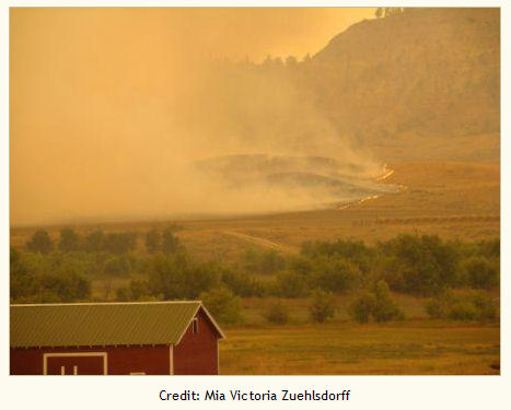
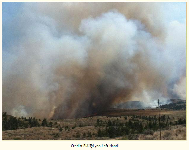
Chalky Fire on Montana's Rosebud Complex
Chalky Fire on Montana’s Rosebud Complex

This is the second major fire to burn on the Northern Cheyenne Reservation this year. The Ash Creek Fire in June burned 18 homes, forced evacuations, and resulted in $20,000 of damage to tribal property. The Chalky Fire is the largest in the Rosebud Complex, which includes six active fires. Crews have made good progress on the fires burning on the Crow and Northern Cheyenne reservations, and officials today lifted evacuation notices and re-opened the roads closed by fire activity. “We got some precip on the fire this morning and that really helped,” said LaDawn Saxton, information officer with BIA Northern Cheyenne Fire and Aviation.

Montana firefighters expecting high winds

A red flag warning is in effect this afternoon through tomorrow, with a dry cold front predicted to bring strong gusty winds from the northwest at 20 mph with gusts up to 40 mph. Firefighters on the 20,000-acre East Sarpy Fire east of Billings, Montana, will focus on structure protection instead of building fireline. The fire area is not heavily populated, but it includes some ranch homesteads and the Westmoreland Sarpy Creek coal mine.

[UPDATE: The Sarpy Hill Complex is estimated at 51,000 acres this afternoon.]


East Sarpy Fire at noon 08/01/2012

Portions of the fire over the last two days have jumped dozer lines. “Everything we tried didn’t work,” said a veteran helicopter manager. An additional five crews will work on the fire today, along with 20 more engines. Crow tribal engines worked through the night, along with Big Horn County Rural Fire resources, dozers, graders, water tenders, and local ranchers. A Type 2 team will take over the fire today.

The East Sarpy and West Tullock Creek fires burned together late yesterday, and the Dawes Fire burned actively all night. East of Dunmore, residents could see the glow of the Little Dry Creek fire, which is a priority today.

Three other fires recently burned more than 15,000 acres north of Winnett. Crews have contained the Wolf Creek, 15-Mile, and Dovetail lightning-caused fires earlier this week. To the east, Rosebud County crews are working on 28 fires burning in the county. Carole Raymond, Rosebud County’s disaster and emergency services coordinator, told the Billings Gazette that the largest of the fires is burning between Rosebud and Butte creeks.

“That’s the biggest one and they don’t have it even kind of handled,” she said. “It’s just running on them.”

Montana firefighters busy, tankers committed

Montana fires are picking up, and a cold front is expected to bring high winds to the region tomorrow.

The Missoulian reported that the Bitterroot National Forest was staffing three active fires between Sula and Stevensville, all lightning-caused and no more than three acres in size. Crews are being demobilized on the 2,500-acre Chrandal Creek Fire.

According to the Helena Independent Record, the week’s forecast includes dry and warm weather with a chance of thunder and lightning. Paul Nutter, meteorologist with the National Weather Service in Great Falls, said the agency’s concerned about fire danger. He said Thursday’s weather will include gusty winds and continued dry conditions, with temperatures in the 80s. July precipitation was only 0.6 inches — normal is 1.12 inches.

Aerial scouts with the Lolo National Forest flew parts of the Scapegoat Wilderness on Tuesday, looking for hikers in the path of a new wilderness fire showing a high potential for growth. The Missoulian reported that the Falls Point Fire grew to 300 acres on Monday and was burning actively Tuesday in the North Fork of the Blackfoot River drainage about 13 miles north of Ovando.

Chrandal Creek Fire smoke drifts over the valley on 07/25

The Northern Rockies Coordination Center noted numerous new fires in the last 48 hours.  Smokejumpers were assigned yesterday to the Goblin Gulch Fire southeast of Great Falls. The fire was at 20 acres by late morning and a ‘shot crew was on order. Resources were also ordered for the 100-acre Chain Butte Fire northeast of Lewistown. Kusicko’s Type 2 IMT was ordered in late afternoon for the 100-acre Butler Fire 28 miles northwest of Missoula. Three airtankers and a lead plane were assigned.

The 3,000-acre East Sarpy Fire was reported this morning about 23 miles southwest of Colstrip. Four airtankers and a lead were assigned, with a Type 2 team on order. The Goblin Gulch Fire grew about 160 acres overnight; it has a lead and an airtanker committed, as does the Butler Fire.

Lead 12 and Tanker 40 are assigned to the Bear Hill Fire southwest of Anaconda. Just after noon today a new set of fires was reported. The Rosebud Complex in Rosebud County includes the 2,000-acre Juniper Fire, the 200-acre Butte Fire, and the 150-acre Midnight Fire. Benes’ Type 2 team has been ordered.

Wilderness Fires in Utah and Montana

The Dallas Canyon Fire, about 50 miles west of Salt Lake City, was mapped today at 43,610 acres. Ignited by lightning on July 27, the fire’s burning in the Cedar Mountain Wilderness Area southwest of the community of Delle. According to the Salt Lake Tribune, the fire area includes sensitive habitat for sage grouse, pronghorn antelope, and wild burros — along with raptor nesting grounds.

Resources on the fire include about 360 firefighters, and Erik Haberstick’s team put the fire at 60 percent containment this morning.

Another wilderness fire, the Rapid Creek Fire in the Bob Marshall, took off yesterday. The Great Falls Tribune reported that the fire is 27 miles west of Augusta.

Rapid Creek Fire
The fire was reported at about noon on Sunday by two different lookouts. It was estimated at 3,000 acres late yesterday, burning in heavy timber and mountain pine beetle kill, and it grew to over 5,000 acres by this morning.

Dave Cunningham with the Lewis and Clark National Forest said an incident management team and air resources have been ordered; fire behavior has included sustained crown runs. The Rapid Creek Fire yesterday burned over the Continental Divide and into the Triple Divide Fire, then into the Elbow Pass Fire. Sheriff’s deputies and USFS personnel contacted cabin owners and others in the area and warned them that the fire could move toward the Benchmark Corridor.

The 700-acre Elbow Pass Fire in the Scapegoat started on July 12 southwest of Augusta, and the Triple Divide fire west of Augusta is at about 7 acres.  The complex is being managed as a suppression fire.