Wildfire potential in the southwest is higher than in 2019

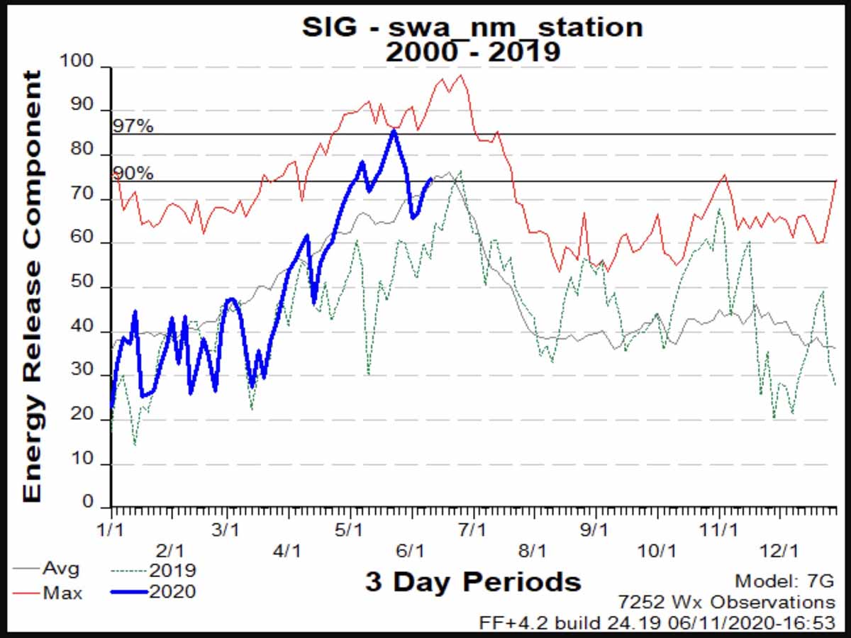
The Energy Release Component in Arizona and New Mexico is average or above for the date, but considerably higher than last year

Energy Release Component New Mexico
Energy Release Component, average of fire weather stations in New Mexico.

For the past two weeks most of the largest wildfires in the United States have been in Arizona, and recently the number of fires in New Mexico has also been increasing.

One of the reasons for this trend is reflected in the Energy Release Component (ERC) which is monitored from data collected at dozens of fire weather stations in the two states.

The ERC is an index indicating how hot a fire could burn. It is directly related to the 24-hour, potential worst case within the flaming front at the head of a fire.

The ERC can serve as a good characterization of a fire season since it tracks seasonal fire danger trends well. Fuel loading, woody fuel moistures, and larger fuel moistures all have an influence on the ERC, while the lighter fuels have less influence and wind speed has none. ERC has low variability, and is the best fire danger component for indicating the effects of intermediate to long-term drying on fire behavior.
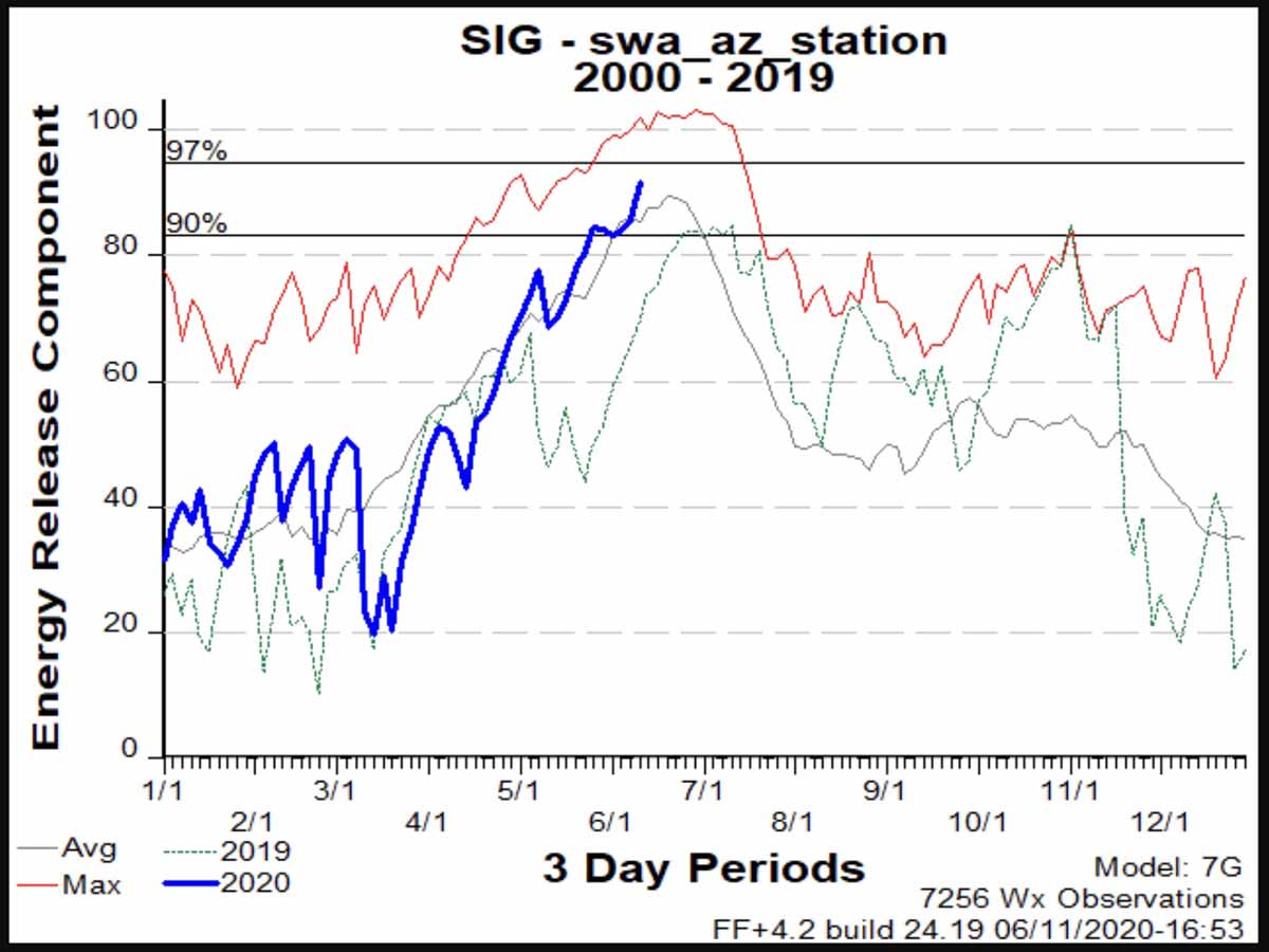
Energy Release Component Arizona
Energy Release Component, average of fire weather stations in Arizona.

During the first six months of 2019 the statewide averages of ERC in Arizona and New Mexico were significantly below average, especially during May and June. So far during those two months this year the average ERCs have been slightly above average or well above. For the past week or so the statewide averages in the southwest have been above the 90th percentile and are nearing the 97th.

Click here to see ERC details at each of the fire weather stations in Arizona and New Mexico.

The weather forecasts for the next couple of weeks indicate that there is not much reason to think the ERCs will dip below average. WeatherUnderground predicts little or no rain in Phoenix, Flagstaff, or Albuquerque through the end of June. But the National Weather Service’s 8-14 day outlook predicts slightly higher probability of precipitation during that 7-day period, but with higher than normal temperatures.
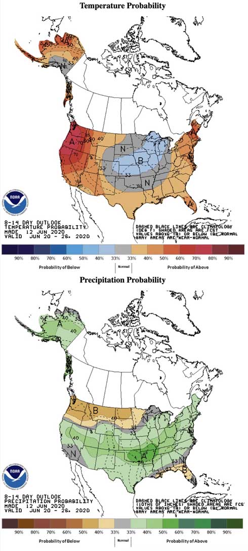
8-14 day temperature and precipitation
8-14 day temperature and precipitation forecast. NWS.

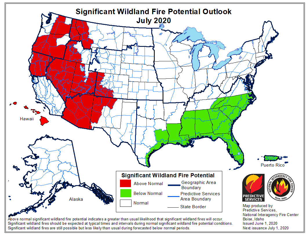
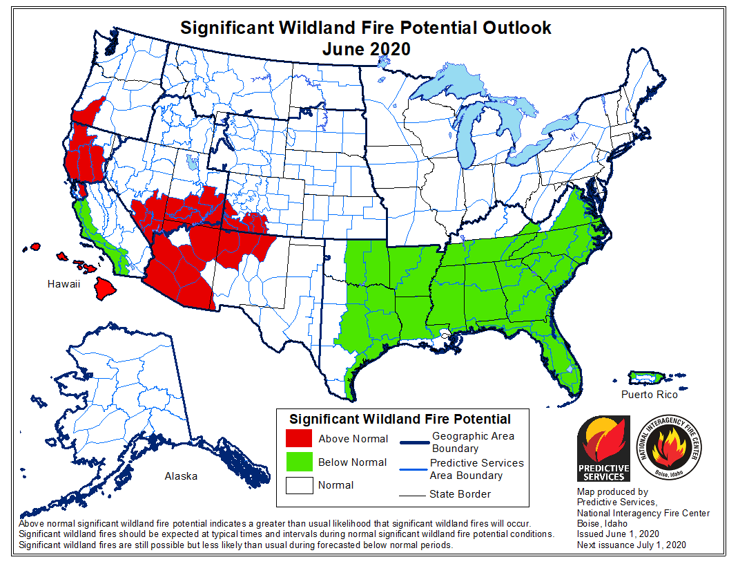
On June 1 the Predictive Services office at the National Interagency Fire Center concluded the fire potential during June and July would be higher than normal in northwest New Mexico and most of Arizona.

potential wildfires fires weather forecast predictionpotential wildfires fires weather forecast prediction

Below are excerpts from NIFC’s June 1 wildfire outlook in the section about Arizona and New Mexico:

“Above Normal significant large fire potential is expected across most of Arizona and northwestern New Mexico through mid-July followed by a return to Normal potential after mid-July as the monsoon arrives. Other locations across the region can expect Normal significant large fire potential.

“Over the past two months, average high temperatures have been from 1-4 degrees above Average west of the divide and generally between 2-6 degrees above average further east. Some spots in eastern New Mexico have seen high temperatures from 6-8 degrees above average. As far as precipitation, most portions of the region have seen much drier conditions over the past 60 days.

“Significant Large Fire potential is anticipated to remain Normal for many areas east of the [Continental] Divide during the month of June while most portions of Arizona into northwestern and northern New Mexico will experience Above Normal significant large fire potential. The fine fuels will be the continued focus of fire activity entering June until the larger fuels become receptive mid-month and remain so until the monsoon’s arrival in mid-July.”

New Mexico and Arizona are currently the wildfire hot spots

Large fires Arizona and New Mexico wildfires
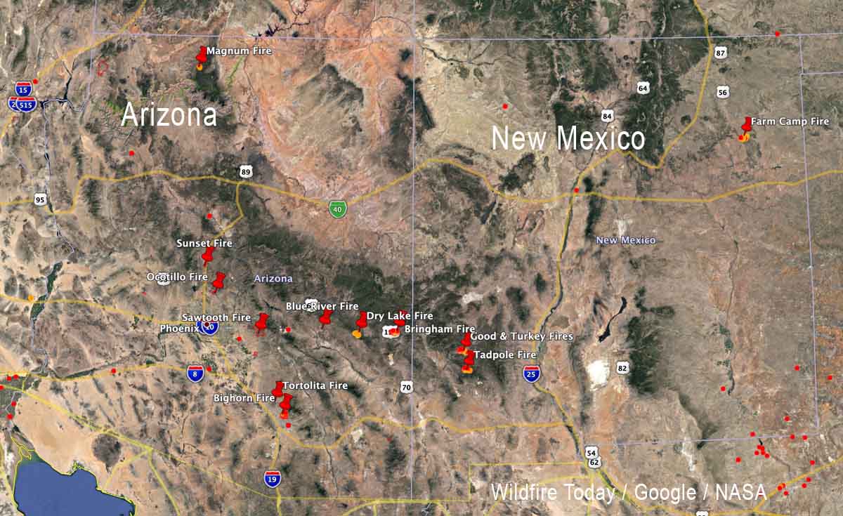
Map showing some of the recent large fires in Arizona and New Mexico. June 11, 2020.

The map shows 13 of the more significant wildfires that have occurred in Arizona and New Mexico over the last several days. Firefighters in southeast Arizona, in particular, have been very busy.

Former inmate firefighters establish forestry company

All Around Forestry
All Around Forestry photo

Former inmates that acquired skills while they were incarcerated are making use of that training and experience in the woods of New Mexico.

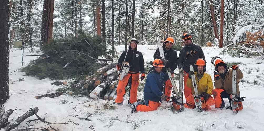
Lawrence Jaramillo and Joshua Melendrez became qualified as wildland firefighters and chain saw operators while serving time in Los Lunas prison. The Inmate Workers Camp program (IWC) taught them the basics of wildland firefighting.

After they spent three years in prison the two of them formed a private company, All Around Forestry LLC.

I talked with Mr. Jaramillo Friday just after the final inspection was completed on the largest project they have worked on since the company was issued a business license in November. On the 13-acre job the company’s six employees thinned dog hair thickets, removed some large trees, and otherwise reduced hazardous fuels around structures at the Ponderosa Christian Camp in the Jemez Mountains. He said they have submitted bids on other projects that they hope to hear from soon.

Mr. Melendrez told us, “The cool thing about it is that every single one of our employees with us are wildland fire certified as well,” he said. “We all have done the program. We all went through as ADs for New Mexico State Forestry [after we got out of prison] — went on fires and fought fires with each other for quite some time now. We all have the knowledge of what needs to be done, and to do it thoroughly as well.”

They want to realize what is implied in the company’s name, All Around Forestry LLC, and hope to provide additional services such as a 20-person crew and a fire engine.

All Around Forestry
All Around Forestry photo

Below is an excerpt from an article at KOAT:

For these men it’s about giving people like them a second chance.

“A lot of people are happy and proud to see, I guess, a success story,” Melendrez said. “We owe a lot of it to IWC but it’s also our own mindset to be better for ourselves.”

“They’ve been doing an amazing amount of work, they’ve gotten an amazing amount done,” Ponderosa Christian Camp board director Craig Mathews said. “We hope this is just a spring board for them, and that they’re very successful in the projects they get awarded in the future.”

Not only is it an opportunity to grow, but also a chance to go at life a different way this time.

“We did wrong in the past but that’s not us anymore, we’ve changed our lives completely,” Melendrez said.

Jaramillo said they are looking for other clients to do business with, as well as other former inmates who want to join the company.

“Fire is inevitable”

tree density wildfires exclusion
A screengrab from a video below illustrating how the number of trees per acre can increase if fires are excluded from an area.

In the first two in a series of 12 videos produced by the Santa Fe National Forest in Northern New Mexico, Fuels Program Manager Dennis Carril discusses the inevitability of vegetation fires and how fuel, standing trees and deep layers of litter, can build up as a result of fire exclusion. Each video is less than three minutes long.

The videos are “unlisted” on YouTube, however they have been promoted on Twitter by @SantafeNF and @DOIWildlandFire.

Pine Lodge Fire reaches Capitan Peak

The fire is 16 miles east of Capitan, New Mexico

Pine Lodge Fire Mopup
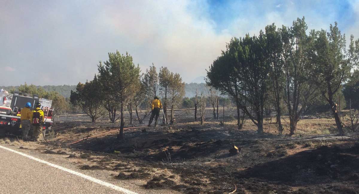
Firefighters mopup near a highway on the Pine Lodge Fire. Uploaded to InciWeb July 3, 2019.

The Pine Lodge Fire reached Capitan and Sunset Peaks yesterday and is visible on the south side of the Capitan Mountain Range and from Hwy 380 and Hwy 70. Low to moderate fire behavior will continue due to outflow winds from thunderstorms, but due to higher humidities and lack of fuel, minimal fire growth in expected.

The 14,783-acre  fire continues to burn on the north and south sides of the Capitan Mountains in the wilderness area. Fire activity is minimal near containment lines and continues to consume unburned pockets of fuel within the lines, but all fire lines are holding well.

The fire was reported June 19 and is now 16 miles east of Capitan, New Mexico.

Crews continue to patrol and mop-up along fire lines as needed. Fire activity is being monitored in the Copeland Canyon and Peachtree Canyon drainages to keep the fire from moving west. The fire may continue to creep further into the Wilderness. Rehabilitation work from suppression activity is ongoing.

There are 145 suppression and support personnel remaining with the Pecos Type 3 Incident Management Team. Additional cooperating and assisting organizations include State of New Mexico, Lincoln County Sheriff Department, NM State Police and Otero County Electric Coop.

(Some of the text above is from InciWeb)

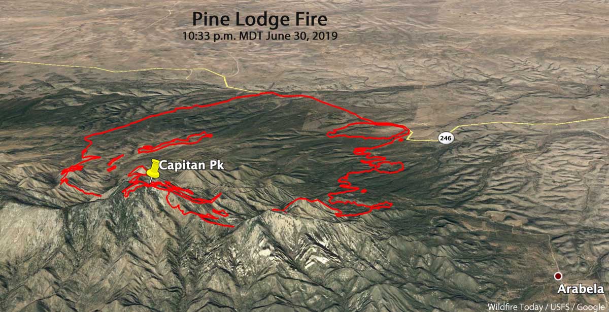
Pine Lodge Fire 3-d map
3-D map of the Pine Lodge Fire at 10:33 p.m. MDT June 30, 2019. Looking north.
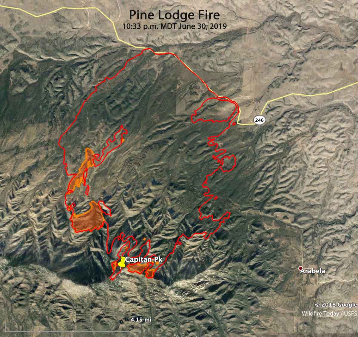
Pine Lodge Fire map
Map of the Pine Lodge Fire at 10:33 p.m. MDT June 30, 2019.

Type 2 Incident Management Team ordered for the Pine Lodge Fire in New Mexico

It is 18 miles east of Capitan, NM

Map Pine Lodge Fire southwest New Mexico
Map showing the location of the Pine Lodge Fire in southwest New Mexico. The red dots represent heat detected by a satellite at 1:26 p.m. MDT June 21, 2019.

The Pine Lodge Fire is burning on the north end of the Smokey Bear Ranger District, Lincoln National Forest in Southwest New Mexico. It is 18 miles east of Capitan and 3 miles northwest of Arabela. A Type 3 Incident Management Team is currently engaged, and a Type 2 Team has been ordered. (See the map, above, of the Pine Lodge Fire)

Our very unofficial estimate of the size, based on heat detected by a satellite at 1:26 p.m. MDT on June 21, is that it has burned approximately 1,800 acres. It was spreading rapidly Friday afternoon pushed by a southwest wind.

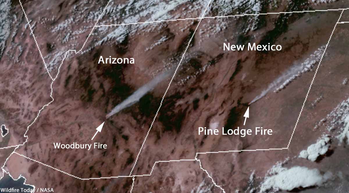
Satellite photo smoke Woodbury and Pine Lodge Fires
Satellite photo showing smoke from the Woodbury and Pine Lodge Fires at 5:01 p.m. MDT June 21, 2019.

The strategy is to suppress the fire. It is burning off Forest Service Road 130 near Boy Scout Mountain in extremely rough, rocky terrain with grass, pinyon-juniper, and mixed conifer vegetation. Firefighters will continue to assess and engage this fire, taking into consideration public and firefighter safety as the number one priority.

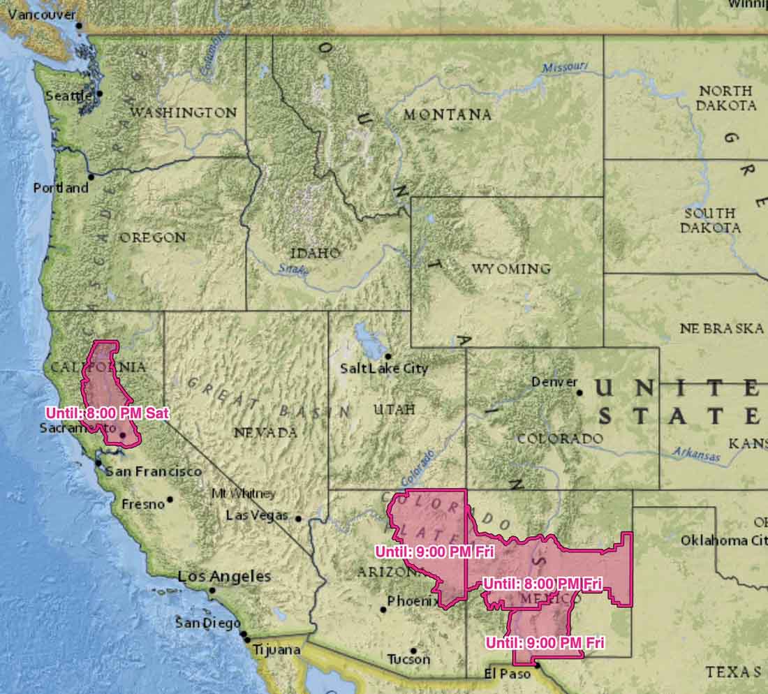
The area is under a Red Flag Warning until 8 p.m. Friday for extreme fire weather. A weather station at the Sierra Blanca Regional Airport, 18 miles to the southwest, recorded a high Friday afternoon of 83 degrees, 10 percent relative humidity, and winds out of the southwest at 15 to 25 mph with gusts up to 40. The forecast for Saturday calls for 87 degrees, RH of 8 percent, and southwest winds at 15 to 20 mph in the afternoon.

Red Flag Warnings
Red Flag Warnings, updated at 10 a.m. MDT June 21, 2019.