Previous assignments of U.S. firefighters to Australia

The United States has sent firefighters to Australia to assist with bushfires twice in the last five years.

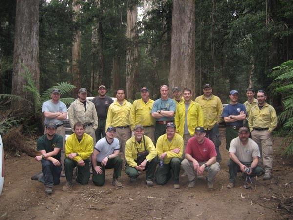
U.S. firefighters in Australia
U.S. firefighters in Victoria, Australia, February, 2009. Photo by Wol Worrell.

With the bushfire season in southeast Australia heating up much earlier than normal, some are wondering if the United States is going to send wildland firefighters down under to give them a hand. In the last eight years this has happened four times, in 2006, 2007, 2009, and 2010. At least two of those deployments were in January and February during their fire season that typically runs from December through February. With this very unusual October siege underway in New South Wales, which has been described as the worst wildfire conditions in more than 40 years, and with more than 200 homes destroyed, these conditions are an outlier, very different from the normal fire occurrence.

We checked with our sources in Boise and there are no immediate plans underway to send American firefighters to Australia. But the down under bushfire season has not even officially started — it could be an interesting summer below the equator.

In February, 2009, the United States sent 60 wildfire specialists to Victoria to assist with operations, planning and logistics. That included two thirteen-person teams specializing in rehabilitating burned areas, and one 20-person suppression team. I believe the “suppression team” was a thrown-together group of experienced firefighters formed into a crew, since no hotshot crews were on duty in February. More information about that deployment is HERE, HERE, and HERE.

In January, 2010, the United States again sent firefighters to Australia. That time it was approximately 17 people, with most of them being assigned within Victoria. Some details about that trip are HERE, HERE, and HERE.

The international assistance has worked in both directions. In July, 2008, 44 Australian and New Zealand firefighters came to the United States to assist with fires in California. The first deployment of firefighters from Australia to the U.S. was in 2000.

Wildfire conditions in Australia the worst in 40 years

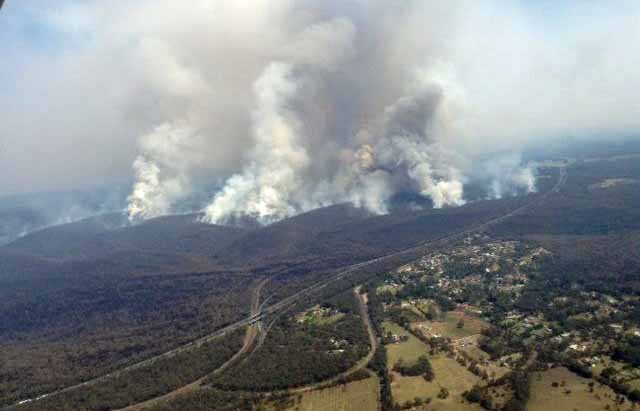
Hall Road Fire, Balmoral Village
Hall Road Fire, Balmoral Village October 17, 2013. NSW RFS photo.

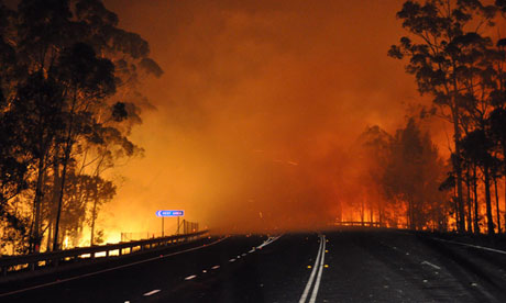
Australian fire officials on Sunday warned that residents of New South Wales are facing the worst wildfire conditions in more than 40 years. Already more than 200 homes have been destroyed and another 120 damaged. One man has died so far trying to protect his property. The weather forecast for Wednesday is even more severe.

The last time firefighters faced a situation like this was in the late 1960s.

Monday some areas received lightning with little or no rain.

lightning and fires NSW
Map showing lightning (in yellow) and fire locations (in blue). October 21, 2013. NWS RFS image.

Assistant police commissioner Alan Clarke said mandatory evacuation orders would be enforced in some areas, describing the risk as “far more extreme” than in past fires.

“Police will be doing forced evacuations if the risk is necessary,” Clarke told reporters.

“At the end of the day we hope we have buildings standing, but if we don’t have buildings standing we don’t want bodies in them.”

The typical wildfire season in Australia is from December through February, but this year firefighters are having to deal with numerous large fires weeks earlier than normal. The contracts for large Erickson Air-Crane helicopters that can carry 2,650 gallons of water were not yet in effect but two of the ships were rushed into service to assist firefighters.

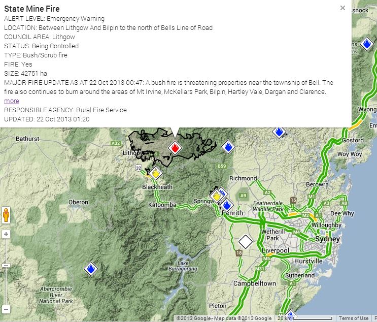
Map of State Mine Fire at 1:20 a.m. October 22, 2013
Map of State Mine Fire at 1:20 a.m. October 22, 2013. NSW RFS.

One of the largest fires is the State Mine Fire about 70 km northwest of Sydney between Lithgow and Bilpin which as burned 42,751 hectares (105,000 acres). It is likely to merge with the New York Road/Mt. Victoria Fire just to the south, which is 2,017 hectares (5,000 acres).

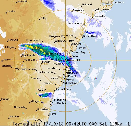
Weather radar showing wildfire smoke Australia
Weather radar showing smoke from the State Mine Fire at 06:42 UTC, October 17, 2013.

Two sources for current maps of fires in Australia: New South Wales Rural Fire Service, and ESRI.

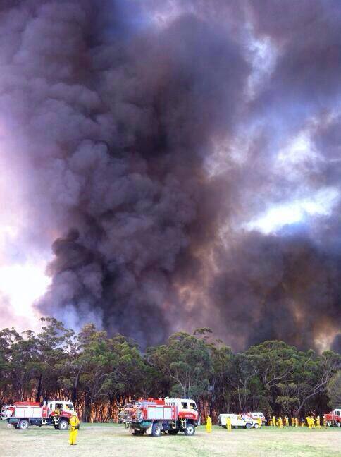
Springwood Fire
New South Wales Rural Fire Service fighting the Springwood Fire near St Columba’s School, October 18, 2013. Photo by Ellie Southwood.

Australian Prime Minister works a night shift on the fire line

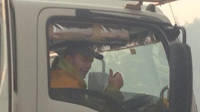
Prime Minister Tony Abbott
Prime Minister Tony Abbott gives a thumbs up after a night shift helping to backburn with the NSW Rural Fire Service

The new Prime Minister of Australia, in office for a month, apparently is not your ordinary chief of state. During the recent rash of bushfires in New South Wales, Tony Abbott worked a night shift helping back burn near Bilpinwith with his Davidson Fire Service Brigade from Sydney’s Warringah Pittwater Rural Fire District. Mr. Abbott has been a volunteer with the Rural Fire Service Brigade for 13 years and is qualified as a specialist breathing apparatus operator, chainsaw operator, and tanker driver.

There are reports that the Prime Minister’s firefighting activities have been a challenge for his Australian Federal Police security detail charged with his protection.

In addition to serving as a firefighter, Mr. Abbott in the past has volunteered as a teacher in remote Aboriginal Communities. Before he was elected he promised he would continue to live one week a year in similar communities after becoming Prime Minister.

Prime Minister Tony Abbott with fellow firefighters
Prime Minister Tony Abbott with fellow firefighters from the Davidson Rural Fire Brigade.

Dozens of homes destroyed in bushfires in southeast Australia

Officials of Australia’s Rural Fire Service are saying that hundreds of homes may have burned in southeast Australia as more than 100 fires burned in New South Wales (NSW), with 36 still uncontained.

The NSW premier, Barry O’Farrell, said that it would be a miracle if there was no loss of life. Australia’s national science agency, CSIRO, warned that several people were likely to have been killed if the estimate of hundreds of properties destroyed proved to be true, as historically an average of one life has been lost for every 17 houses.

These fires are following an unusually early start to the Australian fire season last month, well ahead of their summer which normally reintroduces fires to the landscape.

One of the fires spread from Lithgow towards the Blue Mountains, running more than 25km (15 miles) and burning over 20,000 hectares (50,000 acres) of bushland.

ABC News in Australia has an excellent video report about the fires.


Fire names in Australia

Bush fire in Australia
Bush fire in Australia. Photo: NSW Rural Fire Service.

Kelly pointed out that some of the names of places in Australia, such as Warrumbungle National Park, can be interesting. I agree, and in search of a few more I perused a list of the names of this season’s fires on the New South Wales Rural Fire Service web site. Here are some that I noticed:

Monkey Top, Coonabarabran, Bugaldie, Tooraweenah, Bugaldi, Baan Baa, Yalambee, Ernies Flat, Boolcarrol, Sunnydowns, Mandurma, Nangar, Wearne’s Road, Moonbria, Nanima, Yulladunida, Quinytambie, Tinda Creek, Marrapina, Koonawarra,Munkartie, Mobla, Colong, Coybil, Glenirie, Umbango, Mates Gully, Wokolena, Nundle, Popodopoulos, Swampy Arm, Kiwarrak Cross Road, and Old Soldiers Firetrail.

Wildfire burns structures at observatory in New South Wales

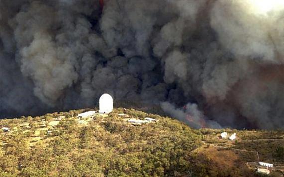
Wambelong Fire, Siding Springs Observatory
The Wambelong Fire threatens the Siding Springs Observatory. Photo by New South Wales Rural Fire Service.

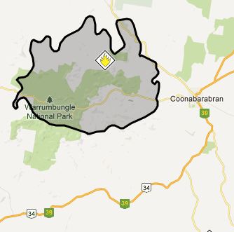
The Wambelong Fire has raged across 39,007 hectares (93,388 acres) in New South Wales (NSW) burning through Warrumbungle National Park and other lands west of Coonabarabran.

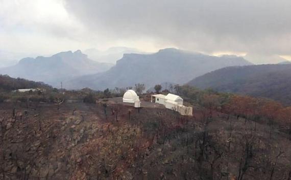
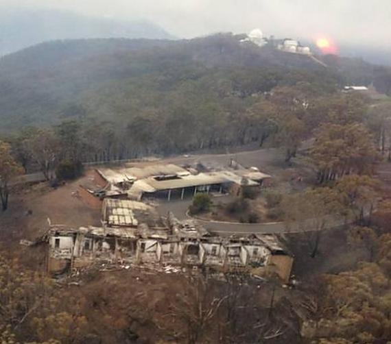
Siding Spring Observatory, post fire
Siding Spring Observatory, after the fire. Photo: NWS RFS

NSW Rural Fire Service Building Impact Assessment Teams have confirmed 33 structures in the Timor Road area have been destroyed, although this number is likely to change as crews continue their assessments. More than 50 outbuildings have also burned, as well as a large number of livestock and farm machinery.

Map, Wambelong Fire
Map of the Wambelong Fire, provided by the RFS, 1:25 a.m. January 15, 2013

Approximately five structures at the Siding Spring Observatory complex have been damaged or destroyed by the fire, including the visitor center and the lodge used as accommodations for visiting researchers. The main telescope has survived, although it is not known if it has been damaged.

The fire is spreading in a northerly direction away from Timor Road and the observatory and is currently burning in the Bugaldie area.

Properties to the west of the the Warrumbungle National Park may come under direct threat if firefighters cannot contain the fire on the western boundary of the National Park.

Approximately 83 firefighters supported by aircraft worked to establish containment lines throughout the afternoon and evening on Monday.

Siding Spring Observatory, after the fire
Siding Spring Observatory, after the fire, showing damaged to the lodge used as accommodations for visiting researchers. Photo: NSW RFS.

Below is a video news report about the fire.