New Jersey Forest Fire Service enters their 84th year of improving forests with prescribed fire

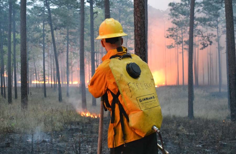
prescribed burn US Air Force’s Warren Grove Bombing Range
A prescribed burn at the U.S. Air Force’s Warren Grove Bombing Range in Ocean County, NJ. Photo: Trevor Raynor

Michael Achey and Marie Cook of the New Jersey Forest Fire Service (NJFFS) wrote this article about their prescribed fire program, which is entering its 84th year in the state.


The NJFFS is the agency responsible for protecting life, property, and New Jersey’s natural resources from wildfire. One of the ways we accomplish our mission is by an aggressive hazardous fuel mitigation program, specifically using prescribed fire.

History and Purpose of Prescribed Fire in New Jersey
NJFFS has been using prescribed fire on state lands since 1936, primarily to reduce hazardous fuel accumulations. Other beneficial effects of these treatments include providing high quality wildlife habitat and resilience in forest health. While reducing the threat to public safety posed by hazardous fuels is always the primary mission, this year’s signing of the New Jersey Prescribed Burning Act has given fire management officers additional latitude for using prescribed fire as a tool to achieve several other ecological objectives. While prescribed burning takes place statewide across all ownerships, much of the activity is concentrated on state lands in fire-adapted Pine Barrens communities.

The state has proposed over 30,000 acres to be treated by prescribed burning this season, a seemingly ambitious goal having come off one of the wettest years current fire managers have ever experienced through the course of their careers. Prior to treatment, all proposed prescribed burn units are approved through a Departmental review process that considers natural resource, historical and ecological concerns, after which burn plans are prepared by local fire managers for each unit. At the time this article was written, towards the culmination of NJ’s prescribed burn season, approximately 15,000 acres of public and private land had been treated.

prescribed fire New Jersey
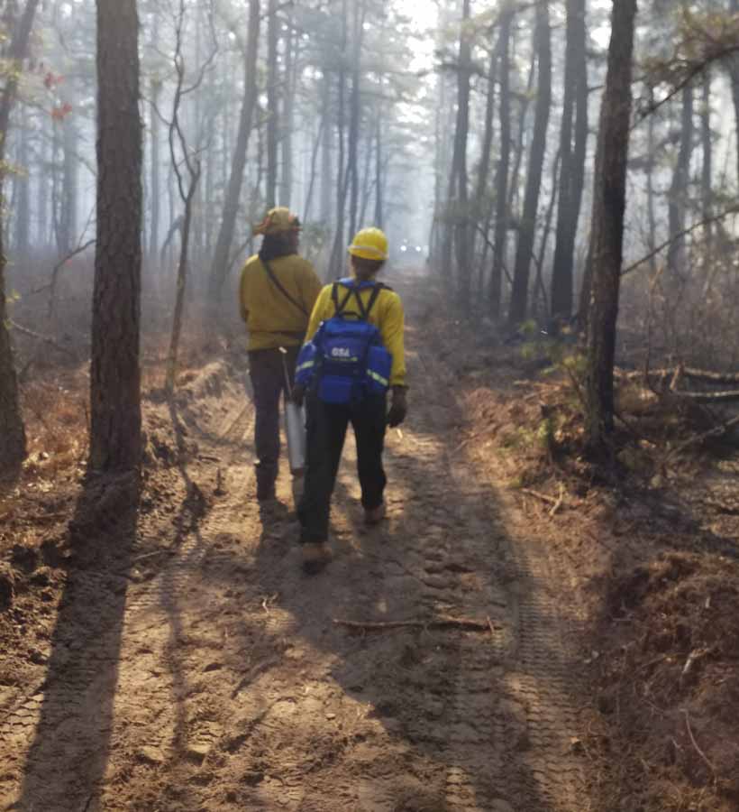
Students from the 2019 Prescribed Fire Exchange work on prescribed burns in New Jersey’s Pinelands region. Photo: Michael Achey
prescribed fire New Jersey
Students from the 2019 Prescribed Fire Exchange work on prescribed burns in New Jersey’s Pinelands region. Photo: Michael Achey

Education and Outreach
The 2019 burn season marks the second formalized annual Prescribed Fire Exchange, a program created to provide opportunities for students and practitioners outside NJFFS for training and exposure to prescribed fire techniques utilized in New Jersey. Students from Northern Arizona University, University of Idaho, and Utah State University have received training so far, as well as professional staff from the New York Department of Environmental Conservation, New York’s Central Pine Barrens Commission, and the Montana Department of Natural Resources. NJFFS is extremely proud of this budding program which continues to receive praise from past and current participants. While our roots hold firm to tradition, we are continually seeking ways to improve our programs and expand the scope of their benefits. Anyone interested in participating in future exchanges should contact NJFFS state headquarters located in Trenton, NJ.

Research
Beginning in 1926, the USDA Forest Service Northern Research Station’s program in the NJ Pinelands has served as a regional hotspot for research of fire and forest management practices.  Over time, the development of a landscape-scale approach of creating a mosaic with prescribed fire each year has resulted in fuel hazard reduction and promotion of forest health and regeneration.

Today, this program capitalizes on the constantly emerging breadth of new knowledge and technology including satellites and laser-based sensors, to drive research on aspects of fire that were once impossible to study.  With topics such as fire spread through ember showers, fire effects, physics-based modeling of fire spread, and technological approaches to assessing hazardous fuels at the wildland-urban interface, this research contributes to the evolution of universally applicable fire science knowledge. Most importantly, the work strives to meet a balance of risk and ecosystem service needs with growing populations and changing forest and climate conditions.

prescribed fire stats New Jersey
2019 NJ Prescribed Burning Statistics as of March 21, 2019; “Other” denotes government land not in state ownership.

Additional information about the Silas Little Experimental Forest and the New Jersey Forest Fire Service and their prescribed burning program.
Are stand replacement fires “bad”?

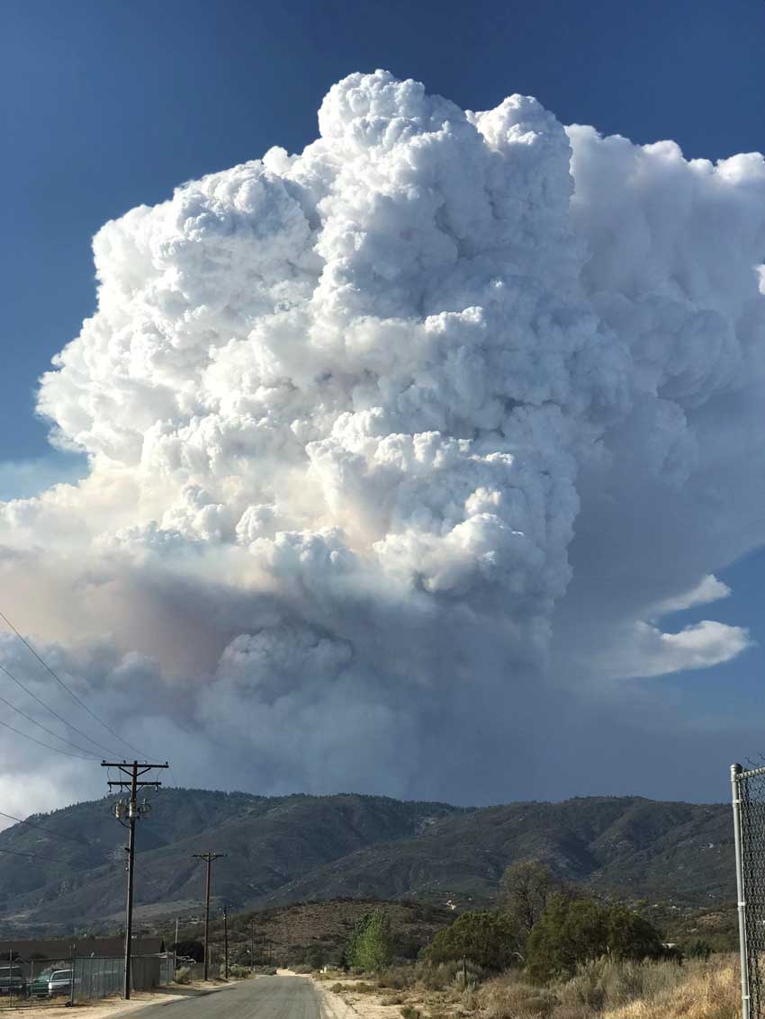
Cranston Fire
Cranston Fire, July, 2018. InciWeb photo.

The video below, paid for by a grant from the U.S. Forest Service, advocates active management of forests as one of the methods of preventing catastrophic wildfires. Most land managers and members of the public will agree with that very general statement, with exceptions for certain parks and wilderness areas.

The video defines active management as thinning to reduce fuels,  prescribed fires, and “managing natural fires when they start”. It begins with Doug Grafe, Fire Protection Chief of the Oregon Department of Forestry stating,”It’s the public perception that catastrophic stand replacement fires are bad. And they are.”

The interviewer enthusiastically said, “Yes they are”.

Chief Grafe continued, “And they’re not natural.”

At the end of the video the narrator says “fire is complex”.

Agreed. It is too complex to throughly explain in a 96-second film which is apparently intended to shape public opinion about how to manage forests.

Not all stand replacement fires, in which most or all overstory trees are killed, are catastrophic, unnatural, or bad. Fires in lodgepole pine, for example, are either creeping and slow moving or rapidly spreading, intense, stand replacing crown fires occurring at 50 to 300-year intervals.

In addition to prescribed fire, thinning, and fuel management, “active forest management” in recent years has been a dog whistle for increasing logging, used by lobbyists and others that make their living from the timber industry. The president used the term along with “health treatments” in a Presidential Order signed on the Friday before Christmas in which he directed a 37 percent increase in timber harvesting.

The moral of this story is, active forest management in most landscapes has many benefits, but beware of how it is defined.

Fire “is like giving the forest a bath”

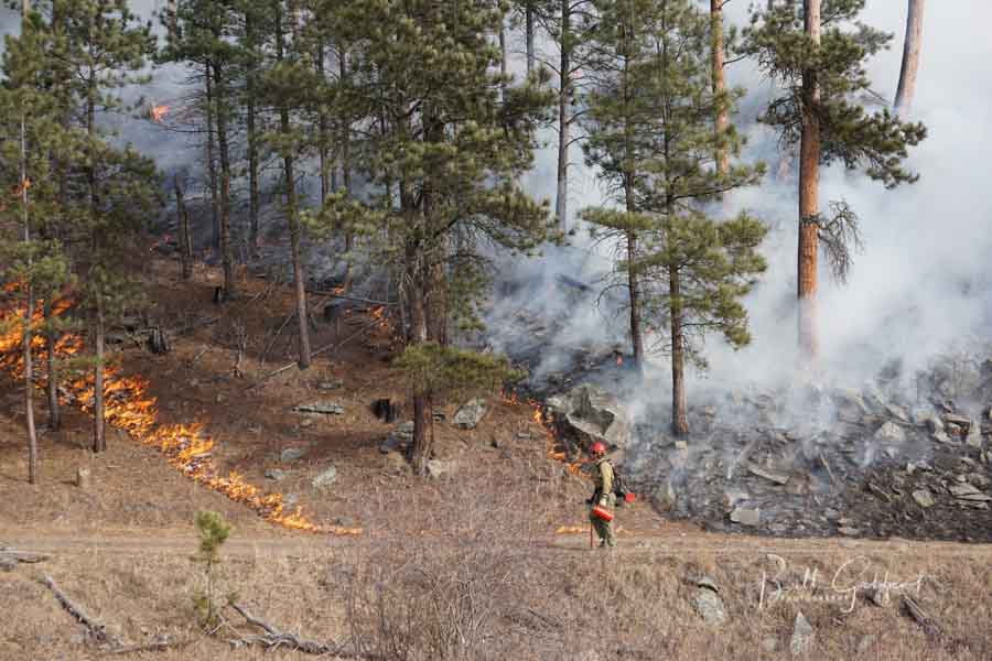
Whaley Prescribed Fire Black Hills of South Dakota
The Whaley Prescribed Fire in the Black Hills of South Dakota, January 13, 2016. Photo by Bill Gabbert.

In this video, Matt Jolly, an ecologist at the U.S. Forest Service’s Rocky Mountain Research Station, talks about the natural and important role of fire in maintaining a healthy ecosystem. He explains that fire “is like giving the forest a bath”.

FSU researchers: Most fires in Florida go undetected

By: Zachary Boehm

A new study by Florida State University researchers indicates that common satellite imaging technologies have vastly underestimated the number of fires in Florida.

Holmes Nowell
Christopher Holmes, assistant professor in the department of Earth, Ocean and Atmospheric Science, and Holly Nowell, postdoctoral researcher in EOAS.

Their report, published in collaboration with researchers from the Tall Timbers Research Station and Land Conservancy, challenges well-established beliefs about the nature and frequency of fire in the Sunshine State. While there were more fires than expected, researchers said, strategically prescribed burns throughout the state are proving an effective force against the ravages of wildfire.

The paper appears in the journal Geophysical Research Letters.

For scientists studying fire, sophisticated satellites whizzing far above the Earth’s surface have long represented the best tool for monitoring wildfires and prescribed burns — carefully controlled and generally small fires intended to reduce the risk of unmanageable wildfires.

But FSU researchers suggest that fire experts themselves have been getting burned by faulty data, and that broadly accepted estimates of fire area and fire-based air pollutants might be flawed.

“There are well-known challenges in detecting fires from satellites,” said lead investigator Holly Nowell, a postdoctoral researcher in the Department of Earth, Ocean and Atmospheric Science. “Here we show that only 25 percent of burned area in Florida is detected.”

Using comprehensive ground-based fire records from the Florida Forest Service — which regulates and authorizes every request for a prescribed burn in the state — researchers found dramatic discrepancies between fires detected by satellites and fires documented by state managers.

prescribed fire Florida
Austin Dixon of the Tall Timbers Research Station and Land Conservancy monitors a prescribed burn. Credit: Kevin Robertson

The majority of fires in Florida come in the form of prescribed burns, but because these fires are designed to be brief and contained, they often fall under the radar of satellites soaring overhead.

This is especially true in a state like Florida, where dense cloud cover is common and the warm, wet climate allows vegetation to regrow quickly after a blaze, disguising the scars that fires leave in their wake.

“Like a detective, satellites can catch a fire ‘in the act’ or from the ‘fingerprints’ they leave behind,” said study co-author Christopher Holmes, an assistant professor in EOAS. “In our area, catching an active fire in a thermal image can be hard because the prescribed fires are short, and we have frequent clouds that obscure the view from space.”

The state fire records also revealed a counterintuitive truth: Unlike in western states such as California, where dry conditions frequently produce massive increases in destructive and often uncontrollable fires, Florida actually experiences a decrease in land consumed by fire during drought.

When drought conditions emerge, researchers said, officials are less likely to authorize prescribed burns. And because prescribed burns account for the overwhelming majority of fires in the state, overall fire activity decreases.

This also suggests that prescribed burning programs — which aim to reduce the risk of wildfire in dry conditions — are having a materially positive effect.

“Although we still have occasional destructive wildfires, including the recent tragic Eastpoint fire, our results indicate that prescribed fire policy is helping to reduce wildfire risk,” Holmes said, referencing the June 2018 wildfire that destroyed dozens of homes in Florida’s Big Bend region.

Tall Timbers specialist Tracy Hmielowski uses a drip torch to ignite vegetation as part of a prescribed burn. Credit: Kevin Robertson
While the team’s study reconfirms the utility of prescribed burning, it calls into question prevailing estimates for airborne pollution from fire. If, as the study suggests, only 25 percent of fires in Florida are detected by satellites, then there could be “a rather large bias and a significant potential underestimation of emissions,” Nowell said.

The study’s findings are specific to Florida, but researchers suspect that similar satellite limitations may be skewing fire detection — and, consequently, emission estimates — in neighboring regions and geographically analogous areas like the savannas of Africa or the agricultural belts of Europe and Asia.

“We believe this result easily extends to the rest of the Southeast United States — which burns more area than the rest of the United States combined in a typical year — and other similar regions throughout the world that use small prescribed burns as a land management technique,” Nowell said.

Kevin Robertson, Casey Teske and Kevin Hiers from Tall Timbers contributed to this study. The research was funded by the National Aeronautics and Space Administration.

Thanks and a tip of the hat go out to Tom.
Typos or errors, report them HERE.

Drone used to ignite burnout operations on Klondike Fire in Oregon

drone ignite prescribed fire
File photo of drone being used for the first time to ignite a prescribed fire at Homestead National Monument, April 22, 2016. Photo by Bill Gabbert.

April 22, 2016 was the first time that a drone, or Unmanned Aerial System, was used to intentionally ignite a managed fire. The University of Nebraska tested a system that had been under development, using it to ignite a portion of a prescribed fire at Homestead National Monument west of Beatrice, Nebraska. As a proof of concept, it was considered a success. The drone dropped plastic spheres which burst into flame about half a minute after landing on the ground, similar to the ones dropped by helicopters for aerial ignition on large wildfires and prescribed fires.

Using the technology developed by the University of Nebraska, drones are being used to help firefighters conduct firing operations on the Klondike Fire about 25 miles southwest of Grants Pass, Oregon.

Daily updates released by the incident management team between August 8 and 13, 2018 documented the use of the drones for lighting strategic fires to even out and increase the depth of burned areas adjacent to fire lines in difficult terrain where firefighter safety could be compromised. Firefighters say drone technology  used on the Klondike Fire has enabled aerial observation and firing operations to continue during smoky conditions, which aids fire containment and completion of contingency lines.

The video below from the Mail Tribune has an interview with Steve Stroud, fleet manager with the Office of Aviation Services, explaining how the aircraft is used. An article at the site has more information.

The next video was filmed in 2016 at the first test of a drone to ignite a prescribed fire.

Thanks and a tip of the hat go out to Kelly.
Typos or errors, report them HERE.

drone nebraska ignite prescribed fire
File photo of the drone used at the 2016 test at Homestead National Monument. Photo by Bill Gabbert.

Thanks and a tip of the hat go out to Kelly.
Typos or errors, report them HERE.