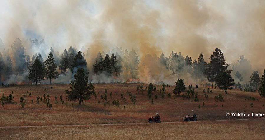
The making of the Whaley Gulch time lapse video

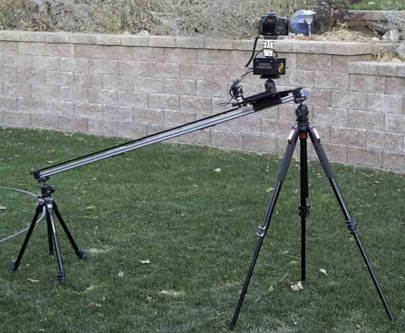
camera slider or dolly
Benjamin Carstens’ camera slider or dolly. Photo by Mr. Carstens.

Being an enthusiastic amateur photographer, I was curious about how Benjamin Carstens made the time lapse video of the Whaley Gulch prescribed fire north of Hill City, SD that we published a week ago. It was not an ordinary time-lapse — it was obvious that the camera was moving very smoothly while the images were being recorded.

Mr. Carstens told us that he used a Canon 5D Mark3. He began the shot at about 5:45 p.m. and ended it at 9 p.m. He used Photoshop and Lightroom to do basic editing, and then Irtimelapse to merge the individual images, shot 25 seconds apart, into a video.

The photo above shows his dolly or slider that moves the camera while the photos are being taken.

There are other cameras that can make time lapse videos without the need for any other equipment. But without the dolly/slider you will not get the camera movement effect which adds a degree of professionalism. Some GoPro cameras can shoot time lapse, but may require some manipulation in their proprietary software to produce the finished video product.

I recently got a Sony A6000, a mirrorless interchangeable lens camera, to which I uploaded an optional software app for time lapse. It creates the video directly without the need for any other processing or software. I really like the camera. Since it does not have a mirror that flops up and down when you take a photo, it can be much smaller and lighter than a conventional DSLR. It has a 24 MP APS-C sensor, ISO up to 51,200, one of the fastest auto focusing systems in existence, can shoot at 11 frames per second (great for air tankers dropping), and built in Wi-Fi, making it possible to transfer photos to your cell phone or computer without swapping cards.

I made the above 13-second time lapse video with the Sony camera, showing clouds moving toward the south over a 45 minute period. The 390 images were shot 7 seconds apart and saved by the camera as a 30 frames per second 279MB .avi file, which I converted on my computer to a 13MB .wmv file. I am looking forward to making a time lapse of a wildfire.

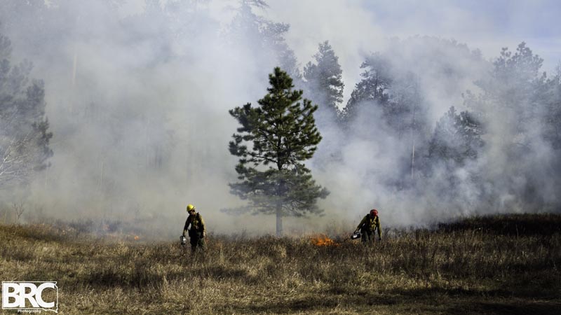
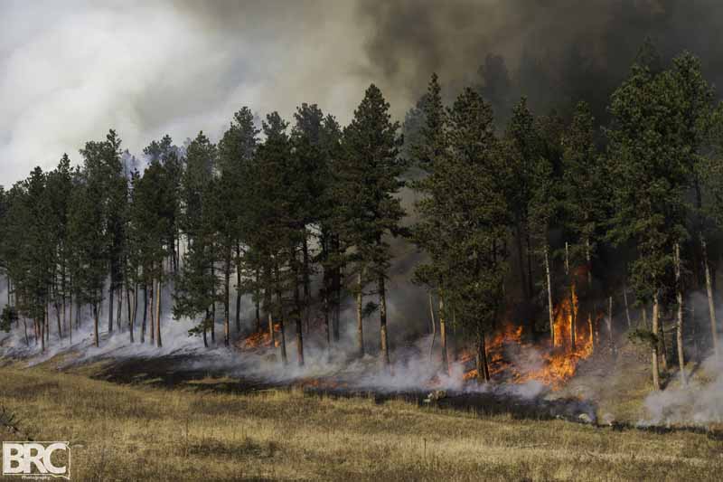
Mr. Carstens sent us more photos taken at the Whaley Gulch prescribed fire as the crews were finishing up the project on November 6.
Whaley Gulch prescribed fire
Whaley Gulch prescribed fire, November 6, 2014. Photo by Benjamin Carstens.
Whaley Gulch prescribed fire
Whaley Gulch prescribed fire, November 6, 2014. Photo by Benjamin Carstens.

Prescribed fires in Wind Cave continue

Cold Brook prescribed fire
The National Park Service burns Unit #3 of the Cold Brook prescribed fire in Wind Cave National Park, October 25, 2014. Photo by Bill Gabbert.

The National Park Service fire staff at the Northern Great Plains Area has been busy this week in South Dakota. On Monday and Tuesday, along with other federal and state cooperators, they executed the 1,938-acre Norbeck Section 2 prescribed fire. On Friday they accomplished about 200 acres in Jewel Cave National Monument, and on Thursday and Saturday burned two units for 1,199 acres in the Cold Brook project in Wind Cave National Park. They still want to burn a third 1,000-acre unit in the Cold Brook area, but are waiting for a specific smoke dispersion condition near an urban interface area.

The weather this week has been close to ideal for burning in the Black Hills, obviously. The high temperatures have been in the low 70’s, the winds moderate and mostly consistent, and the relative humidity has been in the 20’s.

Inversion traps smoke over prescribed fire

Sequoia Kings Canyon National Park
Smoke is trapped by an inversion in Sequoia Kings Canyon National Park. NPS helitack photo.

In this photo taken Wednesday, smoke is attempting to break through an inversion over the Mosquito prescribed fire in Sequoia Kings Canyon National Park in California.

Normally, as you rise in altitude, the temperature decreases due to the changes in air pressure. In a weather (or temperature) inversion, instead of getting cooler at higher temperatures, it is actually warmer higher up.

weather inversion
Cool air trapped under a warmer layer, creating an inversion. From Fortair.org.

South Dakota: Cold Brook prescribed fire

Alpine Hotshots
Members of the Alpine Hotshots walk to their assignment as the Cold Brook prescribed fire began. (Click on the photos to see larger versions.)

Today the National Park Service began igniting the 2,199-acre Cold Brook prescribed fire in Wind Cave National Park in the Black Hills of South Dakota. The project is in a wildland urban interface area with several private residences within a quarter mile of the site. The expectation was that Unit #1 would be burned today, October 23, and additional burning in Units #2 and/or #3 would occur on Friday. (See the map below.)

The goals are to reduce fuel loading in the ponderosa pine forest, decrease encroachment of young ponderosa pine into the prairie, and to decrease the wildfire threat for the nearby residences.

The project is adjacent to US Highway 385, which could be occasionally closed.

Cold Brook prescribed fire weather
Dan Swanson and Mike Prowatzke (L to R) use a chart to convert the wet and dry bulb temperatures to a relative humidity reading on the Cold Brook prescribed fire. It turned out to be 27 percent as this photo was taken at 11 a.m. on October 12, 2014.
Eric Allen, the Fire Management Officer for the NPS' Northern Great Plains Area, conducts the briefing (as the Burn Boss) before the Cold Brook prescribed fire in Wind Cave National Park. NPS photo.
Eric Allen, the Fire Management Officer for the NPS’ Northern Great Plains Area, conducts the briefing (as the Burn Boss) for the Cold Brook prescribed fire in Wind Cave National Park. NPS photo.
Cold Brook prescribed fire
Hunter “Snooki” Smith of the Alpine Hot Shots pauses while lighting the Cold Brook prescribed fire.
Alpine Hot Shots
I inevitably took several photos of Hunter “Snooki” Smith (above) of the Alpine Hotshots because I was on a road and he was lighting adjacent to the road. One of his fellow crew members gave him a hard time about being in so many pictures, and as this photo was taken he was explaining that, Hey, I’m just here and he is taking my picture. I then told the other crew members (jokingly) that Mr. Smith gave me a dollar to take his picture, which produced some laughter among the crew.
thermal infrared image
This is a thermal infrared image of three members of the Alpine Hotshots standing in front of some burning grass on the edge of the prescribed fire. I will write more about the thermal imagery in another article.

Continue reading “South Dakota: Cold Brook prescribed fire”

Norbeck prescribed fire in the Black Hills

Norbeck prescribed fire
Briefing for the Norbeck Section 2 prescribed fire at 7 a.m., October 20, 2014. Photo by Bill Gabbert.

Monday morning we attended the 7 a.m. briefing for the Norbeck Section 2 prescribed fire in the Black Hills. It is a complex, Type 1, 1,938-acre project on State, Federal and private lands approximately 4 miles northeast of Pringle, South Dakota. The 120 personnel will be igniting vegetation in Wind Cave National Park, Custer State park, Black Hills National Forest, and private land. Some of the funding is provided by the Rocky Mountain Elk Foundation. To assist with ignition on the large project a Type 3 helicopter will be dropping plastic spheres that burst into flame about 30 seconds after they exit the dispenser on the helicopter.

When I looked at the large crowd assembled for the briefing and remarked to Todd Pechota, the Fire Management Officer for the Black Hills National Forest, that I didn’t expect to see so many people, he said, “We wanted to get this one right”.

Norbeck prescribed fire
Communications Unit Leader Bob Fischer briefs on radio usage for the Norbeck Section 2 prescribed fire. Photo by Bill Gabbert.

The four different land owners and the funding from a non-government organization are some of the reasons why planning for the project has been going on for at least five years. They brought in a Prescribed Fire Burn Boss, Ross Wilmore the Fire Management Officer on the White River National Forest in Colorado, to work with the trainee Burn Boss, Matt Spring.

And just to make things a little more complicated, the annual buffalo roundup in Wind Cave National Park is occurring now, with the animals being herded to corrals about a half mile east of the prescribed fire. Many people from the national park are tied up on that project.

The ignition of the burn is expected to take two days, Monday and Tuesday of this week. Dew and even frost in some areas may delay the start of the project Monday morning, but things should dry out by mid- to late morning.

Highway 87 through Custer State Park and Wind Cave National Park will be closed Monday through Wednesday. As the fire progresses through the ponderosa pine and grass meadows in the area, it will be putting up a large amount of smoke. The firefighters expect to work from north to south, primarily concentrating on the three northern-most units on Monday, and move to Unit 4 on the south end on Tuesday. (See the map below.)

We will return to the prescribed fire Monday afternoon to report on the progress and hopefully grab some more photos.

(UPDATE: photos taken as the project was underway are here.)

Norbeck prescribed fire
A heliwell and two dozers at the Norbeck Section 2 prescribed fire in the Black Hills of South Dakota. The heliwell is filled with water, so that a helicopter with a buck can dip out it. Photo by Bill Gabbert.
Map of the Norbeck prescribed fire
Map of the Norbeck Section 2 prescribed fire. I drew in NPS 5, the dirt road that intersects with Highway 87 at Drop Point 6. (click to enlarge)

The weather for the project looks pretty good. The spot weather forecast for Monday predicts southwest then south winds at 6 to 10 mph, 72 degrees, and relative humidity of 31 percent; Tuesday looks about the same. The smoke will be pushed toward the north and northeast.