
The spread of the South Main Fire was stopped by 286 firefighters and 4 aircraft
Continue readingReport released for escaped prescribed fire northwest of Fort Collins, CO
The project was on private land, the Ben Delatour Scout Ranch
Continue readingSome prescribed fires are more challenging than others
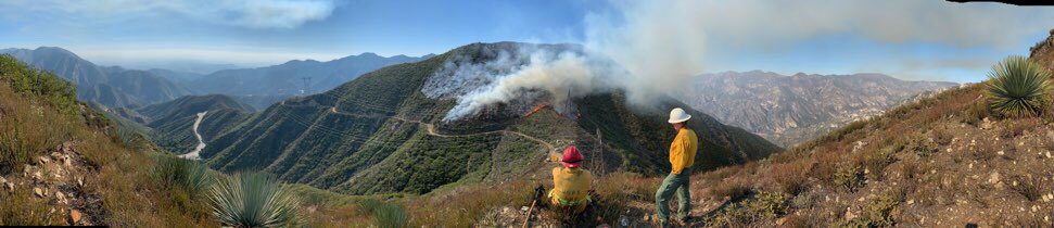
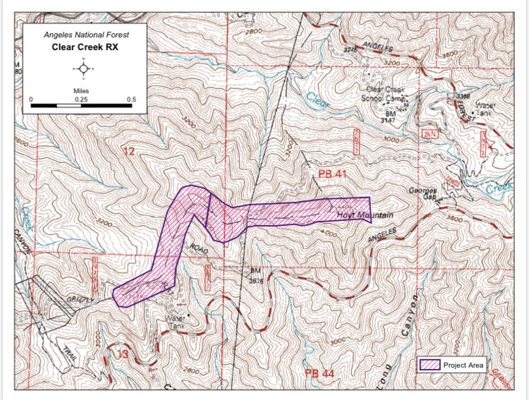
Firefighters on the Angeles National Forest are using prescribed fire on the Clear Creek fuel break north of Los Angeles that separates the Arroyo Seco from the Big Tujunga drainages.
“It helps to protect some of the largest communication sites anywhere, some of LA’s drinking water storage, and major communities,” said Robert Garcia, Fire Chief on the Angeles National Forest. “It is also on some of the toughest ground we have on the ANF making initial attack very difficult. The adjacent slopes are unfortunately known from such incidents as Woodwardia, Bryant and more recently the origins of the 2009 Station Fire.”
When I worked on the Laguna and El Cariso Hotshots nearby on the Cleveland NF, to us the ANF was infamous for its extremely steep slopes, which are evident in these photos.
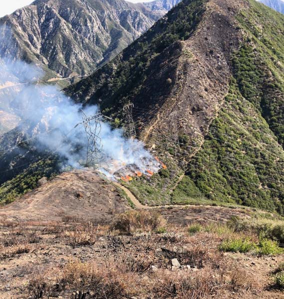

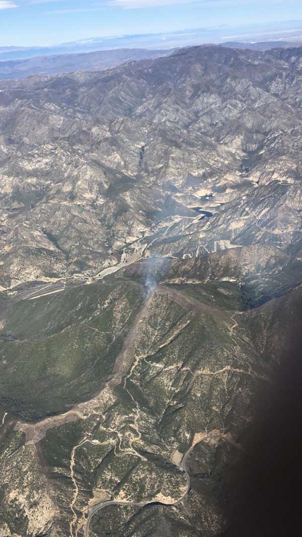
In most other locations super-steep slopes are not a serious obstacle while conducting prescribed fires, as in the example below.

WTREX provides prescribed fire training for women
Women-in-Fire Prescribed Fire Training Exchanges are supported by TNC, USFS, and DOI
Continue readingOSHA reveals more about the fatality on the Fort Jackson prescribed fire
Wildfire Today obtained the information through a FOIA request
Continue readingOSHA finds “serious violations” concerning fatality during prescribed fire in South Carolina
The agency stated, the Army did not furnish “a place of employment free from recognized hazards that were causing or likely to cause death or serious physical harm”
Continue readingPrescribed fire in Santa Barbara County escapes, burns an additional 10-20 acres
The project was east of Vandenberg Air Force Base
Continue readingPrescribed fire escapes on Eldorado National Forest
The fire has burned over 2,000 acres 15 miles southwest of Lake Tahoe in Northern California
Continue readingUpdate on the Fire and Smoke Model Evaluation Experiment
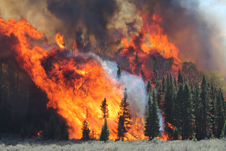
The Fire and Smoke Model Experiment (FASMEE) is a large, multi-agency effort funded by the Joint Fire Science Program and the U.S. Forest Service to identify and collect critical fuel, fire behavior, and other measurements that will be used to advance scientific understanding as well as operational and research modeling capabilities associated with wildland fire. The goal is to allow managers to increase the use of wildfire and prescribed fire.
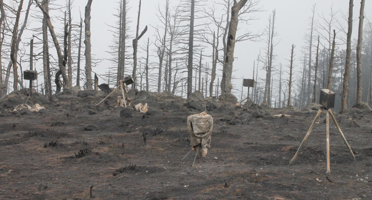
On June 20, 2019, FASMEE completed data collection on Manning Creek, the first of two large, operational stand-replacement burns in a dense mixed conifer-aspen forest as part of FASMEE’s Phase 2 Southwest Campaign (Phase 1 was a planning phase and other campaigns are possible). The burn was conducted by the Richfield Ranger District located on the Fishlake National Forest in Utah. Over 40 scientists participated using ground sampling methods, drones carrying state of the art imagery and air quality sampling instrumentation, fire hardened video and still cameras, and LiDAR to collect a suite of data including fuel loading, fuel consumption, fire behavior, plume dynamics, and smoke data. Readers can view video and photographic imagery captured during the Manning Creek fire at https://fasmee.net/study-sites/manning-creek
Richfield Ranger District personnel will conduct a second stand replacement research fire this fall near Annabella Reservoir with over 120 scientists participating. In addition to the suite of instruments and sampling techniques deployed during the first research burn, two fixed wing aircraft including NASA/NOAA’s FIREX-AQ DC8 will be sampling plume smoke and heat release. Additional LiDAR and radar units have been acquired to better identify plume dynamics, with cameras and thermocouples added within the fire perimeter to capture data on soil heating and aspen regeneration.

“You’ll get to carry fire”
Looking at the experience of prescribed fire
Continue reading