Smoke map, October 8, 2020

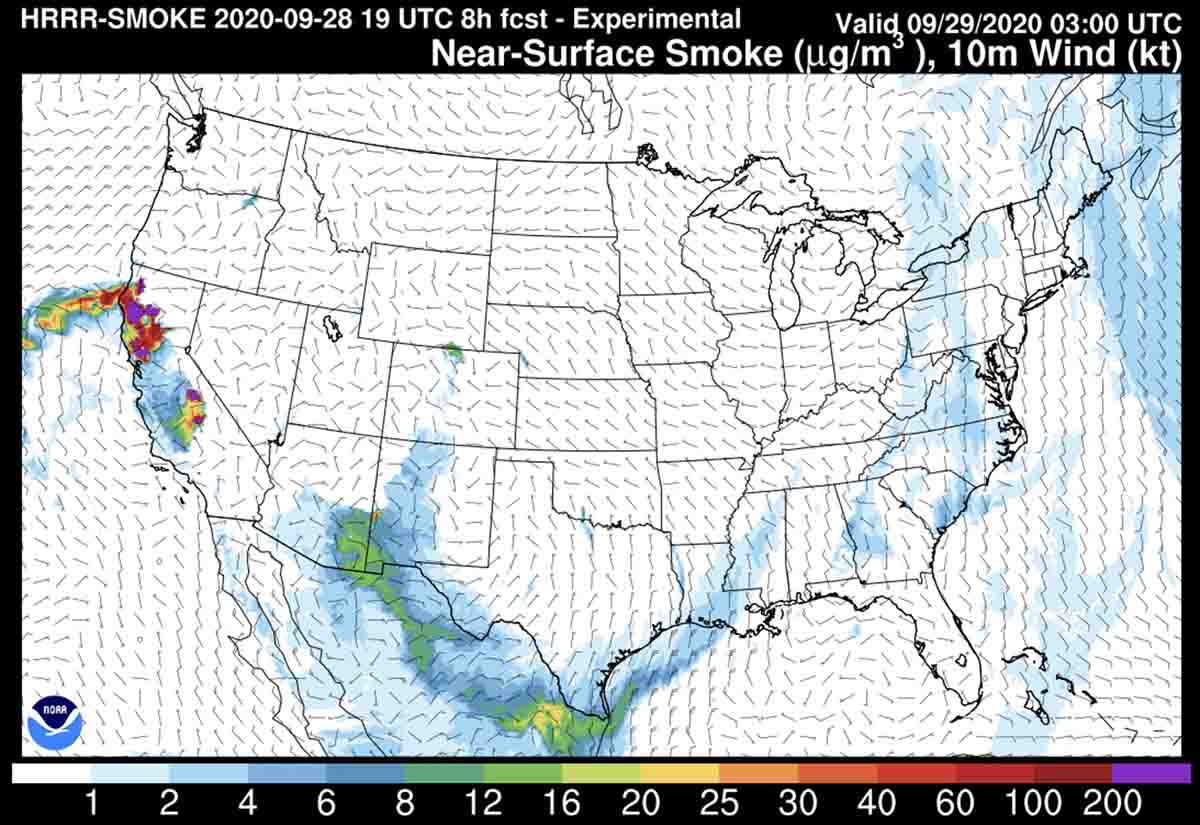
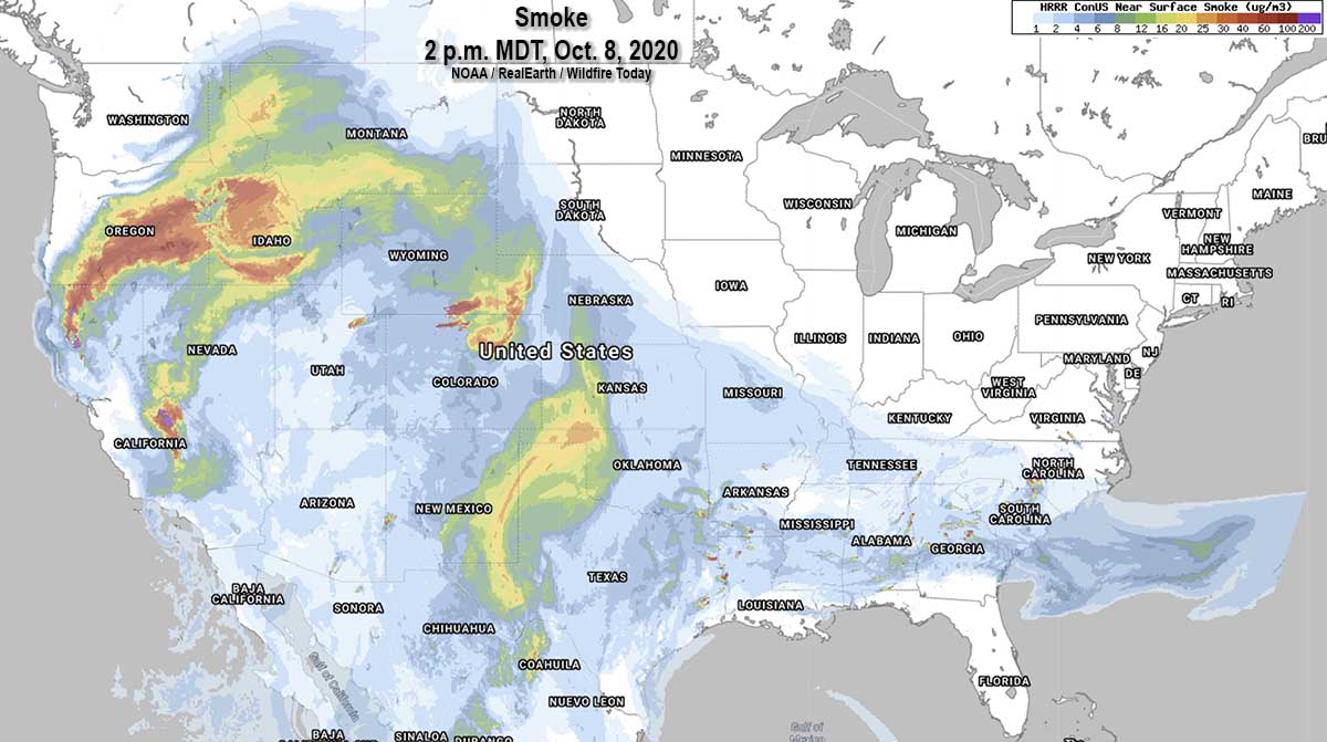
wildfire Smoke map, 2 p.m. MDT October 8, 2020
Smoke map, for near-surface smoke at 2 p.m. MDT October 8, 2020. NOAA.

The primary culprits for smoke in the United States on October 8, 2020 are the Red Salmon and August Fires that have been burning for weeks in Northern California, a few scattered fires in Oregon and Idaho, three fires in Colorado and Wyoming, one in northeast Utah, and the Cow Canyon Fire on the Arizona-New Mexico border.

Breathing smoke

October 4, 2020   |   6:09 a.m. PDT


Photographers at a wildland fire may be able to use and tolerate a mask that traps 95 percent of the 0.3 micron particulates in smoke, but the devices are not practical for firefighters. (see photo above)

In case you are wondering, masks and respirators are divided into rating classes: N is not oil resistant, R is oil resistant, and P is oil proof. The number, such as 95, refers to the percent of particles removed that are at least 0.3 microns in diameter.

Be careful out there.

Smoke and air quality forecasts and maps, October 3-4, 2020

October 3, 2020   |   10:40 a.m. PDT

The first two maps are for air quality, from AirNow.gov. The first was current at 10 a.m. PDT October 3. The second is the forecast for Sunday, October 4.

Air Quality, 10 a.m. PDT Oct. 3, 2020 AirNow
Air Quality at 10 a.m. PDT Oct. 3, 2020. AirNow.
Air Quality Forecast, October 4, 2020 AirNow
Air Quality Forecast for October 4, 2020. AirNow.

The map below is the forecast for near surface wildfire smoke at noon PDT, Saturday October 3, 2020. The one after that is the forecast for 1 a.m. PDT Oct. 4, 2020. It is interesting that the air quality maps (above) do not detect or predict a serious air quality issue in Colorado around the Mullen Fire.

Smoke Forecast for noon PDT Oct. 3, 2020 AirNow
Smoke Forecast for noon PDT Oct. 3, 2020. AirNow.
Smoke Forecast, 1 a.m. PDT Oct. 4, 2020 NOAA
Smoke Forecast for 1 a.m. PDT Oct. 4, 2020. NOAA.

Smoke and air quality maps, September 19, 2020

September 19, 2020  |  4:42 p.m. MDT

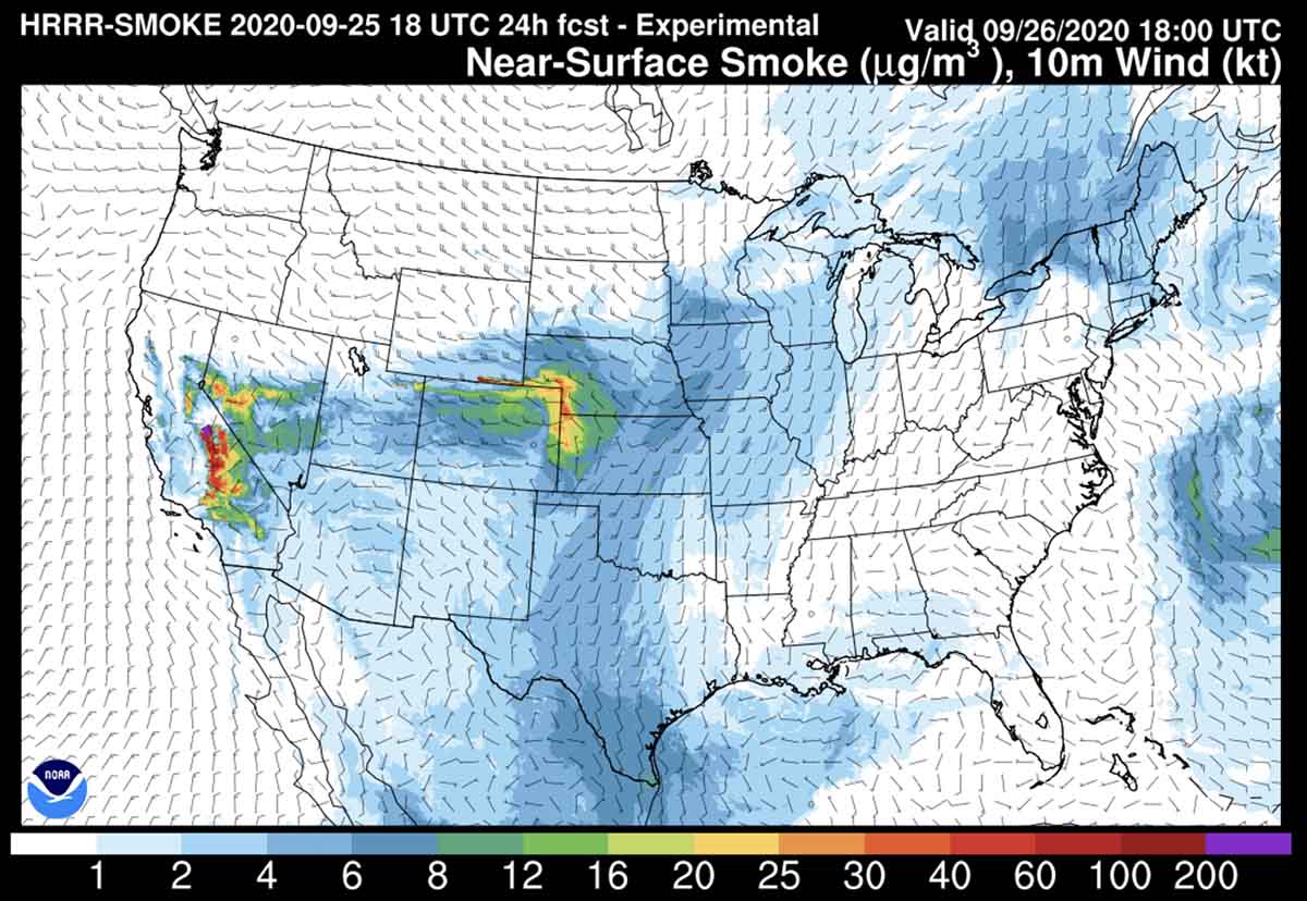
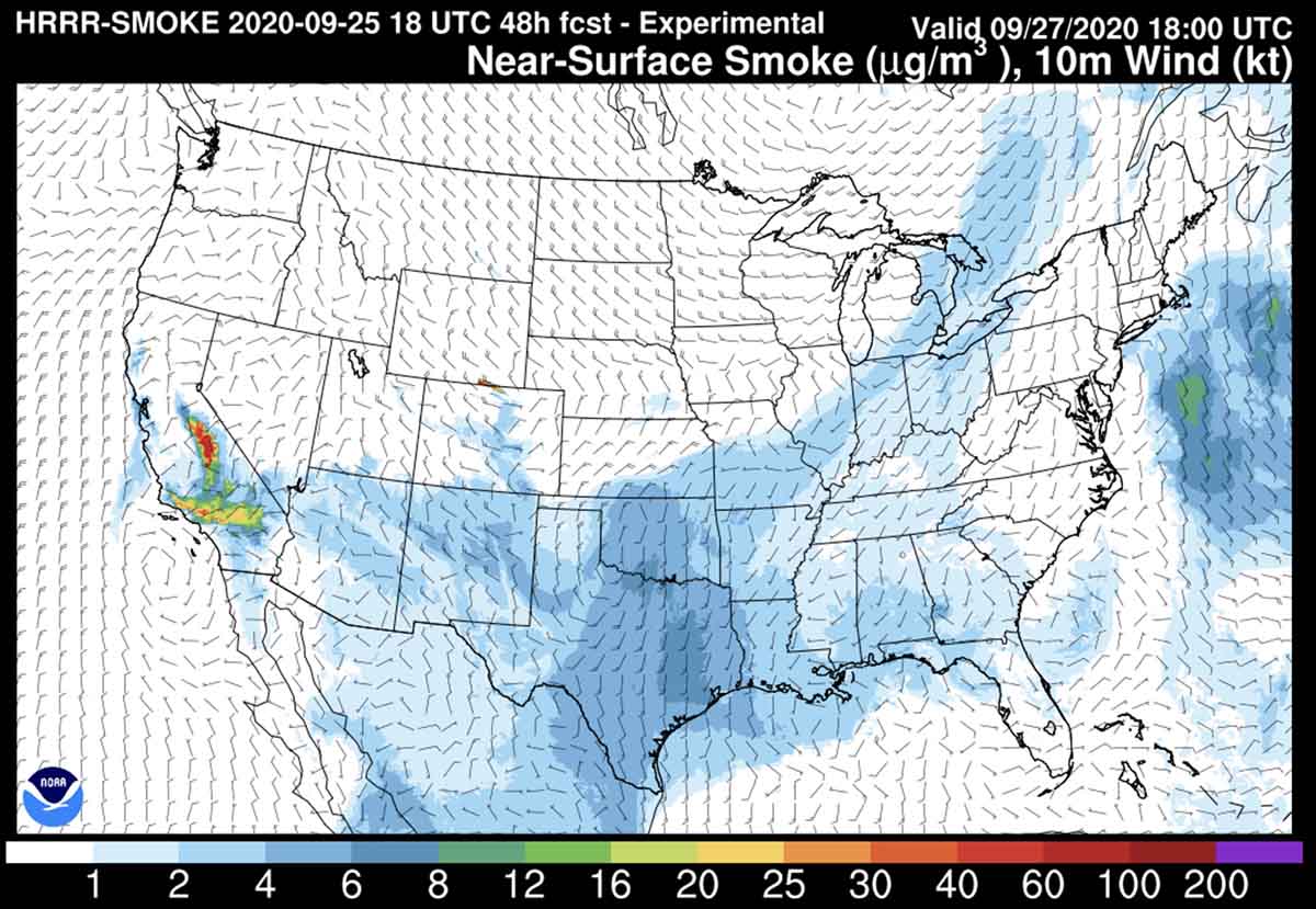
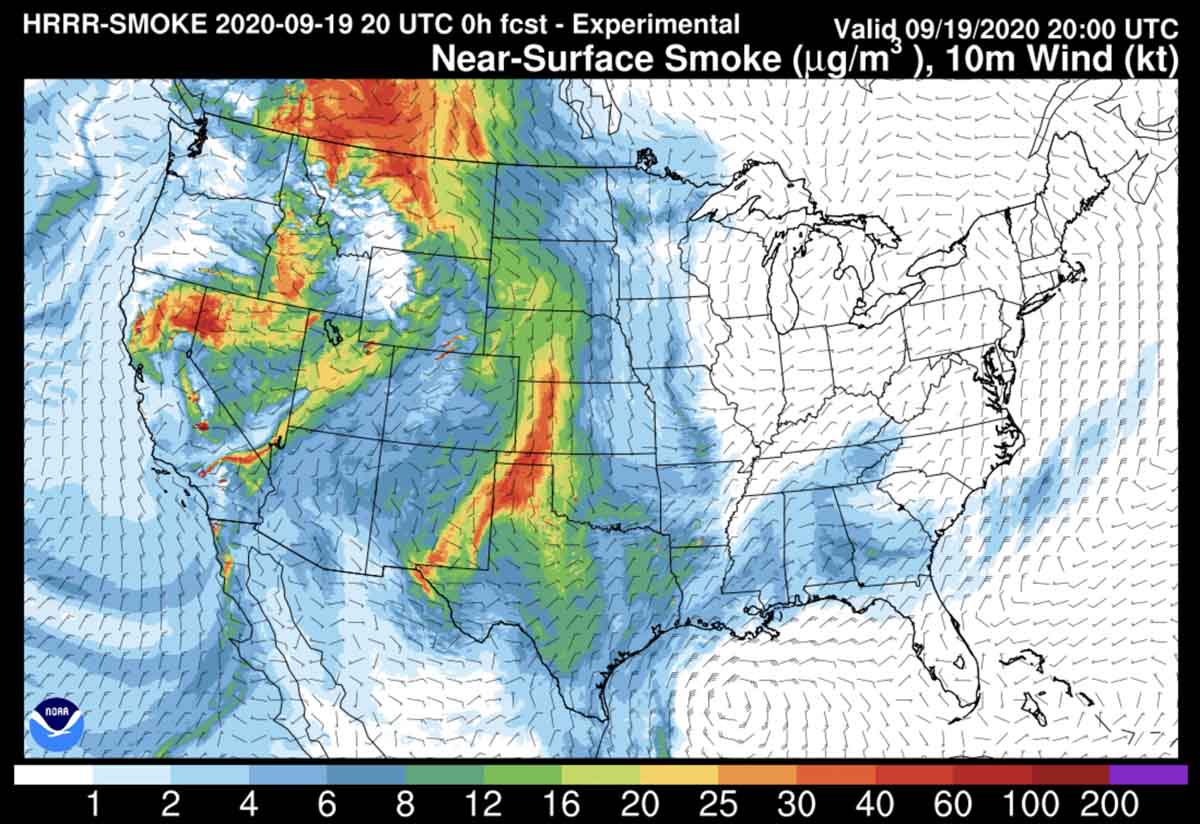
fires Near-surface smoke, at 2 p.m. MDT September 19, 2020
Near-surface smoke, at 2 p.m. MDT September 19, 2020. NOAA. Near-surface smoke refers to the smoke that will hover within 8 meters (26 feet) of the ground—the kind responsible for burning eyes and aggravated asthma.

The text in the Tweet below is about Utah, but the map shows the smoke forecast for the Western U.S. through Monday morning. After you click to begin the animation, you can click again to stop and start it.

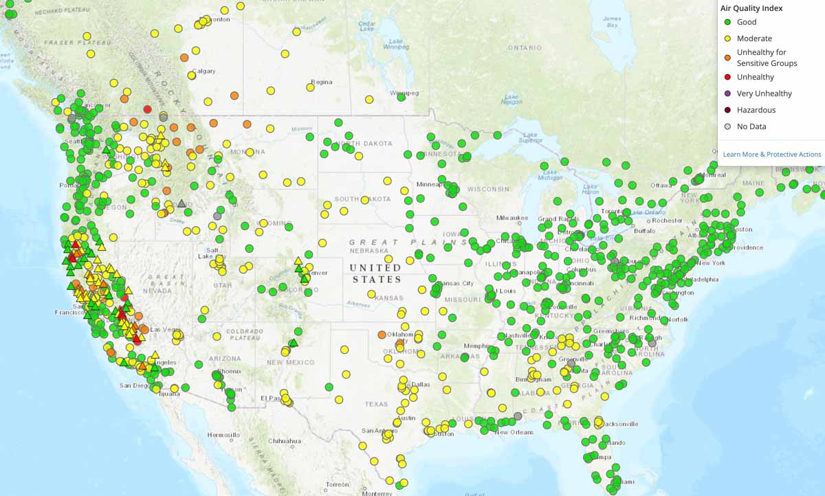
The air quality in the western states has improved over the levels seen several days ago.

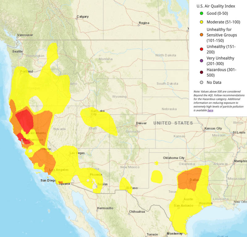
Air Quality
Air Quality, 4:30 p.m. MDT Sept 19, 2020, AirNow.
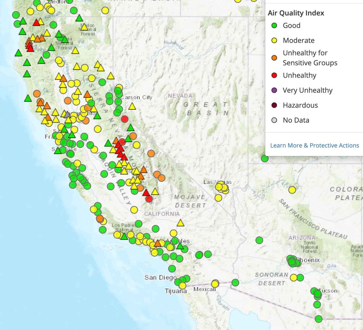
Air Quality California
Air Quality, California and Nevada, 4:30 p.m. MDT Sept 19, 2020, AirNow.

Bookmark https://wildfiretoday.com/tag/smoke/ so you can easily find articles on Wildfire Today about wildfire smoke.