Updates on three California fires, Soberanes, Chimney, and Rey

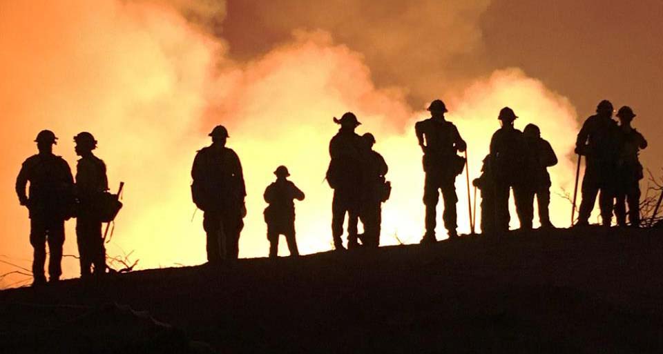
Above: A firing operation on the Soberanes Fire by the Arroyo Grande Hotshots. Inciweb photo.

Soberanes Fire

This fire has been eating through the brush, grass, timber, and poison oak in the coastal mountains south of Monterey since July 22. In that time it has spread mostly to the south blackening over 91,000 acres.

Map Soberanes Fire
Map of the Soberanes Fire. The red line was the perimeter at 11 p.m. PDT Aug. 25. The white line was the perimeter at 1 a.m. PDT Aug. 7. Click to enlarge.

The only large heat sources a satellite 200 miles overhead was able to detect in the last 24 hours were near the perimeter on the south and southeast sides. The Soberanes Fire is being fought by 1,4913 personnel including 21 hand crews; 65 engines; 12 helicopters; 21 dozers; and 14 water tenders.

The fire was caused by an illegal, unattended campfire on the Soberanes Canyon trail in the Garrapata State Park. The suppression costs to date are $160 million.

Poison oak is very prevalent in the area and some firefighters are saying it is the worst they have even seen. Five hundred have reported to the fire’s medical units for poison oak related ailments, with 200 cases in the past three days.

Rey Fire

The Rey Fire north of Santa Barbara has been working its way east over the last several days but that growth has slowed as firefighters make progress by constructing direct firelines on the fire’s edge and completing contingency lines out ahead of the fire.
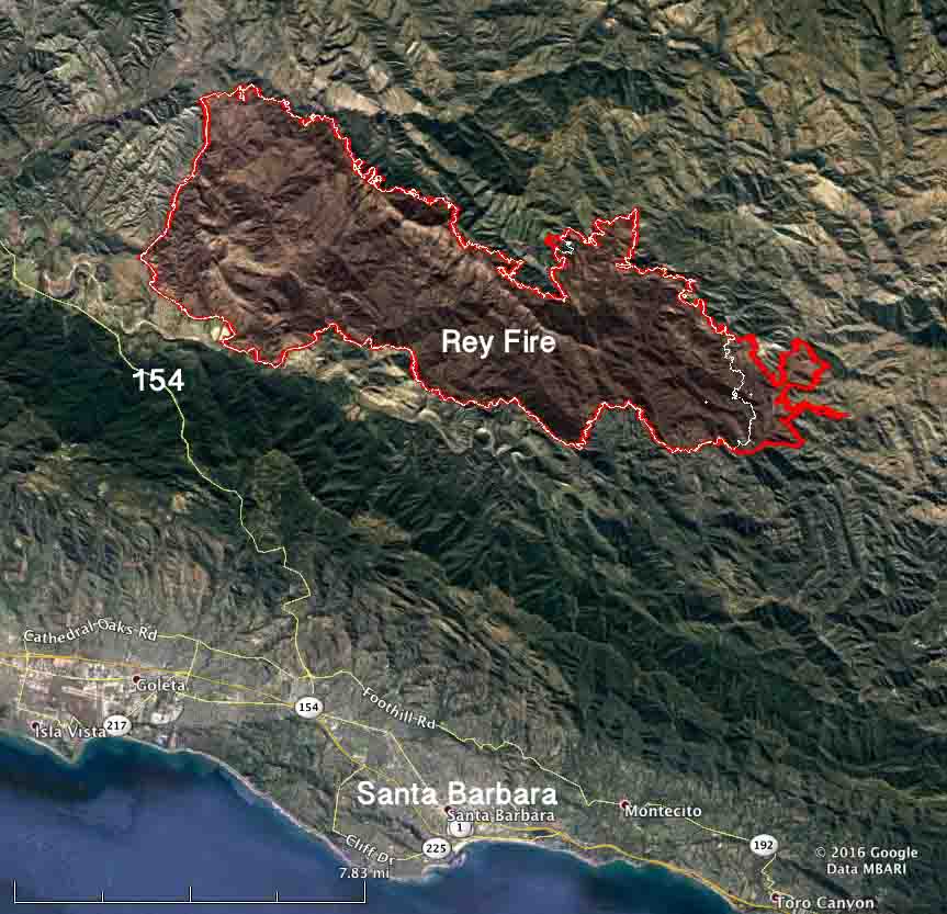
Map Rey Fire
Map of the Rey Fire. The red line was the perimeter at 10 p.m. PDT Aug. 25. The white line was the perimeter at 10 p.m. PDT Aug. 23. Click to enlarge.

The Rey Fire typically slows to a crawl late at night when the marine layer moves in, then the activity increases in the afternoon. The incident management team is calling it 33,006 acres. Approximately 1,976 personnel are assigned to the fire, including 57 hand crews, 99 engines, and 18 helicopters.

Chimney Fire

The Chimney Fire near the central California coast has continued to spread to the north over the last few days through very rough and remote country east of the Hearst Castle.

Map Chimney Fire
Map of the Chimney Fire. The red line was the perimeter at 9 p.m. PDT Aug. 25. The white line was the perimeter at 10 p.m. PDT Aug. 23. Click to enlarge.

CAL FIRE reports that 49 residences and 21 other structures have been destroyed, while 1,898 remain threatened. Some evacuation orders have been lifted but others are still in place.

The 45,000-acre Chimney Fire is being fought by 4,028 personnel, including 328 engines, 106 hand crews, 16 helicopters, 46 dozers, and 69 water tenders.

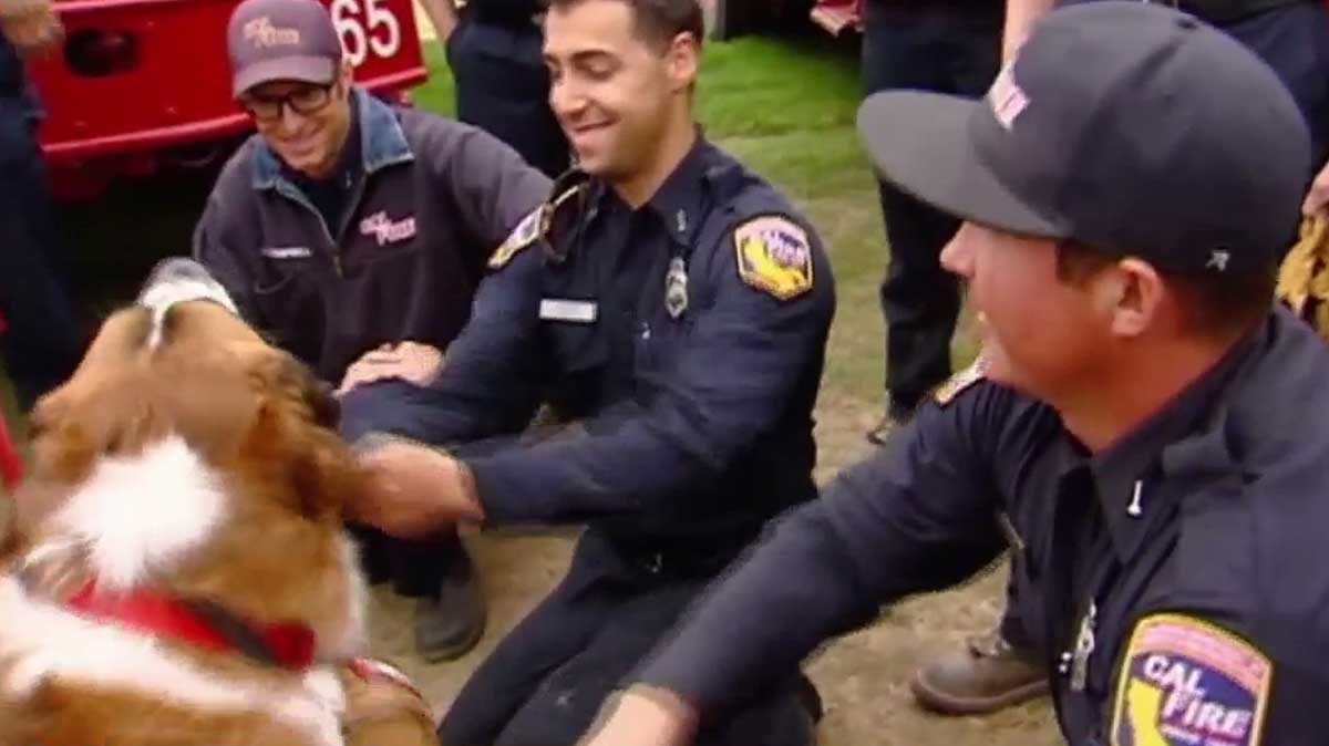
Therapy dogs visit firefighters at the Soberanes Fire

Two therapy dogs visited firefighters at the Soberanes Fire south of Monterey, California over the weekend. The dogs are more commonly seen at hospitals, but they lifted the spirits of the firefighters who had not been home for one or two weeks

“When you see your guys smiling and they’re tired – they worked really hard yesterday – but they got time to come over and play with the dogs. It’s kind of neat,” said Santa Barbara firefighter Jim McCoy.

Therapy Dogs firefighters

Therapy Dogs firefighters

The images are screenshots from an ABC7 video.

Soberanes Fire continues to march through the mountains above Big Sur

Firefighters on the Soberanes Fire
Firefighters on the Soberanes Fire. CAL FIRE photo.

For 16 days the Soberanes Fire has spread through the Santa Lucia Mountains that rise abruptly from the Pacific Ocean above Big Sur. Since we last wrote about the fire on August 2 the fire has grown from 43,000 to 57,845 acres. There have been no reports of additional homes burned since it was announced five days ago that 57 residences and 11 outbuildings had been destroyed. Another three homes have been damaged.

Since starting from an illegal campfire, the blaze has been moving through very steep, rugged, inaccessible terrain. Several areas are under evacuation orders.

3-D Map of Soberanes Fire
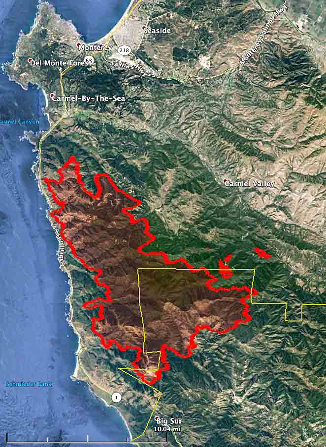
3-D Map of the Soberanes Fire showing the perimeter at 1 a.m. PDT August 7, 2016. MODIS, Google, USFS, Wildfire Today

It has burned to within 1.2 miles of Big Sur on Highway 1, and is 15 miles west of US 101. It has not crossed US 101 and at its closest point is about 1,000 feet from the highway.

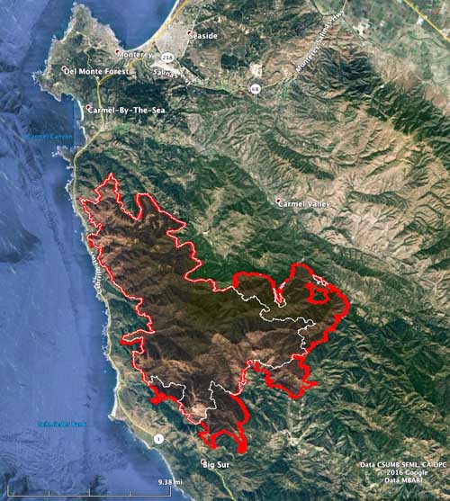
Map of the Soberanes Fire. The white line was the perimeter at 2 a.m. PDT on August 2. The Red line was the perimeter at 1 a.m. PDT August 7, 2016. MODIS, Google, USFS, Wildfire Today

Damage assessment teams document 57 homes destroyed in Soberanes Fire

By Ryan Maye Handy and Bill Gabbert

(UPDATED at 12:27 p.m. MDT August 2, 2016)

Soberanes Fire map
Map of the Soberanes Fire at 2:30 a.m. August 2, 2016.

Damage assessment teams have identified 57 residences and 11 outbuildings that have been destroyed in the Soberanes Fire between Big Sur and Monterey, California.

The Incident Commander, Todd Derum, reports that firefighters have achieved 18 percent containment after fighting the blaze for 12 days, which has now blackened over 43,000 acres.

Several areas are still under evacuation orders.

On the west side the fire has come close to reaching the Pacific Ocean, while the east side is 14 to 18 miles west of US Highway 101.

Resources assigned to the fire include: Engines: 510, Water tenders: 51, Helicopters: 17, Air Tankers: 6, Hand Crews: 107, Dozers: 72, Other: 14, Total Personnel: 5,451.

****

(UPDATED 10:41 a.m. MDT, August 1, 2016)

The Soberanes fire in Big Sur continues to rage with little containment, and on Sunday it prompted more evacuations of local residents.

Businesses in the area have already begun to suffer from the shutdown of various state parks in the famously scenic coastal region, according to a story from Market Watch. 

As of Monday morning, the fire had burned 40,618 acres and was 18 percent contained, according to InciWeb.

The rugged firefighting conditions mixed with hot weather have made the fire harder to contain:

Extremely remote and rugged terrain with limited access coupled with hot and dry weather and an above average cured grass crop has resulted in a high resistance to control.

***

The Soberanes fire in Monterey County has shifted California’s focus from Los Angeles to Big Sur, where the fire has shut down several state parks, destroyed dozens of homes and continues to burn with little containment.

Here are some of the latest stats on the Soberanes fire (or read more background on the Soberanes fire):

  • 29,877 acres – 15 percent contained
  • 2,000 structures threatened
  • 41 homes and 10 outbuildings destroyed
  • One fatality, a bulldozer-operator who died after a rollover.
  • Total personnel: 4,245
  • Resources:  394 engines, 94 crews, 14 helicopters, 6 air tankers, 67 dozers, 41 water tenders.


Firefighter killed in dozer accident on Soberanes fire

(Updated 5:46 a.m. MDT, July 28, 2016)

The operator of a bulldozer was killed while working on the Soberanes fire, one of two major wildfires burning in California and one that has already destroyed 20 homes.

The operator was killed when the bulldozer rolled over, and another operator was injured in a similar incident, The Associated Press reported on Wednesday. Other reports say the dozer operator died of injuries on Tuesday night.

The bulldozer operator was working on a call-when-needed basis overnight when the fatal accident occurred, according to information posted on CAL FIRE’s website. The dozer was one of 60 assigned to the fire in Monterey County.

Officials have not yet released the name of the operator who was killed. California’s other major blaze, the Sand fire, killed a man this week outside of Los Angeles.

UPDATE April 17, 2017: KQED reports that the name of the dozer operator that was killed was Robert Reagan.

Check back with wildfiretoday.com for more on this story.

Thanks and a tip of the hat go out to Chris and Daniel.

 Soberanes fire destroys more homes in Monterey County

Thanks to wildfiretoday.com reader, Rick Baldridge, for sending us this photo, taken when the fire started on July 23.

(Updated 5:50 a.m. MDT, July 28, 2016)

The Soberanes fire in Monterey County has destroyed 34 homes, according to the Wednesday night update posted on CALFire’s information site.

The fire has already taken a heavier toll — a privately-contracted bulldozer operator died Tuesday night from injuries sustained in an accident while working on the fireline.

The fire has burned 23,688 acres and remains only 10 percent contained.

***

(Updated 5:47 a.m. MDT, July 27, 2016)

The Soberanes fire in Monterey County has triggered a local emergency declaration, which will allow affected counties to access emergency funds to help cover costs during and after the fire.

As of Tuesday night, the fire had destroyed 23,500 acres and remains 10 percent contained. It has destroyed 20 homes and continues to threaten 1,650 other structures, according to the latest information posted on InciWeb. The fire has also shut down several state parks, according to The Mercury News.

The cause of the fire is still under investigation.

***

(Updated 10 p.m. MDT, July 25, 2016)

While the Sand fire rages in L.A. County, the Soberanes fire near Big Sur in Monterey County has forced evacuations as it continues to spread with little to no containment.

Some quick stats (see more here):

  • 16,100; 10 percent contained
  • 1,650 structures threatened; 20 homes destroyed, 2 outbuildings
  • Resources:
    Engines: 210
    Crews: 42
    Helicopters: 14
    Air Tankers: 6
    Dozers: 56
    Water Tenders: 20
    Total Personnel: 2,285

CAL Fire’s Chief Public Information Officer Daniel Berlant shared some spectacular photos on Twitter: