Mexican citizens fighting America’s fires

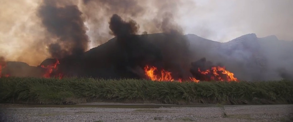
Above: a screen grab from The Atlantic’s documentary about a fire crew from Mexico that assists a U.S. National Park.

The Atlantic produced this seven-minute documentary about Mexican citizens, Los Diablos, that help Big Bend National Park in southern Texas conduct prescribed fires and suppress wildfires. The crew assisted with the Powerline Fire that burned about 1,800 acres in Big Bend in February.

Here is how The Atlantic describes the video:

In Texas, Mexican firefighters are saving the Rio Grande. Known as Los Diablos, or “the devils,” the elite firefighting crew is hired by the National Park Service to fight wildfires and conduct controlled burns along the border. The river provides water to more than 5 million people in the U.S. and Mexico, and sustaining its flow is vital. The water in the Rio Grande is already 150% over-allocated. In this short documentary, The Atlantic follows the group’s conservation efforts to rid the river of giant cane, an invasive plant that narrows the river and threatens native plants and fish.

Below are more screen grabs from the video.

Los Diablos Los Diablos

Thanks and a tip of the hat go out to Bill.

Red Flag Warnings, February 8, 2016


The National Weather Service has issued Red Flag Warnings for areas in Texas, Oklahoma, Kansas and California.

In the California counties of Ventura and Los Angeles 20 to 35 mph northeast winds with gusts of 40 to 50 are in the forecast until 6 p.m. tonight. The Texas and Oklahoma areas under Red Flag Warnings from noon until 6 p.m. CST tonight will experience relative humidities in the teens with wind gusts out of the north to northwest at around 30. Firefighters in south-central Kansas should expect 20 to 30 mph northwest winds gusting to 45 mph along with a minimum humidity of 30 percent from noon until 7 p.m. CST tonight.

The map was current as of 8:45 a.m. MDT on Monday. Red Flag Warnings can change throughout the day as the National Weather Service offices around the country update and revise their forecasts and maps. For the most current data visit this NWS site.

Evaluation of fatal explosion in West, Texas

Above image: A screen grab from the video produced by the U.S. Chemical Safety Board about the explosion in West, Texas in 2013.

You may remember the terrible fire and explosion that injured 260 people and killed 15 in the small town of West, Texas April 17, 2013. Ten firefighters died. The incident occurred at the West Fertilizer Company when 30 tons of fertilizer grade ammonium nitrate exploded after being heated by a fire at the storage and distribution facility.

The U.S. Chemical Safety Board just released this excellent video with professional quality animations explaining how it occurred. They also point out some training, zoning, and regulatory issues that if implemented may have prevented a large-scale catastrophe.

Powerline Fire burns near headquarters of Big Bend National Park

(UPDATED at 7:35 p.m. CST February 5, 2015)

Big Bend National Park reports that the 1,792-acre Powerline Fire is 98 percent contained. They will begin demobilizing firefighting resources Saturday.

****

(UPDATED at 5:42 p.m. CST February 4, 2016)

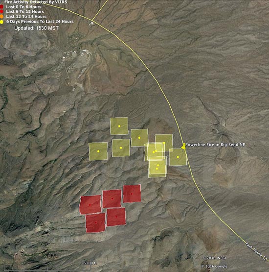
Below is an updated satellite map of the Powerline Fire in Big Bend National Park in south Texas.

Map Powerline Fire 148 pm CST 2-4-2016
Map showing heat detected by a satellite (the red squares) on the Powerline Fire at 1:48 p.m. CST February 4, 2016. The fire appears to be spreading toward the southwest.  Some areas of the fire, especially east of the road, burned and cooled between satellite over flights, and were not detected. The park headquarters and employee housing area can be seen north of the fire.

****

(UPDATED at 10:55 CST, February 4, 2016)

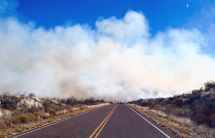
Powerline Fire
Poweline Fire in Big Bend National Park, the afternoon of February 3, 2016. NPS photo.

Better mapping has revealed that the Powerline Fire in Big Bend National Park in south Texas had burned 1,537 acres as of 5 p.m. CST on Wednesday, which is a revision of the earlier estimate of 1,995 acres.

Late on Wednesday the park reported that the fire had approached the southern side of the road between Panther Junction and Rio Grande Village, but it had not jumped the road since Monday February 1st and there was no active fire on the north side of the road.

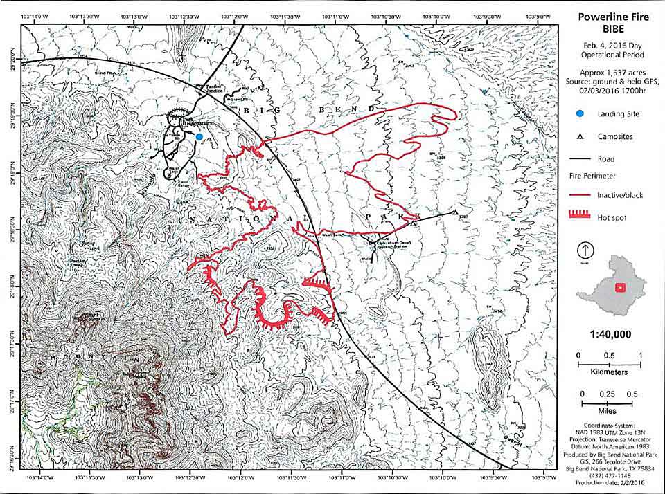
Powerline Fire map
Map of the Powerline Fire for the February 4 operational period. Park Headquarters and the employee housing area are just northwest of the fire. NPS.

Continue reading “Powerline Fire burns near headquarters of Big Bend National Park”

Fires break out in Texas and Oklahoma

On the above photo the red squares indicate heat from a wildfire detected by a satellite at 1:39 p.m. CST, January 30, 2016.  At that time the fire was two to three miles south of Eula, Texas.

Strong winds and low relative humidities have promoted the growth of several large wildfires in Texas and Oklahoma. One of the blazes causing evacuations, the High Line Fire, is about 12 miles southeast of Abiline, Texas, north of highway 36 and two to three miles south of Eula.

The National Weather Service announced at about 6 p.m. on Saturday that an evacuation has been requested for the Eula area.

Several structures have already caught fire. Residents are urged to evacuate to the north toward Interstate 20. Evacuation shelters have also been set up at the Eula High School, and the First Baptist Church in Clyde. The Red Cross will be on scene at these locations after 6 p.m.

A spokesperson from the Callahan County Sheriff’s Office said the suspected cause is a power line.

Portions of west Texas and Oklahoma are under a wildfire Red Flag Warning.

A fire 20 to 25 miles south of Oklahoma City, southwest of Norman between Blanchard and Goldsby is also causing problems. It put up a large amount of smoke that was detected on weather radar, which is represented by the color blue on the map below.