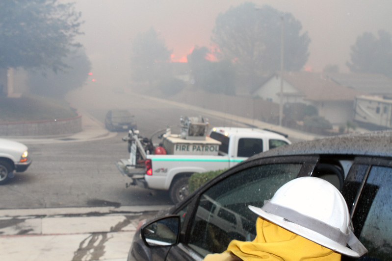
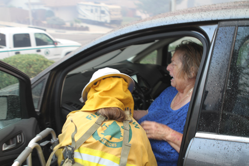
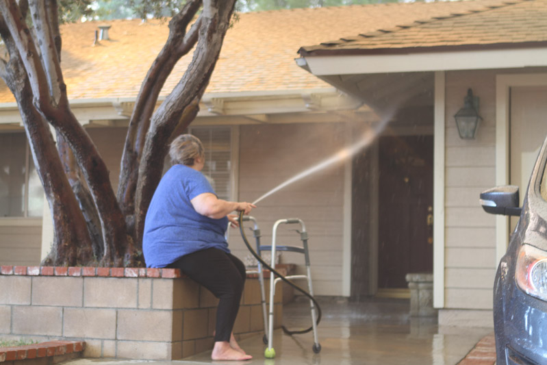
Firefighters assist disabled woman at Tick Fire

firefighters assist disabled woman Tick Fire California

Long time fire photographer Jeff Zimmerman sent us these photos he shot Thursday at the Tick Fire near Santa Clarita in southern California.

Here is his description:

“As flames swept out of Tick Canyon into the Shadow Pines neighborhood in Los Angeles County, it became a race against time to evacuate a disabled woman who was trying to save her home. Barefoot and with a walker, we found this woman frantically trying to save her home with a garden hose. We pulled out our booster line from our volunteer fire patrol to stop spot fires on neighboring property as ash and soot were raining down on her vehicle. We had just minutes to get her shoes, her dog and get her loaded into her vehicle. She was crying hysterically but we were able to get her to safety as fire swept down the street.

“At great personal risk Volunteer Denise Shippy went inside her home to retrieve car keys, shoes and the family dog as I was able to hold back spot fires. Flames erupted across the street in Italian Cypress trees as this woman left to safety. Helping a neighbor in distress is what volunteering is all about.”

firefighters assist disabled woman Tick Fire California firefighters assist disabled woman Tick Fire California firefighters assist disabled woman Tick Fire California

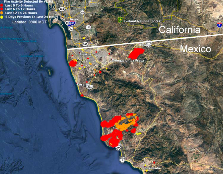
Three large fires are very active in Mexico

The fires are south and southeast of San Diego, California

fires in northwest Mexico ,a[
Map showing heat from fires in northwest Mexico detected by a satellite at 4:24 a.m. PDT Oct. 25, 2019.
Several large fires in northwest Mexico south of San Diego are producing large quantities of smoke. For the time being most of it is being blown over the Pacific Ocean.

One of the fires is west of Tijuana, another is northwest of Ensenada, and the third is south of Tecate.

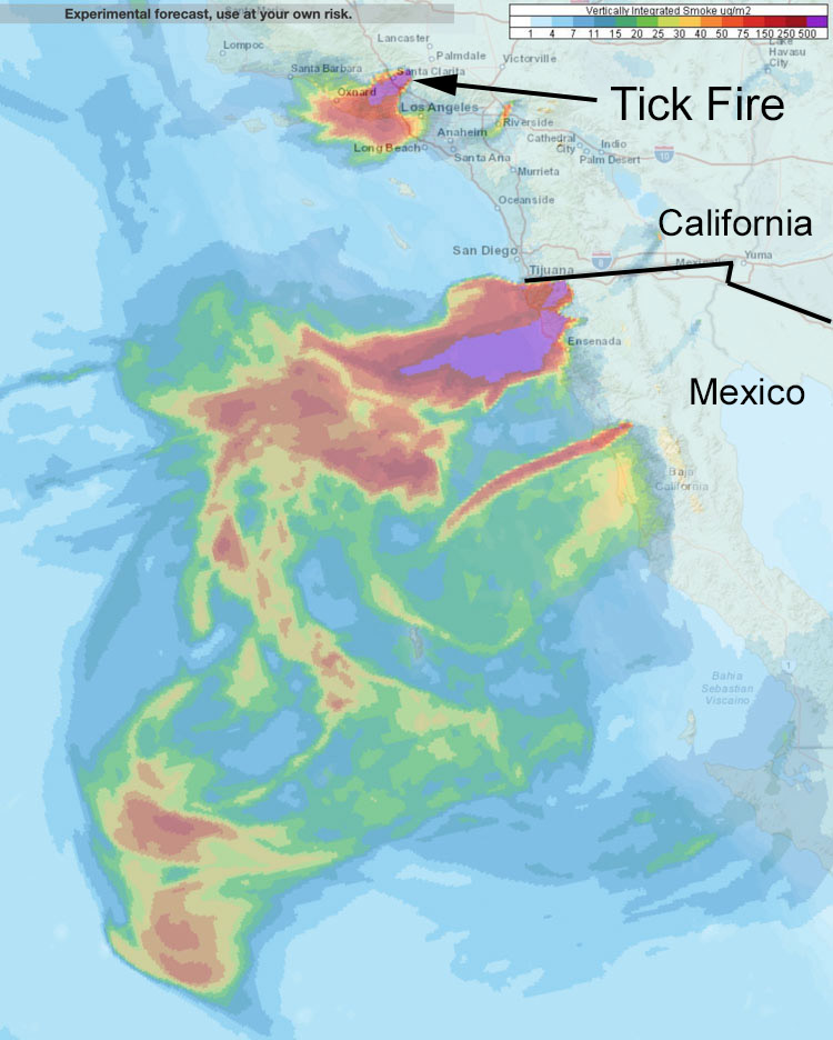
Smoke from the Tick Fire at Santa Clarita is expected to affect Oxnard and western Los Angeles.

smoke wildfire southern California and northwest Mexico.
Forecast for vertically integrated smoke at 5 p.m. PDT Oct. 25, 2019 from wildfires in southern California and northwest Mexico.

Tick Fire crosses the 14 freeway forcing more evacuations

Map Tick Fire 9 p.m. PDT October 24, 2019.
Map of the Tick Fire at 9 p.m. PDT October 24, 2019 before it burned across the 14 freeway. LA County FD.

UPDATED at 9:23 a.m. PDT Oct. 25, 2019

The Los Angeles County Fire Department reported at 7 a.m. PDT Oct. 25 that the Tick Fire at Santa Clarita had burned approximately 4,300 acres including the portion that spread to the south across the 14 freeway overnight, forcing the closure of the road.

At 9:20 a.m. Friday the fire activity had decreased significantly and very little additional spreading was occurring.

About 574 firefighting personnel are assigned to the fire from all over the state. Damage assessment teams have started documenting the structures that have been destroyed or damaged.

Approximately 40,000 residents are under evacuation orders. Officials are working to identify areas that can be repopulated safely.


6:33 a.m. PDT October 25, 2019

The Tick Fire near Santa Clarita jumped across the 14 freeway at about 2:30 Friday morning, requiring it to be closed in both directions between Golden Valley and Escondido Canyon. Additional evacuations have been ordered. The map above shows the perimeter at 9 p.m. October 24 before it crossed the freeway.

At 9 p.m. on Thursday the Tick Fire had burned 3,739 acres, but the growth of the fire to the south and across the freeway during the night may have added another 500 to 1,000 acres.

(To see all articles on Wildfire Today about the Tick Fire, including the most recent, click here.)

The Santa Ana winds are expected to continue Friday, gusting across Los Angeles and Ventura Counties at 40 to 65 mph. Wind speeds of 33 mph gusting to 54  were recorded at the Warm Springs weather station northeast of Castaic overnight.

The Tick Fire spread rapidly north of Los Angeles Thursday afternoon

The Tick, Old, and Verde fires were being pushed by strong winds

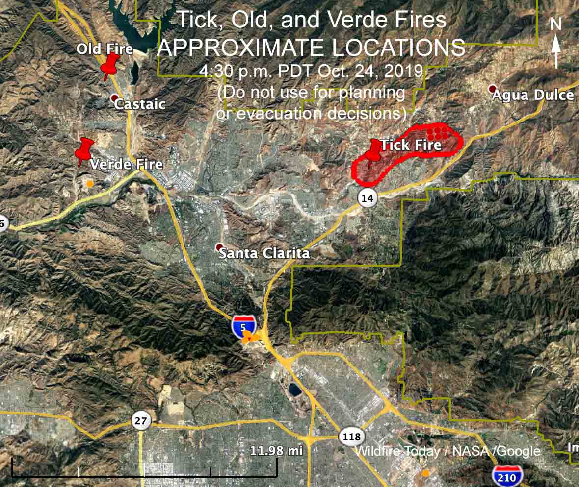
LOCATIONS of the Tick, Verde, and Old Fires
Map shows the APPROXIMATE LOCATIONS of the Tick, Verde, and Old Fires north of Los Angeles. This map should not be used for planning or evacuation purposes. Click to enlarge.

6:16 p.m. PDT October 24, 2019

At least three wildfires were actively spreading on the north side of Los Angeles in Santa Clarita’s Canyon Country Thursday afternoon. At 5:35 the Los Angeles County Fire Department said the largest of the three, the Tick Fire, had burned 3,000 acres. (see map above) By 5:45 p.m. the fires were not spreading as quickly as they were three hours before.

(To see all articles on Wildfire Today about the Tick Fire, including the one posted at 6:33 a.m. Oct. 25, click here.)

TV news helicopters have shown images of burning homes. Wind-blown embers have started spot fires long distances ahead of the main fire.  Mandatory evacuations have been ordered for residents in some locations both north and south of the 14 freeway.

Early Thursday afternoon the Saugus weather station  recorded winds out of the north-northeast of 18 to 26 mph gusting at 32 to 48. The temperature was 83 degrees with 4 percent humidity. By 5:45 p.m. the wind had slowed to 14 mph gusting to 28, still out of the north-northeast. The humidity was 4 percent.

Two other blazes, the Old and Verde Fires, are also being suppressed in the Castaic area west of Interstate 5. The Verde Fire was stopped after it burned one acre and four travel trailers. The Old Fire required the northbound lanes of Interstate 8 to be shut down. Its name was changed to Tick Branch 10.