Williams Flats Fire burns thousands of acres along Columbia River

The fire is 15 miles east of Coulee Dam, Washington

3-d map Williams Flats Fire Washington
3-D map showing the APPROXIMATE perimeter of the Williams Flats Fire looking east, based on heat detected by a satellite at 2:56 p.m. PDT August 3, 2019. The map should not be used for planning or evacuation decisions.

(UPDATED at 5:50 p.m. PDT August 3, 2019)

In an update at 2 p.m. Saturday fire officials reported that the Williams Flats Fire 15 miles east of Grand Coulee, Washington had grown to 8,200 acres. (see map above)

On Saturday firefighters constructed containment lines to protect the valley floor and worked on anchoring the southern perimeter of the fire, which is spreading east toward Redford Canyon. That area was logged five years ago leaving behind slash fueling the fire. Steep slopes, limited roads, and primitive road conditions are hampering control efforts.

Tribal Natural Resources Officers are patrolling Lake Roosevelt Recreation Area to keep boaters safe as three Fire Boss water-scooping single engine air tankers obtained water from the Columbia River.

Other resources on the fire include:

  • 3, large air tankers
  • 1,Type 1 helicopter
  • 4, 20-person hand crews
  • 2, 12-person hand crews
  • 3, dozers
  • 12, Type 6 fire engines, and
  • 5, water tenders
  • For a total of 132 personnel

(Originally published at 10:02 a.m. PDT August 3, 2019)


The Williams Flats Fire in Northeast Washington burned well over 5,000 acres during the first 25 hours after being reported at 3:23 a.m. Friday August 2, 2019.

Saturday morning fire officials said it was 5,640 acres, but satellite data from 4:18 a.m. PDT on Saturday indicates it may have burned an additional 1,000 acres. (see map above below)

Map Williams Flats Fire
Map of the Williams Flats Fire showing heat detected by a satellite as late as 4:18 a.m. PDT August 3, 2019.

Exhibiting extreme fire behavior during Red Flag Warning Conditions, the blaze spread east along the Columbia River 8 miles southeast of Keller and 15 miles east of Grand Coulee, threatening structures. Evacuations are occurring, according to the Northwest Area Coordination Center.

At 6 p.m. Saturday a Type 2 Incident Management Team led by Incident Commander D. Johnson will assume command.

The fire is within the Hellgate Game Preserve on the Colville Indian Reservation.

The fire initially consumed primarily grass, but moved into heavier vegetation. It is fueled by fallen dead trees, grass, sage, and bitter brush, exacerbated by limited access along the Columbia River. Initial suppression efforts included building hand lines, dozer lines, and working from existing roads. Helicopters and fixed winged aircraft cooled hotspots on Friday to allow ground forces time to engage. On-the-ground firefighters are dealing with extremely steep rocky slopes and rattlesnakes.

Weather

On Friday the fire was pushed by 5 to 12 mph winds out of the southwest and west gusting at 15 to 25 mph, but after midnight the direction reversed to come out of the east, according to the Wellpinit weather station south of the fire. Friday’s temperature reached 90 degrees with a relative humidity of 21 percent.

The forecast for Saturday calls for 84 degrees, RH of 14 percent, with 2 to 5 mph winds out of the north shifting to the east in the afternoon. These conditions should reduce the resistance to control of the fire, compared to what firefighters were faced with on Friday.

Cold Creek Fire burns over 40,000 acres in Washington

It is 31 miles east of Yakima

Cold Creek Fire
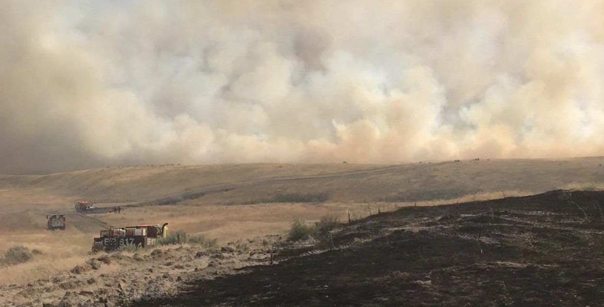
The Cold Creek Fire on the Hanford Reach National Monument. Photo by Franklin County Fire District 3.

A human-caused wildfire in south/central Washington has burned 41,920 acres 31 miles east of Yakima (see the map below). The fire has spread onto a portion of the Hanford Nuclear site that is closed to visitors but does not pose a danger to the public, according to the Washington state Department of Ecology’s Nuclear Waste Program — the agency responsible for oversight of federal environmental cleanup at the site.

The fire began Thursday morning as two fires burned together, and by 6 p.m. had blackened 8,000 acres.

Cold Creek Fire
A portion of the 41,000 acres that burned in the Cold Creek Fire. Photo by Washington Dept. of Ecology’s Nuclear Waste Program.

By Saturday afternoon the spread of the fire had slowed considerably and firefighters expect to have it contained by Sunday.

The Cold Creek Fire is the largest in Washington so far this year. The next largest was the 243 Command Fire that burned 20,380 acres 13 miles west of Royal City.

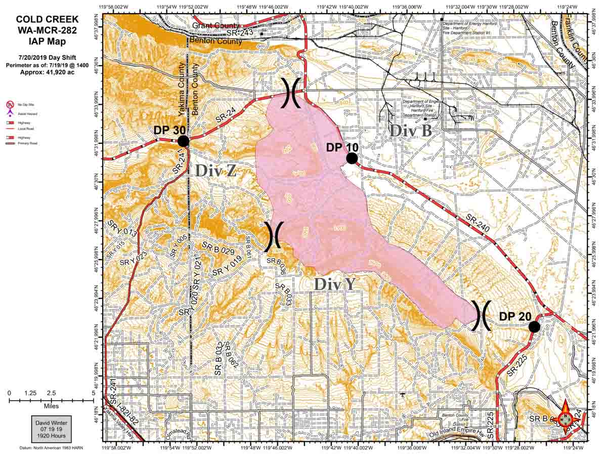
Map of the Cold Creek Fire
Map of the Cold Creek Fire at 2 p.m. PDT July 19, 2019, by David Winter. Click to enlarge.

Fire train assists firefighters in Washington

BNSF fire train
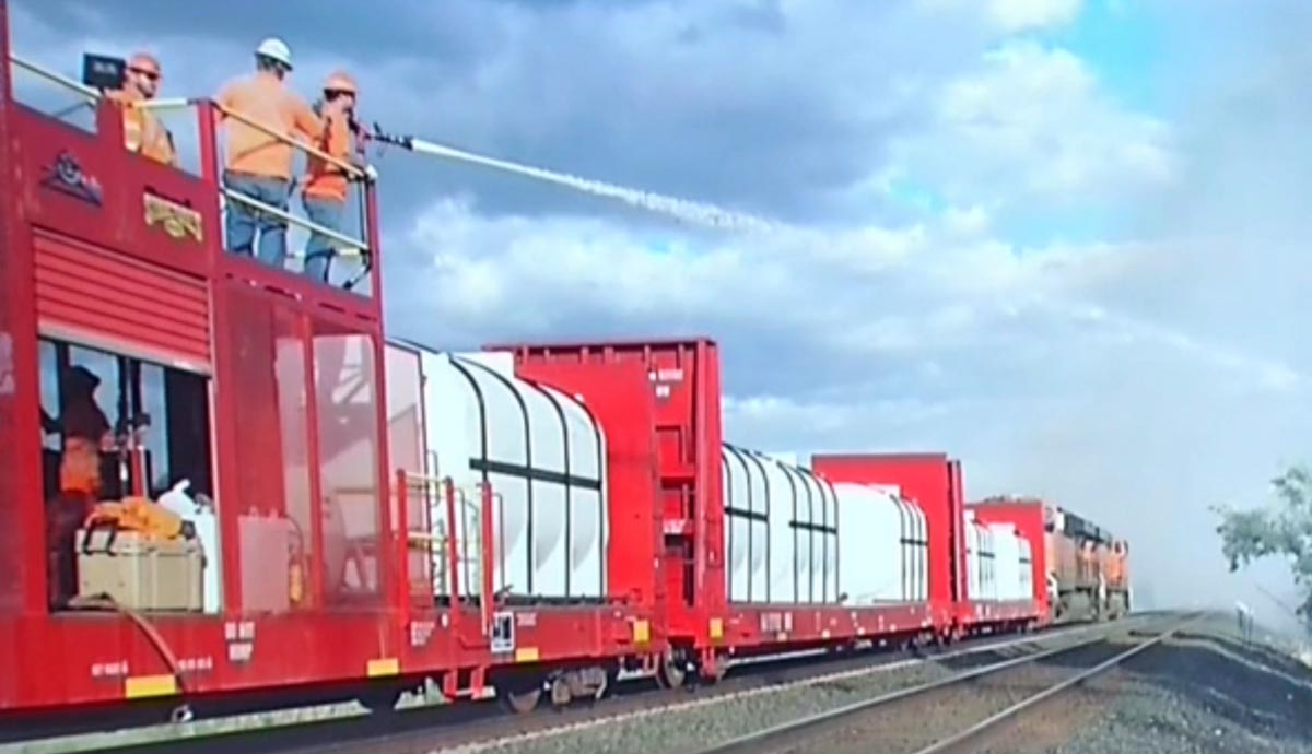
BNSF fire train. Screenshot from KEPR video.

On Thursday a fire train that probably carried nearly 30,000 gallons of water assisted firefighters battling a wildfire along railroad tracks south of Finely, Washington.

Here is a video from KEPR in which a reporter interviews firefighters to get their reaction to this train.

(If the embedded video above does not load, you can view it at the KEPR website.)

Burlington Northern Santa Fe railway has built a number of these firefighting trains.

BNSF fire train
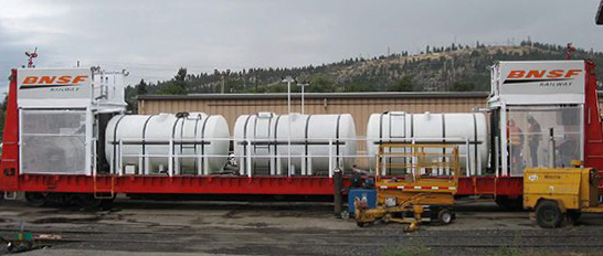
A single car from a BNSF fire train. Each of the individual tanks hold about 3,250 gallons, for a total of 9,750 gallons on the car, plus another 500 gallons of AFFF foam concentrate.

Below is an excerpt from an article at Railway Age about the BNSF fire trains:

…The Spokane fire train utilizes bulkhead flatcars that have been converted to carry three to four modular tanks, each carrying roughly 3,250 gallons of water. Swiveling water/foam cannons are mounted on elevated platforms at both ends of the train’s center car, which also carries a 500-gallon tank of aqueous firefighting foam. BNSF says, “We can reach about 300 feet up an embankment.” The train also includes a caboose that serves as a shelter and command center and houses a generator to power lights for nighttime firefighting.

BNSF built a second fire train in 2008 in Vancouver, Wash., with a different design approach. Stationed along the Columbia River at Wishram, Wash., it uses highly modified tank cars with generators and pump systems housed underneath and swivel cannons mounted on top, plus a command center caboose that’s outfitted with a spray bar that can soak wooden ties or bridges while the train is in motion. Since fire train crews often work jointly with local responders, hoses and couplings on the BNSF railcars are made compatible with fire trucks and other equipment. The cars also have siphons, which allow them to be refilled from storage tanks or natural water sources near the right-of-way…

BNSF fire train foam
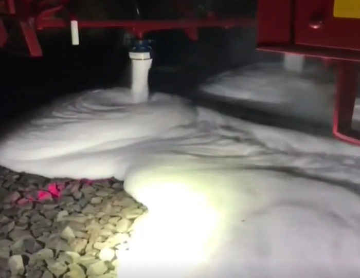
The BNSF fire train has foam nozzles that can be used to coat or cover the railroad ties as the train moves. From the KEPR video.

We have written about fire trains several times before on Wildfire Today.

Communities in Oregon and Washington most threatened by wildfire identified

After assessing the exposure to wildfire of communities across the Pacific Northwest Region, Oregon and Washington, the 50 most-threatened communities in each state were identified.

In the broadest sense, wildfire exposure encompasses the likelihood of wildfire burning a given location on the landscape, and the potential intensity of a wildfire if one were to occur. For this assessment the researchers focused only on wildfire likelihood because the effect of fire intensity on home loss rate is not well studied, and because the inclusion of intensity for this and similar assessments did not influence the conclusions. Wildfire likelihood is measured by annual burn probability, a measure generated by comprehensive simulation of wildfire occurrence and spread (see section below on Wildfire hazard simulations).

Washington Oregon communities exposed wildfire

Oregon top 10 wildfire exposed communities
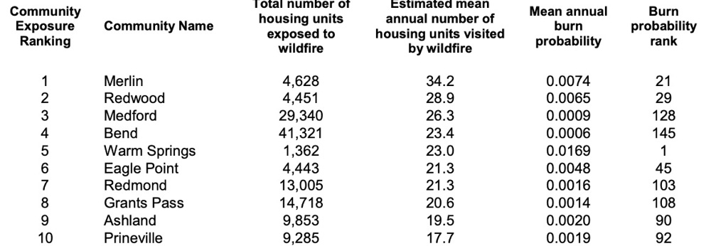
The 10 communities in Washington with greatest cumulative housing-unit exposure to wildfire. The “mean of exposed housing units” rank indicates the mean (typical) burn probability of housing units within each community.

Oregon top 10 wildfire exposed communities
The 10 communities in Oregon with greatest cumulative housing-unit exposure to wildfire. The
“mean of exposed housing units” rank indicates the mean (typical) burn probability of housing units within each community.

The research was commissioned by the U.S. Forest Service’s Northwest Region.

More details, including lists of the 50 most threatened communities in both Oregon and Washington, can be found here.

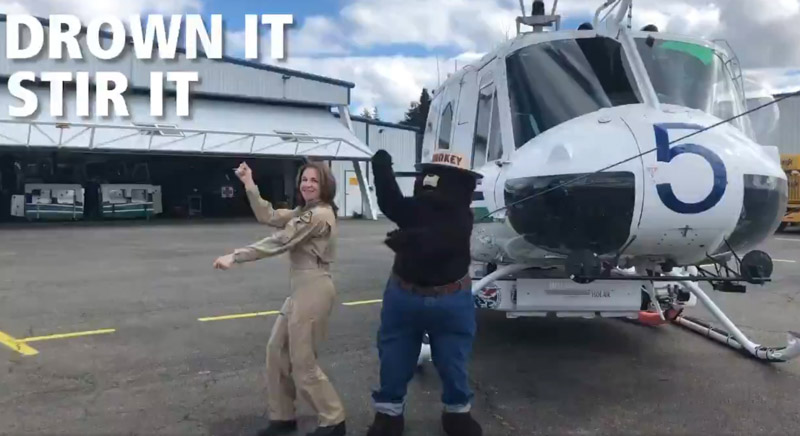
Washington’s Commissioner of Public Lands dances with Smokey Bear

Smokey Bear Hilary Franz
Smokey Bear and Hilary Franz, Washington State’s Commissioner of Public Lands, in a screengrab from the video below.

Smokey Bear and Hilary Franz, Washington State’s Commissioner of Public Lands, filmed a fire prevention public service announcement with Smokey Bear.

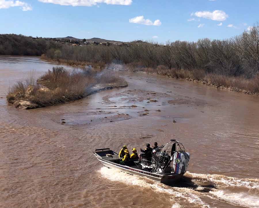
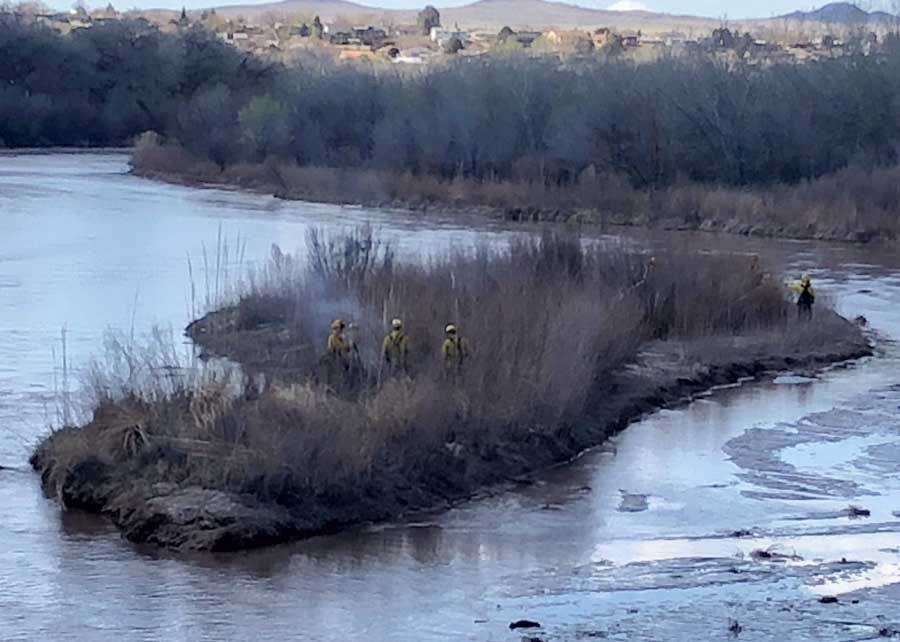
Albuquerque firefighters suppress wildfire on island

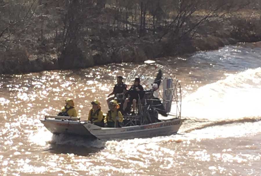
They accessed the fire via airboat

wildfire island bosque albuquerque

Yesterday firefighters from the Albuquerque Fire Rescue Wildland Division dealt with a wildfire on an island in the Rio Grande River. They used an airboat to access the 1/4-acre Bosque fire.

Photos are from @abqfire

wildfire island bosque albuquerque wildfire island bosque albuquerque

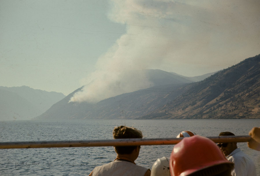
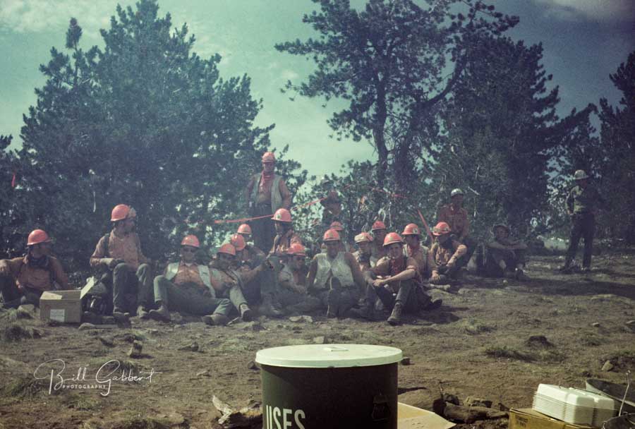
The first LARGE wildfire I was on was the Safety Harbor fire in Washington when I was with the El Cariso Hotshots. After flying from Southern California we loaded onto a chartered bus which dropped us off near an apple orchard. From there we took a boat across Lake Chelan to the fire. We were actually initial attack on the blaze. It grew much larger than seen in the photo below; we spent two or three weeks there at a spike camp. They fed us Continental Cuisine — frozen meals in plastic hairnet bags that were heated in large tubs of water, seen in the second photo below. Sometimes the frozen food was thoroughly heated; other times, there were still-frozen chunks.

Safety Harbor Fire boat ride El Cariso Hot Shots
El Cariso Hotshots and other firefighters took a boat across Lake Chelan to the Safety Harbor Fire in 1970. Photo by Bill Gabbert.
El Cariso Hotshots Safety Harbor Fire
El Cariso Hotshots at a spike camp on the Safety Harbor Fire in Washington, 1970. This picture was taken after one of the times we got chased out. The fire blew up almost every day in the mid-afternoon and we would have to hike back up a steep slope, sometimes at a brisk pace. Photo by Bill Gabbert.

Firefighters — tell us YOUR story about using a boat to get to a fire.