Berry Fire closes south entrance to Yellowstone National Park

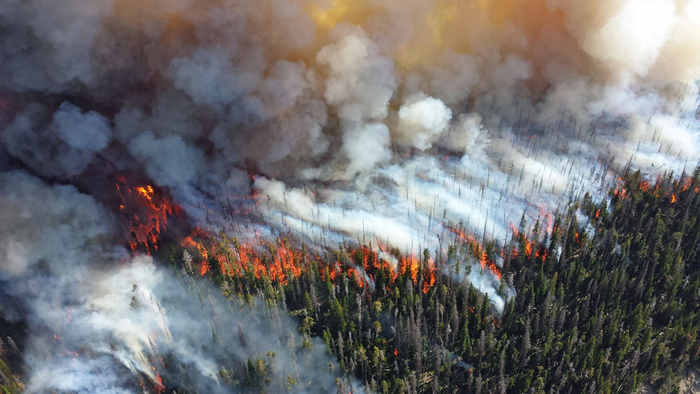
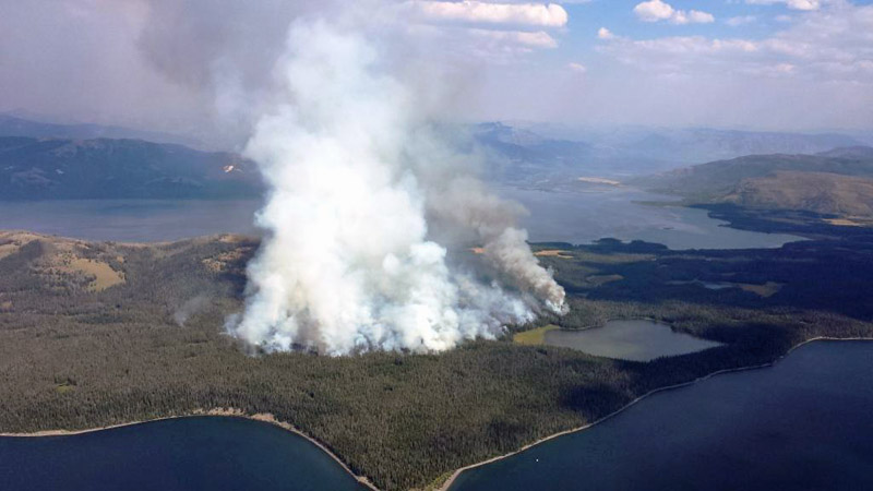
Above: Berry Fire. Undated NPS photo.

(More recent article on the Berry Fire published August 27, 2016.)

(UPDATED at 11:10 a.m. MDT August 24, 2016)

The south entrance into Yellowstone National Park is still closed by the Berry Fire which is being monitored, rather than suppressed, in order to benefit the ecosystem.

On Tuesday the fire spread farther into the Bridger-Teton National Forest after burning out of Grand Teton National Park. The northeast and south sides were the most active where it moved about half a mile beyond the previous perimeter.
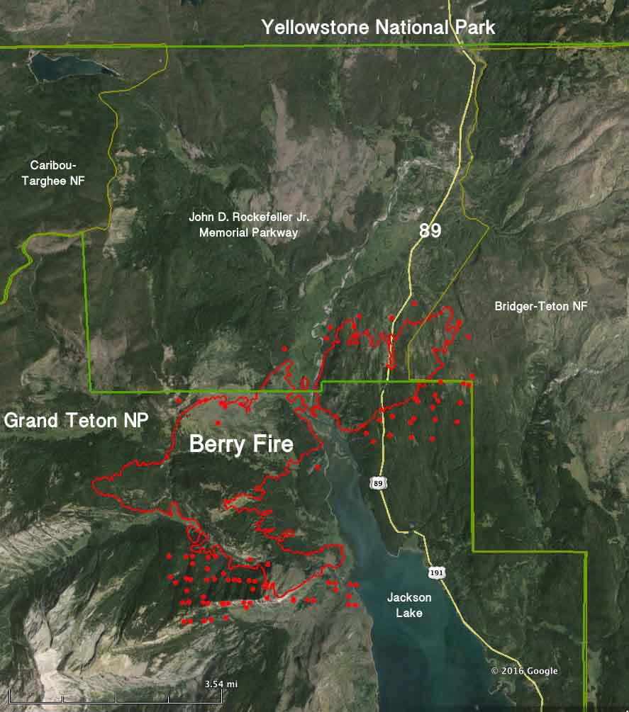
Map Berry Fire
The red line was the perimeter of the Berry Fire at 8 p.m. MDT on August 22, 2016. The red dots represent heat detected by a satellite at 4:12 a.m. MDT August 24, 2016. Click to enlarge.

A Type 2 incident management team led by Incident Commander Tim Rodie is now in place. He is assisted by 115 personnel, which is an increase of 77 over the previous day. There are 4 hand crews, 5 engines, and 3 helicopters assigned to the fire.

The incident management team is calling the fire 6,819 acres.

****

(UPDATED at 5 p.m. MDT August 23, 2016)

The Berry Fire continued to spread Tuesday into the Bridger-Teton National Forest and the John D. Rockefeller Jr. Memorial Parkway.

US Highway 89/191/287 in Grand Teton National Park is closed at Leeks Marina on the south, and at the South Gate of Yellowstone National Park on the north.
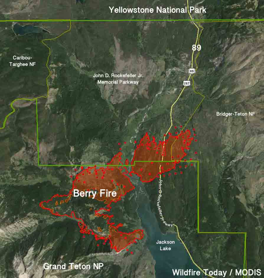
Berry Fire map
Berry Fire. The red line was the perimeter during an 8 p.m. mapping flight August 22. The red shaded areas had the most heat at that time. The red dots represent heat detected by a satellite at 2:16 p.m. MDT August 23, 2016. Click to enlarge.

The weather recorded at the Coyote Meadows weather station 12 miles west of the fire has been fairly moderate for the last 24 hours, showing 2 to 6 mph winds out of the southwest and west and 70 degrees Tuesday afternoon. The exception to the “moderate” weather has been the relative humidity which got up to only 35 percent overnight, and at 5 p.m. Tuesday was 12 percent. That will change Tuesday night when the RH increases to 71 percent, but it will fall to 19 percent Wednesday afternoon. The wind Tuesday night and Wednesday will be out of the northeast and north at 5 to 13 mph. This could influence the fire to move to the south over the next 24 hours.

There are still no plans to put out the fire. Grand Teton National Park explained on Tuesday in a statement:

Fire management goals for the Berry Fire include providing for public and firefighter safety; suppressing fire to protect structures and campgrounds; and monitoring fire growth as it burns in wilderness and contributes to long-term forest health.

****

(Originally published at 10:14 a.m. MDT August 23, 2016)
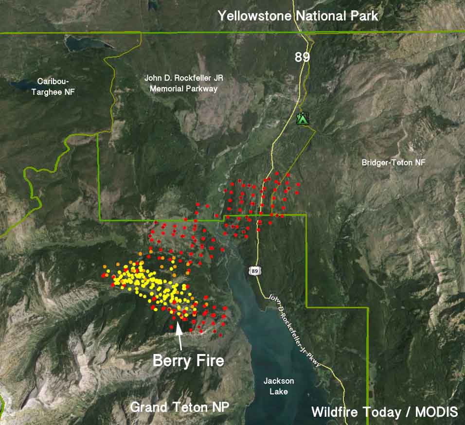
Map Berry Fire
Map of the Berry Fire. The red dots represent heat detected by a satellite at 4:31 a.m. MDT August 23, 2016. The yellow dots were detected within the previous 6 days. Click to enlarge.

The Berry Fire in Grand Teton National Park more than doubled in size Monday, closing Highway 89 which leads to the south entrance of Yellowstone National Park. The highway is closed at Leeks Marina road (south) and the Flagg Ranch (north) and will remain closed indefinitely, a park spokesperson announced Tuesday morning.

Pushed by a 5 to 8 mph southwest wind gusting up to 22 mph, the fire ran out of the park to the northeast crossing the northern tip of Jackson Lake, the Snake River, and Highway 89. It then spread into the John D. Rockefeller Jr. Memorial Parkway and the Bridger-Teton National Forest. Lizard Creek Campground has been evacuated.
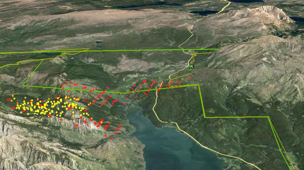
Map Berry Fire 3-d
3-D Map of the Berry Fire looking north. The red dots represent heat detected by a satellite at 4:31 a.m. MDT August 23, 2016. The yellow dots were detected within the previous 6 days. Click to enlarge.

The rapid fire spread on Monday added about 3,800 acres, bringing the size of the Berry Fire up to approximately 6,900 acres as of 4:31 a.m. on Tuesday.

Motorists expecting to enter Yellowstone from the popular south entrance will be forced to take long detours stretching for hundreds of miles. They may not be pleased to learn that National Park Service officials decided on July 25 when the Berry Fire started to allow the fire to “enhance the area’s natural resources”, rather than suppress it. 

The moderately strong winds that caused the fire to leave Grand Teton National Park were accompanied Monday by 7 percent relative humidity and 80 degree temperatures.

Grand Teton National Park brought in a Type 3 incident management team for the fire on August 21 when Red Flag Warnings for extreme wildfire danger appeared in the weather forecast. At that time there were 25 personnel assigned. As of August 22 that had increased to 39. Eight fires listed on the August 23 National Situation Report have more than 500 personnel assigned. Five have more than 1,300. However, those fires are larger and are threatening more structures.

Now that the fire has closed Highway 89 and burned outside the park they have ordered a higher level team, a Type 2 team to manage the fire, with Incident Commander Tim Roide. The next level up would be a Type 1 team.
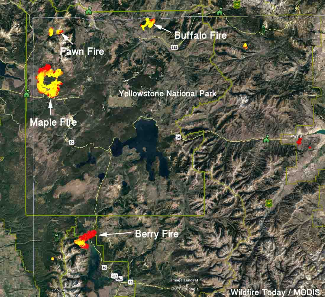
map fires yellowstone grand teton national parks
Wildfires in Yellowstone NP and Grand Teton NP. The red areas represent heat detected by a satellite at 4:31 a.m. MDT August 23, 2016. The yellow areas were detected within the previous 6 days. Click to enlarge.

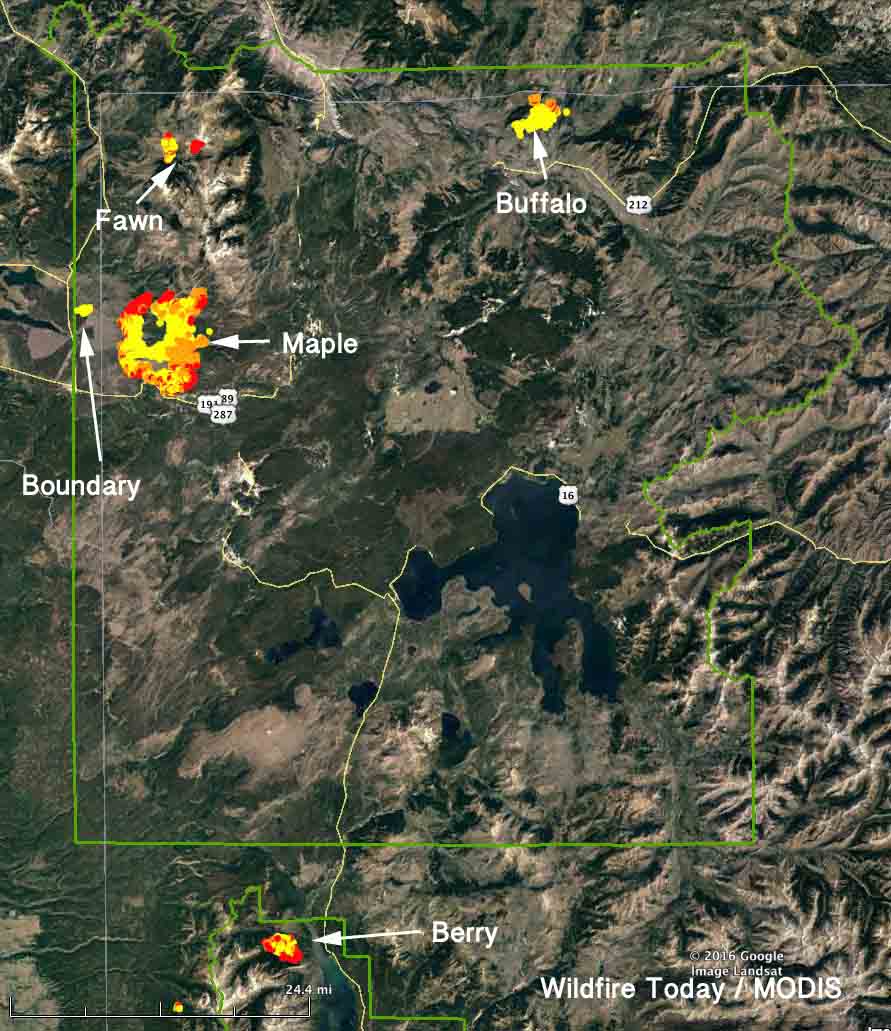
There are three active fires in Yellowstone National Park, the Maple, Fawn, and Buffalo fires. We covered these earlier. They all continued to spread on Monday. The Maple fire east of West Yellowstone, Montana marched another mile to the north, but was active on most of the perimeter. The park says all roads and businesses remain open, including the east and west entrances and the highway that goes right by the Maple Fire, Highway 20.

Five wildfires burning in Yellowstone and Grand Teton National Parks

The five fires have burned over 28,000 acres

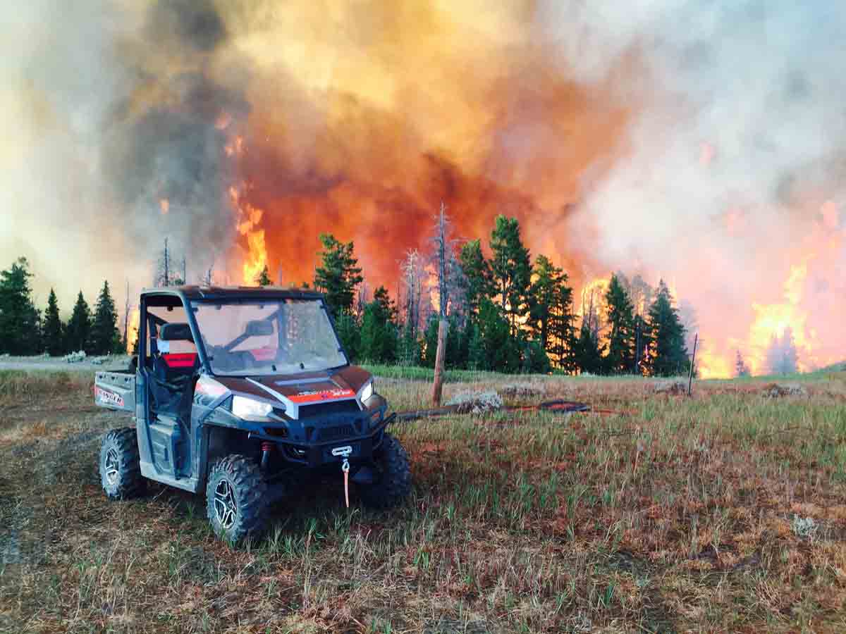
Above: The Maple Fire, August 15, 2016. NPS photo.

(More recent article on these fires, published August 27, 2016.)

(UPDATE at 9 p.m. MDT August 22, 2016)

(Tuesday morning August 23 we posted updated information about the Berry Fire and the closure of the south entrance to Yellowstone National Park.)

Earlier on Monday we repeated the information provided by the National Park Service that the roads in Yellowstone National Park remained open, in spite of the five ongoing fires in that park and just to the south, Grand Teton National Park. That changed Monday evening.

See the map below. The Berry Fire is in the north end of Grand Teton NP just south of the south entrance into Yellowstone NP. Highway 89 is the only way to enter Yellowstone on the south.

Normally from Moran, WY to Yellowstone Lake at Lake, WY, it is a 68 mile trip. With Highway 89 closed, detouring to the east would be a 344-mile journey. Detouring to the west would be 213 miles.

The Berry Fire is not listed in the national situation report. Park management decided to not aggressively suppress the fire, but to “monitor” and “manage” it.

The greater Yellowstone area is under a Red Flag Warning on Monday.

****

There are five wildfires burning in Yellowstone and Grand Teton National Parks in Wyoming and Montana, which together have burned over 28,000 acres. Four are being managed with a less than full suppression strategy, while one was aggressively attacked and has not been very active in the last 24 hours.

Northwest Wyoming is under a Red Flag Warning on Monday.

Officials in Yellowstone National Park emphasize that all roads leading into and through the park are open. Park visitor facilities, including park concession-operated services and businesses in the surrounding communities are not impacted by the fires and remain open.

map yellowstone fires grand teton national park
Fires in Yellowstone and Grand Teton National Parks, showing heat detected by a satellite. The red dots represent the most recent, seen at 3:11 a.m. MDT August 22, 2016.

Yellowstone National Park fires

  • Fawn Fire, 1,496 acres in the northwest corner of the park. Since it started August 4 it has been intermittently active and has been spreading during the last two days.
  • Maple Fire, 22,448 acres 4 miles east of West Yellowstone, Montana. It was first reported by personnel in a smokejumper aircraft passing over the park. The fire has come very close to US Highway 20, but has not crossed it. The highway leads to the west entrance into the park.  The fire has been active on most of its perimeter over the last 24 hours. Should smoke or fire activity increase, pilot cars may be used to safely escort vehicles through the area. 
  • Buffalo Fire, 2,279 acres, in the north-central part of the park, 3 miles northeast of Tower Junction (US Highway 212 and the Grand Loop Road) and half a mile south of the park’s northern boundary. The recent activity has been on the north edge of the fire. Since it was reported on August 13 it has been managed under a combination of monitoring and point-protection strategies.
  • Boundary Fire, 192 acres in Montana 5 miles north of West Yellowstone, Montana and very close to the park’s western boundary. Park personnel have actively suppressed this fire, and it has not been very active in the last 24 hours. A smaller Incident Management Team, a Type 4 team, assumed command Monday morning. Firefighters are mopping up and removing hazardous trees within the perimeter.

Grand Teton National Park

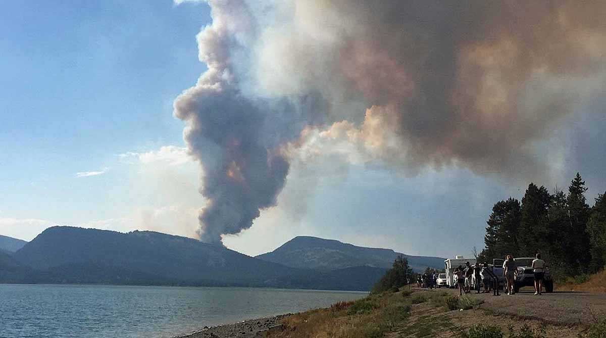
  • Berry Fire, 1,785 acres in the north end of the park, one mile west of the northern end of Jackson Lake, and 2 miles west of Highway 89 (providing photo opportunities for passing tourists). The fire has been active over most of its perimeter during the last 24 hours. It has been burning for almost a month and is now being managed by a Type 3 Incident Management Team which is planning for the expected growth of the fire. An objective of the Team is to “enhance the area’s natural resources where appropriate”. They further state, “The fire will be monitored and management actions will be implemented in advance of any potential impact on values at risk.” The fire has not required the closure of any roads.
Berry Fire
Berry Fire, Aug 15, 2016, NPS photo.

Fire activity increases in Wyoming

Above: Fawn Fire in Yellowstone National Park, August 6, 2016. NPS photo.

Originally published at 5:23 p.m. MDT August 11, 2016.

map wildfires Wyoming
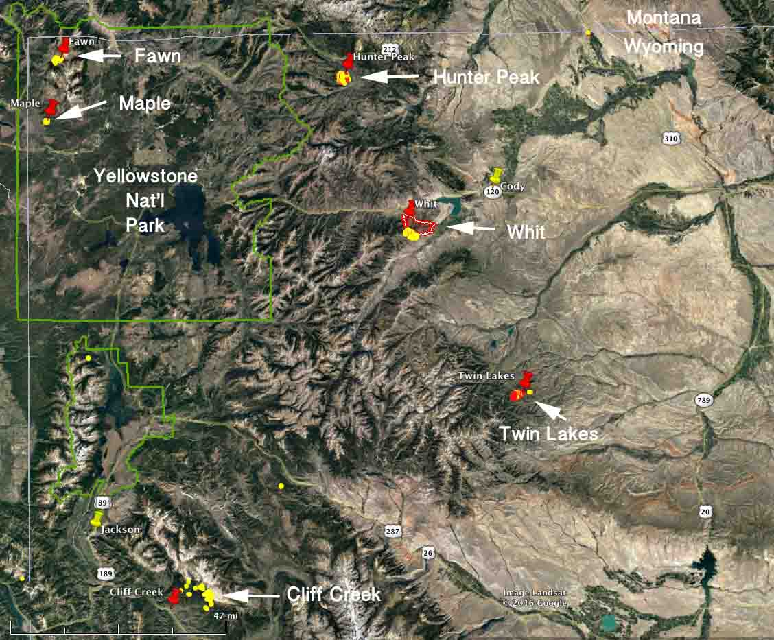
Wildfires in northwest Wyoming August 11, 2016. Click to enlarge.

There are five wildfires currently active in northwest Wyoming.

Twin Lakes Fire
Twin Lakes Fire. Inciweb photo.

The Babaganoush Fire has been renamed the Twin Lakes Fire, we assume because no one could pronounce or spell the name. It was reported on August 8 but has been very active over the last 24 hours growing to about 1,400 acres 35 miles southwest of Meeteetse. A Type 2 incident management team has been ordered.

The Hunter Peak Fire was reported on August 9 about 16 miles southeast of the northeast entrance of Yellowstone National Park, three miles south of the intersection of US Highway 212 and the Chief Joseph Highway. It has burned about 1,700 acres and required some evacuations; 95 structures are threatened. Todd Pechota’s Type 1 Incident Management Team assumed command of the fire at 6 a.m. Thursday.

The Whit Fire 13 miles west of Cody been burning for nine days and did not increase in size on Wednesday. It has blackened over 12,000 acres and still has quite a bit of heat in the southwest portion. (Our previous article about the Whit Fire.)

There are two fires in Yellowstone National Park. The Fawn Fire is in the backcountry in the northwest section of the park 10 miles west of Mammoth and the north entrance. This 930-acre fire is being monitored from the air and was quite active Wednesday.

Fawn Fire,
Fawn Fire, August 8, 2016. NPS photo.

The other fire in the park is the Maple Fire which has burned about 100 acres 8 miles northeast of the community of West Yellowstone. It also was active Wednesday evening in a large expanse of the scar left by the 1988 North Fork Fire. It will be managed under a monitoring and point-protection strategy providing fire managers a unique opportunity to study current fire behavior in the 1988 fire scar.

Photo of Alder Fire used frequently in articles about wildfire

Alder Fire in Yellowstone National Park
Alder Fire in Yellowstone National Park, August 19, 2015. NPS photo. (click to enlarge)

We happened to run across this photo of the Alder Fire in Yellowstone National Park when following up on a lead about how climate change may have influenced weather in 2014. After a few minutes of research we discovered that it was taken August 19, 2013 by fire personnel at Yellowstone National Park when they were monitoring the Alder Fire. It was burning at the same time two other fires were active in the park, the Alum and Druid Fires.

As we reported then, the Alder Fire was on a peninsula at the south end of Yellowstone Lake and eventually burned 4,240 acres. A lightning fire that was discovered on August 14, it was hemmed in by water on three sides and by a recently burned area to the south.

There are two reasons we are running the picture now — our Google research found that it has been used at least 228 times to illustrate various articles in the last two years; and, the picture is fascinating. The way the smoke is laying down on the lower-right side is very interesting, and a little mesmerizing, staying mostly below the tops of the trees. That smoke is apparently being sucked in to the area where the the intensity is greater and convection is developing, carrying the smoke vertically.

Below is another photo of the Alder Fire that we used in our 2013 article about the fires.

Alder Fire in Yellowstone National Park
Alder Fire in Yellowstone National Park, August 16, 2015. NPS photo.

One-liners, June 18, 2014

Assayii Fire June 15
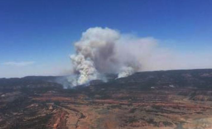
Assayii Fire June 15, 2014. InciWeb photo.

*The Assayii Fire in northwest New Mexico, reported on Friday the 13th, has burned 12,107 acres on the Navajo Nation in the Bowl Canyon area.

*Missoula smokejumpers got checked out on a new Eurocopter (now Airbus Helicopters) EC135 helicopter on Tuesday.

*On Tuesday five fires were intentionally set in vegetation in Oakland, California about two miles from where the Tunnel Fire began, which in 1991 killed 25 people (23 civilians, 1 police officer, and 1 firefighter), injured 150, and destroyed 2,449 single-family dwellings and 437 apartment and condominium units.

*An off duty firefighter employed by the city of Arcadia, California is missing in the Los Padres National Forest in southern California.

*California will give $10 million of the $48 million of the “fire fees” they have collected to counties and organizations who intend to use the funds for fire prevention and mitigation projects.

*Evaluations of how agencies in San Diego County handled the rash of wildfires in mid-May determined that communications was major issue; that and the need for a third helicopter, but the $5 million request for the helicopter was not approved.

*Three cities in the Austin, Texas area plan to install a network of wildfire detection cameras to add to the one purchased last year by West Lake Hills.

*Squirrels may be to blame for some patchy reproduction of lodgepole pines following the 1988 wildfires in Yellowstone National Park.

*An unfortunate raven started a wildfire 25 kilometers northeast of Yellowknife in the Northwest Territories of Canada when it contacted electrical wires; we will add this to our Animal Arson series, although it may have been a case of suicide arson.

*Dan Glickman and Harris Sherman, two former very high-ranking appointees in the Department of Agriculture, wrote an opinion piece for the New York Times supporting the bill that would allow the Forest Service to draw money from federal disaster funds when firefighting costs reach 70 percent of the 10-year average.
Thanks and a hat tip go out to Doug

Tree killed by 1988 Yellowstone fire causes death of visitor

An international visitor to Yellowstone National Park died Monday afternoon after being struck by a falling tree.

The 36-year old man was from Taiwan, the Republic of China. He was part of a group that was hiking the Fairy Falls trail, which is north of the Old Faithful area and west of the Grand Loop Road.

The man left the trail and ascended a nearby tree-covered slope in an apparent attempt to get a better view of Grand Prismatic Spring, when a lodgepole pine tree fell and struck him in the head.

Other visitors who witnessed the incident made their way back to the trailhead, where they encountered two park maintenance employees working in the area, who relayed the information to Yellowstone law enforcement rangers.

The victim was moved by rangers to the trailhead to await helicopter transport to a medical facility, but after attempts to revive him failed, he was declared dead at the scene.

Yellowstone rangers who responded reported windy weather conditions in the area at the time, and that the fallen tree had been a standing, dead lodgepole, fire-killed during the park’s 1988 fires.

The victim’s name is being withheld pending notification of family members.

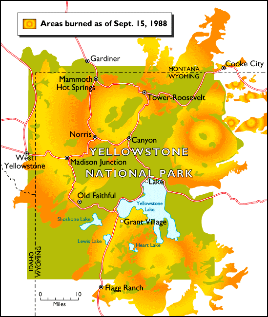
The fires of 1988 burned 793,880 acres or 36 percent of the park according to the National Park Service. About 25,000 people were involved in the suppression effort which cost $120 million. Nine of the fires were caused by humans; 42 were started by lightning. Fires that started outside of the park burned 63 percent or approximately 500,000 acres of the total acreage. Some of the lightning fires in the park were at first declared “let burn”, and were not suppressed until later in the summer.