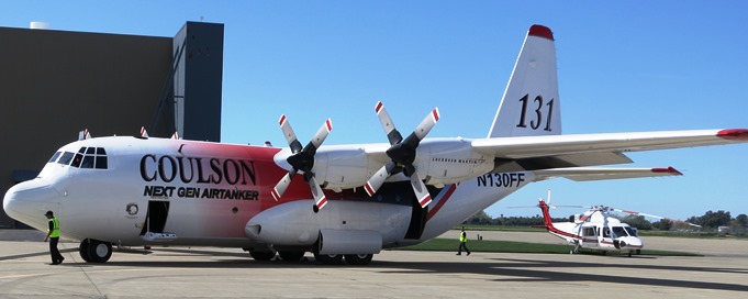
An article at Fire Aviation has current information about the availability of air tankers this year.
News and opinion about wildland fire

An article at Fire Aviation has current information about the availability of air tankers this year.

(Originally published at 12:40 a.m. MDT, April 13, 2014)
UPDATED at 4:23 p.m. MDT, April 14, 2014)
In this video Nick Wiltgen of the Weather Channel explains how winds and geography are affecting the fire.
Below, are before and after photos of a portion of the fire area at Valparaiso.
El antes y después de la zona afectada por el incendio en Valparaíso. pic.twitter.com/A0gCuu5hUG
— Luis Marín (@ELjustoLucho) April 14, 2014
(UPDATED at 11:25 a.m. MDT, April 14, 2014)
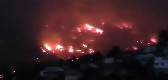
Continued strong winds are preventing firefighters from gaining control of the fire in Valparaiso, Chile. The latest information is that at least 12 people have been killed, 500 injured, and about 2,000 homes have burned.
Some of the communities affected do not have municipal water infrastructure or fire hydrants, and the streets are too narrow for fire engines.
“We are too vulnerable as a city. We have been the builders and architects of our own danger,” Valparaiso Mayor Jorge Castro said Sunday in an interview with Chile’s 24H channel.
NPR’s Lourdes Garcia-Navarro reported:
To contain the blaze, some 20 helicopters have been dumping water on the fires. But in some areas, fire crews have been able to do little other than watch buildings burn and hope the flames don’t spread farther.
The blaze began on Saturday in a forested ravine and has spread quickly — destroying whole areas and pushed on by hot winds. Schools in the city are closed today as many are overflowing with evacuees.
From latino.foxnews.com:
It was already the city’s worst fire since 1953, when 50 people were killed. [President Michelle] Bachelet declared the entire city a catastrophe zone and put the military in charge of maintaining order. Some 1,250 firefighters, police and forest rangers battled the blaze while 2,000 sailors in combat gear patrolled streets to maintain order and prevent looting.
Chile’s emergency response system generated automatic phone calls to each house in danger as the mandatory evacuations expanded. Many people stuffed their cars with possessions after getting these calls, and streets quickly became impassible. Water trucks and firefighters were stuck downhill as people abandoned their vehicles and ran. Some carried television sets and others took canisters of natural gas, fearing an explosion if flames reached their homes.
Incredible charred remains of #Valparaiso hillside after wildfire. Via @RebolledoParra. pic.twitter.com/ft0fTR5FeR
— Anthony Sagliani (@anthonywx) April 14, 2014
(UPDATED at 9:35 a.m. MDT, April 13, 2014)
Incredible photos of the fire are on the Daily Mail website.
The Guardian reports that seven people have died in the fire in Chile, 500 homes have been destroyed, and 5,000 residents evacuated. CNN’s article said 11 have died, 500 homes have burned, and 3,000 people evacuated in front of the 2,000-acre fire. You can see live reports about the fire on CNN Chile.
****
A vegetation fire in Chile has burned hundreds of homes and forced thousands of residents to evacuate. Reports on the number of destroyed structures in the city of Valparaiso vary from 150 to 500. CNN reports that a prison in the city that houses 2,000 inmates will be evacuated.
President Michelle Bachelet declared Valparaiso to be a catstrophe zone, which allows the military to maintain order and handle the evacuations.
Strong winds are pushing the fire and hampering the efforts of the 500 firefighters from seven provinces that are fighting the blaze.
#Prayers #wildfire RT @chilewildfires: #Valparaíso pic.twitter.com/fW49es6rBD @Bomba13valpo
— Dispatch Demon (@DispatchDemon) April 13, 2014
Thanks and a hat tip go out to Barbara.
Warnings for elevated wildfire danger have been issued by the National Weather Service for areas in New Mexico, Texas, Arizona, and Oklahoma.
The Red Flag Warning map was current as of 9:28 a.m. MDT on Saturday. Red Flag Warnings can change throughout the day as the National Weather Service offices around the country update and revise their forecasts. For the most current data, visit this NWS site.
After the discussions on Wildfire Today about the use of prescribed fire in the Flint Hills of Kansas here and here, we, along with some of our readers, have been paying more attention to the use of fire in the state. Over the last 24 hours the weather in Kansas and Oklahoma must have been perfect for burning, because satellite images and the MODIS heat-detecting satellite have picked up a great deal of heat and smoke in the area.
The visual satellite image above shows smoke in northeastern Oklahoma and eastern Kansas at 5:01 CDT, April 11, 2013.
The map above shows heat detected by the MODIS satellite during the 24 hours previous to 7 p.m. CDT, April 11, 2014.
And speaking of smoke, the image below shows smoke detected by radar today from a fire in Horican Marsh, midway between the towns of Horicon and Waupun in Wisconsin. Click here to see an animation of the smoke as the fire increased in size.
Thanks and a hat tip go out to Darren.
Three small fires started Thursday at Los Alamos National Laboratory in New Mexico. The fires began in Technical Area 36, an area that is used for testing up to 2,000 pounds of high explosives. The Lab’s fire department had one fire truck on scene during the test, but called in a second rig after the fires ignited. According to lab spokesman Kevin Roark the total area burned was less than a quarter acre.
Much of the research that developed the first nuclear bomb occurred at Los Alamos. According to their website their current mission “is to develop and apply science and technology to ensure the safety, security, and reliability of the U.S. nuclear deterrent; reduce global threats; and solve other emerging national security and energy challenges.”
Los Alamos has a fire history. The Cerro Grande Fire which began as a prescribed fire on National Park Service land escaped control in 2000 and burned into the laboratory and the community, destroying 280 homes. In 2011 the largest fire in the history of New Mexico, the 150,000-acre Las Conchas Fire, also burned onto the lab’s property.
One of the concerns about fires at Los Alamos is the radioactive material stored in drums on the site.
Below is a description of Technical Area 36 from the Lab’s website:
4.18.2.1.2.1.1 Eenie Site, The Eenie Site (Buildings 3 and 4, Figure 4-18, Sheet 2) has the only aboveground bunker at TA- 36. This bunker allows the use of a variety of optical and electronic diagnostics. Belowgrade bunkers at TA-36 are used to protect 35-mm streak cameras, which observe the test device through a periscope. Image-intensifier cameras, a 70-mm streak camera, a combination streak camera with a 2-million-frame-per-second framing camera, and a laser velocimeter are routinely available at this site as needed for specific tests. The Eenie Site primarily performs small-bore (less than 100 mm) gun tests against conventional, ceramic, and reactive armors; shaped-charge jet tests against conventional, ceramic, and reactive armors; diagnostic experiments to determine shaped-charge jet physics; deflagration-to-detonation experiments; detonation physics experiments; and studies in explosives vulnerability to projectile and shaped-charge attack. The site has a load limit of 2,000 lb (907 kg) of HE. The Eenie Control Building (Building 3) and the Eenie Preparation Building (Building 4) are categorized as L/ENS.
On Thursday a brush fire near Edison, New Jersey threatened hotels, day care centers, and shipping facilities for UPS and FEDEX before it was contained. One report from NBCNEWYORK said about 250 acres of mostly wetlands burned.
The video above has some good aerial shots, but don’t bother adjusting your audio, since there is none.