Update at 5:11 p.m. MT, June 14, 2011:
This afternoon the Wallow fire sent out this rather unusual information:
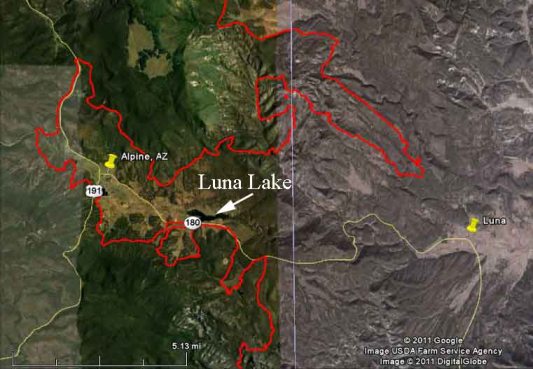
Burnout Operation Underway Near Luna Lake
Firefighters are burning vegetation between Wallow fire and the fireline north of road 180 in the Luna Lake fire camp area. This burnout will strengthen and connect containment lines in zones 1 and 2.
As long as the current favorable weather conditions continue, the crews will ignite unburned fuels in the Luna Lake area and bring fire down toward road 180.
Protection plans are in place for Luna Lake firecamp. If needed, for personal safety related to smoke or fire suppression actions, personnel may temporarily leave the fire camp.
Below is a map we put together showing the location of Luna Lake, which is on the east side of the fire between Alpine, AZ and Luna, NM. The white line is the state line. The red line is the fire perimeter.
=======================

The Wallow fire in eastern Arizona and western New Mexico has grown to become the largest in Arizona history, burning 469,407 acres to eclipse the 2002 Rodeo-Chediski fire which burned 468,638 acres. Area Command reported at 7:00 a.m. Tuesday via Twitter that containment has reached 18% and: “Will see continued line construction & line improvement today. Expect containment to increase.”
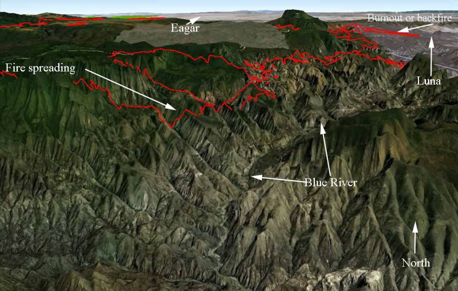
The only areas of the fire that spread significantly on Monday were on the east side between Alpine, AZ and Luna, NM and on the south side above the Blue River.
Firefighters have been conducting a burnout or backfire northwest of Luna but that is not yet complete. They may be waiting for optimum conditions to finish it and tie it in to highway 180.
On the south side, in very remote and rugged terrain, they have been working on 9-10 miles of indirect fireline near the Blue River. When weather conditions are suitable they will burn out the area between the main fire and the constructed line.
Below is a 3-D map of the south and southeast sides of the Wallow fire. Click on it to see a larger version.


