Wildfire briefing, April 16, 2014

Idaho sues over Steep Corner Fire

The state of Idaho has filed a lawsuit to recover the costs they incurred while suppressing the 2012 Steep Corner Fire near Orofino, Idaho. The suit claims that a timber company and its contractor did not meet U.S. Forest Service standards. It names Potlatch Land and Lumber, Potlatch Forest Holdings, Clearwater Paper Corp., Potlatch Corp., and DABCO Inc., a Kamiah-based logging contractor.

A firefighter, Ann Veseth, in her second season working as a firefighter for the USFS, was killed when she was struck by a falling 150-foot tall fire-weakened green cedar tree. The tree fell on its own and was 13 inches in diameter where it struck her.

Nebraska to join a fire compact

If the governor of Nebraska signs a bill approved by the legislature, the state will become a member of the Great Plains Interstate Compact, making it easier to share firefighting resources with Colorado, Wyoming and the Dakotas.

UPDATE, April 18, 2014Gov. Dave Heineman announced that he signed the bill.

Next-generation 911

The next generation of 911 could include live video and photographs which could be sent to first responders.

From Governing.com:

On May 1, 2010, a terrorist attack in New York City’s Times Square was thwarted when street vendors noticed smoke coming from a vehicle in which a homemade bomb had failed to explode. Imagine if those street vendors could have used their cellphones to send pictures or video of the vehicle and its license plate to a 911 call center. What if the 911 center could then push that data to first responders and police to get the location from GIS and buildings visual in the photos?

“They could really capture the dynamics of the event,” said Brian Fontes, executive director of the National Emergency Number Association (NENA). “That is what I call an information-rich 911 call, which will be supported in a next-generation 911 system…

Wildfire activity in British Columbia

From cbc.ca:

Fire officials are keeping a close eye on wildfires in the interior. There have been twice the average number of fires so far this year in the Kamloops Fire centre. Monday, five homes were put on evacuation alert in Bridge River near Lillooet. Nearly two dozen firefighters were sent to the area. Two fires are also being fought in the Okanagan. Kayla Pepper is an information officer with the Kamloops Fire Centre. She says it is dry and there has been a fair amount of wind throughout the Interior and Okanagan. She says there have already been 34 wildfires in the region. Pepper says so far, it’s too early to predict how active wildfires will be this year.

National Parks with web pages devoted to wildland fire

The National Park Service has a web page that lists dozens of Parks that have web pages devoted to their unique wildland fire programs. Below is a screen shot of a portion of the page.

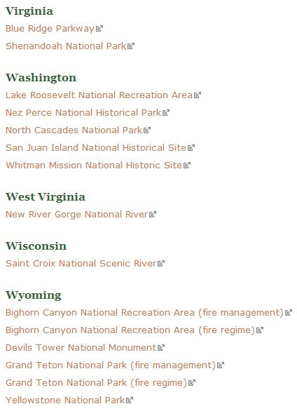
NPS park fire programs

Red Flag Warnings, April 16, 2014

wildfire Red Flag Warning, April 16, 2014

Warnings for elevated wildfire danger have been issued by the National Weather Service for areas in New Mexico, Oklahoma, Kansas, Nebraska, Iowa, Missouri, Alabama, and Texas.

The Red Flag Warning map was current as of 10:57 a.m. MDT on Wednesday. Red Flag Warnings can change throughout the day as the National Weather Service offices around the country update and revise their forecasts. For the most current data, visit this NWS site.

Comparing managing a fire, to the shootouts after the Boston Marathon bombing

A few days after the two bombs went off near the finish line at the Boston Marathon a year ago today, there were two shootouts between the bombing suspects and law enforcement officers. During both incidents dozens or perhaps hundreds of officers self-deployed. Representing many different agencies, they heard about the encounters and simply responded. In some respects there was little or no coordination between them as they attempted to operate on different radio frequencies.

During the first shootout, which occurred at night, the suspects found themselves surrounded in an almost circular fashion. The officers saw someone firing a weapon in their general direction and fired back at the other shooter. A policeman was seriously injured by friendly fire. At least 100 rounds were fired by the officers while the two suspects, who had only one gun between them, fired 10 or less.

The second shootout when the remaining suspect was holed up in a boat, was almost as chaotic, as numerous self-deployed officers arrived at the scene. One SWAT team sharpshooter took a position on a roof only to be surprised by another sharpshooter from another team. They argued for a while, but both remained on the roof.

While law enforcement officers rarely find themselves suddenly in an emergency with hundreds of participants from many different agencies, most firefighters have seen chaos during the early stages of fires when resources are arriving from multiple jurisdictions. The adoption of the Incident Command System and later the National Incident Management System has provided a framework for reducing or eliminating unorganized mayhem — on fires as well as planned or unplanned incidents.

The establishment of an Incident Commander, a chain of command, delegation of responsibilities, and the use of staging areas are powerful and effective management tools. And they can be set up in minutes, even on small and emerging incidents, not just on large incidents that have been going on for days.

Geoff Alpert, a criminology professor at the University of South Carolina, compared managing the shootouts last year in Boston to managing a fire. Below is an excerpt from an article at NBCNews:

“There should have been protocols in place that night and the analogy is a fire,” Alpert said. “Firefighters and firetrucks are not going to just show up and start spraying each other. Each group is going to have a responsibility and someone is going to coordinate among those groups. Police work is no different, except the consequences can be even more disastrous for not having general, pre-established procedures before the chaos hits.

“There might be breakdowns and people might make decisions on less information than they would like in less than ideal conditions, but someone has to be in charge. Otherwise, you have all these individuals making decisions on very limited information and on very limited resources instead of pooling them.”

Scott Reitz, a former LAPD SWAT unit member and a national firearms tactics and deadly force expert, said that most officers act “with the best of intentions,” and that the “confusion, misdirection and overall chaos” of an incident like Watertown can’t be understated, especially weighed against the limitations of training vs. real-world experience.

“In essence, it would be analogous to practicing on a stick-shifted Volkswagen Bug and then being thrown into the Le Mans in a Formula One race car, at night, in the rain,” Reitz said. “One cannot train to one level of proficiency when an entirely different level is required in the real world. The results are somewhat predictable.”

Arizona: Type 1 Team ordered for Brown Fire

Brown Fire, April 13, 2014. US Forest Service Photo.

(UPDATED at 2:18 p.m. Ariz. time, April 17, 2014)

The incident management team on the Brown Fire in southern Arizona is listing the fire at 240 acres; 232 of the acres are on U.S. Army Fort Huachuca, and 8 acres are on the Coronado National Forest. That is a 34 percent reduction in size as a result of a more accurate map produced after a fixed wing infrared mapping flight Wednesday night.

Fire crews have been working on the fire since Monday constructing fire line, but Clay Templin’s incident management team continues to say there is zero percent containment after four days of work.

Below is a description of Wednesday’s activity on the fire:

Low humidities and gusty erratic winds occurred on the fire area. Low fire behavior with some areas of creeping and smoldering fire were observed. Firefighters made progress building direct fireline on the east and west flanks of the fire however containment will not occur until firefighters are confident the lines will hold. The forward spread of the fire has been stopped. Use of retardant and water from the helicopter was effective in assisting ground forces. Contingency line preparation continued in Sawmill Canyon to the west of the fire and Ramsey Canyon to the east of the fire. Firefighters conducted structural assessments in the Ramsey Canyon area.

This will be our last report on the Brown Fire unless it increases substantially in size.

****

(UPDATED at 12:05 p.m. Ariz. time, April 16, 2014)

The size of the Brown fire in southern Arizona is still reported to be 366 acres, the same as on Monday. Clay Templin’s incident management team continues to say there is zero percent containment, implying that no fireline has been constructed and held. Below is an update from the team at 8 a.m. Wednesday, describing the activities on Tuesday:

Three hotshot crews anchored the fire and began constructing fireline on the southeast and southwest flanks of the fire. Firefighters also scouted contingency lines. Airtankers and helicopters continued to drop retardant and water on the fire to try to minimize the fire’s spread. Aircraft began utilizing the tanker base at Libby Field with the exception of the DC-10 VLAT which is based out of Phoenix-Mesa Gateway Airport. Clay Templin’s Type 1 Southwest Incident Management Team assumed command of the fire Tuesday at 6pm.

****

(UPDATED at 2:52 p.m. Ariz. time, April 15, 2014)

A satellite pass over the Brown Fire in southern Arizona at 11:40 a.m. Ariz. time today did not detect any large hot areas on the fire, nor have any been found by the satellite during other passes since the flyover at 10:48 a.m. Ariz. time, April 14. Current images from a weather satellite do not show a large smoke plume. This tends to indicate that the fire has not been very active today. However, that could change.

An update issued by the Incident Management Team at 11:50 a.m. today still listed the fire size at 366 acres with no containment, the same as on Monday. The growth potential was described as “moderate” and the fire behavior as “Active fire. Short runs. Isolated torching with short range spotting”. No structures are threatened, and the terrain is described as the proverbial “steep, rugged, and inaccessible”.

Another Fire Weather Watch is in the forecast again for Wednesday due to low humidity, strong winds, and continued drought conditions.

A public meeting will be held Tuesday at 7 p.m. at the Sierra Vista Ranger District office, 4070 S. Avenida Saracino, Hereford, AZ

****

(Originally published at 10:54 a.m. Ariz. time, April 15, 2014)

A Type 1 Incident Management Team has been ordered for the Brown Fire burning in Garden Canyon on the north side of the Huachuca Mountains in southern Arizona. As you can see on the map of the fire below, it is burning seven miles north of the Mexican border and eight miles southwest of Sierra Vista, Arizona.

Brown Fire 10:48 a.m. AZ time, April 14, 2014
Map showing the location of the Brown Fire. Heat was detected by the MODIS satellite at 10:48 a.m. AZ time, April 14, 2014. The fire has grown since then. (click to enlarge)

At 9 p.m. on April 14 the Brown Fire was reported to be 366 acres with no containment, a little small for a typical Type 1 Incident Management Team (IMT) assignment, but apparently the managers of the Coronado National Forest believe the fire has the potential to become large and complex. It started on Fort Huachuca, a U.S. Army base, on April 13 and burned onto the Forest Monday morning. The fire is human-caused.

Helicopters and air tankers, including a DC-10, have been dropping water and retardant on the fire.

The area is under a Fire Weather Watch today for low relative humidity, drought conditions, and strong winds.

The IMT ordered was Clay Templin’s Type 1 Southwest team. They are scheduled to assume command at 6 p.m. on Tuesday.

Today firefighters expect to scout for handline construction contingencies, use helicopters for crew shuttles, and continue to use helicopters and air tankers to drop water and retardant.

As of 9 p.m. Monday, firefighting resources assigned or en route include 160 personnel:

  • 2 hotshot crews on scene – Ironwood IHC & Silver City IHC (3 additional hotshot crews enroute)
  • Coronado NF crew 5 short crew
  • 2 Single Engine Air Tankers (SEATs)
  • 2 P2V air tankers
  • 1 Very Large Air Tanker (VLAT)
  • 1 Type 3 helicopter
  • 1 Type 2 helicopter
  • (1 one Type 1 helicopter enroute)
  • Miscellaneous fire engines (crews supporting suppression efforts)
  • Miscellaneous overhead

More winners announced for Lead By Example Award

Two weeks ago the National Park Service announced that two of their wildland fire personnel received Paul Gleason Lead By Example Awards for 2013 — Chad Fisher, wildland fire safety program manager, and Jim Shultz, wildland fire training program manager.

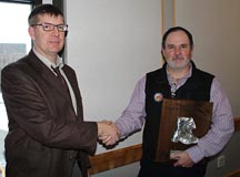
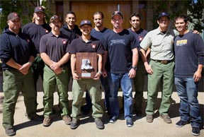
Today the National Interagency Fire Center distributed a news release stating that two other Lead By Example awards were also issued. Below is the text of the release (we added the photos of Mr. Seilstad and the Palomar Hotshots; photos of Mr. Fisher and Mr. Shultz are in the previous announcement).

****

Lead by Example Award Winners for 2013

Boise, Idaho – The National Wildfire Coordinating Group Leadership Subcommittee announced that Chad Fisher, Dr. Carl Seielstad, Jim Shultz and the Palomar Interagency Hotshot Crew were selected for the 2013 Paul Gleason Lead by Example Award. The recipients were nominated for demonstrating valued leadership traits during or in support of wildland fire operations.

The Lead by Example Award is based on three categories: motivation and vision; mentoring and teamwork; and innovation or initiative. Individuals and groups from federal, state, local and tribal agencies are eligible for the award.

The annual award was created to honor Paul Gleason, a wildland firefighter whose career spanned several decades. Gleason is best known for developing the LCES (Lookout, Communication, Escape Routes, Safety Zones) concept that became the foundation of wildland firefighter safety. The awards highlight Gleason’s influence on and contribution to wildland fire management, while honoring those who demonstrate the spirit of leadership for which he was known.

Award Recipients for 2013

Chad Fisher, National Park Service, National Interagency Fire Center, was selected for his motivation and vision work with the Dutch Creek mitigations which resulted in a change in firefighter safety regardless of size or complexity. Fisher’s dedication to ensure safety across agency boundaries has resulted in a shift in culture regarding incident-within-an-incident planning.

Carl Seielstad 2013
Dr. Carl Seielstad

Dr. Carl Seielstad, College of Forestry and Conservation, University of Montana, was selected for his initiative and innovation by establishing the Wildland Fire Program and Prescribed Fire Practicum in partnership with the Nature Conservancy, which provides students with hands-on leadership and prescribed fire experiences. Seielstad’s visionary leadership offers students a unique opportunity while providing a background to become highly effective fire managers.

Jim Shultz, National Park Service, National Interagency Fire Center, was selected for mentoring and teamwork across agency boundaries through programs like the Fire and Aviation Mentoring program and National Interagency Joint Apprentice Committee. Shultz’s leadership skills and calm demeanor also helped ensure that all honor guards worked together during the Granite Mountain Hotshot Memorial Service

Palomar Hotshots 2013
Palomar Hotshots

The Palomar Interagency Hotshot Crew, Palomar Ranger District/Cleveland National Forest, US Forest Service, was selected for demonstrating initiative and innovation through efforts like their crew website and 2012 “Leadership is Action” video. Palomar Hotshots continue to provide leadership development through non-traditional leadership styles and allow individuals to strive for a higher performance level as a leader.”