Firefighters making more progress on the Rocky Fire

(UPDATE at 7:21 a.m. PT, August 8, 2015)

The Rocky Fire east of Clearlake, California, was quiet again on Friday. The satellite did not detect any large heat sources on the blaze that CAL FIRE is calling 69,636 acres and 62 percent contained. Many areas have been repopulated but others are still under mandatory evacuation orders.

Almost 3,000 personnel are assigned to the fire, as well as 195 engines and 84 hand crews.

****

(UPDATE at 9:47 p.m. PT, August 5, 2015)

Firefighters on the Rocky Fire east of Clearlake, California had another successful day — for the second day in a row keeping the additional acres burned to less than 100. A mapping flight at 7 p.m. Wednesday determined that 37 acres were added, bringing the total to 68,924.

Today CAL FIRE updated the number of structures destroyed to 43 residences and 53 outbuildings.
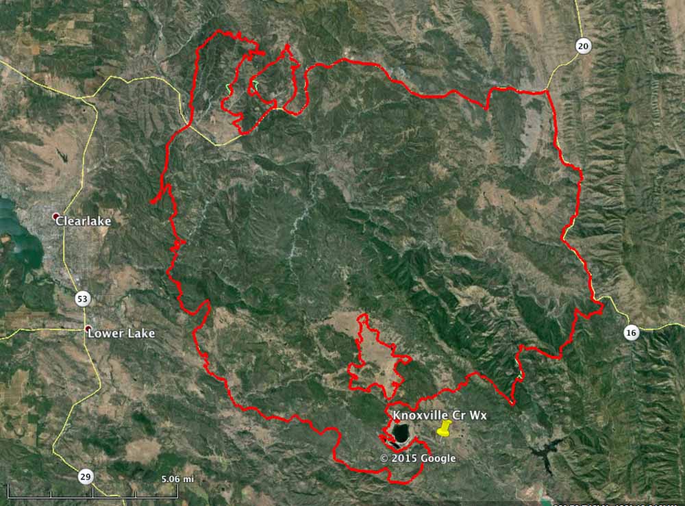
Map Rocky Fire
Map of the Rocky Fire (in red) at 7 p.m. PT August 5, 2015. The green line was the perimeter the day before. (click to enlarge)

The mapping flight was earlier than usual, perhaps because one of the two USFS infrared (IR) line scanning aircraft is down for major planned maintenance, leaving a large workload for the single remaining IR ship operated by the US Forest Service. It’s an inopportune time for planned maintenance that sometimes must be done with a certain number of hours on the aircraft. But thankfully the ship carrying the load is a twin-engine jet-powered Cessna Citation that cruises at over 450 mph so it can visit many fires during its shift.

USFS IR aircraft, Cessna Citation Bravo
One of the U.S. Forest Service’s Infrared aircraft, a Cessna Citation Bravo, N144Z USFS photo.

The jet’s daily grand tour of wildfires is usually at night because there is more of a difference between the temperatures of the ground and the fire, making it easier for the fire to be detected. Just one quick pass is all that’s required of a fire that’s up to several thousand acres — more are needed for very large blazes such as the complexes of scores of scattered fires burning in northern California on the Shasta-Trinity National Forest that are scanned as one large “box”, requiring six passes on a recent night.

But back to the Rocky Fire. The weather conditions on Wednesday were warmer and drier than the day before, but they were not extreme; lets call them moderate, at least for California. And about the same is in the forecast for Thursday. Firefighters deserve kudos for limiting the spread to much, much less that we were seeing several days ago.

On the map of the fire above, only a few changes in the perimeter can be picked out (if you click on the map to enlarge it). Two are on the north side where the fire jumped across Highway 20. The other is on the southeast side.

The resources assigned to the fire include 3,483 personnel, 323 engines, 87 hand crews, 17 helicopters, and 63 dozers.

****

(The article below was originally published at 10:24 a.m. PT, August 5, 2015)
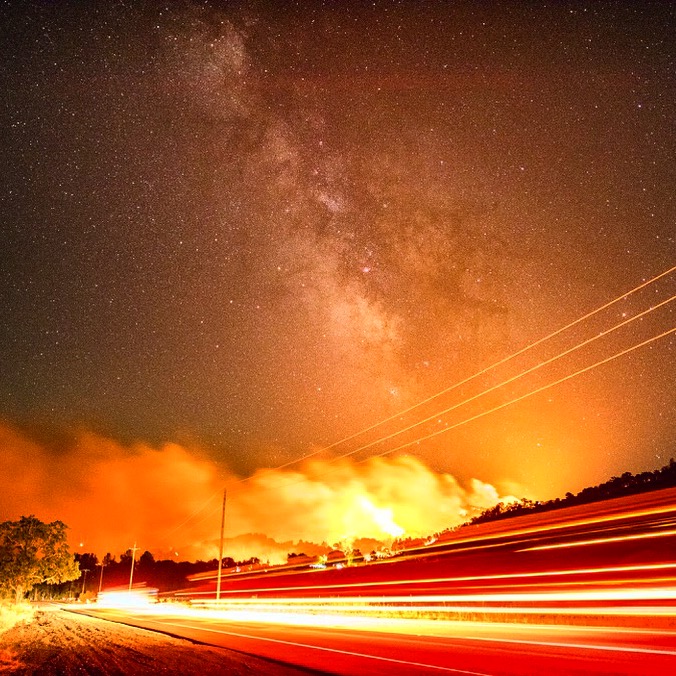
Rocky Fire
A firing operation on the Rocky Fire August 3, 2015. Photo by Stuart Palley used with permission.

On Tuesday firefighters got a temporary break from extreme weather and fire behavior on the Rocky Fire east of Clearlake, California. A small amount of rain was reported in some areas of the fire, however the Knoxville Creek weather station on the southeast side did not record any precipitation.

The fire perimeter is still virtually the same as was shown on the map we posted August 4.

There was very little additional growth of the Rocky Fire Tuesday. A total of 76 acres were added, which occurred on the north side where it spotted across Highway 20, and on the southeast side west of Highway 16. A mapping flight at 10 p.m. Tuesday updated the size to 68,886 acres.

CAL FIRE updated the number of structures destroyed to 39 residences and 52 outbuildings. They caution that the numbers may increase as damage assessment teams are able to access the burned areas.

Mandatory evacuations are still in effect for many areas, affecting about 13,000 residents. Other areas are under evacuation advisories.

The high temperature of 75 degrees Tuesday occurred at 10 a.m. and it actually dropped to 69 at 3 p.m. thanks to clouds that moved in. The relative humidity increased to 58 percent at 3 p.m. and then decreased as the sky cleared somewhat.

Conditions will change on Wednesday as the forecast predicts 89 degrees, 24 percent relative humidity, clear skies, and winds out of the east at 3 to 6 mph.

Cause of death and plans for final arrangements released for firefighter killed in California

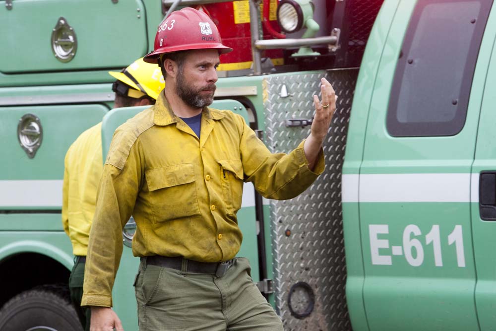
Dave Ruhl
Dave Ruhl. USFS photo.

The cause of death of the firefighter who was killed July 30 while fighting the Frog Fire in northern California was released today. The U.S. Forest Service said the autopsy that began August 4 determined that David (Dave) Ruhl’s death was attributed to “carbon monoxide poisoning and smoke inhalation.”

Mr. Ruhl went missing the evening of July 30 while engaged in initial attack on the Frog Fire, which was reported at approximately 5:45 p.m. on July 30 in a very remote area of the Modoc National Forest 46 air miles east of Mt. Shasta, California.

The Modoc County Sheriff’s Office was called for assistance. Search and rescue personnel started the initial search at approximately 8 p.m. It continued until about midnight when it was halted because of hazardous fire conditions. Efforts began again at 6 a.m. July 31 and Mr. Ruhl’s body was discovered at 9:17 a.m.

A National Incident Management Organization (NIMO) team, with Incident Commander Bob Housman, is managing the aftermath of the fatality, while Norcal Team #1 with Incident Commander Jay Kurth is running the Frog Fire, which has now grown to 4,745 acres and has 523 personnel assigned.

Before Tuesday afternoon, the USFS released very little information about the fatality, and would not divulge if it was caused by a burnover, vehicle accident, lightning, or something else. A 72-hour preliminary report about the accident that was also released today further explained that while Mr. Ruhl was scouting the fire on foot during initial attack, he “was entrapped and killed.”

The fatality is currently being investigated by OSHA, the Office of Inspector General for the Department of Agriculture, the County Sheriff, and a Coordinated Response Protocol (CRP) team. According to Safety Matters the CRP team is led by Mike Dudley, who also served as secondary team leader for the Serious Accident Investigation Team for the Yarnell Hill Fire and the deaths of 19 members of the Granite Mountain Hotshots in 2013.

Mr. Ruhl had been on a temporary detail since June 14 as an Assistant Fire Management Officer on the Modoc NF. His regular job was Engine Captain on the Black Hills National Forest in Rapid City, South Dakota.

Mr. Ruhl, 38 years old, began his Forest Service career in 2001 as a seasonal forestry technician. Previously, he served in the U.S. Coast Guard and as a correctional officer with the state of South Dakota. He lived in Rapid City with his wife and two children.

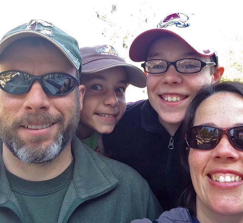
Dave Ruhl family
Dave Ruhl, his children Tyler and Ava, and wife Erin. Photo by Erin Ruhl. Used with permission.

Shalista Anderson, who has been a friend of Mr. Ruhl’s wife, Erin, for over 20 years, set up a GoFundMe account to support Erin and their two children, Tyler and Ava. Ms. Anderson told us that “Erin will have control over all funds and they will be deposited directly into her account.”

The goal of the effort is to raise $20,000, but I hope we can do a lot better than that.

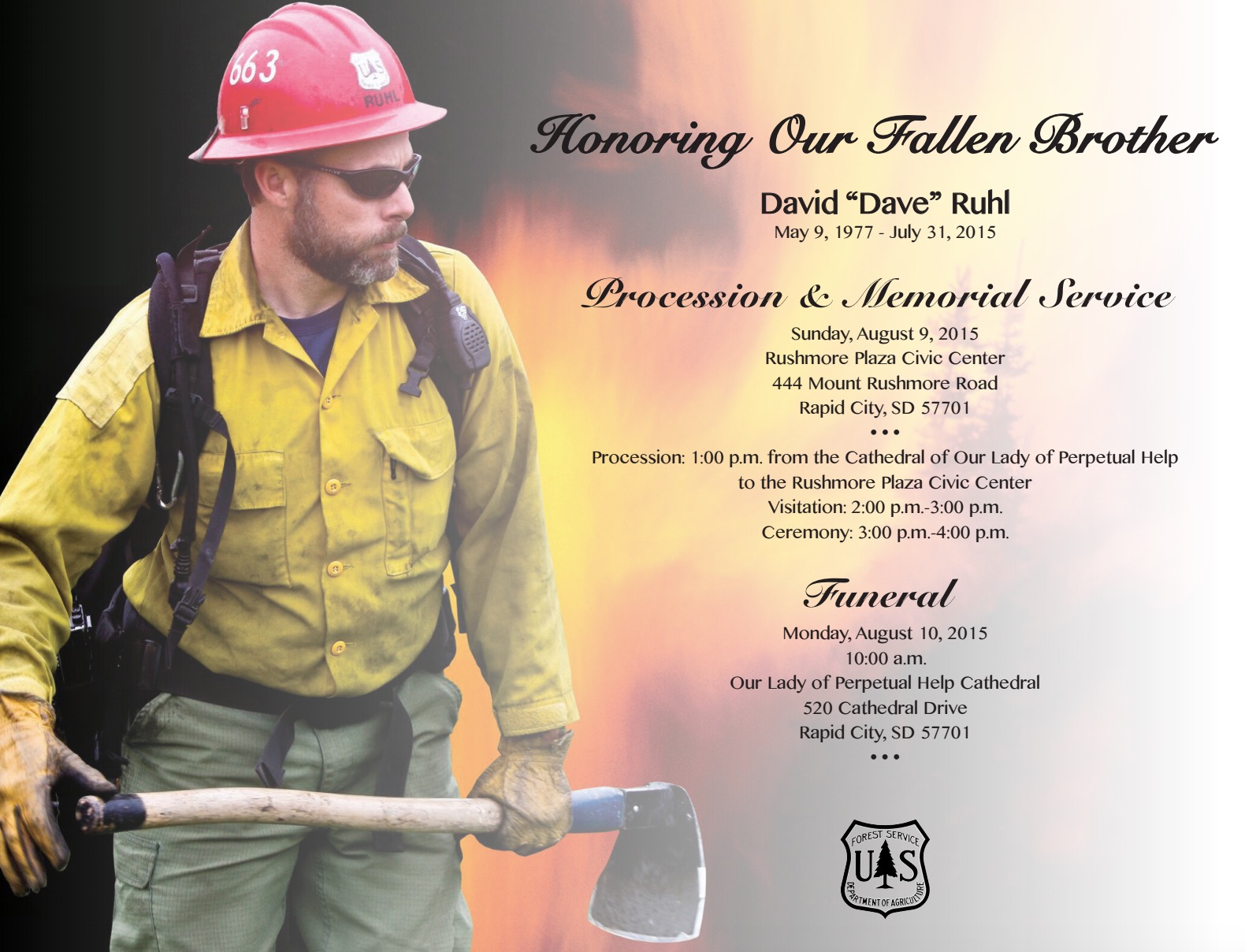
Some of the final arrangements have been made.

Procession in California: In a procession from Mt. Shasta to Redding, California on Thursday, August 6, Mr. Ruhl will be accompanied by engines from the Modoc National Forest and will be joined by other fire departments during portions of the journey. The procession will depart from Mt. Shasta Memorial Chapel at 8 a.m. and will proceed along Interstate 5 and Hwy. 44 to the northern California Geographic Area Coordination Center in Redding. Mr. Ruhl will rejoin his family in a private setting at the center.

Procession in Rapid City, South Dakota: On  Sunday, August 9, a procession will begin at 1 p.m. from the Cathedral of Our Lady of Perpetual Help, 520 Cathedral Drive in Rapid City (map) to the Rushmore Plaza Civic Center (map). The route will go north along 5th Street and conclude in the west parking lot of the Rushmore Plaza Civic Center.

Memorial Service: Visitation will be at 2 p.m. at the Rushmore Plaza Civic Center, 444 Mt. Rushmore Rd., Rapid City, followed by a memorial service that will begin at 3 p.m.

Funeral: Mr. Ruhl’s funeral will be held Monday, August 10, at 10 a.m. at the Cathedral of Our Lady of Perpetual Help.

Dave Ruhl services

A view of a few California wildfires

“Boosting” is smokejumper terminology for temporarily being stationed at a smokejumper base away from their home duty station.

Smoke from fire in Washington creating concern in Montana

smoke Wolverine Fire Montana
Smoke from the Wolverine Fire in north-central Washington travels into Idaho and northern Montana Sunday afternoon. (click to enlarge)

Smoke from the Wolverine Fire in north-central Washington is creating some concern in northern Montana. Some residents smelling the smoke that is blowing into Idaho and Montana are assuming the fire is nearby, but it is actually 300 to 600 miles away, depending on where you are in Montana. Some people in the state are searching for phrases on the internet such as “current Montana wildfire”.

At this time, there are no large, active fires in Montana, except for the Reynolds Fire in Glacier National Park which occasionally sends up a burst of smoke when a patch of vegetation burns out. Some residents in the state could be smelling that as well, since it was putting up some smoke on Sunday and merging with the Wolverine Fire smoke.

More information about the Wolverine Fire on Wildfire Today.

Below are two smoke maps. The first documents the distribution of wildfire smoke as of 4 p.m. MT, August 2. The next is a forecast for smoke at 8 p.m. MT, August 2.

wildfire smoke
Map of wildfire smoke at 4 p.m. MT, August 2, 2015.
smoke forecast
Smoke forecast for 8 p.m. MT, August 8, 2015.

To see the most current smoke reports on Wildfire Today, visit the articles tagged “smoke” at https://wildfiretoday.com/tag/smoke/

Wolverine Fire in Washington continues to grow

(UPDATED at 7:30 a.m. PT, August 6, 2015)

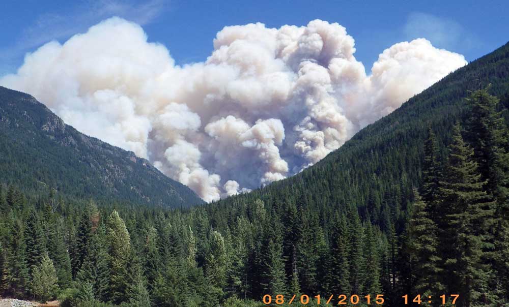
Wolverine Fire Aug 1, 2015
Wolverine Fire Aug 1, 2015. Photo by Mario Isaias-Vera.

Since we last reported on the Wolverine Fire on Lake Chelan in northern Washington August 3 it has grown by about 2,000 acres to 26,614, according to data from a 12:09 a.m. mapping flight on Thursday.

map of Wolverine Fire
Map of Wolverine Fire (in red) at 12:09 a.m. August 6, 2015. The yellow line was the perimeter on August 3.

Scroll down to see other maps.

****

(UPDATED at 2:20 p.m. PT, August 3, 2015)

map of Wolverine fire
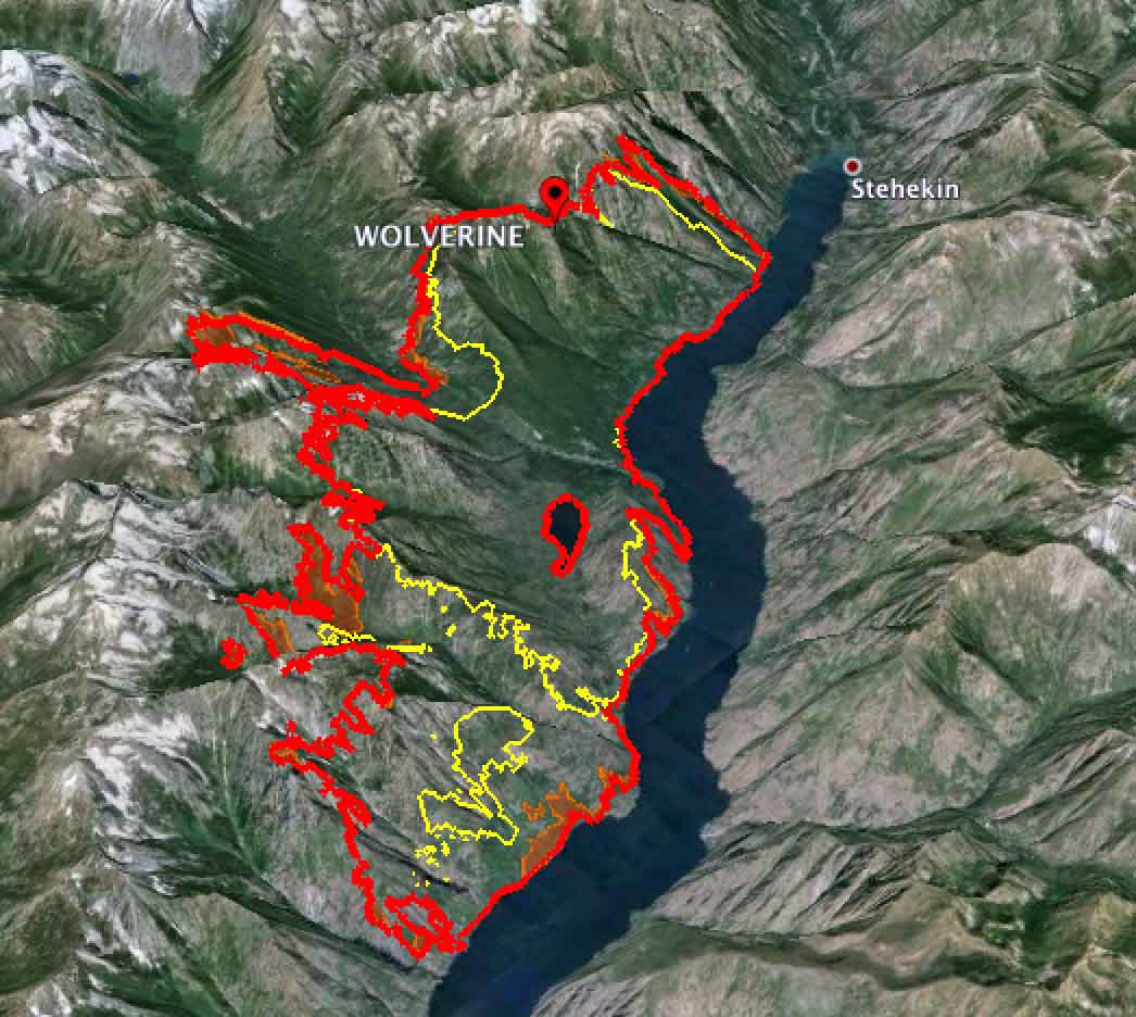
3-D map showing the perimeter (in red) of the Wolverine Fire, looking northwest at 3 a.m. PT, August 3, 2015. The yellow line was the perimeter the previous day. The lake is Chelan.

The Wolverine Fire in north-central Washington grew by more than 8,000 acres on Sunday and has now burned about 24,500 acres. Most of the fire’s spread was on the south and west sides. It progressed a mile and a half up the Railroad Creek drainage on the west side and about three miles on the southwest side in the Clone Creek and Tumble Creek drainages. The fire perimeters are on the map above. Scroll down to see other maps of the fire.

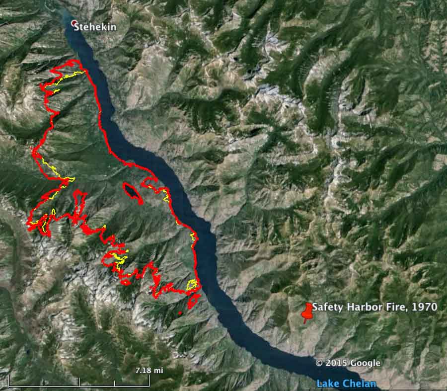
Some of the peaks where the fire is burning now reach over a mile above Lake Chelan, the east boundary of the fire. Hopefully the firefighters will not be ferried by boat up the lake to the fire and have to hike to the ridge tops, like we did on the El Cariso Hotshots on the Safety Harbor Fire in that area in 1970. Going down, weeks later, we got a ride in a helicopter. I would have preferred it to be reversed. Fly up, walk down.

****

(Originally published at 3:29 p.m. PT, August 2, 2015)

Wolverine Fire
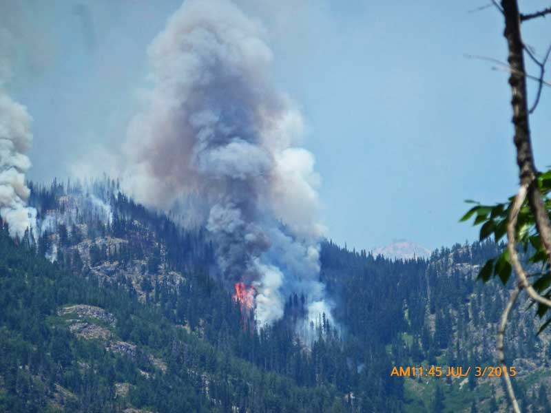
Fire activity on the Wolverine Fire, July 3, 2014. InciWeb photo.

The Wolverine Fire near the north end of Lake Chelan in north-central Washington slowly grew since it started on June 29 to 3,714 acres on July 31. That changed the next day when it more than quadrupled to 15,760 acres. (See the maps below.) After burning for more than a month, suddenly Level 3 evacuations were ordered for Holden Village and Holden Mine Remediation, which meant there was no time to grab anything — leave immediately. The evacuation was accomplished through a combined effort of Holden Village, Rio Tinto, Lake Chelan Boat Company, Chelan County Sheriff’s Office, and the US Forest Service. The incident management team provided more information:

Holden Village is not threatened but a Level 3 evacuation was necessary as Lucerne Landing was in danger which is the evacuation route for the Village.

A Level 3 evacuation has also been ordered for Lucerne, Riddle and Lightning Creek.

Sunday morning a Type 2 incident management team assumed command of the Wolverine Fire. They will be relieved Tuesday by a Type 1 team.

The Wolverine Fire has spread throughout the Burn Creek, South Lake Creek, and Forks Creek drainages and is well established in the Emerald Park Creek drainage.

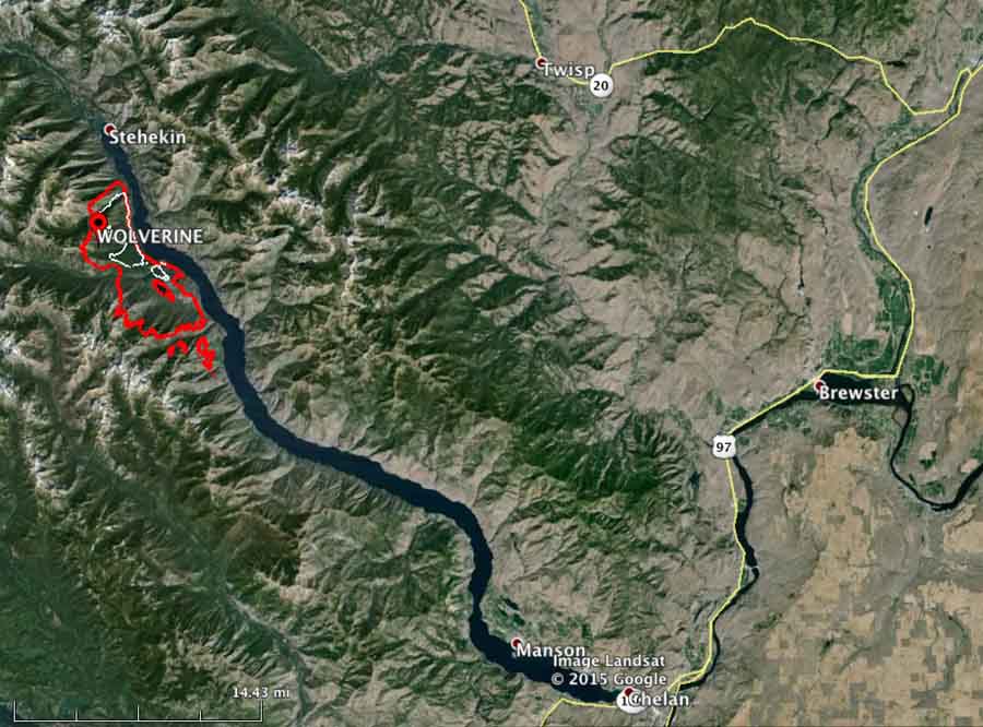
It is on the 45-mile-long Lake Chelan, 23 air miles southwest of Twisp and 30 miles northwest of the city of Chelan.

Click on the maps below to see larger versions.

Wolverine Fire
Map of the Wolverine Fire. The red line was the perimeter at 8 p.m. PT August 1, 2015. The white line is from 24 hours before.

Continue reading “Wolverine Fire in Washington continues to grow”