New book of nighttime fire photography

book Terra FlammaTERRA FLAMMA
Wildfires at Night
by Stuart Palley
176 pages, Schiffer Publishing
$25.85 at Amazon

Fires can be deadly, but they can also be beautiful. Most of us have spent time staring at a campfire or fireplace. It can be mesmerizing on a small scale, but when you see hundreds of acres being consumed by flames, it can be hard to turn away.

Television news might cover wildfires even less than they already do if the images were not so fascinating.

Flickering flames on a landscape at night can be captivating. A well-know wildfire photographer has made it an area of special interest during the last five years. After most fire photographers spent hours getting shots of fires during daylight hours and went home to rest, re-hydrate, and edit photos, Stuart Palley would often take advantage of the very special lighting, set up his tripod, and take multi-second exposures keeping the shutter open long enough for the dim light to be captured on the camera’s sensor.

He writes about it in his book that was just released, Terra Flamma; Wildfires at Night:

Soon I found the night shots more interesting than the day. As the painter Vincent Van Gogh said, “I often find that the night is more colorful than the day”.
book Terra FlammaThe book is a compilation of 110 color photographs of 39 wildfires shot at night in California over the past 5 fire seasons, including the Rim, Rough, and Thomas Fires. There is also an introductory section about his background, on photographing the fires, and his experience at the incidents in addition to statistics about each wildfire.

Terra Flamma, Mr. Palley explains, is a rough Latin translation for “earth on fire”.  I am not a fan of using words from a foreign language in a motto, company name, or book title. If people reading it don’t speak that language, the words can be meaningless.

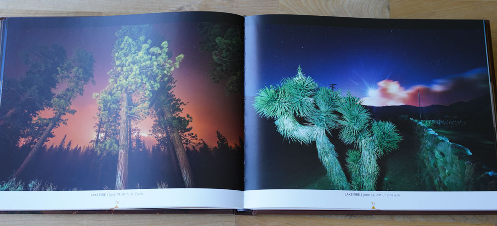
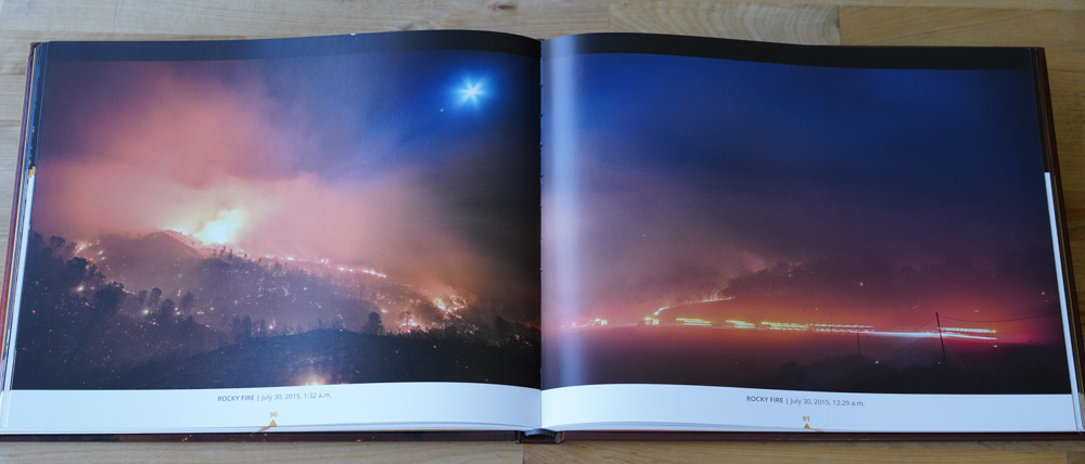
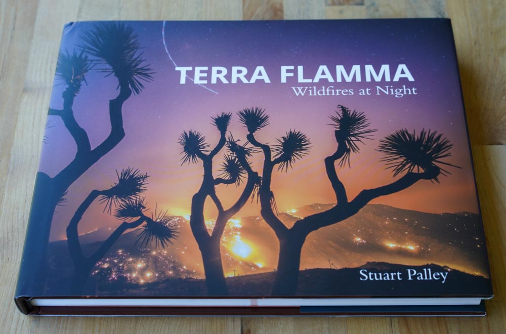
I took these three photos of the book cover and some of the pages within, but they do not do justice to the excellent photos and the beautifully printed pages. I didn’t even snap pictures of his best images, not wanting to spoil the pleasure of someone opening the book for the first time.

Too often we see photos that firefighters take at fires that have been tweaked and manipulated within an inch of the pictures’ lives, cranking up the intensity, screwing with the color saturation, adding Instagram filters, or merging three or more photos into one with high dynamic range. Or worse, using the camera’s software to manipulate just one image into what the vendor calls high dynamic range. These can become extremely unrealistic. I have fallen into that trap once or twice, making one very little post production “enhancement” that’s barely noticeable, then one more, and another. Then when done, I have compared the tweaked version to the original and see that they are very dissimilar, and may tell a different story. That’s when I start over.

But Mr. Palley explains that he used “minimal enhancement, with the goal to reproduce what I saw at the fire”.

And it works. His experience as a journalist, news photographer, his masters degree in photojournalism, and years spent chasing wildfires all over California can be seen on the 176 pages.
book Terra Flamma
The cover of Terra Flamma

50th anniversary of the Loop Fire commemorated

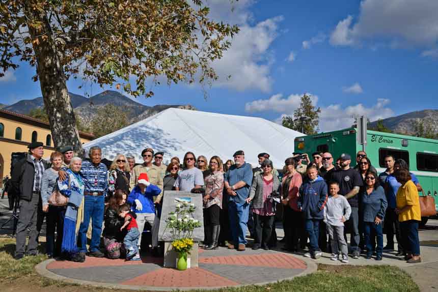
Above: Hundreds of firefighters from municipal and wildland departments attended the 50th anniversary memorial for the Loop Fire tragedy in Sylmar Tuesday. Present were the Los Angeles County Fire Department, Los Angeles Fire Department, US Forest Service, CAL FIRE, and many other agencies.

November 1 marked the 50th anniversary of the day that 12 wildland firefighters perished on the Loop Fire. The El Cariso Hotshots were constructing fireline on the Angeles National Forest in southern California in 1966 when the fire blew up below them.

Yesterday hundreds of people attended a commemoration event held at El Cariso Regional Park in Sylmar, California. Having been on the crew four years after the disaster, from 1970 through 1972, I wish I could have been there. But Stuart Palley, an accomplished fire photographer, was, and he took these excellent photos and wrote the captions. Thanks Stuart for allowing us to use them here.

Loop Fire memorial
Gordon King, former crew supervisor for the El Cariso Hotshots, unexpectedly stepped forward to deliver remarks at the 50th anniversary ceremony of the 1966 Loop Fire tragedy. While speaking Gordon was overwhelmed by emotion and Cal Fire Riverside chief John Hawkins, left, and Angeles National Forest fire chief Robert Garcia, right, jumped forward to support and encourage King.
Loop Fire memorial
Sand Fire Burn area and El Cariso Hotshots memorial 50th Anniversary ceremony held at El Cariso Park in Sylmar, CA Tuesday November 1st, 2016. In attendance was CAL FIRE Chief Ken Pimlott, USFS Fire and Aviation Director Shawna Legarza, and current and former El Cariso Hotshots. The memorial ceremony honored the 50th anniversary of the El Cariso Hotshots burn over at the Loop Fire in 1966 in the hills above the memorial park.
Loop Fire memorial
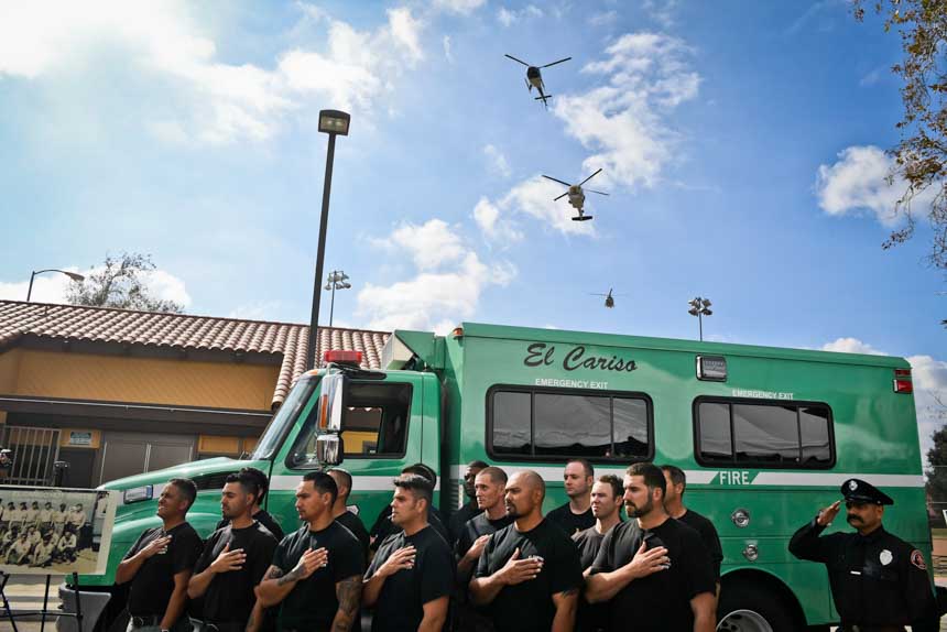
Current El Cariso crew during the Pledge of Allegiance and opening prayer for the 50th anniversary ceremony for the Loop Fire tragedy. A flyover of LA County helicopters also occurred.

Continue reading “50th anniversary of the Loop Fire commemorated”

Some evacuations lifted on Erskine Fire

Above: Power line repair, Erskine Fire. Undated uncredited photo from InciWeb.

(UPDATED at 9:17 a.m. PDT June 28, 2016)

Most of the evacuation orders have been lifted for residents that were forced to leave their homes during the Erskine Fire near Lake Isabella, California.

Map of the Erskine Fire
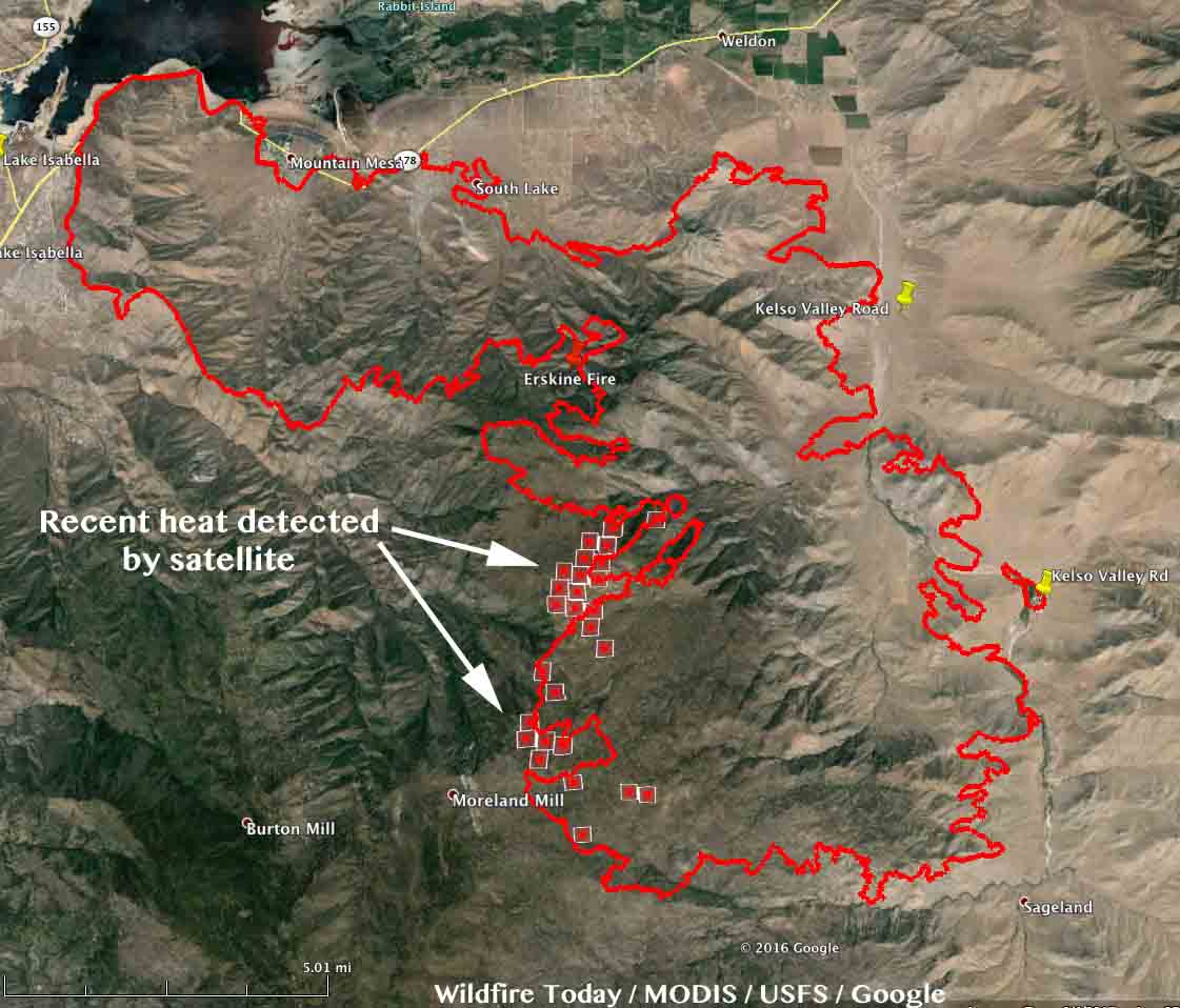
Map of the Erskine Fire. The square red icons represent heat detected by a satellite at 2:51 a.m. June 28, 2016. The red line was the fire perimeter at 11:30 p.m. PDT June 26, 2016.

The latest satellite overflight showed much-reduced heat on the Erskine Fire, only detecting heat on the southwest side where there was some westward movement of the fire. This does not mean the rest of the fire is out. The satellite is hundreds of miles away and only finds the larger heat sources. There is no doubt some fire activity in other areas, but this latest data does show that much of the fire is not still spreading.

Highway 178 is now open. However some roads off of Highway 178 remain closed, including Entrada, McCray Rd, Dogwood, Kelso Valley Rd and Kelso Creek Rd.

The incident management team has not updated the size of the fire since Monday when they said it had burned 45,388 acres.

****

(UPDATED at 7:15 a.m. PDT June 27, 2016)

The latest results from the damage assessment at the Erskine Fire at Lake Isabella, California reveal that at least 250 structures have been destroyed and another 75 were damaged.

The Incident Management Team reports that 45,388 acres have burned, an increase of about 9,000 acres over the figure released on Sunday.

Map Erskine Fire at 1130m MDT June 26, 2016
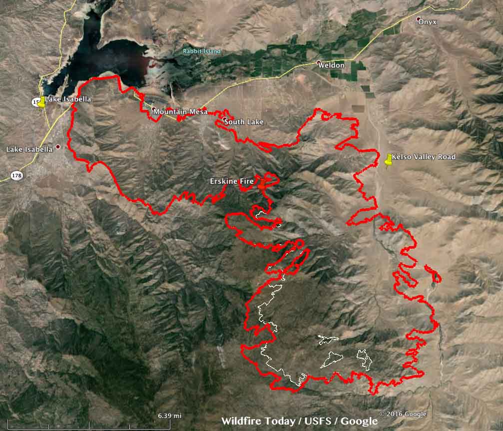
Map of the Erskine Fire. The red line was the fire perimeter at 11:30 p.m. PDT June 26, 2016.

On Sunday an incursion by a privately operated hobby drone in an area where helicopters were assisting with firefighting operations caused fire managers to ground all of the helicopters due to safety concerns. The drone operator was located and detained, and the helicopters were able to resume fire operations after a 30-minute delay.

The fire continued to spread Sunday on the southwest side toward Inspiration Point and has crossed Bright Star Creek.

Air tankers were very busy yesterday working on the south side of the fire.

Continue reading “Some evacuations lifted on Erskine Fire”

Firefighters making more progress on the Rocky Fire

(UPDATE at 7:21 a.m. PT, August 8, 2015)

The Rocky Fire east of Clearlake, California, was quiet again on Friday. The satellite did not detect any large heat sources on the blaze that CAL FIRE is calling 69,636 acres and 62 percent contained. Many areas have been repopulated but others are still under mandatory evacuation orders.

Almost 3,000 personnel are assigned to the fire, as well as 195 engines and 84 hand crews.

****

(UPDATE at 9:47 p.m. PT, August 5, 2015)

Firefighters on the Rocky Fire east of Clearlake, California had another successful day — for the second day in a row keeping the additional acres burned to less than 100. A mapping flight at 7 p.m. Wednesday determined that 37 acres were added, bringing the total to 68,924.

Today CAL FIRE updated the number of structures destroyed to 43 residences and 53 outbuildings.

Map Rocky Fire
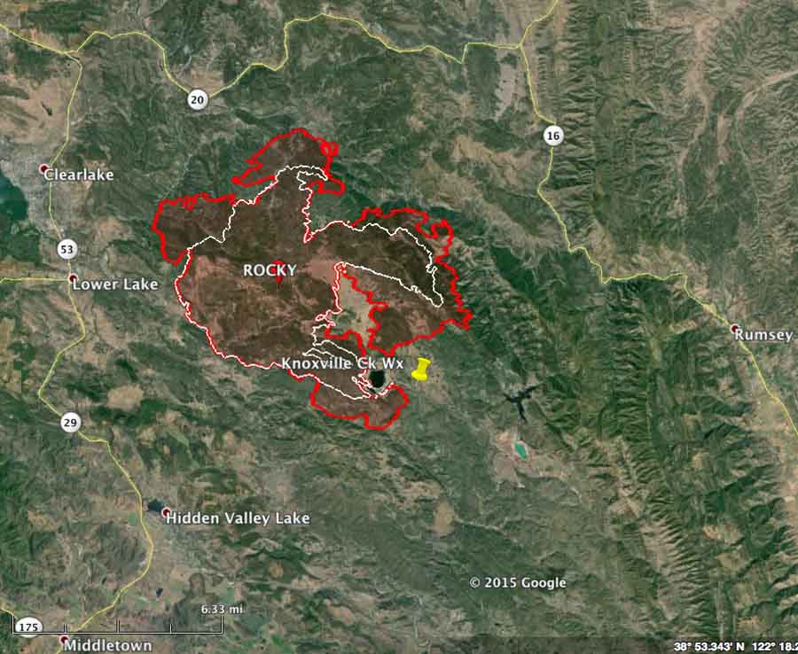
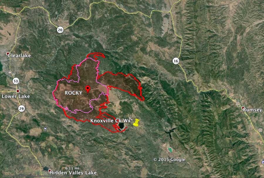
Map of the Rocky Fire (in red) at 7 p.m. PT August 5, 2015. The green line was the perimeter the day before. (click to enlarge)

The mapping flight was earlier than usual, perhaps because one of the two USFS infrared (IR) line scanning aircraft is down for major planned maintenance, leaving a large workload for the single remaining IR ship operated by the US Forest Service. It’s an inopportune time for planned maintenance that sometimes must be done with a certain number of hours on the aircraft. But thankfully the ship carrying the load is a twin-engine jet-powered Cessna Citation that cruises at over 450 mph so it can visit many fires during its shift.

USFS IR aircraft, Cessna Citation Bravo
One of the U.S. Forest Service’s Infrared aircraft, a Cessna Citation Bravo, N144Z USFS photo.

The jet’s daily grand tour of wildfires is usually at night because there is more of a difference between the temperatures of the ground and the fire, making it easier for the fire to be detected. Just one quick pass is all that’s required of a fire that’s up to several thousand acres — more are needed for very large blazes such as the complexes of scores of scattered fires burning in northern California on the Shasta-Trinity National Forest that are scanned as one large “box”, requiring six passes on a recent night.

But back to the Rocky Fire. The weather conditions on Wednesday were warmer and drier than the day before, but they were not extreme; lets call them moderate, at least for California. And about the same is in the forecast for Thursday. Firefighters deserve kudos for limiting the spread to much, much less that we were seeing several days ago.

On the map of the fire above, only a few changes in the perimeter can be picked out (if you click on the map to enlarge it). Two are on the north side where the fire jumped across Highway 20. The other is on the southeast side.

The resources assigned to the fire include 3,483 personnel, 323 engines, 87 hand crews, 17 helicopters, and 63 dozers.

****

(The article below was originally published at 10:24 a.m. PT, August 5, 2015)

Rocky Fire
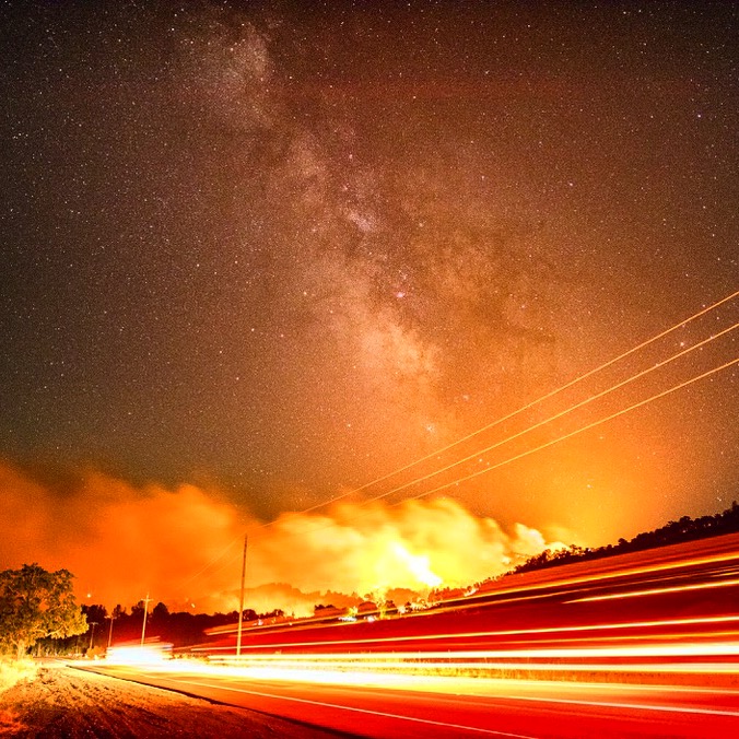
A firing operation on the Rocky Fire August 3, 2015. Photo by Stuart Palley used with permission.

On Tuesday firefighters got a temporary break from extreme weather and fire behavior on the Rocky Fire east of Clearlake, California. A small amount of rain was reported in some areas of the fire, however the Knoxville Creek weather station on the southeast side did not record any precipitation.

The fire perimeter is still virtually the same as was shown on the map we posted August 4.

There was very little additional growth of the Rocky Fire Tuesday. A total of 76 acres were added, which occurred on the north side where it spotted across Highway 20, and on the southeast side west of Highway 16. A mapping flight at 10 p.m. Tuesday updated the size to 68,886 acres.

CAL FIRE updated the number of structures destroyed to 39 residences and 52 outbuildings. They caution that the numbers may increase as damage assessment teams are able to access the burned areas.

Mandatory evacuations are still in effect for many areas, affecting about 13,000 residents. Other areas are under evacuation advisories.

The high temperature of 75 degrees Tuesday occurred at 10 a.m. and it actually dropped to 69 at 3 p.m. thanks to clouds that moved in. The relative humidity increased to 58 percent at 3 p.m. and then decreased as the sky cleared somewhat.

Conditions will change on Wednesday as the forecast predicts 89 degrees, 24 percent relative humidity, clear skies, and winds out of the east at 3 to 6 mph.

Rocky Fire near Clearlake, CA burns thousands of acres in first 5 hours

THIS ARTICLE IS NO LONGER BEING UPDATED. Since it was becoming lengthy, we began a fresh one Sunday morning, August 2, 2015.

(UPDATED at 9 a.m. PT, August 1, 2015)

The Rocky Fire three miles east of Clearlake, California continued to expand Friday in almost all areas except for the southwest side. Friday night it was within 2.3 miles of the outskirts of Clearlake and 2 miles of Highway 20.

CAL FIRE reports that it has burned 22,500 acres.

Mandatory evacuations are in effect for Jerusalem Valley area east of Soda Creek, Bonham Road, Quarter Horse Lane, Mustang Court, Bronco Court, Sunset Court, Morgan Valley east of Bonham Road, Canyon Road, June Bug Road, Cambell Ranch Road, Sloan Ranch Road, Sky High Ranch Road, Rocky Creek Road, and Dam Road from the gate to the dam.

An Evacuation Advisory has been issued for the City of Clear Lake impacting 5000 residences

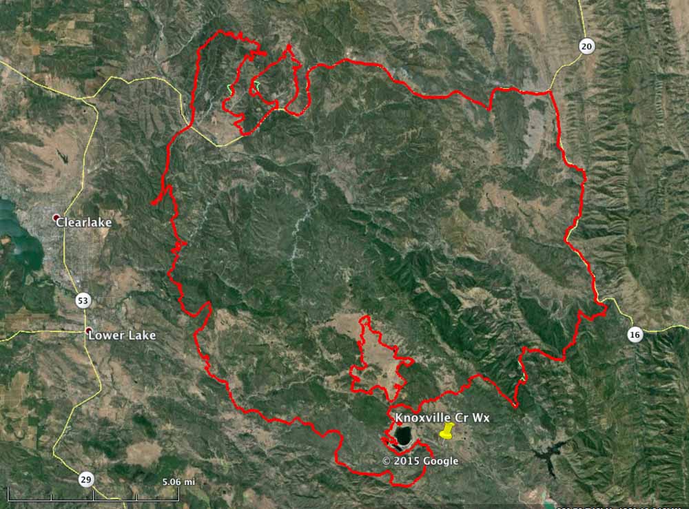
map rocky fire california
Map of Rocky Fire at 11 p.m. PT, July 31, 2015 (the red line). The white line is the perimeter about 24 hours before.

A chance of thunderstorms, cooler temperatures, and higher humidity are in the forecast for Saturday.

The fire is being battled by 1,951 personnel, 160 fire engines, 28 hand crews, 19 helicopters, and 46 dozers. The number of air tankers varies throughout the day.

****

(UPDATED at 8:55 p.m. PT, July 31, 2015)

The wind controlling the direction of spread of the Rocky Fire east of Clearlake, CA changed to coming out of the northeast on Friday between 7 a.m. and 3 p.m. This has pushed the smoke and some of the hottest portions of the fire to the west in the direction of the communities of Clearlake, Lower Lake, and Twin Lake. Below is an update from CAL FIRE at 5:45 p.m. on Friday:

New – The Rocky Fire has progressed and is currently moving southwest towards Lower Lake and the eastside of Clearlake. The Lake County Sheriff’s Office along with the Clearlake Police Department have issued an advisory evacuation of all areas east of Highway 29 starting at Riata Road to the Highway 53 junction. As well as all areas east of Highway 53 north to Highway 20 and Ogulin Canyon Road. An evacuation advisory is not a mandatory evacuation but it is strongly recommended. Residents are advised to gather their medications, pets and important papers. Residents should be prepared to leave the area with little notice. If residents are evacuated they may seek shelter at the Middletown High School or the Kelseyville High School.

Mandatory Evacuations:

The Lake County Sheriff’s Office has issued a mandatory evacuation order for the Jerusalem Valley area east of Soda Creek, west of Soda Creek, Bonham Road, Quarter Horse Lane, Mustang Court, Bronco Court, Sunset Court and Morgan Valley Road east of Bonham Road.

The forecast calls for the east component wind to continue until noon on Saturday, after which it will change to come out of the south and then the southwest, reducing the threat for a while to the communities on Highways 29 and 53. The humidity Friday night will increase to 69 percent which should slow the fire somewhat.

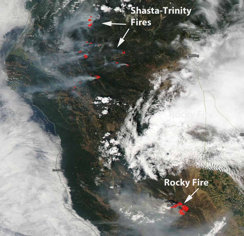
Rocky fire wildfire
A satellite image showing heat detected on the Rocky Fire and the multiple new lightning-caused fires on the Shasta-Trinity National Forest. The wind is blowing the smoke toward the west.

****

(UPDATED at 2:16 p.m. PT, July 31, 2015)

The Rocky Fire 3 miles east of Clearlake, California continued its march through vegetation northwest of Sacramento, doubling in size while chewing up an additional 8,000 acres in the 25 hours after it was previously mapped. An 11 p.m. aerial mapping flight last night found that it has blackened over 16,000 acres since it started at 4:10 p.m. PT on July 29.

Map of Rocky Fire
Map of the perimeter of the Rocky Fire (in red) at 11 p.m. PT, 7-30-15. The pink line was the perimeter 25 hours before.

On Thursday the fire spread primarily to the east, sending out two large fingers of flames that were three and four miles long. An evacuation advisory has been issued for the Double Eagle Ranch and homes along the Highway 20 corridor between New Long Valley Rd. and east to the county line. Evacuations are still in effect for the area north of Morgan Valley and east of Bonham Rd, Jerusalem Grade Rd, Spruce Grove Rd (north end), Noble Ranch Rd and Cantwell Ranch Rd. The fire is being battled by 988 personnel, 151 engines, 32 hand crews, 8 air tankers, 8 helicopters, and 30 dozers.

Continue reading “Rocky Fire near Clearlake, CA burns thousands of acres in first 5 hours”