(UPDATED at 10:40 a.m. MDT, May 19, 2016)
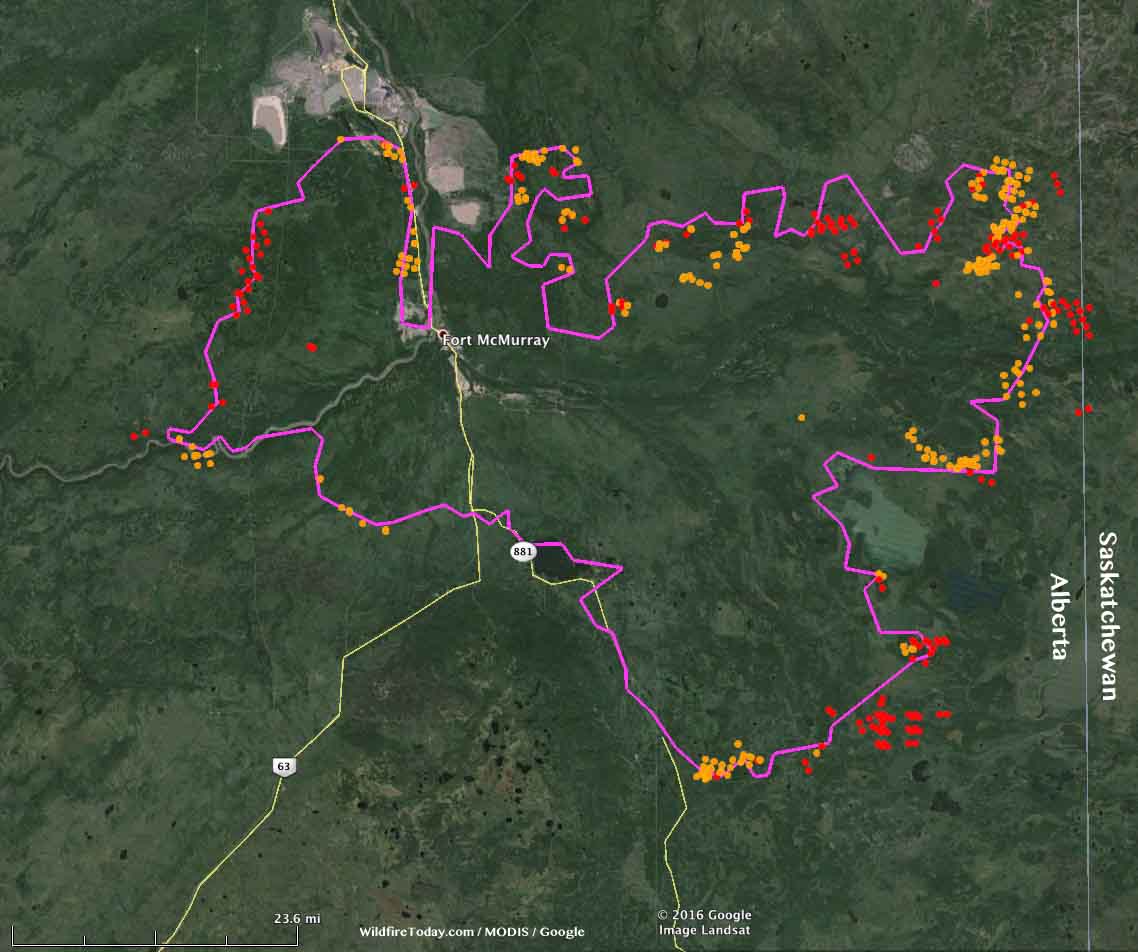
The Fort McMurray Fire (Horse River Fire) was not as active Wednesday as it has been in the preceding three days, but it did move east several kilometers and crossed the boundary from Alberta into Saskatchewan.
The weather forecast through Sunday calls for more moderate conditions and a good chance of rain on Thursday, Saturday, and Sunday. Next week should be clear and warmer.
****
(UPDATE at 8:50 a.m. MDT, May 18, 2016)
Noralta Camp with fire on the doorstep. Stan Laurent CEO Ft. McKay Enterprises video credit. #ymmfire #ymm pic.twitter.com/LigSMRDPFM
— Karen Lavallee (@OceanViewBC) May 17, 2016
Above: Video of the Fort McMurray Fire approaching the Noralta Camp, shot by CEO Ft. Mckay Enterprises.
The Fort McMurray Fire (Horse River Fire) has enlarged its footprint over the last two days to 422,898 hectares (1,045,022 acres, 1,632 square miles). On May 16 it was mapped at 284,000 hectares (702,000 acres, 1,097 square miles). The east side of the fire is approximately 3 miles (5 kilometers) from the Saskatchewan border.
On Tuesday the fire reached the Black Sands Camp and burned the Executive Lodge with its 665 units in spite of the building’s sprinkler system. It next spread to the Noralta Camp that houses 3,000 people, but at the last report firefighters held the fire at bay with no damage to the structures.
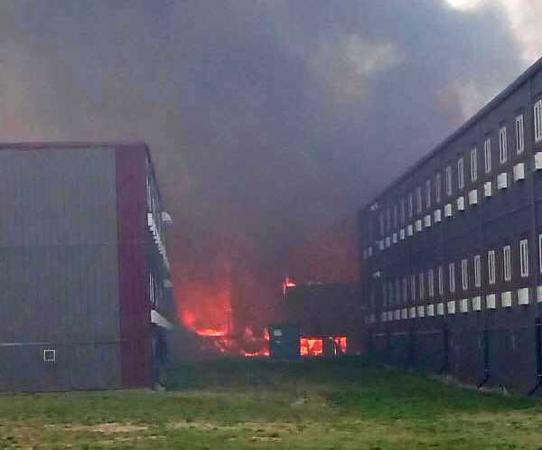
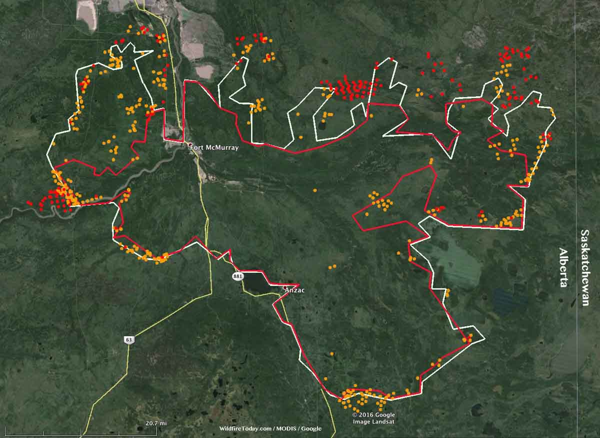
Two houses recently exploded in Fort McMurray, damaging ten other nearby homes. The causes are unknown.
The warm, dry weather that has contributed to this growth will continue today with a high temperature at Fort McMurray of 75 °F, a relative humidity of 28 percent, west winds at 8 to 12 mph, and partly cloudy skies. That will change on Thursday when it should be 20 °F cooler with an RH above 60 percent, and a 50 percent chance of rain.
Fort McKay Enterprises trying to save the Noralta work camp. #ftmacfire #SaveTheOilsands pic.twitter.com/nrTIe6AT5x
— Karen Lavallee (@OceanViewBC) May 17, 2016
****
(UPDATED at 9:35 a.m. MDT May 17, 2016)
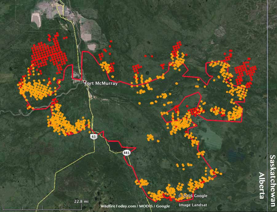
Extreme burning conditions on Monday caused the Fort McMurray Fire (Horse River Fire) to spread further to the north, adding tens of thousands of hectares to the already huge fire. An additional 8,000 people were ordered to evacuate from oil camps north of Fort McMurray and many more are on alert.
On Monday there was major growth of the fire all along the north side. Northwest of Fort McMurray it spread for more than 15 kilometers (9 miles) adding another 35,000 hectares (86,000 acres) just in that area west of Highway 63. The fire crossed Tower Road and was approaching Aostra Road late Monday night. It is approximately 7 kilometers from the Saskatchewan border on the east side.
Below is an excerpt from an article in the Edmonton Sun updated at 10:32 p.m. MDT on Monday:
…At a hastily called news conference, officials said four to five camps on Aostra Road were under a mandatory evacuation order, sending workers north to the Syncrude and Suncor oilsands facilities for refuge. The order was issued because of the “unpredictable nature” of the fire and the fact that those camps could be easily isolated if the road was jeopardized, said Scott Long, executive director of the Alberta Emergency Management Agency.
Just after 10 p.m. Monday evening, the evacuation order was extended to all camps and facilities north of Fort McMurray to just south of Fort MacKay. The order, however, does not include Fort MacKay, Athabasca Camp, and the Beaver River Camp.
As of Monday evening, Highway 63 southbound and within the city is open, however it remains closed for sections of the highway heading north of city limits.
The forecast for Tuesday calls for 75 °F, 29 percent relative humidity, and west winds at 8 to 16 mph under partly cloudy skies that should be mostly clear by 3 p.m.
****
(Originally published at 1:45 p.m. MDT, May 16, 2016)
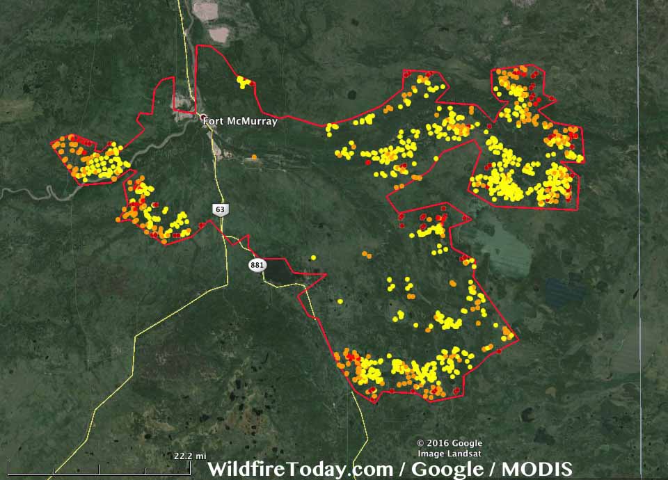
The Fire at Fort McMurray, Alberta will most likely continue to burn for months, according to Alberta wildfire information officer Travis Fairweather. During the last seven days it has continued to spread to the east, and merged with another large fire to the northeast. Mr. Fairweather said the other fire was actually started by airborne embers from the main fire. On May 6 those two fires were approximately 11 miles apart. In our original article about the fire we had several maps showing the distance between the fires.
While it has become known as the Fort McMurray Fire because it burned into that city, Wildfire Alberta’s official name for the blaze is the Horse River Wildfire.
Dozers continue to work on the west, south and north sides and have completed 61 km (38 miles) of fireline.
On Monday, over 1,000 firefighters and firefighting personnel, 134 pieces of heavy equipment, 39 helicopters, and 11 airtankers were assigned to the fire. Additional firefighters and various pieces of heavy equipment are expected to continue to arrive over the next few days.
On May 12 the government enumerated 2,432 structures destroyed by fire, 530 damaged, and 25,000 that were still standing.
As of today, May 16, Wildfire Alberta reports that the fire has burned 284,000 hectares (702,000 acres, 1,097 square miles). It is 11 km (6 miles) from the Saskatchewan border (the vertical white line on the right side of the map above).
The weather through Wednesday will be warm, 77 degrees each day, under clear or partly cloudy skies. On Saturday and Sunday there is a 30 to 60 percent chance of rain.

No updates anymore?
From the Alberta Wildfire website:
http://srd.web.alberta.ca/fort-mcmurray-area-update
They try to have updates everyday, sometimes twice daily.
https://wildfiretoday.com/2016/05/27/animation-of-the-spread-of-fort-mcmurray-fire/