
Equipment more sensitive than a conventional spirometer was able to detect lung damage
Continue readingOfficial report shows Fort McMurray Fire created lightning-started fires 26 miles away

Officially named the Horse River Fire, it burned 589,552 hectares (1.4 million acres) in 2016, destroyed 2,400 structures, and forced 80,000 to evacuate.
Continue reading1 in 5 firefighters on 2016 Fort McMurray Fire suffered from respiratory problems
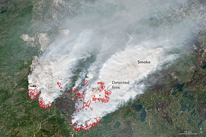
Some firefighters who fought the 1,500,000-acre Fort McMurray Fire that burned 2,400 homes in Alberta last year also battled respiratory and mental health issues.
Below is an excerpt from a CBC news article:
The University of Alberta study surveyed 355 firefighters and found a “very large proportion” of them complained of respiratory issues including coughing, breathlessness, wheezing and chest tightness in the immediate aftermath of the fire.
“When we saw them later, probably about one in five of those still had problems with their chests that they felt had been caused or made worse by the fire,” said Nicola Cherry, the epidemiologist leading the study.
And they’re battling more than just physical ailments — mental-health issues affect one in six of study participants.
“When we collected this information, it was early days and people may develop bigger issues as time goes forward,” Cherry said.
****
Articles on Wildfire Today tagged Fort McMurray Fire.
Fort McMurray Fire spreads into Saskatchewan
(UPDATED at 10:40 a.m. MDT, May 19, 2016)
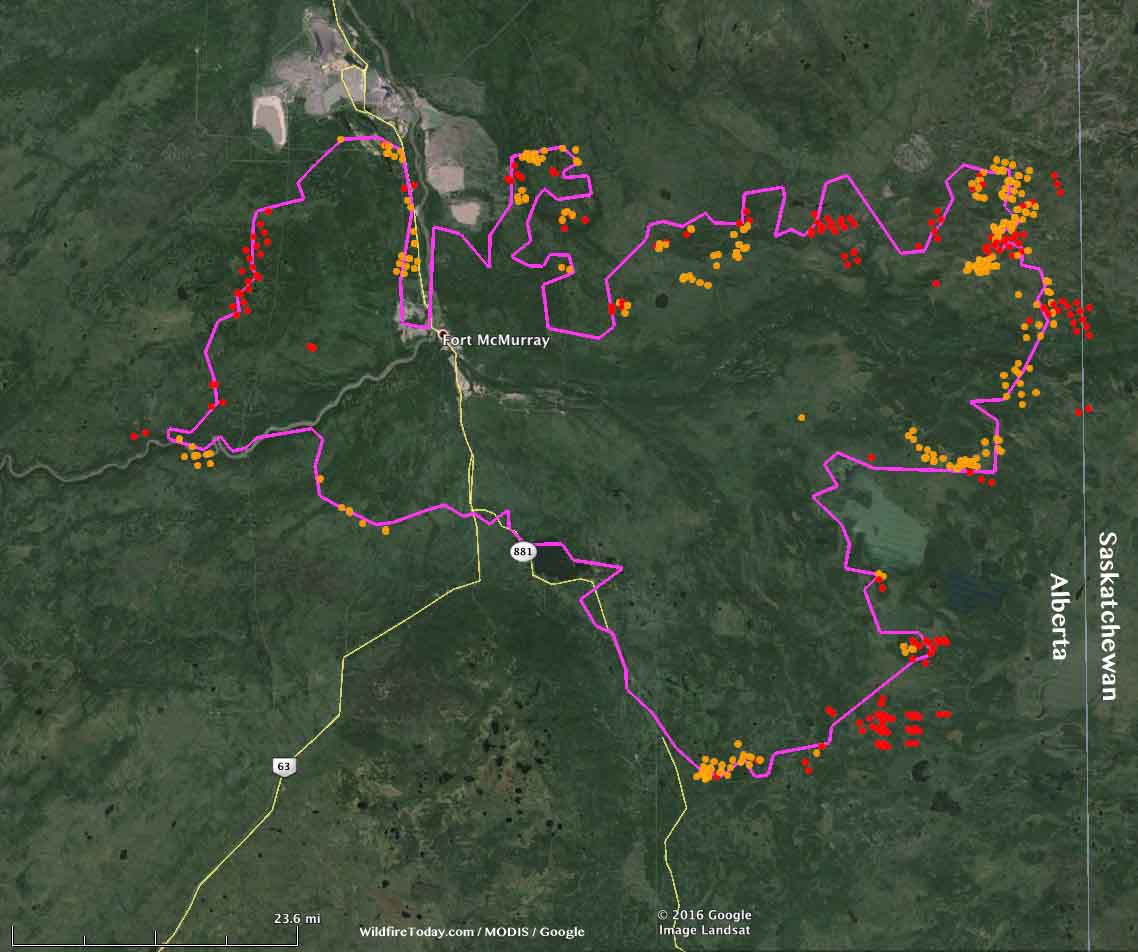
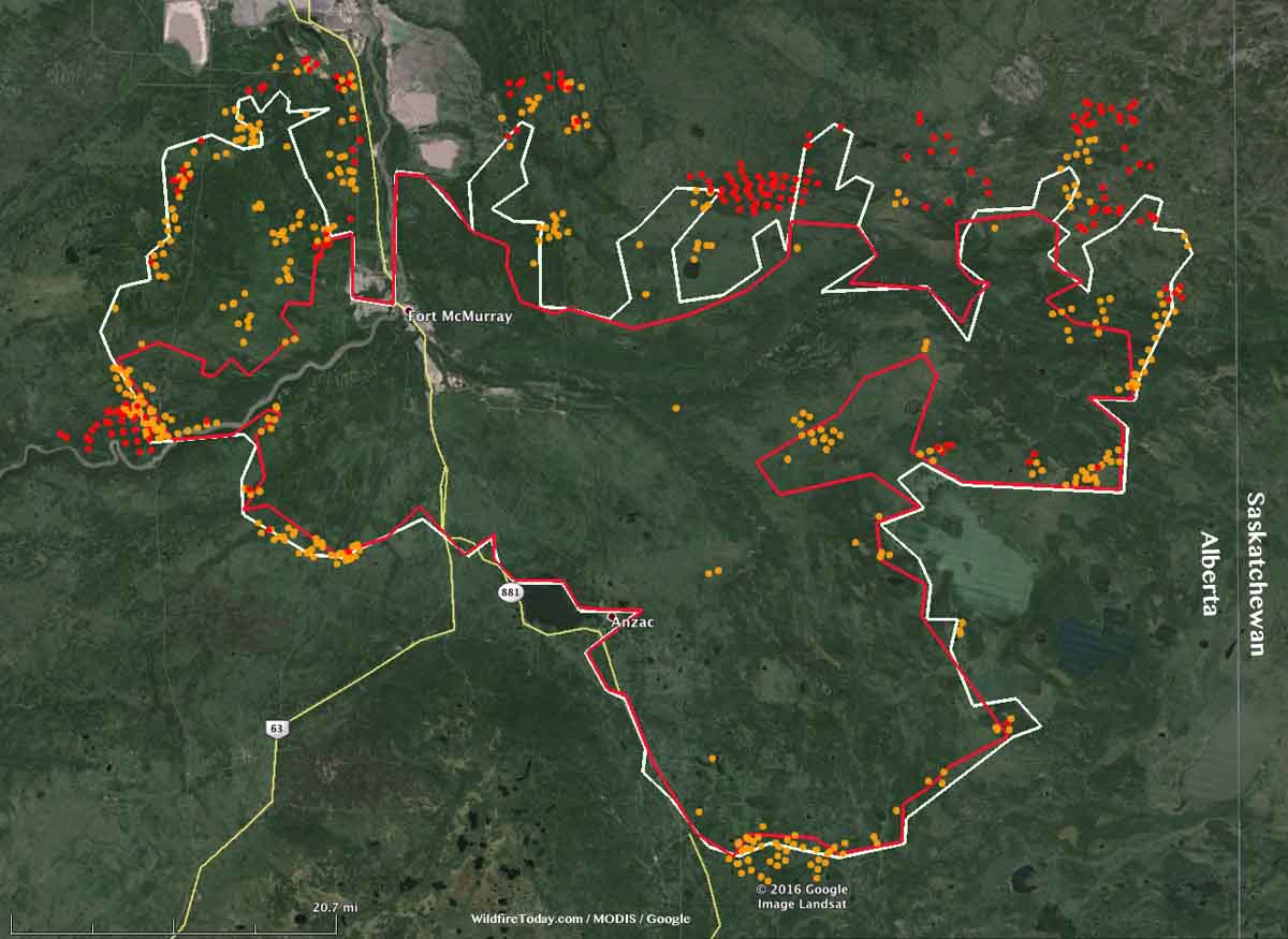
The Fort McMurray Fire (Horse River Fire) was not as active Wednesday as it has been in the preceding three days, but it did move east several kilometers and crossed the boundary from Alberta into Saskatchewan.
The weather forecast through Sunday calls for more moderate conditions and a good chance of rain on Thursday, Saturday, and Sunday. Next week should be clear and warmer.
****
(UPDATE at 8:50 a.m. MDT, May 18, 2016)
Noralta Camp with fire on the doorstep. Stan Laurent CEO Ft. McKay Enterprises video credit. #ymmfire #ymm pic.twitter.com/LigSMRDPFM
— Karen Lavallee (@OceanViewBC) May 17, 2016
Above: Video of the Fort McMurray Fire approaching the Noralta Camp, shot by CEO Ft. Mckay Enterprises.
The Fort McMurray Fire (Horse River Fire) has enlarged its footprint over the last two days to 422,898 hectares (1,045,022 acres, 1,632 square miles). On May 16 it was mapped at 284,000 hectares (702,000 acres, 1,097 square miles). The east side of the fire is approximately 3 miles (5 kilometers) from the Saskatchewan border.
On Tuesday the fire reached the Black Sands Camp and burned the Executive Lodge with its 665 units in spite of the building’s sprinkler system. It next spread to the Noralta Camp that houses 3,000 people, but at the last report firefighters held the fire at bay with no damage to the structures.
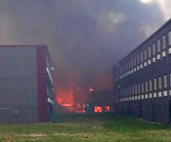
Two houses recently exploded in Fort McMurray, damaging ten other nearby homes. The causes are unknown.
The warm, dry weather that has contributed to this growth will continue today with a high temperature at Fort McMurray of 75 °F, a relative humidity of 28 percent, west winds at 8 to 12 mph, and partly cloudy skies. That will change on Thursday when it should be 20 °F cooler with an RH above 60 percent, and a 50 percent chance of rain.