Looking back at NIFC’s June prediction for August-September wildfire activity

At the beginning of the month here on Wildfire Today we usually summarize the National Interagency Fire Center’s (NIFC) monthly prediction of wildfire potential for the next three to four months. Their analysis represents the cumulative forecasts of the ten Geographic Area Predictive Services Units and the National Predictive Services Unit.

The primary variable factors that affect large scale wildfire activity are the condition of the fuel (vegetation) and the weather when the fires ignite and continue to burn. In the western United States the amount of the lighter fuels available, such as grass, is affected by the precipitation in the winter and spring. That same precipitation also affects the amount of moisture in the live fuels as well as the dead and down duff and woody material.

Another factor that we have often said is even more important than conditions in the winter and spring is the weather DURING the fire season. In the West if the summer is relatively cool and wet, the fire activity will be less intense than average. On the other hand, a hot, dry summer can lead to more acres burned than normal —  in spite of the winter/spring weather.

When someone asks me during the first six months of the year for my prediction of the coming Western fire season, I will tell them to ask me again in August.

This year many areas in the West had unusually high amounts of rain and snow over the winter which might have led some prognosticators to assume there would be fewer fires in the summer. But that has not been the case.

Nationally, according to NIFC, 8.4 million acres have burned so far this year, which is 47 percent higher than the 10-year average to this date. Montana, which accounts for 1.2 million of those blackened acres, has been a focal point for seemingly endless fires producing staggering quantities of smoke. Combined with the smoke created by other fires in Idaho, Oregon, Washington, and northern California, the fouled air has affected residents across large sections of the country.

A spokesperson for Montana’s Department of Natural Resources and Conservation, Angela Wells, said “the period from June to August was the hottest and driest on record in Montana, and our fire season started about a month earlier than it usually does.”

It is extremely difficult to accurately predict the weather more than three or four days in advance. Attempting to forecast wildfire activity three or four MONTHS out, takes audacity. On June 1 NIFC produced the following graphic as part of their monthly report, illustrating their prediction for “normal” fire potential in Montana, Idaho, Washington, Oregon, and extreme northwest California.
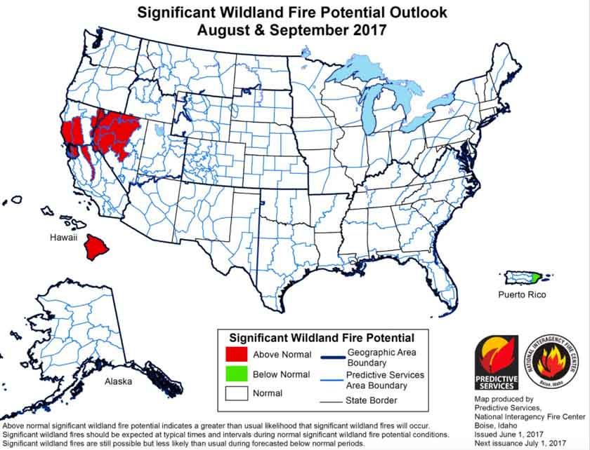
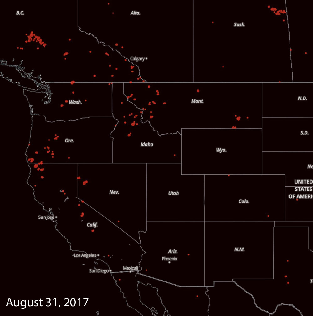
wildfire potential August September 2017As we now know, those areas had a very active summer fire season. The map below shows in red, heat on fires detected by a satellite on August 31, 2017.
wildfires map satellite heat
Fires detected by a satellite on August 31, 2017.

Here is an excerpt from NIFC’s analysis that was published on June 1, 2017:

Above normal precipitation and soil moisture is leading to a robust green-up across the West. Overall cooler than average temperatures and a heavy snowpack have led to slower than normal melting of the mountain snowpack in nearly all locations across the West. This should lead to a delayed start to the fire season in the higher elevations which may, in turn lead to a compressed season…

Above normal large fire potential will continue across southeastern Georgia and Florida into mid-June before the cumulative effects of precipitation events begin to take hold. Below Normal potential is expected across most of the remainder of the southeast through July before returning to Normal for August and September. Recent dry conditions across the southwest will lead to Above Normal potential across southeastern Arizona and Southern California. Below Normal to Normal large fire potential is also expected in the a majority of the higher elevations across the West in June and July.

July and August may be periods of concern. Above Normal potential is expected across the western portion of the Great Basin and across the middle elevations in California in July and August after the abundant grass crop cures. Fire activity will be mostly driven by short term weather events.

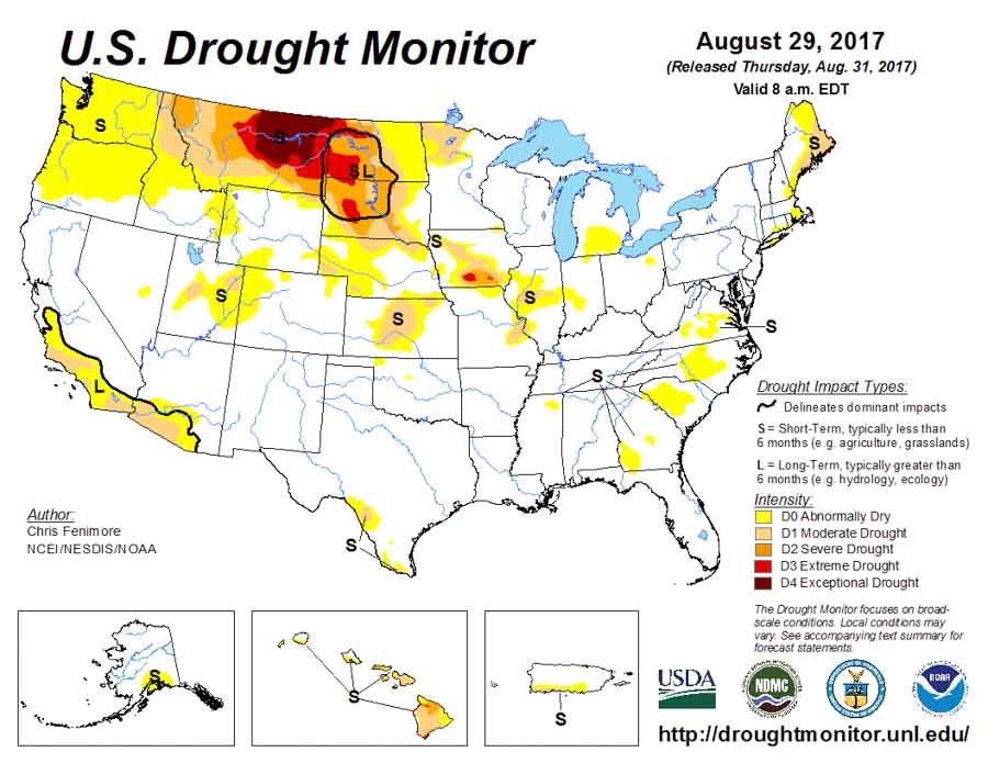
Below is the Drought Monitor from August 29, 2017:

weather forecast

Wildfire smoke travels to Paris

From NASA’s Earth Observatory:

On September 5, 2017, residents of the Pacific Northwest awoke to ash falling from the sky like snow. But even as ash hit the ground, wildfires burning across the western United States and Canada lofted smoke high into the atmosphere. Some of it drifted all the way to Europe.

Snapshots of the smoke’s intercontinental journey are shown in the maps above. The data were collected from September 4–7 by the Ozone Mapping Profiler Suite (OMPS) on the Suomi NPP satellite. The maps show relative aerosol concentrations, with lower concentrations in yellow and higher concentrations in dark orange-brown.

Throughout the series, high concentrations of aerosols appear over their sources in the Pacific Northwest. But prevailing winds also swept up the high-altitude smoke aerosols and carried them east across the continent. On September 4, the smoke appears to have arrived over the U.S. Midwest, and by September 5 it reached Newfoundland. By September 6, the smoke cloud is obvious over the middle of the Atlantic Ocean.

“You can see that the smoke cloud on September 6 is part of the long stream of smoke emanating from the Pacific Northwest,” said Colin Seftor, an atmospheric scientist working for NASA’s Goddard Space Flight Center. “It almost looks like it was flung across the Atlantic.”

By September 7, the smoke had arrived over Ireland, the United Kingdom, and northern France. These aerosols are high in the atmosphere, so they are not a serious concern for near-ground air quality and human health. Still, it shows how events on one continent can have effects halfway around the world.

“It’s not that uncommon for smoke from fires in North America to reach Europe,” Seftor said. He has casually noticed, however, that the smoke clouds reaching Europe this year seem to be larger and thicker. He also points out that they seem to be more persistent; large fires in mid-August sent smoke to Europe that hung around for days.

Wildfires were burning long before these maps were compiled, and they continue to burn even now. This natural-color image shows smoke across the upper Midwest on September 13, 2017, as observed by the Moderate Resolution Imaging Spectroradiometer (MODIS) on NASA’s Aqua satellite. Record heat in parts of the U.S. West has been cited as a possible cause for the widespread fire activity this year—which was somewhat unexpected, given the region’s wet winter and spring.

“There has been a lot of smoke over the whole northern hemisphere this year, and that is somewhat striking to me,” Seftor said. “It’s going to take awhile for everything to dissipate.”

NASA Earth Observatory images by Jesse Allen and Jeff Schmaltz, using Suomi NPP OMPS data provided courtesy of Colin Seftor (SSAI), and MODIS data from LANCE/EOSDIS Rapid Response. Story by Kathryn Hansen.

Five pieces of equipment burned in Sheep Gap Fire

Five pieces of equipment burned Tuesday September 12 in the Sheep Gap Fire near Thompson Falls, Montana. Irv Leach, the Incident Commander whose Incident Management Team had just arrived at the fire, said two Temco feller bunchers, one dozer, a skidder and a pickup truck burned when firefighters and operators were forced to abandon the area as the fire spread toward their location.

Mr. Leach said in a news release:

As the afternoon progressed, the temperature and wind began to increase; relative humidity began to decrease and the fire became very active. Because of the very low fuel moistures and poor humidity recovery from the night before, the fire became active and burned very rapidly. This fire condition and rates of spread made it unsafe for firefighters and equipment operators to remain. A safety decision was made to abandon the operation and retreat to established safety zones.

Thankfully there were no injuries, but the equipment did not fare as well, as you can see in the photos below.

Since the Sheep Gap Fire started August 28, it has burned over 20,000 acres.

Interview with Incident Commander of the Beaver Fire in South Dakota

Incident Commander Todd Hoover provided information about the Beaver Fire east of Pringle, South Dakota, September 14, 2017. We asked him about how aircraft were used, and we also have video and still photos of firefighters, air tankers, and helicopters.

The fire has burned approximately 400 acres between Wind Cave National Park and Pringle, South Dakota. On Friday, September 15, it was slowed by rain in the area.

We apologize for wind noise in the recording.

Articles tagged Beaver Fire and the Rankin Fire on Wildfire Today.

Rain slows wildfires in Northern Rockies and South Dakota

Above: Precipitation received at RAWS weather stations in northwest Montana in the 24 hours before 9:42 a.m. September 15, 2017. The amounts range from a few hundredths to almost half an inch.

Western Montana and the northern Great Plains are receiving some much needed moisture that will slow the spread of dozens of large fires in the area, some of which have been burning for more than a month and a half.

The Rice Ridge Fire has spread over 155,000 acres just east of Seeley Lake 35 miles northeast of Missoula, Montana since it was discovered July 24. The incident management team reported Thursday evening that the east side of the fire had received a quarter of an inch of rain. A weather station just northeast of the community of Seeley Lake recorded 0.05″ overnight, and the forecast calls for another quarter of an inch at that location on Friday.

A weather station near the 53,000-acre Lolo Peak Fire south of Missoula recorded 0.16″.

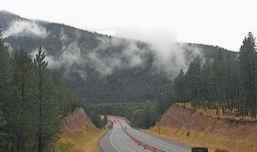
weather cam nine mile
A weather cam view at Nine Mile on Interstate 90 west of Missoula, 8:30 a.m. September 15, 2017.

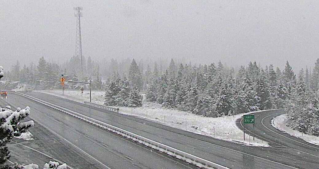
Some of the higher elevations in western Montana are receiving snow.

weather cam homestake pass
A weather cam view at Homestake Pass, 6,329′ elevation, on Interstate 90 southeast of Butte, MT, 9:08 a.m. September 15, 2017.

Firefighters are “backhauling” equipment on the Rice Ridge Fire, collecting items that are no longer needed and taking them back to the incident base, such as fire hose, water pumps, and portable tanks.

Most of the weather stations in the southern Black Hills where the Beaver and Rankin Fires are burning have received about a third of an inch of rain as of 10 a.m. on Friday, but one station northeast of Newcastle, WY measured almost three-quarters of an inch. Some firefighting resources, including crews and engines, were released from these two fires late in the day Thursday.