Above: Satellite photo at 5:37 p.m. MDT Sept. 13, 2018 showing smoke from wildfires in Utah and Colorado.
(Originally published at 7:16 p.m. MDT September 13, 2108)
The Red Flag Warning that brought strong winds and very low humidities Wednesday and Thursday contributed to the rapid growth of several wildfires in Utah and Colorado.
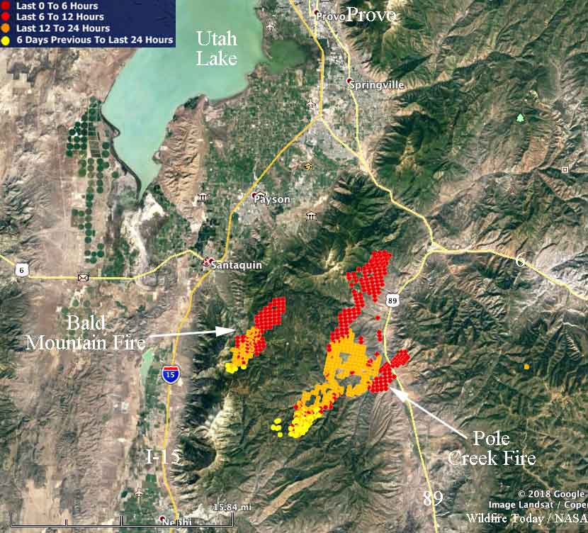
In Utah two fires about 18 miles south of Provo spread very rapidly Wednesday night and Thursday. The Pole Creek and Bald Mountain Fires, between Highways 54 and 89, are only about five miles apart. Two Type 1 Incident Management Teams are en route to these fires. Todd Pechota’s team will manage the Bald Mountain Fire and Beth Lund’s team will take the Pole Creek Fire.
To see all articles on Wildfire Today about the Pole Creek and Bald Mountain Fires, including the most current, click HERE.

At 2:36 p.m. MDT a satellite detected heat on the Pole fire indicating that it had spread over a relatively narrow path 14 miles long and had crossed Highway 89. This information from a satellite 200 miles overhead is preliminary and needs to be confirmed by someone closer to the ground.
The Bald Mountain Fire appeared to have spread about five miles. Both fires were pushed by strong southwest winds, causing them to grow to the northeast.
Our extremely rough very unofficial estimate of the size of the two fires in Utah, based on the 2:36 p.m. MDT satellite data on Friday — at that time the Bald Mountain Fire had burned approximately 2,000 acres and the Pole Creek Fire had grown to about 14,000 acres.
Two fires along Highway 318 in northwest Colorado 10 and 24 miles northwest of Maybell were quite active Thursday. They are named the Three Wash and Boone Gulch Fires.
The Silver Creek Fire 16 miles northwest of Kremmling, Colorado continued to spread toward Highway 40. Thursday afternoon it was about three miles west of the highway.

