Drone catches fire, ignites wildfire north of Flagstaff

(UPDATED at 11:33 a.m. MST March 7, 2018)

The drone that landed, caught fire, and ignited what became a 335-acre fire in Northern Arizona was battery-powered and approximately 16″ x 16″, a spokesperson for the Coconino National Forest said. The operator reported the fire and was later cited for causing timber, trees, slash, brush, or grass to burn. The spokesperson did not know exactly how the drone caught fire.

****

(Originally published at 4:42 p.m. MST March 6, 2018)
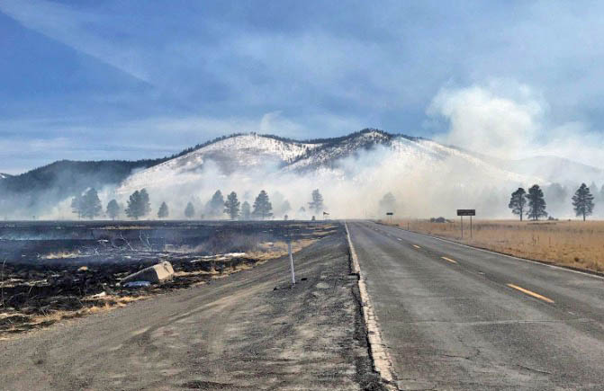
Kendrick Fire Arizona

This article first appeared on Fire Aviation.

There’s no doubt that Unmanned Aerial Systems can play an important part in improving situational awareness for wildland firefighters.

But today investigators have determined that the preliminary cause of a wildfire north of Flagstaff is a drone that landed and caught fire. At 3:25 p.m. MST Tuesday the Coconino National Forest said firefighters had stopped the spread of the resulting wildfire after it burned 335 acres near Kendrick Park by Forest Roads 514 and 524.
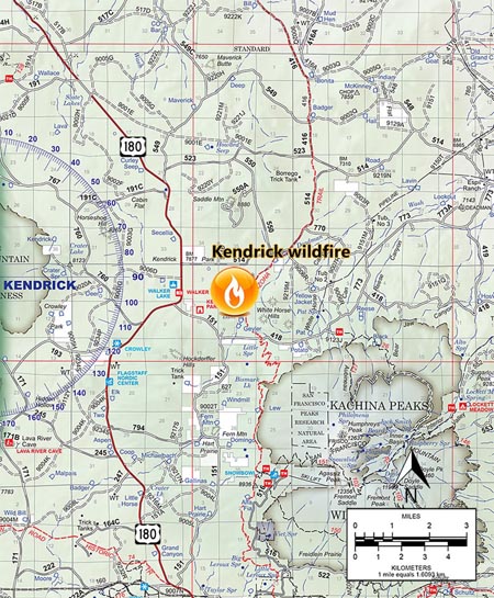
map kendrick fire

There is no information yet about the operator of the drone or if it was powered by a battery or gasoline.

All of these photos were provided by the Coconino National Forest.
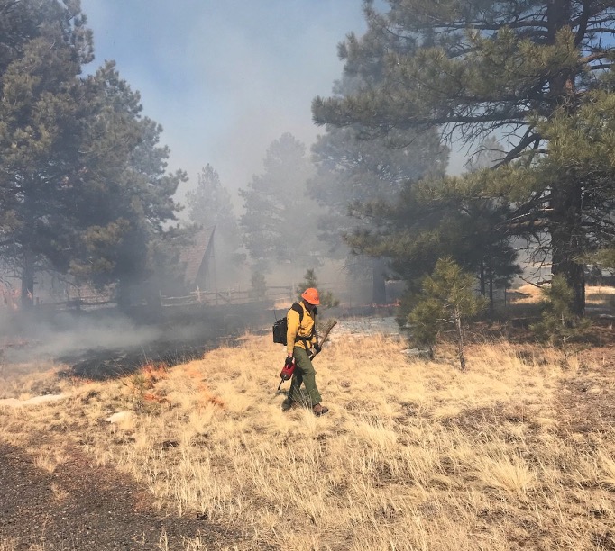
Kendrick Fire Arizona

Thanks and a tip of the hat go out to Tom.

Typos or errors, report them HERE.

Drone lands, catches fire, ignites wildfire

Kendrick Fire Arizona

(UPDATED at 11:27 a.m. MST March 7, 2018)

The drone that landed, caught fire, and ignited what became a 335-acre fire in Northern Arizona was battery-powered and approximately 16″ x 16″, a spokesperson for the Coconino National Forest said. The operator reported the fire and was later cited for causing timber, trees, slash, brush, or grass to burn. The spokesperson did not know exactly how the drone caught fire.

****

(Originally published at 4:32 p.m. MST March 6, 2018)

Just a couple of hours ago we wrote about how proud the Department of the Interior is of their drone program (as they should be). And there’s no doubt that Unmanned Aerial Systems can play an important part in improving situational awareness for wildland firefighters.

But today  investigators have determined that the preliminary cause of a wildfire north of Flagstaff is a drone that landed and caught fire. At 3:25 p.m. MST Tuesday the Coconino National Forest said firefighters had stopped the spread of the resulting wildfire after it burned 335 acres near Kendrick Park by Forest Roads 514 and 524.

kendrick fire map arizona drone

There is no information yet about the operator of the drone or if it was powered by a battery or gasoline.

All of these photos were provided by the Coconino National Forest.
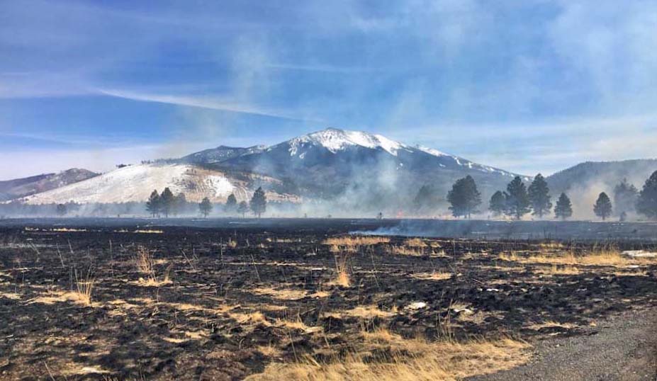
Kendrick Fire Arizona

Kendrick Fire Arizona

Thanks and a tip of the hat go out to Tom.
Typos or errors, report them HERE.

Fire in Laramie destroys 9 structures

Above: video posted to Facebook by OceanDylan Andrew.

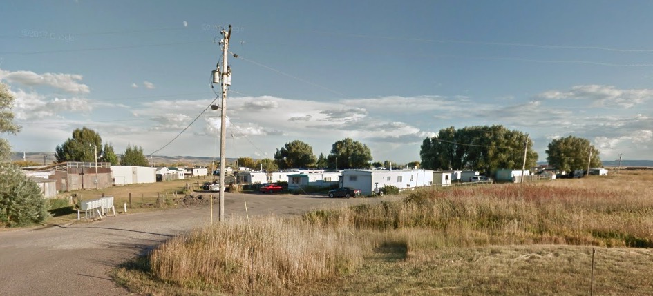
Nine structures were destroyed Monday morning in a wildfire on the southwest side of Laramie, Wyoming (map). Pushed by strong winds, the fire spread through Wade’s Mobile Manor and burned about four acres of vegetation before being knocked down by firefighters.

Wades's Mobile Manor
File photo of Wades’s Mobile Manor. Google Street View.

Red Flag Warnings in 7 states, March 6, 2018

wildfire red flag warning

The National Weather Service has issued Red Flag Warnings for areas in Nebraska, Colorado, Kansas, Oklahoma, Arkansas, Missouri, and Texas. The forecasts for the affected zones predict strong winds and low humidities.

The Red Flag Warning map was current as of 7:50 a.m. MST on Tuesday. Red Flag Warnings can change throughout the day as the National Weather Service offices around the country update and revise their forecasts.

Strong winds recorded in CO, NE, KS, and OK

Nebraska strong wind

Above: Map showing maximum wind gusts in Nebraska at 1:25 p.m. MST March 5, 2018.

(Originally published at 1:32 p.m. MST March 5, 2018)

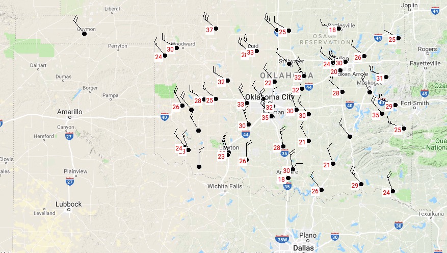
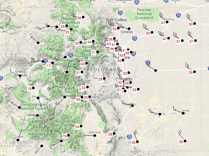
As predicted in the Red Flag Warnings Monday morning, strong winds are are occurring in Nebraska, Colorado, Kansas, and Oklahoma.

These maps of the four states show maximum wind gusts updated at 1:25 p.m. MST March 5, 2018.

Kansas

Kansas strong wind
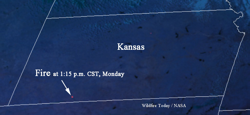
Matt told us about a fire in Clark County, Kansas. The GOES 16 satellite detected it.

fire clark county kansas
The map below shows a fire detected by a satellite in Clark County Kansas at 1:15 p.m. CST March 5. It is south of Dodge City and west of Ashland.

UPDATE at 1:54 p.m. MST March 5, 2018: the satellite is detecting another fire in Kansas, farther west, near Hugoton.

UPDATE at 3:19 p.m. MST March 5, 2018. The fire in Clark County is reportedly contained. That fire and the one farther west are no longer being detected by the satellite.

Oklahoma

Oklahoma wind

Colorado

Colorado strong wind

Red Flag Warnings in 5 states, March 5, 2018

Red Flag warning wildfire weather

The National Weather Service has issued Red Flag Warnings for areas in Nebraska, Colorado, Kansas, Oklahoma, and Texas. The forecasts for the affected zones predict strong winds gusting to 45 mph, and in some areas up to 65 mph. The relative humidity will drop into the teens.

These conditions will present challenges for firefighters in areas that are experiencing extreme drought, such as Kansas, Texas, and Oklahoma.

Drought monitor
Drought monitor, March 1, 2018. National Drought Mitigation Center.

The Red Flag Warning map was current as of 8:20 a.m. MST on Monday. Red Flag Warnings can change throughout the day as the National Weather Service offices around the country update and revise their forecasts.