Southwest Oregon and Northwest California — a hotbed of fire activity for at least 20 years

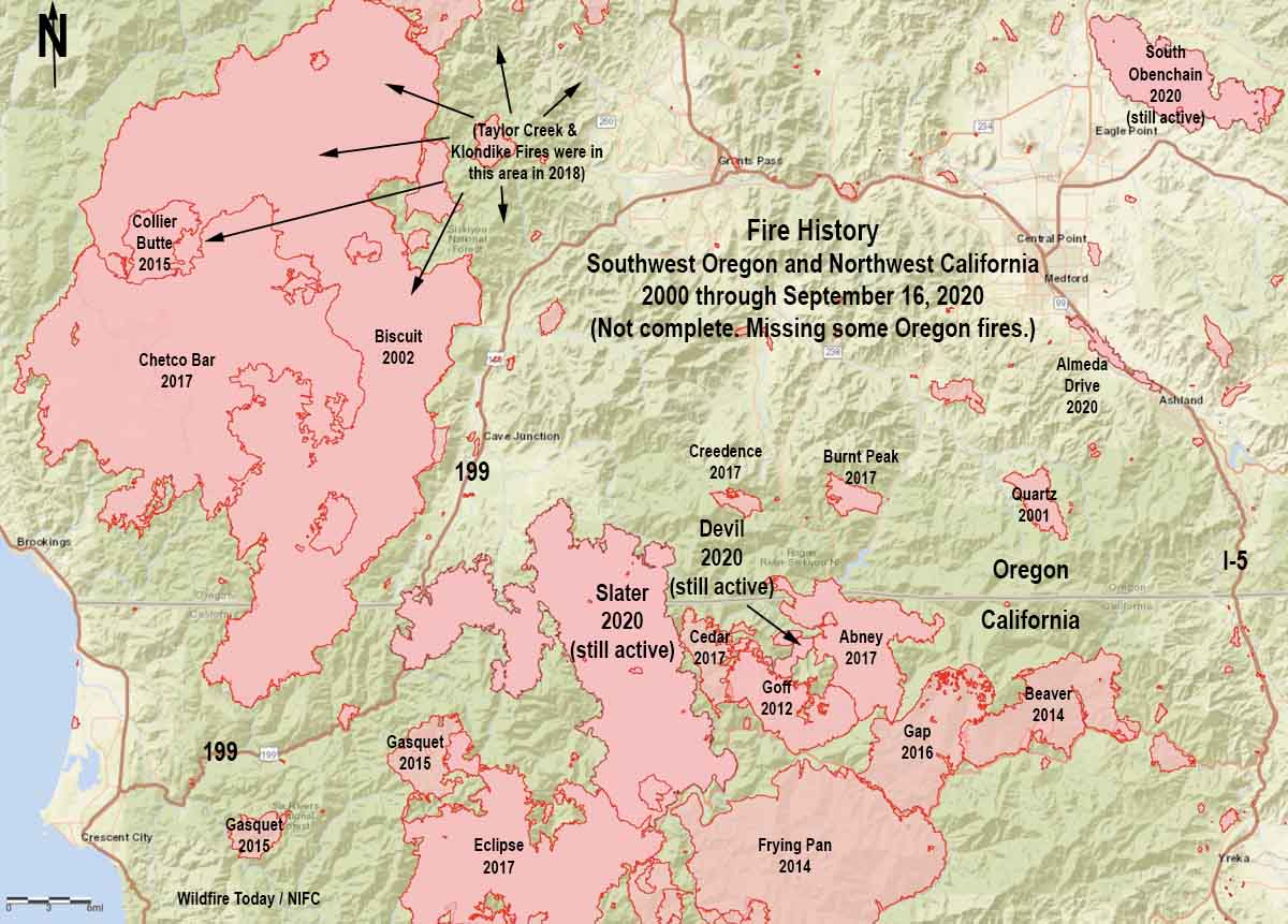
map history of fires in Northwest California and Southwest Oregon
A partial history of fires in Northwest California and Southwest Oregon, 2000 through Sept 17, 2020.

The Northwest California/Southwest Oregon area has kept firefighters very busy at times during the last 20 years, as you can see on the map above.

A new fire is rapidly putting itself into that history. The Slater Fire reported September 8 grew to 89,000 acres by September 9 and has now spread to 150,000 acres. That growth, however, has slowed in the last several days.

It started northeast of Happy Camp, California and ran north into Oregon then took a left and crossed Highway 199. It has come to within about four miles of the 2002 Biscuit Fire.

If recent fire history is any indication, the Slater Fire may not even slow down when and if it reaches the Biscuit burn, and of course it depends on the weather, which has moderated this week. The 2017 Chetco Bar Fire and the 2018 Klondike Fire burned for miles into the then 17 or 18-year old fire scar. The entire eastern two-thirds of the Chetco Bar Fire was in the footprint.

Strong winds that drove the dozens of fires September 8 in Oregon are not super rare. The Klondike Fire west of Grants Pass started July 15, 2018. In early October it had become virtually dormant, but a few hot spots were revitalized by an east wind event on the 14th. According to an article in the Mail Tribune the suddenly vigorous fire was transporting burning embers that started spot fires six miles out ahead of the flaming front:

“Extreme spotting” propelled fine embers up to six miles ahead of the main fire, dropping the live ash right between firefighters’ tents and close to people’s homes.

“We even had to move our own fire camp,”  [information officer Kale] Casey said.

So if the weather this year is anything like it was two years ago, firefighters could be busy in the area for at least another month.
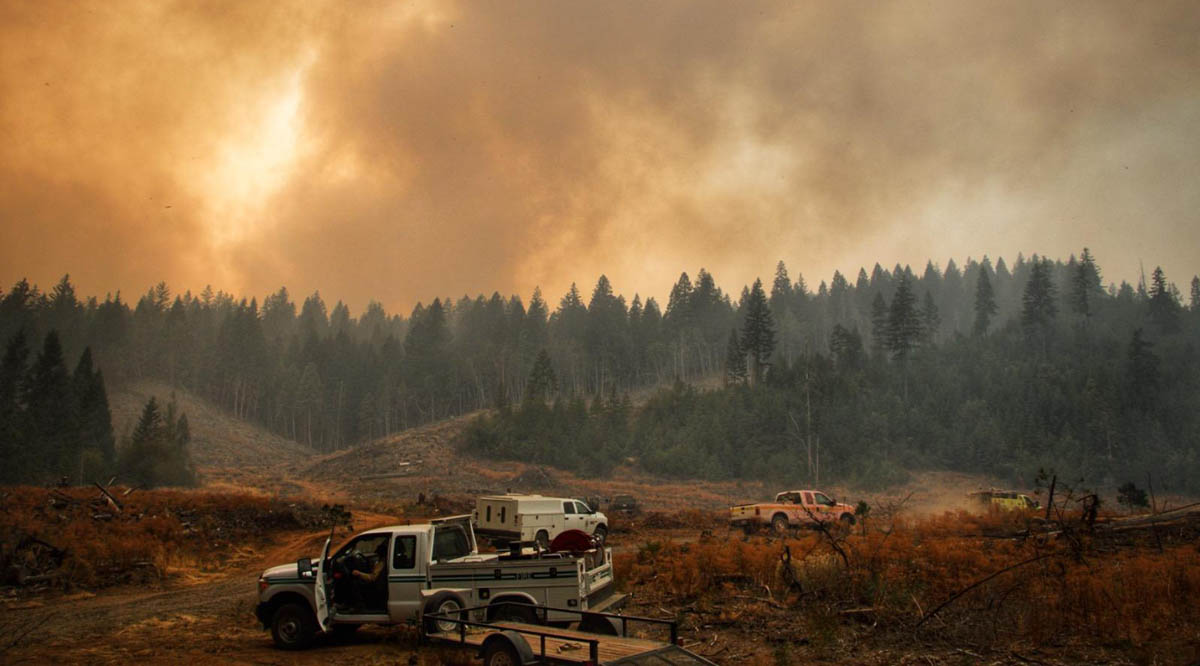
Slater Fire
Slater Fire, Sept. 15, 2020. InciWeb.

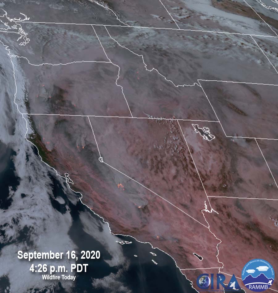
Satellite photo of smoky Western skies

September 17, 2020 | 7:24 a.m. PDT

smoky western skies Satellite photo at 4:26 p.m. MDT Sept. 17, 2020
Satellite photo at 4:26 p.m. MDT Sept. 16, 2020. (an earlier photo had an incorrect date)

The satellite photo shows smoky skies in the Western states caused by wildfires in California and Oregon.

Current information about air quality and smoke can be found at https://wildfiretoday.com/tag/smoke/

Smoke and air quality maps for September 17, 2020

September 17, 2020 | 7 a.m. PDT

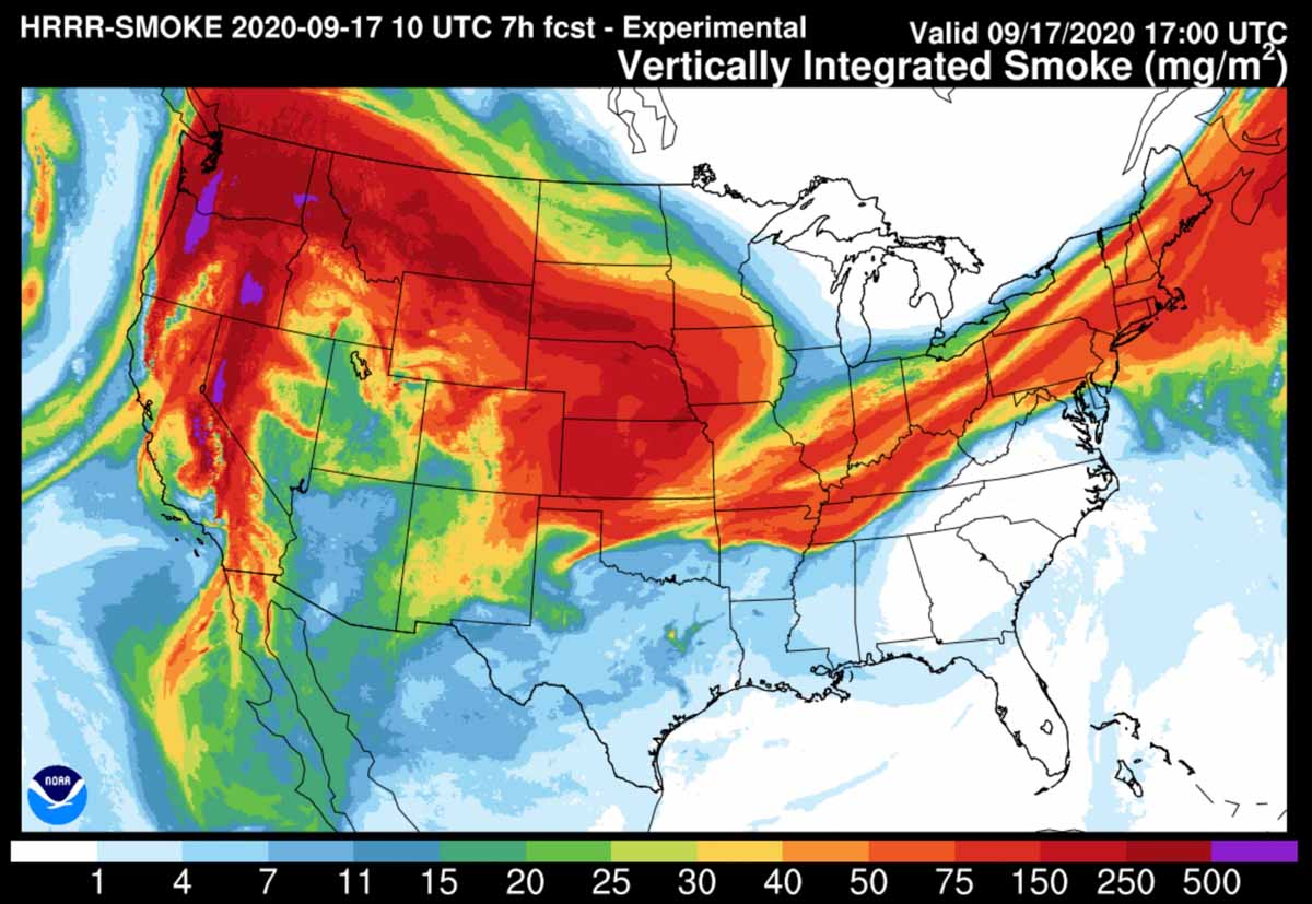
Forecast for vertically integrated smoke
Forecast map for vertically integrated smoke at 1 p.m. MDT Sept. 17, 2020

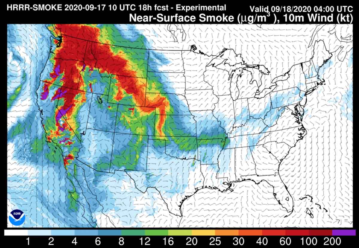
Near-surface smoke refers to the smoke that will hover within 8 meters (26 feet) of the ground—the kind responsible for burning eyes and aggravated asthma.

Vertically integrated smoke depicts all of the smoke in a vertical column, including smoke high in Earth’s atmosphere and can produce red sunrises and sunsets. In some cases where it is only at high altitudes it may not be very noticeable on the ground.

You can bookmark https://wildfiretoday.com/tag/smoke/ to always go to the latest article on Wildfire Today about smoke.

Forecast for near-surface smoke
Forecast map for near-surface smoke at 1 p.m. MDT Sept. 17, 2020
Forecast for near-surface smoke
Forecast map for near-surface smoke at 10 p.m. MDT Sept. 17, 2020.
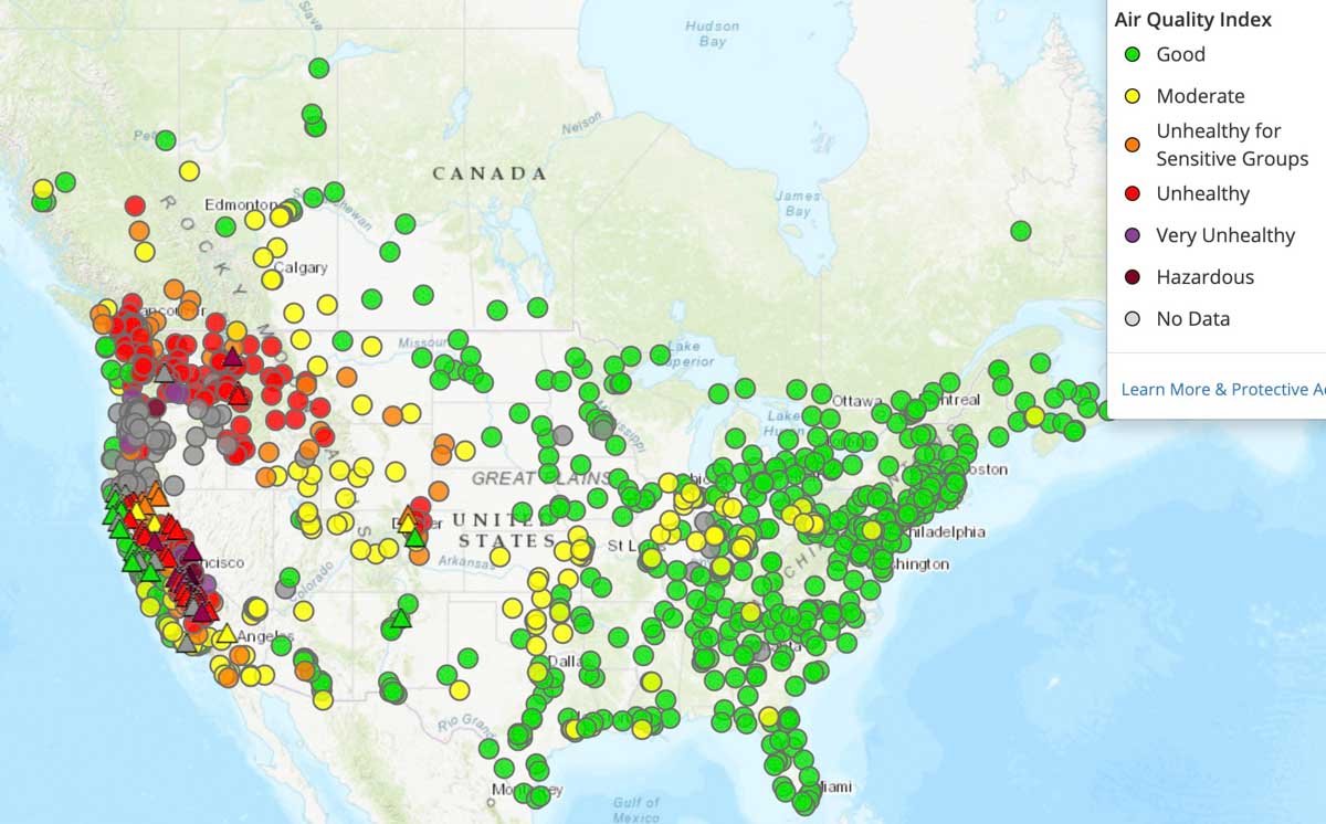
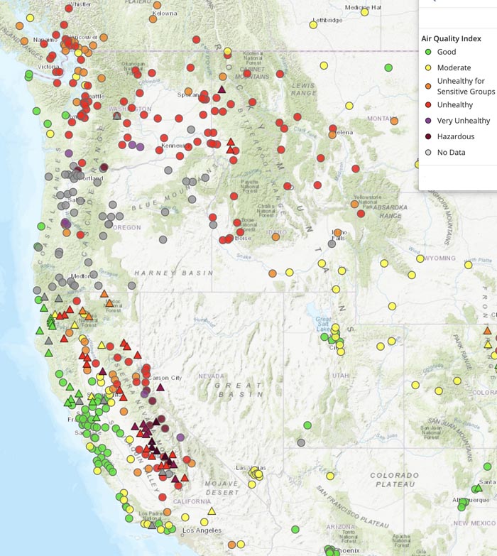
Air quality map 7:30 a.m. MDT September 17, 2020
Air quality map at 7:30 a.m. MDT September 17, 2020. AirNow.
Air quality west coast
Air quality map at 7:30 a.m. MDT September 17, 2020. AirNow.

An additional 250 active duty military personnel assigned to fire suppression duty

soldiers mobilized fire
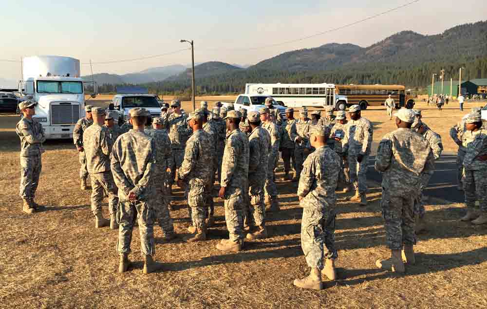
File photo. Members of the Army’s Task Force First Round are briefed on the layout of the Incident Command Post after arriving at the Tower Fire, near Newport, Washington August 22, 2015. The 200 soldiers along with support personnel underwent fire suppression training prior to traveling from their home at Joint Base Lewis-McChord to assist in containing the blaze. The last use of active duty soldiers for firefighting duty in the United States was in 2018. Wildfire Today has articles about mobilizations in 200820152017, and 2018..

At the request of the National Interagency Fire Center and in support of the U.S. Forest Service, approximately 250 Marines and sailors will assist wildland firefighting efforts in Central California. The National Multi-Agency Coordinating Group (NMAC), comprised of state and federal wildland fire managers at NIFC, requested the personnel, along with command and support staff, from the Department of Defense (DOD).

The Marine unit from Camp Pendleton, California will receive wildland firefighting training before assisting with response efforts in Central California.

In late August 200 active duty U.S. Army personnel were mobilized to help battle the blazes.

Wildfire Today has articles about other mobilizations of the military in 200820152017, and 2018.

Fire leadership is concerned about the decreasing number of firefighters in the fall months

Strategies are being suggested to mitigate the shortage

Elkhorn Fire, September 3, 2020
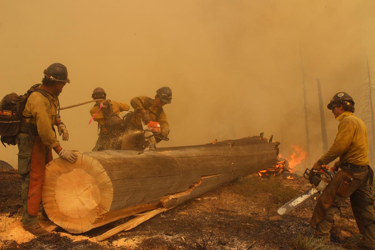
Elkhorn Fire, September 3, 2020. Photo by Mike McMillan.

As we move into the fall months Federal fire officials at the national level are expressing concerns about how students leaving and tours of duty ending will affect the availability of firefighting resources. Today September 16 there are over 31,000 personnel nationwide working on wildfires. That is an extremely high number that has not been reached often and will be difficult to maintain if the present rate of wildfire activity continues.

In August when all hands should have been on deck, there were, and still are, severe shortages of engines and hand crews. Many fires organizations have been trying to suppress fires larger than 10,000 acres with about 20 percent of the resources they would normally have on a similar fire, back in the old days of, say 2019. Incident Management Teams were also in short supply. A Type 2 Incident Management Team from the eastern United States was assigned to a large, very complex fire threatening thousands of homes in southern California. (They may have done a great job, but it was unusual.)

As a step toward confronting the problem, the National Multi-Agency Coordinating Group issued a memo dated September 15 suggesting some strategies to mitigate an even worse possible shortage of firefighters in the coming weeks and months.

It is a lengthy letter, but here is a very condensed version of some of their suggestions for local units:

  • Hunt for additional funds to extend employees’ tours of duty.
  • As students leave for school, combine hand crews and engine crews to fill empty spots.
  • Many Incident Management Teams disband for the season; combine what’s left from multiple teams.
  • As contract periods for aircraft used by smokejumpers and helicopters end, assemble the jumpers and helitack personnel into hand crews, fire suppression modules, or have them be available for single resource assignments.

The memo had a list of attachments which were not available to Wildfire Today that appear to offer temporary exceptions to regulations about time and employment limits. We were not able find any information about additional funding.

Bobcat Fire crosses Angeles Crest Highway

Updated maps of the Southern California fire

map of the Bobcat Fire
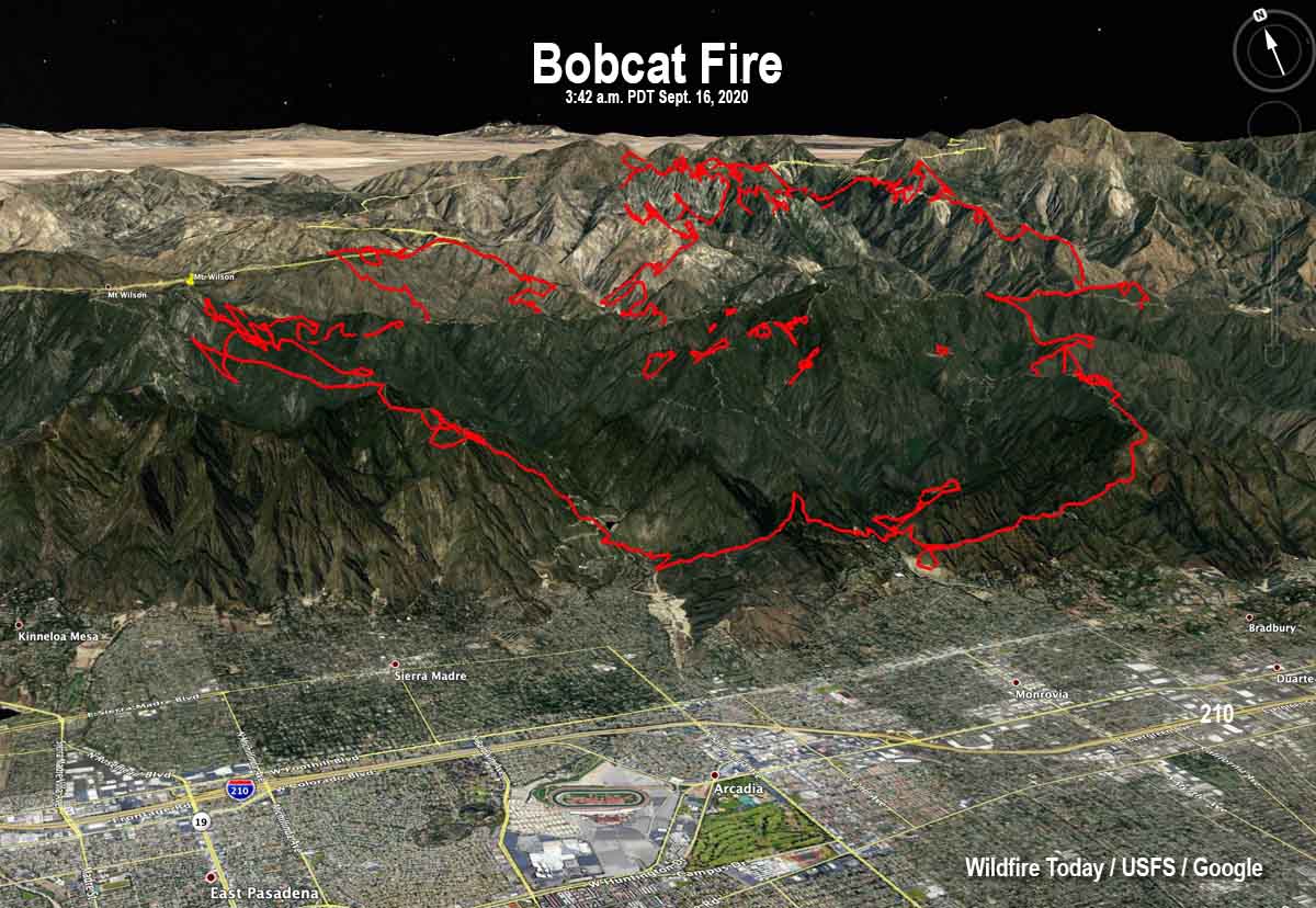
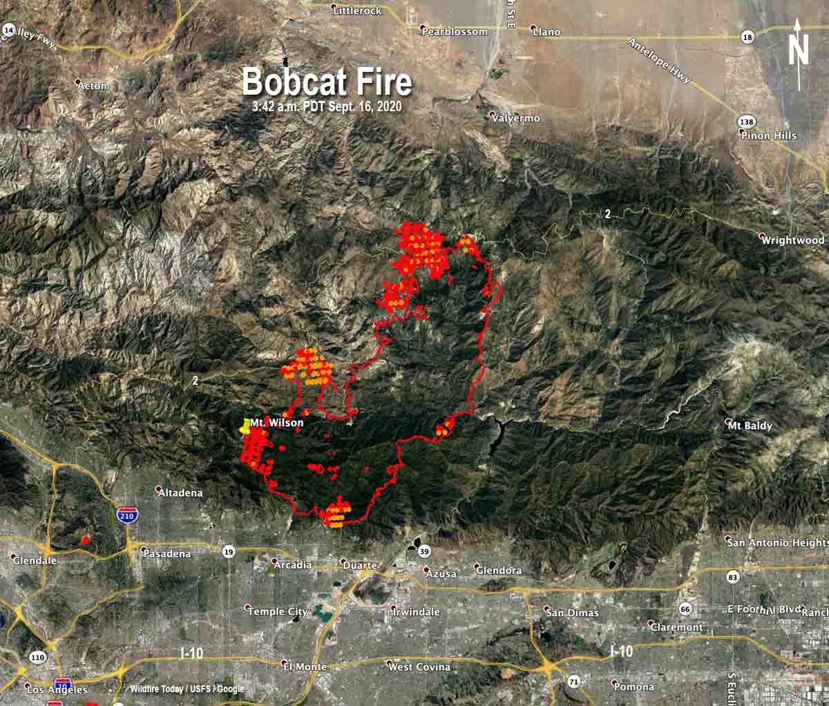
3-D map of the Bobcat Fire. The red line was the perimeter as mapped by an aircraft at 10:48 p.m. MDT Sept. 15, 2020. Looking north-northeast.

The north end of the Bobcat fire has burned across the Angeles Crest Highway (Hwy. 2) burning approximately 800 acres on the north side near Waterman Mountain and Cooper Canyon.

Seven air tankers were used to help firefighters contain the spot fires north of the highway until about 1:30 p.m. Wednesday when smoke limited the visibility. When the smoke cleared at 3:30 several tankers were again used.

Firefighters are holding on to what has been accomplished on the rest of the fire over the last few days near the foothill communities and Mt. Wilson Observatory. Crews are strengthening the lines and looking for opportunities to attack the fire directly. Additional strategic firing may occur as necessary to secure the lines, including along along Highway 39.

The blaze is burning on the mountain slopes above the communities of Arcadia, Sierra Madre, Monrovia, and Duarte.

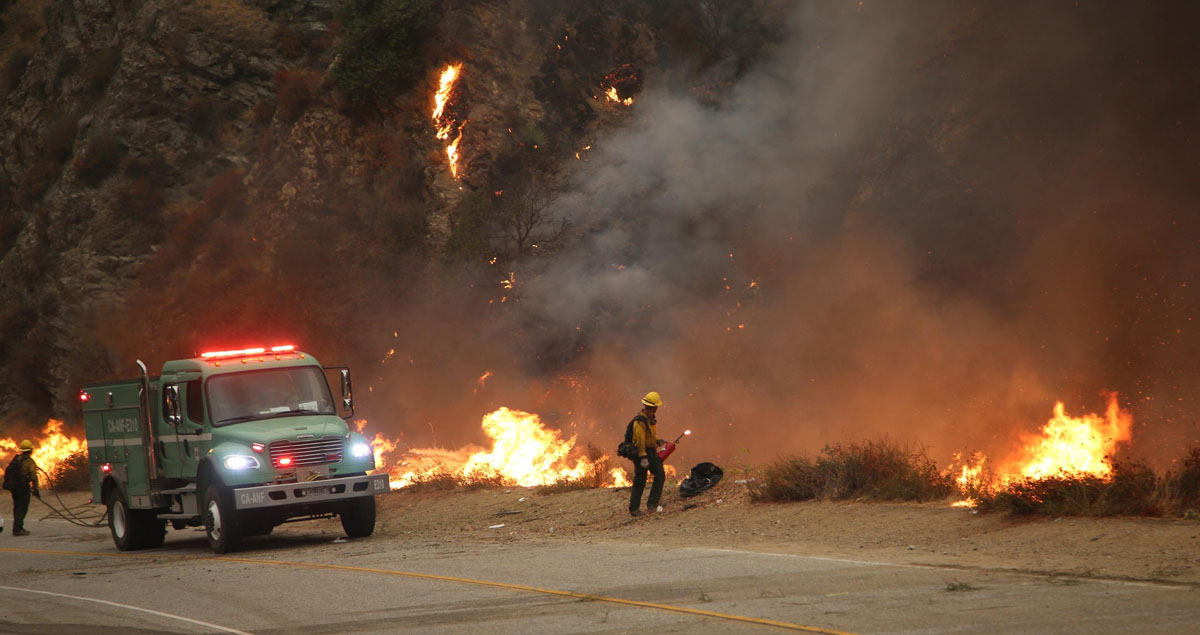
Firefighters conduct firing operation Bobcat Fire
Firefighters conduct firing operation on the Bobcat Fire, Sept. 14, 2020. InciWeb.
map of the Bobcat Fire
Map of the Bobcat Fire. The red dots represent heat detected by a satellite at 3:42 a.m. PDT Sept 16, 2020. The red line was the perimeter when mapped by an aircraft at 10:48 p.m. MDT Sept. 15, 2020.