
Researcher uses radar data to make three-dimensional maps of smoke plumes
Continue readingUpdated smoke forecast and air quality maps, September 13, 2020
Air quality between Unhealthy and Hazardous is reported in most of Washington, Oregon, Idaho, and northern California
Continue readingBobcat Fire spreads closer to foothill communities of Arcadia and Monrovia in southern California
Evacuation order issued Sunday morning for a portion of Arcadia
Continue readingTeen firefighting pilot flies Blackhawks and Chinooks
Ashli Blain is 19 years old
Continue readingAir quality and smoke forecasts for September, 13, 2020
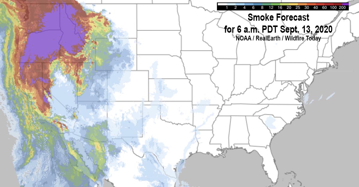
The map above shows the forecast for the distribution of near-surface smoke at 6 a.m. PDT September, 13, 2020.
It appears that severe impacts will occur in areas of Washington, Oregon, Idaho, and Montana.
(UPDATED smoke and air quality maps for September 13 can be found HERE)
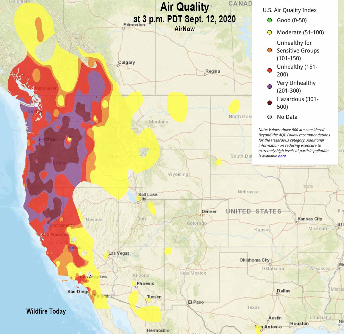
Air quality from AirNow at 3 p.m. PDT September 12, 2020 is below. Most of Oregon, Washington, and northern California are in the categories of Unhealthy, Very Unhealthy, or Hazardous. If you’re in those areas and are lucky enough to have an N95 mask, this is a good time to use it. Being indoors does not help much unless you are aggressively filtering the air with a HEPA category filter. (Information about how to reduce your exposure to smoke.)
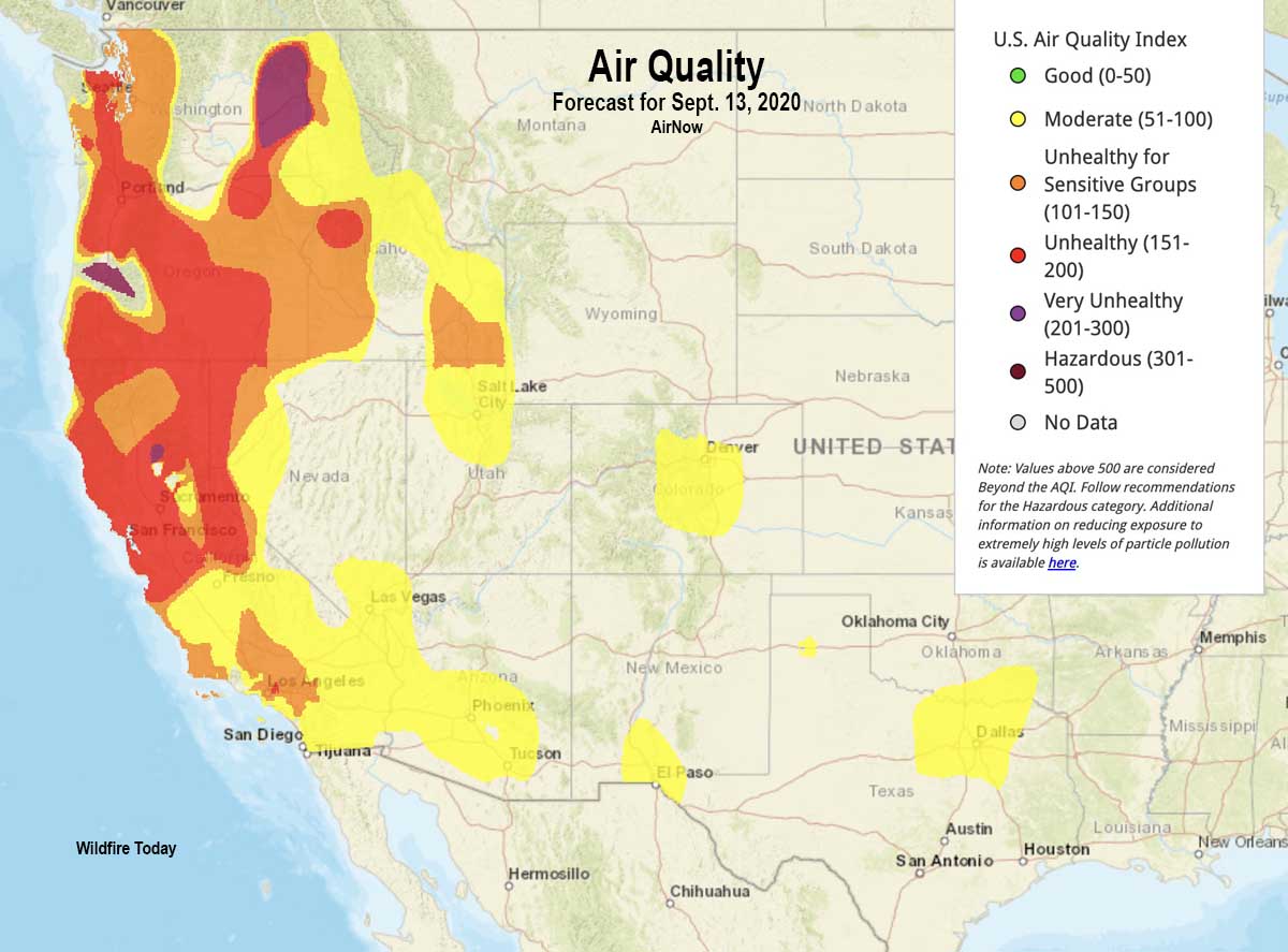
Below is the air quality forecast for Sunday September 13, 2020.
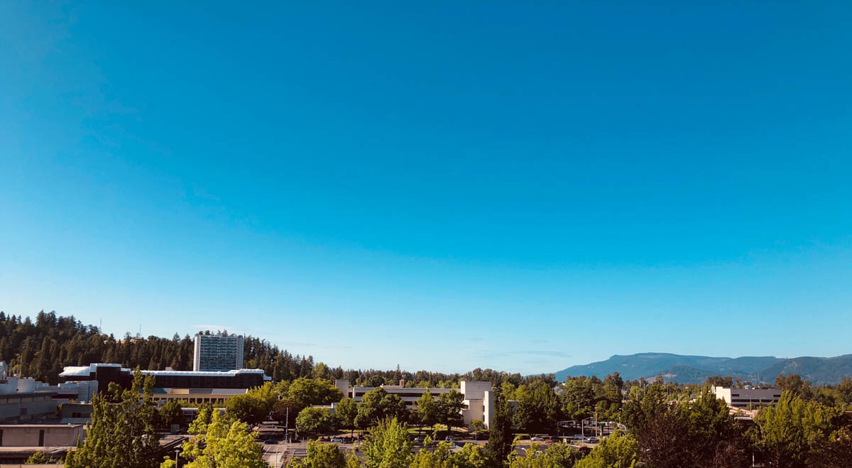
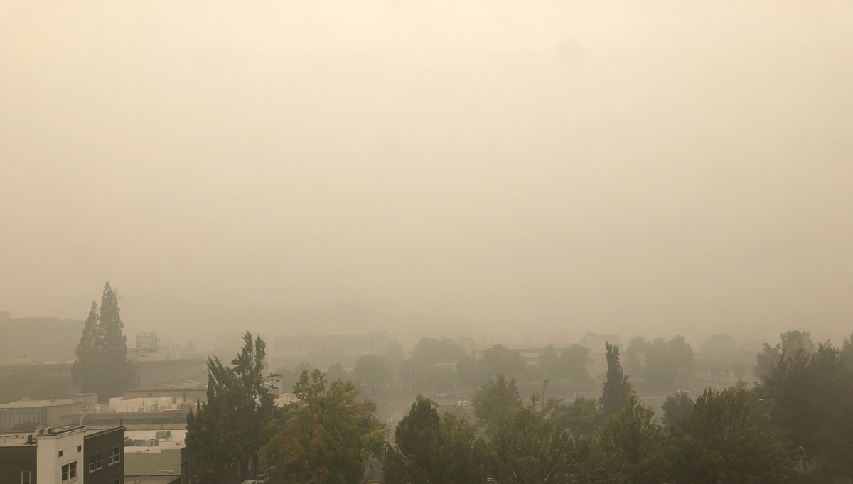
The photos below compare visibility in Eugene, Oregon on a clear day and today, September 12, 2020.
Video shows large number of structures burned during the Almeda Drive Fire in southern Oregon
It impacted the cities of Talent and Phoenix, September 8, 2020
Continue readingOregon fires have burned about a million acres
An Area Command Team has been mobilized to assist local units in the state
Continue readingStunning photos of pyrocumulus clouds over the Claremont-Bear Fire
Northern California
Continue readingWildfire smoke forecast September 12, 2020
September 11, 2020 | 8:43 p.m. PDT
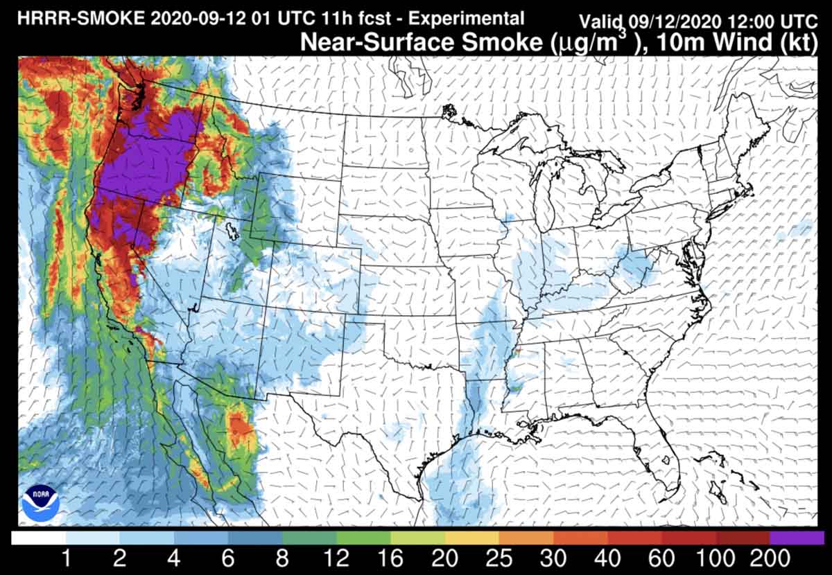
Above is the forecast for the distribution of smoke from wildfires at 5 a.m. PDT, September 12, 2020.
The satellite photo below shows much of the smoke from the west coast fires being blown out over the Pacific, while some remains in Washington, Oregon, and California, and also is being transported to the east.
(Information about how to reduce your exposure to smoke.)
