How to reduce your exposure to smoke

Smoke and air quality September 14, 2020
Smoke and air quality September 14, 2020. AirNow.

September 14, 2020 | 7:40 a.m. MDT

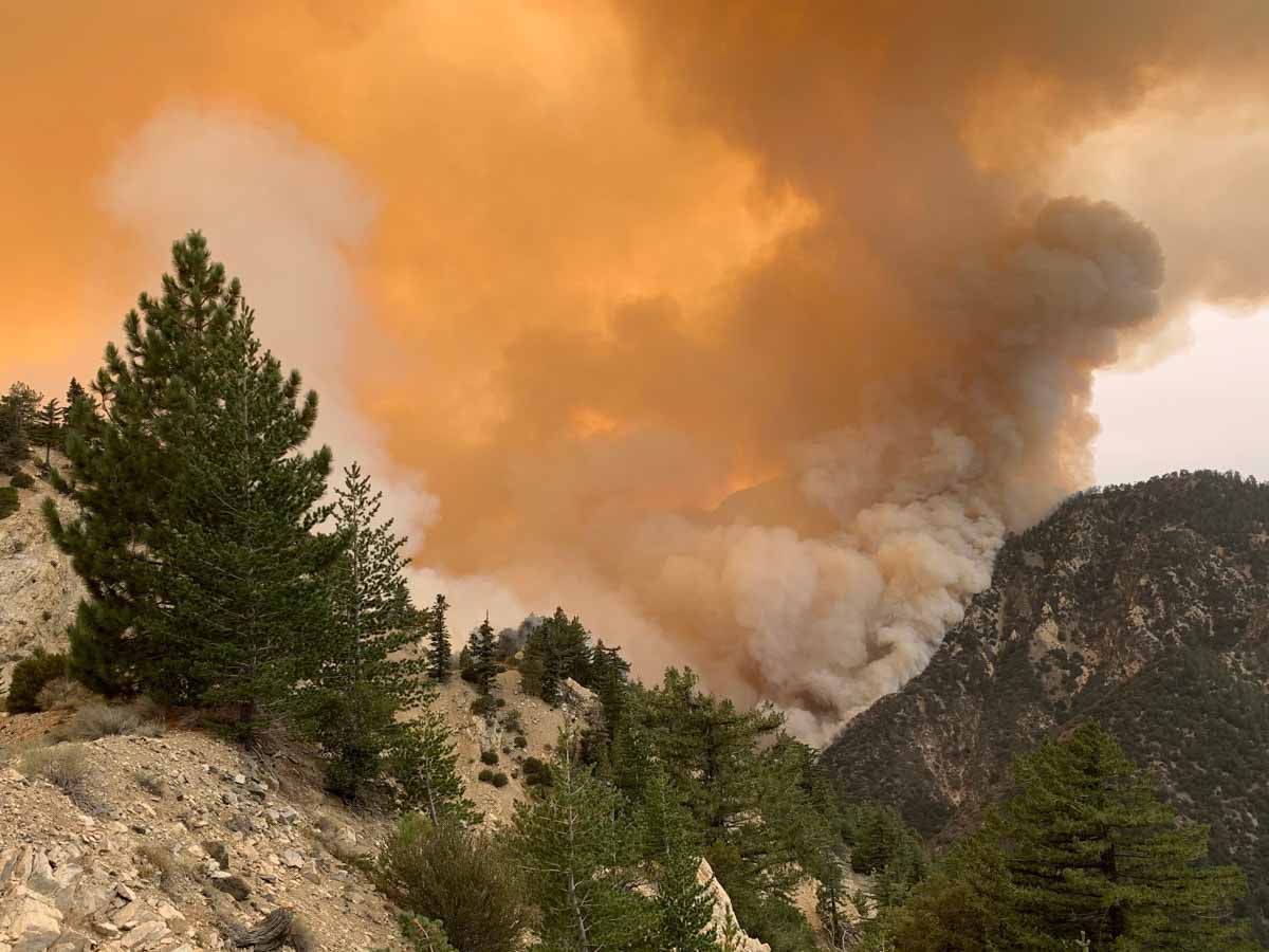
Wildfires in the West are producing large quantities of smoke that is severely affecting residents in those areas, but it is also spreading to other states.

Simply staying inside is not enough to protect yourself unless you are aggressively filtering the air with HEPA filters. Outdoor air finds ways to come into your home. If there was no air exchange, you would eventually die as the carbon dioxide levels rose and all of the oxygen was used.

The information below is from AirNow.gov.


What can I do to reduce my exposure to fine particle pollution when levels are extremely high?

  • Stay indoors in an area with filtered air. Particle pollution can get indoors, so consider purchasing an air cleaner if you live in an area with high levels of particle pollution. (See information on selecting an air cleaner below.)
    • Air cleaners that remove particles include high-efficiency mechanical filters and electronic air cleaners, such as electrostatic precipitators. Avoid using an air cleaner that works by generating ozone, which will increase the pollution in your home.
    • If you do not have air cleaners in your home, try to go somewhere that does have air filtration. This could, for example, be a friend’s home, if it has air filtration.
  • Keep your activity levels low.
    • Avoid activities that make you breathe faster or more deeply. This is a good day for indoor activities, such as reading or watching TV.
  • If you cannot buy filters for your entire home, create a clean room for sleeping.
    • A good choice is a room with as few windows and doors as possible, such as a bedroom.
    • If the room has windows, keep them closed.
      • Run an air conditioner or central air conditioning system if you are certain your air conditioner does not draw air from outdoors and has a filter. If the air conditioner provides a fresh air option, keep the fresh-air intake closed. Make sure that the filter is clean enough to allow good air flow indoors.
    • Use an air filter in that room. Avoid using an air cleaner that works by generating ozone. Those types of cleaners will increase the pollution in your home.
    • Follow steps for keeping pollution in your home low (see next section).
  • Take additional steps to keep pollution in your home low. Air cleaners alone may not be enough. Because particle pollution from the outdoor air can easily get inside, take steps to avoid adding even more pollution indoors when outdoor PM2.5 levels are high:
    • Avoid using anything that burns, such as wood fireplaces, gas logs and even candles or incense.
    • Keep the room clean – but don’t vacuum unless your vacuum has a HEPA filter. That stirs up particles already inside your home. Wet mopping can help reduce dust.
    • Don’t smoke.
    • Be cautious when the weather is hot. If it is too hot to stay inside with the windows closed, or if you are in an at-risk group, go somewhere else with filtered air.
    • When air quality improves, open the windows and air out your home or office.
  • Selecting an air cleaner:
    • Air cleaners that remove particles include high-efficiency mechanical filters and electronic air cleaners, such as electrostatic precipitators. Avoid using an air cleaner that works by generating ozone, which will increase the pollution in your home.
  • Should I wear a dust mask if I have to go outside?
    • Do not rely on dust masks for protection. Paper “comfort” or “dust” masks are designed to trap large particles, such as sawdust. These masks will not protect your lungs from small particles such as PM2.5. Scarves or bandanas won’t help either.
    • Disposable respirators known as N-95 or P-100 respirators will help if you have to be outdoors for a period of time. It’s important that you wear the respirator correctly.

Now that the extreme weather has moderated, firefighters beginning to make progress on fires in northwest Oregon

Map of fires in northwest Oregon, September 13, 2020 Riverside Beachie Creek Lionshead
Map of fires in northwest Oregon, September 13, 2020.

Lionshead Fire

Of the three very large fires south of Portland, Oregon the 138,718-acre Lionshead has been the most active in the last 24 hours, with most of the growth occurring on the northeast and southeast sides. Crews continue to secure and protect property and conduct damage assessments as fire activity, smoke, and other hazards allow. Wildfires have not burned in the area for many decades, which has resulted in heavy layers of fuel on the ground that firefighters must work through to construct fireline and mop up, a very laborious and time-consuming process.

Resources assigned to the fire include 51 hand crews, 62 engines, and 10 helicopters for a total of 1,482 personnel.

Air quality on the Lionshead Fire
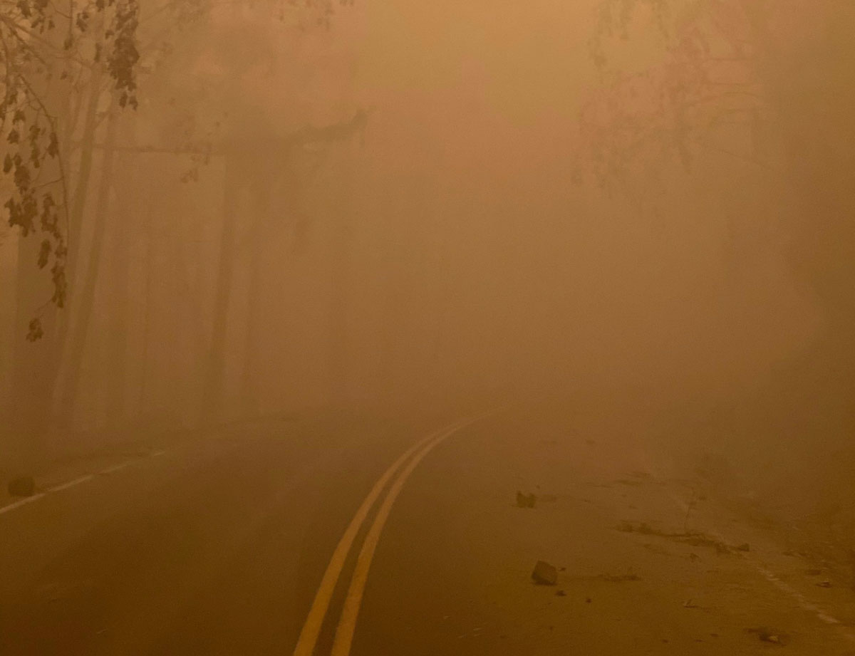
Air quality on the Lionshead Fire, Sept 11, 2020. InciWeb photo.

Riverside Fire

On the Riverside Fire dozers completed a line around spot fires on the west side to help secure the areas closest to the communities of Estacada and Molalla. On Sunday crews were working on the north side above the North Fork Reservoir, looking at opportunities to move towards the east. Firefighters are using two unmanned aerial systems (UAS, or drones) to assess fire conditions from the air. Helicopters are flying when visibility allows.  The blaze has burned 53 structures at last count, and 133,799 acres, and is still a mile away from the Beachie Creek Fire. Resources assigned to the fire include 8 hand crews, 11 engines, and 3 helicopters for a total of 315 personnel.

“You’ll start in the coming days to see some lines showing containment” on the Riverside fire said Alan Sinclair, incident commander for the Type 1 incident management team. “We’re having a little bit more favorable weather and things are coming together.”

Riverside Fire
Riverside Fire, from La Dee Flats September 9, 2020. InciWeb photo.

Beachie Creek Fire

Fog slowed activity of the fire and firefighters on the 188,374-acre Beachie Creek Fire Sunday. After it dissipated firefighters resumed work on the perimeter and accessing damage to structures. Crews and heavy equipment are tying in the control lines on the west and northwest sides. The Beachie Creek and the Riverside Fires remain about one mile apart. Resources assigned to the fire include 11 hand crews, 45 engines, and 7 helicopters for a total of 563 personnel.

Three Area Command Teams (ACT) were mobilized Thursday to assist local units in suppressing the fires in the western states. One of them, led by Area Commander Joe Stutler, will be coordinating the efforts in northwest Oregon. The other two will be California.

Scientist says more fire tornados are being reported at wildfires this year

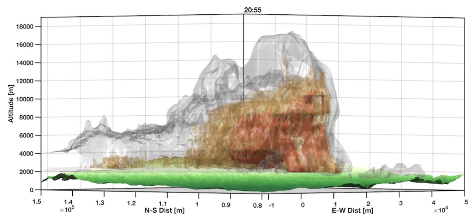
Researcher uses radar data to make three-dimensional maps of smoke plumes

Radar rendering of smoke plume over the Creek Fire
Radar rendering of smoke plume over the Creek Fire. By Neil Lareau, University of Nevada Reno.

The extreme heat caused by a large high pressure system in the West has led to an unusual number of fire tornados.

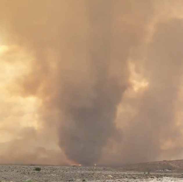
An article in the Washington Post by Matthew Cappucci explains how Neil Lareau, a professor of atmospheric sciences in the department of physics at the University of Nevada at Reno, used detailed weather radar data to make three-dimensional maps of smoke plumes over fires. While it is unusual to have a fire tornado anytime, the data indicates that on at least three fires this year fire tornados have been detected by radar. One was photographed on the Loyalton Fire August 15 about 12 miles northwest of Reno, Nevada. National Weather Service meteorologists who spotted it on radar issued the agency’s first-ever fire tornado warning.

Fire tornado Loyalton Fire
Fire tornado on the Loyalton Fire, by @DVRockJockey August 15, 2020.

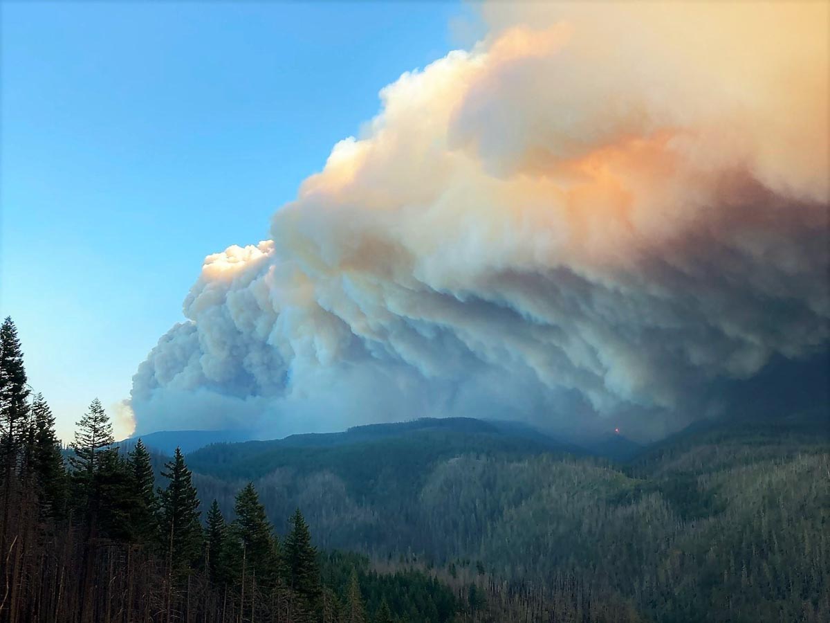
Fire tornados and huge smoke plumes topped by massive pyrocumulus clouds are indicators of extreme fire behavior. There is absolutely nothing firefighters or aircraft can do to slow a blaze under those conditions — and those pyrocumulus clouds seem to be occurring more frequently this year.

Creek Fire
Creek Fire September 5, 2020. IMT photo.

The day after the Creek Fire started, its smoke plume grew to 55,000 feet, taller than the tornadic thunderstorms seen in Oklahoma and Kansas in the the spring.

From the Post:

“Anecdotally, this is the deepest that I’ve seen,” said Lareau, who was shocked by the height achieved by the smoke plume. “It’s about a solid 10,000 feet higher than we’re typically seeing with the highest of these plumes.”

Before 2020, only a few fires had ever produced documented fire tornadoes in the United States; now we’re seeing them every week or two. Lareau says the tremendous heights of the wildfires’ clouds, combined with more concerted and astute observation, are factors in the numerous fire tornadoes that have been reported this year. He thinks there may also be some truth to the apparent increase.

“We have a ton of eyes on every fire, looking at every frame, but still, we weren’t seeing these before,” he said. “And we’re seeing all too much of it right now. It’s rather worrying.”

Thanks and a tip of the hat go out to Jim.

Updated smoke forecast and air quality maps, September 13, 2020

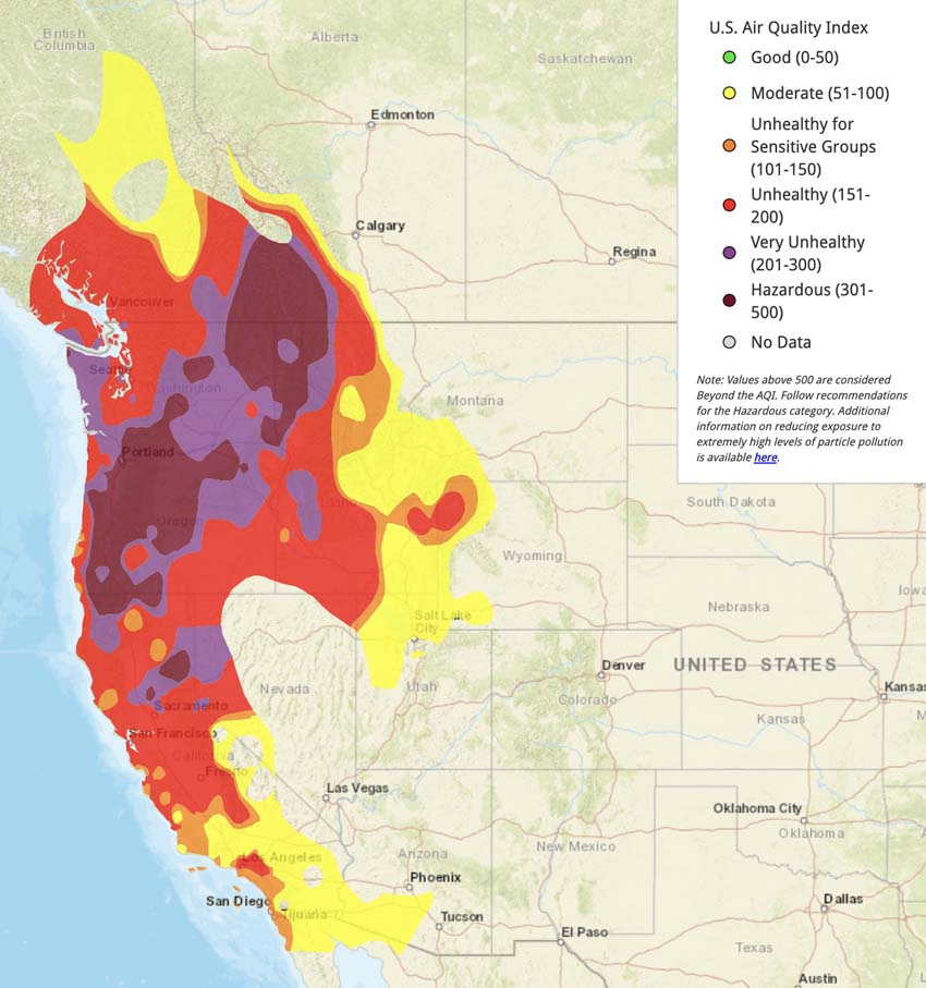
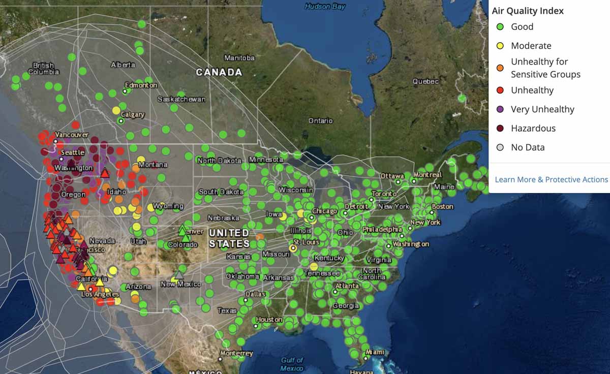
Air quality between Unhealthy and Hazardous is reported in most of Washington, Oregon, Idaho, and northern California

Air quality at 12:54 p.m. PDT Sept. 13, 2020
Air quality at 12:54 p.m. PDT Sept. 13, 2020. AirNow.

Above is the air quality in the western United States as reported by AirNow at 12:54 p.m. PDT September 13, 2020. Air quality between Unhealthy and Hazardous is reported in most of Washington, Oregon, Idaho, and northern California.

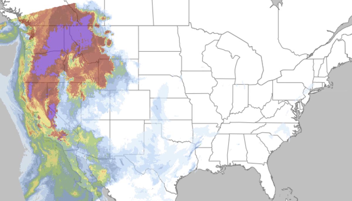
The smoke forecast is below, for 11:59 p.m. PDT Sept 13, 2020. It predicts the smoke will be spreading east, farther into Montana, Nevada, Utah, and Wyoming.

Smoke Forecast for 11:59 p.m. PDT Sept 13, 2020
Smoke Forecast for 11:59 p.m. PDT Sept 13, 2020.

Information about how to reduce your exposure to smoke.

Bobcat Fire spreads closer to foothill communities of Arcadia and Monrovia in southern California

Evacuation order issued Sunday morning for a portion of Arcadia

Updated September 13, 2020  |  8:22 p.m. PDT

Bobcat Fire, Sept 13, 2020
Bobcat Fire Sept. 13, 2020. USFS photo.

Firefighters on the ground and in the air fought back the Bobcat Fire as it spread downhill toward Chantry Flat in Santa Anita Canyon Road Sunday afternoon. There was significant western growth towards Mt. Wilson and Mt. Harvard where hand crews and dozers are working to protect the area. Crews conducted strategic firing operations on the north side and six large air tankers dropped retardant. Some of the drops were between the Mt. Wilson Observatory and Sierra Madre.

At the top or north end of the fire crews stopped the spread of spot fires near Buckhorn Flat and Highway 2.

Sunday night the priority will be to protect the foothill communities using the additional resources that recently arrived.

Sunday evening fire officials said the Bobcat Fire had burned 33,312 acres.

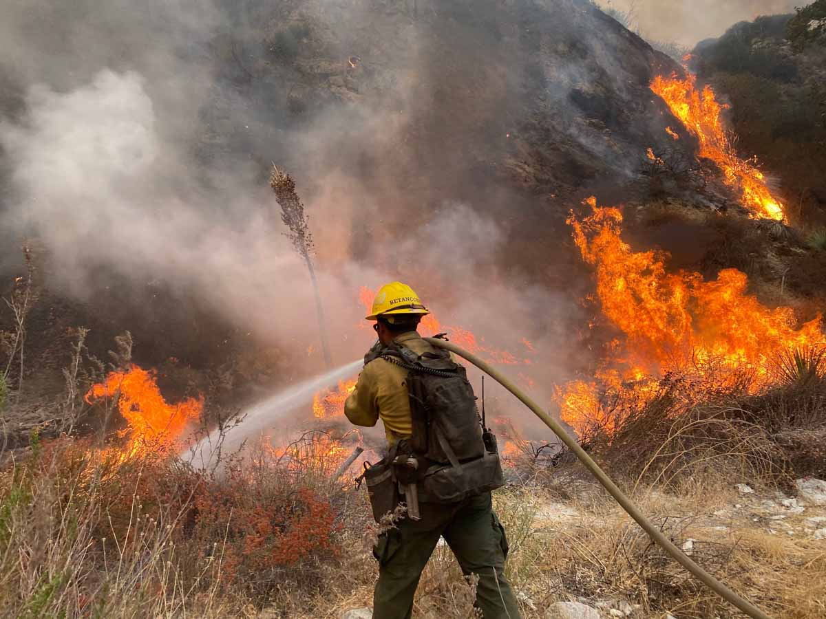
firefighters Bobcat Fire
Firefighters constructing fireline on the Bobcat Fire, Sept. 13, 2020.

September 13, 2020  |  10:40 a.m. PDT

 map of the Bobcat Fire
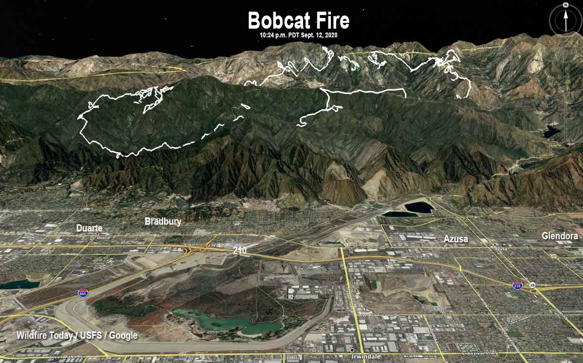
Map of the Bobcat Fire. The white line was the perimeter at 10:24 p.m. PDT Sept 12, 2020. The red dots represent heat detected by a satellite at 3 a.m. PDT Sept. 13, 2020.

The Bobcat Fire in Southern California remained active Saturday night and early Sunday morning, continuing to burn downhill toward Monrovia, Sierra Madre, and Duarte. It is also moving north toward SR2 in the Buckhorn Flat area, and there is significant western growth toward Mt Wilson. The fire has burned 31,991 acres.

Sunday morning an evacuation order was issued for residents north of Elkins Avenue and East of Santa Anita Avenue in Arcadia. Evacuation sites have been set up at Santa Anita Racetrack. The most current information for Arcadia residents is at the city’s website.

Crews are constructing hand line and dozer line where possible to stop the downhill progression. Indirect lines are being used where direct attack is not possible. As visibility allows, helicopters, when available, are being used to support the ground forces. Elsewhere on the fire the focus will be on keeping it south of Highway 2 and west of Highway 39. Indirect dozer line continues to be constructed to keep the fire away from Mount Wilson and to herd it into the Station Fire scar where there will be significantly reduced fire behavior. This fire has mainly been driven by steep terrain and dry fuels, some of which have not seen fire activity in at least 60 years.

 map of the Bobcat Fire
3-D map of the Bobcat Fire at 10:24 p.m. PDT Sept 12, 2020.

Resources assigned to the fire include 18 hand crews, 72 engines, 5 helicopters, and 7 dozers for a total of 813 personnel.

Bobcat Fire
Bobcat Fire September 12, 2020. InciWeb.
Bobcat Fire
Bobcat Fire September 10, 2020. Photo by Tim Dunfee.

Air quality and smoke forecasts for September, 13, 2020

Smoke Forecast fire September 13, 2020
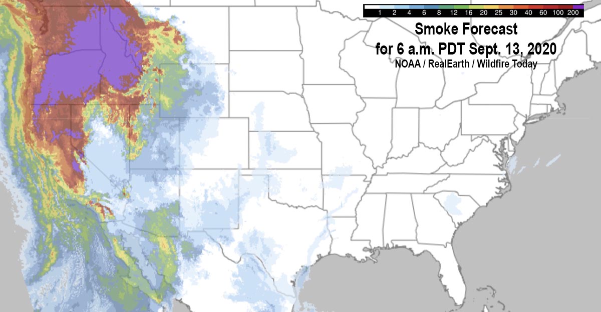
Smoke forecast for 6 a.m. PDT Sept 13, 2020.

The map above shows the forecast for the distribution of near-surface smoke at 6 a.m. PDT September, 13, 2020.

It appears that severe impacts will occur in areas of Washington, Oregon, Idaho, and Montana.

(UPDATED smoke and air quality maps for September 13 can be found HERE)

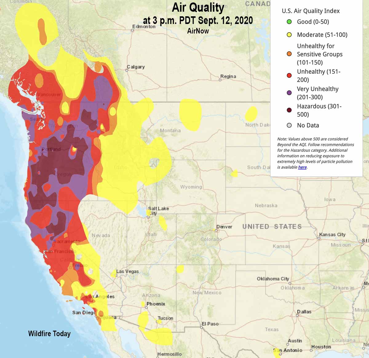
Air quality from AirNow at 3 p.m. PDT September 12, 2020 is below. Most of Oregon, Washington, and northern California are in the categories of Unhealthy, Very Unhealthy, or Hazardous. If you’re in those areas and are lucky enough to have an N95 mask, this is a good time to use it. Being indoors does not help much unless you are aggressively filtering the air with a HEPA category filter. (Information about how to reduce your exposure to smoke.)

Air quality at 3 p.m. PDT Sept. 12, 2020
Air quality at 3 p.m. PDT Sept. 12, 2020. AirNow.

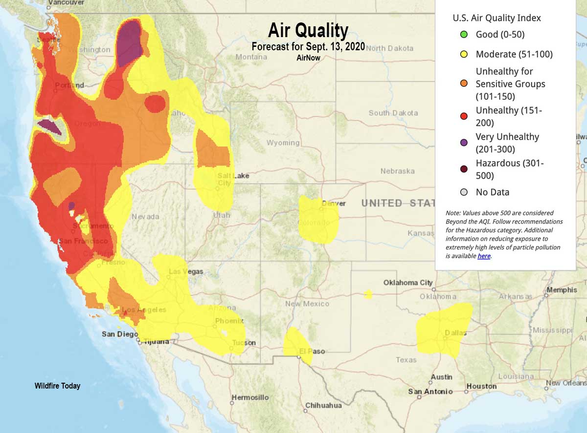
Below is the air quality forecast for Sunday September 13, 2020.

Air Quality forecast for September 13, 2020
Air Quality forecast for September 13, 2020. AirNow.

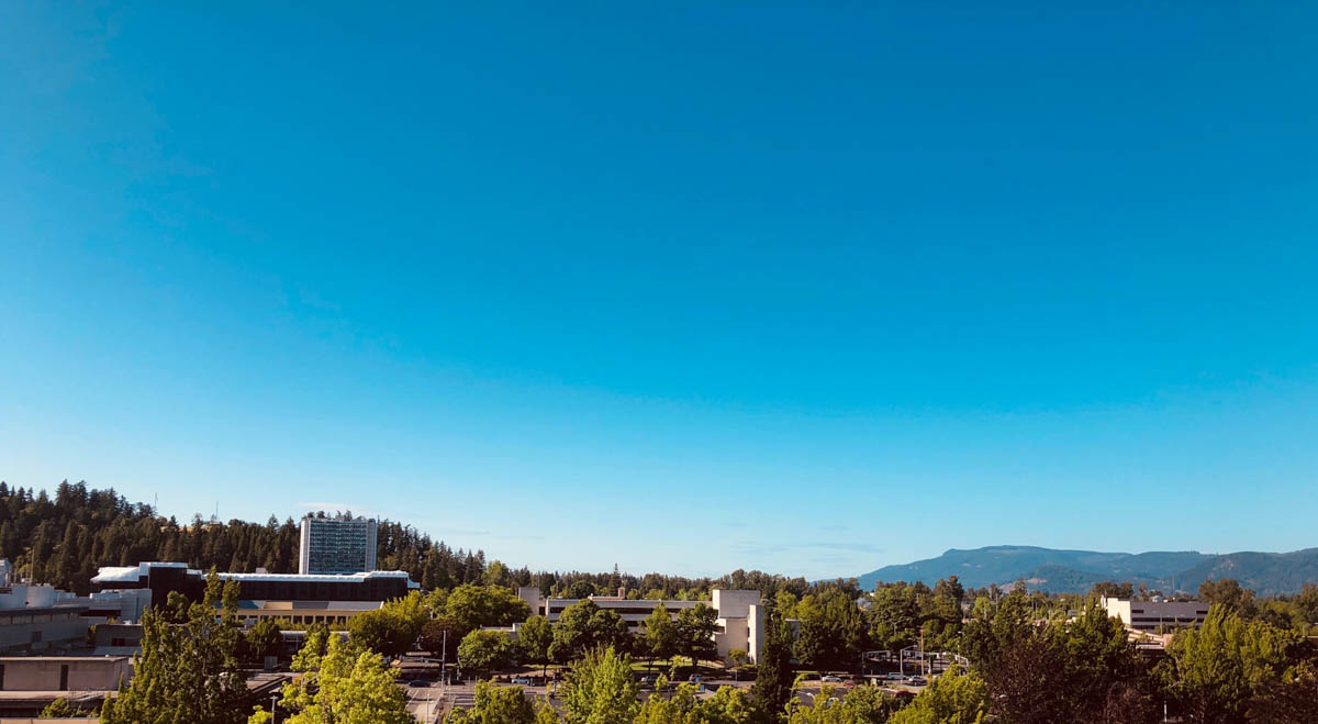
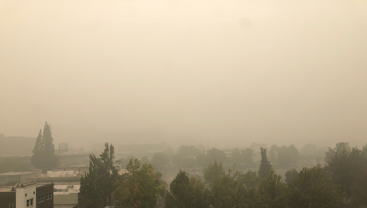
The photos below compare visibility in Eugene, Oregon on a clear day and today, September 12, 2020.

Visibility Eugene, Oregon clear day
Visibility in Eugene, Oregon on a clear day.
Visibility Eugene, Oregon today September 12, 2020 smoke fires
Visibility in Eugene, Oregon today, September 12, 2020.