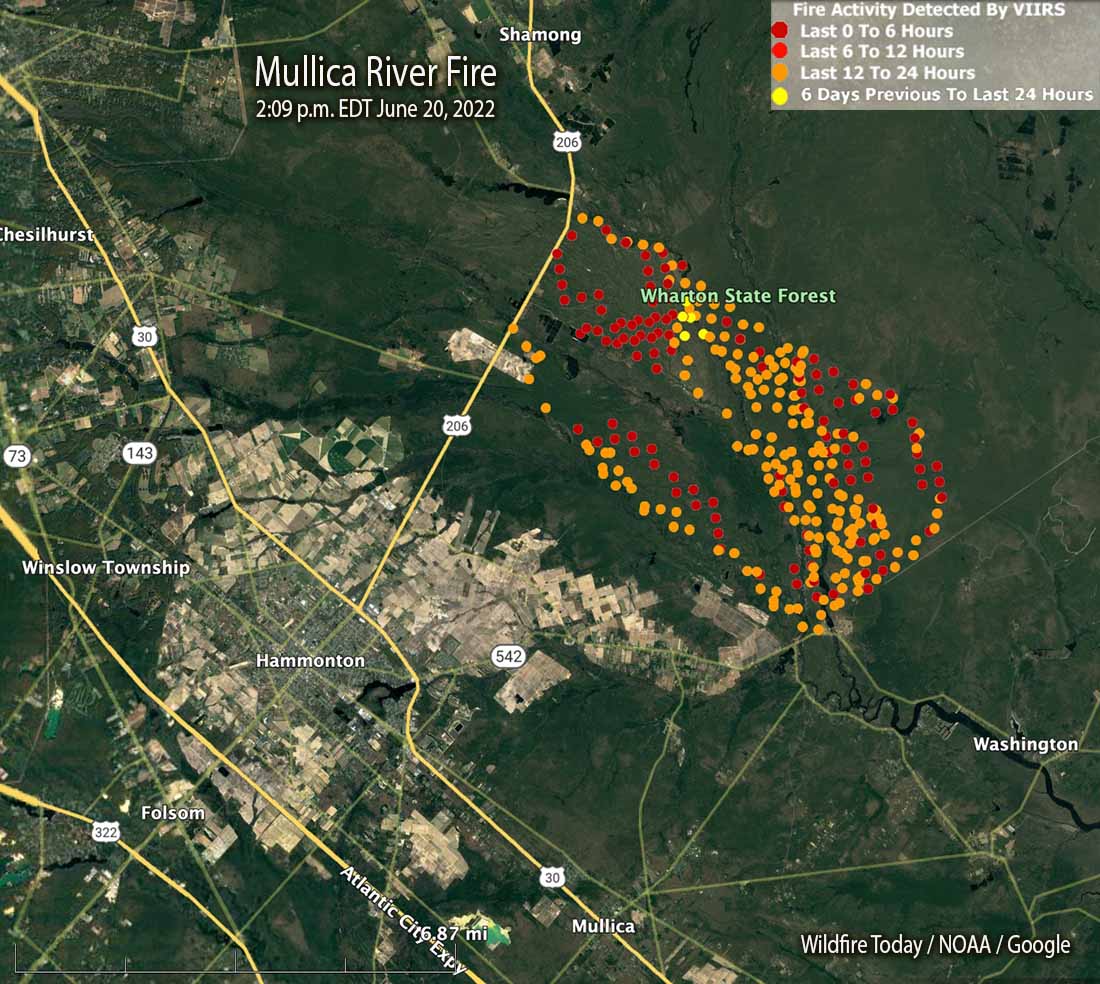
Mullica River Fire map showing heat detected by satellites as late as 2:09 p.m. EDT June 20, 2022.
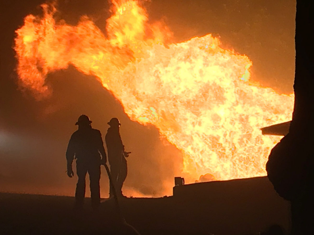
The Mullica River Fire that started Sunday morning in New Jersey’s Wharton State Forest could become the state’s largest in the last 15 years. Chief Gregory McLaughlin of the New Jersey Forest Fire Service said a direct attack was not effective because it is in a very remote area with difficult access so firefighters backed off to implement an indirect attack. They are conducting burning operations out ahead of the fire to remove the fuel, fighting fire with fire, so that as the fire spreads to the freshly burned areas it will stop.
There are 18 structures threatened, including several campgrounds as well as blueberry and cranberry farms. The blaze is burning in four townships, Washington, Shamong, Hammonton, and Mullica. It is four miles northeast of Hammonton, east of Highway 206.
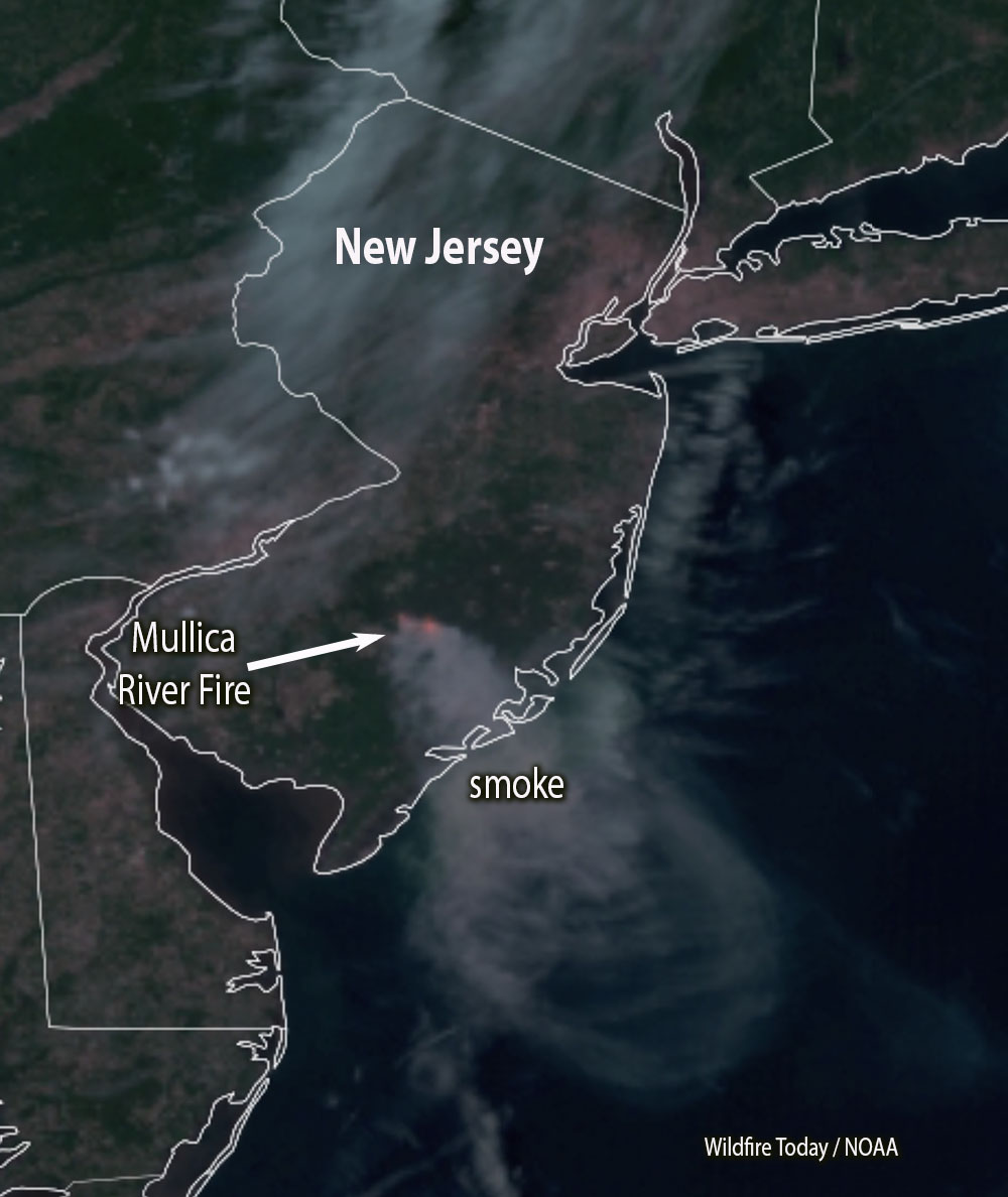
Satellite photo of smoke from the Mullica River Fire in New Jersey at 4:18 p.m. EDT June 20, 2022.
At 3:45 p.m. on Monday fire officials said it had burned about 11,000 acres.
NJ Environmental Commissioner Shawn LaTourette said the Mullica River Fire was not caused by lightning, it was human caused.
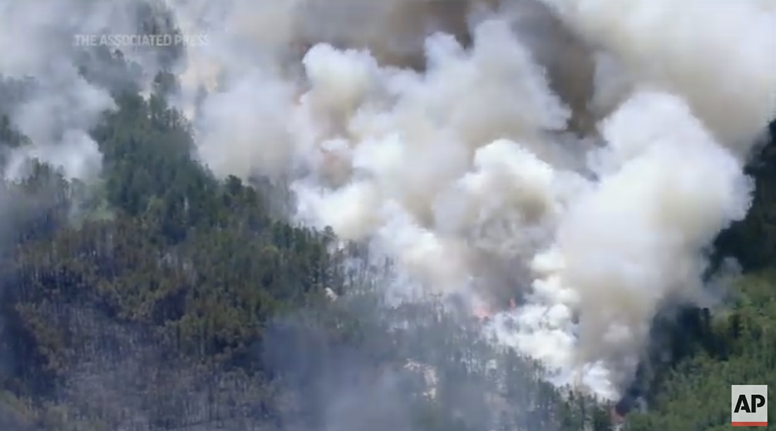
Mullica River Fire in New Jersey, Associated Press.
An escaped prescribed fire is being investigated as the original cause
Updated at 6:51 a.m. MDT June 20, 2022
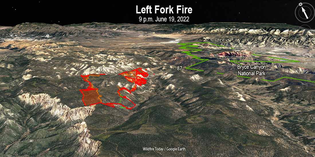
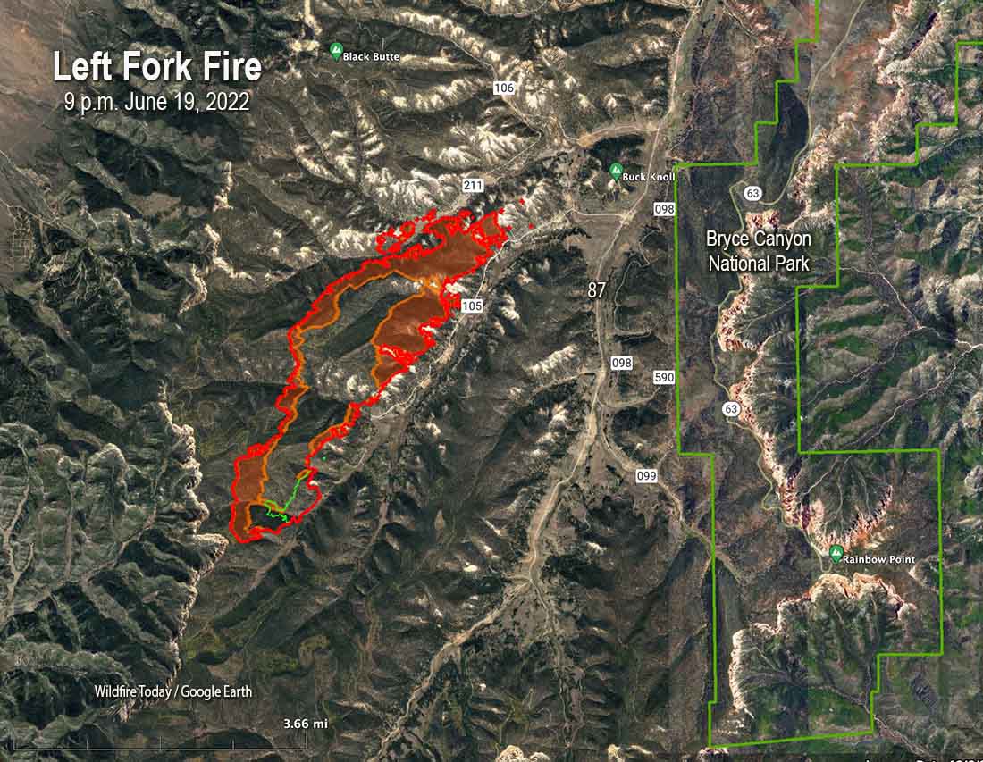
Map of the Left Fork Fire looking north-northeast. The green line was the perimeter May 11, 2022. The red line was the perimeter at 9 p.m. MDT June 19, 2022; the orange areas indicate intense heat at that time.
The Left Fork fire continued to spread to the northeast Sunday night in the Dixie National Forest in Southern Utah. When it was mapped at 9 p.m. Sunday it had burned approximately 2,600 acres. At that time it was about 2 miles west of the 87 road and Bryce Canyon National Park.
Map of the Left Fork Fire. The green line was the perimeter May 11, 2022. The red line was the perimeter at 9 p.m. MDT June 19, 2022; the orange areas indicate intense heat at that time.
9:50 p.m. MDT June 19, 2022
Left Fork Fire map, showing heat (at the arrow) detected by a satellite at 1:57 p.m. June 19, 2022.
The Left Fork Fire in Southwest Utah has taken off again after being dormant for about a month on the Dixie National Forest. It was first detected May 9. On May 10 the Forest Service said it ignited from material still burning from a prescribed fire conducted April 7, 2022. On May 11, 12, and 13 the daily updates about the wildfire posted by the Forest Service stated it was “human caused.” The escaped fire burned 97 acres in early May.
Apparently undetected smouldering material on or under the ground, such as stumps, duff, or tree roots, must have continued burning for weeks after the prescribed fire, and later after the spread of the 97-acre wildfire was stopped. Follow up monitoring of both events either did not occur or was inadequate to detect the still burning fires. The strong winds on June 18 may have fanned it back into an active burning condition, and it spread across a fireline, or hot embers were blown outside the perimeter into receptive fuels.
Left Fork Fire, June 19, 2022, by @april_reeve.
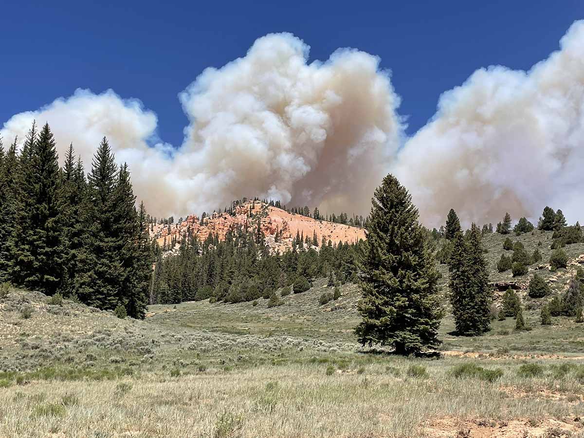
On June 18 the fire began spreading again pushed by strong winds. Utah Fire Information said that day it was estimated at 300 to 500 acres. Sunday afternoon, June 19, it had grown to 600 to 700 acres in rugged terrain, putting up a huge smoke plume affecting the air quality in eastern Utah and southwest Colorado.
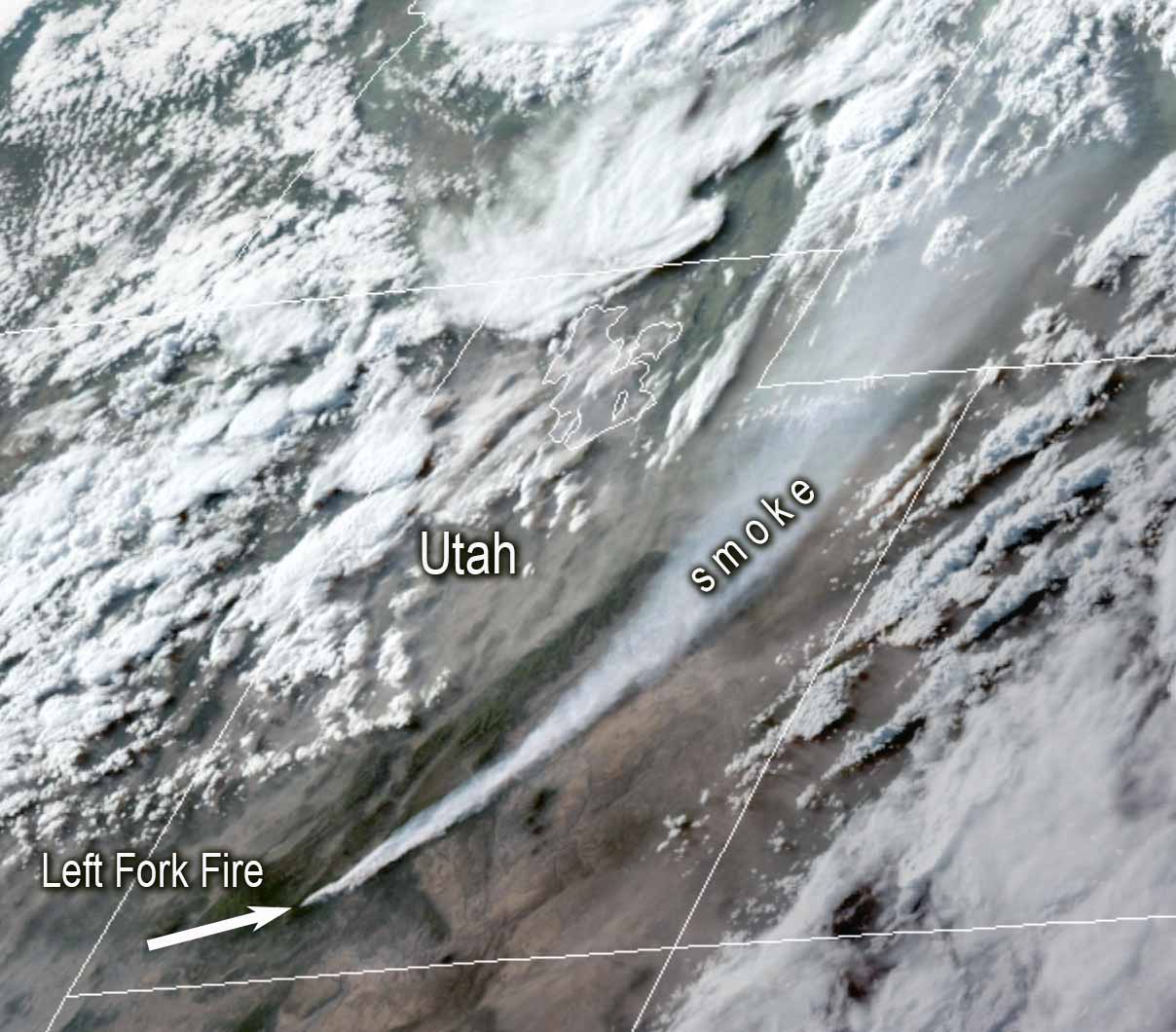
Satellite photo of smoke from the Left Fork Fire, 7:16 p.m. MDT june 19, 2022. NOAA.
The original cause of the fire is still listed as “human caused.” There are dozens of ignition sources that cause wildland fires. Saying it is caused by humans only eliminates two — volcano and lightning — and both could be ruled out very quickly.
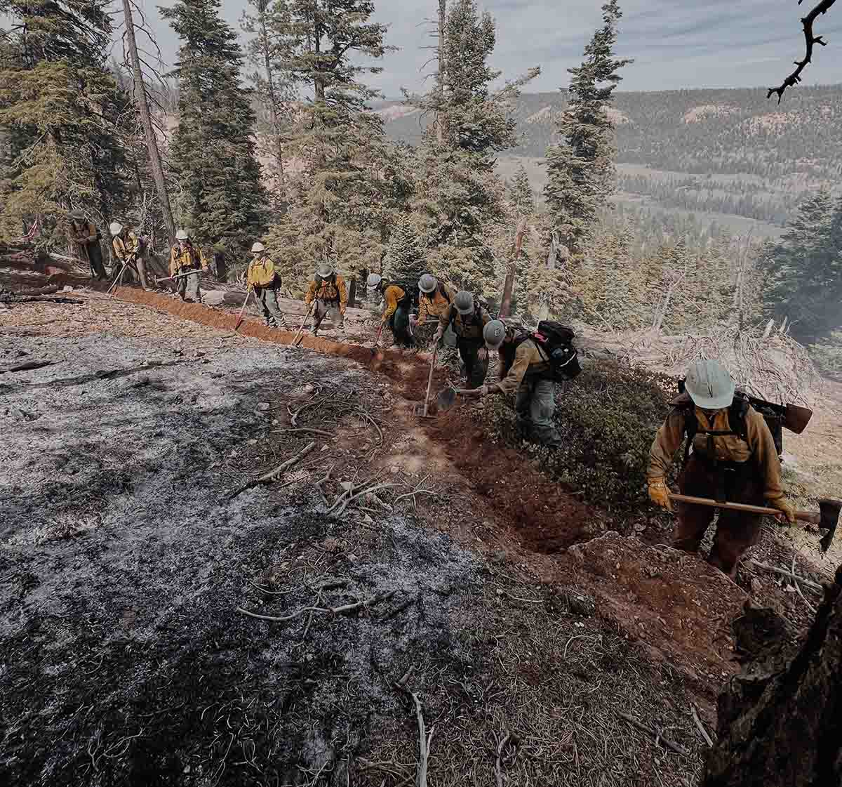
Firefighters construct fireline on the Left Fork Fire in Utah which was apparently caused by an escaped prescribed fire. Posted by the Dixie NF, May 12, 2022. Photo by Mervin Garcia, Engine 322.
Sunday afternoon the Left Fork Fire was spreading to the northeast and was about 2 miles west of Bryce Canyon National Park, 7 miles east of Highway 89, and 20 miles south of Panguitch; it had reached Blubber Creek drainage. It is burning between 8,000 and 9,000 feet above sea level.
The area was under a Red Flag Warning Sunday for relative humidity in the teens and 20 mph southwest winds gusting at 35 to 40 mph. The strong winds kept helicopters and fixed wing aircraft grounded, unable to assist firefighters on the ground.
The NWS spot weather for Monday calls for 70-72 degrees, 10-12 percent relative humidity, and 5 to 15 mph winds out of the west shifting to southwest. Tuesday will be about the same except the wind will be out of the southeast at 10-20 mph in the afternoon.
A Color Country Type 3 Incident Management Team will assume command of the incident Sunday evening.
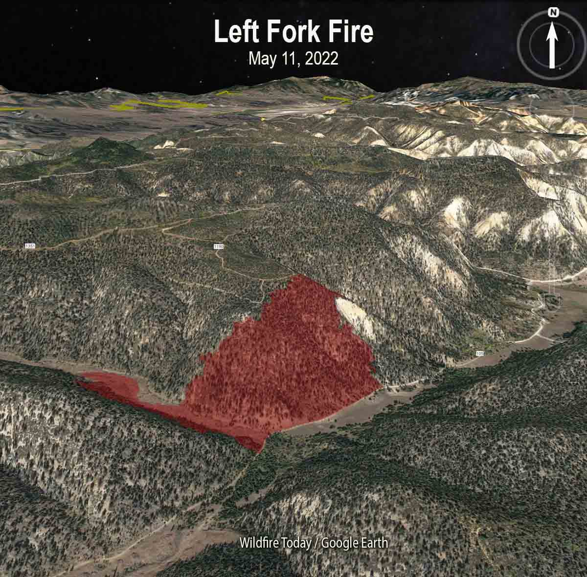
The map below shows the location of the Left Fork Fire after the spread was temporarily stopped around May 11, 2022.
Left Fork Fire 3-D map, looking north May 11, 2022.
About a week after the first attempted suppression of the Left Fork Fire the US Forest Service announced May 20 in a press release that a “pause” was in effect for all prescribed fire operations on National Forest System lands. The reason given was “because of the current extreme wildfire risk conditions in the field…while we conduct a 90-day review of protocols, decision support tools, and practices ahead of planned operations this fall,” Forest Service Chief Randy Moore said in the statement. At the time several other prescribed fires had recently escaped in addition to the Left Fork incident.
Firefighters have made progress on the Contreras Fire in Southern Arizona.
It started from a lightning strike on June 11 and is being managed by a Type 2 Eastern Area Incident Management Team led by Incident Commander Brian Pisarek. It is 20 miles north of the US/Mexico border 16 miles east of Sells, AZ. Sunday morning the team said it had burned 18,843 acres.
To see all of the articles on Wildfire Today about the Contreras Fire, including the most recent, click HERE.
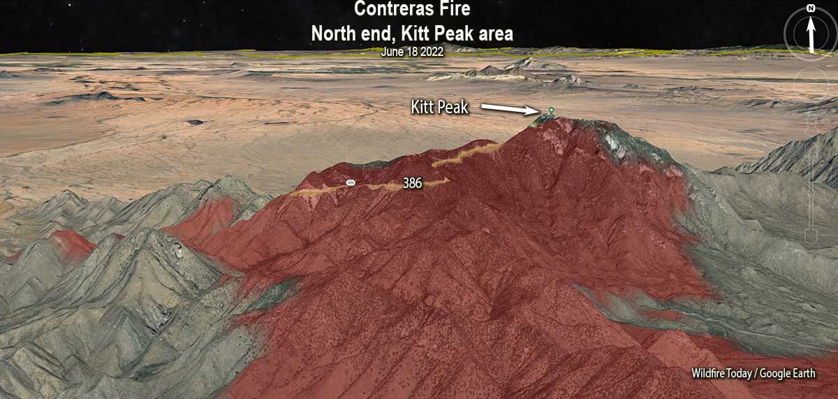
A statement Sunday afternoon from the Kitt Peak National Observatory said that while they are not out of danger, the situation is improving. All of the telescope domes are still standing but four non-scientific structures (dormitories and other support buildings) were destroyed on the morning of June 17. Astronomical facilities and instrumentation appear intact, but assessments of damage to equipment will only begin once conditions allow for safe entry into the area.
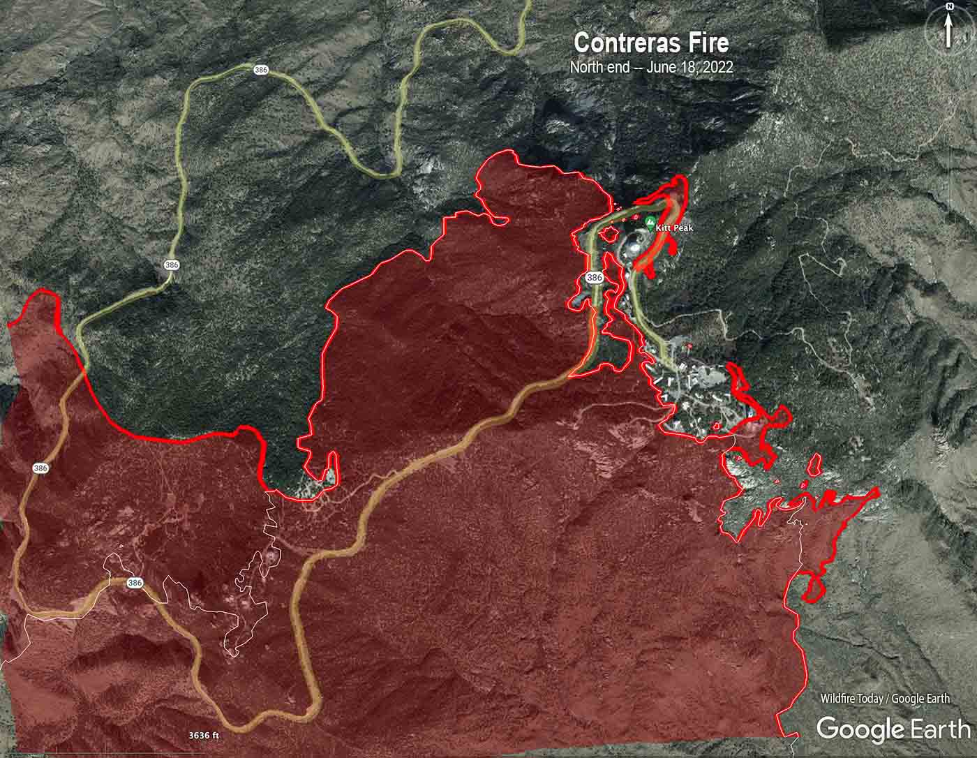
Map of the north end of the Contreras Fire. The red line was the perimeter at the end of the day on June 18, 2022. The white line was the perimeter about 24 hours before.
Because of reduced fire activity on the south and east sides, some of the firefighting resources in those areas are being moved north to Kitt Peak to assist with ongoing fire suppression northeast of the observatories.
The incident management team intends to monitor, using hand crews and engines, the north side of the fire along Highway 86, toward the Pan Tak and Cowtown communities. The fire staff is working on a structure protection plan for these communities. The western perimeter of the fire is being allowed to burn down the slope into what the team described as more advantageous terrain that will allow crews to safely engage the fire.
Contreras Fire, June 18, 2022. Photo via Kitt Peak National Observatory.
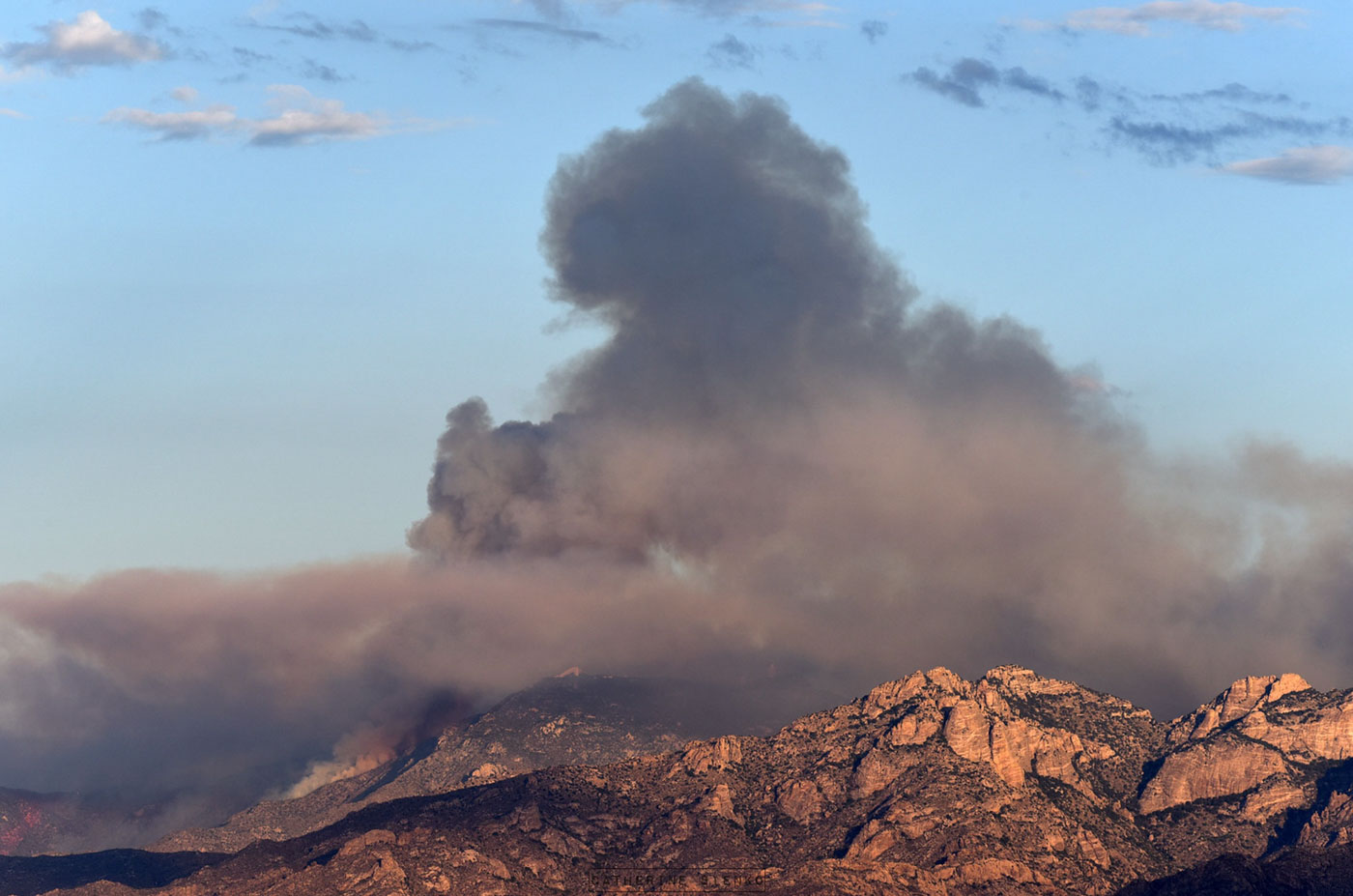
Over the last two days clouds and higher humidities have moderated the fire behavior, but Sunday afternoon the cloud cover decreased and the fire became more active as the humidity dropped to 23 percent with 13 mph winds gusting to 30 mph out of the southwest.
The photos below are courtesy of Catherine Sienko, a professional photographer from the area.
Contreras Fire, 2:30 p.m. June 17, 2022. Catherine Sienko.Contreras Fire, June 17, 2022. Catherine Sienko.
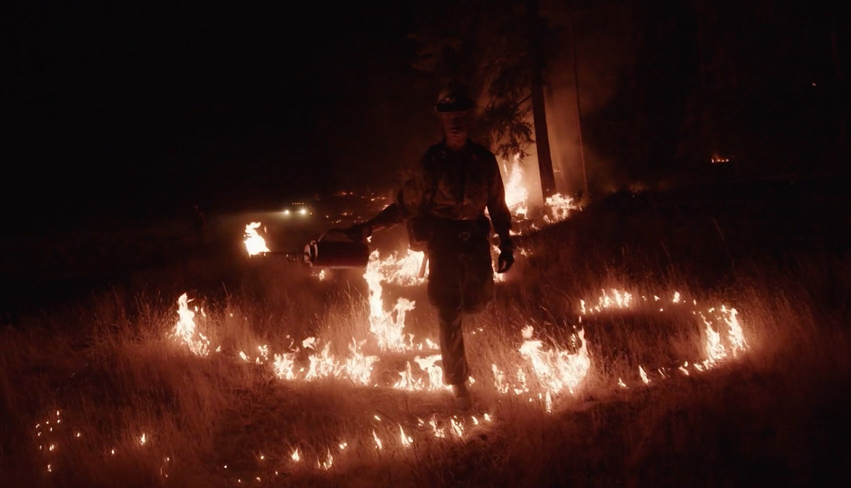
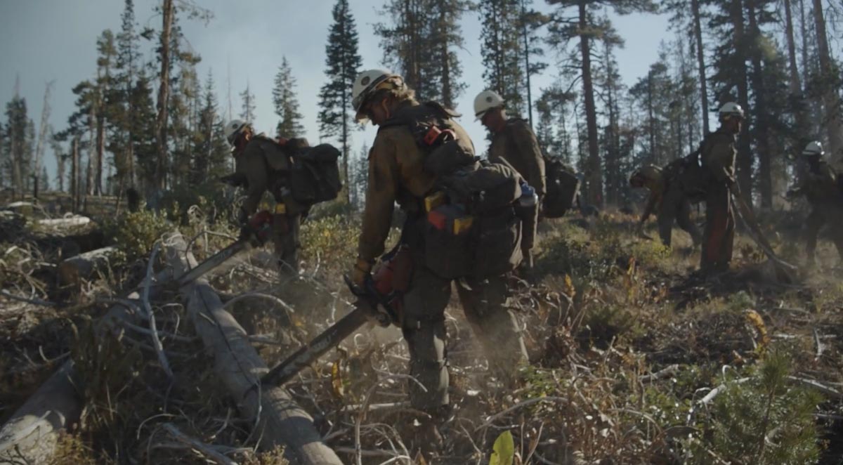
Still image from BLM video, “The Wild Land”. Videography by Matt Irving.
In 2021, the Bureau of Land Management Craig Interagency Hotshot Crew was joined on a two-week assignment by a Bureau of Land Management Fire program contract videographer, Matt Irving. He was able to capture the crew while assigned to incidents in California and Montana.
Still image from BLM video, “The Wild Land”. Videography by Matt Irving.
The videography is excellent and gives the viewer a small sample of what it is like to work on a hotshot crew. It is one of the best examples I have seen about the work being performed routinely by these public servants. Check it out, below.
This is a great example of why the federal land management agencies must emphasize the importance of assigning contract photographers and videographers to capture images of fires and the personnel who manage them. In these times of very challenging recruitment, this could be a small step toward encouraging potential applicants. Obviously the BLM recognizes its value. Here is how they described the video when it was posted on their Facebook page this week:
Looking for a #FireJob? Have you ever thought about applying for one of the 13 Bureau of Land Management’s Interagency Hotshot Crews (IHCs)? If so, take a moment to watch “The Wild Land” video by Matt Irving, as he followed the Bureau of Land Management – Colorado Craig IHC and hear about why they love working in The Wild Lands! #NotYourOrdinaryJob #WeAreBLMFire
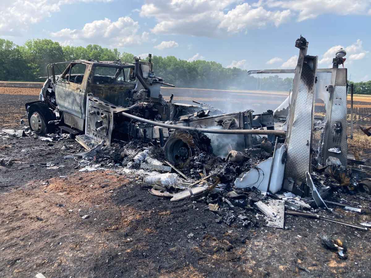
A Town Creek Volunteer Fire Dept. truck was burned over and destroyed June 16, 2022 in Alabama. Photo via the department’s Facebook page.
A truck operated by the Town Creek Volunteer Fire Department was burned over and destroyed in Alabama, Thursday, June 16.
Donna F. Campbell wrote about it on the Department’s Facebook page:
We had a wheat field fire today and lost one of our trucks. I was out of the truck when the fire shifted and got back in to try to get the truck moved. The flames were coming up over the front and I jumped out. Another fire fighter was there from another department with me and he tried spraying water on it. This is what our truck 502 looks like now. None of my firefighters or any of the firefighters from the other 2 departments were injured.
A Town Creek Volunteer Fire Dept. truck was burned over and destroyed June 16, 2022 in Alabama. Photo via the department’s Facebook page.
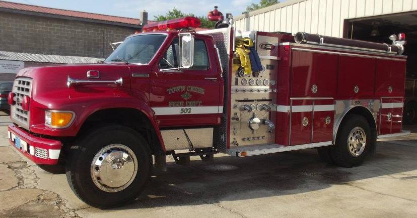
Below is what the truck looked like in 2014.
Truck 502. From Town Creek Volunteer Fire Dept. Facebook page, June 14, 2014.
Firefighters on the Dixie Fire at Greenville, CA, 2021. Jay Walter.
Saturday morning CBS broadcast an 8-minute piece on national TV that laid out some of the issues causing the recruitment and retention issues for wildland firefighters in the federal land management organizations. They interviewed several very experienced firefighters including some who resigned. Forest Service Chief Randy Moore was confronted about his statement before a Congressional Committee that 90 percent of firefighting positions were filled. It turns out he was assuming that 100 percent of the job offers were accepted, which was not accurate.