In Europe war and increasing wildfires stress military and firefighters

Erickson Air-Cranes in Greece
At least nine Erickson Air-Cranes photographed together for the first time. October, 2021 in Greece. Photo by Dimitris Klagos. (According to a report from Erickson, there may have been 10 Air-Cranes at the site.)

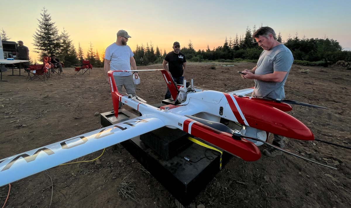
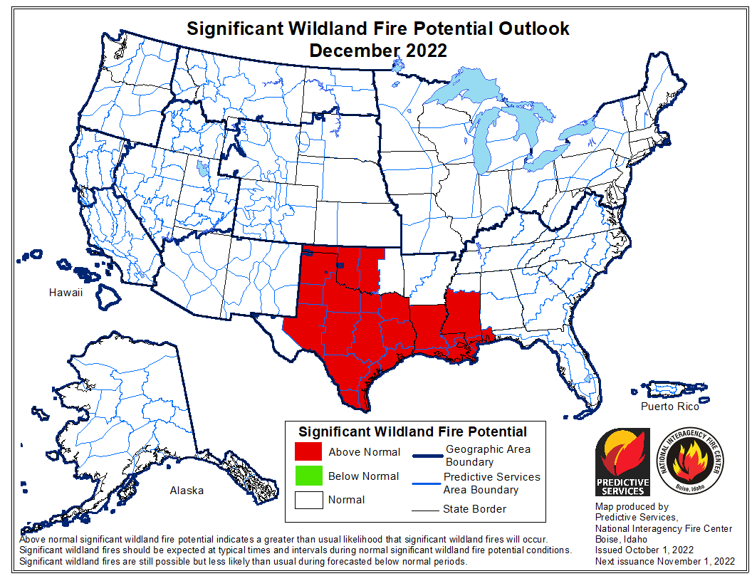
Climate change, increasing wildfires, and Russia’s war in Ukraine are combining to put unusual stresses on governments, especially in Europe. When wildfires become numerous or very large, threatening large numbers of residents, many countries will mobilize military units. They may use helicopters to drop water or transport firefighters or trucks to assist with logistics. The United States has eight Modular Airborne FireFighting Systems (MAFFS) that can be quickly loaded into military C-130s to drop retardant on fires. Soldiers on the ground can be transformed from warfighters to firefighters.

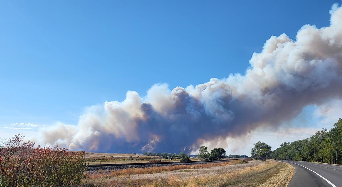
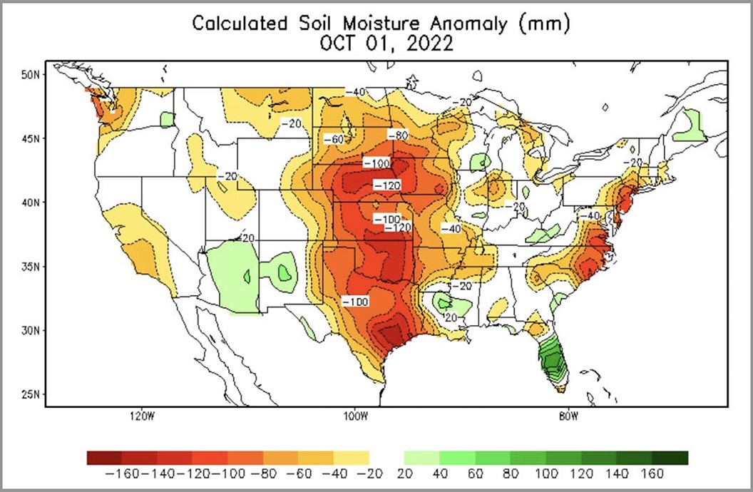
This year was the hottest summer on record in Europe. It followed what what is now the second hottest summer on the continent. During the worst drought in centuries wildfires burned about 50 percent more acres than the previous record set in 2017.

The Washington Post has an article about how the war is affecting countries in Europe, in this case Slovenia, that need to both fight wildfires as the climate changes and bolster the military as international tensions mount.

“There will be these disasters of fires or floods. It will be more and more common,” Defense Minister Marjan Šarec said in an interview. “We must spend our money for everything that is needed. Because safety has no price.”

“It’s not a dilemma of cannons or butter,” said Šarec, who has also been a volunteer firefighter. “As a serious country we must do both.”

But military leaders say the dual-headed challenge can sometimes be significant, and even contradictory.

“Our training is going on in a military way. Exercises. How to use military equipment, how to fight, how to protect. How to defend,” said Glavaš, the head of Slovenia’s military command. “When you stop this training and you go to civilian tasks you need to focus your mind from fighting to something else. It’s very hard sometimes.”

He said that fighting fires “definitely” had an impact on combat readiness.

Currently the European Union coordinates and funds the deployment of 12 fixed wing firefighting airplanes and one helicopter pooled by EU countries. Fire Aviation reported in July that the EU plans to purchase additional air tankers.

The European Commission issued a press release on  Oct. 5, 2022 confirming they are proposing to spend €170 million from the EU budget to reinforce its rescEU ground and aerial assets  in the summer of 2023. The rescEU transitional fleet would then have a total of 22 planes, 4 helicopters as well as more pre-positioned ground teams. Beginning in 2025, the fleet would be further reinforced through an accelerated procurement of airplanes and helicopters.

The Washington Post reported that Slovenian defense leaders decided this month to cancel a $343 million purchase of armored troop carriers as they contemplate buying more aircraft that could be used to fight fires.

Gérald Moussa Darmanin, France’s Minister of the Interior, said recently, “We want to increase the number of Canadair [water scooping air tankers] in our own fleet from twelve to sixteen. But the problem is not to buy them, it is to produce them. Today there are no longer any factories that do so.”

The CL-415 water scooping air tanker has been out of production for years, but De Havilland, which now owns the rights to the aircraft, announced on September 21 the planned construction of a huge aircraft manufacturing facility east of Calgary, Alberta. They expect to employ 1,500 workers to produce at least three lines of aircraft — DHC-515 (a modernized variant of the CL-415), DHC-6 Twin Otter, and Dash 8-400 (Q400).

An announcement from De Havilland said, “European customers have signed letters of intent to purchase the first 22 aircraft pending the positive outcome of government-to-government negotiations through the Government of Canada’s contracting agency, the Canadian Commercial Corporation. De Havilland Canada expects first deliveries of the DHC-515 [water scooping air tanker] by the middle of the decade, with deliveries of additional aircraft to begin at the end of the decade, providing other customers the opportunity to renew existing fleets or proceed with new acquisition opportunities at that time.”

In the near term it does not seem likely that European countries are going to be able to find and purchase dozens of purpose-built air tankers to meet their needs.

Before this year many of the firefighting aircraft typically used in Western Europe and the Middle East during the summer were contracted from Russia. With the war and sanctions that source has virtually dried up.

The Helicopter Investor reported that in April the Portuguese government expelled a team of Russian mechanics working on three of their Russian made Kamov helicopters, and shut down the hangar in Ponte de Sor where the maintenance crew was working. In 2006 the government spent €348 million to buy six Kamov Ka-32A helicopters which could transport personnel and drop water, but over the last 10 years have had difficulty keeping them airworthy. In January none of the six were operational.

The Portuguese Air Force has signed an agreement to purchase six Blackhawk helicopters outfitted for fighting wildfires. The aircraft will be supplied by Arista Aviation Services, a US-based firm which specializes in modernizing surplus US Army UH-60 Black Hawk helicopters. Delivery of the first two is scheduled for the first quarter of 2023.

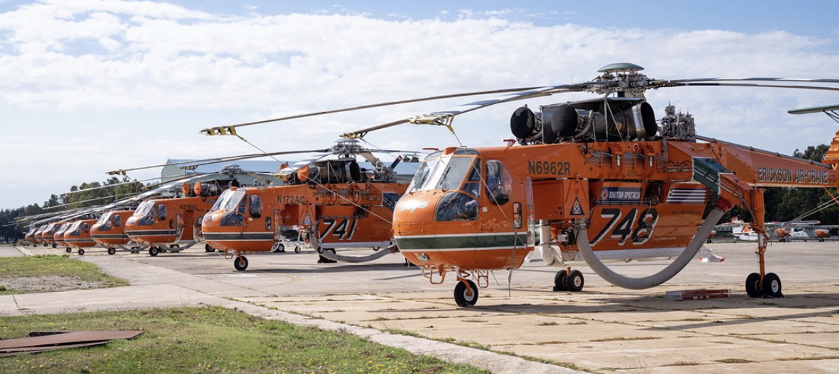
For a number of years Erickson Inc. has contracted their firefighting Air-Crane helicopters to European governments. In 2021 Columbia Helicopters had Columbia Model 234 Chinook’s on contract in Turkey. Single engine air tankers regularly make the migration between South America and Europe as the fire season switches hemispheres.

The Staging Area, Oct. 8, 2022

Reading Fire staging area
Reading Fire staging area, August 4, 2012, Credit: Lassen NPS

This weekend we are continuing an occasional feature we started a few months ago. This post can serve as the beginning of an open thread where our readers can talk about issues that we have, or have not, gotten into yet. This is literally an off-topic thread. You have the floor.

The usual rules about commenting apply. And remember, no personal attacks or politics, please.

Let’s enjoy a wide-ranging conversation!

Topic starter

Fire Country. CBS.
CBS

Did anyone see the pilot episode of Fire Country Friday night on CBS? It stars stars SEAL Team actor Max Thieriot playing a convict who works to redeem himself through CAL FIRE’s inmate fire crew program.

In May the Director of CAL FIRE, Joe Tyler, sent an email to the agency’s employees indicating that CAL FIRE was not pleased after a trailer was released. Here is an excerpt from the message:

This television series is a misrepresentation of the professional all-hazards fire department and resource protection agency that CAL FIRE is. The dramatization of inmate firefighters fighting members of CAL FIRE is a poor reflection of the value of our Camps Program and the incredible work and leadership of our fire captains who supervise our handcrews.

While we cannot prevent this television series from airing, I believe it is important for each of you to hear from me directly that the Department was not involved in its creation or support.

Drones are playing an increasingly important role in fighting wildfires

drone wildland fire firefighter
A contracted UAS crew with Precision Integrated Programs / Overwatch Aero — Tyler Kock, Daniel Rodriguez, and Cliff Savage — on the Lighting Complex of fires. US Forest Service photo by Andrew Avitt. FVR-90, N170WA.

By Andrew Avitt, US Forest Service, Pacific Southwest Region

Drones – also called UAS or unmanned aerial systems – are playing an increasingly important role in fighting wildfires by supporting operations with aerial ignition and gathering intelligence for firefighters. The greatest benefit drones provide is they can take to the sky when manned aircraft are grounded for pilot safety.

Take, for example the FVR-90, a fixed-wing drone with a 14-foot wingspan capable of traveling at speeds up to 46 mph with a flight time of 8 hours. They are sent airborne just at dusk when other manned flights are grounded. The sky is theirs, and the overhead view they have of the fire is detailed and in real time.

“The way we use UAS now is very much a supplement,” said Justin Baxter, the Forest Service National UAS Operations Specialist. “There are certain times that it’s just not safe for us to utilize manned helicopters or fixed-wing aircraft, like nighttime operations or in thick smoke or high winds.”

drone wildland fire firefighter
USFS photo by Andrew Avitt.

The drones that Baxter and his team fly are equipped with cameras that are not your normal cameras. They have multiple types of sensors, including infrared, that allow the team to see through smoke and, at night, see heat signatures, or thermal-based imaging. This allows the identification of areas where fire is still active and new areas where flames have advanced, such as spot fires.

Spot fires occur when embers from the main fire are thrown into the air and pushed by wind until they fall to the ground, starting a new fire. They are notoriously hard to identify because they are small at first and visibility is diminished by smoke. They may occur in hard-to-reach places difficult for firefighters to patrol, like on steep slopes or down in drainages.

“Drones are changing that labor-intensive process to identify these spot fires, especially when an operational area can span hundreds of thousands of acres,” Baxter said. With drones, fire managers and incident management teams can scan large areas quickly and easily identify spot fires that may be a mile from the main fire. That enables firefighters to get in and suppress those new starts before they grow.

“To give you an idea, this drone can detect a 2-inch by 2-inch spot fire from a half-mile away,” said Baxter as he gestured to the imposing drone just to his left minutes before takeoff to fly around the perimeter of the Six Rivers Lightning Complex Fire near Willow Creek, California.

Baxter said that much has changed since 2015 when the agency began the UAS program.  With each passing year, incident management teams have increasingly incorporated the capability into their strategies.

The communication between the UAS crew and firefighters on the ground flows in both directions. The drone may be flying over and see heat in an area and transmit the information to a hotshot crew. Conversely, the hotshot crew can ask the UAS crew for assistance in exploring an area that they suspect might be active, and then view a feed from the drone of the area in question.

John Crotty served as the air operations branch director with California Interagency Incident Management Team 15 that responded to the Lightning Complex Fire on the Six Rivers National Forest.

drone wildland fire firefighter
A drone equipped for aerial ignition. USFS photo by Mike Yearwood.

Aerial intelligence isn’t new in wildland firefighting, said Crotty referring to the recently retired Cobra helicopter and its Firewatch capabilities. But the implications of unmanned flight— that opens up new possibilities.

“With the Cobra aircraft, we needed a pilot and an interpreter up there to run the camera and talk to the folks on the ground. So, we expose two individuals plus a flight [to risk],” said Crotty, “But what we really needed was the visibility to fly.”

Thick smoke on the fires like the Lightning Complex can ground manned aircraft. That’s where drones come into play and the images it captures can inform firefighters working across a large area.

“The other day I heard from one of the hotshot crews out there. They were in heavy smoke conditions, at night. With the low visibility they couldn’t see if they had a spot fire across the line,” Crotty said. “This tool being up in the air, looking down at that exact area, the UAS crew was able to pinpoint the spot and provide precise coordinates to the firefighters who were able to check it out and put it out. That kind of information we would never have without these unmanned aircraft and that capability. Drones are the future of aviation for not only fire but for aviation in general. It’s a win-win for the agencies to operate under an umbrella of this type of aircraft that can provide precise and timely info to firefighters and incident management teams. And most importantly, we can do it safely.”

60 Minutes investigates initial attack on Caldor Fire

60 Minutes, Grizzly Flats, Caldor Fire

Last year’s Caldor Fire and the community that was heavily damaged by it, Grizzly Flats, has been in the news recently. The latest is a piece aired on CBS’ 60 Minutes yesterday (see video below) about the fire southwest of Lake Tahoe, California. On August 16 Cap Radio wrote about the fuel treatment program the US Forest Service planned to conduct around the town, but barely started. Then on September 26 and 27 National Public Radio published articles about the failed project and difficulties in conducting prescribed fires.

The 13-minute piece on 60 Minutes concentrated on the initial attack of the fire, which was first reported at about 7 p.m. on August 14. One of the first challenges was gaining access, complicated by a washed out road and others that had not been maintained. According to a dispatch log the Incident Commander ordered everyone off the fire at 1:42 a.m., about seven hours after it started. The reason stated in the log was for “accountability.” 60 Minutes said the Forest Service told them it was for the safety of the firefighters. Later on day 2, according to 60 Minutes, the agency  “dismissed a half dozen CAL FIRE engines and crews, letting most of them go before their replacements arrived.”

As you can see on the map below, about 29 hours after it started the fire was mapped at 781 acres. After another 44 hours it had burned through Grizzly Flats, growing to more than 55,000 acres.

Caldor Fire map, Aug 15 & 17, 2021
Caldor Fire map, August 15 & 17, 2021.

Our take

I strongly believe in aggressive initial attack “with overwhelming force using both ground and air resources, arriving within the first 10 to 30 minutes when possible.” But it is difficult to criticize, especially a year later, an Incident Commander’s decision to pull everyone off a fire due to concerns about safety. Obviously the burning conditions were in favor of the fire that first night, not the firefighters. In 44 hours it grew from 781 to 53,465 acres while spotting more than a mile ahead according to mapping data from infrared aircraft.

If the Forest Service had completed the huge fuel treatment project they had promised around Grizzly Flats, that does not automatically mean no structures would have been destroyed in the community. Would the treatment have been a mile wide, reducing the number of burning embers landing in the town? Probably not. And it only takes one — landing in a leafy gutter, on a deck, on wooden steps, in a vent, on firewood, or dead grass near a structure and the home can be destroyed. When one home ignites, it becomes another ember generator, showering the rest of the community with ignition sources, resulting in the fire growing exponentially.

In September of 2021 Jack Cohen and Dave Strohmaier wrote about the Home Ignition Zone on Wildfire Today:

“Surprisingly, research has shown that home ignitions during extreme wildfires result from conditions local to a home. A home’s ignition vulnerabilities in relation to nearby burning materials within 100 feet principally determine home ignitions. This area of a home and its immediate surroundings is called the home ignition zone (HIZ). Typically, lofted burning embers initiate ignitions within the HIZ – to homes directly and nearby flammables leading to homes. Although an intense wildfire can loft firebrands more than one-half mile to start fires, the minuscule local conditions where the burning embers land and accumulate determine ignitions. Importantly, most home destruction during extreme wildfires occurs hours after the wildfire has ceased intense burning near the community; the residential fuels – homes, other structures, and vegetation – continue fire spread within the community.”

Bovee Fire prompts evacuation of Halsey, Nebraska

Multiple structures reportedly destroyed at 4-H camp

Updated 5:26 p.m. CDT Oct. 4, 2022

Bovee Fire map, Oct. 4, 2022
Bovee Fire map, Oct. 4, 2022. Data acquired by the Colorado State Multi-mission aircraft late Tuesday morning. This was originally unofficial, but has now been accepted by the Incident Management Team.

An updated map is available for the Bovee Fire near Halsey, Nebraska, showing that it has burned approximately 18,932 acres. Compared to the last map update Sunday night it is shown to be substantially farther to the north, crossing from Thomas County into Cherry County. The overall length, north to south, is 17 miles and at its widest point southwest of Halsey is 3 miles across.

All evacuations on the fire have been lifted and Highway 2 is open. Drive with caution, firefighters advise, as there may be heavy fire traffic and smoke in the area.

In the video below recorded Tuesday morning Planning Section Chief Tom Barter presented an update. At that time he did not have access to the newest map, above.


Updated 7:39 p.m. CDT Oct. 3, 2022

Showers and high humidity have slowed the spread of the Bovee Fire west of Halsey, Nebraska. Two weather stations west and north of the fire have recorded 0.24″ and 0.17″ of rain since 1 a.m. Monday.

The Rocky Mountain Complex Incident Management Team, led by Incident Commander Dan Dallas, is en route to the incident.

Bovee Fire map 7:30 p.m. Oct 2, 2022.

The Lincoln Journal Star reported that a volunteer firefighter, Mike Moody assistant Chief of the Purdum Volunteer Fire Department, died at the fire Sunday after suffering a medical emergency. Moody, 59, had served with the department for more than 40 years and had previously been its chief, according to a news release from the agency.

“We had a good night last night and made a lot of progress on the east and north,” said Incident Commander Brian Daunt. “Today’s focus is going to be holding those lines, and constructing line to the west of the fire.”

More than 100 firefighters are on scene, including two Interagency Hotshot Crews, 10 engines, and a dozer. Colorado’s Multimission Aircraft is scheduled to fly the fire this afternoon to provide detailed infrared mapping of the fire perimeter.

A mapping flight at 7:30 p.m. Sunday found that the fire had burned 7,780 acres. Officially, the Nebraska National Forest is still going with 15,000 acres, an estimate developed Sunday afternoon before it was mapped from an aircraft.

Nebraska Highway 2 has been reopened between Thedford and Halsey.


11:53 a.m. CDT Oct. 3, 2022

Bovee Fire map 7:30 p.m. Oct 2, 2022.

The Bovee Fire has prompted an evacuation of the community of Halsey in central Nebraska. After it was reported Sunday at 1:38 p.m. CDT it spread north very rapidly. When the fire was mapped at 7:30 p.m. it had blackened 7,780 acres.

It is burning on the Nebraska National Forest and on private land on both sides of Highway 2 west of Halsey, 13 miles southeast of Thedford.

Bovee Fire, Oct. 2, 2022
Bovee Fire, Oct. 2, 2022. By Voice News West.

The Forest Service reported that multiple large and single engine air tankers assisted firefighters Sunday and an incident management team has been ordered.

Multiple structures are reported to have been destroyed at the Nebraska State 4-H camp.

Nebraska State 4-H Camp structures burned fire

When the fire started the relative humidity was in the 20s and the wind was gusting to 34 mph out of the south-southeast. The wind speed decreased overnight as clouds moved in and after midnight light rain was detected at the Thedford Airport. A weather station north of the fire at the Valentine National Refuge measured 0.13″ Monday between 2 and 11 a.m. CDT.

Bovee Fire satellite photo, 236 p.m. MDT Oct. 2, 2022
Bovee Fire, Oct. 2, 2022. USFS photo
Bovee Fire, Oct. 2, 2022. USFS photo.

In May of this year the 201 East Fire just south of the current Bovee Fire burned 4,100 acres in the Nebraska National Forest.

Wildfire potential shifts to the south-central states

wildfire potential map

The forecast for wildland fire potential issued October 1 by the National Interagency Fire Center predicts that the wildfire potential shifts to the south-central United States over the next several months. Most of California has received more than the average amount of rain recently.

However some of the Southern California mountain areas have not received much wetting rain, therefore the prediction there is for above normal fire potential in October and November, possibly into December. The first widespread wetting rain this fall will likely follow two to three offshore wind events in Southern California.

NIFC’s monthly forecasts are for the next four months, but in the shorter term, by the end of this week temperatures in the western US and Canada are expected to be 5C to 10C degrees above average for the date.

Temperatures week of Oct 2, 2022
Temperature anomaly October 9, 2022.

The fire potential text and maps from NIFC shown here represent the cumulative forecasts of the ten Geographic Area Predictive Services Units and the National Predictive Services Unit. Additional graphics are included from other sources.

Below:

  • Excerpts from the NIFC narrative report for the next four months;
  • Additional NIFC monthly graphical outlooks;
  • NOAA’s temperature and precipitation forecasts;
  • Drought Monitor;
  • Keetch-Byram Drought Index;
  • Soil moisture.

“Drought continues in much of the West, with expanding and intensifying drought in portions of the Northwest, Idaho, and Montana due to warmer and drier than normal conditions in September. Most of California received well above normal rainfall for the month and much of the Northeast did as well, helping to reduce drought in New England. Warmer and drier than normal conditions also occurred in much of the southern and northern Plains into parts of the Southeast, Texas, and Midwest.

“Near normal temperatures and near to above normal precipitation are likely for portions of the Pacific Northwest and northern Rockies into early winter. Near to below normal precipitation is forecast for the rest of the West through the southern and central Plains into the Gulf Coast and Southeast, barring any landfalling tropical cyclones on the Gulf and Atlantic Coasts. Near to above normal temperatures and near normal precipitation are forecast for the Midwest through the Mid-Atlantic and Northeast.

“Above normal significant potential is forecast for much of Oklahoma, Texas, the Lower Mississippi Valley, and central Gulf Coast into December. Above normal potential is likely for much of the Mississippi Valley in October and the western Ohio Valley through the Ozarks into November. Southern Area is forecast to return to near normal significant fire potential during January.

“The Transverse and Peninsular Ranges of southern California to the coast, areas prone to Santa Ana winds, will have above normal significant potential October through November, before returning to normal potential in December. The Hawai’ian Islands will continue to have above normal potential, especially lee sides, through November before returning to normal potential in December. All the US is forecast to have near normal significant fire potential during January.”


wildfire potential map wildfire potential map wildfire potential map

NOAA temperature and precipitation outlooks Drought Monitor, Sept. 27, 2022 KBDI October 1, 2022

Soil Moisture, October 1, 2022