River Complex ran over 6 miles Wednesday, threatening Callahan, California

Tuesday night and Wednesday morning the Haypress Fire established itself on Billy’s Peak during extreme fire behavior and a six-mile run to the northeast

8:02 a.m. PDT Sept. 9, 2021

River Complex fires map
River Complex of fires mapped by a fixed wing aircraft at 7:15 p.m. Sept. 8, 2021. The red areas had intense heat when the fire was mapped. The dots represent isolated heat.

Above is an updated map of the River Complex. The largest fire is the 162,543-acre Haypress Fire. The other is the Cronan Fire which has burned 5,940 acres.

Tuesday night and Wednesday morning the Haypress Fire established itself on Billy’s Peak during extreme fire behavior and a six-mile run to the northeast.

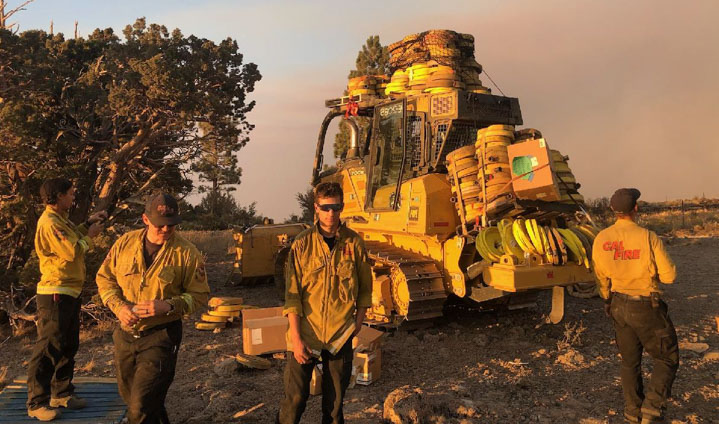
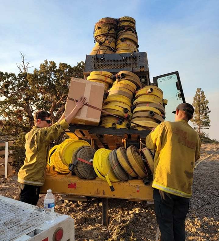
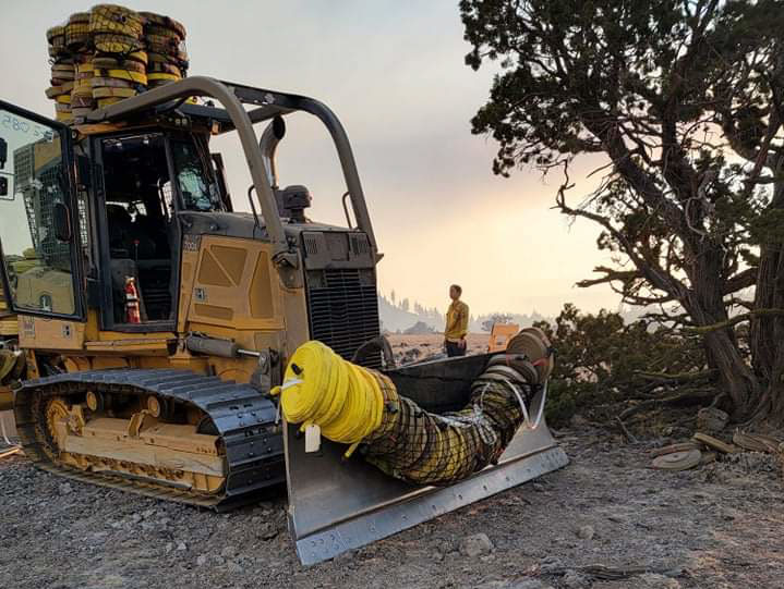
Resources assigned include 12 hand crews; 8 helicopters; 48 engines, 18 dozers; 26 water tenders; 9 masticators; 7 skid steers; 14 mules,  and 3 horses for a total of 816 personnel and 17 animals. Six residences have been destroyed.


7:54 p.m. PDT Sept. 8, 2021

A fixed wing mapping flight early Wednesday morning roughly confirmed the heat detected on the River Complex by a satellite at 3:51 a.m. Wednesday (see the map below). At the video briefing from the Incident Management Team Wednesday evening the map being used had not been updated accurately in about 24 hours. The briefing did not include any information about additional significant fire spread during the day.

Wednesday was a little more humid, there was a cloud and smoke cover, and there was much less wind at the Callahan #2 weather station, all reasons for more subdued fire activity.

Thursday’s weather forecast for Callahan predicts very little wind through Friday morning except for six to nine mph breezes from the southwest for about six hours Thursday afternoon. The area will be under a Red Flag Warning from noon Thursday to noon on Friday for the possibility of dry lighting Thursday evening and night. There is a chance for a small amount of rain Thursday night.


12:32 p.m. PDT Sept. 8, 2021

River Complex fire map at 3:51 a.m. Sept. 8, 2021
River Complex map at 3:51 a.m. Sept. 8, 2021. The red dots represent heat detected by a satellite at 3:51 a.m. PDT Sept. 8, 2021, which have not yet been confirmed by surveillance resources closer to the ground.

The River Fire in Northwest California near Coffee Creek was extremely active Tuesday evening. After 5 p.m. the wind shifted at the Callahan #2 weather station to come out of the southwest gusting at 15 to 26 mph with relative humidity in the teens. At a Wednesday morning briefing the Operations Section Chief said this pushed the north side of the fire about two miles to the north in the South Fork drainage along Cecileville Road, prompting the evacuation of Callahan.

The east side of the fire rapidly spread up Wolford Creek to the northeast. It spotted across Coffee Creek southeast of the footprint of the 2014 Coffee Fire and continued to the northeast and east along Coffee Creek.

The Operations Section Chief said it was “Rapid explosive fire behavior and what we have been talking about as the worst case scenario of fire growth. It was a flaming crown run in the tree tops at a rapid pace.”  The fire ran for about 6.5 miles along the Coffee Creek drainage, he said, creating spot fires up to two miles ahead.

The map above shows the fire perimeter (in green) from September 7. Cloud cover Tuesday night prevented a fixed wing aircraft from mapping the entire fire. A satellite detected heat at the red dot areas shown, and they were so far from the previous perimeter I at first doubted their accuracy. Satellites and even sensors in fixed wing aircraft can sometimes falsely identify heat in a very large, intense convection column of smoke as heat on the ground. But fires typically spread more slowly and with less intensity and heat at night. The satellite overflight was at 3:51 a.m. Wednesday when typically there is no very large smoke column. These heat locations also are consistent with the descriptions by the Operations Section Chief in the Wednesday morning briefing. The bottom line: if these satellite detections exaggerate the fire spread, it is not by much.

After the fire passed through the upper reaches of Coffee Creek firefighters rescued some residents who had earlier refused to evacuate.

On Wednesday firefighters expect the fire to move toward Mosquito Flats and the communities of Coffee Creek, Callahan, and Eagle Creek. They will make sure all of the residents are out of the mandatory evacuation areas which are on a map maintained by Siskiyou County. Air tankers will drop retardant near the communities if the inversion, wind, and smoke conditions allow the safe use of aircraft.

Personnel will assess areas southwest of the community of Coffee Creek for locations to construct contingency firelines. Damage assessment teams on Wednesday will begin working their way into the recently burned area to evaluate possible damage to structures.

Dixie Fire burns to Highway 395 again

Southeast of Susanville, California three miles southeast of Herlong Junction

9:45 a.m. PDT Sept. 7, 2021

Dixie Fire map, southeast side cross Highway 395
Dixie Fire 3-D map. Looking northwest at the escarpment along US Highway 395 at 8:29 p.m. PDT Sept 6, 2021. Bright red areas had intense heat during the mapping flight.

Monday afternoon and evening the southeast side of the huge 917,000-acre Dixie Fire ran to the east pushed by variable winds down a steep escarpment and across US Highway 395. During an 8:29 p.m. mapping flight the fire stretched for a mile along the west side of the highway and for about half that distance had burned across the road. At that time it had not spread very far beyond the highway as it moved into agricultural land. The fire reached US 395 south of Honey Lake three miles southeast of Herlong Junction between roads A25 and A26.

Dixie Fire map, southeast side cross Highway 395
Dixie Fire map, southeast side where by 8:29 p.m. PDT Sept. 6, 2021 the fire had reached and crossed US Highway 395. Bright red areas had intense heat during the mapping flight.
Dixie Fire 8:29 p.m. PDT Sept 6, 2021.

The north side of the fire is also active. At least half of Lassen Volcanic National Park has burned. Within the park on Monday the fire was making a push to the north and northeast across the park boundary south of Badger Mountain. It was also very active around Prospect and West Prospect Peaks within and just north of the park.

Dixie Fire map north side
Dixie Fire map, north side, 8:29 p.m. PDT Sept. 6, 2021. Bright red areas had intense heat during the mapping flight.

West of Highway 44 south of the Bogard Rest Area there were three spot fires Monday night about half a mile west of the highway that combined had burned approximately 130 acres as of sunset on Monday.

On Tuesday crews will continue to complete line in the steep and rugged terrain in the wilderness of Lassen National Volcanic Park and are establishing direct and indirect containment lines south of Old Station utilizing lines created during the 2012 Reading Fire.

Firefighters are preparing for increased fire danger due to predicted strong winds. The forecast for the north side of the fire calls for southwest winds gusting around 20 mph or more every afternoon through Friday with relative humidities close to 20 percent.

Briefing on five major wildfires in Oregon

Middle Fork, Rough Patch, Jack, Devils Knob, & Bull

4:18 p.m. Sept. 6, 2021

Map of Oregon Fires Sept. 6, 2021
Map of Oregon Fires Sept. 6, 2021.

There are five major wildfires or complexes of wildfires in western Oregon. None of them are raging, but there is not much standing in their way to to take off if a wind event comes over the horizon. The exception is the Jack Fire which is pretty quiet and only staffed by five personnel.

As you can see in the satellite photo below which shows approximately the same area as in the map above, an inversion is trapping smoke on the four southern-most blazes. This indicates that there is not much wind on the fire. The inversion and smoke partially block convection above the fire and solar heating of the vegetation, slowing the spread.

Satellite photo, Oregon Fires, 1:56 p.m. PDT Sept, 6, 2021
Satellite photo, Oregon Fires, 1:56 p.m. PDT Sept, 6, 2021.

Starting from the north, here are a few details about these five fires. The term “complex” means there is more than one fire being managed by the same Incident Management Team.

Bull Complex, 16,724 acres, Mt. Hood National Forest, 571 personnel. It is 18 miles east-northeast of Mill City. Following a round of lightning in the afternoon on August 2, four fires were identified on the south end of the Mt. Hood National Forest. Three, Janus, Kola, and Ridge Fires, were in the southeast corner of the Bull of the Woods Wilderness in the Janus Butte area. The fourth fire, Round Lake, was east of the wilderness. And a fifth, Ogre Creek Fire, was detected August 3 in the Round Lake area. By August 18 they had all merged. The fire is currently being managed by Northern Rockies Type 2 Team #4.

It is actively spreading to the west in Welcome, Mother Lode, Battle, and Elk Lake Creek drainages, and to the north along the ridges between Dickey Creek and the Collawash River.

Bull Complex of fires
Bull Complex of fires, Rhododendron Ridge, OR, Sept. 2, 2021 Inciweb.

Middle Fork Complex, 24,930 acres, Willamette NF, 2 fires, 686 personnel. It is 23 miles southeast of Eugene and is being managed by the Pacific Northwest Team 6, a Type 2 Team which says that many snags, steep terrain, and smoky conditions make direct attack unsafe. They are planning burning operations on the Gales Fire and are staffing both night and day shifts to take advantage of weather which is slowing the spread. Firefighters are preparing for heightened fire behavior on Tuesday afternoon.

On the Kwis Fire, an engine crew continues to break up and put out all remaining burning material near the fire perimeter. “Every once in a while, we find a stump hole burning,” said Field Operations Chief Ryan Sullivan.

Gales Fire, Middle Fork Complex, OR
Gales Fire, Middle Fork Complex of fires, OR, Aug. 16, 2021, InciWeb.

Rough Patch Complex, 41,185 acres, Umpqua NF, 4 fires, 714 personnel. It is 18 miles southwest of Oakridge and started July 29 from 20-plus lightning ignitions. Several more fires were later added to the complex including the Jack Fire when another storm moved through August 1, bringing the total to 42. On August 28th Northern Rockies Team 1 (Type 1 IMT) assumed command.  The Complex now consists of four fires: Chaos, Little Bend, Buckhead, and Near Minky, all being managed under a full suppression strategy. Firing operations on all four fires are either being planned, prepped, or are underway.

Jack Fire, 23,990 acres (grew by 4 acres in 24 hours), Umpqua NF,  5 personnel. It is 31 miles east of Roseburg. They are calling it full suppression but report that only 55 percent of the perimeter is contained.

Devils Knob Complex, 46,596 acres, Umpqua NF, 2 fires, 711 personnel. It is 20 miles northeast of Azalea. Initially it was a group of 43 fires mostly on the Tiller Ranger District that started from lightning on July 29 and August 1. All fires in the Complex are being managed under a full suppression strategy. On September 6, the Rocky Mountain Type 1 Incident Management Team assumed command.

The two largest fires still spreading are the Smith and Big Hamlin Fires. The Smith is primarily north of the South Umpqua River, while the Big Hamlin is south of the river. Of the two the Smith Fire is the most active. Firing operations are underway on these two fires. The other fires are being monitored and held.

Firefighter Devils Knob Complex of fires
Firefighter on the Devils Knob Complex of fires, OR, Aug. 13, 2021, InciWeb.

How two engine crews installed a 16,000-foot hose lay

On the Dixie Fire

Two engine crews dozer install 16,000 feet hose Dixie Fire
Two engine crews and a dozer install 16,000 feet of hose on the Dixie Fire. CAL FIRE photo.

The hardest part of installing long hose lays in rugged terrain is hauling the hose, and it is usually uphill. When the plans called for 16,000 feet of hose to be installed on the Dixie Fire it just took two engine crews and some ingenuity to get it done. They enlisted the help of dozer E2085 from Paula and sons Earthwork.

The CAL FIRE crews were Lassen Modoc engines E2271 and E2251.

Two engine crews dozer install 16,000 feet hose Dixie Fire
Two engine crews and a dozer install 16,000 feet of hose on the Dixie Fire. CAL FIRE photo.
Two engine crews dozer install 16,000 feet hose Dixie Fire
Two engine crews and a dozer install 16,000 feet of hose on the Dixie Fire. CAL FIRE photo.
Two engine crews dozer install 16,000 feet hose Dixie Fire
Two engine crews and a dozer install 16,000 feet of hose on the Dixie Fire. CAL FIRE photo.

One day in the not too distant future it will become routine to haul hose with drones.

To see all articles on Wildfire Today about the Dixie Fire, including the most recent, click here.

Crews on Caldor Fire take advantage of weather to increase containment

Mandatory evacuations lifted for South Lake Tahoe

Caldor Fire map
Caldor Fire map, east side, Sept. 6, 2021. Incident Mgt. Team.

The combination of milder weather and in some cases the fire moving into higher elevations with less fuel has allowed the 5,072 firefighters and support personnel on the Caldor Fire near South Lake Tahoe to make increased progress in recent days. Hand crews and dozers have constructed more direct lines on the fire’s edge, stopping the spread in additional areas. The fire was mapped Sunday night at 216,358 acres, an increase of about 1,000 in the last 24 hours.

Several areas have had their mandatory evacuation orders downgraded to warnings, allowing thousands of residents to return to the city of South Lake Tahoe. El Dorado County maintains a map showing the current status of evacuations.

To see all articles about the Caldor Fire on Wildfire Today, including the most recent, click HERE.

Crews have confirmed that 714 residences and 208 other structures have burned. Officials have posted a map showing structures which have been evaluated for damage.

Caldor Fire, Sept. 6, 2021

On the east side of the fire directly south of Lake Tahoe the large finger of fire east of Christmas Valley and Highway 89 that has burned more than 7,000 acres has fire line completed on the west and north sides. On the southern flank of that finger, hand crews with help from dozers are constructing direct line to keep it from moving to the south and east. They have made great progress. The perimeter of that finger is more than 20 miles, making just this section of the fire alone a huge undertaking.

A wildland fire module has been inserted into the Desolation Wilderness north of Highway 50 to help contain the northwestern corner of the East Zone. A heli-rappel module will also be inserted and additional wildland fire modules are on order for this area.

Sunday night the humidity recovery was poor, rising only into the low 20s on the slopes. On Monday the forecast calls for extremely dry air to remain over the fire area with above average temperatures and humidities in the low to mid-teens. Light winds on ridges in the morning will become westerly during the afternoon. Wednesday through Friday will bring increasing winds, 14 mph out of the west and west-southwest occasionally gusting into the low 20s, and even stronger on the weekend.

On the south side northeast of Kirkwood firefighters have made progress with dozer lines but north of Highway 88 the there is still work remaining.

Firefighters on Caldor Fire
Firefighters on the Caldor Fire, Aug. 22, 2021. CAL FIRE photo.

Two firefighters at California fires died, one from COVID, the other from unspecified illness

Updated at 8:53 a.m. PDT Sept. 5, 2021

US Army soldiers fire training
Active duty US Army soldiers receive fire training before assisting at the Dixie Fire Sept. 1, 2021. About 200 soldiers have been activated to assist with wildfires in California. InciWeb.

Two firefighters assigned to wildfires in California have died.

One of two emails sent to employees on the Stanislaus National Forest about the fatality of one of their employee/retirees said he “passed away earlier this week due to complications of COVID-19 while assigned to the French Fire near Kernville, CA. He had been hospitalized in Bakersfield.”

The person’s name has not been released by the Stanislaus, but at least three sources confirm it was Allen Johnson.

Allen Johnson
Allen Johnson. USFS.

Allen was a Forest Service retiree and was working as an Administratively Determined (AD) employee on the French Fire. The email to the forest’s staff said it’s very early in the process, but “Tentative plans for honoring Allen include a Dignified Transport of remains followed by a Memorial Service. To the best of our current knowledge, Allen’s dignified transport and Memorial Service will occur on or after September 26.”

California Interagency Incident Management Team 14 posted on Facebook Sept. 1, 2021, “Our team, the firefighting community, and the world lost a great friend, mentor, teacher and comrade last night. Retired South Central Sierra Interagency Incident Management Team IC and Liaison Officer Allen Johnson passed away from complications related to COVID 19.”

So in the absence of official information from the US Forest Service about this line of duty death, it appears from the post by his incident management team that Allen died August 31, 2021.

Saturday night NBC Bay Area reported another fatality — a US Forest Service firefighter assigned to the Dixie Fire near Susanville, California.

A spokesperson for the U.S. Forest Service told NBC Bay Area Saturday that the firefighter, an employee with the Lassen National Forest died from an illness. The official added that the firefighter’s death was not related to the fire. No other details have been released at this time.

The official information from CAL FIRE about the Dixie Fire confirms there was a first responder fatality from an illness on September 2.

UPDATE at 11:08 a.m. PDT Sept. 6, 2021: NEWS4 reported today that the US Forest Service said the firefighter that died who had been assigned to the Dixie Fire was Marcus Pacheco, an assistant fire engine operator for the Lassen NF with 30 years of fire experience. He passed away Sept. 2 from what the USFS is calling an "unspecified illness". Late at night on September 5 the Lassen National Forest created a post on Facebook announcing the two fatalities and confirming the names.

The Dixie Fire has burned more than 889,000 acres near Susanville, California and is still actively spreading.

The 25,000-acre French Fire is west of Kernville, California.

Last week a strike team of five engines with 16 firefighters on the Caldor Fire near Lake Tahoe was quarantined for two weeks due to one of their members testing positive for COVID. There have been other reports of firefighters and crews sidelined, quarantined, or sickened, but specifics are hard to come by.

Two weeks ago Wildfire Today asked the five federal land management agencies for the number of their firefighters that have tested positive for COVID or had to quarantine after exposure. All five refused to release any information on the topic and would not explain their reasoning for keeping it secret. On September 2 we asked the US Forest Service again for the numbers of their firefighters who have tested positive for COVID, were hospitalized, or died. We are still waiting for the answers.

We send out our sincere condolences to the family, friends, and co-workers of the two firefighters who passed away while on duty.

(Edited to include the names of the firefighters.)

Thanks and a tip of the hat go out to people who passed along this information.