Senators call for creation of wildland firefighter job series and an increase in firefighters’ pay

In August 600 US Forest Service firefighter positions were unfilled

Firefighter on the Myrtle Fire
Firefighter on the Myrtle Fire in the Black Hills of South Dakota, July 22, 2012.

The way the federal government manages wildland firefighters made a small step recently toward gaining enough attention that their issues might be acted upon somewhere down the road. In addition to the legislation that has been introduced this year to establish a wildland firefighter job series and pay them a living wage, two senators wrote a letter to the Secretaries of Agriculture and Interior asking for those issues to be addressed, and also to waive the annual salary cap restrictions for fire personnel and convert seasonal firefighters to permanent.

The letter pointed out that in August 600 US Forest Service firefighter positions were unfilled. In a record-setting year for fires in California and Colorado, having about six percent of the jobs vacant is a problem. Is is also an indication that retention is an issue that needs to be addressed.

The letter was written by the two senators from California, Dianne Feinstein and Kamala Harris. Talking about improving the firefighter program does not accomplish anything, alone. Writing a letter to the Secretaries is a slightly stronger step, as is introducing legislation. PASSING meaningful legislation to make these improvements is what needs to be done, if the executive branch of government can’t or won’t do it on their own.

Below is the full text of the letter written by the senators:


October 19, 2020

The Honorable Sonny Perdue                         The Honorable David Bernhardt

Secretary of Agriculture                                 Secretary of the Interior

1400 Independence Avenue, SW                   1849 C Street, NW

Washington, D.C. 20250                                Washington, D.C. 20240

Dear Secretary Perdue and Secretary Bernhardt:

As California and the West contend with yet another historic and destructive wildfire season, it has become clear that we are entering a “new normal” in which increasingly intense wildfires wreak havoc during a nearly year-round fire season. So far this year, California has had over 8,600 wildfires, which have burned a record-setting 4.1 million acres, killed 31 people, and destroyed more than 9,200 homes and structures. Given the increasing demands placed on firefighters and the fact that the federal government owns 57% of the forest land in California, federal firefighting agencies must adapt to ensure that firefighters have the resources they need. To that end, we write with three requests:

1.  In conjunction with the Office of Personnel Management, please review and consider increasing the General Schedule (GS) pay scale for all wildland firefighters employed by the Departments of Agriculture and Interior. As a part of this effort, we urge you to consider creating a new, separate job series and GS pay scale for federal wildland firefighters to ensure their pay is commensurate with other firefighting agencies and reflects their training requirements and the hazardous conditions they must endure.

The Pacific Southwest Region of the Forest Service has informed us that “hiring and retention is becoming increasingly difficult due to the high cost of living, increasing minimum wage and the significant discrepancy in salary compensation compared to other wildland fire organizations in [California].” For example, the annual base salary for an entry-level Cal Fire firefighter is $58,000; whereas the base salary for an entry-level Forest Service firefighter stationed in the San Francisco Bay Area is just $33,912. The Pacific Southwest Region has further informed us that as a direct result of low, non-competitive pay, nearly 600 Forest Service firefighter positions (seasonal and permanent) were unfilled as of August—a time when California’s fire activity increased substantially. Federal firefighters are specialized workers who face great risk to protect our families, homes, businesses and natural resources. Their salaries must reflect that, and we simply cannot afford to have so many firefighter positions unfilled.

2.  Please examine and consider waiving the annual salary cap restrictions for fire personnel who exceed the GS pay ceiling while working overtime on wildfire emergencies. If Congressional action is necessary to waive these restrictions, please indicate so.

It is our understanding that some federal firefighters are working so many extra hours that they will soon reach the annual pay cap for GS employees and become ineligible for overtime compensation. Being asked to work for no pay places an unfair expectation on federal firefighters. It also serves as a dangerous disincentive for personnel to respond to fires, especially later in the season when conditions are often most dangerous in California. Given that states face different peaks in their fire seasons, we must ensure that federal firefighters remain available later in the year when California’s wildfires are often at their worst.

3.  Please consider reclassifying seasonal federal firefighter positions as permanent, and let us know what additional resources or authorities you might need from Congress to do so.

It has become increasingly clear that wildfires in the West are no longer a seasonal phenomenon and that we can, therefore, no longer afford to have a seasonal firefighting workforce.  Transitioning to a larger, full-time workforce would add immediate capacity to fight wildfires nationwide, allow for greater flexibility in shifting personnel between regions depending on wildfire activity, provide more stable work opportunities and employee benefits, increase employee retention, and reduce agency costs and burdens associated with the seasonal hiring process.

Some of California’s largest active wildfires—including the biggest in State history, which has now exceeded 1 million acres—are burning on federal land. While we are grateful that Cal Fire, local agencies, and other states and countries have sent crews to help fight wildfires on federal lands, the federal government must address the long-term issues with our federal firefighting workforce. Making salaries competitive enough to fill positions and retain personnel, addressing overtime caps, and transitioning seasonal roles to permanent posts are critical first steps. We urge you to address them as soon as possible, and we stand ready to help.

Sincerely,

(end of letter)


For more on Wildfire Today about these issues:

Rocky Mountain National Park says there was minimal loss of structures as the wildfire burned into the park

The East Troublesome Fire burned across the Continental Divide coming to within 7 miles of Estes Park

Kawuneechee
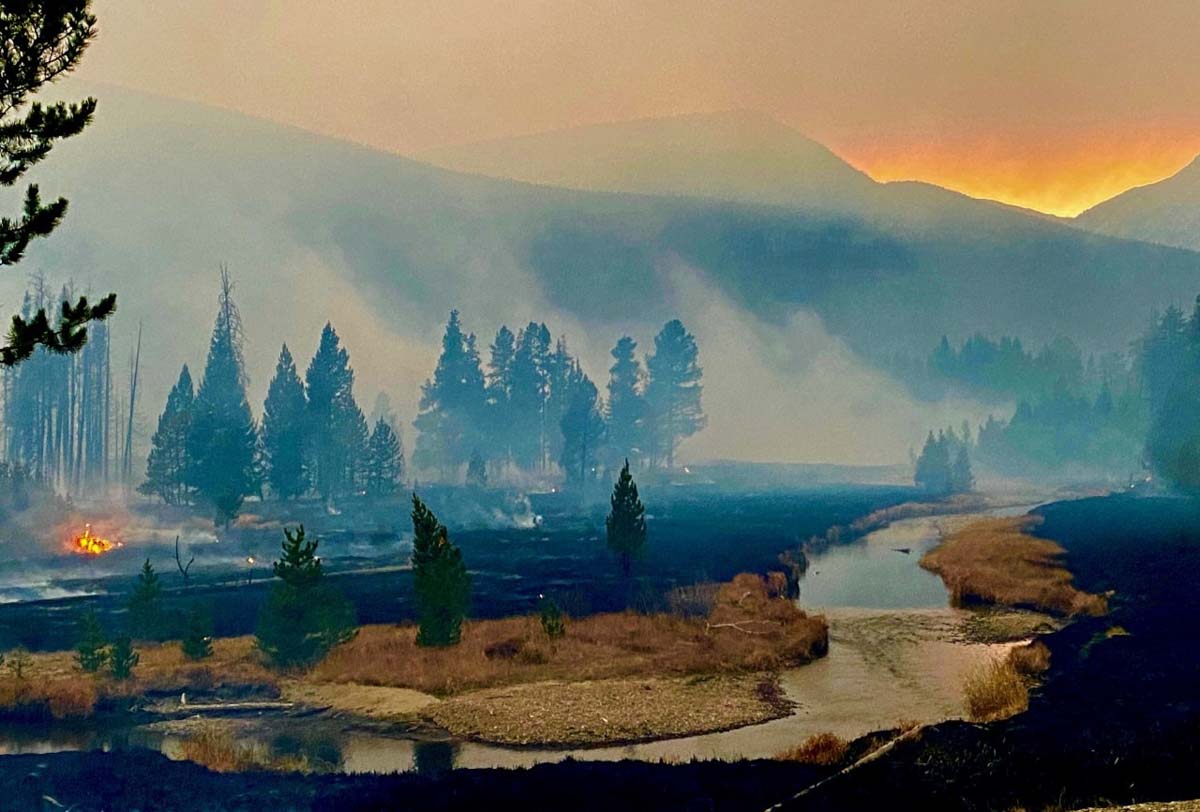
The NPS says this is Kawuneechee near Coyote Valley trailhead. NPS Photo.

The National Park Service said Friday that as a result in the East Troublesome Fire burning from Highway 34 into the west side of the park and across the Continental Divide a preliminary assessment indicates there appears to be some structure loss on the west side of the park, but an initial assessment indicates it is minimal.

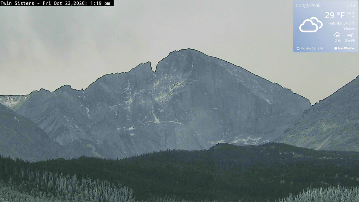
Due to the weather turning much colder and humid Friday on the east side of the Divide after the fire burned into the park, that portion of the fire, which is about 7 miles west of Estes Park, has laid down and is not very active. A weather station in the area recorded a low temperature of 16 degrees at 9:24 a.m. Friday. The photo below from an NPS camera shows ice or frost on some of the trees — conditions which are not conducive to rapid fire spread.

longs peak
NPS camera shows ice or frost on some trees at 1:19 p.m. MDT Friday October 23, 2020. NPS photo.

The forecast for Saturday near Estes Park is for 58 degrees, mostly sunny, 25 percent relative humidity, and 21 mph winds out of the west gusting to 32 mph. But beginning at sunset, rain followed by snow is expected which will continue through Monday, possibly amounting to about 9 inches of snow.

To see all articles on Wildfire Today about the East Troublesome Fire, including the most recent, click here.

Below is an excerpt from information released by the park Friday morning:

“The East Troublesome Fire had spotted [across the Continental Divide] approximately 1.5 miles from the head of Tonahutu Creek to the head of Spruce Creek. Low clouds contributed to the challenge of assessing where smoke was coming from. Park fire lookouts from near the Ute Trail along Trail Ridge Road were able to confirm a smoke column out of Spruce Creek. Due to the location of the fire in the lower Spruce Creek drainage and confluence of Forest Canyon, evacuations began for areas of Estes Park. Humidity levels yesterday greatly assisted in stopping the fire growth and it appears it has remained in that general location. It is in the same general area as the Fern Lake Fire of 2012.

“On the west side of the park, resources were focused on continual life and safety priorities and ongoing evacuations from the night before.  Numerous trees were down on the west side of Trail Ridge Road, north of the Green Mountain Trailhead, blocking that area as a means to evacuate on Wednesday night, October 21. Weather conditions on the west of the Continental Divide were very different than the east side yesterday, with low humidity and winds continuing to add to the fire growth. As of last night, the East Troublesome Fire had moved north of the Coyote Valley Trailhead.

“All of Rocky Mountain National Park remains closed.”

Kawuneecchee
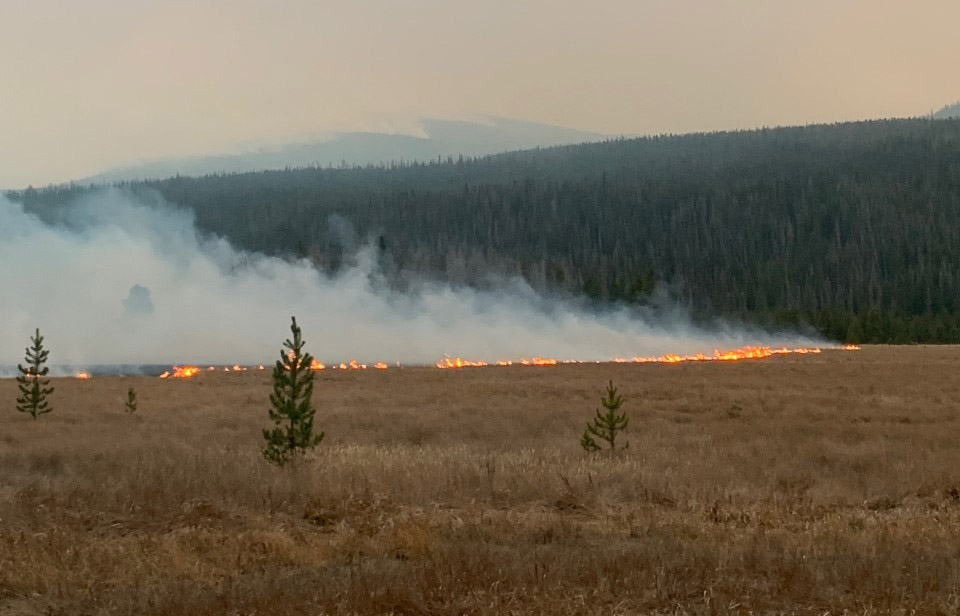
The NPS says this is Kawuneecchee near Coyote Valley trailhead. NPS photo.
Spruce and Forest Canyons
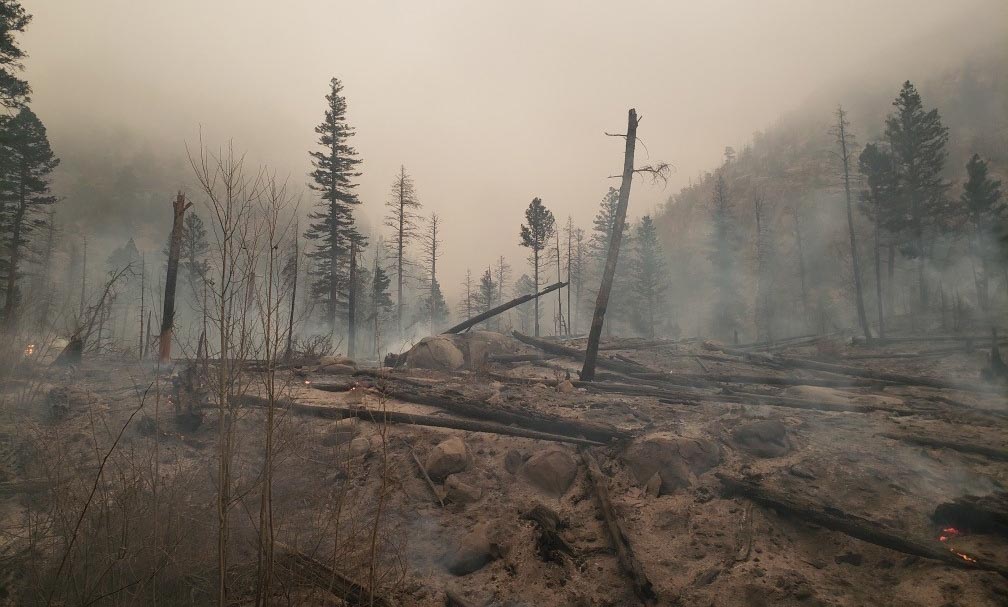
The NPS says this is the confluence of Spruce and Forest Canyons. NPS photo.

East Troublesome Fire grows to 170,000 acres

Becomes the second largest fire in Colorado’s history

Updated October 23, 2020   |   7:54 a.m. MDT

In a briefing Thursday evening the Incident Commander of the Type 1 Incident Management Team, Noel Livingston, said the 50,000 acres of additional growth of the East Troublesome Fire brought the size up to 170,000 acres.

He  confirmed that a spot fire crossed the Continental Divide and became established on the east side of Rocky Mountain National Park on the northwest side of Mt. Wuh. The spot fire stopped spreading when the temperature dropped to 30 degrees and the relative humidity increased to 89 percent as moisture came in from the east with a change in wind direction. The limited mapping that was done around and through clouds Thursday night showed that it had burned about 1,400 acres. Firefighting resources from the Cameron Fire to the north are assisting with this spot fire which is about 7 miles west of Estes Park.

To see all articles on Wildfire Today about the East Troublesome Fire, including the most recent, click here.

Grand County Sheriff Brett Schroetlin, who called the fire the “worst of the worst,” said Thursday morning there was “lots of structure loss,” but didn’t have details on how many had burned.

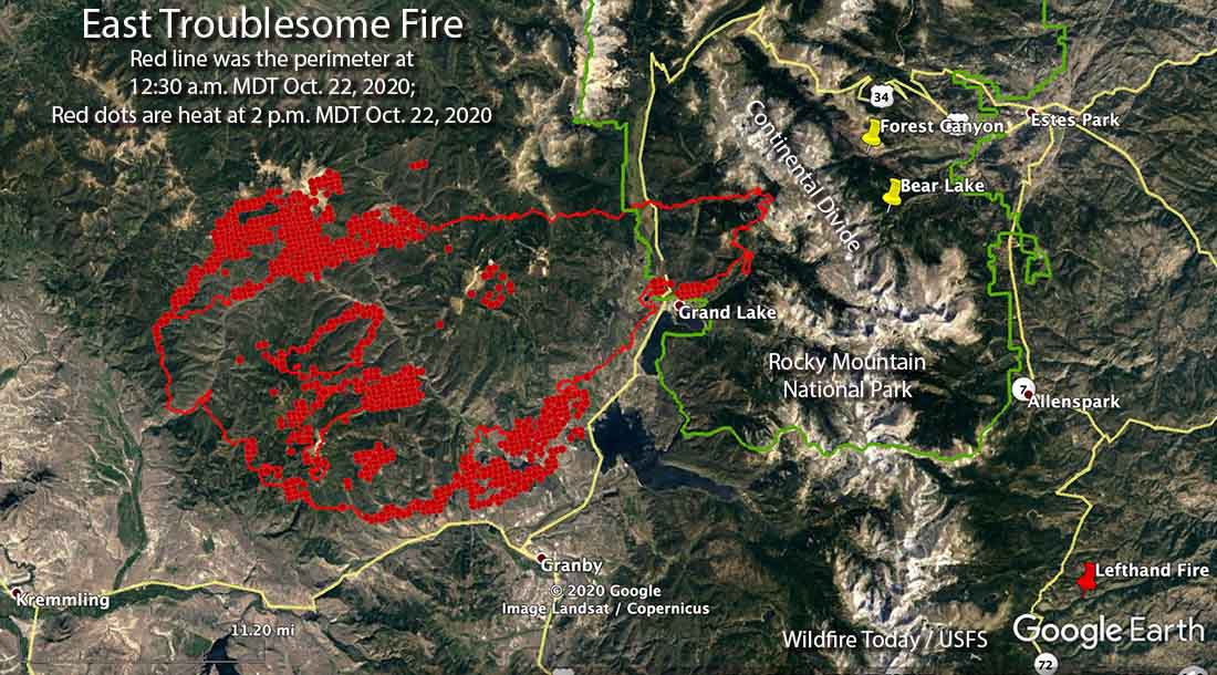
You can zoom in on the map above. The red line is the approximate perimeter of the East Troublesome Fire at 8:30 p.m. MDT October 22, 2020. However clouds over most of the fire partially blocked the view from the fixed wing aircraft that was mapping the fire. The white line was the perimeter at 12:30 a.m. MDT October 22, 2020. The red shaded areas represent intense heat, some of which is shown outside the perimeter line where clouds made it difficult to determine the perimeter.


Updated October 22, 2020   |   6:30 p.m. MDT

East Troublesome Fire map
East Troublesome Fire 2 p.m. MDT Oct. 22, 2020.

After reports of the East Troublesome Fire crossing the Continental Divide into the east side of Rocky Mountain National Park causing the evacuation of much of Estes Park, the community caught a break, however temporary it may be.

Paul Werth, Fire Weather Meteorologist, explained it in a comment below this article:

Good news for Estes Park! The first in a series of cold fronts has moved into the Estes Park area. Within the past few hours, the temperature at the Estes Park RAWS(NPS) has dropped to 30 degrees and the RH has jumped to 89%. The winds have also shifted from the SW gusting to 30 mph to an easterly direction of 10 mph or less. Weather stations a few miles to the west of Estes Park (elevation 8900 ft msl) also show cold temperatures and high RH with easterly winds. The high RH should moisten the 1 and 10-hr fuels to significantly diminish the threat of the fire moving into Estes Park.

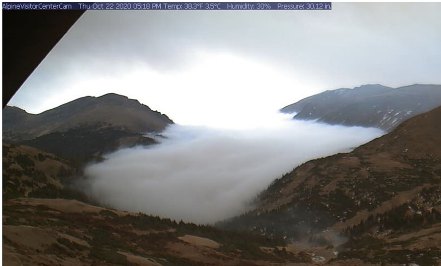
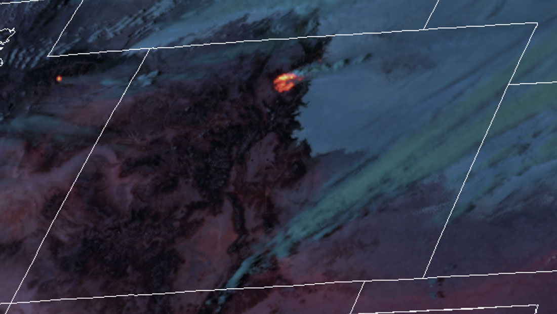
The satellite overflight at 2 p.m. Thursday did not detect any large heat sources east of the Continental Divide. This could be due to low clouds  which blocked detection by the satellite’s sensors. Park employees were heard on the radio Thursday talking about smoke that was mixed with fog, and the GOES 16 satellite showed what appeared to be low clouds or fog east of the Divide, while smoke from the main fire to the west was blowing to the east over the clouds.

Alpine Visitor Center in Rocky Mountain National Park
View from the Alpine Visitor Center in Rocky Mountain National Park at 5:18 p.m. MDT Oct. 22, 2020.

While there is a reduction in the fire activity east of the Divide, the rest of the fire was still active at 2 p.m. Thursday. In the Grand Lake area the wind shifted from coming out of the southwest, to coming from the south and south-southeast from 1 p.m. until 9 a.m. This allowed the activity on the north side to increase. As of 2 p.m. the fire had pushed to the north for about three miles to Parkview Mountain west of Highway 125. (see the map above)

The more moderate conditions in the Estes Park area are expected to last until Friday evening. There is even a 56 percent chance of precipitation in the area Thursday night. It could be back to the races again after 11 p.m. Friday with strong 17 mph winds out of the west gusting to 28 on Saturday, with the humidity in the 20s. Rain changing to snow is expected beginning Saturday evening.

West of the Continental Divide the winds will be moderate until picking up Friday afternoon, then becoming stronger Saturday — 20 mph out of the west gusting above 30 with the humidity in the 20s.


Updated October 22, 2020   |   2:44 p.m MDT

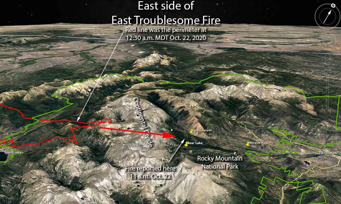
map east side of the East Troublesome Fire
3-D map showing the east side of the East Troublesome Fire with the spread across the Continental Divide. Looking northwest.
East Troublesome Fire satellite photo
The East Troublesome Fire as seen by the GOES 16 satellite at 2:26 p.m. MDT Oct. 22, 2020. Detections of heat have been enhanced.

Updated October 22, 2020   |   1:06 p.m. MDT

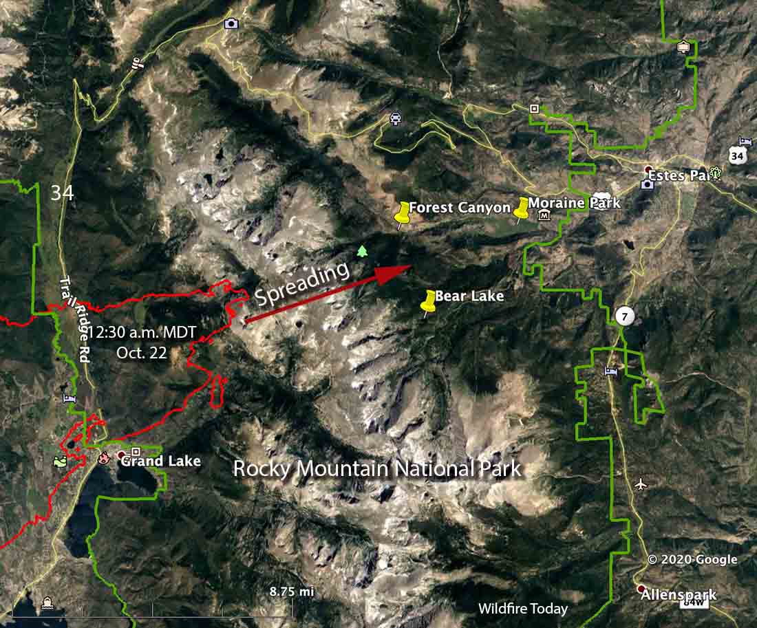
There are unofficial reports from individuals monitoring radio traffic that the East Troublesome Fire running to the east has jumped across the Continental Divide in Rocky Mountain National Park, which is 10,000 to 12,000 feet above sea level. Two of the locations that reportedly have fire is Bear Lake seven miles southwest of the town of Estes Park, and Forest Canyon which is west of Moraine Park.

Map East Troublesome Fire
Map of the east side of the East Troublesome Fire indicating the direction of spread. The red line was the perimeter observed during a mapping flight at 12:30 a.m. MDT Oct. 22, 2020.

Mandatory evacuation has been ordered for parts of Estes Park with the following boundaries: north border of Fall River Road, south border of Highway 36, west border of Elm Road, and the east border of Wonderview. The Larimer County webpage with information about the Cameron Peak Fire now has evacuation updates, including a map, for the east side of the East Troublesome Fire.

Grandby is not under a mandatory evacuation order, as of 1 p.m. Thursday.

Rocky Mountain National Park is closed.

We will update this article as more information is available.


Updated October 22, 2020   |   8:03 a.m. MDT

Map of the East Troublesome Fire
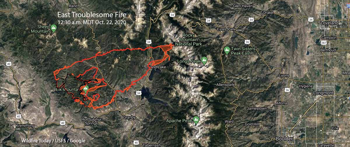
Map of the East Troublesome Fire at 12:30 a.m. MDT Oct. 22, 2020.

The East Troublesome Fire in Colorado grew six times larger Wednesday night. In a 28-hour period, from 8:55 p.m. October 20 to 12:30 a.m. October 22, it spread 19 miles increasing from 19,000 acres to 125,602 acres. (see the map above, and also the one below)

A mapping flight showed that it spread east across Highway 125, continued for 12 miles to Highway 34, and was last mapped 6 miles further east at the 12,000-foot mountains in Rocky Mountain National Park. At 12:30 a.m. Thursday it was about 10 miles west-southwest of Estes Park. The fire may have difficulty crossing the Continental Divide to get much closer to the town.

The community of Grand Lake on Highway 34 was impacted as well as areas west of Shadow Mountain Lake.

On the map below, you can zoom in and out.

When the fire was mapped Wednesday night the south side of the fire had not crossed Highway 40, remaining about one mile to the north. Overnight firefighters conducted a burning operation north of the highway, which was closed in the area at about 12:30 a.m. Thursday.

Evacuation orders and pre-evacuation notices are in effect.  Current evacuation information can be found at gcemergency.com, and at the Facebook page of the Grand County Sheriff’s Department.

The weather forecast indicates the fire could continue rapid growth until snow begins Saturday evening. Strong winds out of the west-southwest and west are predicted gusting to 37 mph Thursday, 22 Friday, and 39 on Saturday along with relative humidities in the 20s.

Pending legislation related to wildland fire

We endorse the bill to establish a federal wildland firefighter occupational series and a significant boost in their pay

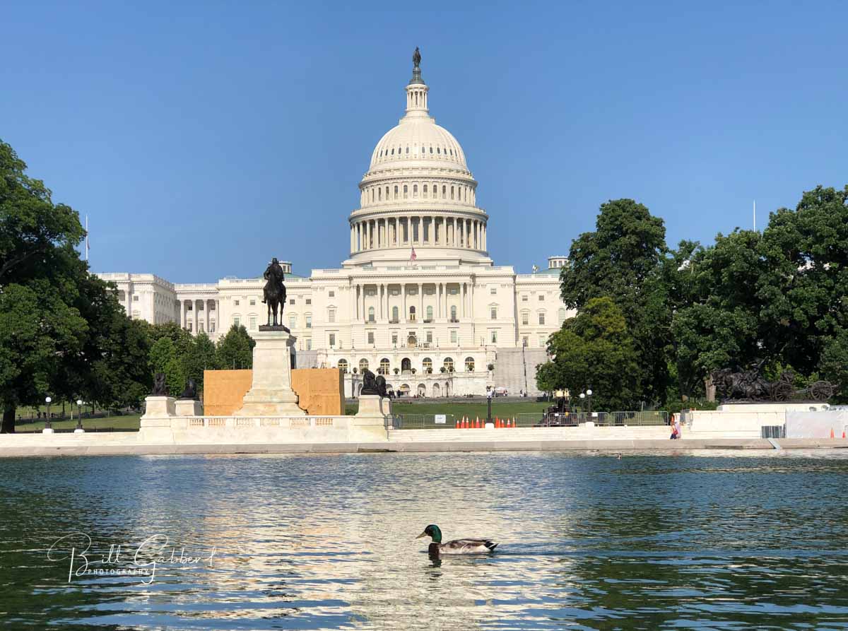
U.S. Capitol building

In a typical Congressional session only three to five percent of bills that are introduced are actually passed and become law. In this two-year session which is drawing to a close so far only one percent have reached that status. So we don’t get too excited when a bill is introduced that looks like it would be beneficial to wildland fire or land management.

Having said that, there are at least four pending pieces of legislation that have been introduced in the last few months that could be of interest to wildland firefighters.


Wildland Fire Mitigation & Management Commission Act of 2020
Senator Mitt Romney announced the bill October 15 and it has not yet been introduced. As described by the Senator in a press release, it would establish a commission of federal and non-federal stakeholders — including city and county level representation — to study and recommend fire mitigation, management, and rehabilitation policies for forests and grasslands.

The Commission would be jointly managed by the Secretaries of Interior, Agriculture, and Administrator of FEMA, and comprised of 25 members: 8 federal and 17 non-federal members.

It would develop two reports which would be presented to Congress:

  1. Recommendations to Mitigate and Manage Fires
  2. Firefighting Aircraft and Aircraft Parts Inventory Assessment

The fact that the Commission would not be dominated by or reporting to the U.S. Forest Service makes it an interesting concept.


National Prescribed Fire Act of 2020 –  S.4625
Introduced by Senator Ron Wyden of Oregon September 17, 2020, it has two co-sponsors and has not been referred to committee. I could not find a House version. It seeks to expand the use of prescribed fire on federal land. Up to $300 million would be appropriated each year beginning in FY 2022 based on requests from the Departments of Agriculture and Interior.

The funds could be used to carry out prescribed fire projects, hire additional personnel and procure equipment “including unmanned aerial systems equipped with an aerial ignition systems to implement a greater number of prescribed fires.” Also, to provide training, reseeding, and monitoring for fire effects.

It would authorize assistance to states and local governments:

“(A) to provide federally sponsored insurance administered by States, in conjunction with State- sponsored training and certification programs, for private persons implementing prescribed fires;
(B) to establish a training or certification program for teams comprised of citizens or local fire services to conduct prescribed fires on private land, consistent with any standards developed by the National Wildfire Coordinating Group or State prescribed fire standards;
(C) to enable additional fire managers and apparatus, whether provided by the local resources of an agency, private contractors, nongovernmental organizations, Indian Tribes, local fire services, or qualified individuals, to be present while implementing a prescribed fire”

The bill requires the Agriculture and Interior departments to carry out prescribed fires each year on 1,000,000 to 20,000,000 acres. It also requires, subject to the availability of appropriations, not later than September 30, 2022, the Secretaries shall each have carried out a minimum of 1 prescribed fire on each unit of the National Forest System, unit of the National Wildlife Refuge System, unit of the National Park System, and Bureau of Land Management district if the unit is at least 100 acres (with some exceptions).

It requires the hiring of additional personnel for conducting prescribed fires, authorizes noncompetitive conversions of seasonal firefighters to permanent, employment of formerly incarcerated individuals, establishment of training centers for prescribed fire, “managed-wildfire”, and a virtual prescribed fire training center.

The bill would establish by law that except in the case of gross negligence, a Federal employee planning or overseeing a prescribed fire that escaped– (1) shall not be subject to criminal prosecution; and (2) shall not be subject to civil proceedings, except in accordance with section 2672 of title 28, United States Code. It would also provide up to $1,000,000 to meet with state officials to discuss liability protection for state certified prescribed fire managers.


Emergency Wildfire and Public Safety Act of 2020S.4431 and H.R.7978
The Senate version was introduced September 16, 2020 by Senator Dianne Feinstein and has four co-sponsors. The House bill was introduced August 7, 2020 by Rep. Jimmy Panett and has nine co-sponsors. The Senate bill has only been introduced, while the House version has at least made it to committee.

It would require the USDA, in consultation with the Department of the Interior, to initiate three “forest landscape projects”, the definition of which is not more than 75,000 acres. The objectives would be to reduce the risk of wildfire, restore ecological health, and adapt the landscape to the increased risk of wildfire due to climate change.

The bill excludes certain forest management activities from environmental review requirements.

It authorizes the Secretary of Agriculture to declare that an “emergency situation” exists, which would then allow:

“(A) the salvage of dead or dying trees;
(B) the harvest of trees damaged by wind or ice;
(C) the commercial and noncommercial sanitation harvest of trees to control insects or disease, including trees already infested with insects or disease;
(D) the reforestation or replanting of fire- impacted areas through planting, control of competing vegetation, or other activities that enhance natural regeneration and restore forest species”


Wildland Firefighter Recognition ActS.1682 and H.R.8170
Introduced in the House September 4, 2020 by Rep. Doug LaMalfa, and in the Senate May 23, 2020 by Senator Steve Daines. The Senate bill has gone nowhere, and the House version is in committee.

This bill requires the Office of Personnel Management to develop a distinct wildland firefighter occupational series. The Department of the Interior and the Department of Agriculture must use the series in the advertising and hiring of a wildland firefighter.

The bill requires an employee in a wildland firefighter occupational series to receive a pay differential based on the unusual physical hardship or hazardous nature of the position.

An individual employed as a wildland firefighter on the date on which the occupational series takes effect may (1) remain in the occupational series in which the individual is working, or (2) be included in the wildland firefighter occupational series.


Wildfire Today strongly endorses S.1682 and H.R.8170 and the establishment of the wildland firefighter occupational series with a significant boost in their pay. These jobs are one of the most hazardous, and require a level of knowledge and skill that can take a decade or more to acquire and develop. Wildland firefighters are tactical athletes, special forces, some of whom work well over 100 hours a week with only a few days off each month, traveling around the country separated from their families missing birthdays, anniversaries, and soccer games. Recognizing them and paying what they deserve, could improve retention which could enhance the overall quality of the workforce.

If you have an opinion about these pieces of legislation, contact your elected officials. If you support the Wildland Firefighter Recognition Act, feel free to borrow some of the words in the previous paragraph when you contact your legislators.

East Troublesome Fire spreads east across Highway 125

Size estimated at 30,000 acres

Updated October 21, 2020   |   9:26 p.m. MDT

East Troublesome Fire map
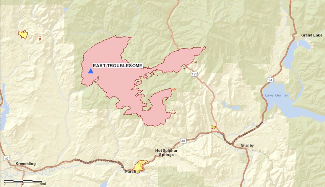
East Troublesome Fire at 6:50 p.m. MDT October 21, 2020.

The East Troublesome Fire made a big push to the east Wednesday afternoon and crossed Highway 125 at Cabin Creek (County Road 21) reaching a point just south of Little Gravel Mountain. It also crossed  northwest of Willow Creek Reservoir. The incident management team estimated Wednesday evening it had grown to almost 30,400 acres, an increase of 11,000 acres from Tuesday night’s mapping flight.

To see all articles on Wildfire Today about the East Troublesome Fire, including the most recent, click here.

Additional evacuations have been ordered. At 4:15 p.m. the Sheriff issued an evacuation notice for Area E; east of Highway 125 from milepost 5 to Highway 40. Highway 40 is open. Highway 125 remains closed.

More information about evacuations.

When the fire spotted across Highway 125 there was nothing firefighters could do to contain it at that location. The smoke from the main fire made it impossible for aircraft to work in the area and the fire behavior was too extreme for firefighters to work safely on the ground.

Aircraft on the southeast portion of the fire had to be shut down in the afternoon due to very strong winds.

Wednesday afternoon a weather station west of the fire recorded sustained 26 mph winds out of the west-southwest gusting at 32 to 40 mph with relative humidity of 11 percent. The Wednesday night forecast for the fire east of highway 125 calls for west-southwest winds of 16 gusting to 25 continuing into Thursday. The wind will decrease substantially Thursday night then increase again on Friday.

Five to seven inches of snow is expected beginning Saturday evening.

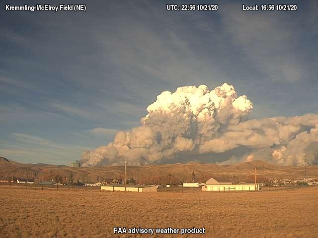
East Troublesome Fire
East Troublesome Fire at 4:56 p.m. MDT Oct. 21, 2020. As seen from Kremmling.

Updated October 21, 2020   |   8:33 a.m. MDT

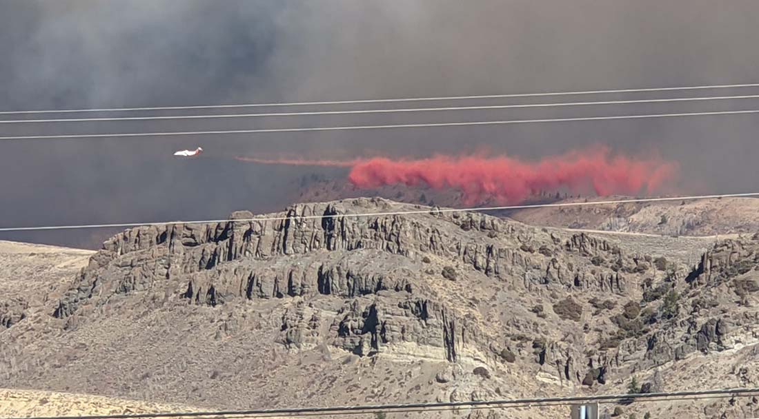
retardant drop on the East Troublesome Fire
A BAe-146 air tanker makes a retardant drop on the East Troublesome Fire. Photo by Cassie Goldgehn.

The East Troublesome Fire 11 miles northeast of Kremmling, Colorado was mapped Tuesday night as having grown to within about 2 miles of Highway 40 on the southeast side and approximately 1/2 mile from Highway 125 on the east side.

The mapping flight Tuesday night estimated the fire had burned about 19,000 acres.

Evacuation orders and pre-evacuation notices are in effect.  Current evacuation information can be found at gcemergency.com. Colorado Department of Transportation has closed Highway 125 north of Granby from milepost 5 to 27.


October 20, 2020 | 3:30 p.m. MDT

East Troublesome Fire
East Troublesome Fire Oct. 18, 2020. Inciweb.

Mostly sunny skies will dominate Tuesday on the East Troublesome fire 43 miles west of Boulder, Colorado. Low relative humidity indices and warm temperatures are producing near red flag conditions. Winds from the southwest will transition to the northwest in the afternoon at 15-20 mph with gusts to 30 mph.

Poor humidity recovery and strong winds continued to push the fire to the north and east to the Ethel Creek and East Troublesome Creek drainages Monday night. The fire is estimated at 15,546 acres with 293 personnel currently assigned.

On Tuesday aircraft will continue water and retardant drops on active areas in the north and southeast parts of the fire. Helicopters will engage in bucket work on the eastern side of the active fire front near Kinney Creek, Sawmill Creek, and the Highway 125 corridor protecting values at risk. A helibase is being established in Kremmling to support air operations.

Ground crews are tying lines together on the north side of the fire. Some resources have shifted to the southeast section of the fire to assist in containing spot fires and increasing structure protection efforts. A second structure protection group has been created specifically to install hose lays and sprinklers around structures along the Highway 125 and Highway 40 corridors. Crews are working to reinforce fire lines around Grouse Mountain using multiple strategies which could include tactical firing operations as conditions allow.

(The above is adapted from an update by the incident management team October 20, 2020.)

The fire is 11 air miles northeast of Kremmling. On Monday night it was active on the north and east sides, but was most active on the southeast side 4 miles north of Hot Sulphur Springs. It was about a mile west of Highway 125.

Fires are usually named after a nearby landmark. In this case it was East Troublesome Creek.

Updated map of the Calwood Fire northwest of Boulder, Colorado

Firefighters have slowed the spread

October 20, 2020   |   8:56 a.m. MDT

On Monday the Calwood Fire northwest of boulder grew a relatively small amount on the west and northwest sides. An overnight mapping flight updated the size to 9,365 acres.

On the map above the red line is the perimeter of the Calwood Fire at 9:15 p.m. MDT Oct. 19, 2020, mapped by a fixed wing aircraft. The red shaded areas represent intense heat at that time. The small black line was the perimeter about 24 hours before.