Lawsuit filed against Southern California Edison for allegedly causing the Rey Fire

The fire burned over 32,000 acres north of Santa Barbara in 2016

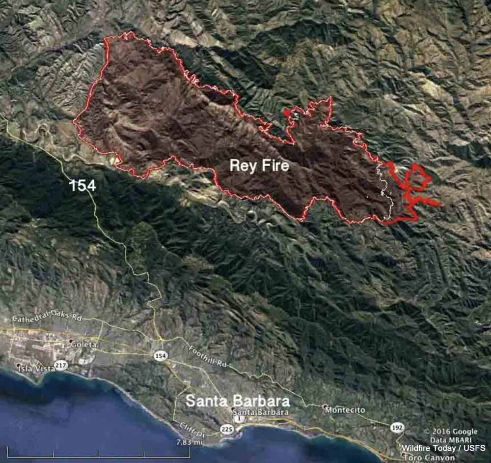
Map Rey Fire August 25 2016
Map of the Rey Fire. The red line was the perimeter at 10 p.m. PDT Aug. 25, 2016. The white line was the perimeter at 10 p.m. PDT Aug. 23.

The federal government has filed a lawsuit against Southern California Edison and two other companies for allegedly allowing the Rey Fire to ignite north of Santa Barbara, California on August 18, 2016. The complaint that was filed in U.S. District Court August 17, 2019 contends that of the 32,606 acres that burned in the fire, 19,752 acres were within the Los Padres National Forest. Also named in the lawsuit were Frontier Communications (a telecommunications company) and Utility Tree Service (a tree trimming company).

The fire started when a tree fell on power and communications lines. The court document states, “SCE and UTS were informed of the potential danger the tree that fell on the subject lines posed, were aware of the danger that said tree might fall on the subject lines before it fell, and failed to take any action to prevent it from falling on the subject lines.”

The filing says Frontier failed to, “…maintain proper vegetation clearance around and below its communication lines, and using a device, including its communication lines and equipment, which may cause a fire and failure to take reasonable precautions to avoid starting and spreading a fire.”

The Government alleges SCE violated the terms of its Special Use Permit for the powerlines by “…failure to prevent damage to the land and property of the United States; to take reasonable precautions to prevent and suppress fires; to construct, maintain and operate its equipment and power lines in a safe and effective working order; and to properly and safely maintain, operate, use and occupy the premises of National Forest System lands.”

On the date the suit was filed, SCE had not paid any of the suppression or rehabilitation costs which amounted to more than $26 million.

In addition to those costs, the Government hopes to recover costs of “wrongful injury to [National Forest] trees, loss of timber and vegetation, loss of habitat and environmental damages, damage to the soil, loss of use, scenic views, and aesthetic values”, in an amount to be determined at a trial by jury.
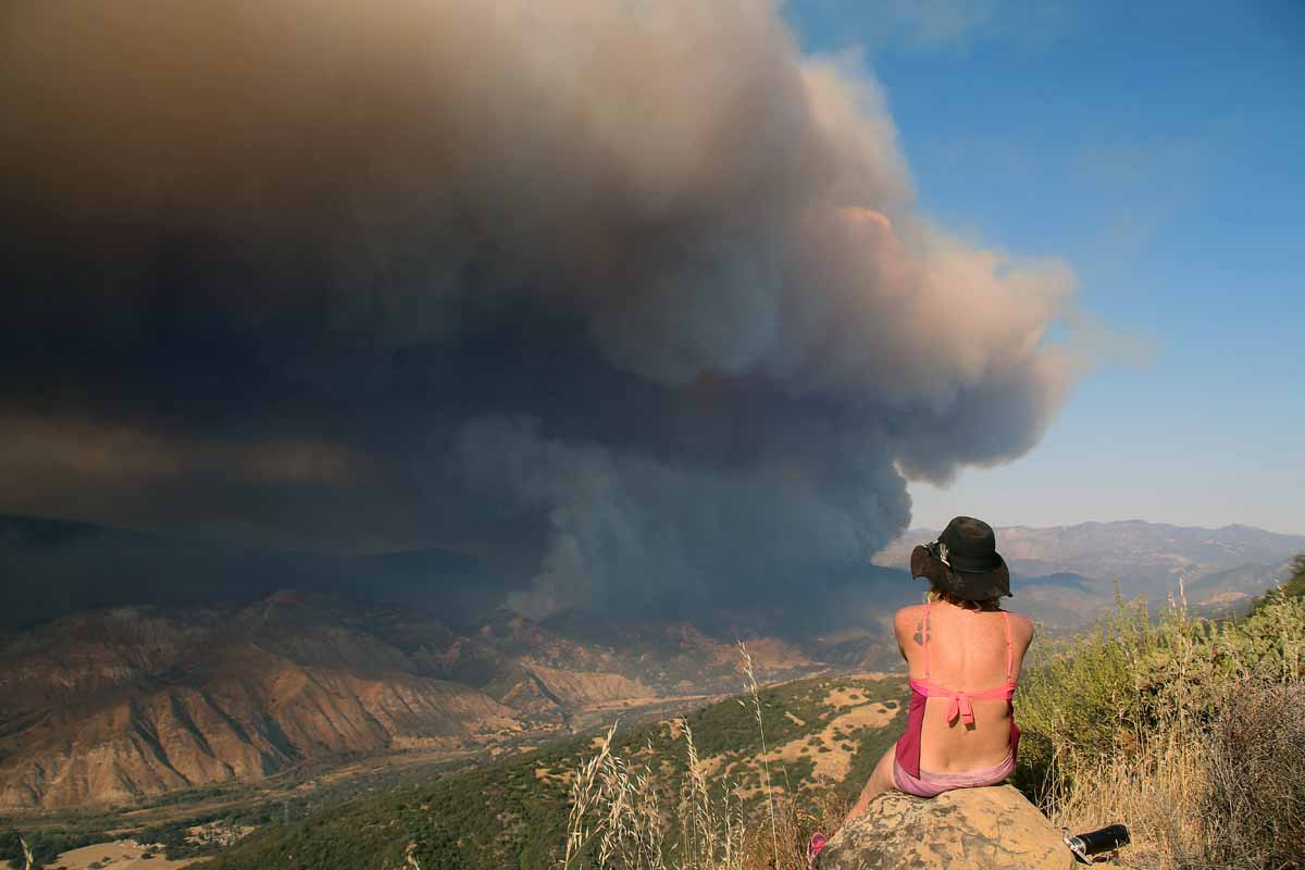
Rey Fire.
Rey Fire, August 21, 2016. Photo by Jeff Zimmerman.


Pedro Mountain Fire burns over 19,000 acres near Pathfinder Reservoir in Wyoming

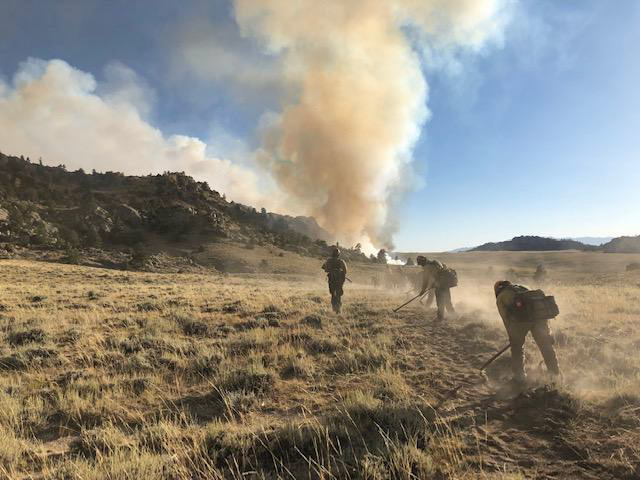
Pedro Mountain Fire line construction
Firefighters construct fireline in preparation for burnout operations on August 28, 2019. Photo by Andrew Maue, Laramie Peak Fire Zone.

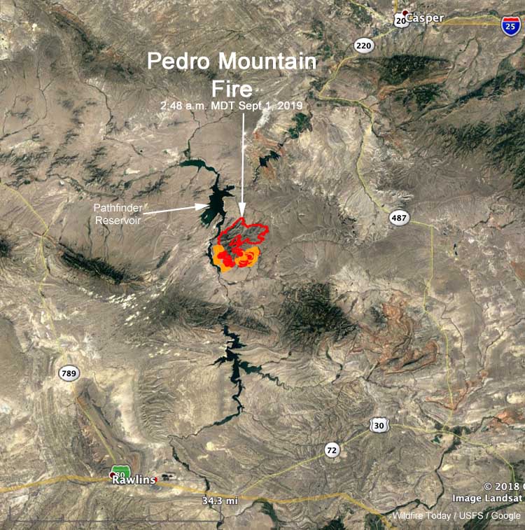
Since the Pedro Mountain Fire started from a lightning strike August 24 it has burned over 19,000 acres in southeast Wyoming. The fire is just east of the Pathfinder Reservoir, 37 miles northeast of Rawlins and 39 miles southwest of Casper. Evacuations are in effect for some areas.

From InciWeb:

Saturday’s Summary
Four hotshot crews, assisted by initial attack crews, completed a large and successful burn operation throughout the southern half of the fire on Saturday. The control line stretched for several miles, including Gooseberry Canyon and areas just west of Carbon County Road 291. This reduced the amount of vegetation in the fire’s path and is a key strategy in the effort to protect homes and property.

Sunday’s Operations
While some crews will continue working in the area of yesterday’s successful efforts in the south, other firefighters and engines will be rerouted to the northeast corner near Rocky Gap, where infrared flights show pockets of heat with the potential to spread to uncontrolled fire line. Fire prediction tools used by the incident management team show the fire has the most potential to spread to the east/northeast in the next 24 hours, based on weather and topography. Addressing these hot spots will limit significant fire growth and assist in closing up the containment line.

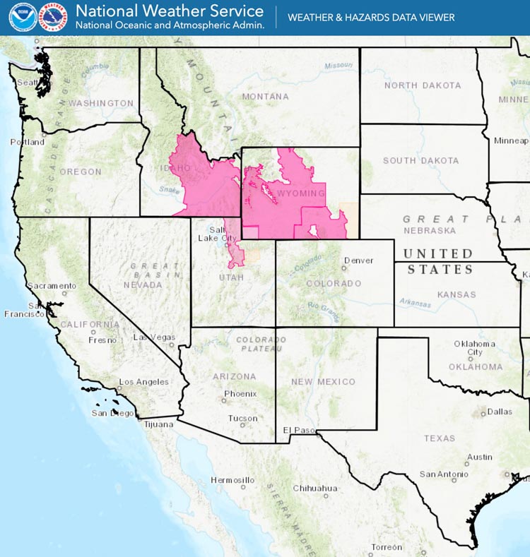
Crews are working under red flag warning conditions again today, with temperatures in the 90s, low humidity, and strong winds.

The evacuations and closures listed below remain in effect because firefighters are still engaged in efforts to stop the fire from spreading. With uncontrolled lines, the fire has potential to move to the east and south, putting fire and smoke closer to County Road 291. With well over 400 personnel on the fire, large numbers of crews and apparatus need to move unimpeded throughout the fire zone. The incident management team understands the public’s interest in returning to the area and will begin discussing plans with the Carbon County Sheriff’s Office to allow residents access to their homes and properties in a timely manner as soon as the area is safe from further fire spread and other impacts.

Map location Pedro Mountain Fire
Map showing the location of the Pedro Mountain Fire at 2:48 a.m. MDT September 1, 2019.

Closures / Public Safety
Evacuations are still in place for the following areas: Pedro Mountain Estates, Pedro Mountain Ranch Road, and Cardwell Ranch.

Natrona County Road 407 / Carbon County 291 (also known as Kortes Road) is closed from the intersection of Natrona County 408 (also known as Fremont Canyon) south to Leo/Sage Creek until further notice due to fire operations and public safety. The closure includes all roads west of the above location to Pathfinder Reservoir.

Incident Commander addresses issue of motorists driving through intense wildfire

The Swan Lake Fire has burned over 162,000 acres south of Anchorage

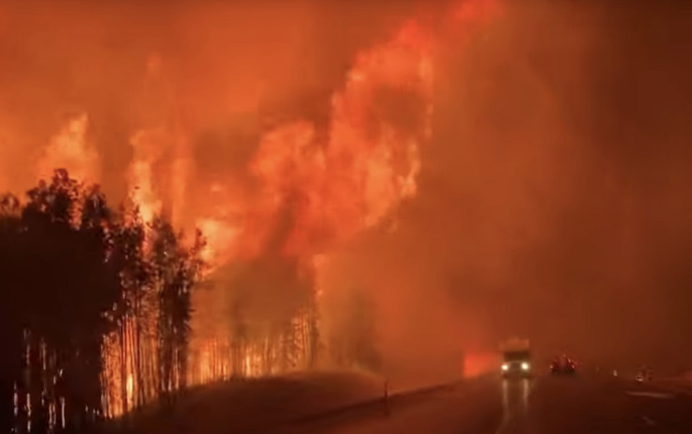
flames fire Sterling Highway
Driving along the Sterling Highway, August 26, 2019.

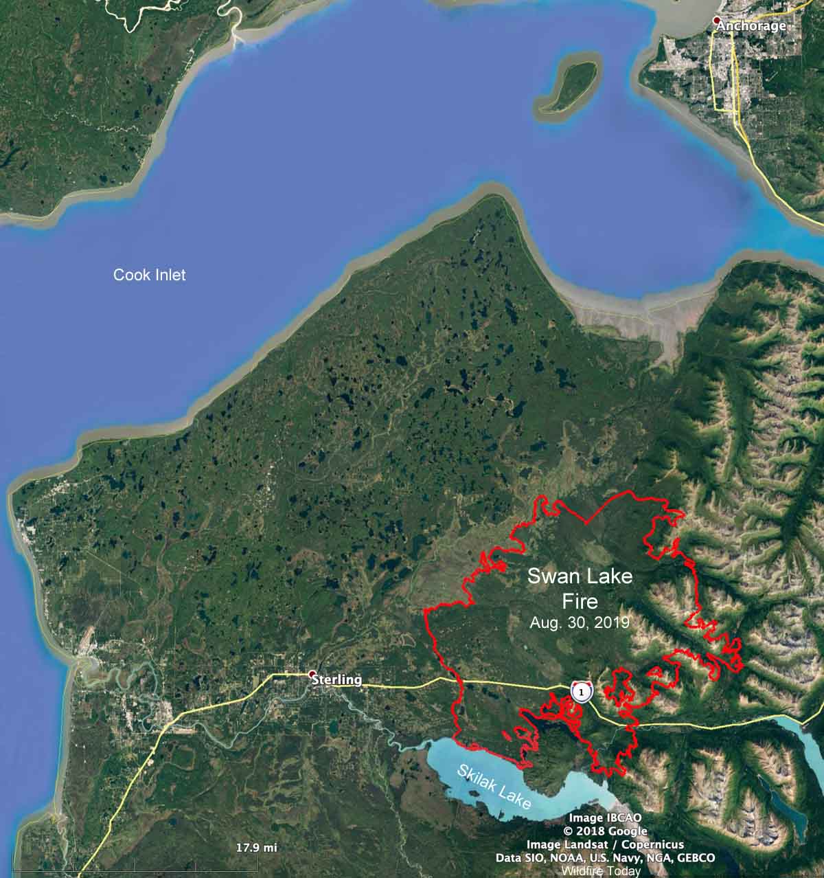
The Swan Lake Fire, ignited by lightning on June 5, is being managed but not fully suppressed on the Kenai Peninsula 28 air miles south of Anchorage, Alaska. On August 17 it spread south across the Sterling Highway and has now grown to over 162,000 acres.

Map Swan Lake Fire August 30, 2019
Map of the Swan Lake Fire, August 30, 2019. Perimeter provided by the Incident Management Team. Map compiled by Wildfire Today.

The Sterling Highway, Alaska Route 1, is a major thoroughfare that goes south from Anchorage down the Kenai Peninsula to Sterling, Soldotna, and Homer. During the night of August 25 some motorists on the highway found themselves driving past a crowning timber fire that was approaching the highway with what looked like 50 to 75-foot flames that were in some cases very close to the road. Some drivers said traffic alternated between slow rubber-necking and then rapid acceleration where flames were near, adding another variable to the smoke and dodging construction barriers.

Warning — the video below has strong language.

?? Swan Lake ? ?sorry for the F bombs buuut we were ?!! the Peninsula is still burning!! DRIVE SAFELY!!! from r/alaska

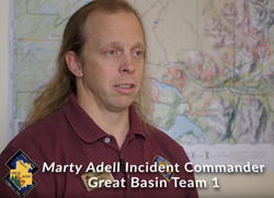
Marty Adell Incident Commander Swan Lake FireAfter travelers reported on social media some of their experiences driving past the flames, the Incident Commander of the Swan Lake Fire produced a video to shed some light on the incident. He explained the conditions on the highway were “constantly monitored” for fire and smoke hazards. He said at one point they closed the highway but before they could completely sweep that section some travelers were still in the area with active fire.

Miami has armored vehicle for high water, high winds, & active shooter incidents

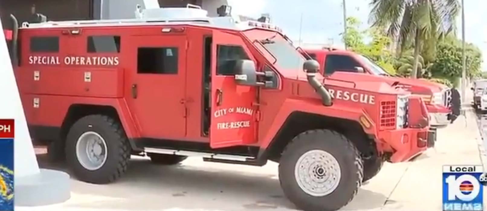
Miami fire department armored vehicle
Miami Fire Department’s armored truck. From ABC 10 video.

The Miami Fire Department has acquired an armored truck that can be used for incidents involving high winds, high water, and active shooters. Since we are seeing more of these types of emergencies it might be very useful.

The video lays out the details, including the body armor labeled “FIRE”.

Miami fire department armored vehicle bullet proof vests
Body armor for firefighters in the armored truck.Miami Fire Department’s armored truck. From ABC 10 video.
Miami fire department armored vehicle
Changing a tire appears to be complicated.Miami Fire Department’s armored truck. From ABC 10 video.

Evacuations lifted at Gun Range Fire

The fire burned 365 acres at Bountiful and Centerville, Utah August 30

Gun Range Fire
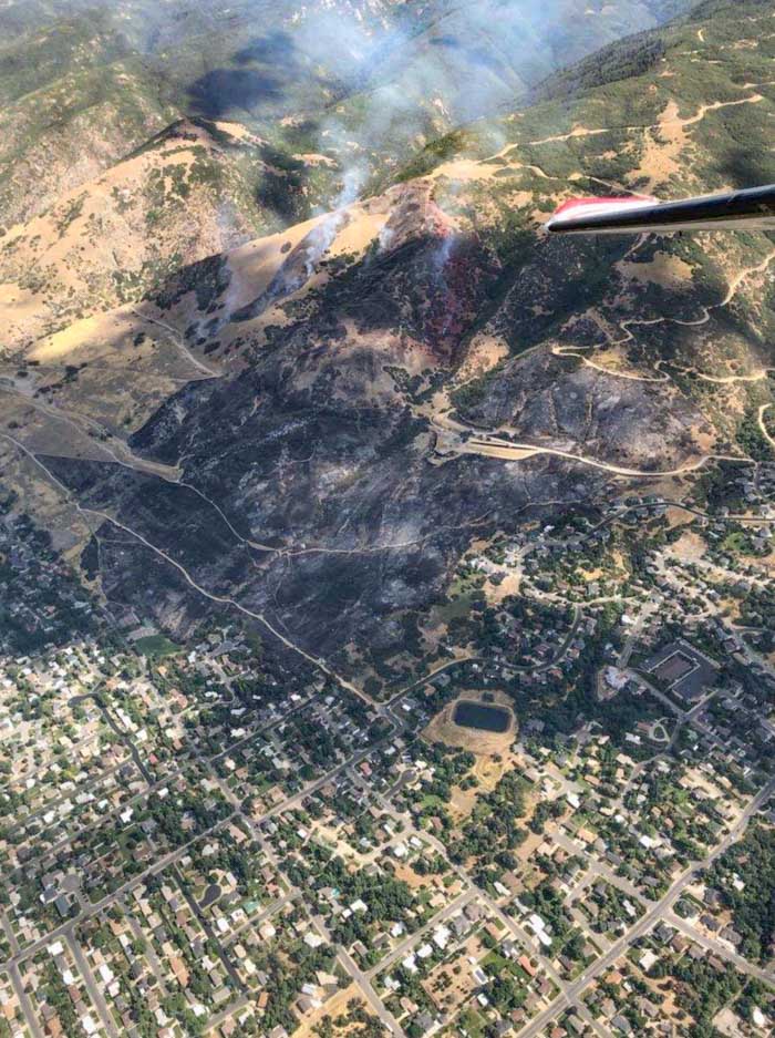
The Gun Range Fire started August 30, 2019 in a wildland-urban interface. Photo provided by Utah Fire Info.

The last of the evacuation orders were lifted Saturday morning by the Bountiful Police Department for the areas near the Gun Range Fire that burned 365 acres near Bountiful and Centerville, Utah Friday.

Officials with the Uinta-Wasatch-Cache National Forest said the fire started from an abandoned campfire believed to have originated above the Lions Gun Range in Bountiful. Authorities are searching for two individuals in a small SUV.

The photo above shows that the fire, which destroyed three homes, occurred in a wildland-urban interface. It appears that firefighters succeeded in keeping that number lower than it could have been.


More information about the Gun Range Fire at Bountiful.