Goose Point Fire burns over 6,000 acres southwest of Provo, Utah

Posted on Categories UncategorizedTags

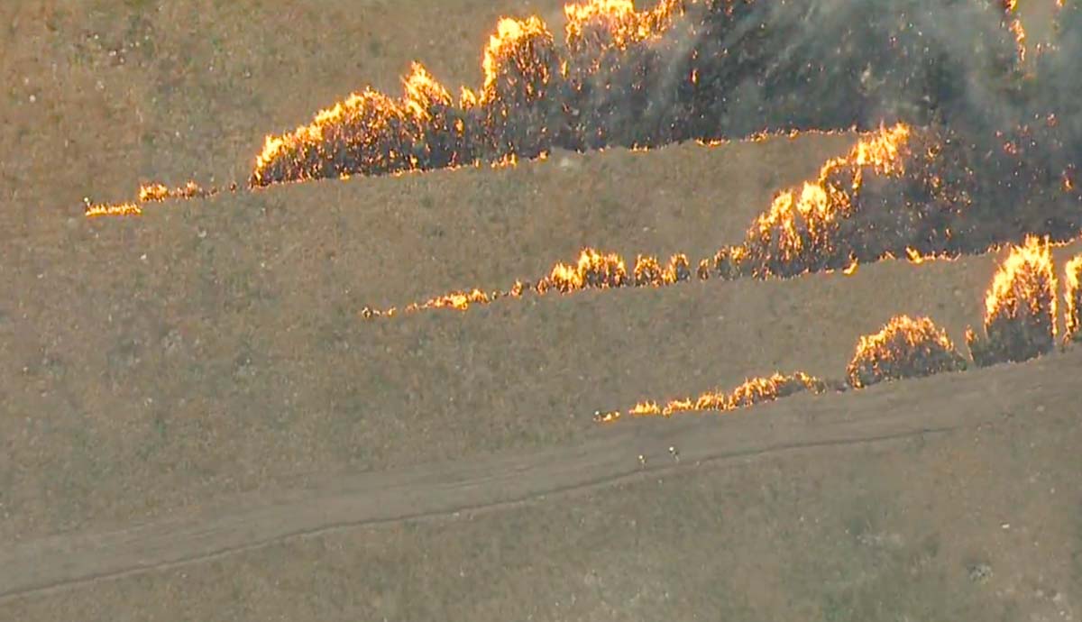
Firefighters fought fire with fire

Goose Point Fire Provo, Utah burnout
Firefighters burn out from a dozer line on the Goose Point Fire southwest of Provo, Utah. Screenshot from KSL 5 TV video.

The Goose Point Fire grew quickly when it started late Wednesday afternoon on West Mountain 11 miles southwest of Provo, Utah. After it burned through the night, firefighters on Thursday worked with dozers to fight fire with fire — burning the fuel between dozer lines and the main fire. At 11:00 a.m. Thursday firefighters using GPS equipment mapped it at 6,451 acres and soon thereafter stopped the spread.

The preliminary cause is machinery that was operating in the area, according to Dave Vickers, an area fire management officer with the Utah Division of Forestry, Fire and State Lands.
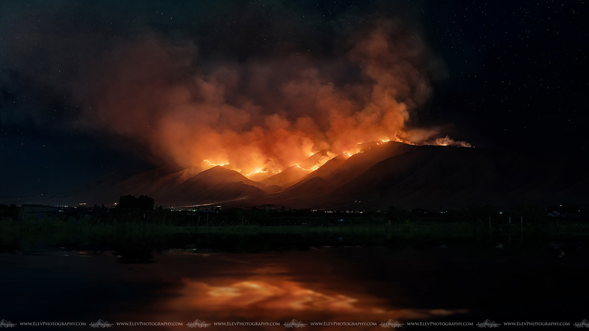
Goose Point Fire Provo, Utah
Goose Point Fire on West Mountain. Photo by Jocelyn Marie Cooley.
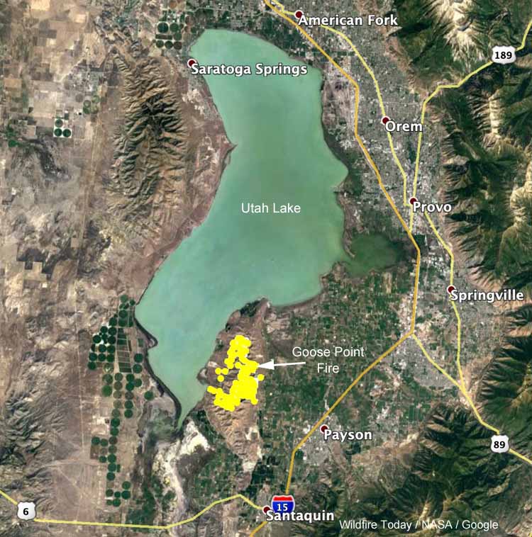
map Goose Point Fire Provo, Utah
Map showing the location of the Goose Point Fire southwest of Provo, Utah.

The KSL 5 TV video footage below has some excellent shots of the Goose Point Fire.

Mountain Fire causes evacuations northeast of Redding, California

The fire is 4 miles east of the community of Shasta Lake

map Mountain Fire Redding California
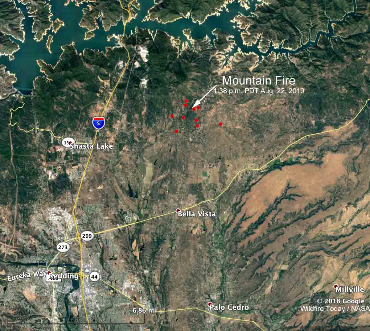
The red dots represent heat detected on the Mountain Fire by a satellite at 1:38 p.m. PDT August 22, 2019. Click to enlarge.

The Mountain Fire is causing evacuations in Northern California, northeast of Redding. The fire is 4 miles east of the community of Shasta Lake and is north of Highway 299.  At 1:38 p.m. PDT most of the fire was between Bear Mountain Road and Dry Creek Road, an area with many structures.

It was reported at noon on Thursday and by 2:40 p.m. had burned approximately 600 acres. Later in the afternoon Air Attack estimated the size at 820 acres.

Pacific Gas and Electric shut off the power to about 1,200 customers.

By 5:50 p.m. PDT the radio traffic on the incident had slowed considerably, which often indicates the spread of the fire has slowed as well. It was first burning in timber and other heavy fuels but some portions moved into lighter vegetation that provided less resistance to control, and where aircraft could be more effective.

The Shasta County Sheriff’s Office has a lengthy list of areas under evacuation orders. The evacuation center is at Crosspointe Community Church, 2960 Hartnell Road, Redding CA. According to the Sheriff’s  Office, 1,110 structures are threatened and 3,885 residents have been evacuated.

Three central Arizona fires total over 14,000 acres

Sheridan, Boulin, and Saber fires, all within 70 miles of Flagstaff

maplocation of wildfires Arizona Sheridan Saber wildfires
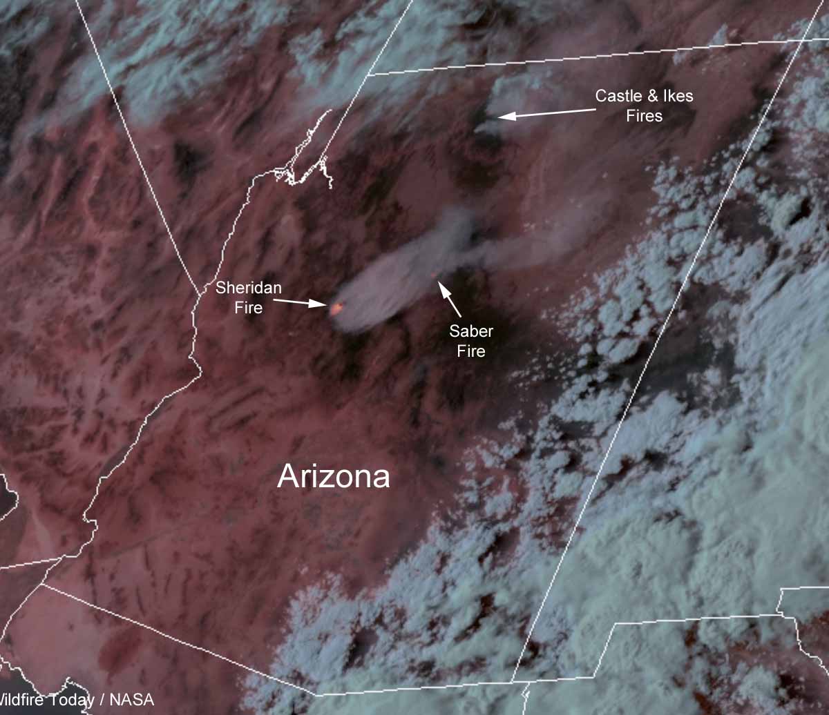
GOES 16 satellite photo (enhanced with infrared imagery) showing smoke generated by wildfires in Arizona at 6:46 p.m. MDT August 21, 2019.

Three wildfires in Central Arizona have burned a total of more than 14,000 acres. All of the fires are being managed, rather than suppressed, in order to enhance the natural resources.

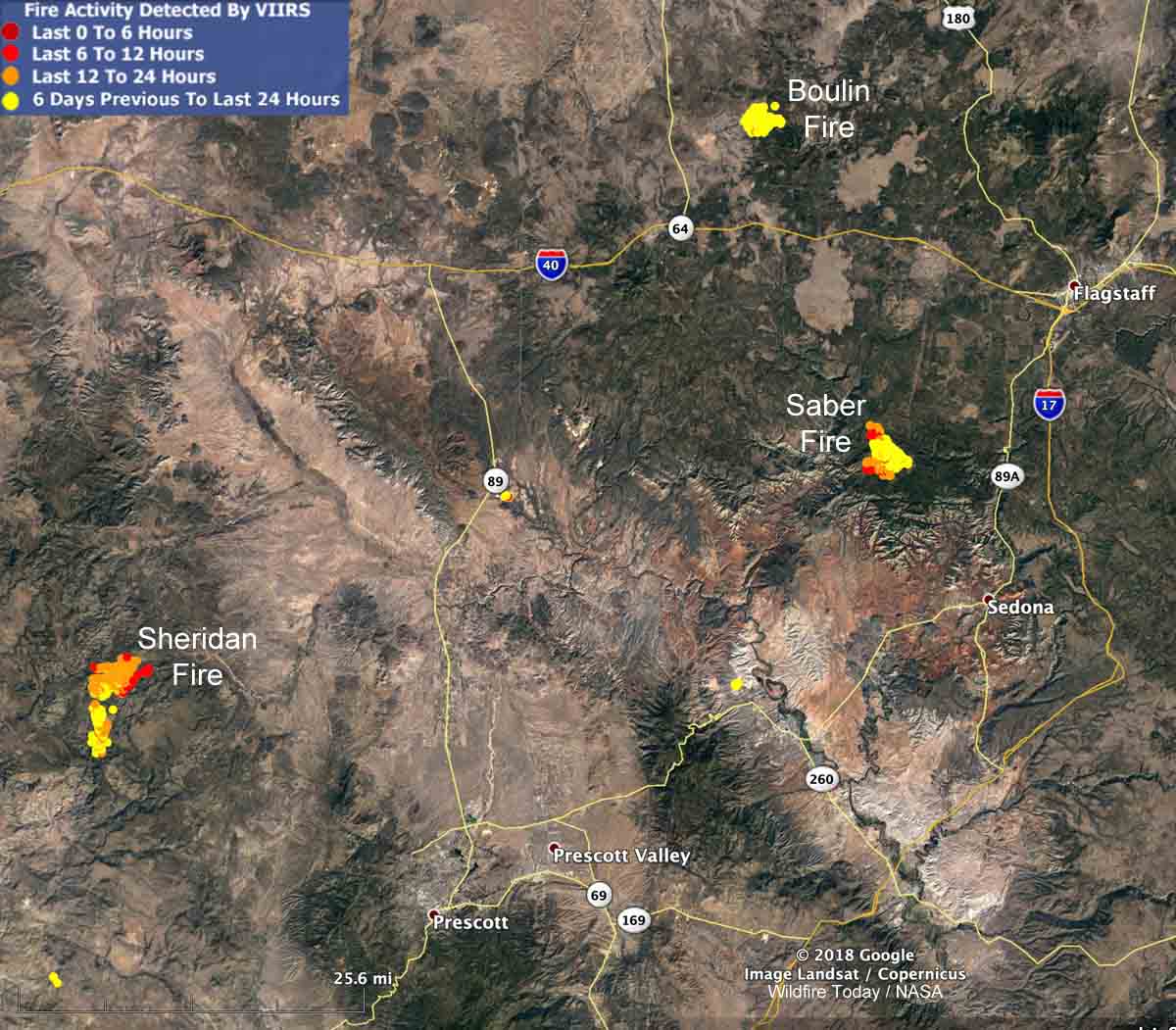
The Sheridan Fire 26 miles northwest of Prescott is by far the most active of the three, more than tripling in size over the last two days. (See map below) The fire behavior is described as extreme, with running, wind-driven runs, and short-range spotting. A mapping flight early Thursday morning found that the lightning-caused fire had burned 8,594 acres. About 75 percent of the fire is being monitored while 25 percent is under a point protection strategy, suppressing or retarding the spread in order to protect specific sites.

The Saber fire, also started by lightning, has burned 2,093 acres 16 miles southwest of Flagstaff. Very little current information is available about this incident.

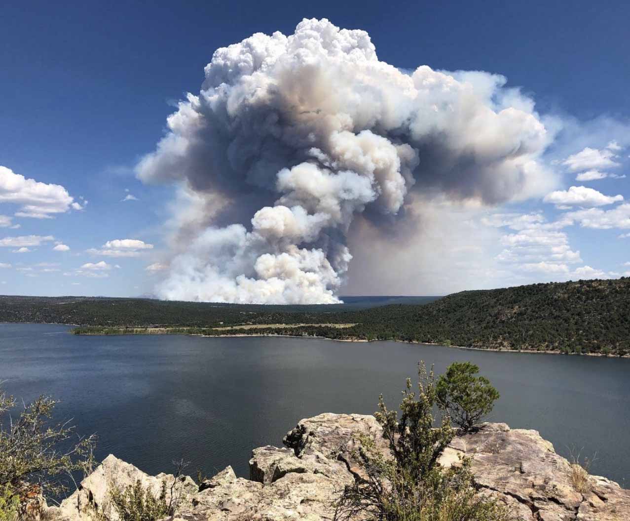
The 3,900-acre Boulin Fire 24 miles northwest of Flagstaff has calmed down considerably after putting up a large column of smoke on August 20.

Map location of wildfires in Arizona Sheridan Saber wildfires
Map showing the location of wildfires in Arizona at 4:24 a.m. MDT August 22, 2019.

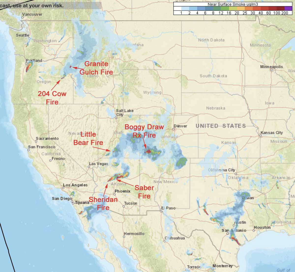
Wildfire smoke map, August 21, 2019

States affected include Washington, Idaho, Utah, Colorado, New Mexico, Arizona, Alaska, and Texas

Boggy Draw prescribed fire
The Boggy Draw prescribed fire north of Dolores, Colorado at 12: 51 p.m. August 20, 2019. U.S. Forest Service photo.

While currently there are not a great many active wildfires in the lower 48 states, the ones that are burning are creating a surprising amount of smoke.

Smoke from wildfires in Texas is expected to move into the Austin, Dallas, and Fort Worth areas Wednesday afternoon.

wildfire fire smoke August 21, 2019
Forecast for the distribution of smoke at 6 p.m. MDT August 21, 2019. NOAA data, fire labels by Wildfire Today.

Ignition on the Boggy Draw prescribed fire in the San Juan National Forest north of Dolores, Colorado is complete, but the fire is still producing smoke. The Colorado Department of Public Health and Environment issued a statement Wednesday, saying,  “Light-to-moderate impacts are expected in the immediate vicinity of the fire. No public health concerns are anticipated at this time.”

We don’t have a smoke map for Alaska but smoke from local fires is expected to plague residents of Anchorage until this weekend.

How to configure a Heavy Equipment Task Force

Posted on Categories UncategorizedTags ,

As used in the Northern Rockies

(Above: screenshot from the video below)

The Northern Rockies Coordinating Group worked with the Montana Logging Association to create this video to educate fire managers about the concept and configuration of Heavy Equipment Task Forces used on timber fires in the Northern Rockies Geographic Area.

The task forces can be configured with the following pieces of equipment:

  • Feller buncher
  • Rubber tired skidder
  • Type 2 Dozer
  • Drop tank skidgen or pumper cat
  • Transport trucks
  • Optional: excavator, boom-mounted masticator, or a second feller buncher

The first 8 minutes and 15 seconds covers how the task forces are organized and fit into the incident management organization. The rest goes into detail about the capabilities of each category of equipment.

The anonymous producer, director, editor, and videographer obviously put a great deal of work into creating this video, using dozens and dozens of clips that clearly illustrate everything mentioned in the narrative. They should get the credit they deserve.


(If the embedded video does not appear above it may be because the Northern Rockies Geographic Area file was moved. If that happens and you know the new location, let us know.)

Thanks and a tip of the hat go out to Eric. Typos or errors, report them HERE.