Updated 1:39 p.m. MDT July 5, 2022
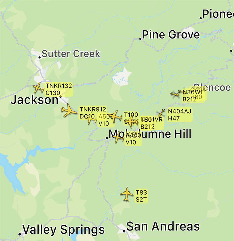
The activity on the Electra fire southeast of Jackson, California has been increasing since noon Tuesday. Several air tankers are dropping retardant, including a DC-10, MD-87, C-130, and S-2T.
The Amador County Sheriff’s office has created an online map showing the areas under evacuation orders.
To see all articles on Wildfire Today about the Electra Fire, including the most recent, click HERE.
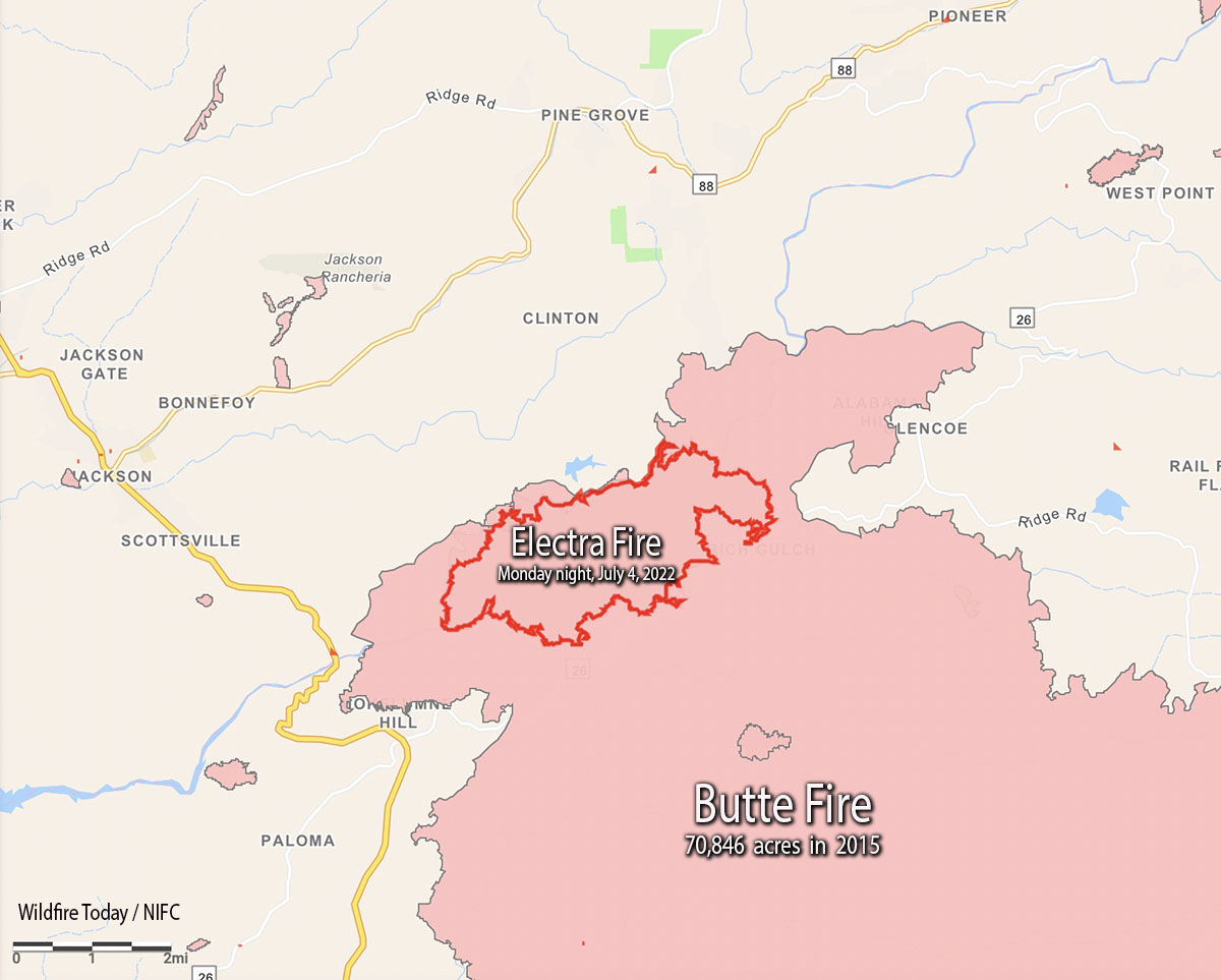
As of the Monday night mapping data, the Electra Fire has been burning entirely within the footprint of the huge Butte Fire that blackened more than 70,000 acres in 2015 while leading to two deaths and 135 destroyed homes.

Resources working the fire include 128 engines, 22 water tenders, 33 dozers, 39 hand crews, and multiple aircraft.
On Monday approximately 100 recreational visitors and PG&E employees had to shelter in the Electra Powerhouse, but were safely evacuated from the area by 9:30 p.m.
The control objectives are to keep the fire east of Hwy. 49, south of Hwy. 88, north of Jesus Maria Road, and west of Hwy. 26 and Railroad Flat Road.
About 450 structures are threatened.
The weather at the Golden Chain Highway weather station south of Jackson at 1:20 p.m. Tuesday was 80 degrees, 49 percent relative humidity, and 6 mph winds out of south gusting to 12 mph. The forecast is for the RH to drop to about 40 percent by late afternoon. Monday afternoon while the large convection column was raging, the nearby weather stations recorded a minimum RH of around 60 percent — remarkably high for such vigorous fire behavior.

Updated 5:25 a.m. PDT July 5, 2022
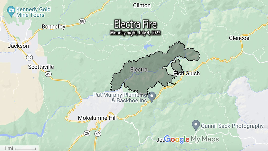
The Electra Fire 5 miles south of Jackson, California grew substantially Monday evening and into the night, but the activity slowed in the very early hours of Tuesday. Most of the growth was on the north and east sides after it crossed the Mokelumne River and reached highway 26 near Rich Gulch.
The FIRIS mapping crew estimated the size at 3,034 acres at about 1 a.m. Tuesday.
6:00 p.m. MDT July 4, 2022
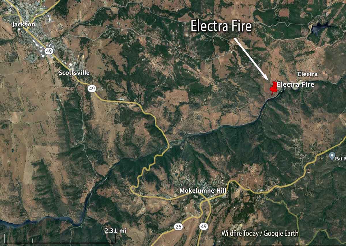
The Electra Fire that started Monday afternoon near Electra Road approximately 5 miles southeast of Jackson, California has prompted evacuations. At 5:06 p.m. a mapping aircraft estimated the size at nearly 390 acres. It is on both sides of the Mokelumne River.

At 5:36 the Amador County Sheriff Office said a mandatory evacuation order has been issued for all residents in the Butte Mountain Road area. Butte Mountain Road will be closed except for egress purposes.
An evacuation warning is in effect for all residents in a two mile radius around Lake Tabeau.
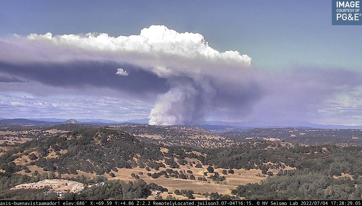
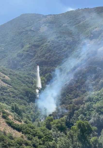
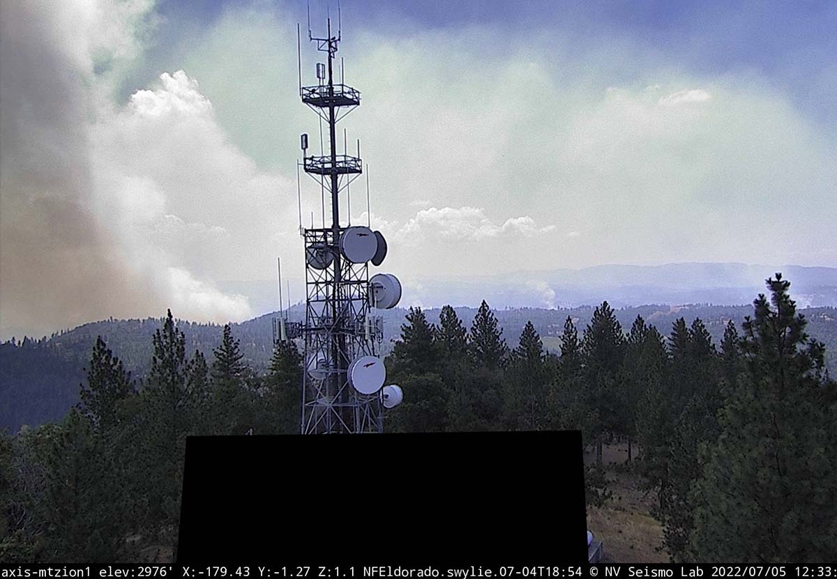
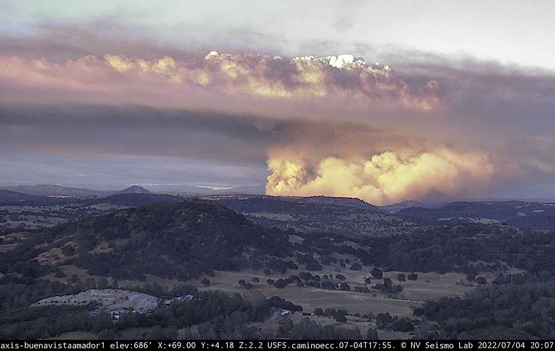
Soon after it started the fire was putting up a very large plume of smoke topped by condensation and a pyrocumulus cloud, indicating extreme fire behavior.
OCFA’s Intel 12 on the #ElectraFire Amador County. Fire is mapped at 390 acres at 17:06 hours. pic.twitter.com/fVzbCJ0cMA
— FIRIS (@FIRIS) July 5, 2022