National Firefighter Registry hopes to begin testing in coming months

Congress required the creation of the registry almost 4 years ago

Lone firefighter in smoke
Image from the NWCG “Wildland Firefighter Mental health” video.

The National Firefighter Registry (NFR) that is supposed to collect data on a voluntary basis to better understand the link between workplace exposures, cancer, and other chronic diseases among firefighters, hopes to begin testing the enrollment system “in the coming months,” according to an update from the leader of the Registry, Kenny Fent.

That is the gist of the message sent by Mr. Fent today, with no other significant details about the registry itself. But he announced three additions to the NFR Subcommittee, one of which is Tom Harbour, the former Director of Fire and Aviation for the US Forest Service. Three members of the Subcommittee are stepping down, including Chuck Bushey who also has a wildland fire background. Mr. Fent said the purpose of the Subcommittee is to “provide independent advice and guidance.”

Almost four years ago the Firefighter Cancer Registry Act of 2018 which passed July 7, 2018 required that the National Institute for Occupational Safety and Health (NIOSH), an agency within the Centers for Disease Control and Prevention (CDC), establish a Firefighter Cancer Registry. Firefighters on the ground have yet to see any concrete examples of the effort, other than changing the name to just “National Firefighter Registry.”

Last year Congress made another attempt to get the registry started by adding a provision into the Tim Hart Wildland Firefighter Classification and Pay Parity Act, legislation which would also accomplish several things to improve the pay and working conditions of federal wildland firefighters. (We covered that legislation in another article.) But the Tim Hart Act has not made it out of committee since it was introduced in the House October 19.

Our take

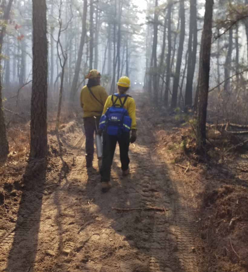
The National Firefighter Registry has the potential to develop data that documents the health effects of fighting fire. Personnel considering it as a profession could make a better-informed decision in their career choice. And those tactical athletes who have been breathing smoke while working in one of the most physically demanding professions, could have facts to back up claims for treatment of conditions likely caused by the job. Congress and the Office of Worker’s Compensation Programs (OWCP) could better establish presumptive disease policies so that firefighters would not have to attempt to prove that certain cancers or their damaged lungs, knees, or back, were a result of their employment with the government.

Congress must exercise their oversight responsibility and hold hearings if necessary to strongly encourage Kenny Fent, the leader of the FR, to make every effort possible to establish the registry sooner rather than later.

It’s been almost four years.

Firefighters are biased toward action. They know how to get stuff done. Let’s get the NFR done.

PBS covers the growing trend of micro-prescribed fires on private land

Community-led efforts help reduce fuels

prescribed fire New Jersey
Students from the 2019 Prescribed Fire Exchange work on prescribed burns in New Jersey’s Pinelands region. File photo by Michael Achey

The Public Broadcasting System has produced a 10-minute report on a small but growing trend of landowners conducting or helping to execute small prescribed fires on their property. Some of the community-led projects are just a few acres or, less than an acre. More organizations that specialize in land management are providing information to property owners that are interested in reducing hazardous fuels, using fire as a tool.

This is certainly not, and may never reach the level where it makes a large difference in the overall grand picture as far as acres treated. But as more members of the public see successful outcomes of prescribed fires, it could accelerate acceptance of allowing fire to visit on routine basis. It may also educate homeowners about the importance of hardening the defenses in their home ignition zone.

And, as firefighters know, once you pick up and use a drip torch to ignite a few hundred feet of fire, you don’t really want to put it down. I learned the value of letting National Park Superintendents, for example, operate the tool, and watched their smile grow as they walked with fire.

It is a very good report, below. Check it out. You’re welcome.

Presumido Peak fire burns thousands of acres in Southern Arizona

About two miles north of the US/Mexico border

Presumido Peak Fire map March 28, 2022
Vicinity map of the Presumido Peak Fire, March 28, 2022.

The Presumido Peak Fire in Southern Arizona had burned about 2,600 acres of grass, brush, oak, and juniper when it was mapped Monday. That number will be updated today after it made wind-driven runs Monday afternoon during Red Flag Warning conditions.

It is about 20 miles northwest of the border town Sasabe, two miles north of the US/Mexico border, on the edge of the Tohono O’odham Nation Reservation, and two miles west of the Buenos Aires National Wildlife Refuge.

Presumido Peak Fire map March 28, 2022
Presumido Peak Fire map March 28, 2022. Incident Management Team.

On Monday the fire received light showers which decreased fire activity significantly. The forecast for Tuesday calls for 54 degrees and cloudy skies with a 70 percent chance of  0.10″ rain, with clouds clearing by 11 p.m. On Wednesday and Thursday firefighters should expect mostly clear skies, temperatures of 68 to 75, winds out of the west and then south at 15 mph, and relative humidity in the low 20s and high teens.

Monday night the management of the incident transitioned to a Type 3 organization with approximately 70 personnel assigned. Aircraft remain assigned and on standby, if needed. The human-caused blaze was discovered Saturday afternoon near Presumido Peak

Presumido Peak Fire
Presumido Peak Fire, March 28, 2022. Incident Management Team.

Two transportable water tanks with pumps, for wildfires or prescribed burns

Both hold 1,000 gallons, and one can be carried by pickup truck or ferried by helicopter

Heliskid

Last week at the Aerial Firefighting conference in San Diego a company from Spain was displaying a small version of a transportable pump/tank combination. It reminded me of the Klump Pump which has been around for decades. More about that later, but let’s take a look at the unit made by the Spanish company, Vallfirest. They have at least two models — the one in Europe is sized to fit into compact pickup trucks that are common in those countries. The United States’ variety is larger and holds about 1,000 gallons. Scott Reimann, their representative at the San Diego meeting, said it will fit into a half- or three-quarter ton truck, or it can be flown in by helicopter.

The clever feature of the Heliskid is that it can be removed from a pickup truck by attaching the legs which extend out beyond the sides of the truck, jacking the unit up, and then driving the truck out from under it.

Without water, it weighs 750 pounds.

Fire Aviation produced the video above, which was filmed last week at the Aerial Firefighting conference in San Diego.

The video below is a product of the manufacturer, Vallfirest.

Klump Pump

The Klump Pump, also known as the Uni-Engine, is named after its inventor, Jim Klump. A former smokejumper and Type 1 Operations Section Chief, he recognized the need for a water delivery system during initial and extended attack in remote locations that could be set up quickly and was easy to operate. The basic components are similar, a 1,000-gallon tank and a pump. It can also be deployed by a helicopter, but will not fit in a pickup, however it comes with a trailer. It features a foam concentrate tank and a proportioner, unlike the Heliskid.

Klump Pump
Klump Pump photo.

Mr. Klump sold the business in 2019 to Jerry Vice of High Sierra Fire, at which time the name was officially changed to “Klump Pump.” The new owner’s headquarters is in Janesville, California in Northeastern California, with a few of the units remaining in Central California for quicker deployment to southern areas.

The Klump Pump weighs 1,600 pounds empty.

Klump Pump
Klump Pump photo.

NCAR wildfire prompts evacuations near Boulder, Colorado

The fire has burned 189 acres south of the Mesa Laboratory of the National Center for Atmospheric Research, on the southwest side of the city

10:55 a.m. MT, March 27, 2022

map NCAR Fire Boulder Colorado
Map showing the perimeter of the NCAR Fire at 10:02 a.m. March 27, 2022. The evacuation area is shown in red.

The NCAR Fire that started at about 2:08 Saturday afternoon on the southwest edge of Boulder, Colorado initially required the evacuation of 19,000 people and 8,000 homes. By early Sunday morning the blaze had slowed and the evacuation area had been reduced, affecting 1,629 people and 699 housing units. The fire was mapped Sunday morning at 189 acres. They are calling it 21 percent contained.

NCAR fire, 2:39 pm MT March 26, 2022
Smoke from the NCAR fire, 2:39 p.m. MT March 26, 2022. Image from Louisville Cam.

Regarding the status of the fire, Incident Commander Mike Smith of Boulder Fire Rescue said Sunday morning, “I think right now we’re in a good position. The wind speeds are nothing like they were during the Marshall Fire, we’ve got a lot of good resources in place, we have full structure protection groups as well as assets up on the hill. I think as long as the weather does what it is supposed to do today and tomorrow we’re gonna be in good shape.”

The fire came within 1,000 yards of homes on the southwest side of Boulder, but no structures have been destroyed. The incident is near the Mesa Laboratory of the National Center for Atmospheric Research (NCAR).

The Marshall Fire, pushed by winds gusting at 60 to 100 mph, on December 30 spread rapidly as it destroyed more than 1,000 homes. Most were in the city of Louisville and the town of Superior. It started about 4 miles southeast of the NCAR Fire.

Mr. Smith said there have been no injuries. The cause is under investigation but the area of origin has been identified as being on the northwest side of the fire in the Bear Canyon/Bear Creek area.

NCAR fire, 6:44 a.m. MT March 27, 2022
Smoke from the NCAR fire, 6:44 a.m. MT March 27, 2022. Image from Louisville Cam.

Resources available on the fire Sunday will include 110 personnel, 2 fixed wing air tankers, and one helicopter. Initially on Saturday over 200 firefighters from about 30 agencies responded.

The plan for today is to reinforce the fire line and “corral the fire up into the rocks and snow”, Mr. Smith said. The evacuation areas will be reevaluated today.

Mike Smith NCAR fire
Mike Smith, Incident Commander on the NCAR Fire, speaks to reporters, at 9 a.m. Sunday, March 27, 2022.

“Good planning, good prep, and a lot of good mitigation work are the reasons why we had good success today,” said Incident Commander Mike Smith. “The forecast today is for north and northwest winds which is a little less favorable [than in an earlier prediction] but the wind speeds are not that high, 15 maximum to 20. We have the plan in place to create more evacuations [if necessary], our hope is that we don’t have to do any of those.”

Some nearby water reservoirs were frozen and were not available for firefighting helicopters as a source of water, according to @mitchellbyars, a reporter with the Daily Camera.

The forecast for Monday in the fire area is for 80 degrees, very low humidity dropping to 10 percent, and light winds ranging from 5 to 12 mph out of the southwest.

The intensity of this fire in a few places was pretty high, Mr. Smith said, but for the most part it was a pretty low intensity fire. He was also the Incident Commander on the Marshall Fire.

“Between aggressive initial attack and having the aviation assets, the single engine air tankers being able to put some retardant down in between the homes was a real benefit,” said Mr. Smith.

On the Marshall Fire strong winds prevented aircraft from dropping water or retardant as homes were burning.

When asked by a reporter, “It’s been a long year — how are you feeling?” Mr. Smith replied, “It’s March but it feels like it’s November. No, we’re doing good. We’re nervous about the season coming up. When you look at the long term forecast for the upcoming season I think this is just a sign of the way things are going to go…We only have 365 fire days a year,” he said with a smile.

Researchers develop new modeling tools for prescribed fire

USFWS Rx fire
Florida Panther National Wildlife Refuge conducted a 704-acre prescribed fire on April 4, 2014 in the southeast corner of the refuge near I-75 and SR 29 in southwest Florida. Firefighter Connor Bowden uses a drip torch to ignite a portion of the prescribed fire. Photo Credit: Paul Stevko – USFWS

Below are portions of a press release issued March 24 by the U.S. Forest Service’s Southern Research Station.


By Stephanie Siegel, Southern Research Station

March 24, 2022 – Much of what is known about planned fire comes from a burn manager’s memory.

“It takes years to get that kind of experience,” says Joseph O’Brien, fire research ecologist with the USDA Forest Service. “If things are changing, like invasive species or climate, or if you’re a new manager, you need help.”

O’Brien, writing in Fire Ecology with J. Kevin Hiers of Tall Timbers Research Station and others, identified a need for more science-based prescribed fire predictions and models. Fire researchers and managers can use these tools to test scenarios, teach new prescribed fire managers, and identify possible improvements in fire prescriptions and plans.

For predicting fire behavior, the Southern Research Station (SRS) team developed and is testing QUIC-Fire. The real-time modeling tool uses 3D maps of fuels and forest structure and accounts for how chemistry, material science, fluid mechanics, and heat transfer interact to influence fire behavior — yet it can run on a laptop computer. “It’s definitely a revolution in modeling and a quantum leap in fire management,” says O’Brien.

QUIC-Fire was created, evaluated, and improved by access to prescribed fire operations, “where we could measure conditions before, during, and after the burn in detailed and extensive ways,” adds O’Brien.

After ten years in development, QUIC-Fire is getting good results in testing.

“We have been building demonstration landscapes on Oconee National Forest and Piedmont National Wildlife Refuge,” says O’Brien. “We’re going to get feedback from the managers who know those lands best. Managers’ insights will mold the product to meet timber stand management objectives. “For example, a land manager could say, ‘We want to manage underbrush without scorching the pines.’”

The new WIFIRE Lab at the University of California, San Diego has integrated QUIC-Fire as the model behind its new prescribed fire decision support tool BurnPro3D.

QUIC-Fire’s developers organized themselves this year as a modeling hub for advanced forest and fire technology. They teamed up with partners from Tall Timbers, the Forest Service’s Pacific Northwest Research Station, Los Alamos National Laboratory, and the University of Georgia.

Based at the Athens Prescribed Fire Lab, the hub includes seven scientists who previously created the Prescribed Fire Science Consortium. The Consortium brought together various fire managers and scientists annually at a burn site to observe, network, share experiences, and vet ideas.

“Anybody who manages land that is prone to fire has insights that are valuable,” says O’Brien. “Our collaboration with Southern Region fire management gave us the exposure to fire operations that generated the insights we are pursuing. Fire managers have the knowledge we need, and there are gaps they need to fill.  There’s respect for each other on both sides.”

“The goal of the modeling hub is to operationalize QUIC-Fire and the framework of required 3D inputs that also serve to revolutionize fire effects assessment and fuels treatment monitoring,” says O’Brien.