The map shows the distribution of wildfire smoke in the United States at 5:10 p.m. MDT August 23, 2013.
News and opinion about wildland fire
Firefighter dies in Portugal
A female firefighter was killed and nine were injured Thursday on a wildfire in Portugal near the small city of Tondela. Commander Antonio Ribeiro of the Serra de Caramulo firefighters said the crew ran from the fire but the firefighter who died fled in the wrong direction. Euronews reports that three firefighters have died this month. High temperatures and strong winds have contributed to the spread of 13 large fires in Portugal.
The national wildfire situation
Today there are 49 uncontained large fires listed on the national Situation Report in the United States, and that number does not include individual fires within complexes. There are currently 854,480 acres within the perimeters of those active fires. The national Preparedness Level has reached the highest category, PL 5, for the first time since 2008. And while it may seem like much of the west is on fire, the number of acres burned to date, 3.4 million, is much less than average, which is 5.6 million.
Competition for firefighting resources is occurring. There is only one California-based Type 1 or Type 2 incident management team available that is not assigned to a fire; 33 IMTeams are assigned nationwide. But surprisingly, there are no Area Command Teams committed.
We have 11 large and very large air tankers working right now on exclusive use contracts, and there are another 9 that the USFS has borrowed from the military, the state of Alaska, and the Canadian government. In 2002 there were 44 large air tankers on contract.
Forest Service runs out of money for firefighting
For the sixth time in the last ten years the U.S. Forest Service has run out of funds for suppressing wildfires. Even though the number of acres burned to date this year is below average, the USFS is having to divert funds from other non-fire accounts in order to cover the shortfall. This is due in part to reductions in the amount of money Congress allocates for the FLAME fund, which is supposed to fund firefighting while protecting other accounts. The Washington Post has more details.
Scott Olsen writes about a firefighter’s first day on the job
You may have seen the articles written last year by W. Scott Olsen, a professor of English at Concordia College in Moorhead, Minnesota about “the war on wildfires out west, meeting shot-callers and looking at the operation from the inside”. He has just published a new article at the Huffington Post about a wildland firefighter’s first day on the job.
Granite Mountain 19
The issues surrounding the deaths of the 19 members of the Granite Mountain Hotshots June 30 on the Yarnell Hill Fire continue to make the news. Firefighters with the New York City Fire Department have raised $30,000 so far for the families of the 19, and they are hoping to add to that total. The Prescott Daily Courier asked the candidates for Mayor and the City Council to express their positions on the discrepancy between the benefits for the seasonal and full time members of the crew. And there is a debate about whether the city’s hotshot crew should be rebuilt.
Investigative reporter John Dougherty has two recent articles about the Yarnell Hill Fire: “Yarnell Hill Fire: The Granite Mountain Hotshots Never Should’ve Been Deployed, Mounting Evidence Shows” and “A Granite Mountain Hotshot’s Father Says the Blaze That Incinerated His Son Could’ve Been Controlled“.
Montana residents contribute for free coffee for firefighters
Residents near Lolo, Montana are contributing to a fund to provide free, good quality coffee for firefighters working on the Lolo Creek Complex. According to an article at KZBK, Samantha Harris, a barista at Florence Coffee Company in Lolo, said customers have been donating money to give firefighters coffee.
“We have a huge tab here so all the firefighters’ coffee is paid for,” Harris said. “Which has been really fun to tell them their coffee is free.” The tab is at nearly $300, she said.
Florence Coffee Company is at 11880 HWY 93 in South Lolo, Montana.
Photos of pyrocumulus
The Alaska Dispatch has some very impressive photos of pyrocumulus smoke columns caused by wildfires.
Goat manure fire stinks up town
A burning pile of goat manure is affecting the quality of life for residents of Windsor, Vermont. The pile ignited from spontaneous combustion Wednesday at George Redick’s 800-goat dairy. Windsor Town Manager Tom Marsh said he could smell the fire at his home which is five miles from the dairy.
Red Flag Warnings and Fire Weather Watches for enhanced wildfire danger have been issued by the National Weather Service for areas in Idaho, California, Washington, Montana and Oregon. Click the map above to see a larger version.
The Red Flag Warning map was current as of 9 a.m. MDT on Thursday. Red Flag Warnings can change throughout the day as the National Weather Service offices around the country update and revise their forecasts. For the most current data, visit this NWS site.
The map below shows the distribution of wildfire smoke in the United States at 9:40 a.m. MDT August 22, 2013.

Matt Johnson shot this time lapse photography of scenes in the southern Colorado mountains, plus smoke columns from the Windy Pass, West Fork, and Papoose fires. All of the footage is beautiful, but in case you’re wondering, the fire scenes begin at 1:55.
Mr. Johnson’s description:
Colorado is currently experiencing some of the largest wildfires in the state’s history. In July, I visited the Bruce Spruce Ranch a little ways outside of Pagosa Springs and watched as the Windy Pass, West Fork, and Papoose wildfires burned thousands of acres of forest. I have never seen such a powerful event up close like this before, it was truly humbling.
Please visit http://whoismatt.com/pagosatimelapse and download this film in high definition. The video itself is 3 Gigabytes in size and looks amazing.
Music by Salomon Lighthelm at The Music Bed // http://www.themusicbed.com/#!/In-The-Sullen-Silence-5326/
If you have trouble viewing the video, you can try the Vimeo site.
(UPDATE at 9:45 a.m. PDT, September 10, 2012)

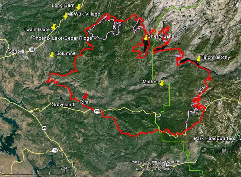
Firefighters have made some progress on the Rim Fire since our last update on September 4. As you can see in the map below, the fire has grown very little in the last six days, and most of the change in the fire perimeter is most likely a result of firefighters burning out the vegetation ahead of the fire.

The fire has burned 254,685 acres and the incident commander is calling it 80 percent contained. Over 3,000 personnel are assigned to the incident, down from more than 5,000 a week or so ago. Over the last 24 days since it started, the costs for suppressing the fire has grown to $100.4 million.
****
(UPDATE at 6:50 a.m. PDT, September 4, 2013)

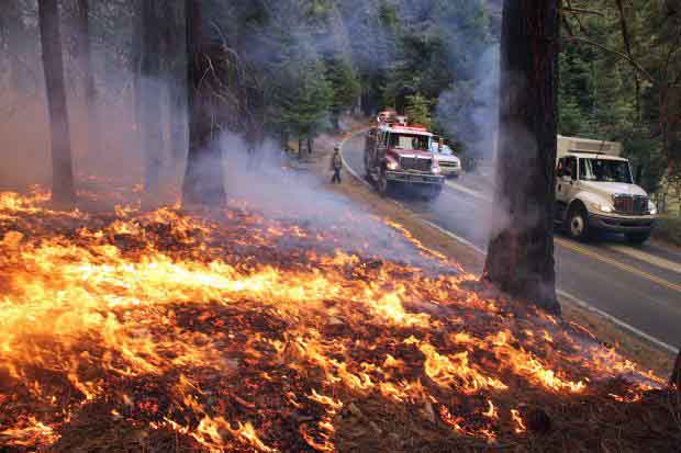
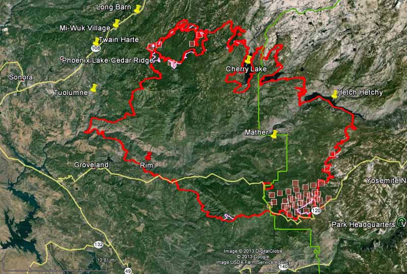
As shown in the map below, the spread of the Rim Fire has slowed considerably over the last several days. Most of the acreage increases are a result of burnout operations out ahead of the fire, sometimes miles from the fire’s edge, in order to remove the fuel, eventually stopping the spread. The west and southwest sides of the fire have been very quiet for a few days. The only significant movement of the fire which may not be related to burnouts are on the east side, with most of it being in the Cherry Lake area. On the southeast flank firefighters have selected Highway 120/Tioga Road as their fireline and are burning out along the north side.
The fire has burned 237,341 acres and the incident commander is calling it 80 percent contained. Another 3,000 acres and it becomes the third largest fire in California history.

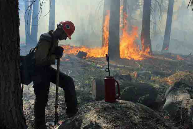
The strategy and tactics employed by the firefighters appear to be working. Instead of choosing the NEXT ridge for a fireline or burnout, they are selecting the BEST ridge, or sometimes a road, as the place to make their stand. This gives them enough time to execute what can be a miles-long burnout operation, and allows them some flexibility to conduct it at a time when the weather is favorable. These tactics have been used successfully on some very large fires on the Los Padres National Forest, including the Whitewater-Baldy, Basin Complex, Indians, Iron Alps, and Zaca fires.
There are currently no mandatory or advisory evacuation orders effective in Mariposa County. The evacuation advisory has been lifted for Ponderosa Hills and areas east, along the south side of Highway 108 up to Pinecrest. Highway 120 at the Yosemite National Park boundary west to Buck Meadows remains under evacuation.

This video has some excellent photos of the Beaver Creek Fire southwest of Ketchum, Idaho. If you look closely, you’ll see evidence of what required the replacement of the number two engine on air tanker 910, a DC-10.