Burners light up Nachusa Grasslands in Illinois

A Nachusa fire crew hit a 24-acre project area of the grassland Tuesday, November 14, for a prescribed burn on the prairie habitat. Fire has historically been an important and natural part of the prairie; clearing the ground cover stimulates new growth, and many native plants rely on wildland fire to open seed pods and regenerate. Sauk Valley Media sent their ace photographer to track the 10-person crew at Nachusa Grasslands as they worked to put in firebreaks, put down a water line, and ignite the grasses so the fire will burn in their planned direction.

Nachusa Grasslands RxFire
Conditions were just right for a prescribed fire on November 14 at Nachusa Grasslands in northern Illinois. Fire managers hope to do another burn at the end of the week. Photo courtesy Alex T. Paschal.

The 4,100-acre Nachusa Grasslands preserve consists of large remnant prairie, woodlands, and wetlands reconnected through habitat restoration to create one of the largest and most biologically diverse grasslands in Illinois. Including 4,000 acres of restored and remnant prairie, Nachusa Grasslands is home to 180 species of birds, more than 700 native plant species, and a herd of bison.

The Nature Conservancy purchased the core of the preserve in 1986, recognizing that Nachusa offered a terrific opportunity to restore a diverse native grassland.

Working hand-in-hand with Nature Conservancy staff, volunteer stewards collect and plant seeds, manage invasive species, repair wetlands, and conduct prescribed burns to preserve this ecosystem.

RxFire Nachusa
Prescribed burning: A volunteer fire crew sets a prescribed burn at Nachusa Grasslands preserve in Illinois. ©Andrew Simpson / The Nature Conservancy

The Friends of Nachusa Grasslands has a calendar online for its volunteer workdays; hunting season is scheduled in early December and the spring RxFire season will start up in March 2024. If you’re interested in volunteer opportunities, most workdays are scheduled on Thursday and Saturdays.

The Nachusa Grasslands and its visitor center are south of Rockford, Illinois and about a 2-hour drive west of Chicago.

The Friends organization is established to fund endowments for long-term protection of the Grasslands, conducting and encouraging stewardship, supporting science and education, and protecting the land here. Nachusa Grasslands is open from dawn to dusk, and visitors are welcome to hike in the non-fenced areas. Wildlife inhabitants include a herd of bison, which range across 1,500 acres and are often not visible from the Visitor Center or the roadsides. Almost 10 years ago, 30 bison were introduced to Nachusa Grasslands from three preserves owned by The Nature Conservancy in South Dakota, Iowa, and the Dunn Ranch in Missouri. 2013 Wind Cave National Park bison and elkWind Cave National Park bison and elk, photo ©2013 Bill Gabbert

Originally part of the herd from Wind Cave National Park in South Dakota, these bison have been tested and show no traces of cattle genes. No hiking is permitted inside the fenced North or South Bison Units.

The bison and the grassland vegetation species all benefit from prescribed fire and the Nature Conservancy’s fire research, and this fire — like others at the Grasslands — was timed for weather and fuels conditions that would be conducive to a controllable prescription burn.

“Wind and dry air is what determines whether we can have a burn,” Nachusa Director Bill Kleiman on Tuesday told photographer Alex Paschal.

A light south wind pushed the flames and smoke north, so crews planned for locations of the firebreaks and road warnings for motorists traveling the area. The burn was roughly an “L” shape on Carthage Road, and two separate crew units started the process on either side — so the fire could burn together in the middle.

“If the side upwind doesn’t have enough of a firebreak,” Kleiman said, “it can jump it and burn the other side.”

Alex Paschal has a photo gallery from the burn [HERE].

RxFire workforce expands under new FS agreement with Nature Conservancy

The U.S. Forest Service will fund almost $45 million over five years for The Nature Conservancy (TNC) to expand the organization’s prescribed fire projects and workforce.

In a recent statement, TNC said the funding will prioritize prescribed fire in the 21 landscapes and 250 high-risk firesheds in the Western U.S., and hiring to expand the workforce started in October. TNC also received permission to work on prescribed fires in any national forest within Idaho, according to Boise State Public Radio.

“For more than a century, policies suppressing wildfire and stamping out Indigenous Peoples’ burning practices largely kept healthy fire from hundreds of millions of acres of North American landscapes that needed it,” said Marek Smith, director of TNC’s North America Fire program.

Nature Conservancy photo

The expansion is part of the FS Wildfire Crisis Strategy, specifically the program’s National Prescribed Fire Resource Mobilization.

Along with expanding its prescribed fire workforce, the strategy also calls for an expansion of both the Forest Service Fuels Academy and National Interagency Fire Training Center, which train new prescribed fire practitioners, managers, and entry-level fuels specialists. It also calls to address issues in resource availability, including overtime and hazard pay, contracts and agreements, and hiring more authorities.

A related strategy, the National Cohesive Wildland Fire Management Strategy is reportedly in its “final stage” of developing a national cohesive wildland fire management system. The effort began in 2009, and the final phase has been in development since 2014.

“Implementation of the National Cohesive Strategy will be undertaken in the same manner it was created — with recognition of the differences among stakeholders across the country and a vision of how we can collectively achieve more together,” the plan says. “Together, we can learn from and replicate existing collaborative behaviors and successful practices to achieve even greater success.”

Surviving relatives sue Forest Service over flash flood deaths

Family members of three people who were killed last year in a flash flood that originated from the burn scar of the largest wildfire in New Mexico’s recorded history are suing the U.S. Forest Service. The wrongful death lawsuit, according to a PBS report, was filed earlier this month and alleges the USFS was negligent in managing the original prescribed burn and also failed to close roads and prevent access to areas at risk of flooding after the Hermit’s Peak – Calf Canyon Fire.

Calf Canyon -Hermits Peak Fire at Highway 434, May 10, 2022. Inciweb.

Three people from west Texas were vacationing at a family cabin in northern New Mexico in July of 2022 when seasonal monsoon storms hit the burn scar near Tecolote Creek. The resulting flash flood swept the three people to their deaths.

The lawsuit also contends that the USFS failed to warn the victims about the dangers of the wildfire and of potential flooding in the area. Neither the USFS nor the USDA has formally responded to the lawsuit, which states that the USDA did not provide a settlement offer or a denial of the claims that were initially filed in the case earlier this year.

The escaped fire burned more than 341,000 acres between early April and late June in the Sangre de Cristo Mountains and was the largest of the record-breaking New Mexico fire season; it was in fact the largest of 2022 in the lower 48 states. It burned over 900 structures, including several hundred homes, and threatened more than 12,000 other structures in the area. A smoldering prescribed fire project rekindled and escaped control, merging with another prescribed burn that had also escaped. The combined fires burned for months.

The Las Dispensas prescribed fire, 1:07 p.m. MDT April 6, 2022. USFS photo.
The Las Dispensas prescribed fire, 1:07 p.m. MDT April 6, 2022.  USFS photo

Congress allotted nearly $4 billion to compensate victims, and FEMA has paid over $101 million so far. Many families, though, complain that the federal government is not acknowledging the extent of the damage or the emotional toll the fire has taken, according to a Denver7 report.

FEMA has paid out just 2 percent of the fund designated to help wildfire victims rebuild. Some can’t wait much longer, and Source NM reported last month that many survivors are in limbo as they await compensation for the fire.

Test fire for the Las Dispensas RxFire in early April of 2022.

The prescribed fire was originally planned to reduce the risk of wildfire. The first small spot fire occurred at 1:35 and was controlled. At 2:26 another quarter-acre spot fire was caught.

Radio communication with some of the personnel was discovered to be a problem. It was later found that Bravo Holding was using a separate “crew net” and was not monitoring the planned frequency.

Ignition stopped a couple of times as spot fires were suppressed, but by about 4 p.m. when the RH dropped to 10 percent there were at least a dozen spots. Shortly thereafter the burn boss requested contingency resources and all resources were pulled off the fire. At 4:25 a dispatcher reported that the contingency resources were actually in Taos, New Mexico, 70 miles away, at a training exercise.

About 4 hours after ignition began, a dispatcher told the agency administrator that the burn boss and FMO recommended it be declared a wildfire; the administrator made the wildfire declaration and the Las Dispensas burn officially became the Hermits Peak Fire.

An 80-page report (4.7Mb PDF) by the USFS later concluded that management of the prescribed fire generally followed the approved prescribed fire plan for most — but not all — of the parameters. The people on the ground thought they were within (or close to) the prescription limits, but fuel moistures were lower than they realized and the increased heavy fuel loading after fireline prep also contributed to increased risk of escape.

FROM THE REPORT:  “We ask them to make up ground on long-needed and far-behind proactive restoration work while barely allowing time to recover from a previously taxing wildland fire response and preparing to respond yet again. We ask them to restore fire process to ecosystems that have evolved to burn, but many of which are now primed for extreme fire behavior due to our own decisions to exclude or suppress fire in these areas.”

Climate change to lessen safe prescribed burn days, change wildland firefighter schedules

A recent study from UCLA found that a projected 2° Celsius increase in global temperatures by 2060 would reduce the number of days when a prescribed burn could be safely set by 17 percent. The Four Corners region could see as much as a 29 percent decrease in favorable days, while the Pacific Southwest could see a 24 percent decrease.

The main driver behind the decrease in safe prescribed fire days is a combination of a decrease in large-diameter fuel moisture across seasons, an increase in vegetation aridity, and an increase in smoke-trapping low-level stagnation events.

“The narrowing of prescribed fire windows, as well as increases in extreme wildfire burning conditions at other times, will further challenge fire and land management agencies and entities already constrained by limited budgets and growing administrative burdens,” the study said.

However, the study also found that winter may increasingly become a viable season for prescribed fires with researchers predicting a four percent rise in favorable days, especially for northern states. Regions that have historically been too moist or too cool to support prescribed fire may see a boost in safe burn days, assisted by vegetation aridification. Additionally, decreases in safe prescribed burn days mainly affect forested locations, while non-forested areas would see substantial safe burn days.

The study ended by recommending a huge shift in USFS agency fire crew staffing. Seasonal wildland fire workers, who are usually laid off over the winter based on historical burn patterns, may need to capitalize on burn days during winter if safe burn days drastically decrease over the summer. The study also pointed to other research that found winter and spring to be underutilized seasons for prescribed fire in California.

“Our findings provide direct evidence supporting recent calls for an expanded year-round fire management workforce whose responsibilities extend beyond fighting wildfires to also encompass the management of prescribed fire,” the study said. “These findings also highlight the growing importance of tangible support—including increased funding and removal of existing regulatory barriers–for cultural burning practices by Indigenous fire practitioners, including via interagency partnerships.”

Prescribed burning underway in western Oregon

The U.S. Fish & Wildlife Service last weekend participated in prescribed burns for habitat improvements and ecological health at the Howard Buford Recreation area near Eugene.

KEZI-TV reported that the Friends of Buford Park and Mt. Pisgah, Lane County Parks, and other conservation partners including the FWS and Rivers to Ridges worked on the burn; about 30 firefighters burned some 65 acres.

“Fire has been a really important component of the landscape,” said Ed Alverson, coordinator for Lane County Natural Areas. “And the native species that live here — the plants and the animals — are adapted to fire. In fact, burning by Calapooia People over thousands of years has helped create this species-rich landscape.”

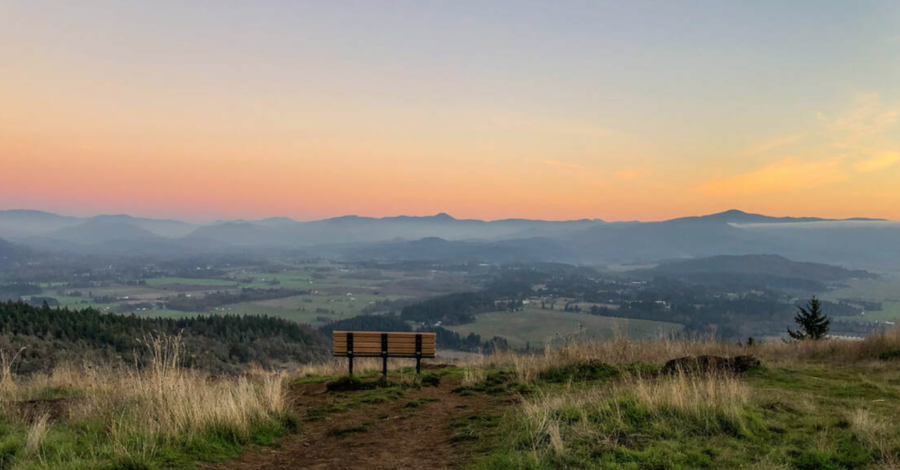
Mt. Pisgah summit at sunset -- HikeOregon photo
Mt. Pisgah summit at sunset in Lane County, Oregon — HikeOregon photo

Mt. Pisgah is within the recreation area and is visible for miles  across the Eugene-Springfield area. It’s a favorite local destination; along with the 118-acre arboretum, the park includes some of the last remaining sizable, contiguous, native oak savannah prairie in the valley. Approximately 17 miles of trails lead up and around the 1,518-foot butte, with 360-degree views of the surrounding valley and mountains. Some trails are open for equestrian use; some are closed during seasonal prescribed fires.

The South Bottomlands burn on Sept. 19, 2023. (Photo courtesy Lane County Parks)

Prescribed fire helps maintain native species in the area and helps prevent the open prairie conversion to closed forest land. Fire improves soil fertility and removes the buildup of thatch, along with reducing the risk of high-intensity fires in the future. A small wildfire near Mt. Pisgah was quickly contained early in August; the area of a 50-acre fire in 2019 now illustrates the habitat resilience in a post-fire area.

“Howard Buford Recreation Area supports one of the largest remaining blocks of prairie and oak habitats in the Willamette Valley,” said Alverson. “Fire is a regular and natural part of the environment of these habitats. We work closely with Lane Regional Air Pollution Authority and our Rivers to Ridges partners throughout the area to make sure the burn is safely implemented and will not disrupt the community.” More than a dozen prescribed fires have been conducted in the area since 1999 and more are planned in the upcoming weeks.


The annual Mt. Pisgah fall plant sale is scheduled for this weekend —  native plants will be sold on Saturday from 9 a.m. to 1 p.m. at the Native Plant Nursery. The Friends of Buford Park and Mt. Pisgah nurture over 100 native plant species in their nursery. (541)674-3257

Buford Park map
Buford Park, 34639 Frank Parrish Rd., Eugene, Oregon

North Carolina fire reaches 3500 acres

The Pulp Road Fire in Brunswick County reached 3,500 acres today and was still at zero percent containment. The 15,000-acre preserve where it’s burning crosses Brunswick and Columbus counties and is designated a National Natural Landmark. According to the N.C. Forest Service, the area was cleared of unburned fuels outside the fire perimeter, and crews had mopped up spot fires.

Pulp Road Fire

The N.C. Forest Service — one of several state forestry agencies in the U.S. that are named “Forest Service” — has mobilized its Red Incident Management Team to take over the fire. Resources earlier today included multiple engine and tractor plow strike teams plus aircraft. The PortCityDaily out of Wilmington reported that personnel will staff the fire through the weekend.

The state DEQ raised air pollution alerts to red in Brunswick County and orange in both New Hanover and Pender counties.

According to the Wilmington Star News, the fire initially was lit as a controlled burn in the Green Swamp Game Land and Green Swamp Nature Preserve, but yesterday the fire burned out of control and was classified as a wildfire. It nearly doubled in size since Thursday night. Smoke is thick in some areas and it is affecting visibility; officials have urged drivers to use caution.

State and local officials urged residents with respiratory issues to remain indoors.