Williams Flats Fire spreads to the east and north

The fire is 15 miles east of Coulee Dam, Washington

3-d map Williams Flats Fire Washington
3-D map showing the location of the Williams Flats fire in northeast Washington, looking east. The red line was the perimeter determined by a fixed wing mapping flight at 11:08 p.m. PDT August 5, 2019. The red shaded areas represent intense heat. The white line was the perimeter 26 hours before.

(UPDATED at 8:17 a.m. PDT August 6, 2019)

On Monday the Williams Flats Fire in Northeast Washington spread for another half mile to a mile toward the north and east, to bring the total burned area up to 16,781 acres according to data from an overnight fixed wing mapping flight. (see map above)

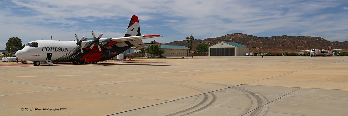
The fire spread across Whitestone Ridge on the southeast flank.  Dozers are constructing direct fireline and crews are burning out fuels as construction progresses toward the fire’s northeast corner. Helicopters were able to drop water as needed Monday to reduce the risks of loss to timber, Hellgate Game Reserve, and archeological sites, but water-scooping planes and large air tankers were unable to fly due to heavy smoke which compromised visibility.

Challenges firefighters are facing on this include high temperatures, reduced visibility, steep rocky terrain, and wildlife dangers such as snakes and bears.

Firefighting resources assigned to the Williams Flats Fire:

  • 22 hand crews
  • 8 helicopters
  • 18 fire engines
  • 9 dozers
  • 22 water tenders
  • 764 total personnel

(Originally published at 1 p.m. PDT August 5, 2019)

Williams Flats Fire Washington
Retardant can be seen in the distance being dropped on a ridge on the Williams Flats Fire. The photo was uploaded to InciWeb August 4, 2019.

The Williams Flats Fire along the Columbia River 15 miles east of Coulee Dam, Washington spread half a mile to one mile on the north and east sides on Saturday and Sunday to bring the size up to 13,497 acres.  (see map below)

The fire is burning on Confederated Tribes of the Colville Reservation and Washington Department of Natural Resources protected lands. On Monday firefighters will strengthen existing containment lines and begin mop-up of hot spots on the west flank. Line construction is on-going on the southeast flank toward Whitestone Ridge. Dozers are constructing direct fireline and crews are burning out fuels as construction progresses toward the fire’s northeast corner.

Williams Flats Fire Washington
The Incident Management Team titled this photo, “Success at the goat ranch”. It was uploaded to InciWeb August 4, 2019. A single-engine air tanker can be seen scooping water from the Columbia River.

Firefighting resources assigned to the Williams Flats Fire include 14 hand crews, 18 fire engines, 8 dozers, 19 water tenders, and 7 helicopters for a total of 542 personnel.

Helicopters are dipping and air tankers are scooping water (see above) from nearby Lake Roosevelt to aid on-the-ground firefighters in suppression efforts and the aircraft need space to work. The public is asked to avoid these activities on the water. The area is being patrolled by the the Confederated Tribes of the Colville Reservation Law Enforcement.

Weather

The forecast for Monday calls for 91 degrees, 15 percent relative humidity, and winds out of the southwest and west at 6 mph, with limited humidity recovery Monday night. Tuesday should be the hottest day of the week, with 94 degrees, 14 percent RH, and variable winds at 2 to 7 mph.

map Williams Flats Fire Washington
Map showing the location of the Williams Flats fire in northeast Washington. The red line was the perimeter determined by a fixed wing mapping flight at 9:41 p.m. PDT August 4, 2019. The white line was the perimeter 47 hours before. The red dots represent heat detected by a satellite at 3:35 a.m. PDT August 5, 2019.
3-d map Williams Flats Fire Washington
3-D map showing the location of the Williams Flats fire in northeast Washington, looking east. The red line was the perimeter determined by a fixed wing mapping flight at 9:41 p.m. PDT August 4, 2019. The white line was the perimeter 47 hours before.


California power company has a team of six fire coordinators

Randy Lyle is the Fire Program Manager for San Diego Gas and Electric

Randy Lyle, Fire Program Manager
Randy Lyle, Fire Program Manager for SDG&E. Photo: SDG&E.

If a fire flares up anywhere in San Diego or Southern Orange counties, Randy Lyle, the fire program manager for San Diego Gas and Electric, and his team of fire coordinators, will know in real time where it’s breaking out and whether it is burning in proximity to any of the company’s infrastructure.

Lyle was the second fire coordinator hired by SDG&E company to enhance the coordination and partnership with local public safety agencies to better protect communities from wildfires. The fire coordination program was launched in 2004 with one person. Today Randy oversees a team of five fire coordinators – all of whom are veteran firefighters like him.

His team has expertise in a variety of specialties, such as electrical safety, natural gas safety, energy storage safety and fire safety training, fuel treatment, fire planning for projects, and forensic fire investigation.

When Randy joined SDG&E in 2007, he brought with him 32 years of experience in all aspects of wildland fire control, including engine, hand crew, and aerial firefighting, along with expertise in applying fire hazard data and tools to better understand fire risk and fire behavior.

As a CAL FIRE Division Chief, Randy served as the unified incident commander for the Cedar Fire in 2003. That historic fire – ranked as one of the top 5 most destructive wildfires in California history – burned more than 273,000 acres, killed 14 people, including one firefighter, and destroyed more than 2,800 structures.

Recently, we had a conversation with Randy, a San Diego native who loves horses and surfing, about his experience and background and what his team does.

What does it mean to be an SDG&E Fire Coordinator?

Fire coordinators serve as a critical link between fire agencies and SDG&E. They provide situational awareness at times of actual fires to help support emergency response. For example, if a public agency has a request for SDG&E to de-energize a power line near a fire to protect first responders, a fire coordinator will work with our grid operations staff to help coordinate that request.

Fire coordinators also train internal personnel on fire safety and external personnel (first responders) on electrical safety. We are translators of intel into actionable information.

Are fire coordinator positions unique to SDG&E?
Other utilities have similar positions, but their actual duties vary quite a bit from utility to utility.

How did you make the decision to get into this field and when did it all start for you?
I had firemen in my family. I started my fire career with the California Department of Forestry and Fire Protection (CAL FIRE), six weeks after graduating high school. Growing up here, I remember watching large fires like the Laguna Fire in 1970 as it made news day after day and I was fascinated by its enormity.

What is your most memorable experience as a firefighter? 
I was the CAL FIRE Unified Incident Commander on the 2003 Cedar Fire for the first three days, then transitioned to a Branch Director for the west wind push when I had two Strike Teams trapped by fire in Harrison Park near Julian. I lost radio contact with them and for about two hours, thought that 40 firefighters had perished. Turned out OK in the end. Radios were rendered inoperable, presumably by heavy, dense smoke and heated air.

What is your busiest season?
Peak season is from about September 1 until we get rains in fall or early winter. Typically, any summer day can be an ‘average bad fire day’. There are a few weeks after strong green-up where there will not be any fires because wildland fuels are not cured well enough to dry.

(From SDG&E)

Intense fire along Interstate 5

Jeff Zimmerman fire southern California
Wildfire along Interstate 5 in Southern California August 3, 2019, 10 miles north of Castaic. Photo by Jeff Zimmerman.

Jeff Zimmerman got this shot of engine crews from Los Angeles County FD arriving at an intensely burning wildfire along Interstate 5 yesterday, August 3. It was on the east side of Interstate 5 in Southern California 10 miles north of Castaic.

Here is what Jeff said about the fire:

With hot dry weather and lower humidity we saw more energy release than previous wildfires last month. 100 acres along Interstate 5 north of Templin Highway burned with good fuel consumption. Increased fire behavior and increased energy release components are predicted through early next week.

Thanks Jeff!

Ramona Air Attack Base hosts a C-130 air tanker

The runway is too short for some large air tankers

(This article was first published at Fire Aviation)

It is unusual to see an air tanker larger than an S-2 at the Ramona Air Attack Base in Southern California, but a C-130Q under contract with the California Department of Forestry and Fire Protection (CAL FIRE) was seen at the base yesterday, August 3. Kevin Pack, who took the photo below, said it had been dropping on a fire, possibly the Sage Fire, in San Diego County.

The relatively short runway restricts which types of aircraft can use the facilities at Ramona. When the U.S. Navy built the airport in 1945 to be used as an emergency landing field it was only 4,000 feet long and remained that length well after it was conveyed to the County of San Diego in 1956.

Air Tanker 134 C-130 Ramona
Air Tanker 134, a C-130Q, parked at Ramona Air Attack Base August 3 2019. Photo by K. E. Pack Photography.

CAL FIRE established an Air Attack Base there in 1957 and the U.S. Forest Service followed three years later.

The runway was lengthened in 2002 to 5,001 feet but it is difficult for some large air tankers and impossible for very large air tankers to work at the base. CAL FIRE has allowed BAe-146 air tankers under their CAL FIRE contracts to use the runway, but currently the Forest Service prohibits their large air tankers from using the airport.

Air Tanker 134 C-130 Ramona
Air Tanker 134, a C-130Q, was still parked at Ramona Air Attack Base at 7:53 a.m. PDT August 4, 2019. HPWREN photo.

CAL FIRE bases two S-2 air tankers and an Air Tactical Group Supervisor at the airport, and the Forest Service bases a helicopter there.

The S-2s can carry up to 1,200 gallons of retardant. In 2016 another Coulson C-130, T-131, completed 520 sorties averaging 3,404 gallons per load. A BAe-146 has a capacity of 3,000 gallons.

The C-130Q at Ramona on Saturday was Coulson’s Tanker 134, the fourth C-130 the company has converted. Its first drop on a fire was around November 1, 2018 while on a contract in Australia. It had just finished being reconfigured as an air tanker after being rescued from storage in Tucson and had not yet been painted.

t-134 c-130Q
Air tanker 134 on the sortie when it was making its first live drop on a fire in Australia, around November 1 , 2018.

CAL FIRE is using Tanker 134 to train their pilots who are transitioning from the S-2 air tankers to the seven HC-130Hs the agency has acquired after the U.S. Forest Service lost interest in the aircraft which were previously operated by the U.S. Coast Guard.

Williams Flats Fire burns thousands of acres along Columbia River

The fire is 15 miles east of Coulee Dam, Washington

3-d map Williams Flats Fire Washington
3-D map showing the APPROXIMATE perimeter of the Williams Flats Fire looking east, based on heat detected by a satellite at 2:56 p.m. PDT August 3, 2019. The map should not be used for planning or evacuation decisions.

(UPDATED at 5:50 p.m. PDT August 3, 2019)

In an update at 2 p.m. Saturday fire officials reported that the Williams Flats Fire 15 miles east of Grand Coulee, Washington had grown to 8,200 acres. (see map above)

On Saturday firefighters constructed containment lines to protect the valley floor and worked on anchoring the southern perimeter of the fire, which is spreading east toward Redford Canyon. That area was logged five years ago leaving behind slash fueling the fire. Steep slopes, limited roads, and primitive road conditions are hampering control efforts.

Tribal Natural Resources Officers are patrolling Lake Roosevelt Recreation Area to keep boaters safe as three Fire Boss water-scooping single engine air tankers obtained water from the Columbia River.

Other resources on the fire include:

  • 3, large air tankers
  • 1,Type 1 helicopter
  • 4, 20-person hand crews
  • 2, 12-person hand crews
  • 3, dozers
  • 12, Type 6 fire engines, and
  • 5, water tenders
  • For a total of 132 personnel

(Originally published at 10:02 a.m. PDT August 3, 2019)


The Williams Flats Fire in Northeast Washington burned well over 5,000 acres during the first 25 hours after being reported at 3:23 a.m. Friday August 2, 2019.

Saturday morning fire officials said it was 5,640 acres, but satellite data from 4:18 a.m. PDT on Saturday indicates it may have burned an additional 1,000 acres. (see map above below)

Map Williams Flats Fire
Map of the Williams Flats Fire showing heat detected by a satellite as late as 4:18 a.m. PDT August 3, 2019.

Exhibiting extreme fire behavior during Red Flag Warning Conditions, the blaze spread east along the Columbia River 8 miles southeast of Keller and 15 miles east of Grand Coulee, threatening structures. Evacuations are occurring, according to the Northwest Area Coordination Center.

At 6 p.m. Saturday a Type 2 Incident Management Team led by Incident Commander D. Johnson will assume command.

The fire is within the Hellgate Game Preserve on the Colville Indian Reservation.

The fire initially consumed primarily grass, but moved into heavier vegetation. It is fueled by fallen dead trees, grass, sage, and bitter brush, exacerbated by limited access along the Columbia River. Initial suppression efforts included building hand lines, dozer lines, and working from existing roads. Helicopters and fixed winged aircraft cooled hotspots on Friday to allow ground forces time to engage. On-the-ground firefighters are dealing with extremely steep rocky slopes and rattlesnakes.

Weather

On Friday the fire was pushed by 5 to 12 mph winds out of the southwest and west gusting at 15 to 25 mph, but after midnight the direction reversed to come out of the east, according to the Wellpinit weather station south of the fire. Friday’s temperature reached 90 degrees with a relative humidity of 21 percent.

The forecast for Saturday calls for 84 degrees, RH of 14 percent, with 2 to 5 mph winds out of the north shifting to the east in the afternoon. These conditions should reduce the resistance to control of the fire, compared to what firefighters were faced with on Friday.

Heavy equipment operators train for firefighting in Mississippi

Mississippi Equipment Operator Training firefighting
Photo: Mississippi Forestry Commission

Earlier this year Mississippi Forestry Commission technicians took part in a heavy equipment academy to learn safe practices and proper techniques when they suppress wildfires.

Mississippi Equipment Operator Training firefighting
Photo: Mississippi Forestry Commission
Mississippi Equipment Operator Training firefighting
Photo: Mississippi Forestry Commission