Firefighters stop wildfire at Springville, UT after burning 167 acres

Round Fire Utah
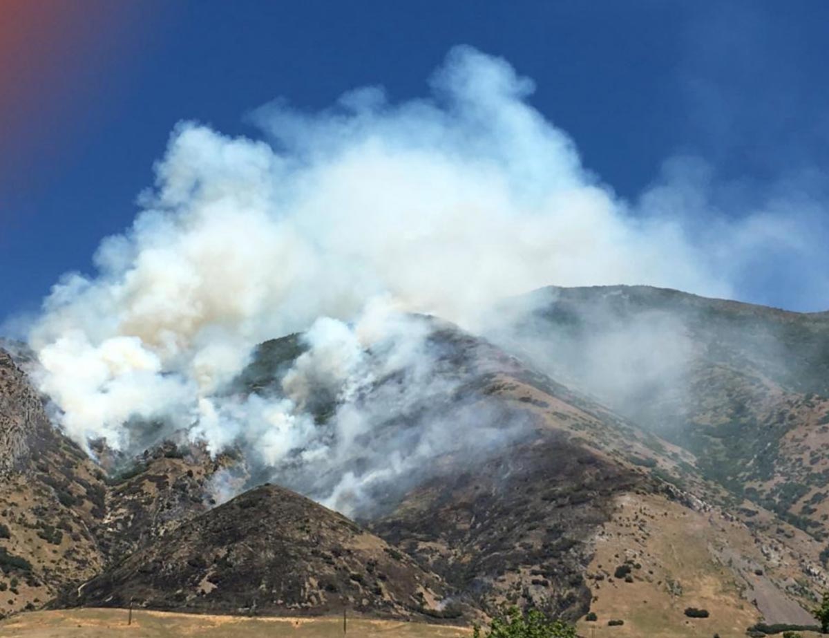
Round Peak Fire east of Springville, Utah.

A wildfire just east of Springville, Utah (see the map below) burned 167 acres before it was stopped by firefighters yesterday. At Wildfire Today we don’t often devote an article to a fire this size, but the Round Peak Fire is notable in two ways. One, that the U.S. Forest Service employed a different strategy from what they used last summer on the Bald Mountain and Pole Creek Fires about 8 miles to the south. Those fires were initially managed to accomplish resource management objectives. In other words, they were not suppressed, just herded around. As the Uinta-Wasatch-Cache National Forest inadequately considered fuel moistures, drought, and the weather forecast, the two fires merged and burned over 120,000 acres forcing evacuations of communities.

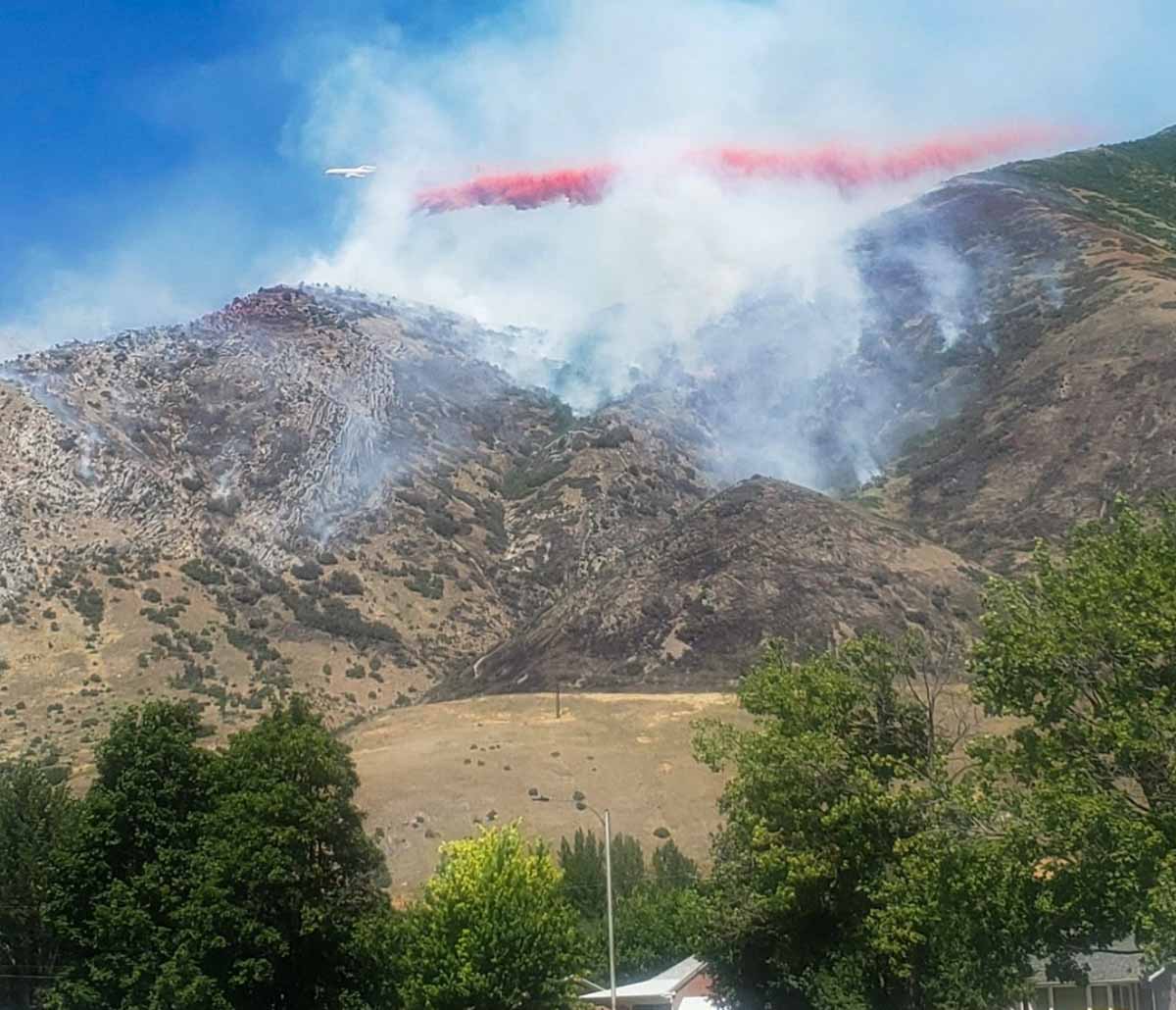
But the Round Peak fire, ignited by a campfire at 9:30 p.m. July 15, was suppressed. The resources the Forest Service used included 4 hand crews, 2 helicopters, 4 Single Engine Air Tankers, 1 large air tanker (MD-87), and 1 Very Large Air Tanker (DC-10).

In the video below it is difficult to determine what type of fixed wing aircraft it is, but it appears to be a DC-10, especially considering the length of the drop.

In addition to the Forest Service aggressively attacking this new fire, another reason we are writing about this fire is that numerous photos of the fire are available, supplied by Utah Fire Info and the Uinta-Wasatch-Cache National Forest.
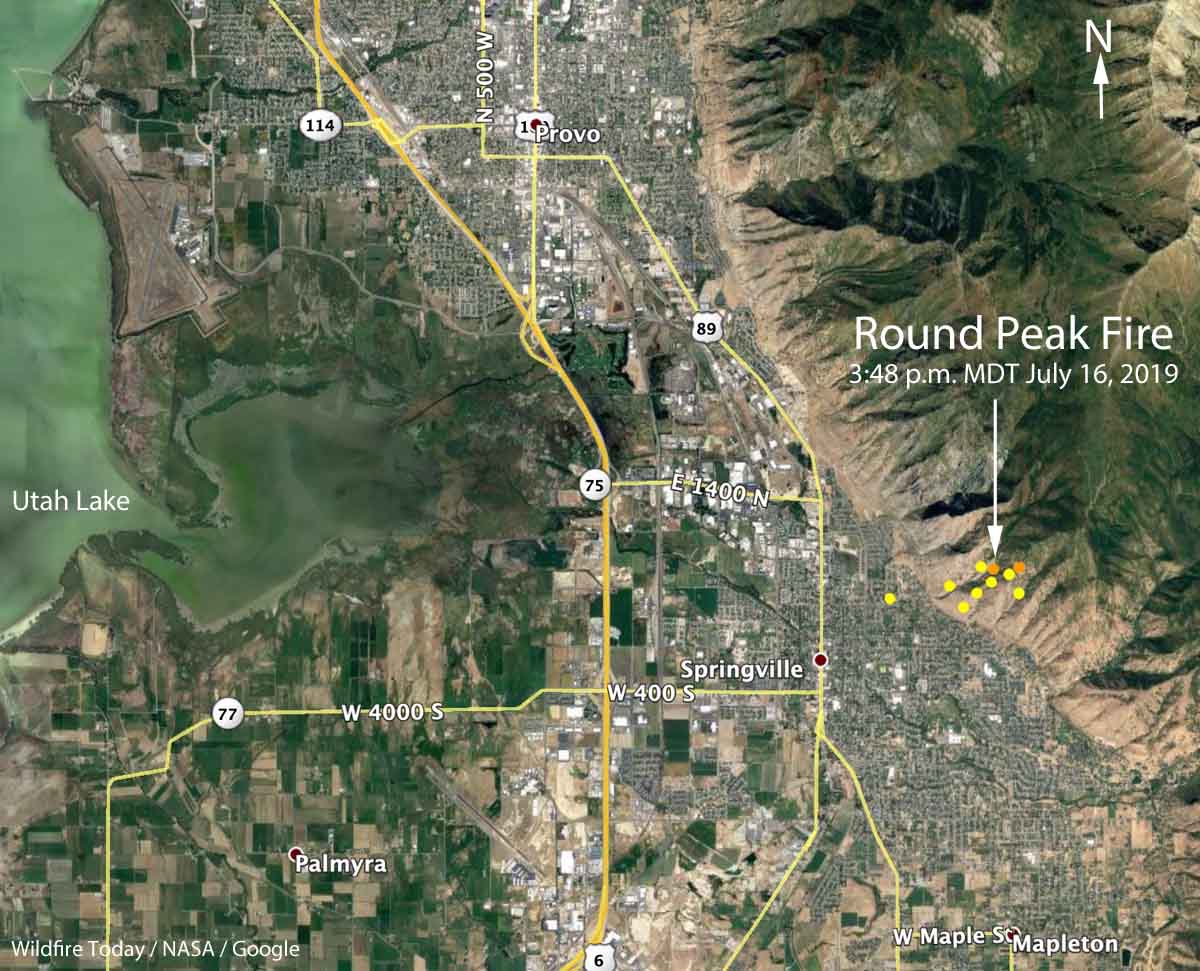
map Round Peak Fire
Map showing the location of the Round Peak Fire east of Springville, Utah. Wildfire Today.
Round Fire air tanker drop Utah
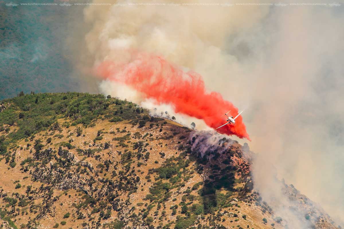
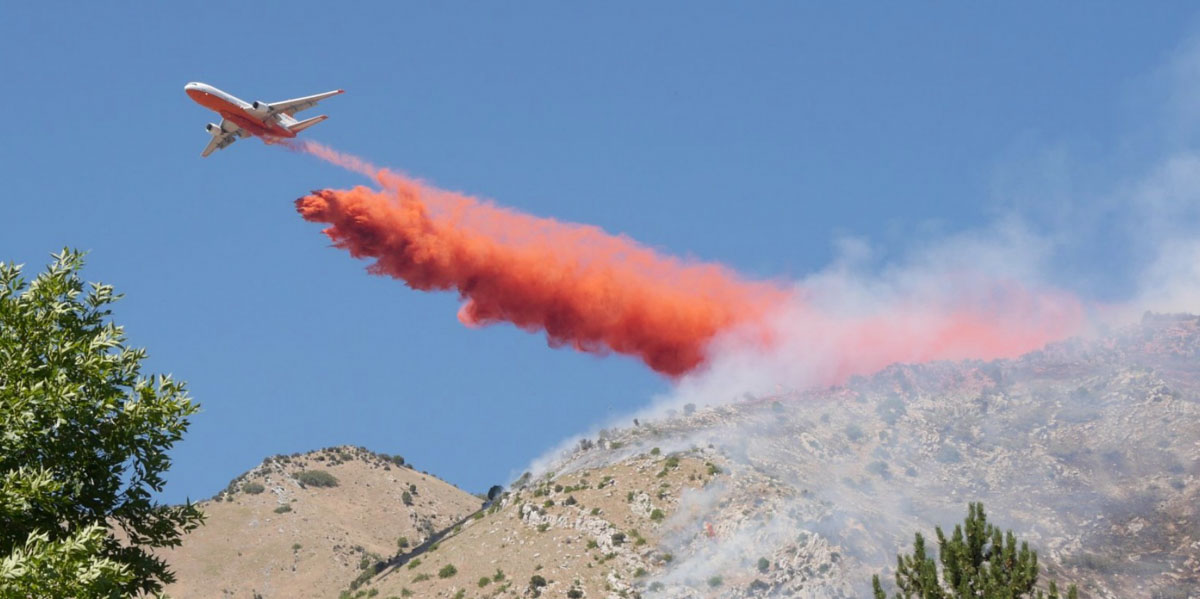
A DC-10 drops through the smoke on the Round Peak Fire east of Springville, Utah.
MD-87 drops on the Round Peak Fire
An MD-87 drops on the Round Peak Fire east of Springville, Utah. Photo by Jocelyn Marie Cooley.
Round Fire air tanker drop Utah
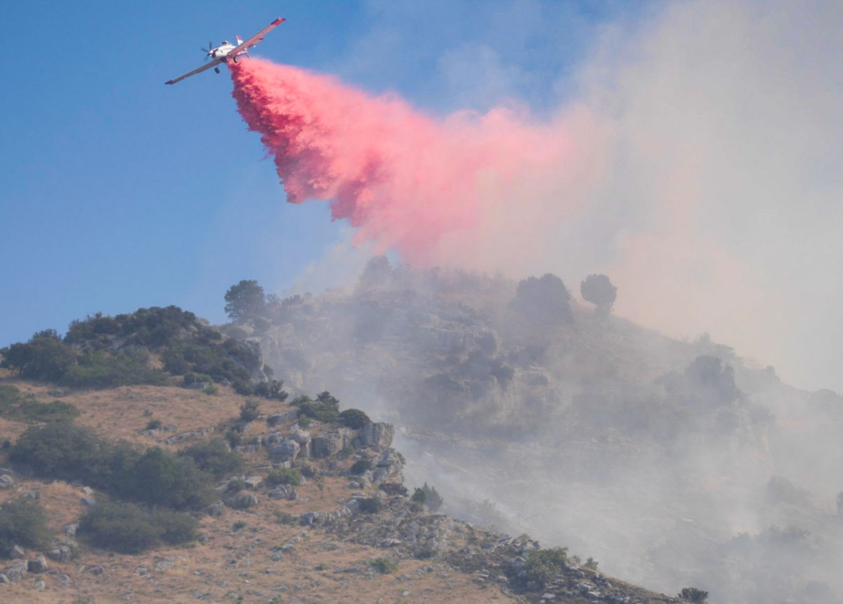
A Single Engine Air Tanker drops on the Round Peak Fire east of Springville, Utah.
helicopter Round Fire Utah
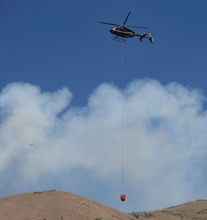
A helicopter with a water bucket maneuvers over the Round Fire east of Springville, Utah. Two Single Engine Air Tankers are in the background..
Round Peak Fire air tanker drop Utah
A DC-10 drops on the Round Peak Fire east of Springville, Utah.

Wildfires above the Arctic Circle in Greenland and Alaska

Alaska Garnet Creek Fire
The Garnet Creek Fire (#576) as seen from the air on Monday, July 15, 2019, was burning about 12 miles southwest of Rampart, Alaska. The fire was started by lightning. Alaska Fire Service.

Alaska

Wildfire activity is moving north. Of the 26 new fires reported over the past two days in Alaska, ten were above the Arctic Circle. Isolated thunderstorms are expected in the central and eastern interior today, Tuesday, with high temperatures reaching the low 80s in the Yukon Flats area.

Fifteen new fires were reported across Alaska Monday. Twenty-three fires are actively burning in the Tanana Zone today, with a total of 30 fires reported this year.

Greenland

In addition to the fires in Alaska, on July 10 a satellite detected heat signatures in Greenland that were consistent with those seen at wildland fires. And another satellite photographed what appears to be smoke.

Wildfires in Greenland are rare but not unheard of. There were also fires there in 2015 and 2017.

A year ago thunderstorms ignited more than 100 wildfires in Oregon

map fires oregon california
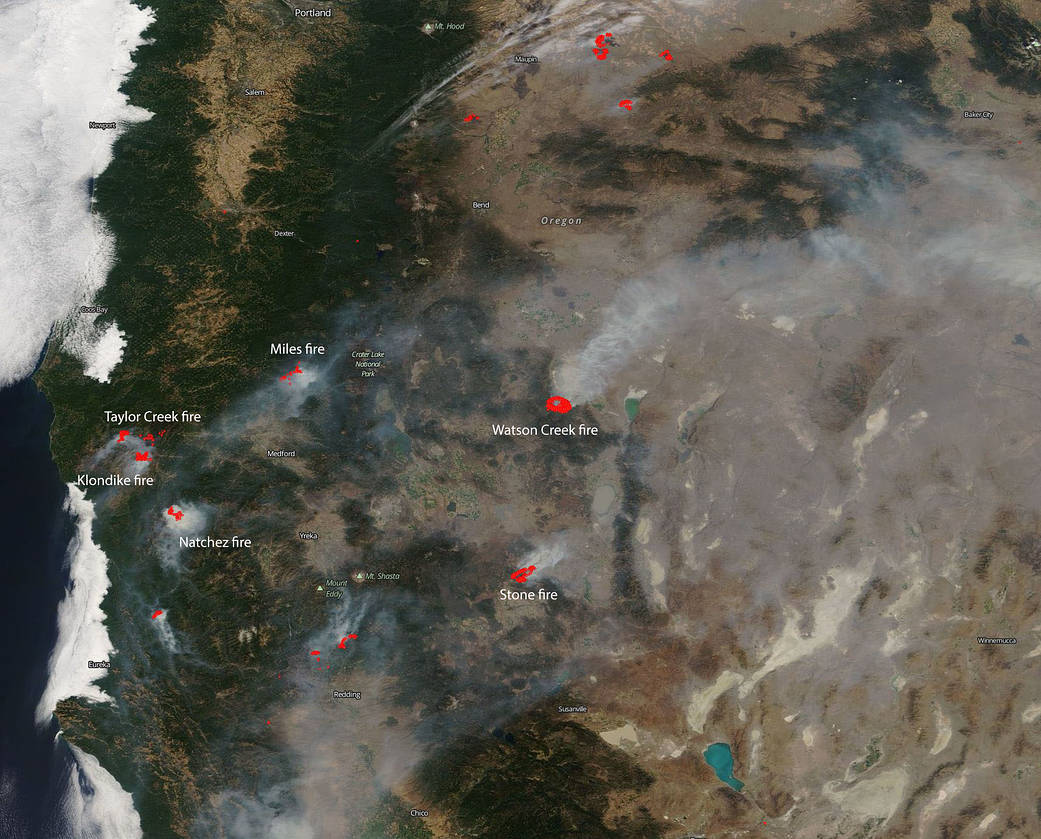
This natural-color satellite image was collected on July 18, 2018. Actively burning areas are outlined in red. NASA image courtesy NASA/Goddard Space Flight Center Earth Science Data and Information System (ESDIS) project.

About this time last year on July 15 a lightning storm swept across Oregon that ignited more than 100 fires according to the U.S. Forest Service.

An article at News10 looks back on what it was like at that time. Below is an excerpt:

…Oregon Department of Forestry called in all resources possible. New fire starts popped up every two minutes for hours, according to [Chris] James, [Detection Center Lead at Oregon Department of Forestry].

[Marcus] Havinear, [a 10-year veteran firefighter with the Oregon Department of Forestry], started his shift early that Sunday morning. Typically firefighters in the thick of fire season will work 12-hour shifts and get replaced by fresh firefighters. This shift lasted 27 hours. Havinear did not leave his post until 11 a.m. the next day.

Inside the dispatch center for ODF, it was a similar story. Normally, five dispatchers rotate through calls, but when fire season hit last year everyone got called in for the agency.

“As you’re getting those calls, you’re trying to allocate your resources as best you can and order more resources as best you can as the calls keep coming in,” Teresa Burkhart, the lead dispatcher for ODF, said.

ODF personnel spotting smoke like James saw 56 different clouds of smoke on their cameras at the exact same time – something James has never seen before.

“92 smokes that we reported over that three day period,” James said. “31 of those were first detection by us.”

Three months later the Klondike fire was still active. During a major run in mid-October it spotted six miles ahead, dropping burning embers between firefighters’ tents in fire camp, forcing a relocation of the incident command post.

Red Flag Warnings in effect Tuesday and Wednesday

Areas of Colorado, Utah, Nevada, and Arizona

Red Flag Warnings Colorado Utah Nevada Arizona
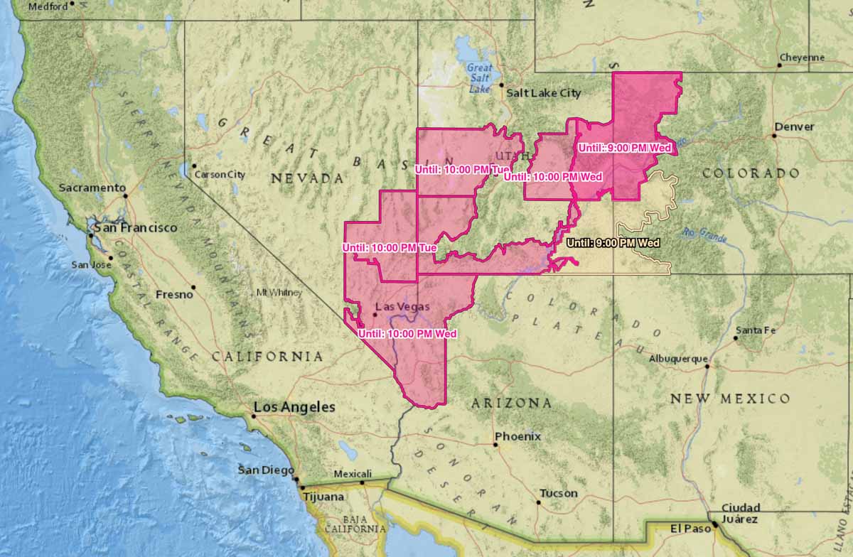
Red Flag Warnings in effect July 16 and 17, 2019.

The National Weather Service has issued Red Flag Warnings for elevated wildfire danger beginning at about 11 a.m. Tuesday, July 16 for areas of Colorado, Utah, Nevada, and Arizona.  As you can see on the map they expire at various times between Tuesday night and Wednesday night.

The forecasts for those areas include strong winds and low humidity.

(Red Flag Warnings can be modified throughout the day as NWS offices around the country update and revise their weather forecasts.)

Explosive peat moss

Peat Moss Flame
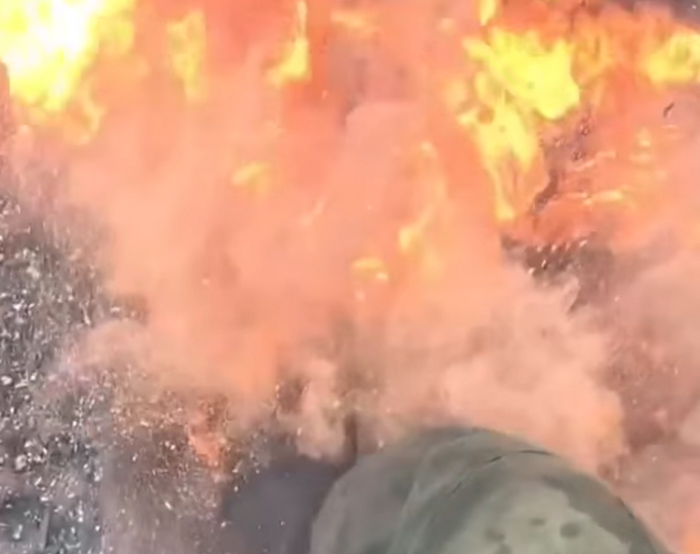
Screenshot from the video below.

In at least one location in Alberta, Canada the peat moss is so dry it can turn to dust when disturbed, and in the presence of sufficient heat and oxygen is damn near explosive.

It’s a good example of the Fire Triangle: Heat + Fuel + Oxygen = Fire

Video courtesy of @whitecourtunitcrew

Thanks and a tip of the hat go out to Tom. Typos or errors, report them HERE.