Wildfire potential October through January

(Originally published at 4:48 p.m. MDT October 1, 2018)

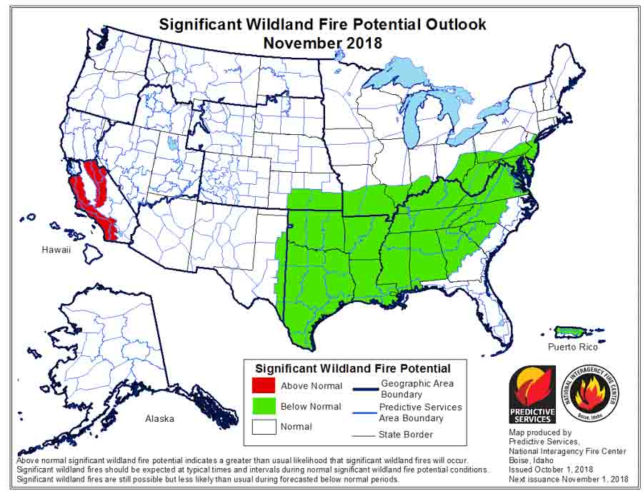
On October 1 the Predictive Services section at the National Interagency Fire Center issued their Wildland Fire Potential Outlook for October through January. The data represents the cumulative forecasts of the ten Geographic Area Predictive Services Units and the National Predictive Services Unit.

If their analysis is correct, the only areas with above normal wildfire activity in October will be California, Southern Idaho, and Northern Nevada. Those areas will shrink in November to just Central and Southern California, and in December to just Southern California and the Central Coast. In January only Hawaii will have above normal potential.

Below:

  • An excerpt from the NIFC narrative report for the next several months;
  • More of NIFC’s monthly graphical outlooks;
  • NOAA’s three-month temperature and precipitation forecasts; and,
  • Drought Monitor.

“October and November mark another transition in the western fire season as the focus typically shifts to California as occasional Foehn wind events develop. The Southeast also typically experiences a fall peak during this period. The fall season this year might not follow the traditional script, however. Expected long-range weather patterns for at least October do not support the development of a significant number of wind events. While they may occur, the total number of events should be less than average. Considering that expected precipitation will be below average during this period, this could be a big factor in keeping some of the impacts from having an elevated potential at bay. Across the Southeast, conditions have been very wet over the past several months. With the potential development of an El Niño, the wet pattern is not likely to change. This should result in overall Normal to Below Normal significant wildland fire potential throughout the remainder of the fall.

“Transitioning from November into December and January, all regions are expected to experience reduced fire activity with the arrival of winter. Brief periods of critical fire weather conditions could elevate fire potential during occasional wind events over areas that are not snow covered. Events such as this are generally short in duration. Areas to monitor are along the Rocky Mountain Front, the Great Basin, the Southwest, and the southern Great Plains (during January.) All of these areas were experiencing some measure of drought at the end of September though some improvement is expected along the Rocky Mountain Front in southern Colorado and New Mexico.”

wildfire potential september through January

Continue reading “Wildfire potential October through January”

Border Patrol agent pleads guilty to starting 46,000-acre fire with exploding target

A Border Patrol agent pleaded guilty Friday to starting the Sawmill Fire that burned 46,000 acres southeast of Tucson, Arizona in 2017. Dennis Dickey was holding an off duty party to celebrate his wife’s pregnancy at which the gender of his baby was revealed. On April 23 he mixed colored powder into a Tannerite exploding target which would show blue or pink smoke when shot with a rifle, according to his attorney, Sean Chapman, as reported by the Arizona Daily Star. The target exploded as planned and started what became the Sawmill Fire. A witness recorded a video of the explosion.

A news release from the U.S. attorney’s office says Agent Dickey will make an initial payment of $100,000, then make monthly payments after that. According to the Arizona Daily Star and the Green Valley News, he agreed in court to pay $500 a month for the next 20 years, which adds up to $120,000, for a total of $220,000. He also will be sentenced to 5 years of probation and agreed to participate in a public service announcement with the U.S. Forest Service concerning the cause of the Sawmill fire.

The off-duty agent could not be charged with arson since it was not a willful act. He pleaded guilty to a misdemeanor charge of causing a fire without a permit, which may allow him to keep his job as a Border Patrol Agent.

Agent Dickey said he attempted to put out the fire but when that failed, he reported it. At one point during the next week at least 799 firefighters were working to put out the fire, which ran up costs of approximately $8.2 million according to the May 5, 2017 national Situation Report.

satellite map Sawmill Fire Arizona
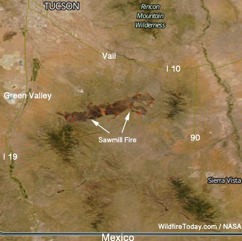
A satellite photographed the darkened outline of the Sawmill Fire east of Green Valley, Arizona on April 26, 2017. The red dots represent heat.

On April 23, 2017, the day the fire started, the Hopkins weather station not far from where the fire began near Madera Canyon, recorded a high temperature of 80 degrees, 11 mph WSW winds gusting to 25, and 6 percent relative humidity. The weather station is at 7,100 feet and the location of the party where the fire started is most likely around 4,000 feet. If correct, this would put the temperature at the fire origin between 90 and 100 degrees.

In court, Agent Dickey told the judge, “It was a complete accident”.

Exploding targets consist of two ingredients that when mixed by the end user explode when shot by a high-velocity projectile. They have caused many fires since they became more popular in recent years, have been banned in some areas, and caused the death of one person. In June, 2013 a man attending a bachelor-bachelorette party in Minnesota was killed after shrapnel from the device struck him in the abdomen. The Missoulian reported that several years ago a woman in Ohio had her hand nearly blown off while taking a cellphone video of a man firing at an exploding target placed in a refrigerator about 150 feet away. In Georgia in 2016 David Pressley’s leg was blown off by an exploding target that he placed in a lawn mower.

After the ingredients are combined, the compound is illegal to transport and is classified as an explosive by the Bureau of Alcohol, Tobacco, Firearms, and Explosives and is subject to the regulatory requirements in 27 CFR, Part 555.

Firefighters making progress on Roosevelt Fire in Wyoming

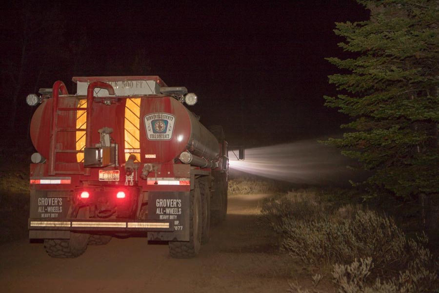
Above: Roosevelt Fire, Wyoming. InciWeb photo. Date and photographer not identified.

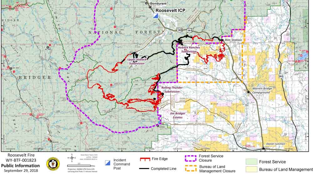
Firefighters have accomplished a great deal on the Roosevelt Fire since it started September 15 south of Bondurant, Wyoming but it has grown to over 60,000 acres, and only about half of the 172-mile fire perimeter has completed fireline.

The focus Sunday was on the southwest side of the fire in the North Dry Beaver Creek area west of Jim Bridger Estates. Firefighters have secured fire lines there, which reduces the threat. Additional resources have been allocated and a structure protection group is working the area ahead of the fire to protect homes.

On the north side of the fire adjacent to the highway, containment lines are in place and holding the fire south of the highway.

In Hoback Ranches, recovery efforts are underway in preparation of an organized repopulation of residents. Lower Valley Energy and Rocky Mountain Energy are working to restore destroyed infrastructure, while firefighters are clearing dangerous snags and suppressing hotspots as they occur. These efforts will continue for a number of days until it is safe for residents to return.

Personnel on the fire could receive help Tuesday night through Wednesday with a 30 to 70 percent chance of precipitation. There could be as much as a quarter-inch on Tuesday. From Thursday until Sunday the chance of additional precipitation is from 20 to 60 percent. Nighttime temperatures will be in the 20s and 30s.

Investigators determined that the fire was caused by an abandoned warming fire.

Highway 191 is fully open through the fire area with reduced speed limits and lane restrictions.

Map of the Roosevelt Fire
Map of the Roosevelt Fire, September 29, 2018. Click to enlarge.
Roosevelt Fire Wyoming
Roosevelt Fire. Photo by Kari Greer.
Roosevelt Fire Wyoming
A Firehawk helicopter executes a fancy water drop on the Roosevelt Fire in an area that is showing fall colors. Photo by Kari Greer.

Two unique ways to thank firefighters

This article first appeared on Fire Aviation.

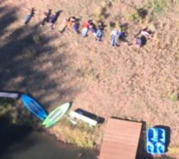
Earlier this week a family wanted to thank a helicopter pilot who was helping to suppress the Black Mountain Fire in Colorado by dropping water. There was apparently no way they could make a billboard-sized sign, so they arranged their bodies, spelling out “THANKS”.

The photo was taken by Joseph Mutchler of Billings Flying Service and posted on Twitter by Air Attack pilot Ron Hauck.

Here is an enlarged version of the family’s message:

family thanks helicopter pilot wildfire

The Black Mountain fire is 14 air miles southwest of Kremmling, Colorado in the southeast corner of Routt County. We can’t find it listed on any official government lists of wildfires, but it created a small heat signature on September 25 during a 3 a.m. satellite overflight.

And here is another great way to thank firefighters!

Successful initial attacks in Santa Barbara County

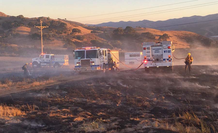
A crew constructs fireline on the Drum Fire September 29, 2018 at Hwy. 246 and Drum Canyon. SBC photo.

The big wildfires that burn homes and thousands of acres are the ones that make the news. We rarely hear about the successful, aggressive initial attacks on new fires that never grow to more than a handful of acres.

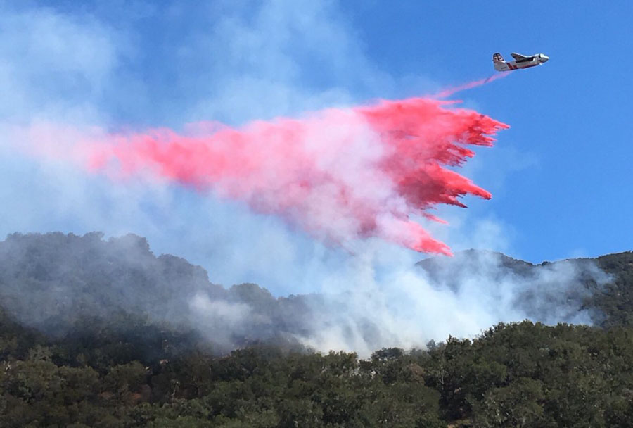
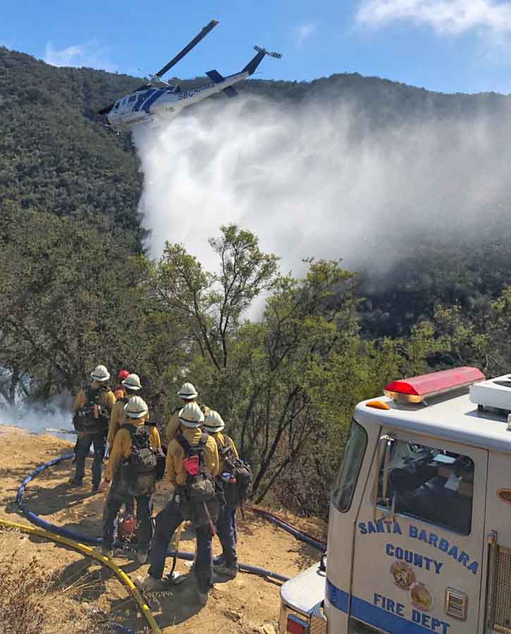
On Friday and Saturday of this week firefighters in Santa Barbara County in Southern California squashed two fires, keeping them both to less than three acres.

The credit for these photos goes to Santa Barbara County.  @EliasonMike of SBC distributed them on Twitter.

Drum Fire
Drum Fire, at Hwy. 246 and Drum Canyon, September 29, 2018.
Peak Fire
An S-2T makes a drop on the Peak Fire, Gaviota Peak near Hwy 101/SR-1, September 28, 2018.
Peak Fire
A helicopter makes a drop on the Peak Fire, Gaviota Peak near Hwy 101/SR-1, September 28, 2018.

New professional football team calls itself “Arizona Hotshots”

Arizona Hotshots football teamOne of the eight teams in the new Alliance of American Football calls itself “Arizona Hotshots”. In February when they begin playing games in Arizona State’s Sun Devil Stadium they will wear yellow helmets and jerseys with dark green pants. The team’s logo features flames and crossed *Pulaskis (although on their website they are called “cross-axe Pulaskis”).

The origin of the name definitely is inspired by firefighting Interagency Hotshot Crews (IHC). Here is an excerpt from their website:

The Hotshots draw inspiration from the  more than 100 elite teams of exemplary, ferocious wildland firefighters from the U.S. Forest Service and other federal, state and county agencies, mostly located in the west. Hotshot firefighters are highly successful and an essential line of defense in battling the most serious wildfires across the country.

The Arizona Hotshots will gratefully display the firefighters’ familiar cross-axe Pulaskis in their logo. The color scheme and designs tip their helmets to the heroes who confront orange-fire disasters wearing yellow helmets and shirts with dark green pants.

(UPDATE September 30, 2018)

*A couple of people have pointed out that the firefighting tools in the logo look more like a fire axe used by structural firefighters than a Pulaski.The people that have pointed this out are correct, but the team calls them Pulaskis and the only people that will notice the difference are wildland firefighters. Maybe it is not a big deal.

Ranger Edward Pulaski invented or improved the tool for wildland firefighters soon after the fires of 1910. The Collins Tool Company sold a similar tool beginning in 1876.