Alamo Fire burns 19,000 acres east of Santa Maria, California

Above: 3-D map of the Alamo Fire looking west, mapped Friday night.

(Updated at 6:18 p.m. PDT July 8, 2017)

We have an updated map of the Alamo Fire that has now grown to within four miles of Santa Maria, California and US Highway 101.
Map Alamo Fire
Map showing the approximate perimeter of the Alamo Fire at 1:36 p.m. PDT July 8, 2017. This is preliminary data is is not official.

Our very, very unofficial estimates using heat data collected by sensors on a satellite, show that it has burned APPROXIMATELY 23,000 acres as of 1:38 p.m. PDT July 8, 2017.

KSBY reports that evacuation orders have been issued for Blazing Saddle Drive, Buckhorn Ridge, White Rock Lane, Colson Canyon Road, Pine Canyon, and Tepusquet Road south of Blazing Saddle Drive to Santa Maria Mesa Road.

****

(Updated at 3:50 p.m. PDT July 8, 2017)

The California Department of Forestry and Fire Protection reported Saturday at 3:05 p.m. that the Alamo Fire had grown to 19,000 acres.

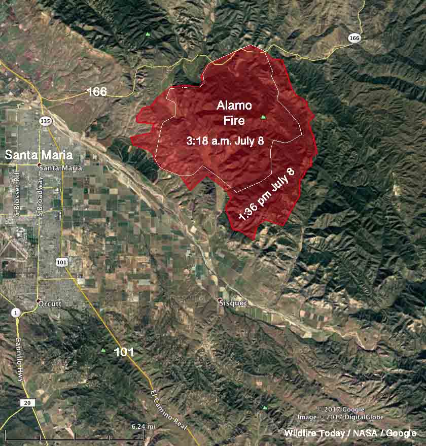
The perimeter of the fire shown in the map below was derived from data collected by heat sensors on a satellite at 3:18 a.m. July 8. At that time the fire was about 13,000 acres, but since then the fire has been very active and produced a pyrocumulus cloud over the fire which is a sign of very intense burning.

map Alamo fire Santa Maria
The perimeter of the Alamo Fire derived from heat detected by a satellite at 3:18 a.m. PDT July 8, 2017.

****

(Originally published at 11:33 a.m. PDT July 8, 2017)

During the first 24 hours after the Alamo Fire started at 3:43 p.m. PDT Thursday July 6 east of Santa Maria, California it spread over several hundred acres. But winds Friday afternoon caused it to grow substantially and by late Friday night it was mapped at about 5,900 acres. It continued to grow over the next 12 hours and could be quite a bit larger as this is written just after noon on Saturday.

Mandatory evacuations are in effect for some areas near Tepusquet Canyon.

The fire is 7 miles east of Santa Maria and US Highway 101.

The wind is expected to shift Saturday afternoon to come out of the northwest.

map Alamo Fire
Map of the Alamo Fire. The data was current as of late Friday night, July 7, 2017.

Air tankers are reloading at the tanker base at the Santa Maria Airport. Live cams with views of the ramp are available here and here.

Satellite photo Alamo Fire
Satellite photo of smoke from the Alamo Fire.

Evacuation lifted for Peak 2 Fire near Breckenridge

Above: 3-D map of the Peak 2 Fire, July 7, 2017.

(Originally published at 7 a.m. MDT July 8, 2017)

Residents of the 463 homes in the Peak 7 neighborhood near the Peak 2 Fire north of Breckenridge, Colorado were able to return to their homes Friday night for the first time since the fire started July 5. The fire has burned 74 to 84 acres, about the size of an 18-hole golf course, but no one would ever build a golf course on terrain this steep (see map above).

Todd Pechota’s Type 1 Incident Management Team assumed command at 6 a.m. Friday.

The resources assigned to the fire include 8 hand crews, 15 engines, and 8 helicopters for a total of 362 personnel.

July Fire: Evacuations lifted for Landusky

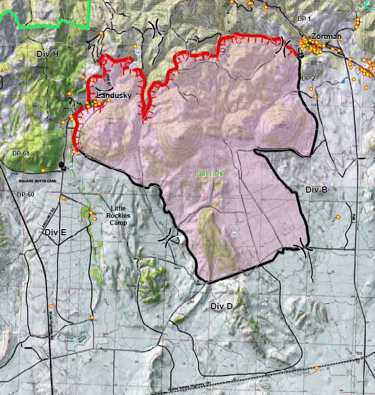
Map July Fire
July Fire, July 8, 2017. The red line represents uncontrolled fire edge and the yellow dots are structures. This is a portion of the map that was developed by the Northern Rockies Incident Management Team. Click to enlarge.

(Originally published at 6 a.m. MDT July 8, 2017)

With the spread of the July Fire slowing and firefighters making progress to contain it, the residents of the evacuated town of Landusky, Montana will be able to return to their homes at 10 a.m. Saturday. However the road closure and evacuation will remain in effect for non-residents.

The Incident Management Team provided the following information Friday evening:

The success of the fire management in the Landusky area was largely facilitated by the efforts of the community in reducing fuels around their homes. Their efforts to make their properties more Firewise helped to both slow the fire and provide safer, more manageable working conditions for the firefighters.

We experienced moderate fire behavior as temperatures increased and the humidity dropped [Friday] afternoon. Additional heavy equipment arrived [Friday], including feller-bunchers and skidders, and is being used on the northwest side of the fire. Aerial resources, including three helicopters with water buckets, also assisted firefighters in holding and reinforcing firelines.

Making rain to extinguish wildfires

The Instagram account below frequently covers wildland fire and smokejumpers in Russia. Here is the automatic Google translation of the caption (without all the hash tags):

“Avialesoohrana” carries out works on artificial precipitation for the purpose of extinguishing forest fires in the regions of Siberia. Details on the site.

Click on the arrows to see two additional photos.