The map, produced by Predictive Services at the National Interagency Fire Center, shows the location of lighting that was detected during the 24 hours ending at 6 a.m. MT, July 2, 2015.
Category: Uncategorized
Wildfire smoke maps, July 2, 2015

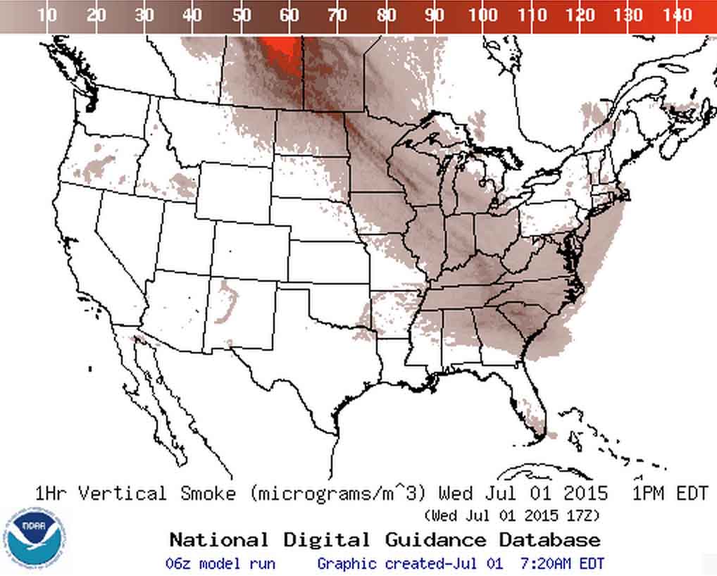
These two images show the distribution of smoke from wildfires. Most of what residents in the United States will see and smell today is coming from fires in Canada, but wildfires in Washington and Oregon are also contributing to the haze, but in comparatively small amounts.
The image above is a forecast for smoke at 4 p.m. MT, July 2, 2015. Below is a “smoke analysis” for July 2, 2015, produced by NOAA. The red dots represent the location of wildfires.

A grass fire under lightning and a full moon
Better shot. Grass fire. Lightning. Under a full moon. pic.twitter.com/tt6gFZTcnV
— Mark Finan (@kcraFinan) July 2, 2015
Mark Finan is the KCRA-TV Chief Meteorologist, based in Sacramento, California.
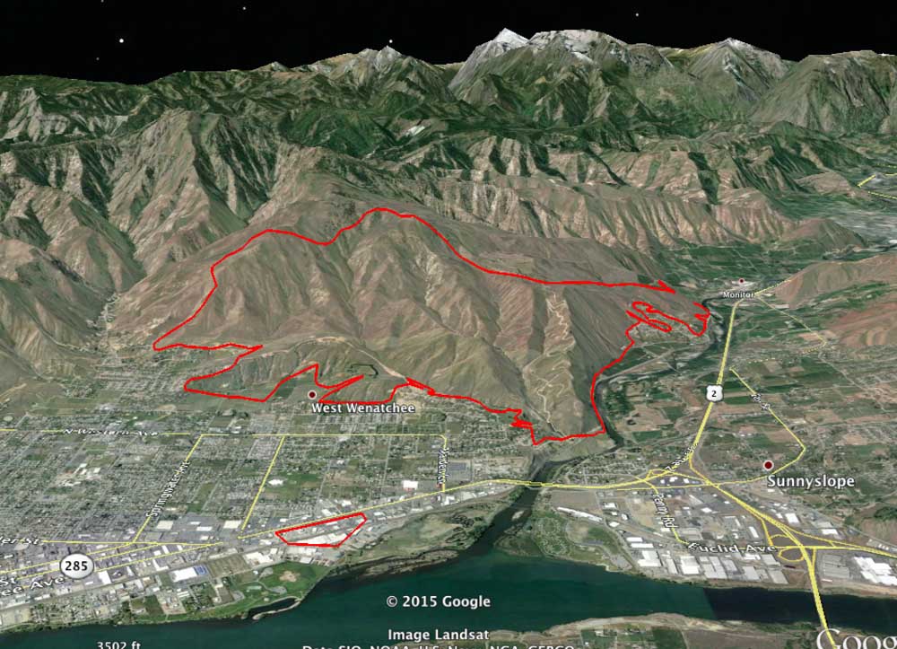
Spot fire from Sleepy Hollow Fire burned commercial structures 1.2 miles from main fire

The map above is a 3-D rendering of the perimeter of the Sleepy Hollow Fire that burned into Wenatchee in central Washington Sunday, June 28. The map is looking west, and was produced after a mapping flight at 1 a.m. PT, July 1. The fire burned 24 residences and several commercial structures.
One interesting thing is the spot fire that caused several businesses to burn near the river 1.2 miles away from the main fire. It is believed that a burning ember landed in some bales of cardboard that were to be recycled. While firefighters were engaged miles away trying to save homes, the fire spread from the cardboard to several nearby commercial structures, some of which were warehouses and fruit packing plants. Monday morning, June 29, smoke was still coming from the facilities of Michelsen Packaging Company, Northwest Wholesale, and Blue Bird Inc.
This is not unheard of, for a burning ember to travel that far and ignite a new fire, and has happened over greater distances. A recent example was on the King Fire in northern California in 2014, where a spot fire occurred 2 miles in front of the main fire.
More information about the Sleepy Hollow Fire on Wildfire Today.
Outlook for wildfire potential through October, 2015
The Predictive Services section at the National Interagency Fire Center has issued their Wildland Fire Potential Outlook for July through October. The data represents the cumulative forecasts of the ten Geographic Area Predictive Services Units and the National Predictive Services Unit.
If their forecasts are accurate, the three west coast states and the western portions of Idaho, Nevada, and Montana will have above normal wildfire activity into October.
Here are the highlights from their outlook.
****
July
– Higher than usual temperatures; minimal summer precipitation; and already dry fuels will combine to continue above normal potential across most of the pacific coast states, as well as the northern Rocky Mountains and northern and western Great Basin.
– Fuels that were exposed to drying earlier than usual as well as hot and dry conditions throughout May and June have led to above normal potential throughout Alaska.
– Abundant spring and early summer precipitation and moist fuels will alleviate much of the fire concern for the Rocky Mountains, Southwest, and areas east of the Mississippi.
August
– Much of the above normal area from July will linger into August, with the exception of some of northern California. Above normal conditions will spread slightly westward to encompass more of the Great Basin.
– Most of the areas experiencing below normal potential will return to a more normal condition, with only some of the Central Rockies and Ohio Valley below normal.
September through October
– Almost all of the above normal potential will return to normal through this period, leaving only far southern California as above normal.
– Below normal fall conditions will develop across inland portions of the southeast.
****
UPDATE: And, as a bonus, here is the Drought Monitor that was released July 2, 2015. Portions of California, Nevada, and Oregon are in Extreme or Exceptional Drought. Nine of the eleven western states have areas in Severe Drought or worse.


