Four large wildfires keep firefighters in Colorado busy

August 15, 2020 | 10 a.m.
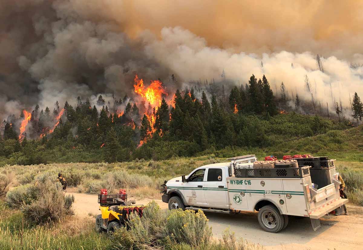
Pine Gulch Fire
The Wyoming Hotshots on the Pine Gulch Fire August 7, 2020. InciWeb.

A week ago when I was talking with a colleague about the national wildfire situation we agreed there was a “lull” in the action. With new fires in California and Colorado since then, that has changed.

In southern California on August 12 the Lake Fire west of Lancaster grew large enough 29 minutes after it was reported to create pyrocumulus clouds above the smoke column. Three hours later it was 10,000 acres and Friday had blackened at least 17,000 acres.

But much of the focus has turned Colorado where four large fires are out of control.

Map four large wildfires Colorado
Map showing four large wildfires in Colorado, August 15, 2020.

The Pine Gulch Fire 15 miles north of Grand Junction, Colorado at 73,381 acres Saturday became the fourth largest fire in the recorded history of the state. The Rocky Mountain Type 1 Incident Management Team with Dan Dallas as Incident Commander assumed command of the Friday morning after transitioning with the type 2 team.

Pine Gulch Fire fourth largest Colorado

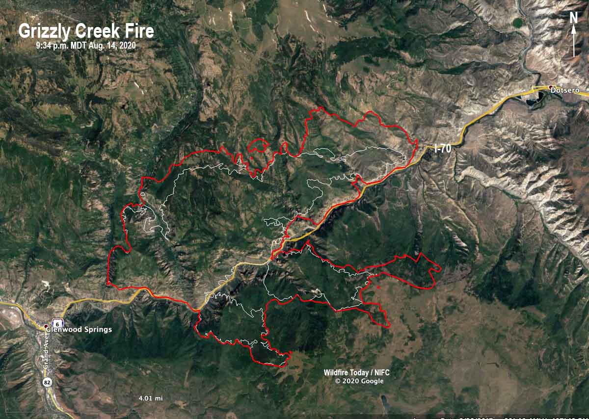
The Grizzly Creek Fire just east of Glenwood Springs has been adding thousands of acres every day since it started August 10. Interstate 70 has been closed since then due to the fire.

More information about the Grizzly Creek Fire on Wildfire Today.
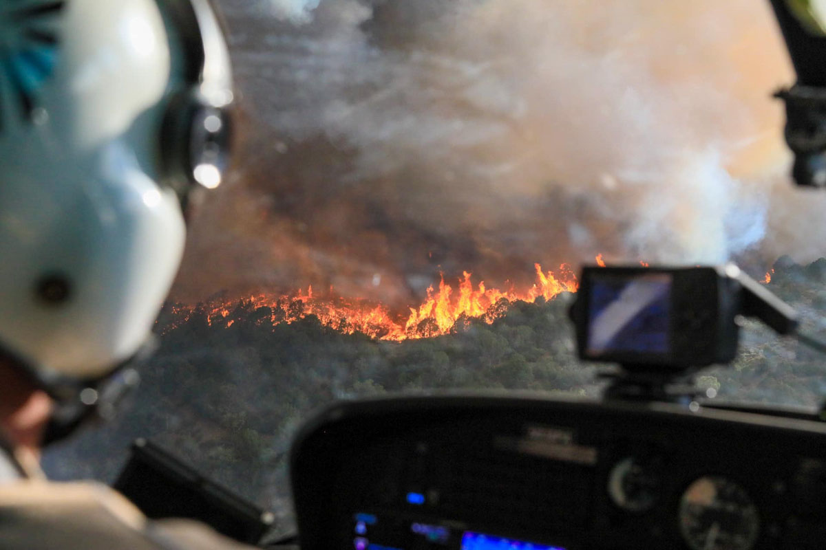
Grizzly Creek Fire
View of the Grizzly Creek Fire from a helicopter August 14, 2020. InciWeb.

The newest of the four large fires in Colorado is the Williams Fork Fire 10 air miles southeast of Williams Fork Reservoir and 19 miles southeast of Kremmling reported just before noon Friday August 14. Firefighters estimated Friday night it was 1,300 acres and said it is exhibiting extreme fire behavior as it moves east and northeast toward Church Park. The fire is currently holding east of CR 30 and south of Keyser Creek in an area with intensive beetle kill from the early 2000s. Henderson Mill and its infrastructure along with multiple other utilities are in the immediate area.
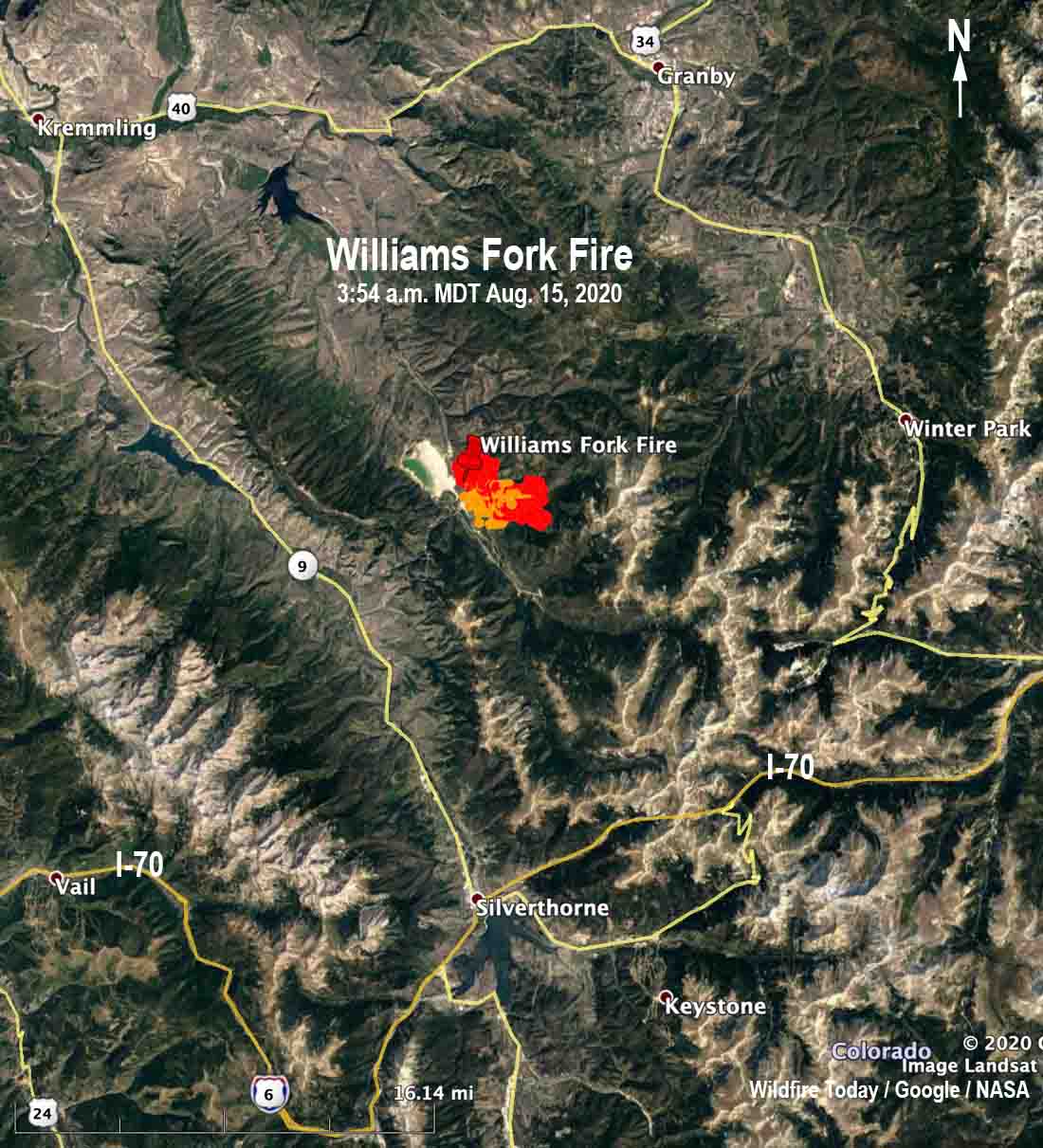
map Williams Fork Fire
Map showing heat on the Williams Fork Fire detected by a satellite at 3:54 a.m. MDT August 15.

The Cameron Peak Fire has been burning since August 13 in the Rawah Wilderness on the Arapaho & Roosevelt National Forests near Highway 14 and Chambers Lake. It is 36 air miles west of Fort Collins, Colorado and as of Friday night had burned about 5,424 acres. Mike Haydon’s Type 2 Rocky Mountain Incident Management Team Blue will assume command today, August 15. The Cameron Peak Fire started west of Chambers Lake and has crossed Highway 14 to the east, burning nearly 800 acres on the south side of the highway.

To see all articles on Wildfire Today about the Cameron Peak Fire including the most recent, click here.
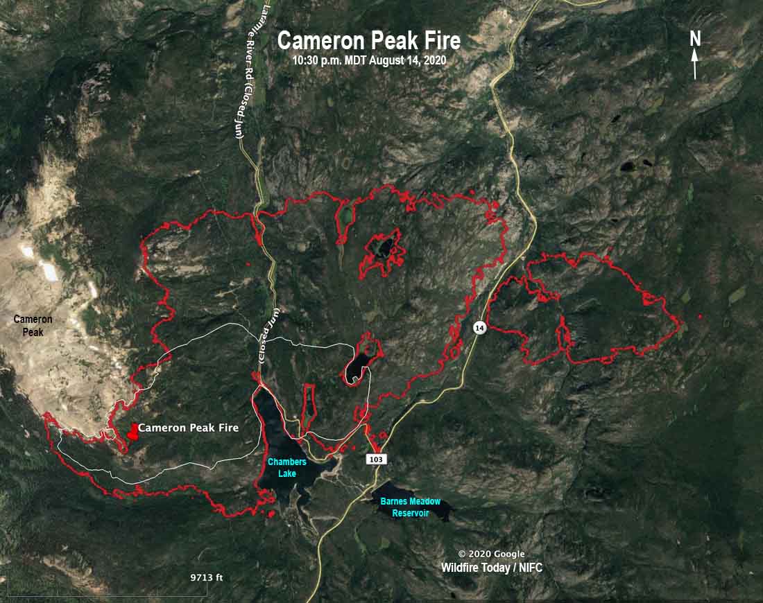
Cameron Peak Fire map
The red line was the perimeter of the Cameron Peak Fire at 10:30 p.m. MDT August 14, 2020. The white line was the perimeter about 24 hours before.

Grizzly Fire near Glenwood Springs continues to spread along Interstate 70

It has grown to over 25,000 acres

August 16, 2020  |  10:35 a.m. MDT

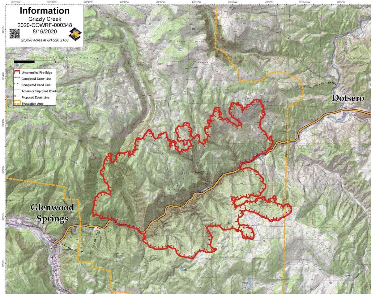
Grizzly Creek Fire Map, 9:02 p.m. MDT August 15, 2020
Map of the Grizzly Creek Fire, current at 9:02 p.m. MDT August 15, 2020. Incident Management Team.

The Grizzly Creek Fire burning on both sides of Interstate 70 east of Glenwood Springs grew by more than 6,000 acres Saturday to bring the total size up to 25,690 acres.

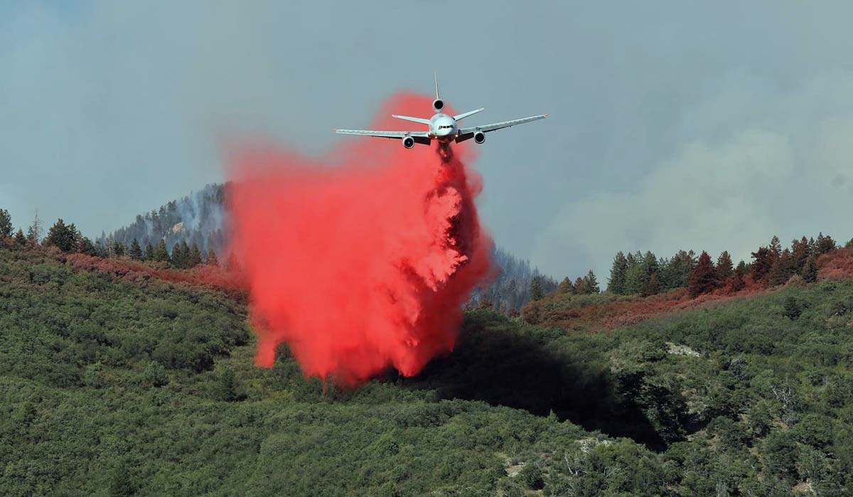
DC-10 air tanker dropping Grizzly Creek Fire Colorado Glenwood Springs
DC-10 dropping on the northwest side of the Grizzly Creek Fire August 14, 2020. InciWeb.

Resources that were assigned to the fire Saturday evening included 13 hand crews, 32 engines, and 13 helicopters for a total of 625 personnel. That was an increase of 72 people over the day before.

For a 25,690-acre fire that started six days ago and has closed a major Interstate highway for that entire time, this is not a huge commitment of hardware and firefighters on a full-suppression fire threatening 1,162 structures. It is difficult to compare fires without worrying about apples vs. oranges, but Saturday an 11,000-acre wilderness fire in remote northern California, the Red Salmon Complex, had 24 hand crews, 36 engines, and 14 helicopters for a total of 1,281 personnel. That was a decrease of 209 people over the day before. The Red Salmon Complex was reported on July 27 and has had more time to develop the organization.

“We have not had problems getting the resources that we need,” said Mary Cernicek, an information officer for the fire’s Incident Management Team.”

Three structures have been destroyed. At least two of those were outbuildings and the third was described as a “small structure”.

The plan developed by the Incident Management Team is for hotshot and engine crews to continue to establish structure protection measures and plans for additional subdivisions and dispersed holdings that may be impacted. Hand crews will establish indirect lines for future control operations in accessible terrain where exposure risks have been mitigated. Heavy equipment will establish indirect lines on the north and south sides of the fire.

The typical COVID-19 precautions and procedures for a fire are in place on the Grizzly Creek Fire, including those for operational period briefings. “The morning briefings are virtual, so we only have the presenters attend those and the rest attend virtually or over the radio,” said Ms. Cernicek.

The estimated cost to date is $6.3 million.


August 15, 2020 | 7 a.m. MDT

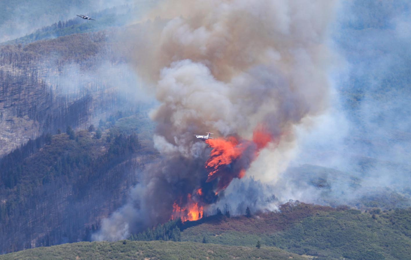
Grizzly Creek Fire air tanker
A lead plane exits the drop area as an RJ85 air tanker applies retardant on the southeast side of the Grizzly Creek Fire August 13, 2020. InciWeb.

The Grizzly Fire east of Glenwood Springs, Colorado spread to the north, east, and south Friday, adding another 6,000 acres to bring the total up to 19,440.

Firefighters were able to confirm that the immediate area around Hanging Lake which was overrun by the fire Thursday did not burn, but there was still fire in nearby. For locals, the lake is a very beautiful and special landmark.

To see all articles on Wildfire Today about the Grizzly Creek Fire, including the most recent, click here.

The fire has forced the closure of a 57-mile section of Interstate 70 for five days; there is no estimate for reopening.

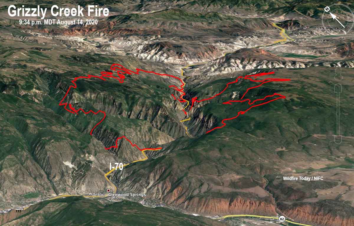
Map Grizzly Creek Fire August 14, 2020 3-D
3-D Map of the Grizzly Creek Fire looking northeast. The red line was the perimeter at 9:34 p.m. MDT August 14, 2020.
Map Grizzly Creek Fire August 14, 2020
Map of the Grizzly Creek Fire. The red line was the perimeter at 9:34 p.m. MDT August 14, 2020. The white line was the perimeter about 24 hours before.
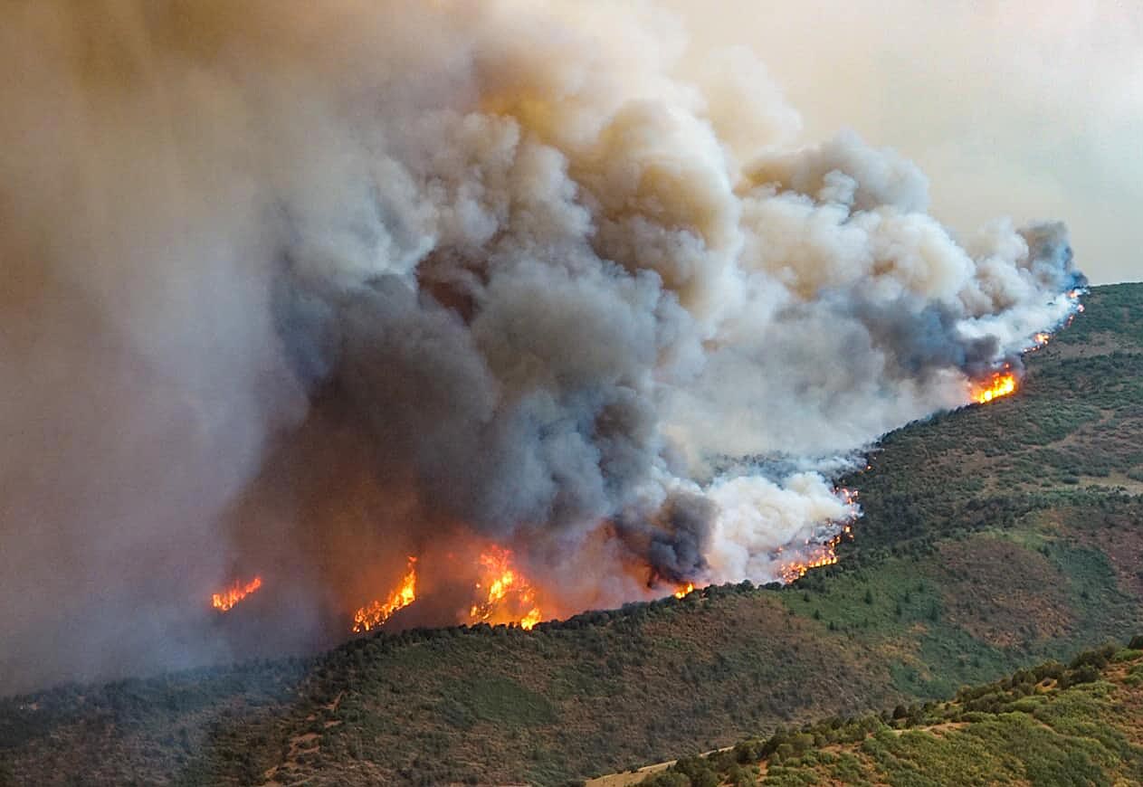
Grizzly Creek Fire
Grizzly Creek Fire August 13, 2020. InciWeb.
Grizzly Creek Fire air tanker
A lead plane exits the drop area as an RJ85 air tanker applies retardant on the southeast side of the Grizzly Creek Fire August 13, 2020. InciWeb.
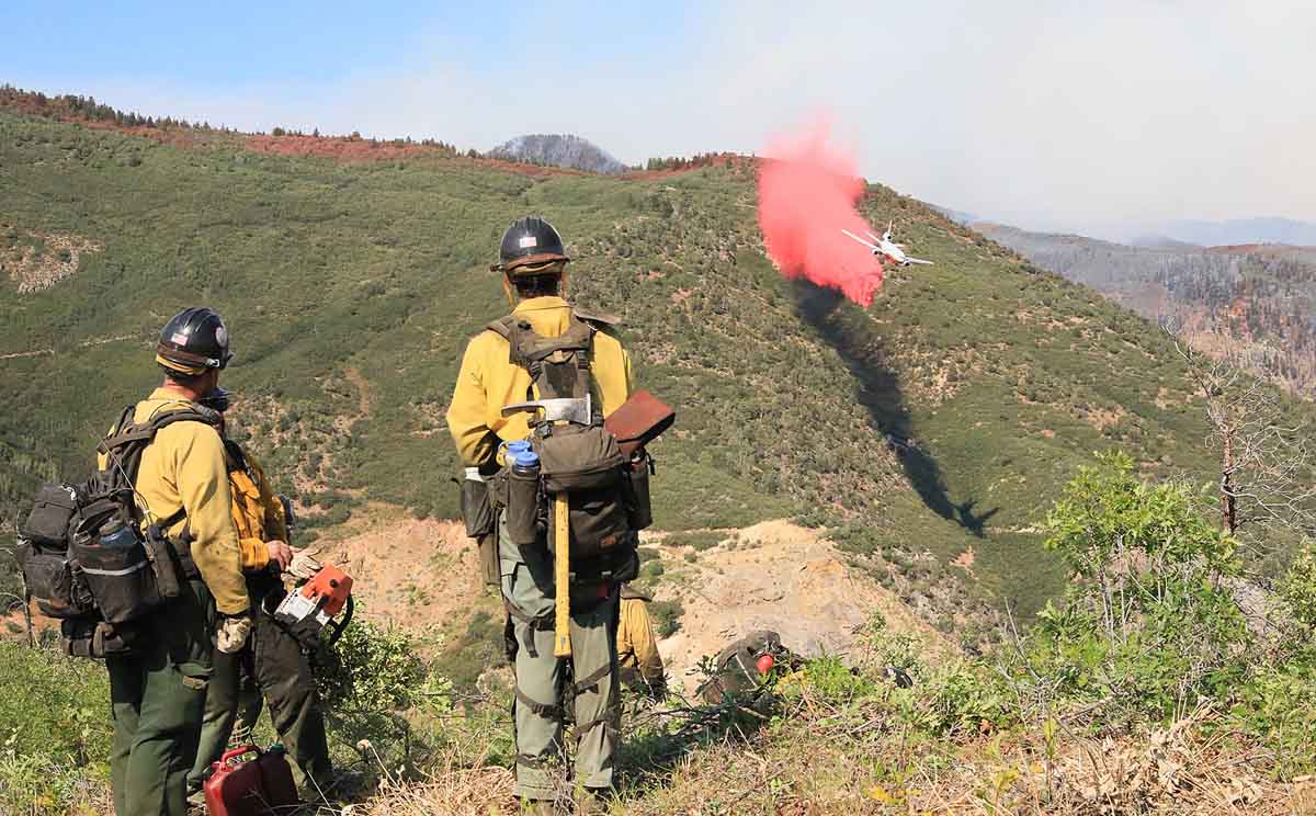
Grizzly Creek Fire air tanker
A DC-10 air tanker makes a downhill retardant drop on the northwest side of the Grizzly Creek Fire, August 13, 2020. InciWeb.

Lake Fire near Lake Hughes, CA was very active Friday and Saturday

Spreading to the northeast

UPDATED August 15, 2020  |  6:17 p.m. PDT

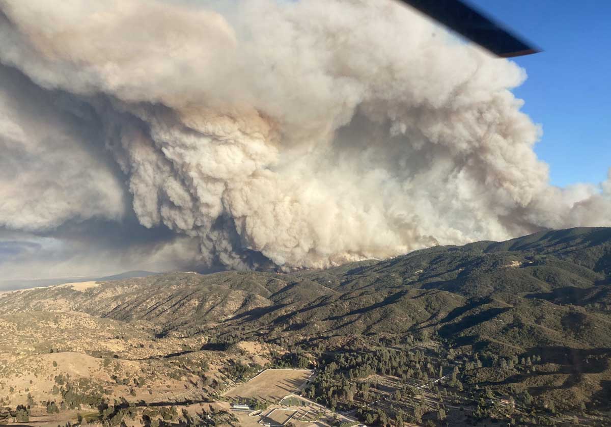
Lake Fire smoke pyrocumulus
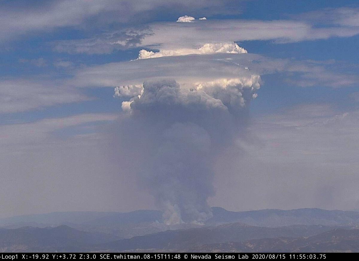
Lake Fire 11:55 a.m. PDT August 15, 2020.

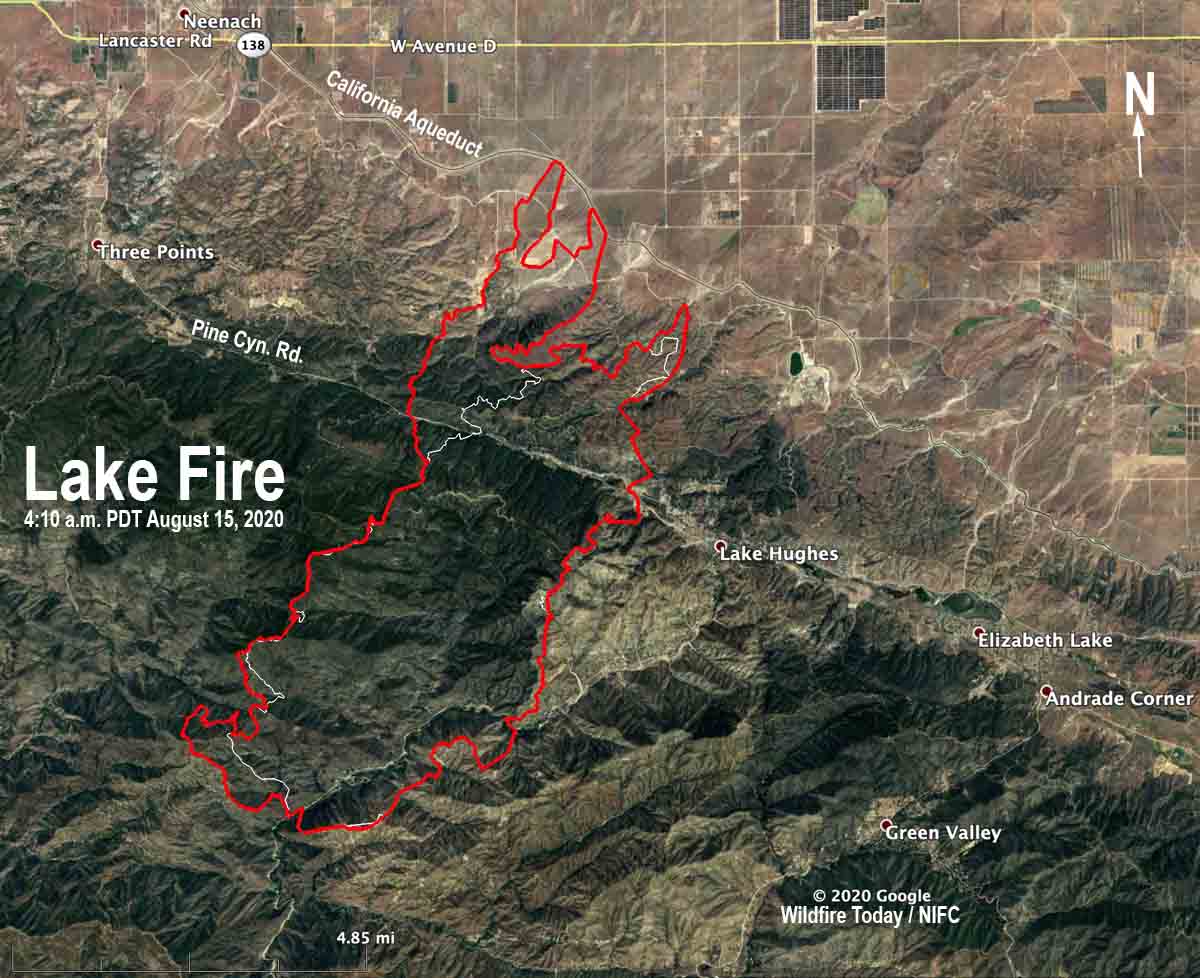
The Lake Fire west of Lancaster, California is up to its old pyrocumulus tricks again as you can see in the photo above taken just before noon Saturday. In the afternoon it was very active and in one location forced firefighters to withdraw to a safer location.

Fire photographer Jeff Zimmerman said, “We are getting hundreds of down strikes to the north of the fire.” This can happen under certain conditions when extreme fire behavior creates a massive pyrocumulus cloud that can generate lightning. The phrase “a fire can create its own weather” is overused, but creating its own lighting is an example.

On Friday it made a three-mile run to the northeast down into the Antelope Valley but firefighters were able to keep it from crossing the California Aqueduct.

map lake fire lancaster california wildfire
The red line was the perimeter of the Lake Fire at 4:10 a.m. PDT August 15, 2020. The white line was the perimeter about 24 hours before.

Air Tanker 944, the 747, was over the fire at 11:45 a.m. Saturday and returned to San Bernardino. As this was being written at 1:35 p.m. Saturday the aircraft was again en route to the same general area, probably to drop another 17,500 gallons.


August 14, 2020 | 4:15 p.m. PDT

Lake Fire
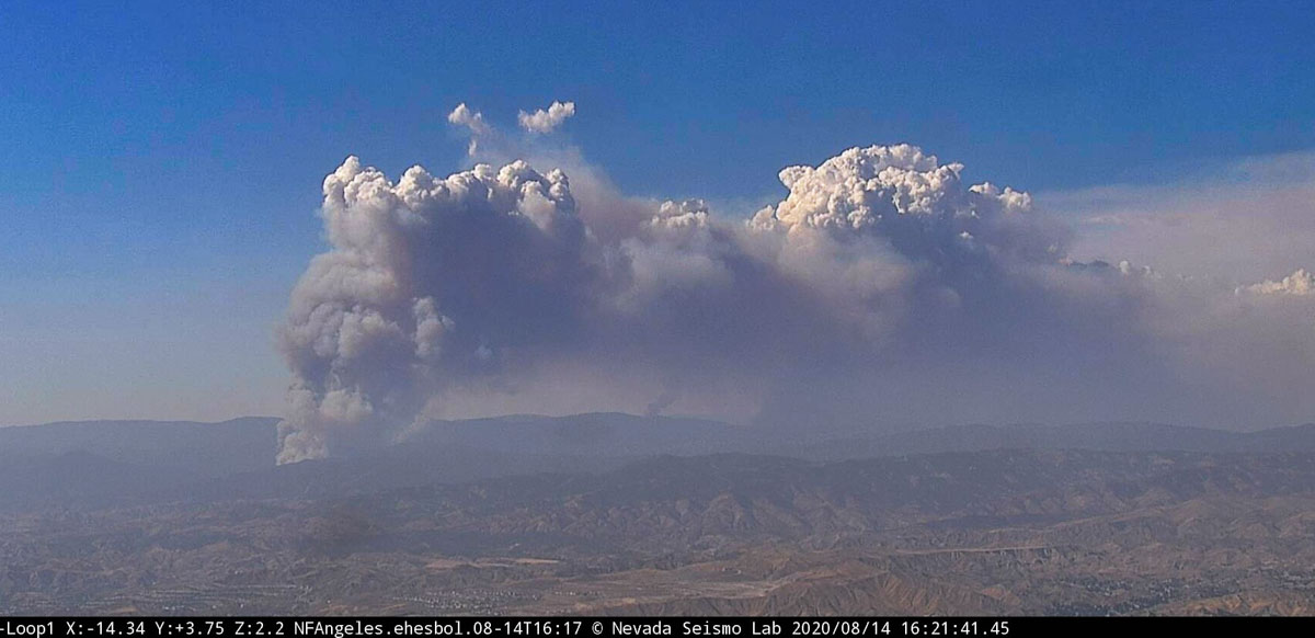
Lake Fire from Loop1 camera, looking N-NW at 4:21 p.m. PDT August 14, 2020.

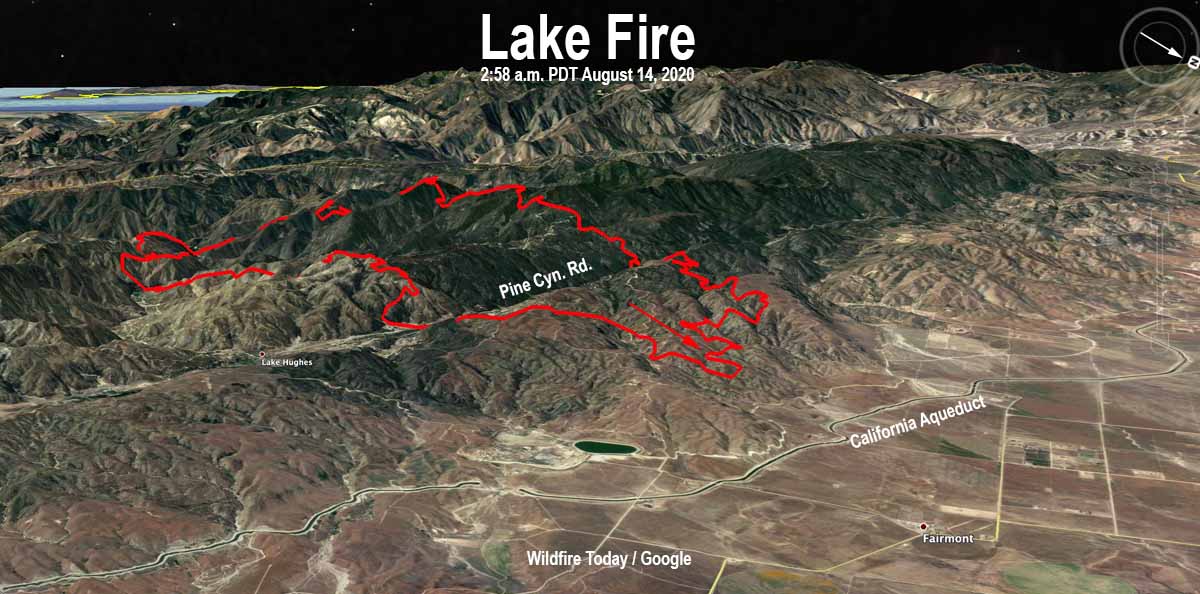
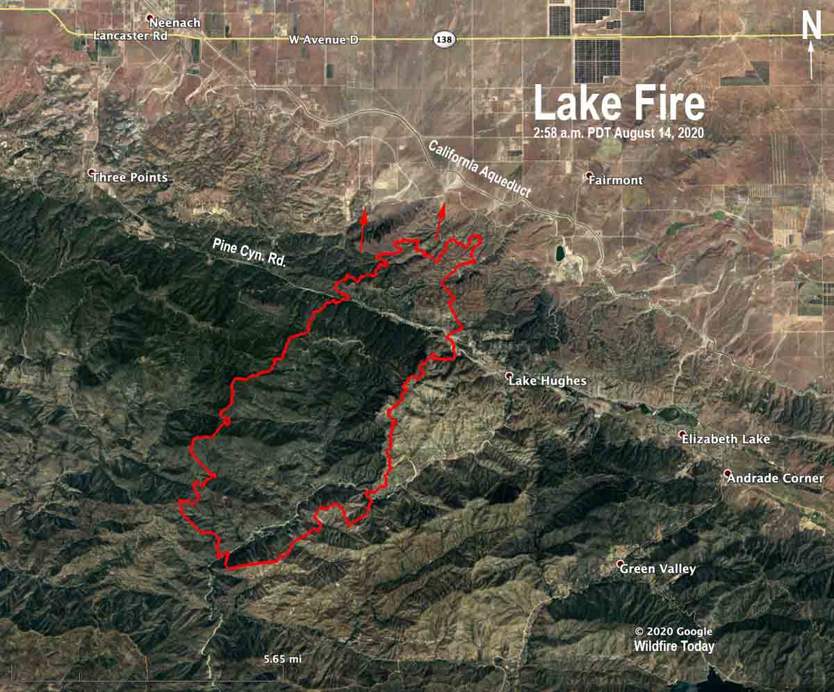
The Lake Fire in southern California near Lake Hughes 17 miles west of Lancaster was very active again Friday afternoon. It is well established east of Pine Canyon road and at 4:30 p.m. was moving to the northeast approaching the California Aqueduct in the Antelope Valley.

Early Friday morning the Lake Fire was mapped at 11,637 acres.

To see all articles on Wildfire Today about the Lake Fire, including the most recent, click HERE.

Map of the Lake Fire
3-D Map of the Lake Fire, looking southwest at 2:58 a.m. PDT August 14, 2020.
Map of the Lake Fire
Map of the Lake Fire at 2:58 a.m. PDT August 14, 2020. The arrows show one of the locations where there was significant spread on Friday.

Cameron Peak Fire burns over 1,500 acres west of Fort Collins

The fire started Thursday afternoon

Updated August 14, 2020 | 7:39 a.m. MDT

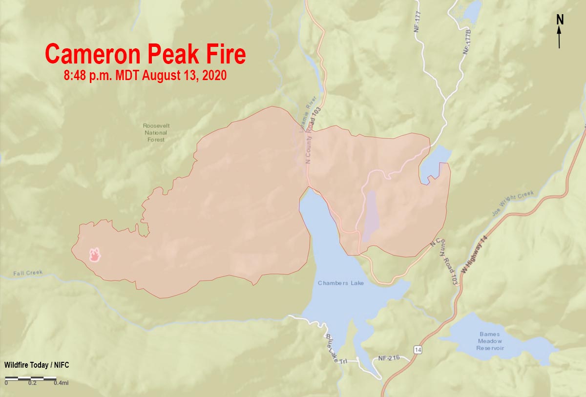
Map of the Cameron Peak Fire
Map of the Cameron Peak Fire at 8:38 p.m. MDT August 13, 2020.

A map from data collected at 8:48 p.m. MDT August 13 shows that the Cameron Peak Fire 36 miles west of Fort Collins, Colorado had burned about 1,540 acres. It is spreading in the Roosevelt National Forest between 8,900 and 10,500 feet above sea level and is under the management of a Type 3 Incident Management Team. A Type 2 Team has been ordered.

To see all articles on Wildfire Today about the Cameron Peak Fire, including the most recent, click here.

The fire is near Cameron Pass, 15 miles southwest of Red Feather Lakes.


August 13, 2020 | 9:22 p.m. MDT

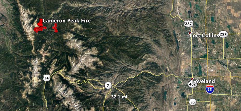
Cameron Peak Fire map
The Cameron Peak Fire is 36 miles west of Fort Collins, Colorado

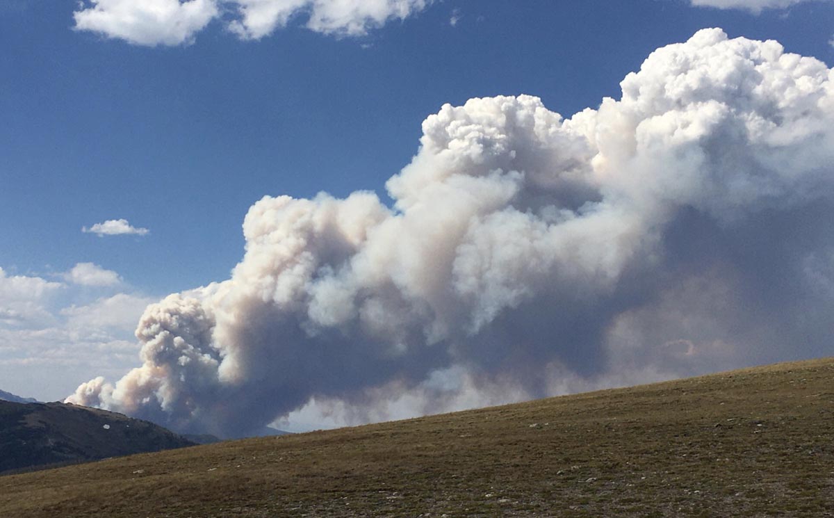
When the Cameron Peak Fire was reported in mid-afternoon Thursday resources dispatched included, in addition to firefighters on the ground, a load of smokejumpers, three helicopters, two large air tankers, and four Single Engine Air Tankers. Within a short time it put up a very large smoke column topped by pyrocumulus clouds which indicate high fire intensity. After 5 p.m. the aircraft were unable to assist due to strong winds. At 7:15 p.m. the U.S. Forest Service estimated it had burned 1,540 acres.

The fire is burning in the Rawah Wilderness on the Arapaho & Roosevelt National Forests near Highway 14 and Chambers Lake.

Cameron Peak Fire
Cameron Peak Fire. Photo by @CritterCat2020 August 13, 2020.

The Larimer County Sheriff’s office ordered evacuations at about 4:30 p.m. Thursday for Chambers Lake and areas near the intersection of Highway 14 and CR 103.

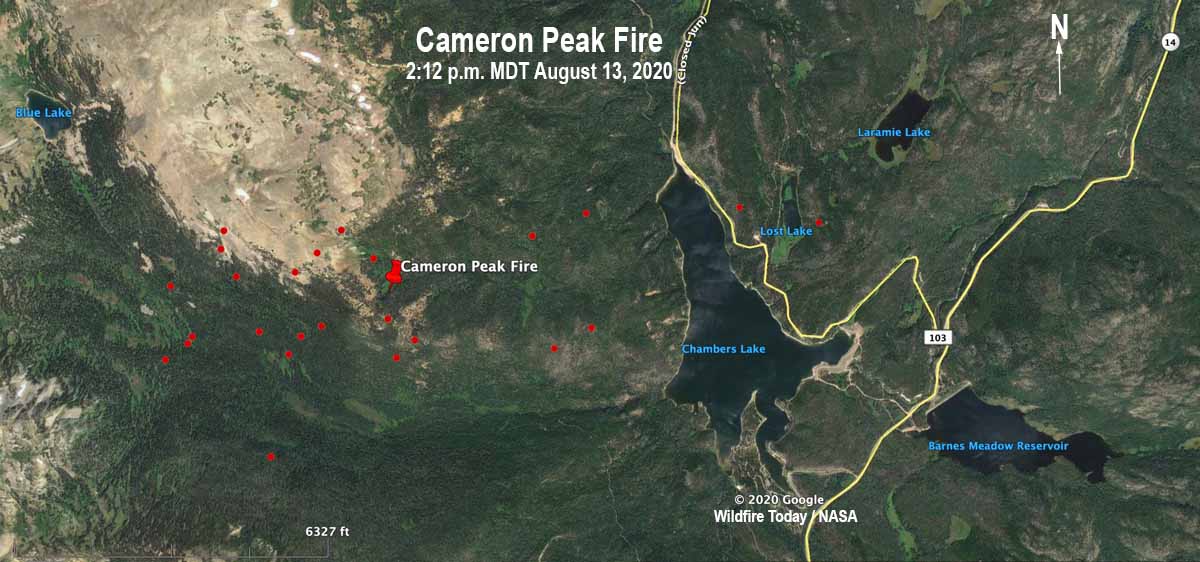
Cameron Peak Fire map
The red dots represent heat detected on the Cameron Peak Fire by a satellite at 2:12 p.m. MDT August 13, 2020. There were other detections two miles to the east, but they may be false positives from heat in the smoke column and will need verification.

Lake Fire spreads 7 miles in 12 hours, burns over 12,000 acres

The fire is 15 miles west of Lancaster, California

Updated August 13, 2020 | 10 a.m. PDT

Map of the Lake Fire
Map of the Lake Fire at 4:04 a.m. PDT August 13, 2020. USFS

The Lake Fire started August 12, 2020 between Castaic Lake and Lake Hughes in southern California. When the first units arrived on scene the fire was about 100 acres burning on both sides of Lake Hughes Road, spreading to the northeast.

It was reported at 3:40 p.m. and within 29 minutes was creating pyrocumulus clouds indicating extreme fire behavior. It is very unusual for a fire to grow that quickly with that intensity.  Three and one half hours after it was reported the size was estimated at 10,000 acres. The rapid spread was aided by burning embers starting spot fires one mile ahead. A map released by fire officials with data from 4:04 a.m. Thursday indicated the fire had burned 12,681 acres. (At 7:10 a.m. Thursday PDT the Angeles National Forest Twitter account said it was 10,500 acres.) At that time the northeast end was on the slopes leading down to the desert after crossing Pine Canyon Road.

(To see all articles on Wildfire Today about the Lake Fire, including the most recent, click here.)

“It’s pretty explosive fire behavior,” said Angeles National Forest Fire Chief Robert Garcia. “It’s typically what we see a little bit later in the season and often driven by wind. The fuel, moisture conditions and the fire at this particular location with the slope, it really created the recipe for rapid fire growth.”

Lake Fire August 12, 2020
Lake Fire August 12, 2020, by Bill Neckels.

The records of a weather station at Elizabeth Lake showed that the fire was pushed to the northeast by a 7 to 13 mph wind gusting at 15 to 22 mph, with relative humidity in the teens and temperature in the low 90s. Western U.S. firefighters would not consider the weather conditions extreme. This begs the question, what kind of fire behavior will Santa Ana winds bring in the next several months?

Early in the incident, fire officials considered the possibility of the fire impacting homes along Pine Canyon Road, almost six miles to the northeast, and that it could keep going into the desert to the east. The Incident Commander placed orders for strike teams of Type 1 engines for structure protection, with 5 engines in each strike team. The orders were placed in multiples of 5 and 10 as the fire rapidly spread. By 6 p.m. a total of 20 strike teams, 100 engines, had been requested. The fire crossed Pine Canyon Road at about 7 p.m. Wednesday.

Evacuations were ordered along Pine Creek Road and for the community of Lake Hughes as well as other areas, affecting about 100 homes. Traffic on the road became very congested as large numbers of media vehicles, fire apparatus, and evacuees tried to occupy the space at the same time. Fire officials requested that all media leave the area in order to reduce the congestion.

Weather conditions moderated after 10 p.m. Wednesday with much calmer winds of less than 4 mph, but there was little humidity recovery, hovering around 20 percent during the night. The forecast for Thursday is for 92 degrees, 18 percent relative humidity, and variable winds generally out of the west at 9 to 15 mph gusting at 20 to 24 mph. There is a 15 percent chance of rain.

The Lake Fire is burning in an area that hasn’t burned since 1968, according to fire officials. The fire started in brush at about 2,300 feet and as it approached Pine Canyon road at over 4,000 feet it got into heavier fuels.

Firefighters, media, and residents were all trying to evacuate or withdraw at the same time.

Lake Fire spreads rapidly near Lake Hughes, California

Evacuations are in effect

August 12, 2020 | 7:29 p.m. PDT

map Lake Fire Lake Hughes California
Map showing the approximate location of the Lake Fire in southern California, at 5:30 p.m. PDT August 12, 2020.

A very rapidly spreading fire broke out Wednesday afternoon in the Angeles National Forest about 19 miles west of Lancaster, California. When units first arrived the fire was about 100 acres burning on both sides of Lake Hughes Road, spreading to the east and northeast.

(To see all articles on Wildfire Today about the Lake Fire, including the most recent, click here.)

At 5:50 p.m. firefighters reported it was generating spot fires one mile ahead and had already grown to about 7,000 acres;  at 7:05 p.m. the estimate increased to about 10,000.

At 6 p.m. the Incident Commander ordered additional strike teams of  Type 1 fire engines for structure protection to bring the total up to 20. With five engines per strike team, that is 100 engines. Evacuations are in effect.

At 7:05 p.m. the fire had crossed Pine Canyon Road and was well established on the east side.

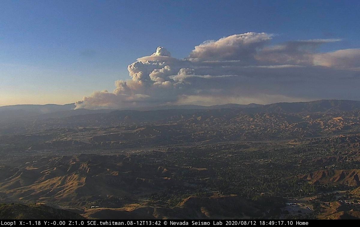
Lake Fire
Lake Fire from Loop, at 6-49 p.m. PDT August 12, 2020


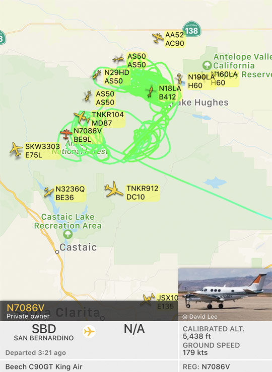
Aircraft over the Lake Fire
Aircraft over the Lake Fire at 7:26 p.m. PDT August 12, 2020. The green line is the track of the King Air in the photo, probably serving as a lead plane. FlightRadar24