Sawtooth Fire grows to over 20,000 acres

The fire is east of Phoenix, six miles east of Gold Canyon

(UPDATED at 8:02 a.m. MDT June 2, 2020)
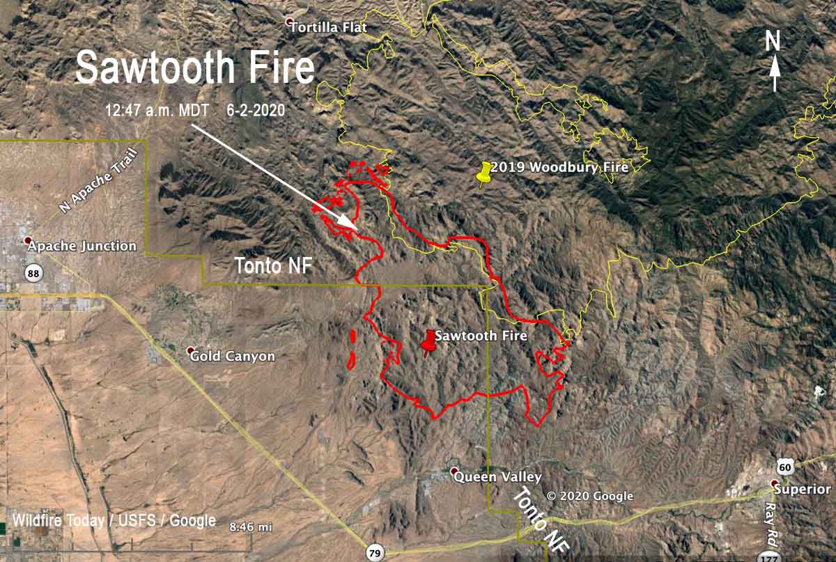
Map Sawtooth Fire June 2, 2020
Map showing the perimeter of the Sawtooth Fire (in red) mapped by a fixed wing aircraft at 12:47 a.m. MDT June 2.

The Sawtooth Fire east of Phoenix 10 miles east of Apache Junction was not as active Monday as it was on Sunday. A fixed wing mapping flight at 12:47 a.m. MDT Tuesday determined that most of the growth was on the north side. When the incident management team releases an update Tuesday morning they are expected to say it has burned over 20,000 acres.

(To see all articles about the Sawtooth Fire on Wildfire Today, including the most recent, click here)

While firefighters faced 104 degrees Monday with 12 percent relative humidity, the wind was slight, about 2 to 5 mph which accounts for the less than massive spread Monday. The forecast for Tuesday calls for stronger winds out of the west at 5 to 10 mph, 13 to 18 percent RH, and a high temperature of 100 to 104. This could result in more fire activity than Monday on the south side of the fire north of Queen Valley and northwest of Superior.

At 12:47 a.m. Monday the Sawtooth Fire was approximately 2 miles north of Queen Valley and 8 miles northwest of Superior.


(UPDATED at 6:08 p.m. MDT June 1, 2020)
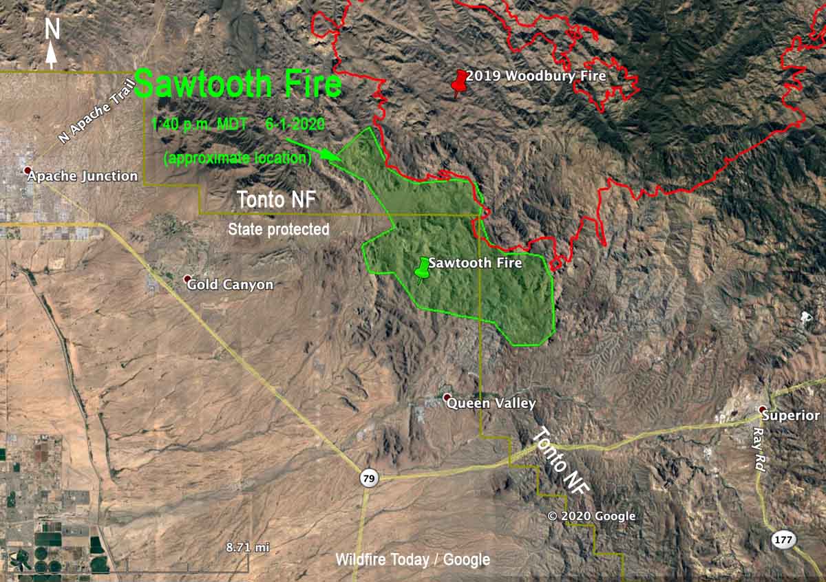
perimeter of the Sawtooth Fire map Arizona Phoenix
Map showing the approximate perimeter of the Sawtooth Fire (in green) based on heat detected by satellites at 1:40 p.m. MDT June 1.

The incident management team on the Sawtooth Fire updated the size at 6:50 p.m. today, saying it has burned 16,000 acres. A Type 1 incident management team has been ordered —  Sinclair’s team from the Southwest Geographic Area.

The updated map above shows the APPROXIMATE location of the Sawtooth Fire using satellite heat sensing data as of 1:40 p.m. Monday. The map includes the boundary of the Tonto National Forest (in yellow).

Most of the recent spread was on the northwest and south sides. It has grown about a mile closer to Queen Valley, and Monday at 2:30 p.m. was about two miles north of the community.

Very little official information is being released about this major wildfire.


(UPDATED at 8:20 a.m. MDT June 1, 2020)
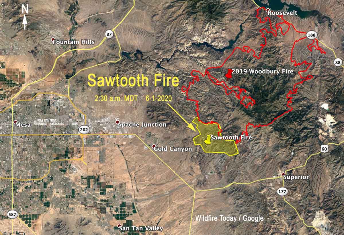
perimeter of the Sawtooth Fire map Arizona Phoenix
Map showing the approximate perimeter of the Sawtooth Fire (in yellow) based on heat detected by satellites at 2:30 a.m. MDT June 1. The fire is burning near the Woodbury Fire (in red) that blackened over 96,000 acres in June, 2019

The Sawtooth Fire east of Phoenix, Arizona was very active Sunday and Sunday night, spreading in all directions. It made a big push during the night growing three miles to the east and southeast.

(To see all articles about the Sawtooth Fire on Wildfire Today, including the most recent, click here)

During a satellite overflight at 2:30 a.m. MDT Monday the fire was six miles east of Gold Canyon, three miles north of Queen Valley, and seven miles northwest of Superior.

The lightning-caused fire was reported Saturday at 10 p.m. It has burned into the footprint of the Woodbury Fire that blackened over 123,000 acres in June, 2019. Sunday night the Forest Service reported that the Sawtooth Fire was 3,500 acres. According to heat detected by satellites at 2:30 a.m. Monday it was approximately 11,000 acres. There has been limited spread into the Woodbury Fire scar.

The Sawtooth Fire is on land protected by the state and is also within the Superstition Wilderness area of the Tonto National Forest.

Weather

The low relative humidity Sunday at Gold Canyon was 10 percent and the high temperature was 112, falling to 78 by 5 a.m. Monday. The wind Sunday was not extreme, blowing at 3 to 8 mph with occasional gusts to 15, and less than that during the night. The direction was generally from the southwest, but switched to come out of the west-northwest after 10 p.m. and later the northeast, which accounts for the spread of the fire to the south detected by the satellite at 2:30 a.m.

The weather forecast for the fire area on Monday predicts a high of 99 to 103 degrees, a minimum humidity of 12 to 17 percent, and 5 to 8 mph upslope winds in the afternoon with isolated gusts to 12. There’s no chance of rain.

Sunset Fire closes Interstate 17 north of Phoenix

Nine miles south of Cordes Lakes, AZ

(UPDATED at 8:30 a.m. MDT June 1, 2020)

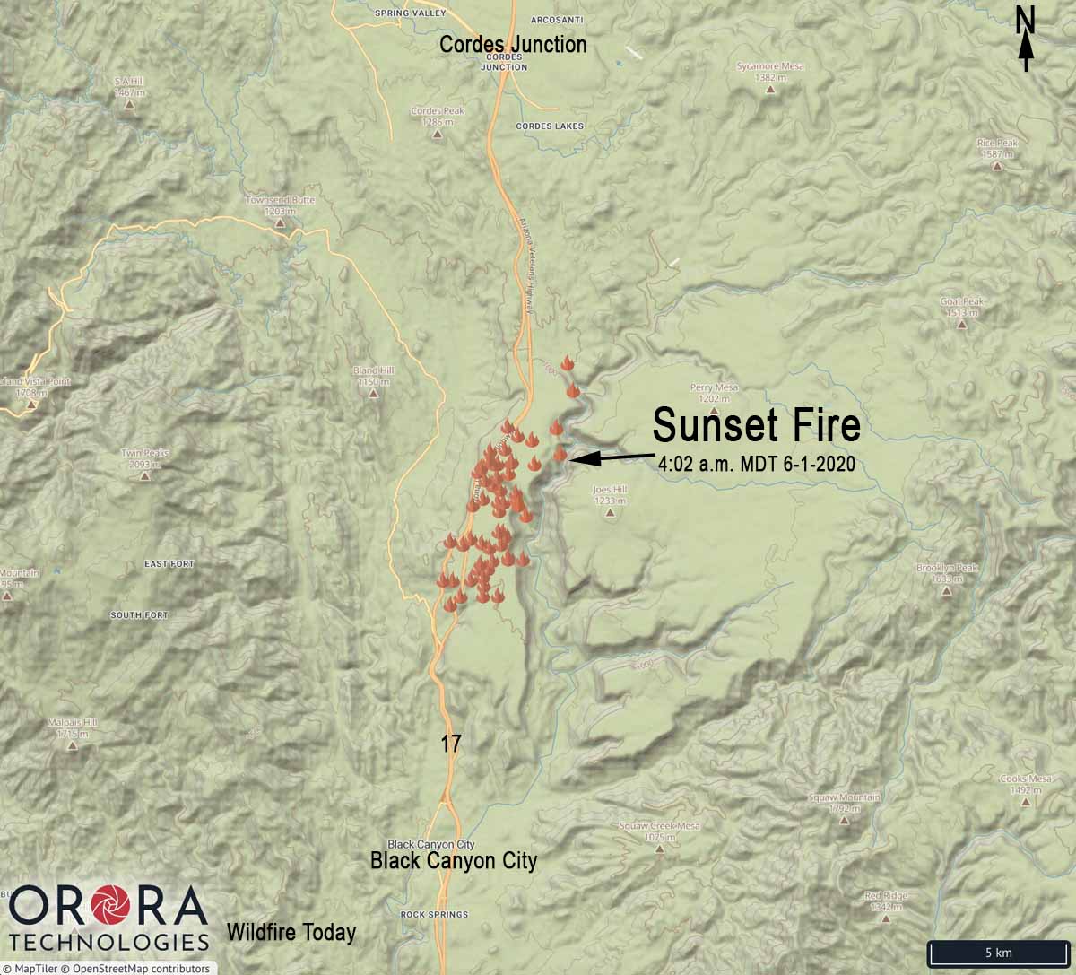
Map Sunset Fire Phoenix interstate 17 Arizona
Map showing the location of heat detected by satellites on the Sunset Fire along Interstate 17 north of Phoenix at 4:02 a.m. MDT June 1, 2020.

The Sunset Fire along Interstate 17 between Black Canyon City and Cordes Junction has burned 4,000 acres, the Bureau of Land Management reported Sunday night. According to the Arizona DOT Interstate 17 is now open in both directions.

Sunset Fire Arizona Interstate 17
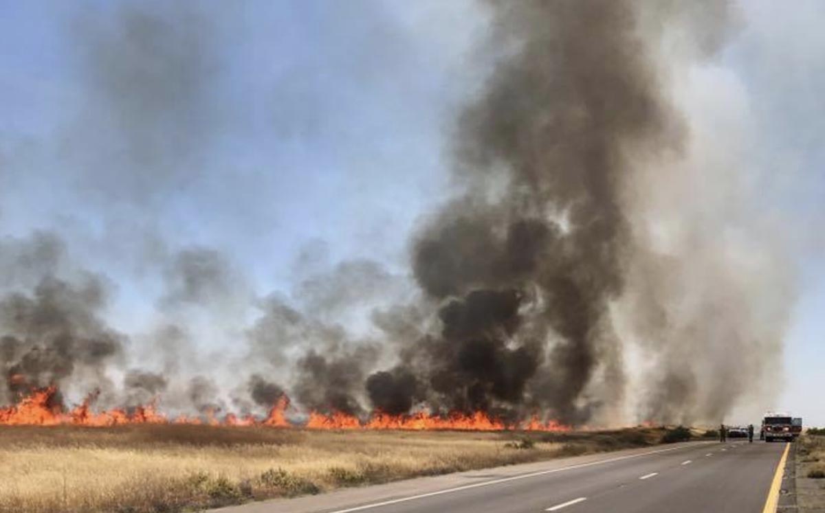
Sunset Fire, Sunday evening May 31, 2020. BLM photo.
Sunset Fire
Sunset Fire 5-31-2020. Photo by AZ DOT.

(Originally published at 3:19 p.m. MDT May 31, 2020)

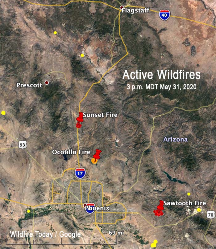
Active Wildfires Arizona

Still another wildfire has broken out in Arizona. The Sunset Fire was reported around noon Sunday and quickly required the complete closure of Interstate 17.

The fire is 5 miles north of Black Canyon City, 9 miles south of Cordes Lakes, and 24 miles north of Highway 74.

A very rough estimate of the size based on satellite data at 1:50 p.m. MDT on Sunday, is approximately 900 acres.

Sunset Fire Arizonas
Sunset Fire closes Interstate 17 five miles north of Black Canyon City.

Sawtooth Fire, another wildfire in the Phoenix area, burns hundreds of acres east of Gold Canyon

One flank of the fire has spread into the footprint of the huge Woodbury Fire that blackened over 96,000 acres in June, 2019

(UPDATED at 3:37 p.m. MDT May 31, 2020)

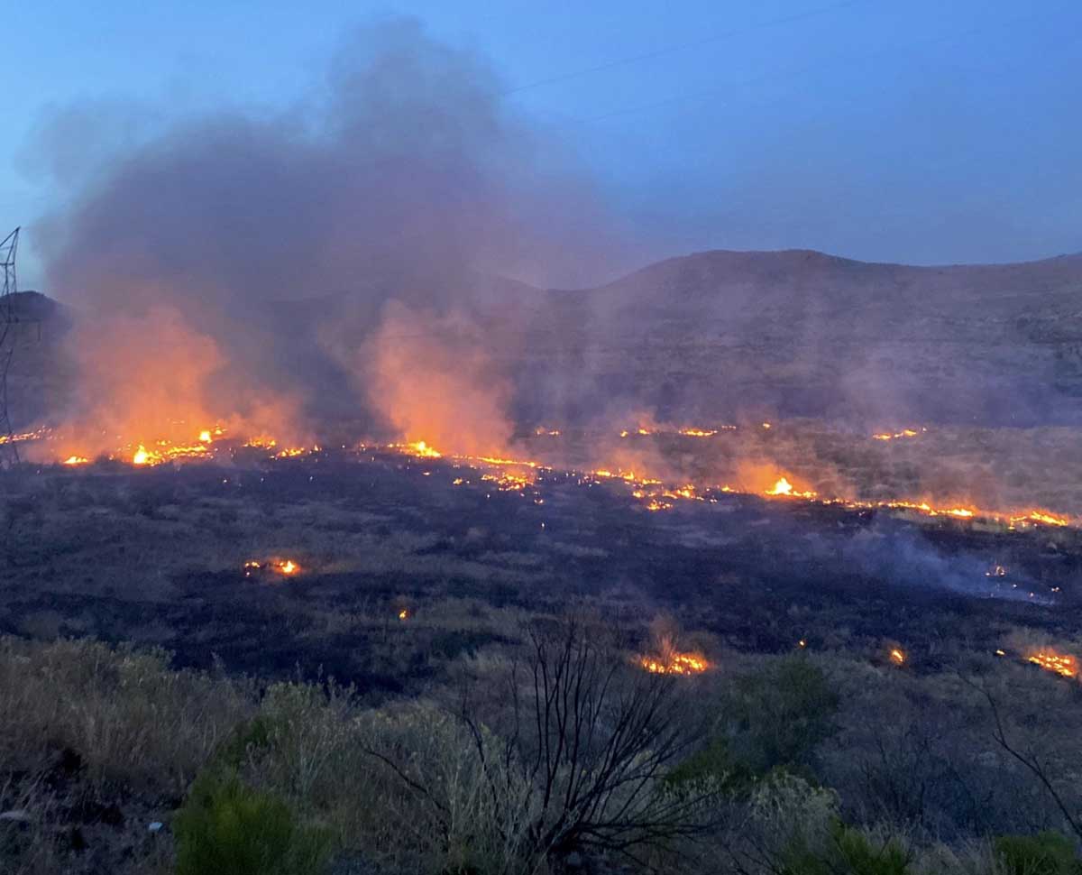
Sawtooth Fire
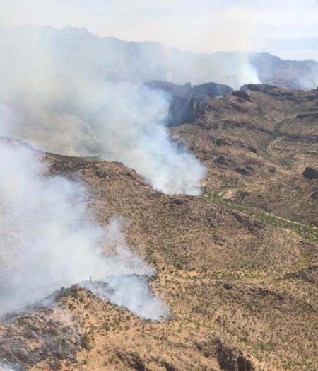
Sawtooth Fire May 31, 2020. Photo by Tonto National Forest.

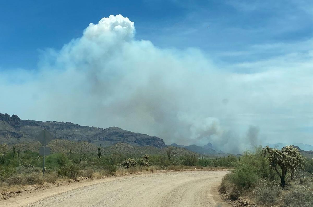
The Tonto National Forest reported at 2:35 p.m. MDT May 31 that the Sawtooth Fire eight miles east of Gold Canyon had burned about 2,500 acres. No structures were threatened.

(To see all articles about the Sawtooth Fire on Wildfire Today, including the most recent, click here)

Sawtooth Fire Arizona
Sawtooth Fire May 31, 2020. Photo by Tonto National Forest.

(Originally published at 9:19 a.m. MDT May 31, 2020)

map Sawtooth Fire
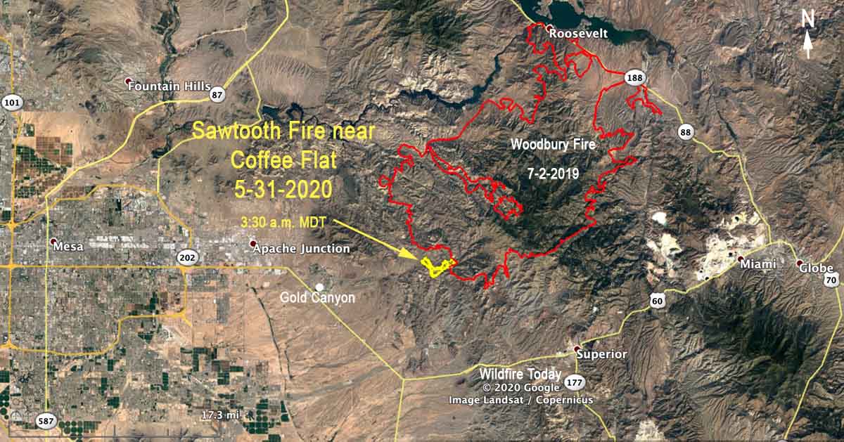
Map based on heat detected by satellites on the Sawtooth Fire at 3:30 a.m. MDT May 31, 2020.

The greater Phoenix area has been plagued with numerous wildfires over the last two weeks. The Sawtooth Fire (the name could change) is the latest, reported Saturday evening near Coffee Flat east of Apache Junction and 8 miles east of Gold Canyon.

It is burning on lands protected by the state of Arizona and the Tonto National Forest where it has spread into the Superstition Wilderness.  A very rough estimate of the size based on heat detected by satellites at 3:30 a.m. Sunday is that the fire has burned at least 600 acres.

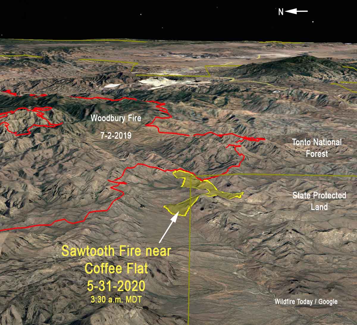
The good news, if there can be any about a wildfire, is that it appears to have burned into the footprint of the huge Woodbury Fire that blackened over 123,000 acres in June of 2019. That flank should not be very difficult to suppress if fire managers decide to suppress the fire, but it could still work around to the west, south, and north in fairly rugged terrain.

3-d map Sawtooth Fire
3-D map based on heat detected by satellites on the Sawtooth Fire at 3:30 a.m. MDT May 31, 2020. Looking east.

Evacuations ordered for the Ocotillo Fire near Cave Creek, AZ

10 miles northeast of the greater Phoenix area

(UPDATED at 9:40 a.m. MDT May 31, 2020)

Glenn Chase of Tempe, AZ uses a backpack pump to mop up part of the Ocotillo Fire that burned through a residential area east of Spur Cross Road in Cave Creek, AZ. Mr. Chase came up to the fire to help family members evacuate horses and then went to work on the fire. Photo by Tom Story, May 30, 2020.

From the Incident Management Team assigned to the Ocotillo Fire near Cave Creek, Arizona, Sunday morning at 8:37:

There was no new growth reported on the Ocotillo Fire overnight and no new structure loss. There is a lot of heat within the interior and in drainages, therefore crews will monitor and patrol those areas to make sure there is no rekindling. Afternoon winds however, could challenge firefighters again, especially within those drainages.

Overnight, crews provided structure protection to homes and worked to build and secure fire line.

An estimated 500 residences were evacuated on Saturday and those evacuation orders remain in place.  An evacuation-area map has been uploaded to this site. The Red Cross has a shelter set up for impacted residents at Cactus Shadows High School. Livestock can be taken to the Cave Creek Memorial Arena.

Today, crews are faced again with hot temperatures, low relative humidity, afternoon winds, and other hazards, including above-ground and underground propane tanks and inaccessible roads.

177 personnel are assigned to the fire from statewide fire departments and districts, including local and federal cooperators.  The fire started Saturday afternoon off Ocotillo Road. At least ten structures were lost; unknown if they are primary or secondary or both. Once it is safe enough to do so, crews will make their way back into the area to assess damage.

The fire was determined to be human-caused and the source is under investigation.


(UPDATED at 7 p.m. MDT May 30, 2020)

Ocotillo Fire Cave Creek Arizona
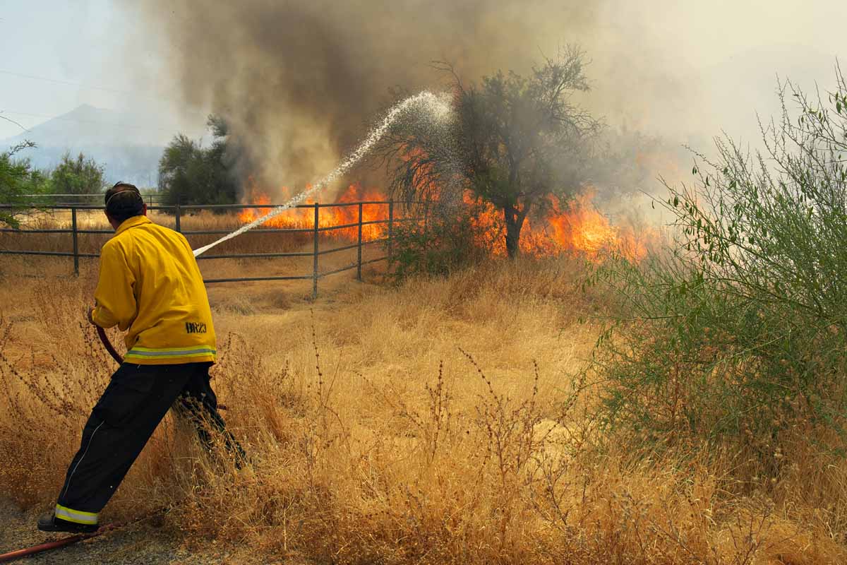
A Phoenix Fire Department firefighter staffing Brush 23 cools down part of the Ocotillo Fire as the blaze burns near the intersection of Old Stage Road and Rockaway Hills Drive in Cave Creek, AZ 05/30/20. Photo by Tom Story.

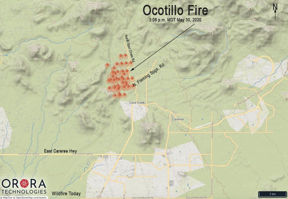
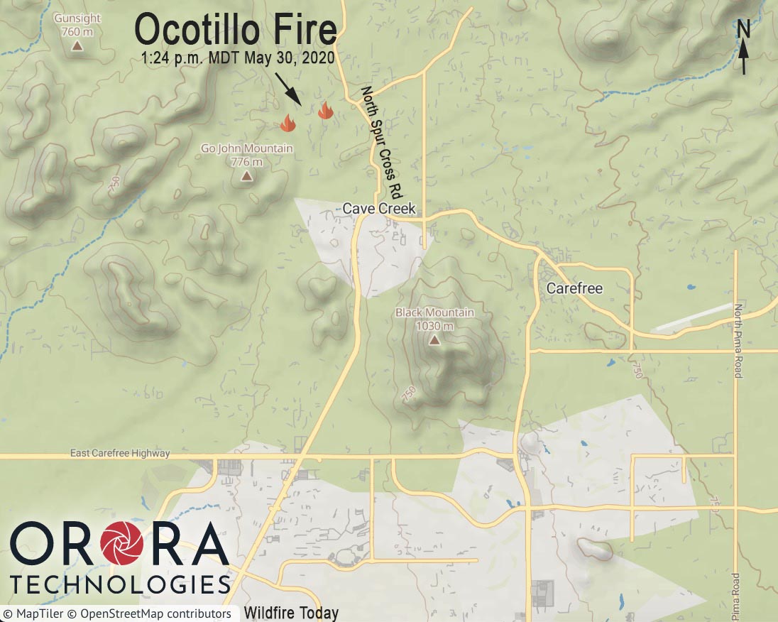
Here is an updated map of the Ocotillo Fire northwest of Cave Creek, Arizona.

Map showing the approximate location of heat detected by a satellite on the Ocotillo Fire northwest of Cave Creek, AZ at 1:24 p.m. MDT May 30, 2020.
Map showing the approximate location of heat detected by a satellite on the Ocotillo Fire northwest of Cave Creek, AZ at 3:06 p.m. MDT May 30, 2020.

At 5:46 p.m. MDT Arizona State Forestry said in a tweet:

#OcotilloFire at 750 acres. Crews working against hot temps, very day conditions, wind gusts & low RH. In turn, fire is exhibiting signs of extreme fire behavior. ⁦@RedCrossAZ set up a shelter at high school. ⁦⁦@mcsoaz
⁩ will have evac info.

Ocotillo Fire Cave Creek Arizona
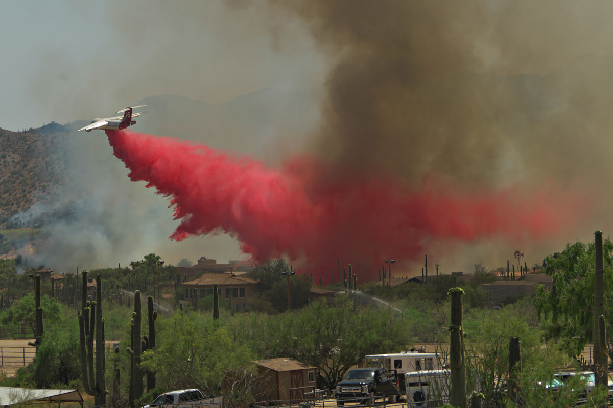
Tanker 15, a BAe-146 operated by Neptune Aviation, drops a load of fire retardant near homes as the Ocotillo Fire burns through part of Cave Creek, AZ 05/30/20. Photo by Tom Story.

This is a very impressive video of a DC-10 dropping on the fire:

We will update this article as more information becomes available.


(Originally published at 4:47 p.m. MDT May 30, 2020)

map Ocotillo Fire Cave Creek
Map showing the approximate location of heat detected by a satellite on the Ocotillo Fire northwest of Cave Creek, AZ at 1:24 p.m. MDT May 30, 2020.

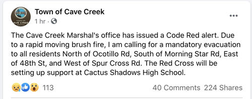
The Marshall’s Office has issued a mandatory evacuation order for the Ocotillo Fire northwest of Cave Creek, Arizona.

Evacuation order for Ocotillo Fire
Evacuation order for Ocotillo Fire at approximately 3 p.m. MDT May 30, 2020.

Jim Cross, Senior News Reporter at KTAR Phoenix, reported that multiple homes have been damaged and others are threatened. At 2:43 p.m. MDT Saturday Arizona State Forestry said the fire had burned about 350 acres.

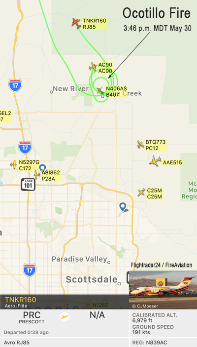
Firefighting aircraft that have been seen over the fire include air tankers (RJ85, BAe-146, and DC-10) and helicopters, some of which are obtaining water at a golf course.

Ocotillo Fire Cave Creek Arizona
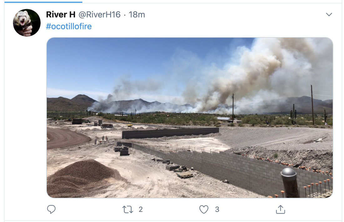
Ocotillo Fire at 4:22 p.m. MDT May 30, 2020. Photo by @RiverH16
Ocotillo Fire northwest of Cave Creek map
Map showing aircraft maneuvering near the Ocotillo Fire northwest of Cave Creek, Arizona at 3:46 p.m. MDT May 30, 2020. Flightradar24 & Wildfire Today.

U.S. Fish and Wildlife Service firefighters reflect on assisting with wildfires in Australia

firefighters from U.S. assist in Victoria Australia
FWS firefighter Reynaldo Navarro and a Victoria Rural Fire Service firefighter attack a spot fire. BLM photo by David Carrera.

BY KARI COBB

Although Australia is no stranger to wildfires, the 2019-2020 season was one of the worst fire seasons on record. Major bushfires began in spring 2019 (June), and by September were stronger, more intense, and more frequent. The fire situation continued to worsen, and by November, Australia requested international assistance to suppress the thousands of fires on the landscape.

Over a span of four months, the United States responded to Australia’s request for firefighters by providing personnel from the Bureau of Indian Affairs, Bureau of Land Management, U.S. Fish and Wildlife Service, Forest Service, and National Park Service. In total, the U.S. Fish and Wildlife Service (FWS) provided 11 individuals to assist in suppression efforts.

FWS employees filled important roles, including engine captain, situation officer, aircraft officer, task force leader, fire behavior analyst, division supervisor, planning section chief, operations section chief, air support group supervisor, and public information officer.

“Our mission was to support the Australian government in suppressing the bushfires and keeping the Australian people and communities safe,” said Reynaldo Navarro, Assistant Fire Management Officer, South Texas Refuge Complex. “Our tasks included firing operations, engine support, mopping up or blacking out, hand line construction, hazard tree felling, and structure triage and protection.”

“Being in Australia was a great, yet very humbling experience,” said Kyle Bonham, Engine Captain at Klamath Basin National Wildlife Refuge Complex, of his time in Australia.

Although the Australia bushfires brought great destruction and impacts to the country, FWS personnel were welcomed with cheer and open arms.

“What stands out to me are the Australian people,” said Richard Sterry, Fire Management Specialist, Lakewood, Colorado. “I was assigned to a more rural area, and the Australian people were wonderful to work with. They always had smiles on their faces and were constantly going out of their way help us learn their system.”

By mid-February, more than 46 million acres (72,000 square miles) burned since the first fires in June, 2019.  Overall, 80 percent of the Blue Mountains World Heritage area in New South Whales, and 53 percent of the Gondwana World Heritage rainforests in Queensland burned.

Fighting bushfires in Australia provided a unique opportunity for FWS firefighters to learn new firefighting skills, as well as hone the skills required to fight fire in the United States. Due to Australia’s location in the southern hemisphere, fire season occurs at a time when much of the U.S. is out of danger of wildfire. Firefighters helping with suppression efforts in Australia were afforded a unique opportunity to polish firefighting skills needed during wildfire season in the U.S.


Kari Cobb is the acting public affairs officer for the U.S. Fish and Wildlife Service at the National Interagency Fire Center.

Cherry Canyon Fire in southeast Colorado grows to nearly 12,000 acres

The wildfire is 58 miles east-northeast of Trinidad

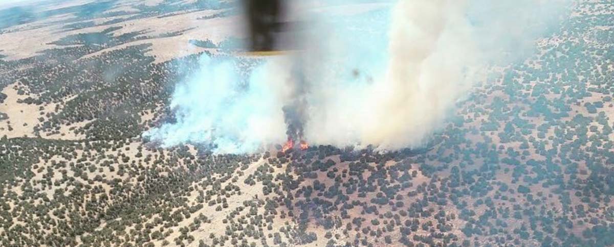
Cherry Canyon Fire Colorado
Cherry Canyon Fire, courtesy of Colorado Fire Prevention & Control

(UPDATED at 11:43 p.m. MDT May 24, 2020)

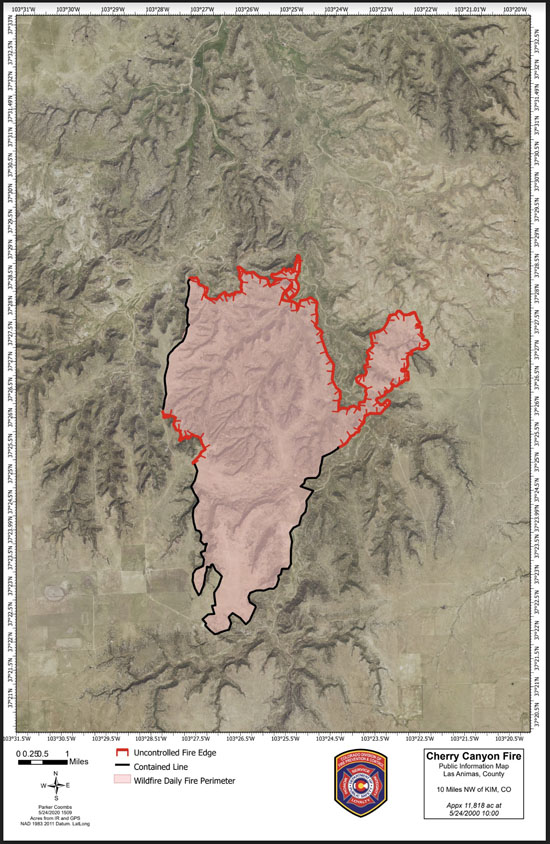
Strong winds and extremely low humidity on Saturday caused the Cherry Canyon Fire, 13 miles north of Kim, Colorado, to spread to the northwest crossing County Road 193.5 west of Highway 109. Colorado Fire Prevention & Control said Saturday evening that the fire was mapped at 11,818 acres at 5 p.m.

In a five-hour period Saturday morning the humidity dropped from 92 to 8 percent while the southwest wind was blowing at 3 to 8 mph gusting to 31, according to records from a portable weather station installed near the fire. Spread of the fire slowed Saturday night and by 7:45 Sunday morning the humidity had risen to 69 percent. Rain began falling after 4 p.m., with 0.15 inches accumulating by 11 p.m.

Below is an excerpt from a news release by Colorado Fire Prevention & Control:

Firefighters camped out on the West side of the fire last night and completed a large portion of work in the accessible terrain and will continue to monitor the inaccessible areas. Firefighters on the East side of the fire were not able to conduct burnout operations last night due to unfavorable conditions, but worked in that region today to tie in the large slopover/run from yesterday afternoon.

Additionally, while there are few structures at risk from this fire, other values, such as grazing land, water, and livestock, are very important in this region. Allowing the fire to continue to burn eliminates feed for cattle, exposes steep slopes to be susceptible to erosion, and causes health concerns from the increased smoke.  As is normal in every wildfire, a risk-benefit analysis is conducted before actions are initiated; from this discussion, it was determined that rather than smoking out communities, removing grazing land for cattle and impacting communities with restrictions on travel/road closures, it is better to suppress the fire.

Cherry Canyon Fire Colorado map

Cherry Canyon Fire Colorado map
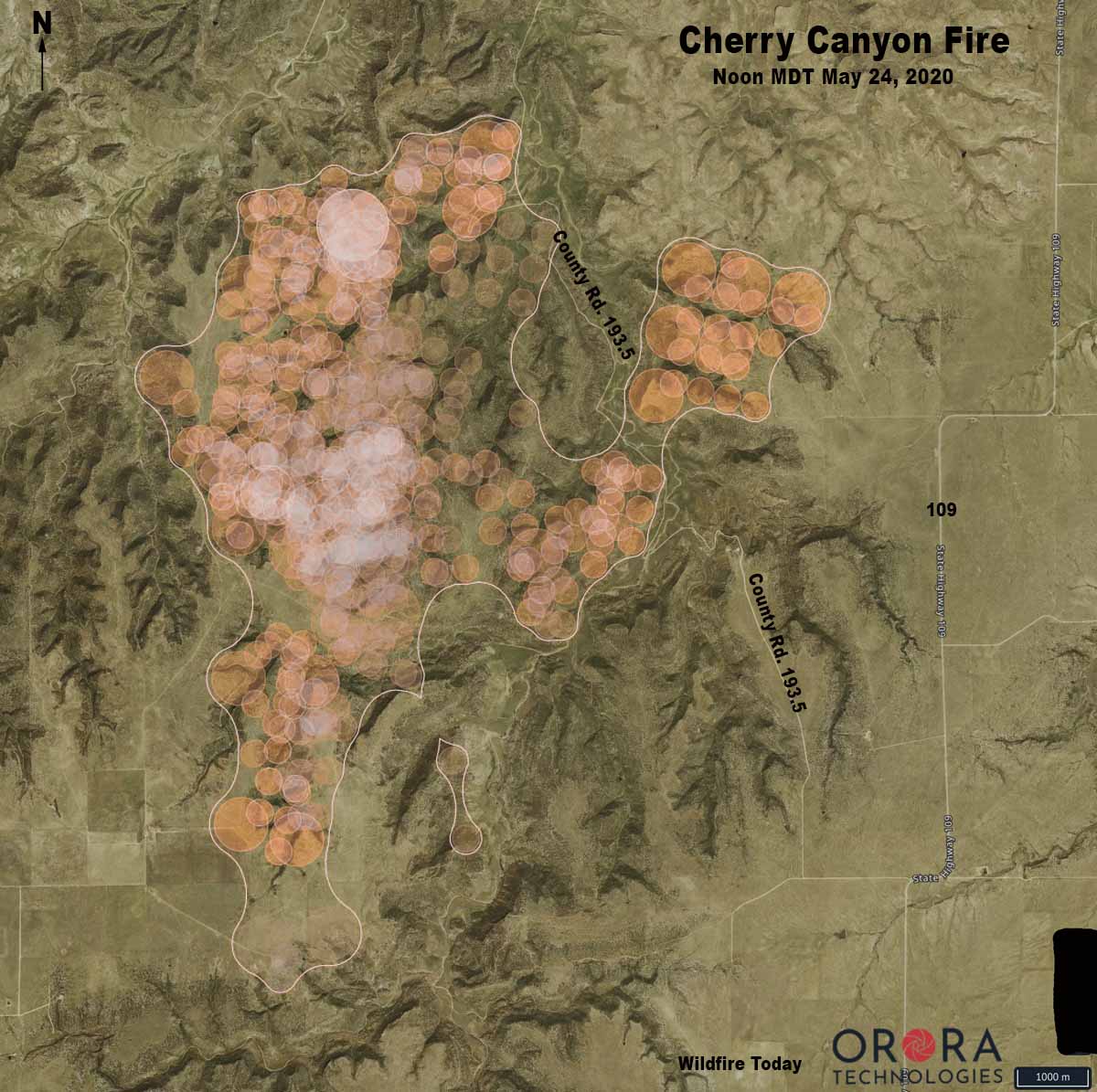
Map showing heat on the Cherry Canyon Fire detected by satellites. Heat was sensed somewhere within each of the circles. The actual perimeter is slightly smaller than the white line seen on the map. All locations are approximate.

(UPDATED at 11:28 a.m. MDT May 23, 2020)

Cherry Canyon Fire wildfire Colorado
Cherry Canyon Fire, courtesy of Colorado Fire Prevention & Control

In an update Friday at 5:40 p.m. MDT the Colorado Division of Fire Prevention and Control said the lightning-caused Cherry Canyon Fire had burned 9,602 acres. A Type 3 Incident Management Team led by Phil Daniels is assigned.

(To see all articles on Wildfire Today about the Cherry Canyon Fire click here)

“Safety is the number one priority and as such, strategies moving forward include maintaining firefighter and public safety by utilizing sound risk management actions and utilizing suppression activities that guide the fire into natural barriers,” the agency said in a news release. “Additionally, [we are] minimizing the potential impacts of COVID-19 through the practice of social distancing, proper personal hygiene, and regular cleaning.”

The fire is in southeast Colorado 9 miles northwest of Kim and 58 miles east-northeast of Trinidad. It was reported at 8:28 MDT on Wednesday.

Strong winds and difficult access are making fighting the fire difficult.

A Red Flag Warning  is in effect again for the fire area from noon to 8 p.m. MDT today due to gusty winds, low relative humidity, and dry fuels.

Map Vicinity Cherry Canyon Fire
Vicinity map of the Cherry Canyon Fire in southeast Colorado.
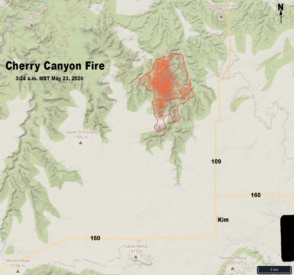
Cherry Canyon Fire wildfire Colorado map
Map of the Cherry Canyon Fire showing heat detected by satellites as late as 3:24 a.m. MDT May 23, 2020.
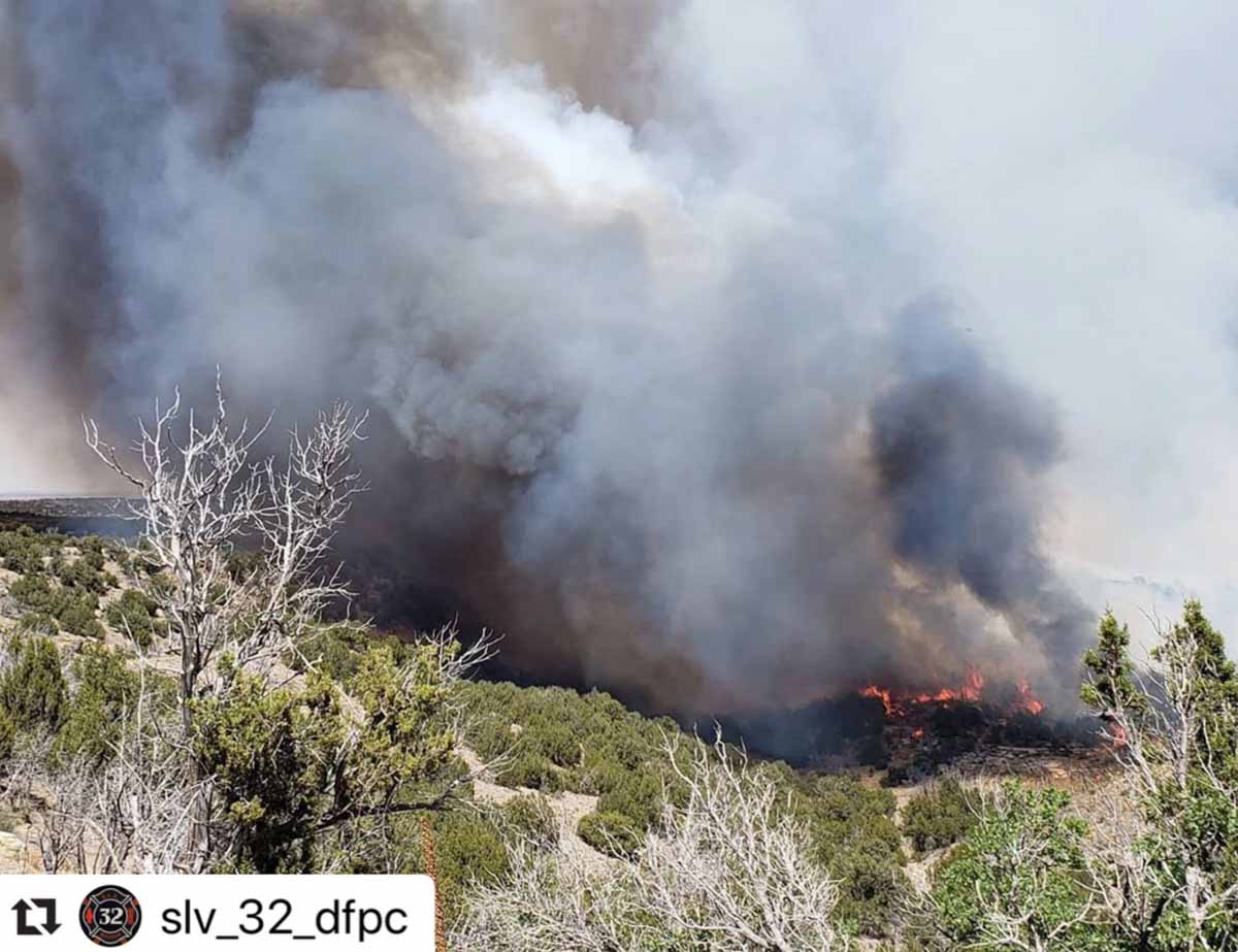
Cherry Canyon Fire wildfire Colorado
Helicopter 58HJ with Cañon Helitack got assigned to the Cherry Canyon Fire near Kim, Colorado shortly after it became available for the fire season. Photo by @getoutgetmoving
Cherry Canyon Fire wildfire Colorado
Cherry Canyon Fire, courtesy of Colorado Fire Prevention & Control
Cherry Canyon Fire wildfire Colorado
Cherry Canyon Fire, courtesy of Colorado Fire Prevention & Control