Additional wildfires break out in Europe as extreme heat continues

Multiple wildland-urban interface fires in greater London destroy dozens of homes

Multiple wildland-urban interface fires destroyed structures United Kingdom
Multiple wildland-urban interface fires destroyed structures in the UK July 19, 2022. Sky News.

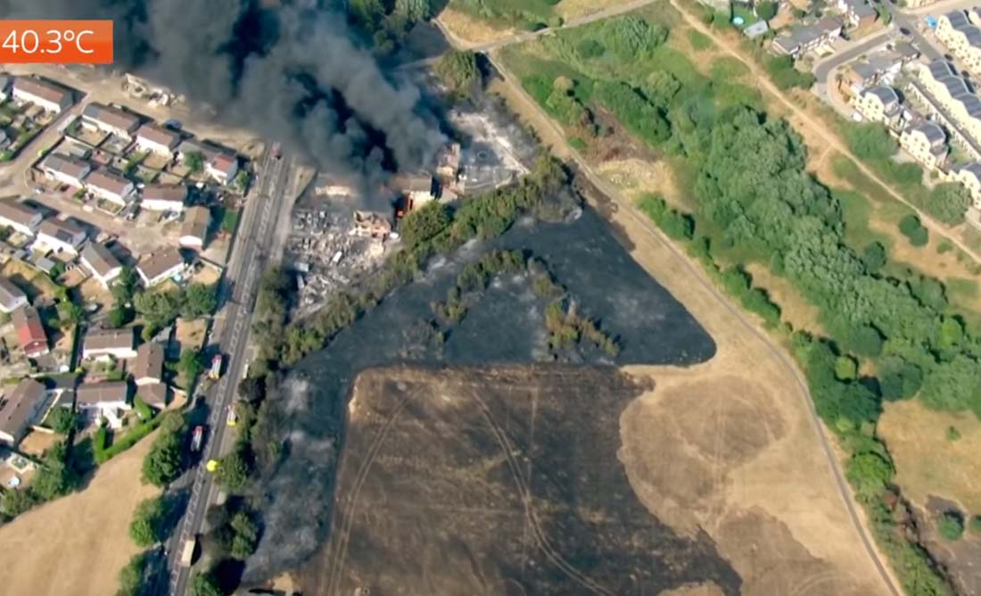
On Tuesday the wildland fire danger north of London reached the “Very Extreme” stage which is three steps up from High which is followed by Very High and Extreme.

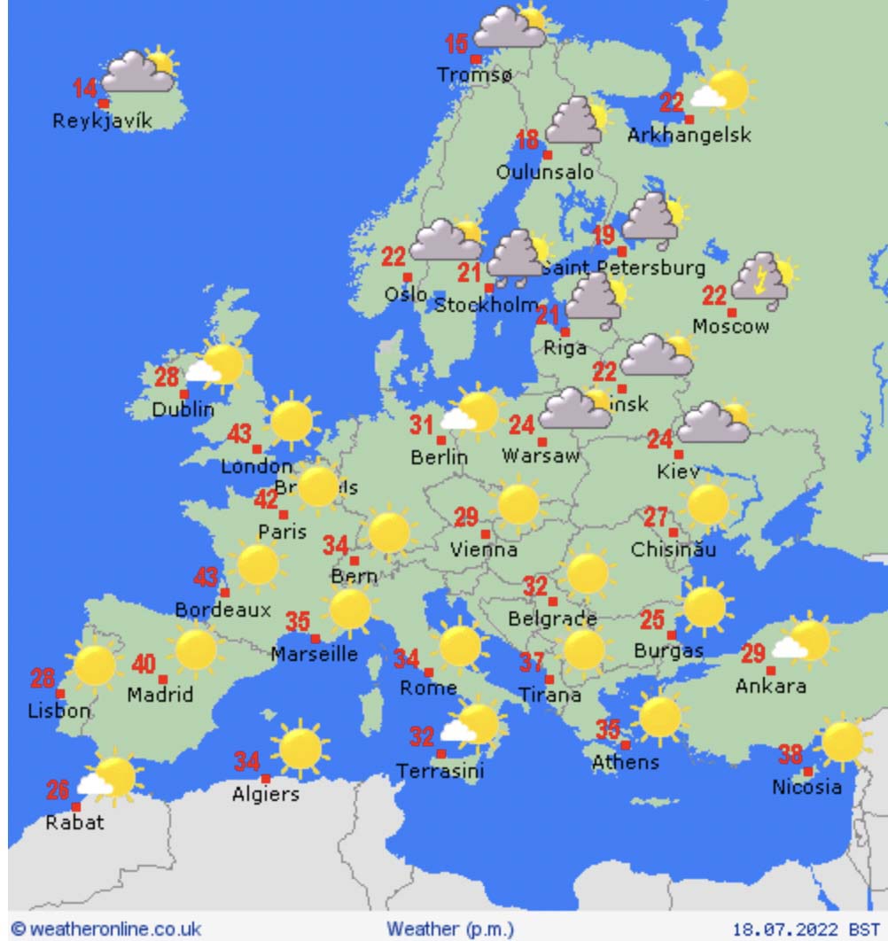
Highest ever temperatures were experienced in the United Kingdom. London Heathrow airport was among six locations to reach 104 degrees (40 Celsius) on Tuesday, shattering Britain’s all-time temperature record after the country declared a national emergency, well above the 2019 record of 101.7 degrees (38.7 Celsius).

Wildland fire danger in the UK, July 19, 2022
Wildland fire danger in the UK, July 19, 2022.

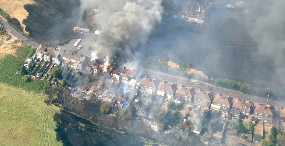
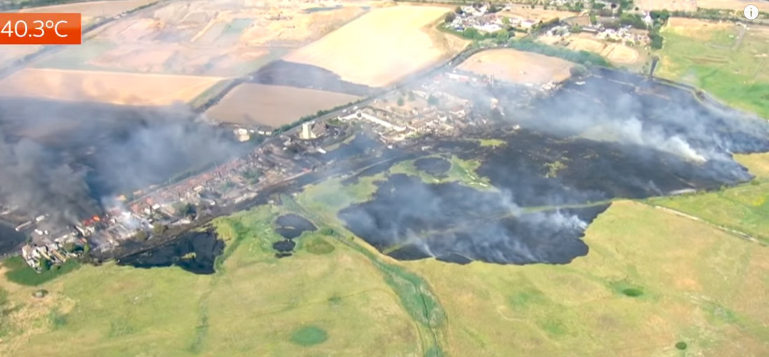
London Mayor Sadiq Khan said on Twitter: “London Fire Brigade has just declared a major incident in response to a huge surge in fires across the capital today. This is critical: @LondonFire is under immense pressure.”

The agency listed 11 fires they were dealing with Tuesday at 3 p.m. local time. At least 10 involve vegetation:

  • Thirty fire engines dealing with a grass fire on Pea Lane in Upminster.
  • Fifteen fire engines tackling a fire on The Green in Wennington.
  • Twelve fire engines tackling a fire involving garden fencing and trees on Uxbridge Road in Pinner.
  • Ten fire engines tackling a restaurant fire on Green Lanes in Southgate.
  • Eight fire engines tackling a grass fire on Oaks Road in Croydon.
  • Eight fire engines tackling a grass fire on Ballards Road in Dagenham.
  • Eight fire engines tackling a fire on The Broadway in Wembley.
  • Six fire engines tackling a grass fire on Sunningfields Crescent in Hendon.
  • Four fire engines tackling a grass fire on Chapel View in Croydon.
  • Four fire engines tackling a fire on Sidcup Road in Eltham.
Multiple wildland-urban interface fires destroyed structures United Kingdom
Multiple wildland-urban interface fires destroyed structures in the UK July 19, 2022. Sky News.

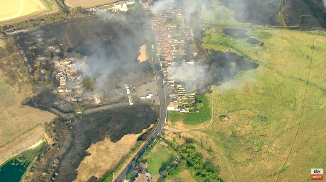
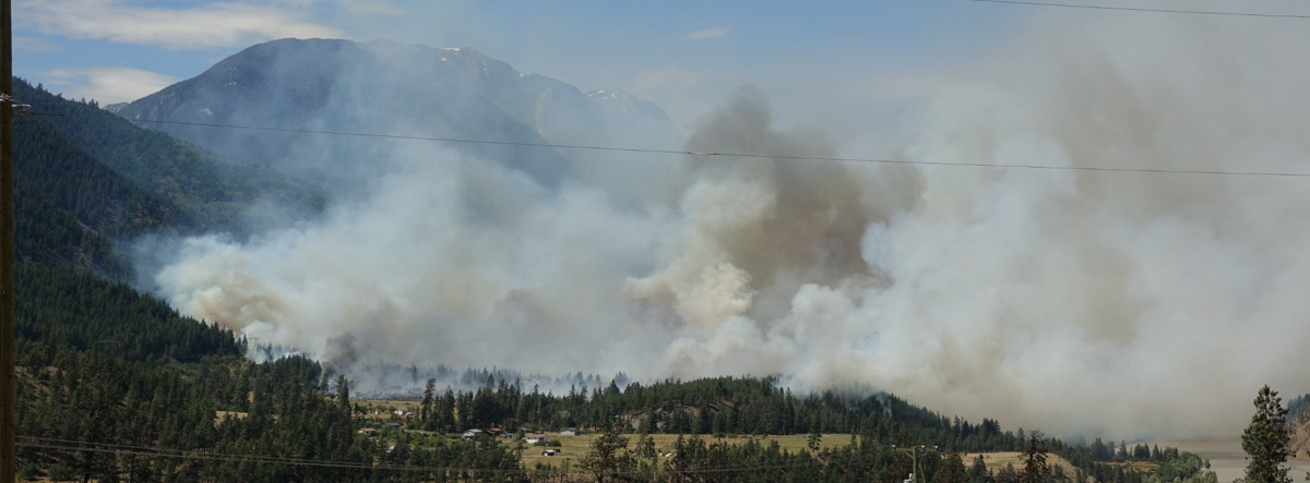
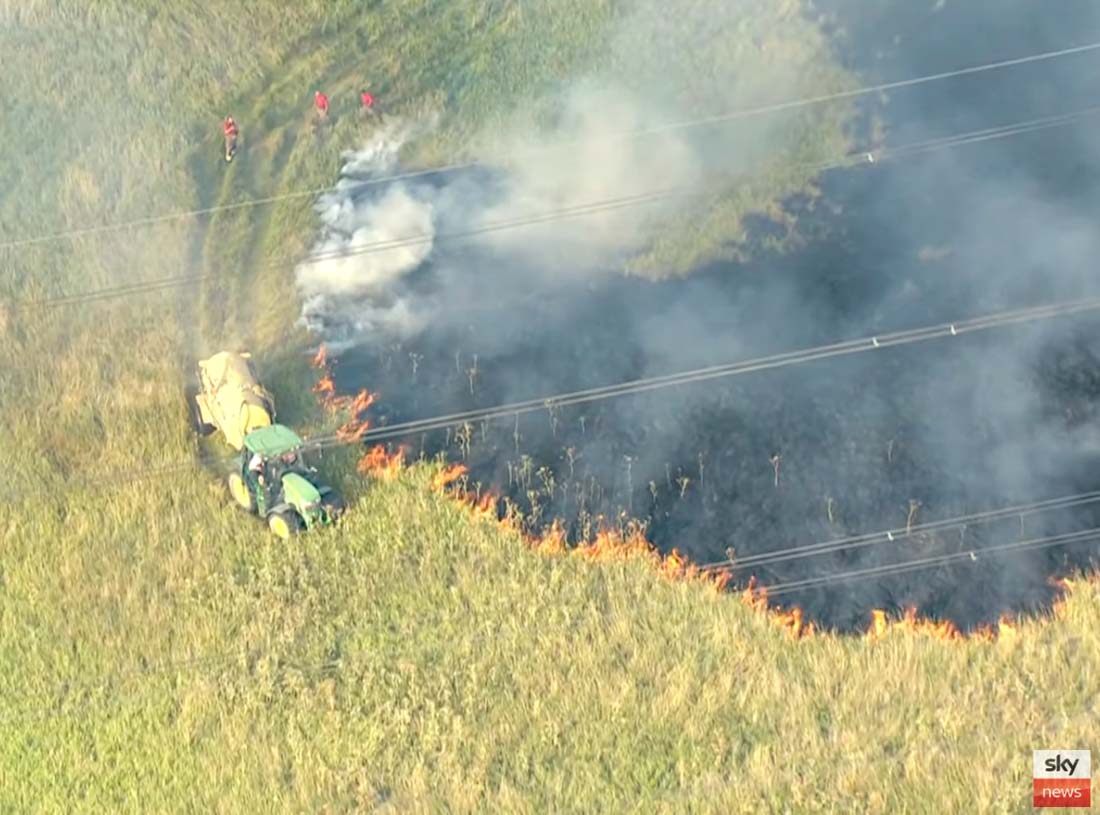
Other wildfires are also occurring in the UK.

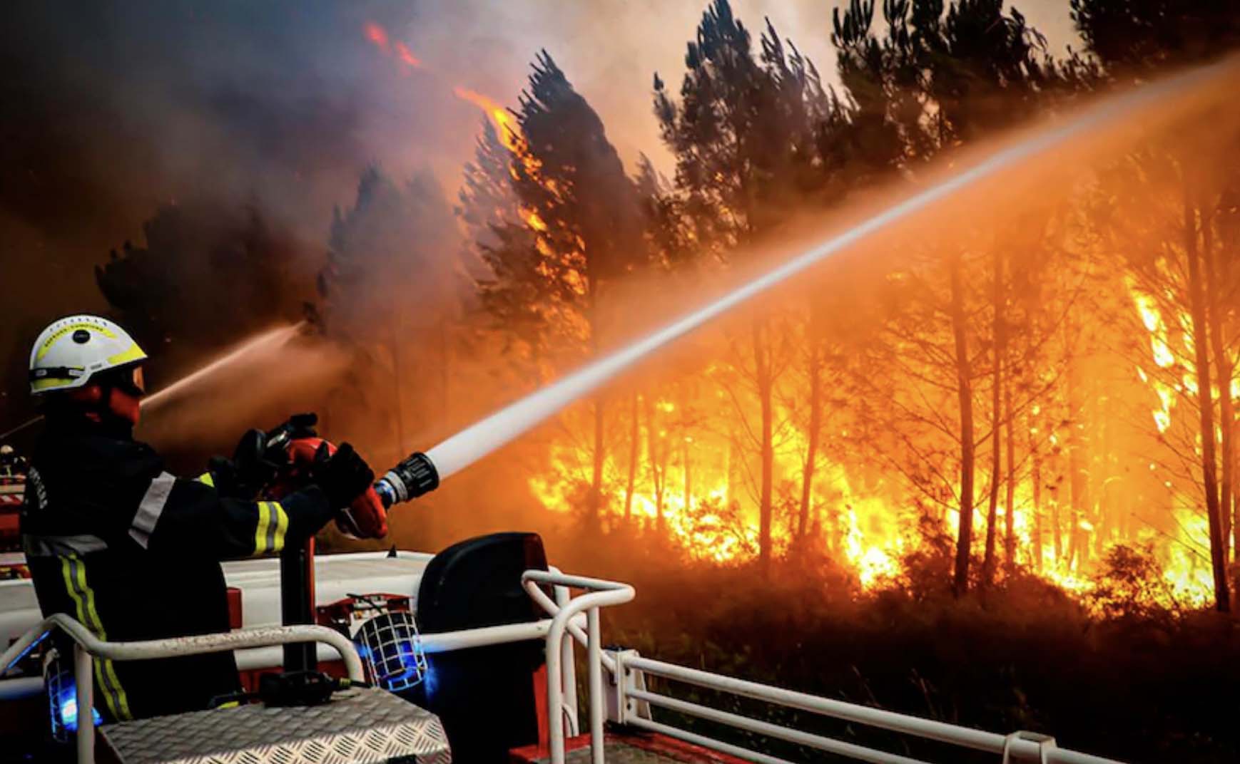
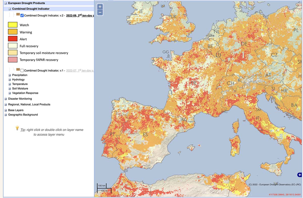
Hundreds of deaths have been attributed to the heat in Spain and Portugal since last week, and wildfires have forced tens of thousands of people out of their homes there, as well as in France.

In Spain a man who was building a fireline with an excavator abandoned the equipment as it was overrun by fire. He fled through a field with his clothes on fire and was transported to a hospital.

In southwestern France, wildfires have destroyed at least 19,000 hectares (47,000 acres) as temperatures rose to 108.8 degrees (42.7 Celsius) Monday, when dozens of locations set all-time highs. Conditions eased Tuesday when  a cool oceanic air mass arrived overnight.

In the United States night time temperatures are rising, which can affect fuel moisture, fuel temperature, and lower than average minimum relative humidity, all resulting in higher wildland fire danger. It also appears to be happening in Europe, at least recently.

From the Washington Post:

The United Kingdom not only posted its highest maximum daytime temperatures on record, but also its maximum overnight temperatures — with some locations not dipping below the upper 70s (25 to 26 Celsius). The lack of nighttime cooling was of grave concern to health officials as only a tiny percentage of British homes have air-conditioning.

By Wednesday, the core of the heat is forecast to focus over central and eastern Germany, Poland and southern Scandinavia as the heat dome is nudged eastward.

From Friday into the weekend, a new heat dome will build over southern Europe with extremely high temperatures over Spain, France and Italy, which have already endured multiple bouts of punishing heat this summer.
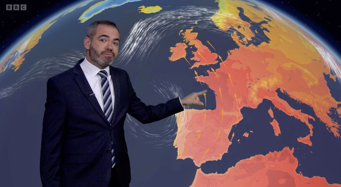
Multiple wildland-urban interface fires destroyed structures United Kingdom
Multiple wildland-urban interface fires destroyed structures in the UK July 19, 2022. Sky News.
Multiple wildland-urban interface fires destroyed structures United Kingdom
A farmer uses spray equipment to check the spread of a grass fire in the UK July 19, 2022. Sky News.
Multiple wildland-urban interface fires destroyed structures United Kingdom
Multiple wildland-urban interface fires destroyed structures in the UK July 19, 2022. Sky News.
Heat Sources detected in Europe fires wildfires
Heat Sources detected in Europe by satellites, for the 7-day period ending July 19, 2022.

Hot dry weather leads to numerous wildfires in Europe

Weather forecast, Europe, for July 18, 2022
Weather forecast, Europe, for July 18, 2022. WeatherOnlne. For reference, 40C is 104F, and 35C is 95F.

As Western Europe enters its second heat wave in the last 30 days the maximum temperatures are predicted to set records. Residents in the United Kingdom could experience conditions none of them have ever seen as the temperature rises to 104F degrees (40C) or more, prompting officials to issue the first ever red “extreme heat” warning for Monday and Tuesday.

Farther south in Europe, in southwest France on Saturday there were temperature peaks of close to 108F (42C), as the city of Biarritz broke a maximum temperature record. Nearly three-quarters of the country’s population, 45 million people, were affected by red or orange heat alerts in what is the earliest heat wave ever recorded in France.

The hot, dry weather has resulted in numerous wildfires in Britain, Spain, Portugal, and France over the last several days, bringing an earlier than usual start of the fire season. Firefighters in London, yes, London, have dealt with more than 800 vegetation fires since the start of last month to July 12.

wildfire in the Bordeaux region of southwest France
Firefighters work on a wildfire in the Bordeaux region of southwest France. AP.

Two blazes near the coastal town of Arcachon in France’s southwest Gironde region have burned more than 24,000 acres since Tuesday. About 3,000 firefighters assisted by firefighting aircraft are battling the blazes in southern France.

On Friday a pilot was killed while working on a fire in Northeast Portugal when an Air Tractor AT-802AF Fire Boss went down near the town of Torre de Moncorvo after scooping water on the Douro river.

Spain is also working on several large fires that have burned tens of thousands of acres. In southern Andalusia, 3,000 people were evacuated after a fire started near the village of Mijas in the province of Malaga. Around 200 firefighters supported by 18 aircraft are assigned to the incident.

European heat wave
BBC weather forecaster Ben Rich.

BBC weather forecaster Ben Rich explained that the current heat wave is caused by the jet stream shifting north and a portion of it breaking off to form a low pressure area west of Portugal, a cutoff low, with south winds pumping heat north into Western Europe including Spain, France and the UK.

Combined drought indicator Europe
Combined drought indicator last 10 days in June, 2022. European Commission’s Drought Observatory..

Much of Western Europe and the southern UK are in drought ranging from warning to alert levels, according to the European Commission’s Drought Observatory. The dry soils allow more surface heating and the result is record-setting temperatures and lower than average moisture in the vegetation, establishing conditions that are conducive to large wildfires with high resistance to control.

The video below is a summary of current wildfires in Western Europe.

Nohomin Creek Fire near Lytton, BC prompts evacuations

At least six home have been destroyed

Updated 6:59 p.m. MDT July 16, 2022

Nohomin Creek Fire July 16, 2022
Nohomin Creek Fire, looking north up the Fraser River towards the Stein Valley. BC Fire Service photo, 3:39 p.m. MDT July 16, 2022.

The British Columbia Fire Service reported at 4:02 p.m. Saturday that the fire activity on the Nohomin Creek Fire northwest of Lytton, BC has been stable today and no major growth was observed. Ground crews and aviation resources are working on the south, east, and north flanks. The western flank  is moving upslope in steep, difficult to access terrain, the agency said.

The Stein Valley Nlaka’pamux Heritage Park is partially closed. Currently, there are no impacts to Highway 1 or Highway 12. The Lytton Ferry is closed in both directions.

There was no update on the size, and it is still reported at 1,500 hectares (3,700 acres).


10:32 a.m. MDT July 16, 2022

Nohomin Creek Fire Lytton, BC
Nohomin Creek Fire Lytton, BC, July 14, 2022. BC Wildfire Service.

The Nohomin Creek Fire on the west side of the Fraser River northwest of Lytton, British Columbia has burned approximately 1,500 hectares (3,700 acres) since it was reported Thursday July 14. Judging from these photos shot that day it spread very rapidly.

Fire officials said Friday that at least six homes have been destroyed, and that number could rise.

The BC Wildfire Service reports that the fire behavior is rank four and rank five, meaning it is crowning, has a moderate to fast rate of spread, and is exhibiting short-range spotting.

Nohomin Creek Fire map Lytton BC
Nohomin Creek Fire map. The red dots represent heat detected by satellites as late as 7 a.m. MDT July 16, 2022.

Winds of 30 to 40 kilometers per hour (19 to 26 miles per hour) are pushing the fire west away from communities, according to the BC Wildfire Service in a Friday evening update. At that time there were no impacts to Highway 1 or Highway 12. The Lytton Ferry is closed in both directions.

The two photos below were taken the day the fire started.

Nohomin Creek Fire Lytton BC
(1) Nohomin Creek Fire across the river from Lytton, BC, July 14, 2022.
Nohomin Creek Fire Lytton, BC
(2) Nohomin Creek Fire across the river from Lytton, BC, at 3 p.m. July 14, 2022.

Evacuations are in effect. Lytton First Nation has the details.

In late June of 2021 the Lytton Creek Fire burned more than 83,700 hectares (206,000 acres) and destroyed 90 percent of the village of Lytton. Two civilians were killed in the fire.

The remaining battle on Yosemite National Park’s Washburn Fire is on the east side

A very steep area with large rock outcroppings

10:06 a.m. PDT July 15, 2022

Washburn Fire 3-D map 10:10 p.m. PDT July 14, 2022
The red line on the 3-D map (looking southeast) was the perimeter of the Washburn Fire at 10:10 p.m. PDT July 14, 2022. The white line was the perimeter about 48 hours before.

The challenge remaining on the 4,759-acre Washburn Fire in Yosemite National Park is to corral the east side where it has spread into the Sierra National Forest, a very steep area with large rock outcroppings.

They have established three helispots on the north side of the South Fork of the Merced River and one on the south side that could be used for inserting firefighters. Their plan is to insert a small group of hotshots on the east side of the fire south of the river at Helispot 5 on the map below, being pointed to by Planning Operations Section Chief Matt Ahern. Their task will be to construct fire line on that corner, west of Iron Creek, working downhill and uphill to anchor and stabilize the fire at that point. This would then enable hotshot crews to “come off the top”, said Mr. Ahern.

Washburn Fire briefing, by Ops PSC Matt Ahern, July 15, 2022
Washburn Fire briefing by Operations Planning Section Chief Matt Ahern, July 15, 2022. He is pointing to Helispot 5 where a small group of Hotshots will be inserted to establish an anchor point on the northeast corner of the fire above the South Fork of the Merced River.

Contingency fire lines are being constructed some distance from the fire on the south and east sides in case extreme weather drives the fire in those directions.

The Buck Cabin east of the fire built in 1931, was recently rehabilitated at great expense. The wood shake shingle roof was replaced with — another wood shake shingle roof. Since it is very, very vulnerable to fire, and in a roadless area, firefighters will be flown by helicopter to the area, rappel to the ground, and wrap it in foil-based structure wrap.

Most of the fire edge near the Mariposa Grove of giant sequoias has been secured with fire line, Mr. Ahern said.

Washburn Fire map 10:10 p.m. PDT July 14, 2022
The red line on the map was the perimeter of the Washburn Fire at 10:10 p.m. PDT July 14, 2022. The white line was the perimeter about 48 hours before.

“Overall the incident is in a very good place,” said Mr. Ahern. “We still have a tremendous amount of work and a heavy commitment of hotshot crews and aerial resources to pinch off Iron Creek.”

The infrared video below shot at 10:39 p.m. July 14 shows the east side of the fire.

Grant Fire burns 74 acres southeast of Sacramento

Grant Fire, July 14, 2022. CAL FIRE
Grant Fire, July 14, 2022. CAL FIRE.

8:09 a.m. PDT July 15, 2022

Thursday afternoon firefighters stopped the spread of the Grant Fire after it burned 74 acres about 15 miles southeast of Sacramento, California. The blaze was reported at 5:44 p.m. 4 miles northwest of Rancho Murieta just west of Scott Road. CAL FIRE reports that one outbuilding was destroyed.

Firefighters worked throughout Thursday night patrolling and building containment lines. On Friday they will continue mopping up hot spots and smoldering areas within oak groves and strengthening containment lines.

Grant Fire map July 14, 2022.

Peter Fire near Anderson, CA prompts evacuations

Updated 9:44 p.m. PDT July 14, 2022

Peter Fire map, 6 p.m. July 14, 2022
Peter Fire map, 6 p.m. July 14, 2022. FIRIS.

CAL FIRE reported at 9 p.m. that the Peter Fire at Anderson, CA has destroyed 12 structures and has burned 304 acres. They did not specify how many of the structures were residences.

Firefighting resources assigned include 51 engines, 18 water tenders, 15 hand crews, 6 helicopters, and 7 dozers for a total of 497 personnel.

The Shasta County Sheriff’s Office has evacuation information. At 8 p.m. they posted the following:

UPDATE. All residents in homes east of the intersection of Third Street and Missouri Lane to Highway 273 can return to their homes. All roads connected to Spring Gulch Road west of Missouri Lane remain under evacuation order. Residences on Diamond Street west of Franklin remain under an evacuation order. The evacuation warning for all streets off Parallel Road and Jacqueline Street remain in effect.


Updated at 6:01 p.m. PDT July 14, 2022

Air Attack reports that the Peter Fire at Anderson, California is looking good, and they have a retardant line around most of the perimeter. They are keeping two air tankers to be able to pick up spot fires as they occur. The other tankers have been released, including a Very Large Air Tanker.

The fire is believed to have started from a structure fire that spread into the vegetation. At 6 p.m. there were no engines available to work on a burning structure, so helicopters were dropping water on it.

The Shasta County Sheriff’s Department has evacuation information on their Facebook page.


Updated at 5:25 p.m. PDT July 14, 2022

Peter Fire map
Peter Fire mapped by FIRIS at approximately 4:11 p.m. PDT July 14, 2022.

FIRIS mapped the Peter Fire at 248 acres at approximately 4:11 p.m. PDT Thursday. At 5:25 p.m. it was mapped again at 303 acres.

Peter Fire photo
Peter Fire, looking southeast from the Falcon camera at 5:11 p.m. PDT July 14, 2022. AlertWildfire.

4:58 p.m. PDT July 14, 2022

air tankers Peter Fire at 4:16 p.m. July 14, 2022
Aircraft near the Peter Fire at 4:16 p.m. July 14, 2022. FlightRadar24

A new fire south of Redding, California is prompting evacuations west of Anderson. The Peter Fire was reported at around 3 p.m. PDT and at last report had burned at least 50 acres. It is four miles south-southwest of the Redding Air Attack base which results in quick turnarounds for air tankers reloading with retardant.

Firefighters on scene have reported 30 structures that are threatened and several times have requested additional engines and aircraft. There are reports that the fire has reached some structures and air tankers are making retardant drops near them attempting to lessen the damage. At least half a dozen air tankers are on scene or en route.

The evacuation center is at West Valley High School, 3805 Happy V Road, Cottonwood, CA.

Peter Fire Anderson California 5:23 p.m. PDT July 14, 2022
Peter Fire, looking southeast from the Falcon camera at 4:23 p.m. PDT July 14, 2022. AlertWildfire.

Weather

Since the fire started the Howard Street weather station in Anderson has recorded 88 degrees, 13 percent relative humidity, and 10 to 12 mph winds out of the south and south-southeast gusting to 12 mph. The forecast for the rest of the afternoon calls for winds increasing to 14 mph out of the south, then slowing after sunset to 3 mph for the rest of the night. The nighttime humidity should rise to 52 percent then on Friday drop to 10 percent in the afternoon with 6 mph winds out of the south.