Firefighters stop the Elmore Fire in Anchorage, Alaska

 Q400 air tanker drops Elmore Fire Anchorage, Alaska
A Q400 air tanker, Tanker 540, drops on the Elmore Fire near Anchorage, Alaska June 23, 2022. Mike McMillan/ AK DOF.

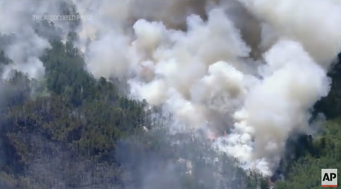
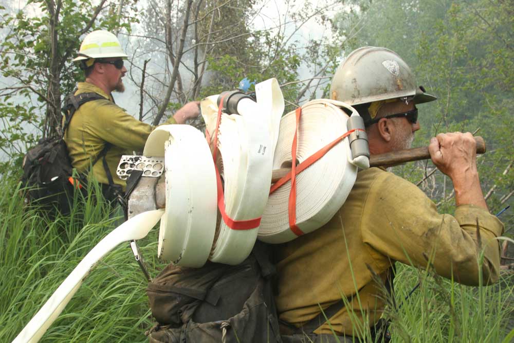
Firefighters in Alaska were able to stop the spread of the Elmore Fire on the east side of Anchorage Thursday at 13 acres before it spread into structures. It was reported at 5 p.m. in the Campbell Track area near the intersection of Dowling and Elmore Roads.

Elmore Fire, Anchorage, AK June 23, 2022
Alaska Dept. of Forestry firefighters on the Elmore Fire, Anchorage, AK June 23, 2022. Mike McMillan-Alaska DOF.

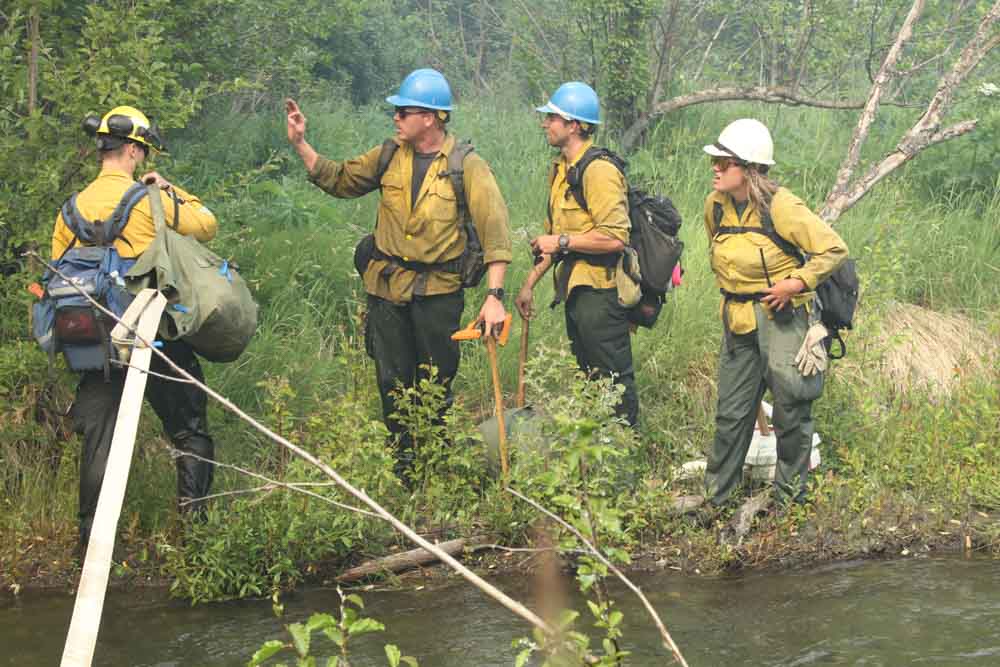
Personnel responded from the Pioneer Interagency Hotshot Crew, Palmer forestry, Joint Base Elmendorf-Richardson, Anchorage Fire Department, and Alaska Division of Forestry (DOF). A group of Canadian firefighters staged in the area with the DOF through the use of the Northwest Compact were also on scene.

Elmore Fire, Anchorage, AK June 23, 2022
Alaska Dept. of Forestry firefighter on the Elmore Fire, Anchorage, AK June 23, 2022. Mike McMillan-Alaska DOF.

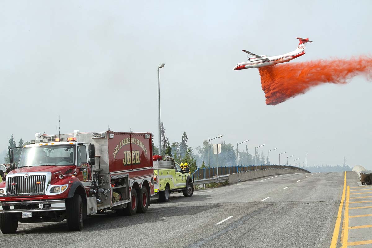
The firefighters were assisted by one DOF helicopter and two fixed wing air tankers operated by Conair, a Q400 and a Convair 580. The Q400, Tanker 540, is seen above.

Elmore Fire, Anchorage, AK June 23, 2022
Elmore Fire, Anchorage, AK June 23, 2022. Brent Goodrum-Alaska Div. or Forestry

The DOF has a contract with Conair to supply two Convair 580 air tankers, but the company has the option to substitute one of their Q400 tankers for a 580 at the same price. One of the tankers is usually based at Palmer and the other at Fairbanks.

Elmore Fire, Anchorage, AK June 23, 2022
Alaska Dept. of Forestry firefighters on the Elmore Fire, Anchorage, AK June 23, 2022. Mike McMillan-Alaska DOF.

In 2021 Conair purchased 11 Q400 aircraft from Flybe Airlines. The first one was delivered at Conair facilities in Abbotsford, British Columbia, February 21, 2021. After being converted to air tankers, called A400ATs (Air Tanker), they will eventually replace the L-188’s and CV-580’s currently operated by Conair. Showcasing a Q400 in Alaska can increase the familiarity of the tanker among Conair’s potential clients.

The repurposed Q400s are capable of holding up to 2,640 gallons of retardant. The CV-580s were produced between 1947 and 1954 and can carry up to 2,100 gallons. The Q400 cruises about 50 mph faster than a CV-580.

Before purchasing the 11 Q400’s from Flybe, Conair had two A400ATs operational within their fleet that were used in 2021 for the first time in the North American fire season, including Alaska. They also had one under contract in Australia during the 2020-2021 bushfire season.

In 2017 the Conair Group secured a deal to sell six Q400MR (Multi-Role) air tankers to France’s Securite Civile (Department of Civil Defense and Emergency Preparedness). These were new aircraft that Conair purchased from Bombardier which can be reconfigured in a few hours to carry passengers, hence the Multi-Role designation. The new aircraft are replacing France’s old S-2 air tankers.

Dempsey Fire burns thousands of acres west of Mineral Wells, Texas

Updated at 9:54 a.m. CDT June 25, 2022

Dempsey Fire map
Dempsey Fire map, 8:54 p.m. CDT June 24, 2022.

The Dempsey Fire showed extreme activity well into Friday night and only slowed down when when high humidity set in early Saturday morning. The fire jumped FM Road 4 and Fortune Bend Road, and crossed the Brazos River in multiple places.

To see all articles on Wildfire Today about the Dempsey Fire, including the most recent, click HERE.

Additional dozer and engine crews have arrived on scene and began constructing and holding line early Saturday morning. Helicopters and air tankers are expected to be available to assist firefighters.

Satellite photo of smoke from the Dempsey Fire
Satellite photo of smoke from the Dempsey Fire at 5:46 p.m. CDT June 24, 2022.

At 9 a.m. Saturday the Texas Forest Service was still saying the size is 6,500 acres. That could change with updated mapping.

An updated spot weather forecast from the NWS for Saturday calls for clear skies, 105 degrees, 19 percent relative humidity, and winds out of the south at 5 to 9 mph.


10:35 p.m. CDT June 24, 2022

Dempsey Fire, west of Mineral Springs, Texas
Dempsey Fire, west of Mineral Wells, Texas, June 24, 2022. Photo via Texas Forest Service.

The Dempsey Fire 6 miles west of Mineral Wells, Texas was extremely active Friday afternoon, growing to approximately 6,500 acres as the temperature soared to 106 degrees. The Texas Forest Service reported it ran to the north and northwest, jumping the Brazos River and FM Road.

Dempsey Fire location map Texas
Dempsey Fire location map, 6 miles west of Mineral Wells, TX.

Engines have been engaged in structure protection as dozers construct line along the flanks of the fire. Aircraft are assisting firefighters by cooling the head and flanks, slowing the rate of spread and buying time for the ground crews. Evacuations are in effect south of Grassy Ridge Road.

Dempsey Fire map
Dempsey Fire map, estimated perimeter at 2:22 p.m. CDT June 23, 2022. Texas Forest Service.

After 2 p.m. Friday the wind at the Mineral Wells Airport was out of the south and southeast at 10 to 18 mph gusting at 20 to 30 while the relative humidity was 17 percent. The spot weather forecast for Friday night calls for 7 to 12 mph winds out of the south and southeast with the humidity rising to 50 percent by dawn. On Saturday the wind will be from the south at 10 to 15 mph with 18 percent relative humidity and a high temperature of 105. These weather conditions will favor the continued spread of the fire to the north and northwest .

Dempsey Fire, west of Mineral Springs, Texas
Dempsey Fire, west of Mineral Wells, Texas, June 24, 2022. Photo via Texas Forest Service.

Firefighter injured by falling tree after water drop

Treated at hospital and released

Canyon Fire
Canyon Fire as seen from the Sunol Ridge 1 camera at 2:37 p.m. June 23, 2022

A Fremont, California firefighter was injured Thursday while working on the Canyon Fire northeast of the city near Sunol in Alameda County. The Fremont Fire Department said Thursday night that “the firefighter was hit by a falling tree after a water drop operation. Thankfully the firefighter was released from the hospital this evening and is expected to be ok.”

A reporter from KPIX TV, @KatiePPIX, said another firefighter was transported to a hospital for a heat related injury after working in “near triple digit temps.”

The spread of the fire was stopped after it burned 71 acres. Firefighters were assisted by helicopters and air tankers.

In the second video below, a large Type 1 helicopter can be seen making a drop on the Canyon Fire.

On May 29, 2022 three firefighters were injured when struck by water dropped from a large Type 1 helicopter on the Calf Canyon-Hermits Peak Fire in New Mexico. They were not injured directly by the water, but were knocked onto boulders by the force of the drop. It occurred while they were crossing a steep rocky piece of ground consisting boulders two to three feet in diameter, according to a preliminary report. The most seriously injured had multiple surgeries to repair facial fractures and a broken kneecap.

In 2018 three firefighters were injured and one was killed by falling tree debris resulting from an air tanker retardant drop. The accident occurred on the Ranch Fire which was part of the Mendocino Complex of Fires east of Ukiah, California.

Thanks and a tip of the hat go out to Tom.

Multiple fires ignited in California following tens of thousands of lightning strikes

A woman and her two dogs were killed by lightning in Pico Rivera

8:15 a.m. PDT June 24, 2022

Map Thunder Fire 4:30 p.m. PDT June 23, 2022
Map of the Thunder Fire, 4:30 p.m. PDT June 23, 2022, near the Grapevine on Interstate 5 in Southern California. Looking south-southeast

It is still possible that some of the 50,000+ lightning strikes in California on Wednesday and Thursday could have started fires that are undetected, very small, and smouldering, but so far most of the blazes that have been reported have been contained, or very close to it. The lack of numerous huge fires in the wake of the lightning is likely due to the rain that accompanied the strikes in some areas, high relative humidity, and it being fairly early in the fire season before fuel moistures drop to critical levels.

The largest has been the Thunder Fire (see map above) just west of the Grapevine on Interstate 5 north of Frazier Park. The official cause has not yet been released, but lightning is suspected said Captain Andrew Freeborn of the Kern County Fire Department. Friday morning it was 2,466 acres and had 311 personnel assigned.

The Romero Fire was reported Thursday afternoon in Merced County near Santa Nella, five miles south of Highway 152. As of early Friday morning it had burned 422 acres of grass and is 100 percent contained. The cause has not been released.

Five other fires in the greater Bay Area have burned 26 to 522 acres; firefighters so far have not had much difficulty in stopping the spread of those incidents.

On Thursday the reported wildfire activity in Southern California was, CAL FIRE, 33 fires; County and local, 14 fires; and US Forest Service, 6 fires. It is not known how many of these can be attributed to lightning.


7:42 a.m. PDT June 23, 2022

lightning map California Arizona New Mexico
Lightning, during the 24 hours ending at 6:15 a.m. PDT June 23, 2022. LightningMaps.org

As monsoonal moisture moved through Southern California Wednesday more than 50,000 lightning strikes were detected, starting wildfires and killing a woman and her two dogs who were walking in Pico Rivera.

Chris Vagasky, @COweatherman, tweeted that a total of 54,329 strikes were recorded across California on Wednesday UTC time.

Thunder Fire map
Map showing heat detected on the Thunder Fire by satellites as late as 3:51 a.m. MDT June 23, 2022.

Multiple fires suspected of being started by lightning occurred in Southern California, with most of them being suppressed while very small. The cause of the Thunder Fire east of Interstate 5 near the Grapevine north of Frazier Park is under investigation, but the suspected cause is lightning, said Captain Andrew Freeborn of the Kern County Fire Department. At 6:45 a.m. Thursday the Department reported it had burned approximately 2,300 acres and was being staffed by 250 personnel.

Small fires on the Angeles National Forest were being worked overnight by firefighters assisted by night-flying helicopters.

Rain fell in some areas, but it was spotty.

Precipitation, 48-hours, 730 a.m. June 23, 2022 southern California

Mullica River Fire in New Jersey’s Wharton State Forest could become state’s largest in 15 years

Four miles northeast of Hammonton, NJ

Mullica River Fire map
Mullica River Fire map showing heat detected by satellites as late as 2:09 p.m. EDT June 20, 2022.

The Mullica River Fire that started Sunday morning in New Jersey’s Wharton State Forest could become the state’s largest in the last 15 years. Chief Gregory McLaughlin of the New Jersey Forest Fire Service said a direct attack was not effective because it is in a very remote area with difficult access so firefighters backed off to implement an indirect attack. They are conducting burning operations out ahead of the fire to remove the fuel, fighting fire with fire, so that as the fire spreads to the freshly burned areas it will stop.

There are 18 structures threatened, including several campgrounds as well as blueberry and cranberry farms. The blaze is burning in four townships, Washington, Shamong, Hammonton, and Mullica. It is four miles northeast of Hammonton, east of Highway 206.

Satellite photo of smoke from the Mullica River Fire in New Jersey
Satellite photo of smoke from the Mullica River Fire in New Jersey at 4:18 p.m. EDT June 20, 2022.

At 3:45 p.m. on Monday fire officials said it had burned about 11,000 acres.

NJ Environmental Commissioner Shawn LaTourette said the Mullica River Fire was not caused by lightning, it was human caused.

Mullica River Fire in New Jersey
Mullica River Fire in New Jersey, Associated Press.

Left Fork Fire in Utah takes off again after being dormant for a month

An escaped prescribed fire is being investigated as the original cause

Updated at 6:51 a.m. MDT June 20, 2022

3-D map of the Left Fork Fire
Map of the Left Fork Fire looking north-northeast. The green line was the perimeter May 11, 2022. The red line was the perimeter at 9 p.m. MDT June 19, 2022; the orange areas indicate intense heat at that time.

The Left Fork fire continued to spread to the northeast Sunday night in the Dixie National Forest in Southern Utah. When it was mapped at 9 p.m. Sunday it had burned approximately 2,600 acres. At that time it was about 2 miles west of the 87 road and Bryce Canyon National Park.

Map of the Left Fork Fire
Map of the Left Fork Fire. The green line was the perimeter May 11, 2022. The red line was the perimeter at 9 p.m. MDT June 19, 2022; the orange areas indicate intense heat at that time.


9:50 p.m. MDT June 19, 2022

Left Fork Fire map
Left Fork Fire map, showing heat (at the arrow) detected by a satellite at 1:57 p.m. June 19, 2022.

The Left Fork Fire in Southwest Utah has taken off again after being dormant for about a month on the Dixie National Forest. It was first detected May 9. On May 10 the Forest Service said it ignited from material still burning from a prescribed fire conducted April 7, 2022.  On May 11, 12, and 13 the daily updates about the wildfire posted by the Forest Service stated it was “human caused.” The escaped fire burned 97 acres in early May.

Apparently undetected smouldering material on or under the ground, such as stumps, duff, or tree roots, must have continued burning for weeks after the prescribed fire, and later after the spread of the 97-acre wildfire was stopped. Follow up monitoring of both events either did not occur or was inadequate to detect the still burning fires. The strong winds on June 18 may have fanned it back into an active burning condition, and it spread across a fireline, or hot embers were blown outside the perimeter into receptive fuels.

Left Fork Fire, June 19, 2022
Left Fork Fire, June 19, 2022, by @april_reeve.

On June 18 the fire began spreading again pushed by strong winds. Utah Fire Information said that day it was estimated at 300 to 500 acres. Sunday afternoon, June 19, it had grown to 600 to 700 acres in rugged terrain, putting up a huge smoke plume affecting the air quality in eastern Utah and southwest Colorado.

Satellite photo of smoke from the Left Fork Fire,
Satellite photo of smoke from the Left Fork Fire, 7:16 p.m. MDT june 19, 2022. NOAA.

The original cause of the fire is still listed as “human caused.” There are dozens of ignition sources that cause wildland fires. Saying it is caused by humans only eliminates two — volcano and lightning — and both could be ruled out very quickly.

Left Fork Fire escaped prescribed fire
Firefighters construct fireline on the Left Fork Fire in Utah which was apparently caused by an escaped prescribed fire. Posted by the Dixie NF, May 12, 2022. Photo by Mervin Garcia, Engine 322.

Sunday afternoon the Left Fork Fire was spreading to the northeast and was about 2 miles west of Bryce Canyon National Park, 7 miles east of Highway 89, and 20 miles south of Panguitch; it had reached Blubber Creek drainage. It is burning between 8,000 and 9,000 feet above sea level.

The area was under a Red Flag Warning Sunday for relative humidity in the teens and 20 mph southwest winds gusting at 35 to 40 mph. The strong winds kept helicopters and fixed wing aircraft grounded, unable to assist firefighters on the ground.

The NWS spot weather for Monday calls for 70-72 degrees, 10-12 percent relative humidity, and 5 to 15 mph winds out of the west shifting to southwest. Tuesday will be about the same except the wind will be out of the southeast at 10-20 mph in the afternoon.

A Color Country Type 3 Incident Management Team will assume command of the incident Sunday evening.

The map below shows the location of the Left Fork Fire after the spread was temporarily stopped around May 11, 2022.

Left Fork Fire 3-D map, May 11, 2022
Left Fork Fire 3-D map, looking north May 11, 2022.

About a week after the first attempted suppression of the Left Fork Fire the US Forest Service announced May 20 in a press release that a “pause” was in effect for all prescribed fire operations on National Forest System lands. The reason given was “because of the current extreme wildfire risk conditions in the field…while we conduct a 90-day review of protocols, decision support tools, and practices ahead of planned operations this fall,” Forest Service Chief Randy Moore said in the statement. At the time several other prescribed fires had recently escaped in addition to the Left Fork incident.