Fires in the Black Hills prompt evacuations

Near Rapid City, Mount Rushmore, and Keystone

Updated at 12:25 a.m. MDT March 30, 2021

In a late night update fire officials said one home and two outbuildings are confirmed to have been destroyed by the Schroeder Fire west of Rapid City, SD.

Firefighters are working during the night in the Cleghorn Canyon, Nameless Cave, and Blessed Sacrament Church areas where they are patrolling and securing structures, in addition to the rest of the fire perimeter.


Updated at 9:22 p.m. MDT March 29, 2021
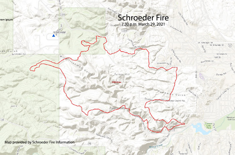
Map of Schroeder Fire
Map of Schroeder Fire, from a mapping flight at 7:30 p.m. March 29, 2020. Map provided by Schroeder Fire Information.

The Schroeder Fire just west of Rapid City, South Dakota was mapped at 1,905 acres at about 7:30 p.m. MDT March 29.

Fire officials said the blaze was reported Monday at 9:22 a.m. in the Schroeder Road subdivision, skipped across the canyon into the Westberry Trials subdivision and the footprint of the Westberry Trails Fire of 1988 .

A cold front with very strong winds came through around noon and pushed the fire south into the neighborhoods of Cleghorn Canyon, Nameless Cave, and Pinedale Heights.

Incident Commander Rob Powell said Monday afternoon that he was optimistic that they can keep the Schroeder Fire from crossing Highway 44.

A map showing evacuation areas is available at the Pennington County website.

The fire is human-caused and still under investigation, but that simply means it was not caused by lightning. Firefighters will staff the fire overnight. Suppression of the fire is a state responsibility, rather than federal.

“We are at record-dry conditions along with high winds playing a major factor in this fight,” said Jay Esperance, Division Director for South Dakota Wildland Fire.

Helicopters and a fixed wing air tanker have been ordered and will be used as needed when weather conditions allow. They can’t be used safely or effectively during strong winds, but a National Guard helicopter was used Monday afternoon after the wind speeds decreased. The Rapid City Air Tanker Base has been activated.


Originally published at 7:25 p.m. MDT March 29, 2021.

Map showing wildfires in the Black Hills
Map showing wildfires in the Black Hills, data from 2:36 p.m. MDT March 29, 2021.

At least three wildfires broke out Monday in the Black Hills of South Dakota. (see the map above)

The largest is the Schroeder Fire just west of Rapid City. Heat detected by a satellite at 2:36 p.m. MDT on Monday showed it to be at least 1,000 acres and primarily between Highway 44 and South Canyon Road. Evacuations are in effect. Officials said between 400 and 500 homes have been evacuated in Rapid City and one home and two outbuildings have been destroyed. A map showing evacuation areas is available at the Pennington County website. Suppression of the fire is a state responsibility, rather than federal.
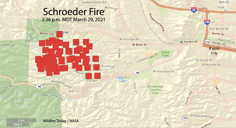
Schroeder Fire map
Schroeder Fire map, data from 2:36 p.m. MDT March 29, 2021

At 2:36 p.m. Monday, another fire, the 244 Fire, was less than a mile northeast of Mount Rushmore National Memorial and about a mile southwest of Keystone. It has burned 75 to 100 acres and the Memorial is closed. Suppression of the fire is a federal responsibility, rather than state.

A third blaze, the 15-acre Keystone Fire, is about 1.5 miles south of Keystone. It is being suppressed by the state.

Highway 244 is closed at the west boundary of the Memorial, and the Highway 16A entrance is closed at the Keystone and Iron Mountain Boundary.

The fires were driven by low humidity and very strong winds out of the west at 18 to 35 mph. Gusts above 50 mph were recorded at the weather station at Mount Rushmore.

We will update this article as more information becomes available.
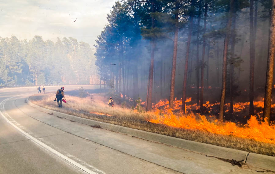
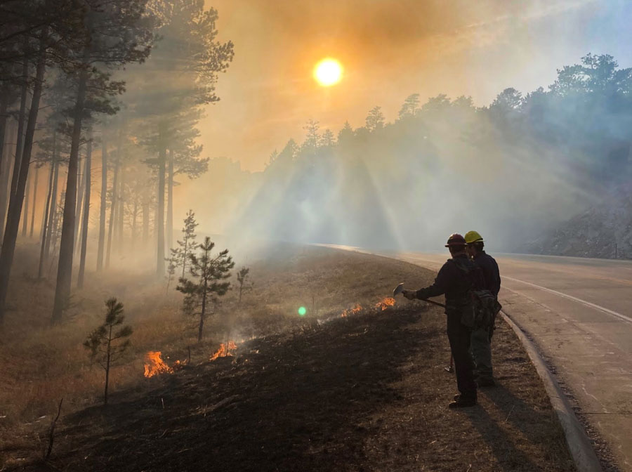
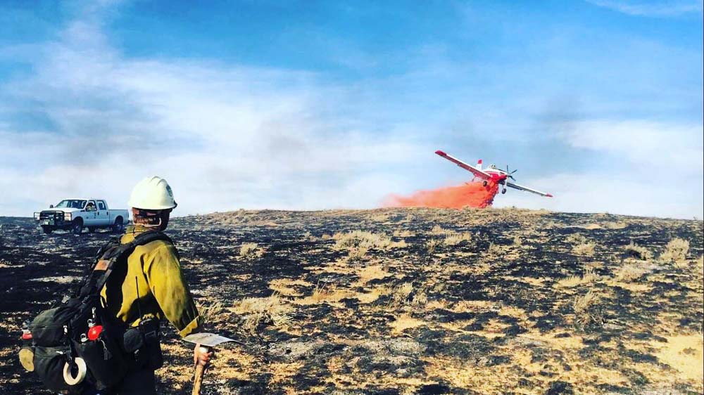
Fire in the Black Hills, March 29, 2021
A firefighter conducts a burnout on the 244 Fire near Mount Rushmore in the Black Hills, March 29, 2021. Photo courtesy of Great Plains fire information.
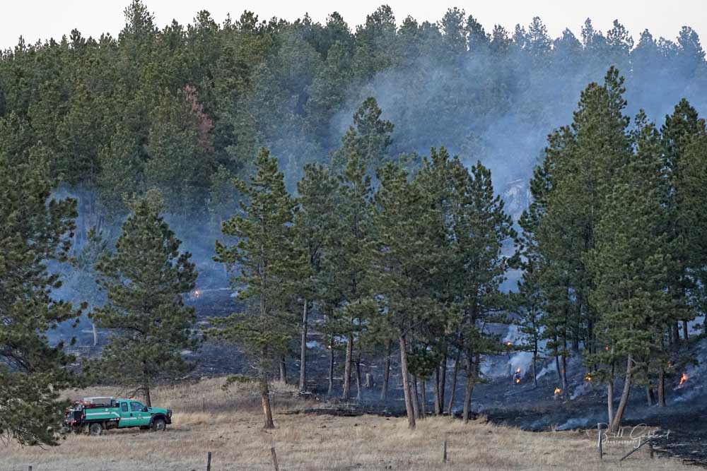
Fire in the Black Hills, March 29, 2021
The 244 Fire in the Black Hills near Mount Rushmore, March 29, 2021. Photo courtesy of Great Plains fire information.

Wildfire east of Browning, MT burns 25,000 acres

The fire prompted evacuations on the Blackfeet Reservation

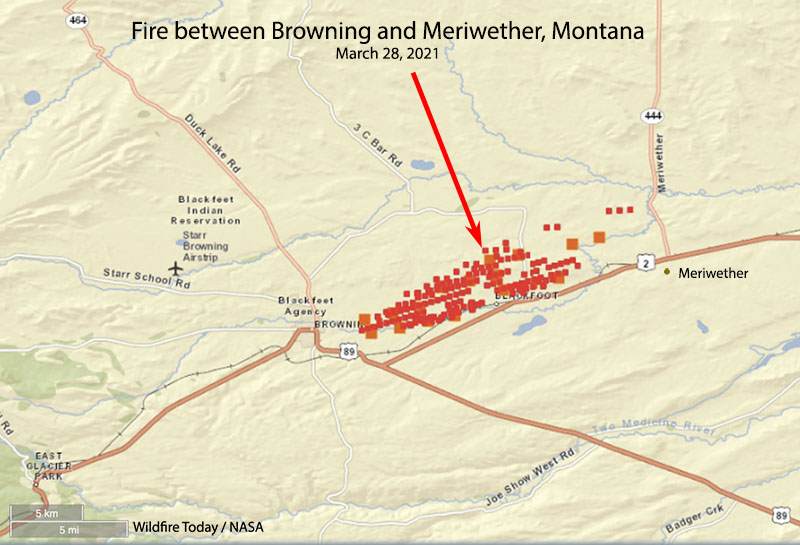
map fire east of Browning, MT
Map showing the approximate location of the fire east of Browning, MT. The red dots represent heat detected by satellites at 3 p.m. March 28, 2021.

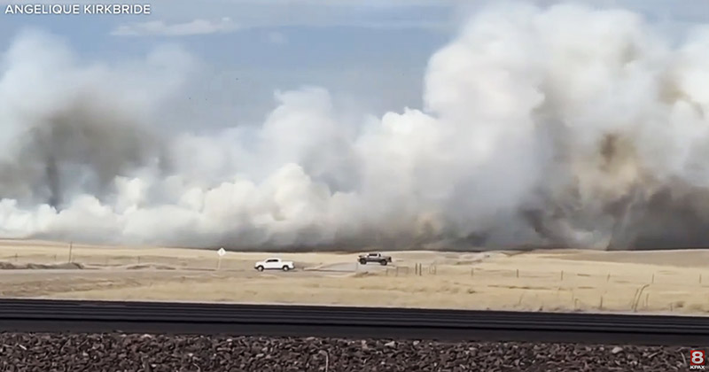
A fire that started about a mile east of Blackfeet Community College burned 25,000 acres between Browning and Meriwether in northern Montana Sunday.

The fire was pushed across farm lands by southwest winds gusting to 54 mph while the relative humidity was in the mid-20s. There is a report that one structure was destroyed.

The Blackfeet Covid-19 Incident Command reported that local fire departments suppressed the fire along with Blackfeet Fire Management and the Chief Mountain Interagency Hot Shots, a crew based in Browning.

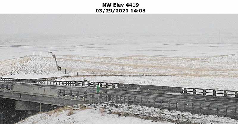
Rain that started at about 9 p.m. Sunday followed by snow during the night and temperatures in the low 20s slowed the spread of the blaze.

Montana DOT camera at Browning, MT shows snow
The Montana DOT camera at Browning, MT showed snow at 2:08 p.m. 3-29-2021.

Thanks and a tip of the hat go out to Dick.

A DC-10 air tanker is assisting firefighters on a fire near Monterrey, Mexico

About this time 10 years ago the Martin Mars, the 747, and two MAFFS air tankers assisted firefighters in Mexico.

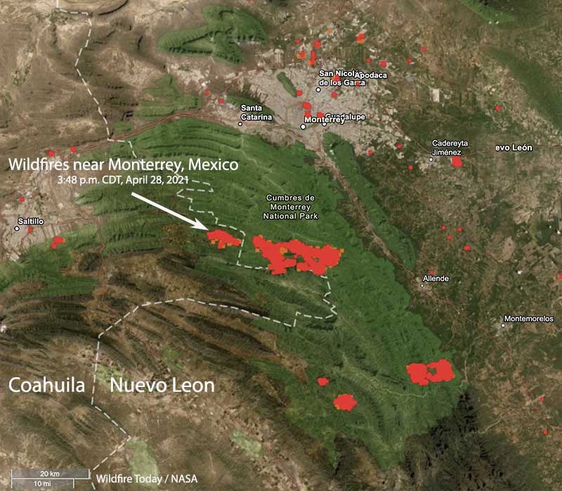
Wildfires near Monterrey, Mexico
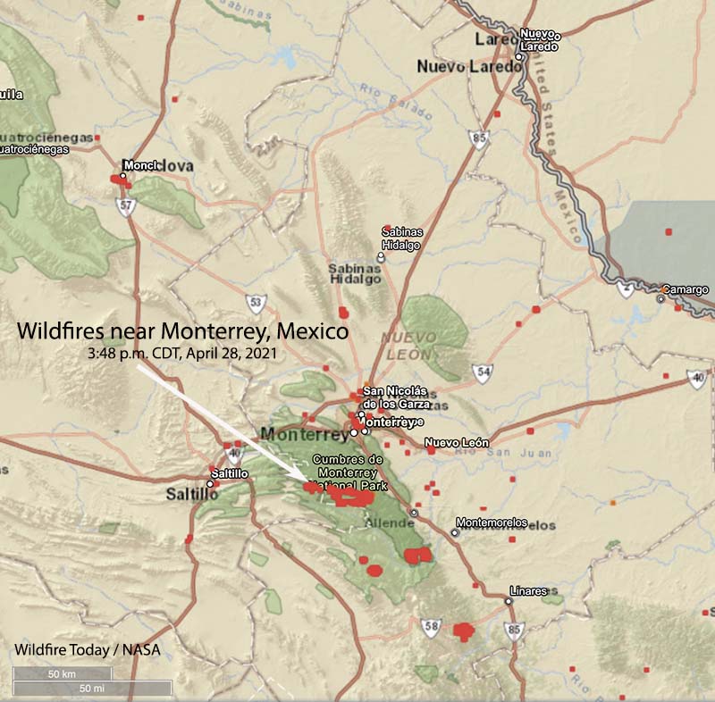
Map showing the location of wildfires (in red) southwest of Monterrey, Mexico 3:48 p.m. CDT March 28, 2021.

One of the DC-10 air tankers, T-912, has started a contract with the state of Coahuila to assist firefighters battling a fire 20 miles southwest of Monterrey in Mexico. Today was its first day of operations but when we spoke to John Gould, President of 10 Tanker at 2:45 p.m. CDT today March 28, the aircraft was on the ground waiting for an improvement in the weather.

They are working and reloading out of the airport in Laredo, Texas about 160 miles northeast of the fire.

The fire they will be dropping retardant on initially is just west of the Coahuila/Nuevo León state line. According to heat detected by satellites it appears to be several thousand acres, while a fire about 4 miles to the east in Nuevo León looks to be more than 22,000 acres. Both fires are near Highway 20.

Wildfires near Monterrey, Mexico
Wildfires southwest of Monterrey, Mexico 3:48 p.m. CDT March 28, 2021.

“Beautiful country there,”  Mr. Gould told Fire Aviation. “Very steep and challenging country for fighting fire. The state of Coahuila is providing the aerial supervision aircraft and we have put one of our pilots with lead plane and Air Tactical Group Supervisor experience in the right seat.”

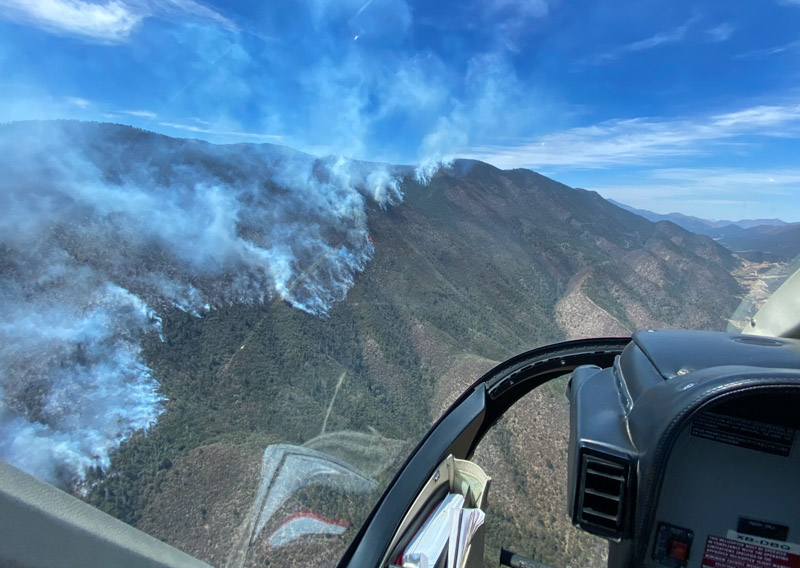
Fire SW of Monterrey in Coahuila, Mexico
Fire SW of Monterrey in Coahuila, Mexico. Noon March 26, 2021. 10 Tanker photo.
Fire SW of Monterrey in Coahuila, Mexico
Fire SW of Monterrey in Coahuila, Mexico. Noon March 26, 2021. 10 Tanker photo.
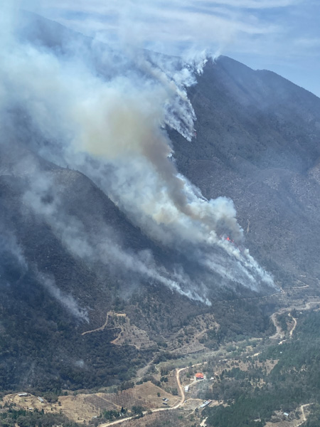
Fire SW of Monterrey in Coahuila, Mexico
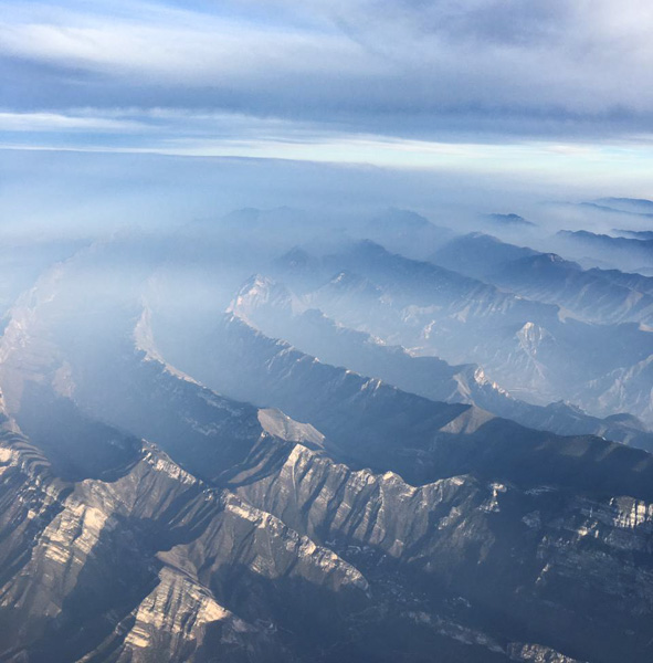
From high altitude, this is the general area of the fires, SW of Monterrey in Coahuila, Mexico. March 27, 2021. 10 Tanker photo.

In 2011 the 747 air tanker, two C-130’s with Modular Airborne Fire Fighting Systems (MAFFS) from Peterson Air Force base in Colorado Springs, and the Martin Mars worked on fires in northern Mexico. The C-130’s were reloading at Laughlin Air Force Base near Del Rio, Texas while the 747 worked out of Lackland Air Force Base near San Antonio, Texas.

The Martin Mars was  based at Lake Amistad reservoir near Del Rio, Texas. The lake straddles the U.S./Mexico border, and the aircraft was moored on the U.S. side.

Mass Bird Die-Off Linked to Wildfires and Toxic Gases

Using observations from crowdsourced science and weather location data, researchers concluded that wildfires caused a mass die-off of birds in the western and central United States in 2020.

By Joshua Rapp Learn

After an abnormally large number of migratory birds turned up dead in people’s backyards in Colorado and other parts of western and central U.S. states, locals began to document their observations on a crowdsourced science platform called iNaturalist. Within the app, a special project was set up specifically for this die-off, which occurred in August and September 2020, so that records of the dead birds could be compiled together.

Around the same period as the birds’ deaths, more than 3 million hectares (7.8 million acres) of land burned, which resulted in habitat loss and the emission of toxic compounds that threaten the health of both avian species and humans. In addition, snowstorms struck parts of the Northwest in early September while these birds were in the midst of their annual migration. Some areas experienced temperature drops of as much as 40°C (72°F) in just a few hours.

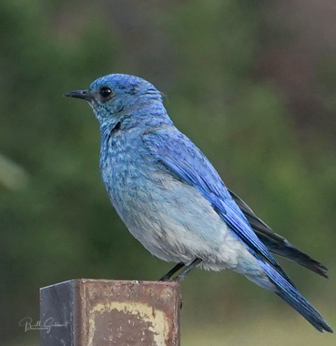
Mountain Bluebird, male
Mountain Bluebird, male. Photo by Bill Gabbert.

Researchers heard of this die-off event and wanted to see whether there was a link between the birds’ deaths and the other major events (wildfires and snowstorms) occurring in the United States at the time. In a new study published in GeoHealth, Yang et al. used the iNaturalist data, which included recordings of a number of migratory species such as warblers, geese, hummingbirds, swallows, flycatchers, and sparrows. The scientists also studied map readings that showed where observations were taken on iNaturalist to compare the locations of the birds’ deaths with the locations of the wildfires and storms.

Their findings were starkly clear. “The wildfire and also the toxic air were the two factors that influenced the birds’ mortality,” said Anni Yang, a postdoctoral fellow in spatial ecology at Colorado State University and one of the study’s authors. There was a strong correlation between the observations of dead birds and wildfires and the toxic gases they produced, but not with the early winter storms.

“The birds are sensitive to the environment,” Yang said. The respiratory system of avian species in particular easily can be damaged by air pollution. Although wildfires have always occurred and birds have evolved to cope with them in some measure, the combination of climate change and decades of fire suppression in parts of the United States has led to fires that burn far hotter and larger than fires that burned in centuries past. The larger fires could cause problems that birds nowadays aren’t capable of dealing with.The researchers also discovered that there were some differences in local areas. In parts of California, for example, more bird deaths occurred farther from the wildfires. The reason could be secondary impacts of the fires affecting humidity levels, which could lead to the deaths of birds in hot, humid air over the ocean.The researchers also noticed other trends. Land cover had an impact on bird deaths; the data showed that more birds died in urban areas. According to the authors, the reason could be known issues that affect birds, such as building strikes. But Yang noted that this correlation may be slightly biased because of quarantining due to the pandemic. In other words, people were spending more time in urban areas and perhaps paying more attention to dead birds around their homes, which inadvertently may have boosted the numbers in cities compared with rural areas.Yang also suggested that the lack of correlation between bird deaths and the snowstorms could be explained by shortcomings in the crowdsourced science application. In that case, fewer people may have been going outside during the bad weather, which could translate to fewer observations of dead birds.

Yang said other local factors might have played roles in the deaths of some species. The researchers looked at all bird deaths equally, but different species could be affected in different ways by climate events like wildfire smoke or a snowstorm.

Rongting Xu, an ecosystem modeler at Oregon State University and another of the paper’s authors, said that it would be great to run the same study over multiple years, comparing the summer of 2020 with previous summers, for example, to see whether wildfires or early snowstorms in other years caused similar die-offs. Such long-term examinations could also reveal whether factors like climate change are playing a role in bird deaths, she said. (GeoHealthhttps://doi.org/10.1029/2021GH000395, 2021)

—Joshua Rapp Learn (@JoshuaLearn1), Science Writer


This article first appeared at EOS, Science News by AGU.
Citation: Learn, J. R. (2021), Mass bird die-off linked to wildfires and toxic gases, Eos, 102, https://doi.org/10.1029/2021EO156447. Published on 26 March 2021.


An introduction to the BLM’s 19 hand crews

Long Draw Fire
Long Draw Fire in Oregon. Photo by Kevin Abel, BLM.

By Steve Shaw, BLM Fire Operations

The perfect harmony of 20 souls. Each one with just a bit more sweat and grit as the one before. The simple gratification of achievement, thanks only to the will and power of heart, mind and muscle.

The Bureau of Land Management Fire hand crew program consists of 19 crews spread across BLM’s diverse landscape, from Fairbanks, Alaska to Bakersfield, California, to Worland, Wyoming, and to Jackson, Mississippi. Each location offers hand crew members endless opportunities for professional and personal growth along with direct access to some of the best recreation on the planet. The hand crew program consists of Interagency Hotshot Crews, or IHC, and the only federal hand crews specifically established to provide opportunities for our nation’s military veterans.

The 2021 fire year starts in Jackson, Mississippi with the Jackson Interagency Hotshots. Established in 1997, the crew is the BLM’s first and only wildland fire resource east of the Mississippi River, with a mission that includes providing employment opportunities for students at historic black colleges and universities. The Jackson IHC typically spends the first half of the fire year in the eastern states assisting interagency partners with prescribed fire and wildland fire suppression. The latter half of the year, Jackson makes the annual trek west to join western firefighting forces for the normal peak of the fire year.

Silver State Interagency Hotshot Crew
Silver State Interagency Hotshot Crew igniting the 2016 Airport Road South Prescribed Fire in Nevada. BLM photo.

Interagency Hotshot Crews are some of the nation’s most highly trained, experienced, and physically conditioned wildland firefighting resources. The first IHCs were established in southern California in the 1940s by the USDA Forest Service and have since multiplied to near 110 total crews between all federal agencies and three IHCs hosted by Utah and Alaska. All IHCs meet the requirements found in the Standards for Interagency Hotshot Crew Operations. BLM’s IHC program began in the late 70s with the Silver State IHC in Nevada. Silver State’s home base and fire station is tucked on the east slope of the Sierra Nevada mountain range, just south of Carson City. The Silver State fire station was built in 2012, purposely designed and constructed to house the diverse gear, equipment, and employees assigned to IHCs. Additional IHC hand crews with purpose-built IHC fire stations are the Diamond Mountain IHC in Susanville, California, Ruby Mountain IHC in Elko, Nevada, Craig IHC in Colorado, and Snake River IHC in Pocatello, Idaho.

In southern Arizona, BLM’s newest hand crew, the Aravaipa Veteran IHC, also begins the annual fire year in March. Joined by Lakeview Veterans IHC in Klamath Falls, Oregon, they comprise the only two hotshot crews that blend traditional IHC traditions with an environment and atmosphere for military veterans. The two hand crews meet all IHC standards but add a mission that strives to be comprised completely of veterans. Aravaipa’s home base is uniquely situated on the Fort Huachuca U.S. Army Installation in Sierra Vista, a location that benefits both the Army and the BLM.

Devils Canyon Veteran Hand Crew
Devils Canyon Veteran Hand Crew in 2017. Photo by Bryan Nealy, BLM.

The BLM Veteran hand crew program began in 2012 with the establishment of the Vegas Valley Hand Crew in Las Vegas, stationed in the picturesque Red Rocks National Conservation Area. Like all BLM hand crews, Vegas Valley spends the summer months crisscrossing the western states in a fleet of specially designed wildland fire vehicles. The fleet includes two pickup trucks and two custom built crew carriers, designed by the National Fire Equipment Program at NIFC. The crew carriers become the adhoc home for each crew member, each with a specific seat and window to thousands of miles of the country. The BLM Veteran hand crew program also includes the Folsom Lake Veteran Hand Crew in Placerville, California, Medford and Spokane Hand Crews in Oregon/Washington, Montana’s Billings Hand Crew, and Devils Canyon Hand Crew in Worland, Wyoming. While all hand crews meets the same National Wildfire Coordinating Group, or NWCG, standards, each one brings their own diverse skillsets, specialties, and traditions.

As the fire year trends towards the hottest months, the remaining BLM IHCs begin their fire year in early May. Joining the above mentioned IHCs are the Kern Valley IHC in Bakersfield, California, Vale IHC in Oregon, and Bonneville IHC in Salt Lake City, Utah. The two remaining BLM IHCs are jointly stationed in Fairbanks, Alaska. The Midnight Sun and Chena IHCs were established in 1985, both hosted by the BLM Alaska Fire Service. Both IHCs spend the first half of the fire year suppressing wildfires across the Last Frontier. These IHCs commonly travel via airplane and helicopter through the Alaskan tundra and spend up to 21 days in remote fire camps. Summer rains in Alaska see both IHCs fly to the “Lower 48” and retrieve crew vehicles at NIFC before joining summer firefighting efforts.

BLM Jackson Interagency Hotshot Crew
The BLM Jackson Interagency Hotshot Crew at the 2018 Spring Creek Fire near Blanca, Colorado. Photo by Jamie Schnick, BLM.

BLM hand crews find closure in October with seasonal employees embarking on well deserved time off and permanent employees starting the annual refurbishing of gear and equipment and starting planning and hiring for the next fire year. The application period for crew member positions begins in early fall, with most selections made in February. Permanent hand crew positions are rare and are advertised on usajobs.gov.

Whether a single fire year or an entire career, BLM’s hand crews provide much more than a modest paycheck. The real value lives in the lifelong memories, friendships, and sweat soaked footsteps across some of the most remote and stunning corners of our beautiful planet.

For more information visit nifc.gov/careers to learn more about #FireJob opportunities. It’s #NotYourOrdinaryJob.

BLM Folsom Lake Veteran Hand Crew
Photo by the BLM Folsom Lake Veteran Hand Crew in 2016.

Note from Bill: The title of the article was edited to correctly indicate that not all of the BLM crews are Interagency Hotshot Crews.

Researcher awarded grant to assess reliability of wildfire burn patterns as a forensic tool

National Institute of Justice commits over half a million dollars to improve training and guidelines for wildfire investigations

North Pole Fire, March 10, 2015, South Dakota.
North Pole Fire, March 10, 2015, South Dakota. Photo by Bill Gabbert.

A skilled wildfire origin and cause investigator can look at burn and char patterns on vegetation and other objects and follow them to the location where the blaze first ignited. If they are lucky, that could lead to the discovery of the cause and other physical evidence which could help track down an arsonist.

Worcester Polytechnic Institute (WPI) researcher Albert Simeoni has been awarded $519,893 from the National Institute of Justice to evaluate the reliability of burn pattern indicators used by investigators to determine the starting point of wildfires.

Albert Simeoni
Albert Simeoni. WPI photo.

Simeoni, professor and head of the Department of Fire Protection Engineering, will use a laboratory wind tunnel at WPI, field studies in a New Jersey forest, and data analysis to determine if scars on a landscape, ash deposits, and other indicators widely used by investigators reliably point to the place where a wildfire originates.

“Investigations are based on burn pattern indicators that have not been scientifically verified, and those investigations have consequences for the people who are impacted by fire, for government agencies, and for companies,” said Simeoni, who is principal investigator of the three-year project. “We want to be sure that investigations are done with the best tools available. We’re not reinventing tools with this study, but we’re looking at the reliability of the tools currently used.”

Wildfires burn millions of acres annually in the United States, causing extensive and costly damage to natural ecosystems, homes, and businesses. Simeoni, a former firefighter, has previously studied how wind impacts wildfires, and he has coordinated training for Greek firefighters combatting wildfires.

Finding the origin of a wildfire can help explain how it started and who might be responsible. Investigators typically examine the shape of burnt grass, the angle of char left behind, craters formed into rocks, marks on buildings, and other physical signs of damage to trace a fire across a landscape and back to its origin point.

Simeoni will study fire indicators in the field in collaboration with firefighters from the New Jersey Forest Fire Service, who manage controlled fires in the New Jersey pine barrens. Simeoni also will conduct studies in a 20-foot wind tunnel at WPI, burning pine needles and other materials under varying conditions such as wind speed, fire intensity, and moisture. Finally, he will compare results from field and lab studies with the results of investigations conducted into fires that burned under similar conditions.

Nicholas Skowronski, a research forester with the U.S. Forest Service, will be co-principal investigator of the project. The project is funded by the National Institute of Justice, which is the research arm of the U.S. Department of Justice.

The project could, Simeoni said, validate existing forensic tools and help fire investigators work more efficiently and with fewer errors. He plans to make the study’s results available to private and public fire investigators.

“Understanding where a wildfire starts can help determine how it started and who, if anyone, may be criminally or financially liable for damages,” Simeoni said. “As a researcher and scientist, I also know that understanding how fires start can help us determine how to prevent, manage, and stop them.”