U.S. Fish and Wildlife Service firefighters reflect on assisting with wildfires in Australia

firefighters from U.S. assist in Victoria Australia
FWS firefighter Reynaldo Navarro and a Victoria Rural Fire Service firefighter attack a spot fire. BLM photo by David Carrera.

BY KARI COBB

Although Australia is no stranger to wildfires, the 2019-2020 season was one of the worst fire seasons on record. Major bushfires began in spring 2019 (June), and by September were stronger, more intense, and more frequent. The fire situation continued to worsen, and by November, Australia requested international assistance to suppress the thousands of fires on the landscape.

Over a span of four months, the United States responded to Australia’s request for firefighters by providing personnel from the Bureau of Indian Affairs, Bureau of Land Management, U.S. Fish and Wildlife Service, Forest Service, and National Park Service. In total, the U.S. Fish and Wildlife Service (FWS) provided 11 individuals to assist in suppression efforts.

FWS employees filled important roles, including engine captain, situation officer, aircraft officer, task force leader, fire behavior analyst, division supervisor, planning section chief, operations section chief, air support group supervisor, and public information officer.

“Our mission was to support the Australian government in suppressing the bushfires and keeping the Australian people and communities safe,” said Reynaldo Navarro, Assistant Fire Management Officer, South Texas Refuge Complex. “Our tasks included firing operations, engine support, mopping up or blacking out, hand line construction, hazard tree felling, and structure triage and protection.”

“Being in Australia was a great, yet very humbling experience,” said Kyle Bonham, Engine Captain at Klamath Basin National Wildlife Refuge Complex, of his time in Australia.

Although the Australia bushfires brought great destruction and impacts to the country, FWS personnel were welcomed with cheer and open arms.

“What stands out to me are the Australian people,” said Richard Sterry, Fire Management Specialist, Lakewood, Colorado. “I was assigned to a more rural area, and the Australian people were wonderful to work with. They always had smiles on their faces and were constantly going out of their way help us learn their system.”

By mid-February, more than 46 million acres (72,000 square miles) burned since the first fires in June, 2019.  Overall, 80 percent of the Blue Mountains World Heritage area in New South Whales, and 53 percent of the Gondwana World Heritage rainforests in Queensland burned.

Fighting bushfires in Australia provided a unique opportunity for FWS firefighters to learn new firefighting skills, as well as hone the skills required to fight fire in the United States. Due to Australia’s location in the southern hemisphere, fire season occurs at a time when much of the U.S. is out of danger of wildfire. Firefighters helping with suppression efforts in Australia were afforded a unique opportunity to polish firefighting skills needed during wildfire season in the U.S.


Kari Cobb is the acting public affairs officer for the U.S. Fish and Wildlife Service at the National Interagency Fire Center.

Firefighter’s symptoms trigger COVID-19 protocol

A helitack crewmember had been on the 84 Fire in southwest Colorado

84 Fire San Juan NF
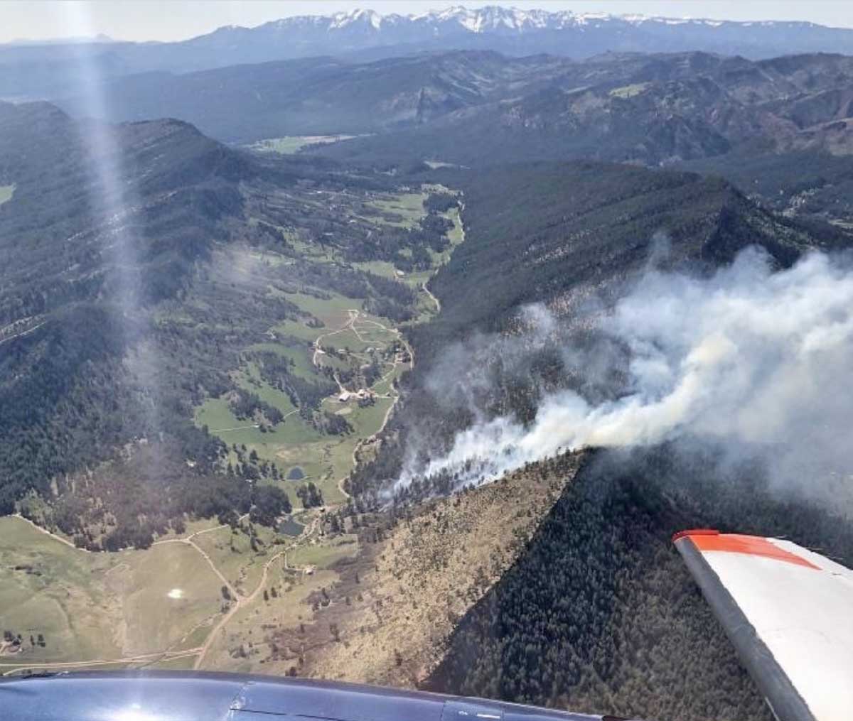
84 Fire. San Juan National Forest photo, May 5, 2020.

The first time that the 11-person Durango, Colorado helitack crew all assembled in the same place they realized they were one person short. That May 7 morning one crewmember had called from home saying they had run a fever overnight. This initiated a response in accordance with the COVID-19 protocols established by the U.S. Forest Service.

A Rapid Lesson Sharing report has been released about how this played out. The information below came from the document.

Since the crew started their wildland fire season 25 days before, they had been following the COVID-19 procedures — the 11-person crew, a “Module as One”, was split into two Squads. One staffs the helicopter from its base of operations with the three-person contract flight crew (Pilot, Mechanic, Fuel Truck Driver). The other half is on call from their places of residence on ordered standby and responds if activated on a delayed response. This schedule switches every seven days, with a day off for each squad every 13 days.

The crew had self-isolated for 14 days prior to working with each other.

On May 5 and 6 five of the crewmembers were on the 84 Fire in southwest Colorado, along with approximately 95 other personnel. The Helicopter Manager flew to the fire with three of the five Helitack crewmembers, while the other two drove in separate vehicles.
84 Fire. San Juan National Forest

Manager+3 is the minimum staffing required for a Type 2 Helicopter and they flew to the fire with the minimum during the COVID-19 conditions. Within the confines of a Type 2 Helicopter, there can be no social distance spacing of 6 feet unless only the pilot is onboard.

They spent two days on the fire, sleeping on the front lawn of a nearby fire station after the first day. At end of shift the next day the five Helitack crewmembers got into the two vehicles that were driven to the fire, two in one vehicle and three in the other. People stayed in the same vehicles throughout and the drivers didn’t change.

The individual that called in May 7 with a fever was one of the five who spent the night on the 84 Fire. That morning 10 of the 11 crewmembers gathered in a physical setting and did an AAR on the 84 Fire. This was the first time they had gathered as crew — it was 25 days after the first onboarding of seasonal employees.

The person with the fever took two COVID-19 tests, on May 8 and 9. The requirement for the agency is that the individual with symptoms must remain at home until three things have happened:

They no longer have a fever (without the use of medicine that reduces fevers); AND other symptoms have improved; AND they have received two negative tests in a row, 24 hours apart.

Both tests results, on May 11, found that the firefighter was negative for COVID-19, however the clinic took another nine days to give the results to the individual, on May 19 — 14 days after reporting that they had a fever.

The crewmember self-isolated at their home while waiting for the test results. They are feeling better and believe they had allergies and cold symptoms.

This crewmember is still in the same pay status as the rest of the crew. A CA-1, CA-2, CA-16 was discussed being filed—but wasn’t. No other crewmembers have reported any symptoms and all appear to be very healthy.

Below are some of the lessons identified in the Rapid Lesson Sharing document:

  • A well-defined notification system should be established so Duty Officers, Line Officers, and various Forest entities are aware of individuals on crews who become sick or ill—to prevent causing a “panic” situation.
  • We shouldn’t hit any panic buttons if someone becomes sick. Rather, we need to take the necessary steps with everyone’s well-being in mind during these heightened times.
  • Symptoms that look like COVID-19 could well be the flu, a cold or seasonal allergies. But as a Supervisor you have to take the “better safe than sorry” approach if adverse health symptoms do arise
  • Expect an employee to be out for at least 7-14 days in self-isolation if they get symptoms and longer if a COVID-19 test comes back positive. It took 14 days from the crewmember’s first symptoms to finding out testing results.
  • Are our Best Practices actually the Best Practices? In an effort to limit people at the Durango Tanker Base we told a mechanic for the helicopter to stay in town. And when ordered for a fire, a minor mechanical issue occurred, and it took 30 minutes for the mechanic to get back to the Tanker Base to deal with it.
  • Forest Leadership needs to reinforce to their Forestry Technician Fire personnel that regardless of being sick or not, they will be paid for their respective crew’s readiness ability as a “Module as One”. This can be as simple as knowing your time will have the approved button clicked.
  • COVID-19 information sharing from the Washington Office to the Regional Office to the Supervisors Office to the District Office is at best a fluid mess of forwarded emails, chain emails, conference calls, and Microsoft Team meetings with unmuted participants and all manner of disturbing background sounds.
  • Information needs to be quality over quantity. We need to flatten the curve on an overabundance of excessive information that nobody doing their real job has time to read.

Questions that need to be addressed and answered:

  • What do we do with employees in government housing who come down with symptoms? For that matter, SW Colorado is high COLA (Cost-of-Living Adjustment). What about employees who share housing with other people and who may become sick? Are we authorized to put these people into a safer hotel situation and on per diem? What about the 1039s who camp in parking lots and elsewhere? What about local AD Tanker Base Employees?
  • Do we have a blank check on Maintaining a Healthy Workforce in terms of funding?
  • Is there a clear crosswalk for Supervisors and for employees about the reality of being exposed to COVID-19 and how well our agency will really support us? CA-1, CA-2, CA-16 OWCP, how’s this going to happen and occur?
  • Honestly, what are we going to do if an employee tests positive? How do we react? How do we respond?

FEMA issues guidance for managing disasters in the COVID-19 environment

FEMA said the information can apply to responses to flooding, wildfires, and typhoons

FEMA guidance COVID emergency incidents

Last week the Federal Emergency Management Agency (FEMA) released the COVID-19 Pandemic Operational Guidance for the 2020 Hurricane Season to help emergency managers and public health officials best prepare for disasters while continuing to respond to and recover from coronavirus (COVID-19). In a news release, FEMA said that while the document focuses on hurricane season preparedness, most planning considerations can also be applied to any disaster operation in the COVID-19 environment, including no-notice incidents, spring flooding,  wildfire seasons, and typhoon response.

Specifically, the guide:

  • Describes anticipated challenges to disaster operations posed by COVID-19;
  • Highlights planning considerations for emergency managers based on current challenges;
  • Outlines how FEMA plans to adapt response and recovery operations;
    Creates a shared understanding of expectations between FEMA and emergency mangers; and,
  • Includes guidance, checklists and resources to support emergency managers response and recovery planning.

The 59-page document does not have a lot of details, for example specifics of how to set up an evacuation center, but there are lists of items to consider.

As an example, here is the section on Evacuation Planning:


Evacuation Planning

State, Local, Tribal & Territorial (SLTT) organizations should review evacuation plans and consider:

  • Assessing community demographics and identifying areas facing high risk, including considerations for those under stay-at-home orders, at higher risk of serious complications from COVID-19, individuals with disabilities, and others with access and functional needs.
  • Reviewing clearance times and decision timelines, with COVID-19 planning considerations, such as mass care and sheltering plans.
  • Considering impacts of business closures/restrictions along evacuation routes; limited restaurant/lodging availability will place extra stress on state and local officials and may require unprecedented assistance to travelers.
  • Maintaining availability of mass transit and paratransit services that provide a transportation option for those individuals who are unable to use the fixed-route bus or rail system for evacuation of people with disabilities in accordance with CDC guidance and social distancing requirements.
  • Using EMPG-S funding to modify evacuation plans to account for limited travel options and increased time needed for evacuation of health care facilities.
  • Targeting evacuation orders and communication messages to reduce the number of people voluntarily evacuating from areas outside a declared evacuation area.
  • Developing communication plans for communities likely impacted by hurricane season or other emergent incidents for any updates or alterations to evacuation strategies, and ensuring communications are provided in a way that is accessible to people with disabilities and limited English proficiency.
  • Reviewing available alternate care sites and federal medical stations as potential evacuation sites or longer-term solution for hospitals and medical facilities, if needed, and considering staffing needed to support facilities.
  • Determining logistics and resource requirements to support government-assisted evacuations.
  • Reviewing, expanding, and/or establishing agreements with NGOs, agencies, volunteers, and private sector vendors that will be needed for evacuee support and ensuring partners are prepared to deliver services in a COVID-19 environment.
  • Engaging with neighboring states and jurisdictions to coordinate cross-border movement of evacuees in large-scale evacuations.
  • Developing host jurisdiction sheltering agreements.

Thanks and a tip of the hat go out to Bill. Typos or errors, report them HERE.

A firefighters’ briefing, 2020 style

Arrowhead Hotshots prescribed fire briefing
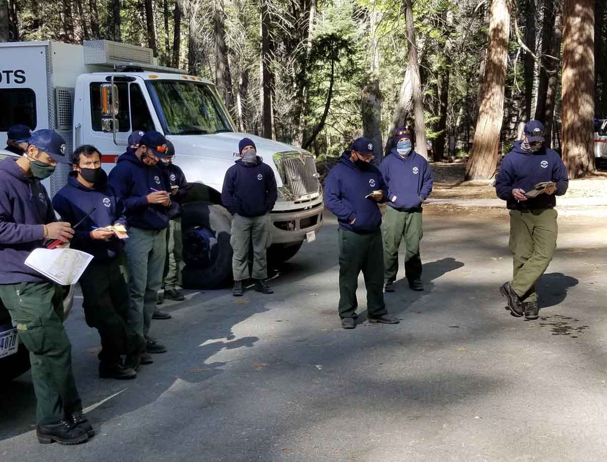
The Arrowhead Hotshots attend a briefing for the Cedar Central prescribed fire. NPS photo by Mike Theune, via @NIFCfire.
This photo was sent out May 26, 2020 by the Twitter account of the National Interagency Fire Center, @NIFCfire:
Arrowhead Interagency Hotshot Crew attend a morning briefing at the Cedar Central #RxBurn on the @SequoiaKingsNPS. Getting #ReadyForWildfire for #FireYear2020!

Cherry Canyon Fire in southeast Colorado grows to nearly 12,000 acres

The wildfire is 58 miles east-northeast of Trinidad

Cherry Canyon Fire Colorado
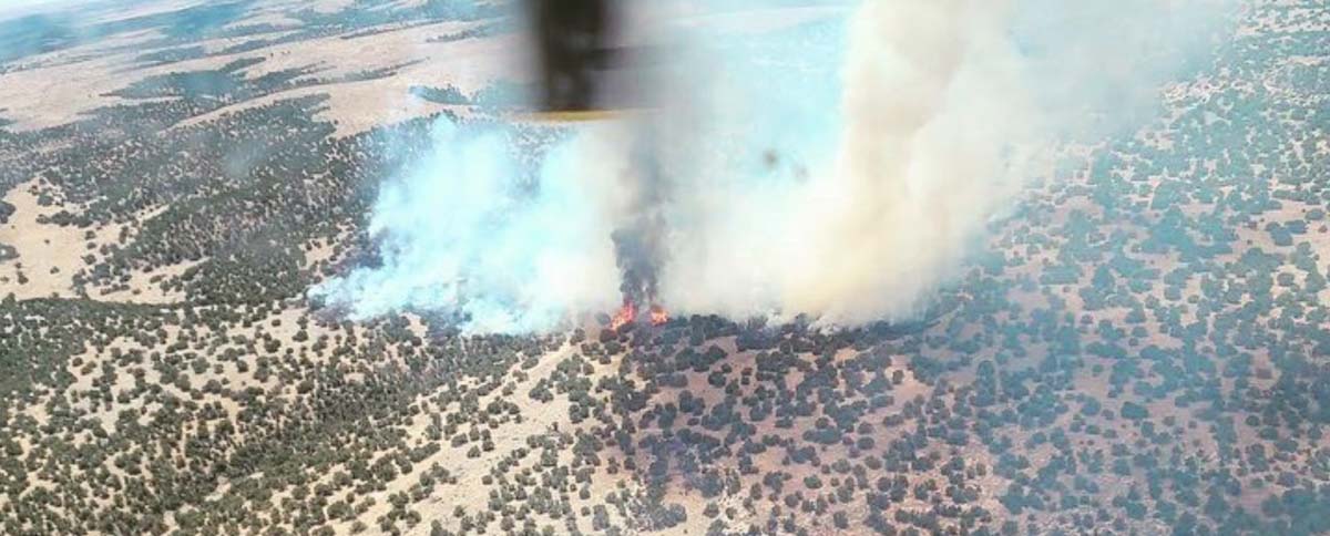
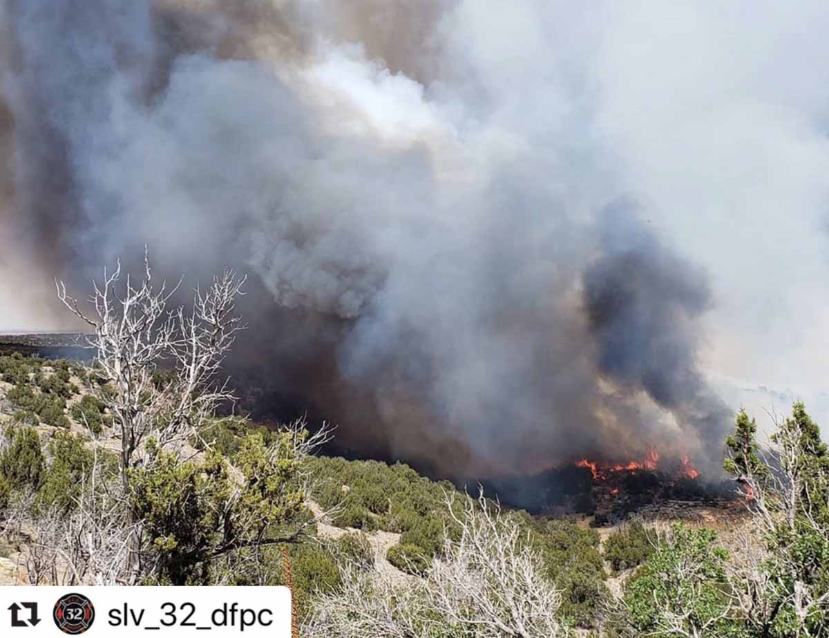
Cherry Canyon Fire, courtesy of Colorado Fire Prevention & Control

(UPDATED at 11:43 p.m. MDT May 24, 2020)

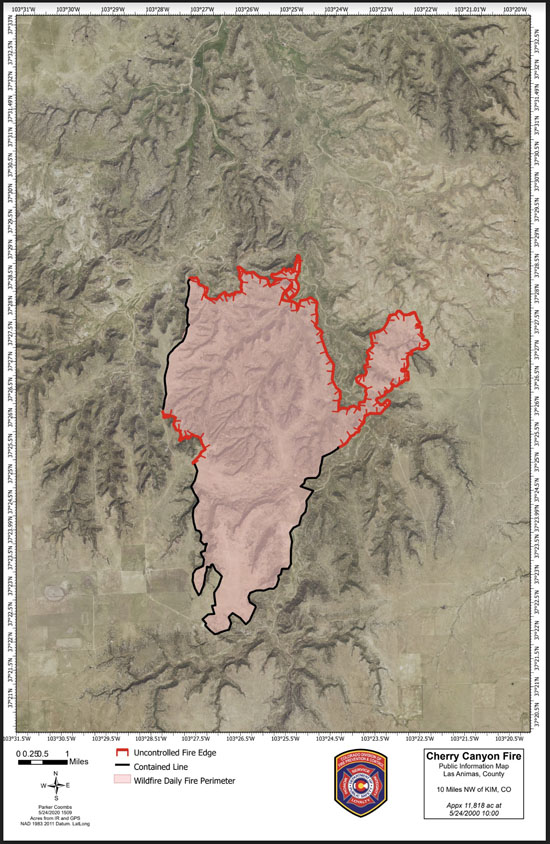
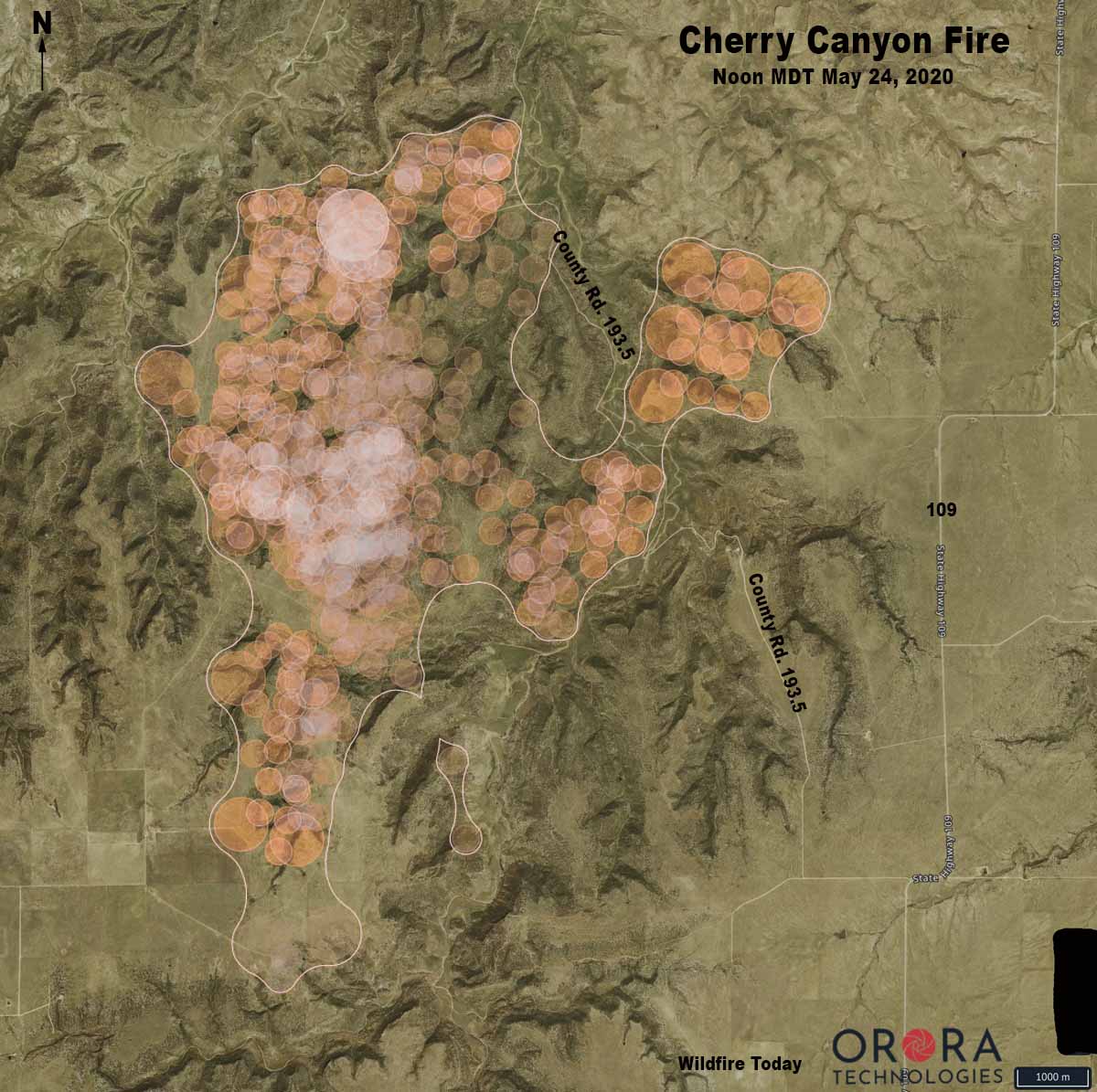
Strong winds and extremely low humidity on Saturday caused the Cherry Canyon Fire, 13 miles north of Kim, Colorado, to spread to the northwest crossing County Road 193.5 west of Highway 109. Colorado Fire Prevention & Control said Saturday evening that the fire was mapped at 11,818 acres at 5 p.m.

In a five-hour period Saturday morning the humidity dropped from 92 to 8 percent while the southwest wind was blowing at 3 to 8 mph gusting to 31, according to records from a portable weather station installed near the fire. Spread of the fire slowed Saturday night and by 7:45 Sunday morning the humidity had risen to 69 percent. Rain began falling after 4 p.m., with 0.15 inches accumulating by 11 p.m.

Below is an excerpt from a news release by Colorado Fire Prevention & Control:

Firefighters camped out on the West side of the fire last night and completed a large portion of work in the accessible terrain and will continue to monitor the inaccessible areas. Firefighters on the East side of the fire were not able to conduct burnout operations last night due to unfavorable conditions, but worked in that region today to tie in the large slopover/run from yesterday afternoon.

Additionally, while there are few structures at risk from this fire, other values, such as grazing land, water, and livestock, are very important in this region. Allowing the fire to continue to burn eliminates feed for cattle, exposes steep slopes to be susceptible to erosion, and causes health concerns from the increased smoke.  As is normal in every wildfire, a risk-benefit analysis is conducted before actions are initiated; from this discussion, it was determined that rather than smoking out communities, removing grazing land for cattle and impacting communities with restrictions on travel/road closures, it is better to suppress the fire.

Cherry Canyon Fire Colorado map

Cherry Canyon Fire Colorado map
Map showing heat on the Cherry Canyon Fire detected by satellites. Heat was sensed somewhere within each of the circles. The actual perimeter is slightly smaller than the white line seen on the map. All locations are approximate.

(UPDATED at 11:28 a.m. MDT May 23, 2020)

Cherry Canyon Fire wildfire Colorado
Cherry Canyon Fire, courtesy of Colorado Fire Prevention & Control

In an update Friday at 5:40 p.m. MDT the Colorado Division of Fire Prevention and Control said the lightning-caused Cherry Canyon Fire had burned 9,602 acres. A Type 3 Incident Management Team led by Phil Daniels is assigned.

(To see all articles on Wildfire Today about the Cherry Canyon Fire click here)

“Safety is the number one priority and as such, strategies moving forward include maintaining firefighter and public safety by utilizing sound risk management actions and utilizing suppression activities that guide the fire into natural barriers,” the agency said in a news release. “Additionally, [we are] minimizing the potential impacts of COVID-19 through the practice of social distancing, proper personal hygiene, and regular cleaning.”

The fire is in southeast Colorado 9 miles northwest of Kim and 58 miles east-northeast of Trinidad. It was reported at 8:28 MDT on Wednesday.

Strong winds and difficult access are making fighting the fire difficult.

A Red Flag Warning  is in effect again for the fire area from noon to 8 p.m. MDT today due to gusty winds, low relative humidity, and dry fuels.

Map Vicinity Cherry Canyon Fire
Vicinity map of the Cherry Canyon Fire in southeast Colorado.
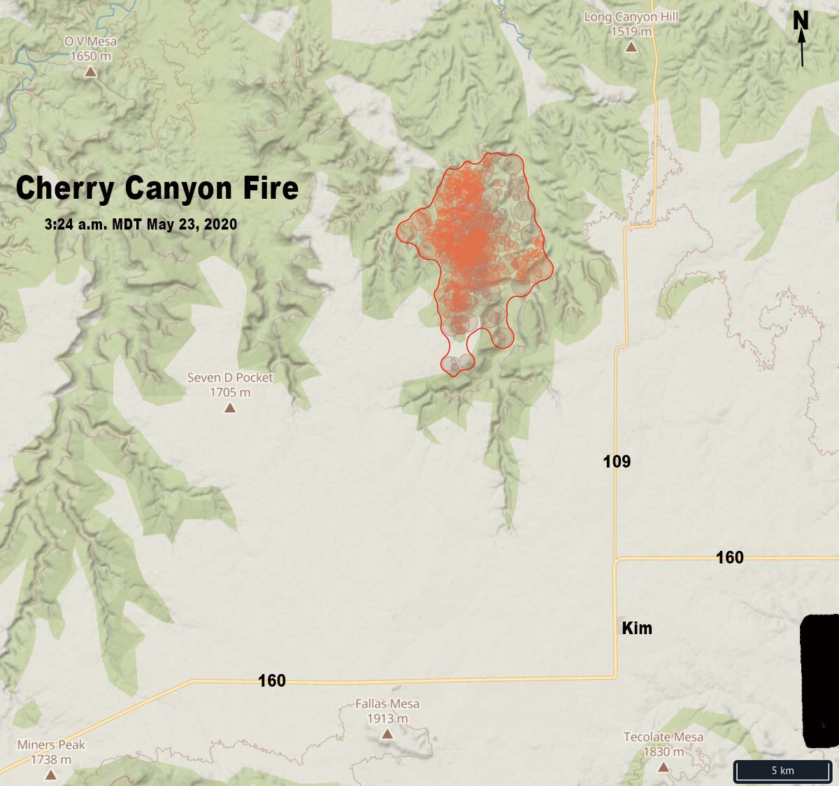
Cherry Canyon Fire wildfire Colorado map
Map of the Cherry Canyon Fire showing heat detected by satellites as late as 3:24 a.m. MDT May 23, 2020.
Cherry Canyon Fire wildfire Colorado
Helicopter 58HJ with Cañon Helitack got assigned to the Cherry Canyon Fire near Kim, Colorado shortly after it became available for the fire season. Photo by @getoutgetmoving
Cherry Canyon Fire wildfire Colorado
Cherry Canyon Fire, courtesy of Colorado Fire Prevention & Control
Cherry Canyon Fire wildfire Colorado
Cherry Canyon Fire, courtesy of Colorado Fire Prevention & Control

Cherry Canyon Fire in Colorado made an impressive run Thursday

It has burned over 7,300 acres in the southeast part of the state near Kim

Cherry Canyon Fire Colorado
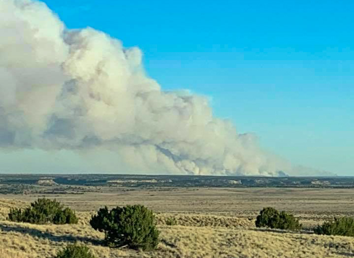
Cherry Canyon Fire as seen from about 10 miles south of La Junta, Colorado. Photo by Otero County Sheriff, May 20, 2020.

(Originally published at 11:40 a.m. MDT May 22, 2020)

The Cherry Canyon Fire that was reported May 20 grew rapidly Thursday and has now burned 7,390 acres. The fire is in southeast Colorado 9 miles northwest of Kim and 58 miles east-northeast of Trinidad.

(To see all articles on Wildfire Today about the Cherry Canyon Fire, including the most recent, click here)

From the Colorado Division of Fire Prevention and Control Friday morning:

Yesterday was the first shift for our folks on the #CherryCanyonFire near Kim, CO. The fire made an impressive 6000+ acre push yesterday due to sustained winds of around 40mph.

On Thursday it was burning in chaparral and short grass exhibiting extreme fire behavior with crowning, torching, and spotting. According to Friday morning’s Situation Report the firefighting resources assigned include 2 hand crews and 10 engines for a total of 61 personnel.

The area is under a Red Flag Warning Friday from 1 p.m. until 9 p.m. for 10 to 20 mph winds gusting to 35 mph, with relative humidity as low as 7 percent. A Fire Weather Watch is in effect Saturday afternoon and evening for similar conditions.

Map Vicinity Cherry Canyon Fire
Vicinity map of the Cherry Canyon Fire in southeast Colorado.
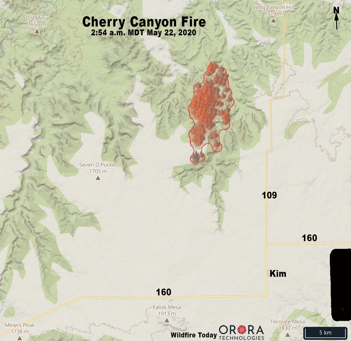
Map of the Cherry Canyon Fire
Map of the Cherry Canyon Fire showing heat detected by satellites as late as 2:54 a.m. MDT May 22, 2020.
Cherry Canyon Fire Colorado
Cherry Canyon Fire. Photo by Colorado Fire Prevention & Control.